
Natural Resources
Conservation Service
Ecological site R043AY501ID
Subalpine Ashy Exposed Mountain Slopes
30-45" PZ Cryic
Bitterroot Metasedimentary Zone
Last updated: 10/15/2020
Accessed: 08/24/2026
-
Search


Major Land Resource Area or ecological site by name and/or ID.
PreviousSectionsNextGeneral information
Provisional. A provisional ecological site description has undergone quality control and quality assurance review. It contains a working state and transition model and enough information to identify the ecological site.
MLRA notes
Major Land Resource Area (MLRA): 043A–Northern Rocky Mountains
Major Land Resource Area (MLRA): 043A–Northern Rocky Mountains
Description of MLRAs can be found in: United States Department of Agriculture, Natural Resources Conservation Service. 2006. Land Resource Regions and Major Land Resource Areas of the United States, the Caribbean, and the Pacific Basin. U.S. Department of Agriculture Handbook 296.
Available electronically at: http://www.nrcs.usda.gov/wps/portal/nrcs/detail/soils/ref/?cid=nrcs142p2_053624#handbookLRU notes
Modal LRU – 43A11 Bitterroot Metasedimentary Zone
This LRU is composed predominantly of mid to high elevation mountain slopes. The soils are loamy Andisols and Inceptisols with ashy surfaces. Colluvium and Residuum from metasedimentary or other rock is the dominant parent material. Soil climate is a frigid or cryic temperature regime and udic moisture regime with average annual precipitation around 1100 mm (43 inches).Classification relationships
Relationship to Other Established Classifications:
United States National Vegetation Classification (2008), A3948 Valeriana sitchensis - Luzula glabrata var. hitchcockii - Xerophyllum tenax Subalpine Mesic Meadow Alliance.
Washington Natural Heritage Program. Ecosystems of Washington State, A Guide to Identification, Rocchio and Crawford, 2015 - ROCKY MOUNTAIN SUBALPINE-MONTANE MESIC MEADOWEcological site concept
Ecological Site Concept:
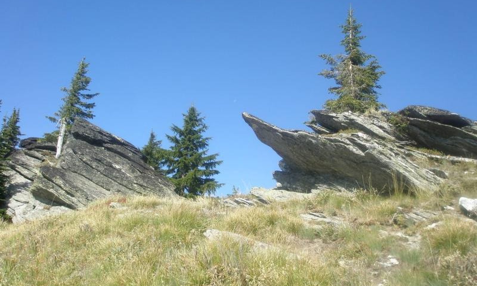
The data below describes the physiographic, climatic and other parameters for Warm-Cryic, Dry-Udic, Loamy, Mountains, beargrass/huckleberry-forbs. Sites are subalpine to montane forb-dominated meadows. Many occurrences are small patches found in mosaics with woodlands, dense shrublands, or just below alpine communities. The system is restricted to lower montane to subalpine sites where soil conditions, snow deposition, or windswept dry conditions limit tree establishment. This ecological site occurs mainly on south facing upper backslopes of mountains and on ridges. Parent materials are colluvium, residuum, and till derived from mixed origins mantled by mixed volcanic ash and loess. Soils are generally moderately deep to bedrock, skeletal and have low to moderate available water holding capacity.Table 1. Dominant plant species
Tree Not specified
Shrub (1) Vaccinium membranaceum
(2) Vaccinium scopariumHerbaceous (1) Xerophyllum tenax
(2) Valeriana sitchensisPhysiographic features
Physiographic Features
Landscapes: Mountains
Landforms: Mountain slope, ridges
Elevation:
Total range = 1285 to 2145 m;
(4,215 to 7,040 feet)
Central Tendency = 1605 to 1825 m
(5,265 to 5,985 feet)
Slope:
Total range = 0 to 90 percent
Central Tendency = 30 to 55 percent
Aspect: Total range = 40-195-310
Central tendency = 130-195-235Table 2. Representative physiographic features
Landforms (1) Mountains > Mountain slope
(2) Mountains > Ridge
Flooding frequency None Ponding frequency None Elevation 5265 – 5985 ft Slope 30 – 55 % Water table depth 80 in Aspect SE, S, SW Table 3. Representative physiographic features (actual ranges)
Flooding frequency None Ponding frequency None Elevation 4215 – 7040 ft Slope 0 – 90 % Water table depth 80 in Climatic features
Climatic Features
During the spring and summer, a circulation of air around a high-pressure center brings a prevailing westerly and northwesterly flow of comparatively dry, cool and stable air into the region. As the air moves inland, it becomes warmer and drier which results in a dry season beginning in the late spring and reaching a peak in mid-summer. In the fall and winter, a circulation of air around two pressure centers over the ocean brings a prevailing southwesterly and westerly flow of air into the Pacific Northwest. This air from over the ocean is moist and near the temperature of the water. Condensation occurs as the air moves inland over the cooler land and rises along the windward slopes of the mountains or highlands. This results in a wet season beginning in October, reaching a peak in winter, then gradually decreasing in the spring.
Temperature
The pattern of average annual temperatures indicates the effect both of latitude and altitude. In general, it can be said that monthly means are 32° F or lower at stations above 5,000 feet from November through March; between 4,000 and 5,000 feet, November through February; 3,000 to 4,000 feet, December through February; and 2,000 to 3,000 feet, only one or two months. The diurnal range of temperature is, of course, most extreme in high valleys and in the semiarid plains. The magnitude of diurnal range varies with the season, being lowest in winter when cloudiness is much more prevalent, and greatest in the warmer part of the year. In summer, periods of extreme heat extending beyond a week are quite rare, and the same can be said of periods of extremely low temperatures in winter. In both cases the normal progress of weather systems across the region usually results in a change at rather frequent intervals.
Precipitation
To a large extent the source of moisture for precipitation regionally is the Pacific Ocean. In summer there are some exceptions to this when moisture-laden air is brought in from the south at high levels to produce thunderstorm activity. Seasonal distribution of precipitation shows a very marked pattern of winter maximum and midsummer minimum.
Snowfall
Snowfall distribution is affected both by availability of moisture and by elevation. Annual snowfall totals have reached nearly 500 inches. The major mountain ranges accumulate a deep snow cover during the winter months, and the release of water from the melting snowpack in late spring is a primary source of instream flows.
(from WRCC: Climate of Idaho)
Frost-free period (days):
Total range = 65 to 110 days
Central Tendency = 80 to 95 days
Mean annual precipitation (cm):
Total range = 750 to 2635 mm
(29 to 104 inches)
Central Tendency = 1220 to 1855 mm
(48 to 73 inches)
MAAT (C)
Total range = 1.9 to 6.5
(35 to 44 F)
Central tendency = 3.3 to 4.6
(38 to 40 F)
Climate stations: none">Influencing water features
Water Table Depth: >80 inches<br />
<br />
Flooding:<br />
Frequency: None<br />
Duration: None<br />
<br />
Ponding:<br />
Frequency: None <br />
Duration: NoneSoil features
Representative Soil Features
This ecological site is associated the soil components Typic Fulvicryands, Brickel, and Joebaldy. These components are classified as Typic Fulvicryands, Vitrandic Haplocryolls, and Humic Vitricryands. These soils have developed in mixed Mazama tephra deposits over colluvium and residuum derived from granitic, metamorphic, or metasedimentary rock. Soils are generally moderately deep to bedrock, skeletal and have low to moderate available water holding capacity.Table 4. Representative soil features
Parent material (1) Volcanic ash
(2) Residuum – granite
(3) Residuum – metamorphic rock
(4) Residuum – metasedimentary rock
Surface texture (1) Gravelly, medial silt loam
(2) Cobbly, medial silt loam
Drainage class Well drained Permeability class Moderate to moderately rapid Depth to restrictive layer 30 in Surface fragment cover >3" Not specified Available water capacity
(0-40in)3.3 in Calcium carbonate equivalent
(0-60in)Not specified Electrical conductivity
(0-60in)Not specified Soil reaction (1:1 water)
(0-60in)6 Subsurface fragment volume <=3"
(10-60in)30 % Subsurface fragment volume >3"
(10-60in)10 % Table 5. Representative soil features (actual values)
Drainage class Somewhat excessively drained to well drained Permeability class Rapid to moderate Depth to restrictive layer 20 – 40 in Surface fragment cover >3" 0 – 0.1 % Available water capacity
(0-40in)3.1 – 5.4 in Calcium carbonate equivalent
(0-60in)0 % Electrical conductivity
(0-60in)0 mmhos/cm Soil reaction (1:1 water)
(0-60in)5.1 – 6.5 Subsurface fragment volume <=3"
(10-60in)13 – 50 % Subsurface fragment volume >3"
(10-60in)0 – 32 % Ecological dynamics
Ecological Dynamics of the Site
Sites have finely textured soils, snow deposition, or windswept dry conditions which limit tree establishment. Sites are gentle to moderate-gradient slopes. Vegetation is typically forb-rich, with forbs often contributing more to overall herbaceous cover than graminoids. Typically, soils are seasonally moist to saturated in the spring and will dry out later in the growing season. Natural burrowing mammal disturbance regimes at montane elevations can increase forb diversity. Early successional stages may be dominated by Agastache urticifolia, Fragaria virginiana, Urtica dioica, Achillea millefolium, and other forbs, and small amounts of grasses such as Bromus carinatus and Deschampsia cespitosa. Stand replacement fires are most common, with an approximate 40 year return interval (Fire regime II LANDFIRE 2007). Mixed severity fires with a mean return interval of 75 years influence late development of meadows by removing shrubs (LANDFIRE 2007). Fire starts were likely native peoples or from adjacent shrub or tree-dominated sites (LANDFIRE 2007). Patch size is 10 to 300 acres (LANDFIRE 2007) (see Rochio and Crawford, 2015)State and transition model
Custom diagramStandard diagram
More interactive model formats are also available. View Interactive Models
More interactive model formats are also available. View Interactive Models
Click on state and transition labels to scroll to the respective textEcosystem states
State 1 submodel, plant communities
State 1
Reference
Vegetation is typically forb-rich, with forbs often contributing more to overall herbaceous cover than graminoids. Tall forb-dominated mesic meadows are typically composed of a wide diversity of genera. At more subalpine elevations, Senecio triangularis, Erigeron peregrinus, Erythronium grandiflorum, Ligusticum species, Veratrum viride and Valeriana species are important forbs. Natural burrowing mammal disturbance regimes can increase forb diversity. Early successional stages may be dominated by Agastache urticifolia, Fragaria virginiana, Urtica dioica, Achillea millefolium, and other forbs, and small amounts of mesic grasses such as Bromus carinatus and Deschampsia cespitosa.
Community 1.1
Reference
Beargrass/thinleaf huckleberry-grouse whortleberry/green false hellebore-sitka valerian-western meadowrue
XETE/VAME-VASC/VEVI-VASI-THOC
This community is dominated by beargrass but also have significant cover of the shrubs thinleaf huckleberry and grouse whortleberry. The herbaceous layer is diverse and includes false green hellebore, sitka valerian and western meadowrue. Foliar cover is very high, ranging 70-96%. The ground cover is predominantly litter and duff with very low cover of gravel, soil, stones and cobbles. The vegetative structure is a taller forb and grass layer between 10-20 inches tall that can include beargrass (Xerophyllum tenax), western meadowrue (Thalictrum occidentale), valerian species, fireweed (Chamerian angustifolium), arrowleaf ragwort (Senecio triangularis), thinleaf huckleberry (Vaccinium membranceum), and others. The lowest layer is up to 10 inches tall and can include arnica, geranium, viola species and yellow avalanche-lily.Dominant plant species
-
thinleaf huckleberry (Vaccinium membranaceum), shrub
-
grouse whortleberry (Vaccinium scoparium), shrub
-
dwarf bilberry (Vaccinium cespitosum), shrub
-
Hitchcock's smooth woodrush (Luzula glabrata var. hitchcockii), grass
-
greenleaf fescue (Festuca viridula), grass
-
common beargrass (Xerophyllum tenax), other herbaceous
-
Sitka valerian (Valeriana sitchensis), other herbaceous
-
western meadow-rue (Thalictrum occidentale), other herbaceous
-
green false hellebore (Veratrum viride), other herbaceous
-
arrowleaf ragwort (Senecio triangularis), other herbaceous
-
beardtongue (Penstemon), other herbaceous
-
western coneflower (Rudbeckia occidentalis), other herbaceous
Community 1.2
DisturbanceIncreased bare soil from fire or erosion. XETE resprouts from rhizomes post disturbance. Pioneer herbaceous species occur.
Dominant plant species
-
tufted hairgrass (Deschampsia cespitosa), grass
-
California brome (Bromus carinatus), grass
-
common beargrass (Xerophyllum tenax), other herbaceous
-
fireweed (Chamerion angustifolium), other herbaceous
-
Virginia strawberry (Fragaria virginiana), other herbaceous
-
stinging nettle (Urtica dioica), other herbaceous
-
common yarrow (Achillea millefolium), other herbaceous
Pathway 1.1A
Community 1.1 to 1.2This pathway represents disturbance to the reference vegetation community including slope movement, erosion or fire.
Pathway 1.2A
Community 1.2 to 1.1This pathway represents time without disturbance that allows regeneration of the reference vegetation community.
Additional community tables
Table 6. Community 1.1 plant community composition
Group Common name Symbol Scientific name Annual production () Foliar cover (%) Table 7. Community 1.2 plant community composition
Group Common name Symbol Scientific name Annual production () Foliar cover (%) Interpretations
Supporting information
References
-
Gregory, S. 1983. Subalpine forb community types of the Bridger-Teton National Forest, Wyoming. Final Report. USDA Forest Service Cooperative Education Agreement: Contract OM 40-8555-3-115.. USDA Forest Service, Intermountain Region, Ogden, UT. 1–97.
-
Johnson, D.H. and T.A. O’Neil. 2001. Wildlife-Habitat Relationships in Oregon and Washington. Oregon State University Press, Corvallis, OR.
-
Rocchio, J.F. and R.C. Crawford. 2015. Ecological systems of Washington State. A guide to identification. Washington Department of Natural Resources.. Natural Heritage Report.. Washington Department of Natural Resources, Natural Heritage Program, Olympia, WA. 1–397.
Approval
Curtis Talbot, 10/15/2020
Rangeland health reference sheet
Interpreting Indicators of Rangeland Health is a qualitative assessment protocol used to determine ecosystem condition based on benchmark characteristics described in the Reference Sheet. A suite of 17 (or more) indicators are typically considered in an assessment. The ecological site(s) representative of an assessment location must be known prior to applying the protocol and must be verified based on soils and climate. Current plant community cannot be used to identify the ecological site.
Author(s)/participant(s) Contact for lead author Date 08/24/2026 Approved by Approval date Composition (Indicators 10 and 12) based on Annual Production Indicators
-
Number and extent of rills:
-
Presence of water flow patterns:
-
Number and height of erosional pedestals or terracettes:
-
Bare ground from Ecological Site Description or other studies (rock, litter, lichen, moss, plant canopy are not bare ground):
-
Number of gullies and erosion associated with gullies:
-
Extent of wind scoured, blowouts and/or depositional areas:
-
Amount of litter movement (describe size and distance expected to travel):
-
Soil surface (top few mm) resistance to erosion (stability values are averages - most sites will show a range of values):
-
Soil surface structure and SOM content (include type of structure and A-horizon color and thickness):
-
Effect of community phase composition (relative proportion of different functional groups) and spatial distribution on infiltration and runoff:
-
Presence and thickness of compaction layer (usually none; describe soil profile features which may be mistaken for compaction on this site):
-
Functional/Structural Groups (list in order of descending dominance by above-ground annual-production or live foliar cover using symbols: >>, >, = to indicate much greater than, greater than, and equal to):
Dominant:
Sub-dominant:
Other:
Additional:
-
Amount of plant mortality and decadence (include which functional groups are expected to show mortality or decadence):
-
Average percent litter cover (%) and depth ( in):
-
Expected annual annual-production (this is TOTAL above-ground annual-production, not just forage annual-production):
-
Potential invasive (including noxious) species (native and non-native). List species which BOTH characterize degraded states and have the potential to become a dominant or co-dominant species on the ecological site if their future establishment and growth is not actively controlled by management interventions. Species that become dominant for only one to several years (e.g., short-term response to drought or wildfire) are not invasive plants. Note that unlike other indicators, we are describing what is NOT expected in the reference state for the ecological site:
-
Perennial plant reproductive capability:
Print Options
Sections
Font
AAAAOther
PrintThe Ecosystem Dynamics Interpretive Tool is an information system framework developed by the USDA-ARS Jornada Experimental Range, USDA Natural Resources Conservation Service, and New Mexico State University.
Accessibility statement


