Natural Resources
Conservation Service
Ecological site R043AX979MT
Alpine Nivation Hollow
Payson’s sedge / black alpine sedge -northern singlespike sedge / Drummond’s rush
(Carex paysonis/ Carex nigricans-Carex scirpoidea/ Juncus drummondii)
Last updated: 4/10/2025
Accessed: 07/10/2026
-
Search


Major Land Resource Area or ecological site by name and/or ID.
PreviousSectionsNextGeneral information
Provisional. A provisional ecological site description has undergone quality control and quality assurance review. It contains a working state and transition model and enough information to identify the ecological site.
MLRA notes
Major Land Resource Area (MLRA): 043A–Northern Rocky Mountains
This MLRA is located in Montana (43 percent), Idaho (34 percent), and Washington (23 percent). It makes up about 31,435 square miles (81,460 square kilometers). It has no large cities or towns. It has many national forests, including the Okanogan, Colville, Kootenai, Lolo, Flathead, Coeur d’Alene, St. Joe, Clearwater, and Kaniksu National Forests.
This MLRA is in the Northern Rocky Mountains Province of the Rocky Mountain System. It is characterized by rugged, glaciated mountains; thrust- and block-faulted mountains; and hills and valleys. Steep-gradient rivers have cut deep canyons. Natural and manmade lakes are common.
The major Hydrologic Unit Areas (identified by four-digit numbers) that make up this MLRA are: Kootenai-Pend Oreille-Spokane (1701), 67 percent; Upper Columbia (1702), 18 percent; and Lower Snake (1706), 15 percent. Numerous rivers originate in or flow through this area, including, the Sanpoil, Columbia, Pend Oreille, Kootenai, St. Joe, Thompson, and Flathead Rivers.
This area is underlain primarily by stacked slabs of layered sedimentary or metasedimentary bedrock. The bedrock formations range from Precambrian to Cretaceous in age. The rocks consist of shale, sandstone, siltstone, limestone, argillite, quartzite, gneiss, schist, dolomite, basalt, and granite. The formations have been faulted and stacked into a series of imbricate slabs by regional tectonic activity. Pleistocene glaciers carved a rugged landscape that includes sculpted hills and narrow valleys filled with till and outwash. Continental glaciation over road the landscape in the northern half of the MLRA while glaciation in the southern half was confined to montane settings.
The average annual precipitation is 25 to 60 inches (635 to 1,525 millimeters) in most of this area, but it is as much as 113 inches (2,870 millimeters) in the mountains and is 10 to 15 inches (255 to 380 millimeters) in the western part of the area. Summers are dry. Most of the precipitation during fall, winter, and spring is snow. The average annual temperature is 32 to 51 degrees F (0 to 11 degrees C) in most of the area, decreasing with elevation. In most of the area, the freeze-free period averages 140 days and ranges from 65 to 215 days. It is longest in the low valleys of Washington, and it decreases in length with elevation. Freezing temperatures occur every month of the year on high mountains, and some peaks have a continuous cover of snow and ice.
The dominant soil orders in this MLRA are Andisols, Inceptisols, and Alfisols. Many of the soils are influenced by Mount Mazama ash deposits. The soils in the area have a frigid or cryic soil temperature regime; have an ustic, xeric, or udic soil moisture regime; and dominantly have mixed mineralogy. They are shallow to very deep, are very poorly drained to well drained, and have most of the soil texture classes. The soils at the lower elevations include Udivitrands, Vitrixerands and Haplustalfs. The soils at the higher elevations include Dystrocryepts, Eutrocryepts, Vitricryands , and Haplocryalfs. Cryorthents, Cryepts, and areas of rock outcrop are on ridges and peaks above timberline
This area is in the northern part of the Northern Rocky Mountains. Grand fir, Douglas-fir, western red cedar, western hemlock, western larch, lodgepole pine, subalpine fir, ponderosa pine, whitebark pine, and western white pine are the dominant overstory species, depending on precipitation, temperature, elevation, and landform aspect. The understory vegetation varies, also depending on climatic and landform factors. Some of the major wildlife species in this area are whitetailed deer, mule deer, elk, moose, black bear, grizzly bear, coyote, fox, and grouse. Fish, mostly in the trout and salmon families, are abundant in streams, rivers, and lakes.
More than one-half of this area is federally owned and administered by the U.S. Department of Agriculture, Forest Service. Much of the privately-owned land is controlled by large commercial timber companies. The forested areas are used for wildlife habitat, recreation, watershed, livestock grazing, and timber production. Meadows provide summer grazing for livestock and big game animals. Less than 3 percent of the area is cropland.LRU notes
This ecological site resides in MLRA 43A in the Livingston-Lewis-Apgar Mountains which includes the bulk of Glacier National Park (GNP) and the lower western valley portions along the Flathead River. The landscape is mountains and landforms include glaciated mountains with associated features such as U-shaped valleys, mountain slopes, alpine ridges, cirques, valley floors and moraines. Glaciation of this area was in the form of alpine, icecaps and valley outlet glaciers. It also includes associated alluvium and outwash features. This area includes low valleys to tall mountains with elevation ranging 989-2,762 m (3,250-9,050 ft.). The climate is cold and wet with mean annual air temperature of 3 degrees Celsius (37 degrees F)., mean frost free days of 65 days and mean annual precipitation of 1,295 mm (51 in.) and relative effective annual precipitation is 169 cm (66 in.). The soil temperature regime is cryic and the soil moisture regime is udic. The geology of this area is dominated by metasedimentary rocks of the Belt Supergroup (Grinnell argillite and Siyeh limestone) with minor Tertiary sediments. Soils are generally weakly developed on mountain slopes within U-shaped valleys. Parent materials are commonly of colluvium, till, and residuum from metasedimentary rocks. Limestone bedrock within this part of the Belt Supergroup is not highly calcareous and due to high precipitation received in this area most carbonates at mid and upper elevations have been leached from the soil profiles. Bedrock depth varies greatly with location, landform and slope position. Volcanic ash is often found in the soil surface with various degrees of mixing. Thicker volcanic ash can be found on more stable positions on mid and upper elevation slopes that are protected from wind erosion. Volcanic ash is not typically found in low elevation areas on stream and outwash terraces associated with streams and rivers. There are numerous large lakes including St. Mary, Bowman, Kintla, Lake Sherburne, Logging, Upper Waterton and numerous creeks (
Classification relationships
NPS Plant Community Name:
Carex nigricans-Sibbaldia procumbens Herbaceous Vegetation
Carex paysonis-Sibbaldia procumbens Herbaceous VegetationEcological site concept
Ecological Site Concept
This ecological site is found in the alpine life zone, on backslope, footslope and toeslope positions on cirque ridge landforms in the mountains, on all aspects, with low to moderate slopes (8-15 percent) at elevations ranging 1,850 to 2,450 meters (6,070-8,040 feet). A Nivation hollow is defined as a shallow, non-cliff depression or hollow on a mountainside permanently or intermittently occupied by a snowbank or snow patch (Wysocki, 2009). The landscape position is a concave bowl shaped depressional area that holds snow far longer than the surrounding areas that resides on a slope. This long duration of snow cover protects the vegetation in winter from harsh winds found at these high elevations. The deep snow cover melts out in spring releasing a pulse of water to the vegetation, and the concave landscape positions collect moisture from surrounding areas which provides resilience against late summer dry conditions. There is no substantial ponding of this site due to the well-drained soils. Vegetation at the site has a simple structure of extremely dense, low-growing sedge turf with a few snow-tolerant forb species. The vegetation is dominated by one to two mat-forming sedges including Paysons sedge (Carex paysonis), black alpine sedge (Carex nigricans), and northern singlespike sedge (Carex scirpoidea). The soils associated with this ecological site are extremely gravelly throughout the soil profile, with very gravelly loam surface textures and loamy-skeletal subsurface textures. Soil parent material is colluvium over residuum from metasedimentary Belt Supergroup rocks. Due to slope gradients and drainage characteristics there is no flooding or ponding at this site.Associated sites
R043AX971MT Alpine Solifluction Terrace Dryas octopetala (Arctostaphylos uva-ursi/Salix arctica)
The 43A Alpine Solifluction Terrace ecological site is found at high elevations 1,700-2,600 m (5,575-8,530 ft.) on ridges or backslopes in the mountains or cirque floors mainly on northern or western aspects of moderate to steeper slopes (10-40 percent). Due to frost heave action, solifluction terraces have developed, in which there is a sorting of gravels and vegetation into stripes. . The 43A Alpine solifluction terrace ecological site has soils that are moderately deep, well drained, and very gravelly in the surface and subsurface. The highest expression of this site has areas of alternating strips covered by vegetation and rock terracing which has low to moderate vegetation cover. The 43A Alpine Solifluction Terrace ecological site has a reference vegetation community of eightpetal mountain-avens (kinnikinnick-arctic willow-moss campion-twinflower sandwort)/alpine smelowskia-cutleaf daisy-alpine bistort/curly sedge.
Table 1. Dominant plant species
Tree (1) Carex nigricans
Shrub Not specified
Herbaceous (1) Sibbaldia procumbens
Physiographic features
This ecological site is found on backslope, footslope and toeslope positions on cirque ridge landforms in the mountains, on all aspects, with low to moderate slopes (8-15 percent) at elevations ranging 1850 to 2,450 meters. A Nivation hollow is defined as a shallow, non-cliff depression or hollow on a mountainside permanently or intermittently occupied by a snowbank or snow patch (Wysocki, 2009). The landscape position is a concave bowl shaped depressional area that holds snow far longer than the surrounding areas that resides on a slope. This long duration of snow cover protects the vegetation in winter from harsh winds found at these high elevations. The deep snow cover melts out in spring releasing a pulse of water to the vegetation, and the concave landscape positions collect moisture from surrounding areas which provides resilience against late summer dry conditions. There is no substantial ponding of this site due to the well-drained soils.

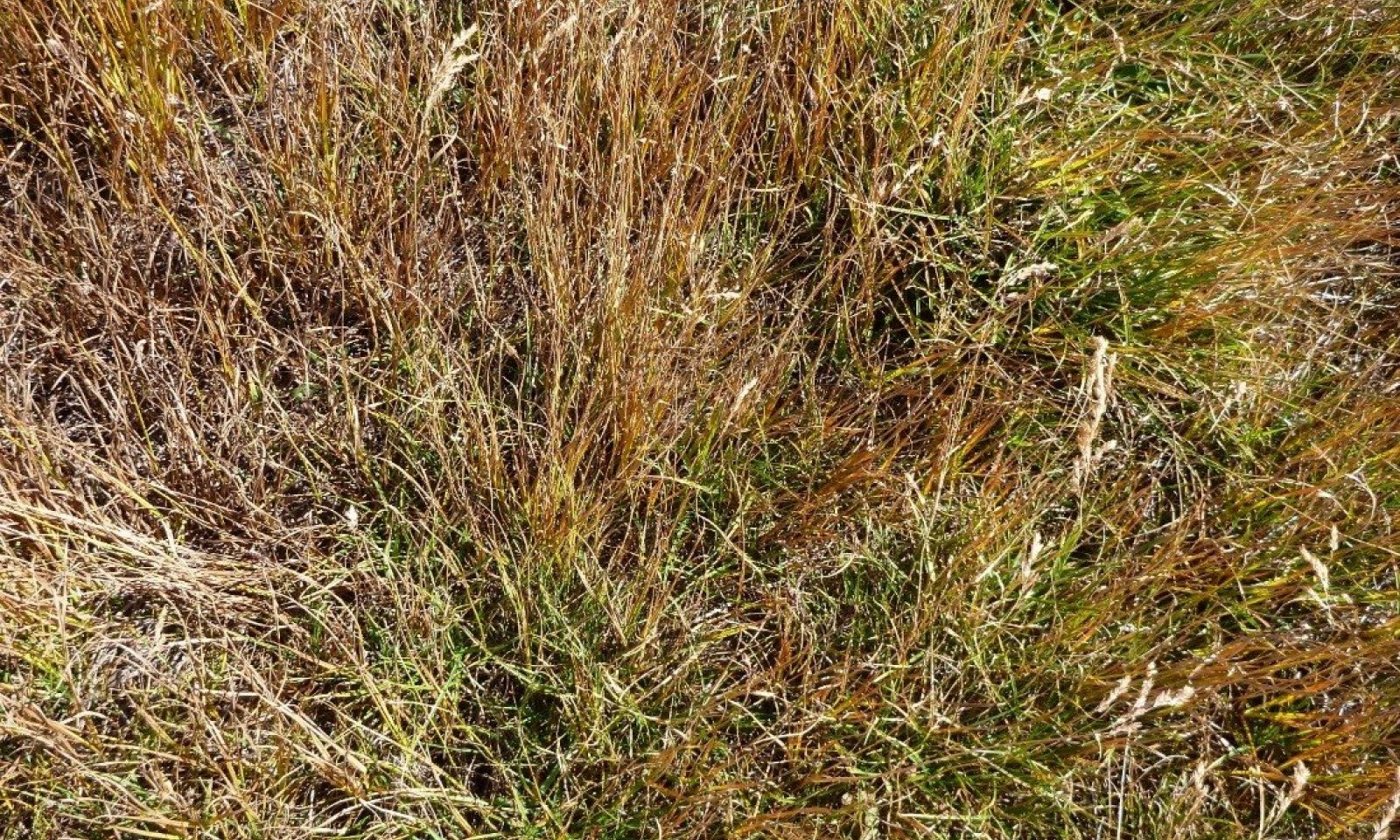
Figure 1. Landscape view of this ecological site.

Figure 2. Landscape view of this ecological site.

Figure 3. Site photo of Nivation Hollows outlined with blue rectangles.

Figure 4. Landscape view of location within ecological site with concave snow filled position at Logan Pass.
Table 2. Representative physiographic features
Landforms (1) Mountains > Ridge > Nivation hollow
Elevation 1850 – 2450 ft Slope 8 – 15 % Aspect W, NW, N, NE, E, SE, S, SW Climatic features
This ecological site is found in the cryic soil temperature regime and the udic soil moisture regime. Cryic soils have average annual temperature less than 8 degrees C, with less than 5 degrees C difference from winter to summer. Udic soil moisture regime denotes that the rooting zone is usually moist throughout the winter and the majority of summer. This site is found on the east side of the Continental Divide and has more continental weather influences.
REPRESENTATIVE INFORMATION FOR THIS SITE:
Mean Average Precipitation: 99-248cm (39-98 inches)
Mean Average Annual Temperature: -1 to 4 Celsius 30-39 degrees F
Frost free days: 30-50
THE FOLLOWING TABLES ARE FROM AVAILABLE CLIMATE STATIONS LOCATED IN VALLEY SITES, USED ONE SNOTEL SITE IN THE OTHER CLIMATE NARRATIVE.Table 3 Representative climatic features
Frost-free period (characteristic range) 60-90 days Freeze-free period (characteristic range) 110-130 days Precipitation total (characteristic range) 20-30 in Frost-free period (actual range) 20-90 days Freeze-free period (actual range) 80-130 days Precipitation total (actual range) 20-30 in Frost-free period (average) 70 days Freeze-free period (average) 120 days Precipitation total (average) 30 in Characteristic rangeActual rangeBarLineFigure 5. Monthly precipitation range
Characteristic rangeActual rangeBarLineFigure 6. Monthly minimum temperature range
Characteristic rangeActual rangeBarLineFigure 7. Monthly maximum temperature range
BarLineFigure 8. Monthly average minimum and maximum temperature
Figure 9. Annual precipitation pattern
Figure 10 Annual average temperature pattern
Climate stations used
-
(1) POLEBRIDGE 1 N [USC00246618], Essex, MT
-
(2) POLEBRIDGE [USC00246615], Essex, MT
-
(3) WEST GLACIER [USC00248809], Kalispell, MT
-
(4) HUNGRY HORSE DAM [USC00244328], Kalispell, MT
-
(5) WHITEFISH [USC00248902], Whitefish, MT
-
(6) LINDBERGH LAKE [USC00245043], Seeley Lake, MT
">Influencing water features
Soil features
This ecological site is found in the cryic soil temperature regime and the udic soil moisture regime. Cryic soils have average annual temperature less than 8 degrees C, with less than 5 degrees C difference from winter to summer. Udic soil moisture regime denotes that the rooting zone is usually moist throughout the winter and the majority of summer.
The 43A ALPINE NIVATION HOLLOW site occurs in alpine depressional areas on backslope, footslope and toeslope positions in cirque basins, cirque headwalls and ridges in mountains. The soils at these sites are well drained and moderately deep. During snow melt-out, water can occur at the site for brief periods due to the run-in or concave position, however, the duration of saturation is not long enough to cause redoximorphic soil conditions. The water availability remains high for the short growing season with early and mid-summer melt-out, summer rains, somewhat drier windy fall conditions, and then returning to snow accumulation in early fall. The site holds snow the longest of any alpine community, and therefore has a very short growing season of 10-12 weeks and then returns to snow. In late summer and fall, there can be drying conditions due to the effect of strong desiccating effect of winds. Sedge litter accumulates in the wet and cold site conditions and due to slow decomposition rates, accumulates as organic matter in upper horizons, giving the soil its dark color. Roots in the soil are very fine to fine in size and exist throughout the soil profile. Water on these sites is generally not limiting and despite having a high gravel content, low water-holding capacity and generally only moderately deep soils, these sites are very productive and appear as green patches relative to surrounding areas in aerial imagery of cirque basin areas and broad ridges along divides and passes.
The soils associated with this ecological site are extremely gravelly throughout the soil profile, with very gravelly loam surface textures and loamy-skeletal subsurface textures. Soil parent material is colluvium over residuum from metasedimentary Belt Supergroup rocks. Due to slope gradients and drainage characteristics there is no flooding or ponding at this site. (Soil Survey Staff, 2015). For more information on soil taxonomy, please follow this link:
http://http://www.nrcs.usda.gov/wps/portal/nrcs/detail/soils/survey/class/?cid=nrcs142p2_053580
SOIL SERIES: Piegan
Taxonomy: Loamy-skeletal, mixed, superactive Typic Haplocryolls
Figure 11. Soil horizons found at this ecological site.

Figure 12. Soil horizons found in the soils associated with this ecological site.

Figure 13. Soil pit at this ecological site with very high presence of fine roots in the upper horizons.
Table 4. Representative soil features
Parent material (1) Colluvium – metasedimentary rock
(2) Residuum – metasedimentary rock
Surface texture (1) Very gravelly loam
Family particle size (1) Loamy-skeletal
Drainage class Well drained Permeability class Moderate Surface fragment cover <=3" Not specified Surface fragment cover >3" Not specified Available water capacity
(1.3-2.5in)Not specified Soil reaction (1:1 water)
(5.8-7in)Not specified Ecological dynamics
Vegetation at the site has a simple structure of extremely dense, low-growing sedge turf with few snow-tolerant forb species. The vegetation is dominated by one to two mat-forming sedges including Payson’s sedge (Carex paysonis), black alpine sedge (Carex nigricans), and northern singlespike sedge (Carex scirpoidea). Overall, due to harsh site conditions, there is lower species diversity although forbs do occur. Forbs at this site include Rocky Mountain groundsel (Packera streptanthifolia), Eschscholtz’s buttercup (Ranunculus eschscholtzii), and arrowleaf ragwort (Senecio triangularis). Other species that occur at the site in high frequency include alpine timothy (Phleum alpinum), alpine bluegrass (Poa alpina), creeping sibbaldia (Sibbaldia procumbens), subalpine fleabane (Erigeron peregrinus), meadow bistort (Polygonum bistorta), varileaf cinquefoil (Potentilla diversifolia), and Rocky Mountain goldenrod (Solidago multiradiata). Growing season is very short, but all species are perennial and able to have very quick springtime assimilation. Other species may occur infrequently and in very low cover representing more incidental occurrence. Species found at this ecological site are designated as facultative wetland, facultative and facultative upland. Therefore, most species are neutral towards or have only a slight affinity to wetland areas. Specifically, Juncus mertensiana is a wetland obligate species and occurs infrequently and in very low cover, at this site. Carex paysonis occurs in high cover throughout most sites, and is a facultative upland species meaning that it is usually in non-wetland conditions, but may occur in wetlands. Carex nigricans can dominate sites, and is a facultative wetland designated species, which means that it is a hydrophyte, which usually occurs in wetlands but also may occur in non-wetland areas. Carex scirpoidea and Juncus parryi can have high coverage at sites, though not in high frequency through all sites, are considered facultative species, which means they can occur in wetland and non-wetland areas.
The vegetative communities of these snowbeds all have a presence of Carex paysonis in varying degree of cover, making it a diagnostic species for snowbeds on the whole. There are four general types each dominated by a different species: the Carex paysonis-dominated, the Carex scirpoidea-dominated, the Carex nigricans-dominated, and the Juncus parryi-dominated. The Carex paysonis-dominated had Juncus drummondii and Sibbaldia procumbens frequently and in fair cover (10 percent). Carex nigricans and Antennaria species were infrequent but had fair cover (10 percent). There was only one site visited with Carex scirpoidea dominant, but it also had Carex paysonis present (5 percent) and Juncus mertensianus (1 percent). The Carex nigricans-dominated type had high cover of Carex paysonis (35 percent) as well as the shrub Salix arctica (33 percent). The Juncus parryi-dominated type had Arenaria capillaris, Erigeron peregrinus, and Sibbaldia procumbens in very low cover. Also present at these sites were Carex species in very low cover including Carex paysonis, Carex phaeocephala, Carex rossii, and Carex rupestris.
This ecological site occurs close to either alpine shallow meadows or to tundra. Damm (2001) postulated that there was a catena sequence from the longest snow-holding site dominated by sedge turf (Carex nigricans, c. paysonis, or c. scirpoidea) to communities with high cover of Parry’s rush and other forbs with moderate snow holding site conditions to tundra. Another sequence on moister sites would be from the highest snow holding sites of sedge turf to ericaceous shrub sites to alpine shallow meadows. A study of snowbanks in Olympic National Park (NP) found that the timing of snow release and the depth and duration of snowpack were significantly related to phenological status of dominant species, productivity and moisture status of plants and soil (Canaday and Fonda, 1974). The amount of snow and the timing of the melt-out determined the plant community present, their phenological onset of growing season, and their productivity. Areas with little snow that were wind-and ice-scoured were dominated by forbs. Areas with light snow had mesic grasses, moderate snow loads had tall sedges, and late-melting snow loads had dwarf sedges dominated by Carex nigricans. The lighter snow communities emerge early, mature early, and must usually tolerate some degree of drought. The heavy snow communities have to be able to complete a vegetative life cycle very quickly in the dramatically reduced growing season (Billing and Bliss, 1959). They do have the protection of snow during high wind and low temperatures, and seldom experience drought. The Carex nigricans community had more available water than any of the other plant communities. The daily productivity was a function of the snow release date. Productivity was high after snowmelt, but then declined and plateaued after flowering. Plants closer to the center of the snowfield also began growth and seed set later. Carex nigricans had a growing season of 45-60 days and flowered 7 days after snow release. An associated species, Erigeron peregrinus, flowered 1-2 weeks later but was also fully able to set and disperse seed within the growing season. All species present at their sites were able to reach maximum height before seed set.
Carex nigricans has fair forage palatability for cattle, sheep, and horses, defined as moderately relished and consumed to a moderate degree. It is moderate in energy and protein value, which means it retains usable energy and digestible protein values moderately well during fall and winter (Hansen, 1995).
Carex nigricans subalpine sedge meadows were found to be very resistant to light and heavy human trampling (Cole, 1985). Both light and heavy human trampling resulted in canopy coverage of Carex nigricans to be above 50 percent post-trampling after 0-800 passes. Grasses were found to be generally resistant to trampling, while forbs were variable in resistance to trampling.
Climate change can have a profound effect on snowbed vegetation communities. The harsh site conditions and very short growing season of Nivation hollows dictate that only highly adapted species are able to thrive. Highly adapted species are not generalist species and therefore do not compete well against other species if dramatic changes occur. These species have special growth conditions, their sensitivity to and inability to respond rapidly to changes in annual snowfall patterns make them particularly vulnerable in a warmer climate. These snowbed communities would be negatively impacted by climate change and will be invaded by species from adjacent plant communities, particularly shrubs (Bjork and Molau, 2007). The amount of time this would take is unknown at this time.
STATE 1.0
COMMUNITY PHASE 1.1: Payson’s sedge (Carex paysonis)/(black alpine sedge (Carex nigricans)-northern singlespike sedge (Carex scirpoidea)/ Drummond’s rush (Juncus drummondii)-Parry’s rush(Juncus parryii)/ slender mountain sandwort (Arenaria capillaris)-creeping sibbaldia(Sibbaldia procumbens). This community phase has high foliar cover and the ground cover is predominantly litter and duff, with very low cover of cobbles, gravels, stones, soil and moss. The vegetation structure is low, all below 10 inches tall.
Generally, this community is dominated by one to two species of low-growing, dense, mat-forming sedges including Carex paysonis, Carex nigricans, or Carex scirpoidea. There is low cover of Drummond’s rush. Snow-loving forbs occur, including slender mountain sandwort and creeping sibbaldia.
Specifically, there are four types of vegetation communities:
1. Carex paysonis type: dominated by Carex paysonis (38 percent average canopy cover), juncus drummondii (10 percent), and Sibbaldia procumbens (11 percent). Incidental but fair average cover includes Carex nigricans (13 percent) and Antennaria species (10 percent).
2. Carex scirpoidea type: dominated by Carex scirpoidea (90 percent average canopy cover), Carex paysonis (5 percent), and Juncus mertensianus (1 percent).
3. Carex nigricans type: dominated by Carex nigricans (65 percent average canopy cover), Carex paysonis (35 percent), Salix arcticus (33 percent), Packera streptanthifolia (6 percent), Poa alpine (2 percent), Sibbaldia procumbens (1 percent), and Luzula glabrata var. hitchcockii (5 percent).
4. Juncus parryi type: dominated by Juncus parryii (19 percent), Arenaria capillaris (6 percent), Erigeron peregrinus (2 percent), Sibbaldia procumbens (5 percent), Carex paysonis (3 percent), Carex sphaerocephala (3 percent), Carex rossii (2 percent), and Carex rupestris (1 percent).
Transition 1
This pathway represents climate change in which the Reference State plant composition is irreversibly changed with the warming temperatures reducing snowpack, increasing growing season length and summer drought, and therefore allowing invasion by associated site species. The amount of time this would take is unknown at this time.
State 2.0
Climate change can have a profound effect on snowbed vegetation communities. The harsh site conditions and very short growing season of Nivation hollows dictate that only highly adapted species are able to thrive. Highly adapted species are not generalist species and therefore do not compete well against other species if dramatic changes occur. These species have special growth conditions, their sensitivity to and inability to respond rapidly to changes in annual snowfall patterns make them particularly vulnerable in a warmer climate. These snowbed communities would be negatively impacted by climate change and would be invaded by species from adjacent plant communities, particularly deciduous shrubs (Bjork and Molau, 2007). It is proposed that snowbed plants have low competitive advantage in a warmer climate than fellfield plants due to their low relative invasion potential, and lengthened growing season and increased snow pollution by atmospheric N and other nutrients (Bjork and Molau, 2007). The amount of time this would take is unknown at this time.State and transition model
More interactive model formats are also available. View Interactive Models
Click on state and transition labels to scroll to the respective textEcosystem states
State 2 submodel, plant communities
State 1
ReferenceVegetation at the site has a simple structure of extremely dense, low-growing sedge turf with a few snow-tolerant forb species. The vegetation is dominated by one to two mat-forming sedges including Payson’s sedge (Carex paysonis), black alpine sedge (Carex nigricans), and northern singlespike sedge (Carex scirpoidea). Overall, due to harsh site conditions, there is lower species diversity although forbs do occur. Forbs at this site include Rocky Mountain groundsel (Packera streptanthifolia), Eschscholtz’s buttercup (Ranunculus eschscholtzii), and arrowleaf ragwort (Senecio triangularis). Other species that occur at the site in high frequency include alpine timothy (Phleum alpinum), alpine bluegrass (Poa alpina), creeping sibbaldia (Sibbaldia procumbens), subalpine fleabane (Erigeron peregrinus), meadow bistort (Polygonum bistorta), varileaf cinquefoil (Potentilla diversifolia), and Rocky Mountain goldenrod (Solidago multiradiata). Growing season is very short, but all species are perennial and able to have very quick springtime assimilation. Other species may occur infrequently and in very low cover representing more incidental occurrence. Species found at this ecological site are designated as facultative wetland, facultative and facultative upland. Therefore, most species are neutral towards or have only a slight affinity to wetland areas. Specifically, Juncus mertensiana is a wetland obligate species and occurs infrequently and in very low cover, at this site. Carex paysonis occurs in high cover throughout most sites, and is a facultative upland species meaning that it is usually in non-wetland conditions, but may occur in wetlands. Carex nigricans can dominate sites, and is a facultative wetland designated species, which means that it is a hydrophyte, which usually occurs in wetlands but also may occur in non-wetland areas. Carex scirpoidea and Juncus parryi can have high coverage at sites, though not in high frequency through all sites, are considered facultative species, which means they can occur in wetland and non-wetland areas.
The vegetative communities of these snowbeds all have a presence of Carex paysonis in varying degree of cover, making it a diagnostic species for snowbeds on the whole. There are four general types each dominated by a different species: the Carex paysonis-dominated, the Carex scirpoidea-dominated, the Carex nigricans-dominated, and the Juncus parryi-dominated. The Carex paysonis-dominated had Juncus drummondii and Sibbaldia procumbens frequently and in fair cover (10 percent). Carex nigricans and Antennaria species were infrequent but had fair cover (10 percent). There was only one site visited with Carex scirpoidea dominant, but it also had Carex paysonis present (5 percent) and Juncus mertensianus (1 percent). The Carex nigricans-dominated type had high cover of Carex paysonis (35 percent) as well as the shrub Salix arctica (33 percent). The Juncus parryi-dominated type had Arenaria capillaris, Erigeron peregrinus, and Sibbaldia procumbens in very low cover. Also present at these sites were Carex species in very low cover including Carex phaeocephala, Carex rossii, and Carex rupestris.
Carex nigricans has fair forage palatability for cattle, sheep, and horses, defined as moderately relished and consumed to a moderate degree. It is moderate in energy and protein value, which means it retains usable energy and digestible protein values moderately well during fall and winter (Hansen, 1995).
Carex nigricans subalpine sedge meadows were found to be very resistant to light and heavy human trampling (Cole, 1985). Both light and heavy human trampling resulted in canopy coverage of Carex nigricans to be above 50 percent post-trampling after 0-800 passes. Grasses were found to be generally resistant to trampling, while forbs were variable in resistance to trampling.Community 1.1
Payson’s sedge (Carex paysonis)/(black alpine sedge (Carex nigricans)-northern singlespike sedge (Carex scirpoidea)/ Drummond’s rush (Juncus drummondii)-Parry’s rush(Juncus parryii)/ slender mountain sandwort (Arenaria capillaris)-creeping sibbaldia
Figure 14. View of vegetation.

Figure 15. View of vegetation in community phase 1.1 of this ecological site.
Generally, this community is dominated by one to two species of low-growing, dense, mat-forming sedges including Payson's sedge (Carex paysonis), black sedge (Carex nigricans), or northern singlespike sedge (Carex scirpoidea). There is low cover of Drummond’s rush. Snow-loving forbs occur, including slender mountain sandwort and creeping sibbaldia. On average, the species composition in pounds per acre for production is dominantly Payson's sedge at 64 percent, northern singlespike sedge at 18 percent, black alpine sedge at 10 percent, Parry's rush at 3 percent, ebony sedge at 2 percent.
Specifically, there are four types of vegetation communities:
1. Carex paysonis type: dominated by Carex paysonis (38 percent average canopy cover), juncus drummondii (10 percent), and Sibbaldia procumbens (11 percent). Incidental but fair average cover includes Carex nigricans (13 percent) and Antennaria species (10 percent).
2. Carex scirpoidea type: dominated by Carex scirpoidea (90 percent average canopy cover), Carex paysonis (5 percent), and Juncus mertensianus (1 percent).
3. Carex nigricans type: dominated by Carex nigricans (65 percent average canopy cover), Carex paysonis (35 percent), Salix arcticus (33 percent), Packera streptanthifolia (6 percent), Poa alpine (2 percent), Sibbaldia procumbens (1 percent), and Luzula glabrata var. hitchcockii (5 percent).
4. Juncus parryi type: dominated by Juncus parryii (19 percent), Arenaria capillaris (6 percent), Erigeron peregrinus (2 percent), Sibbaldia procumbens (5 percent), Carex paysonis (3 percent), Carex sphaerocephala (3 percent), Carex rossii (2 percent), and Carex rupestris (1 percent).Dominant plant species
-
slender mountain sandwort (Arenaria capillaris), shrub
-
Payson's sedge (Carex paysonis), grass
-
black alpine sedge (Carex nigricans), grass
-
northern singlespike sedge (Carex scirpoidea), grass
-
Drummond's rush (Juncus drummondii), grass
-
Parry's rush (Juncus parryi), grass
-
creeping sibbaldia (Sibbaldia procumbens), other herbaceous
Figure 16. Annual production by plant type (representative values) or group (midpoint values)
Table 5. Soil surface cover
Tree basal cover 0% Shrub/vine/liana basal cover 0% Grass/grasslike basal cover 10-20% Forb basal cover 0-10% Non-vascular plants 0% Biological crusts 0% Litter 50-70% Surface fragments >0.25" and <=3" 0-10% Surface fragments >3" 0-0% Bedrock 0% Water 0-10% Bare ground 0-10% Table 6. Canopy structure (% cover)
Height Above Ground (ft) Tree Shrub/Vine Grass/
GrasslikeForb <0.5 – – 20-50% 0-10% >0.5 <= 1 – – 20-50% 0-10% >1 <= 2 – – – – >2 <= 4.5 – – – – >4.5 <= 13 – – – – >13 <= 40 – – – – >40 <= 80 – – – – >80 <= 120 – – – – >120 – – – – State 2
InvadedClimate change can have a profound effect on snowbed vegetation communities. The harsh site conditions and very short growing season of Nivation hollows dictate that only highly adapted species are able to thrive. Highly adapted species are not generalist species and therefore do not compete well against other species if dramatic changes occur. These species have special growth conditions, their sensitivity to and inability to respond rapidly to changes in annual snowfall patterns make them particularly vulnerable in a warmer climate. These snowbed communities would be negatively impacted by climate change and will be invaded by species from adjacent plant communities, particularly shrubs (Bjork and Molau, 2007). The amount of time this would take is unknown at this time.
Community 2.1
Invasion by associated site species i.e. tundra shrubs arctic willow, eightpetal mountain-avens and drier forb speciesTransition T1A
State 1 to 2This pathway represents climate change in which the Reference State plant composition is irreversibly changed with the warming temperatures reducing snowpack, increasing growing season length and summer drought, and therefore allowing invasion by associated site species. The amount of time this would take is unknown at this time.
Additional community tables
Table 7. Community 1.1 plant community composition
Group Common name Symbol Scientific name Annual production () Foliar cover (%) Grass/Grasslike1 Grass 0–5908 Payson's sedge CAPA31 Carex paysonis 29–5908 – northern singlespike sedge CASC10 Carex scirpoidea 0–3668 – black alpine sedge CANI2 Carex nigricans 0–2108 – Parry's rush JUPA Juncus parryi 0–491 – ebony sedge CAEB Carex ebenea 0–368 – Mertens' rush JUME3 Juncus mertensianus 0–175 – alpine bluegrass POAL2 Poa alpina 0–49 – Hitchcock's smooth woodrush LUGLH Luzula glabrata var. hitchcockii 0–47 – Drummond's rush JUDR Juncus drummondii 0–14 – alpine timothy PHAL2 Phleum alpinum 0–5 – Forb2 Forbs 0–211 arrowleaf ragwort SETR Senecio triangularis 0–211 – fleabane ERIGE2 Erigeron 0–42 – fringed grass of Parnassus PAFI3 Parnassia fimbriata 0–21 – subalpine fleabane ERPE3 Erigeron peregrinus 0–21 – common yarrow ACMI2 Achillea millefolium 0–16 – garden sorrel RUAC2 Rumex acetosa 0–16 – creeping sibbaldia SIPR Sibbaldia procumbens 0–14 – American thorow wax BUAM2 Bupleurum americanum 0–14 – slender mountain sandwort ARCA7 Arenaria capillaris 0–14 – alpine leafybract aster SYFO2 Symphyotrichum foliaceum 0–7 – varileaf cinquefoil PODI2 Potentilla diversifolia 0–6 – maiden blue eyed Mary COPA3 Collinsia parviflora 0–5 – Rocky Mountain groundsel PAST10 Packera streptanthifolia 0–3 – fireweed CHAN9 Chamerion angustifolium 0–3 – Table 8. Community 1.1 forest understory composition
Common name Symbol Scientific name Nativity Height (ft) Canopy cover (%) Grass/grass-like (Graminoids)black alpine sedge CANI2 Carex nigricans – – 55–95 Payson's sedge CAPA31 Carex paysonis – – 5–85 bluegrass POA Poa – – 17.5 Parry's rush JUPA Juncus parryi – – 0.5–15 Hitchcock's smooth woodrush LUGLH Luzula glabrata var. hitchcockii – – 0.5–10 alpine bluegrass POAL2 Poa alpina – – 0.5–3 Mertens' rush JUME3 Juncus mertensianus – – 0.5–2 alpine timothy PHAL2 Phleum alpinum – – 0.5–2 Cusick's bluegrass POCU3 Poa cusickii – – 1.5 dunhead sedge CAPH2 Carex phaeocephala – – 0.5–1.5 sedge CAREX Carex – – 1 Drummond's rush JUDR Juncus drummondii – – 0.5 muttongrass POFE Poa fendleriana – – 0.5 Forb/Herbnorthern singlespike sedge CASC10 Carex scirpoidea – – 90 slender mountain sandwort ARCA7 Arenaria capillaris – – 0.5–31.3 varileaf cinquefoil PODI2 Potentilla diversifolia – – 0.5–21.3 catchfly SILEN Silene – – 21.3 Bourgov's milkvetch ASBO3 Astragalus bourgovii – – 4–21 creeping sibbaldia SIPR Sibbaldia procumbens – – 0.5–12.8 Rocky Mountain groundsel PAST10 Packera streptanthifolia – – 0.5–11.5 pale agoseris AGGL Agoseris glauca – – 2.5–10.5 common yarrow ACMI2 Achillea millefolium – – 5.5–7.5 subalpine fleabane ERPE3 Erigeron peregrinus – – 0.5–5.5 Parry's silene SIPA4 Silene parryi – – 5.5 Rocky Mountain goldenrod SOMU Solidago multiradiata – – 0.5–5.3 bluebell bellflower CARO2 Campanula rotundifolia – – 0.5–4 Rydberg's arnica ARRY Arnica rydbergii – – 0.5–3.3 umber pussytoes ANUM Antennaria umbrinella – – 0.5–1.5 arrowleaf ragwort SETR Senecio triangularis – – 0.5–1 moss campion SIAC Silene acaulis – – 0.5 spearleaf stonecrop SELA Sedum lanceolatum – – 0.5 maiden blue eyed Mary COPA3 Collinsia parviflora – – 0.5 autumn dwarf gentian GEAM3 Gentianella amarella – – 0.5 rosy pussytoes ANRO2 Antennaria rosea – – 0.5 rocky ragwort SEME Senecio megacephalus – – 0.5 green false hellebore VEVI Veratrum viride – – 0.5 Sitka valerian VASI Valeriana sitchensis – – 0.5 broadleaf arnica ARLA8 Arnica latifolia – – 0.5 fireweed CHAN9 Chamerion angustifolium – – 0.5 stonecrop SEDUM Sedum – – 0.5 Virginia strawberry FRVI Fragaria virginiana – – 0.5 alpine leafybract aster SYFO2 Symphyotrichum foliaceum – – 0.5 American alpine speedwell VEWO2 Veronica wormskjoldii – – 0.5 Rocky Mountain pussytoes ANME2 Antennaria media – – 0.5 Nuttall's rockcress ARNU Arabis nuttallii – – 0.5 lanceleaf springbeauty CLLA2 Claytonia lanceolata – – 0.5 darkthroat shootingstar DOPU Dodecatheon pulchellum – – 0.5 pimpernel willowherb EPAN4 Epilobium anagallidifolium – – 0.5 yellow avalanche-lily ERGR9 Erythronium grandiflorum – – 0.5 Rainier pleated gentian GECA Gentiana calycosa – – 0.5 slender hawkweed HIGR Hieracium gracile – – 0.5 spiked woodrush LUSP4 Luzula spicata – – 0.5 woodrush LUZUL Luzula – – 0.5 Nuttall's sandwort MINUN2 Minuartia nuttallii ssp. nuttallii – – 0.5 fringed grass of Parnassus PAFI3 Parnassia fimbriata – – 0.5 coiled lousewort PECO Pedicularis contorta – – 0.5 yellow penstemon PECO6 Penstemon confertus – – 0.5 American bistort POBI6 Polygonum bistortoides – – 0.5 Eschscholtz's buttercup RAES Ranunculus eschscholtzii – – 0.5 garden sorrel RUAC2 Rumex acetosa – – 0.5 Fern/fern allyRocky Mountain woodsia WOSC Woodsia scopulina – – 0.5 Shrub/Subshrubarctic willow SAAR27 Salix arctica – – 31.5 Treeundergreen willow SACO2 Salix commutata – – 1 Table 9. Community 2.1 plant community composition
Group Common name Symbol Scientific name Annual production () Foliar cover (%) Interpretations
Supporting information
Other references
Bjork, R. and U. Molau. 2007. Arctic, Antarctic and Alpine Research, Vol. 39, No. 1, 2007, pp. 34-43. Ecology of alpine snowbeds and the impact of global change.
Billings, W. 1973. Arctic and alpine vegetation: similarities, differences, and susceptibility to disturbance.
Billings, W. and L. Bliss. An alpine snowbank environment and its effects on vegetation, plant development, and productivity. Ecology, Vol. 40, No. 3, 1959.
Canaday, B. B., and R. W. Fonda. "The influence of subalpine snowbanks on vegetation pattern, production, and phenology." Bulletin of the Torrey Botanical Club (1974): 340-350.
Cole, D. 1985. Recreational trampling effects on six habitat types in western Montana. Research paper INT-350.
Damm, Christian. 2001. A phytosociological study of Glacier National Park, Montana, USA, with notes on the syntaxonomy of alpine vegetation in western North America.
NatureServe, 2007. U.S. National Vegetation Classification Standard: Terrestrial Ecological Classifications. Waterton-Glacier International Peace Park, Local and Global Association Descriptions.
Soil Survey Staff. 2015. Illustrated guide to soil taxonomy. U.S. Department of Agriculture, Natural Resources Conservation Service, National Soil Survey Center, Lincoln, Nebraska.
USFS, FEIS, Web page.
Wysocki, D.A., and Schoeneberger, P.J. 2009. Geomorphic description system, version 4.12. Natural Resources Conservation Service, National Soil Survey Center, Lincoln, NE.Approval
Kirt Walstad, 4/10/2025
Rangeland health reference sheet
Interpreting Indicators of Rangeland Health is a qualitative assessment protocol used to determine ecosystem condition based on benchmark characteristics described in the Reference Sheet. A suite of 17 (or more) indicators are typically considered in an assessment. The ecological site(s) representative of an assessment location must be known prior to applying the protocol and must be verified based on soils and climate. Current plant community cannot be used to identify the ecological site.
Author(s)/participant(s) Contact for lead author Date 12/18/2020 Approved by Approval date Composition (Indicators 10 and 12) based on Annual Production Indicators
-
Number and extent of rills:
-
Presence of water flow patterns:
-
Number and height of erosional pedestals or terracettes:
-
Bare ground from Ecological Site Description or other studies (rock, litter, lichen, moss, plant canopy are not bare ground):
-
Number of gullies and erosion associated with gullies:
-
Extent of wind scoured, blowouts and/or depositional areas:
-
Amount of litter movement (describe size and distance expected to travel):
-
Soil surface (top few mm) resistance to erosion (stability values are averages - most sites will show a range of values):
-
Soil surface structure and SOM content (include type of structure and A-horizon color and thickness):
-
Effect of community phase composition (relative proportion of different functional groups) and spatial distribution on infiltration and runoff:
-
Presence and thickness of compaction layer (usually none; describe soil profile features which may be mistaken for compaction on this site):
-
Functional/Structural Groups (list in order of descending dominance by above-ground annual-production or live foliar cover using symbols: >>, >, = to indicate much greater than, greater than, and equal to):
Dominant:
Sub-dominant:
Other:
Additional:
-
Amount of plant mortality and decadence (include which functional groups are expected to show mortality or decadence):
-
Average percent litter cover (%) and depth ( in):
-
Expected annual annual-production (this is TOTAL above-ground annual-production, not just forage annual-production):
-
Potential invasive (including noxious) species (native and non-native). List species which BOTH characterize degraded states and have the potential to become a dominant or co-dominant species on the ecological site if their future establishment and growth is not actively controlled by management interventions. Species that become dominant for only one to several years (e.g., short-term response to drought or wildfire) are not invasive plants. Note that unlike other indicators, we are describing what is NOT expected in the reference state for the ecological site:
-
Perennial plant reproductive capability:
Print Options
Sections
Font
AAAAOther
PrintThe Ecosystem Dynamics Interpretive Tool is an information system framework developed by the USDA-ARS Jornada Experimental Range, USDA Natural Resources Conservation Service, and New Mexico State University.
Accessibility statement