
Natural Resources
Conservation Service
Ecological site R043AX961MT
Subalpine Avalanche
Rocky Mountain maple-Redosier dogwood
Acer glabrum-Conus sericea ssp. sericea-Amelanchier alnifolia
Last updated: 4/10/2025
Accessed: 10/07/2026
-
Search


Major Land Resource Area or ecological site by name and/or ID.
PreviousSectionsNextGeneral information
Provisional. A provisional ecological site description has undergone quality control and quality assurance review. It contains a working state and transition model and enough information to identify the ecological site.
MLRA notes
Major Land Resource Area (MLRA): 043A–Northern Rocky Mountains
This MLRA is located in Montana (43 percent), Idaho (34 percent), and Washington (23 percent). It makes up about 31,435 square miles (81,460 square kilometers). It has no large cities or towns. It has many national forests, including the Okanogan, Colville, Kootenai, Lolo, Flathead, Coeur d’Alene, St. Joe, Clearwater, and Kaniksu National Forests.
This MLRA is in the Northern Rocky Mountains Province of the Rocky Mountain System. It is characterized by rugged, glaciated mountains; thrust- and block-faulted mountains; and hills and valleys. Steep-gradient rivers have cut deep canyons. Natural and manmade lakes are common.
The major Hydrologic Unit Areas (identified by four-digit numbers) that make up this MLRA are: Kootenai-Pend Oreille-Spokane (1701), 67 percent; Upper Columbia (1702), 18 percent; and Lower Snake (1706), 15 percent. Numerous rivers originate in or flow through this area, including, the Sanpoil, Columbia, Pend Oreille, Kootenai, St. Joe, Thompson, and Flathead Rivers.
This area is underlain primarily by stacked slabs of layered sedimentary or metasedimentary bedrock. The bedrock formations range from Precambrian to Cretaceous in age. The rocks consist of shale, sandstone, siltstone, limestone, argillite, quartzite, gneiss, schist, dolomite, basalt, and granite. The formations have been faulted and stacked into a series of imbricate slabs by regional tectonic activity. Pleistocene glaciers carved a rugged landscape that includes sculpted hills and narrow valleys filled with till and outwash. Continental glaciation over road the landscape in the northern half of the MLRA while glaciation in the southern half was confined to montane settings.
The average annual precipitation is 25 to 60 inches (635 to 1,525 millimeters) in most of this area, but it is as much as 113 inches (2,870 millimeters) in the mountains and is 10 to 15 inches (255 to 380 millimeters) in the western part of the area. Summers are dry. Most of the precipitation during fall, winter, and spring is snow. The average annual temperature is 32 to 51 degrees F (0 to 11 degrees C) in most of the area, decreasing with elevation. In most of the area, the freeze-free period averages 140 days and ranges from 65 to 215 days. It is longest in the low valleys of Washington, and it decreases in length with elevation. Freezing temperatures occur every month of the year on high mountains, and some peaks have a continuous cover of snow and ice.
The dominant soil orders in this MLRA are Andisols, Inceptisols, and Alfisols. Many of the soils are influenced by Mount Mazama ash deposits. The soils in the area have a frigid or cryic soil temperature regime; have an ustic, xeric, or udic soil moisture regime; and dominantly have mixed mineralogy. They are shallow to very deep, are very poorly drained to well drained, and have most of the soil texture classes. The soils at the lower elevations include Udivitrands, Vitrixerands and Haplustalfs. The soils at the higher elevations include Dystrocryepts, Eutrocryepts, Vitricryands , and Haplocryalfs. Cryorthents, Cryepts, and areas of rock outcrop are on ridges and peaks above timberline
This area is in the northern part of the Northern Rocky Mountains. Grand fir, Douglas-fir, western red cedar, western hemlock, western larch, lodgepole pine, subalpine fir, ponderosa pine, whitebark pine, and western white pine are the dominant overstory species, depending on precipitation, temperature, elevation, and landform aspect. The understory vegetation varies, also depending on climatic and landform factors. Some of the major wildlife species in this area are whitetailed deer, mule deer, elk, moose, black bear, grizzly bear, coyote, fox, and grouse. Fish, mostly in the trout and salmon families, are abundant in streams, rivers, and lakes.
More than one-half of this area is federally owned and administered by the U.S. Department of Agriculture, Forest Service. Much of the privately-owned land is controlled by large commercial timber companies. The forested areas are used for wildlife habitat, recreation, watershed, livestock grazing, and timber production. Meadows provide summer grazing for livestock and big game animals. Less than 3 percent of the area is cropland.LRU notes
This ecological site resides in MLRA 43A in the Livingston-Lewis-Apgar Mountains which includes the bulk of Glacier National Park (GNP) and the lower western valley portions along the Flathead River. The landscape is mountains and landforms include glaciated mountains with associated features such as U-shaped valleys, mountain slopes, alpine ridges, cirques, valley floors and moraines. Glaciation of this area was in the form of alpine, icecaps and valley outlet glaciers. It also includes associated alluvium and outwash features. This area includes low valleys to tall mountains with elevation ranging 989-2,762 m (3,250-9,050 ft.). The climate is cold and wet with mean annual air temperature of 3 degrees Celsius (37 degrees F.), mean frost free days of 65 days and mean annual precipitation of 1295 mm (51 in.) and relative effective annual precipitation is 169 cm (66 in.). The soil temperature regime is cryic and the soil moisture regime is udic. The geology of this area is dominated by metasedimentary rocks of the Belt Supergroup (Grinnell argillite and Siyeh limestone) with minor Tertiary sediments. Soils are generally weakly developed on mountain slopes within U-shaped valleys. Parent materials are commonly of colluvium, till, and residuum from metasedimentary rocks. Limestone bedrock within this part of the Belt Supergroup is not highly calcareous and due to high precipitation received in this area most carbonates at mid and upper elevations have been leached from the soil profiles. Bedrock depth varies greatly with location, landform and slope position. Volcanic ash is often found in the soil surface with various degrees of mixing. Thicker volcanic ash can be found on more stable positions on mid and upper elevation slopes that are protected from wind erosion. Volcanic ash is not typically found in low elevation areas on stream and outwash terraces associated with streams and rivers. There are numerous large lakes including St. Mary, Bowman, Kintla, Lake Sherburne, Logging, Upper Waterton and numerous creeks (
Classification relationships
NPS Plant Community Name:
Acer glabrum Avalanche Chute Shrubland
Alnus viridis ssp. sinuata / Athyrium filix-femina - Cinna latifolia Shrubland
Rubus parviflorus / Chamerion angustifolium - Heracleum maximum Shrubland
Carex geyeri Herbaceous Vegetation
Amelanchier alnifolia / (Mixed Grass, Forb) Shrubland
Populus balsamifera ssp. trichocarpa - Populus tremuloides - Conifer / Cornus sericea Forest
Abies lasiocarpa - Picea engelmannii / Menziesia ferruginea / Streptopus amplexifolius Woodland
USFS Habitat Types:
ALVI/ATFI
ACGL/alnc
ALVI/MEIC
RUPA/HEMA
PSME/SYAL-CARU
ABLA/ARCO
ABLA/VASC-VASC
ABLA/CAGE
PSME/SYAL-SYAL
ABLA/CLUN-XETEEcological site concept
Ecological Site Concept
This ecological site is defined by the active movement of rock material and snow during avalanches through the chute and into the run-out area. The force of the avalanche precludes tree establishment in the chute and transports fine soil material into the run-out area, causing a nutrient-rich, lush vegetation community. Avalanches occur in the montane to lower subalpine on slopes beyond the angle of repose (generally 15-60 percent), and are due to unstable snowpack. It is dominated by tall and medium sized shrubs with total shrub cover at each site ranging from 60% to 135% including all canopy layers. It is more typically as a mix of resprouting shrubs such as: Sitka alder, Rocky mountain maple, serviceberry, thimbleberry, prickly current, Greenes mountain ash, chokecherry (Prunus virginiana), and bitter cherry (Prunus emarginata), and redosier dogwood, but can occur as a monoculture (from literature). The understory has fragrant bedstraw (Galium triflorum), cowparsnip (Heracleum maximum) and blue wildrye (Elymus glaucus). This site has very deep soils with high vegetative production, resulting in an abundance of roots and organic matter accumulation. These soils are dark and fertile due to the regular and continual avalanche disturbances. Pulses of additional water in the form of greater snowpack thicknesses and entrained debris provide inputs which contribute to maintaining the high productivity on this site. Soils associated with this site are very deep and well drained, and are classified in the Mollisols taxonomic soil order due to the presence of a thick dark surface with high base saturation called a mollic epipedon. Many of these soils have a mollic epipedon that is of greater thickness than what is normally required for a mollic epipedon, these extra thick (greater than 40cm thick) mollic epipedons are referred to in soil taxonomy as Pachic mollic epipedons (Soil Survey Staff, 2015). Correspondingly, soils are classified as either Pachic Haplocryolls or Typic Haplocryolls subgroups. These soils are loamy-skeletal and typically have greater than 35 percent rock fragments throughout the subsoil layers. There are less than 5 percent surface fragments, primarily stone-sized, found on this site. When present, a surface organic layer is thin, typically less than 10 cm. Soil diagnostic features include a mollic epipedon and a cambic subsurface horizon.Associated sites
F043AX951MT Lower Subalpine Cool Dry Coniferous subalpine fir- Engelmann spruce/ Sitka alder/ thinleaf huckleberry/ common beargrass
The 43A Lower Subalpine Coniferous Cool Moderately Dry, (ABLA/CLUN2-XETE) ecological site is found in cool, moderately dry mid-elevations that span the lower subalpine areas. It is found primarily on lateral moraine and glacial valley wall landforms, on back or footslope positions, at elevations ranging 1,000 to 2,100 meters (3,300-6,900 feet), on all aspects and on moderate to steep slopes ranging 10-35 percent.The 43A Lower Subalpine Coniferous Cool Moderately Dry, (ABLA/CLUN2-XETE) site has soils associated with this Ecological Site that are very deep and well drained. These soils have developed in glacial till or colluvium parent materials derived from metasedimentary rock that typically have varying amounts of influence of volcanic ash in the soil surface layers. The dominant taxonomic soil order associated with these soils is Inceptisols with Andic subgroups indicating that there is 18 to 37 centimeters of volcanic ash. The 43A Lower Subalpine Coniferous Cool Moderately Dry, (ABLA/CLUN2-XETE) ecological site has a reference vegetation community with an overstory of subalpine fir and Engelmann spruce with an understory of Sitka alder, huckleberry, beargrass and queencup bead lily.The 43A Lower Subalpine Coniferous Cool Moderately Dry, (ABLA/CLUN2-XETE) ecological site has a reference vegetation community with an overstory of subalpine fir and Engelmann spruce with an understory of Sitka alder, huckleberry, beargrass and queencup bead lily.
F043AX952MT Lower Subalpine Cool Moist Coniferous subalpine fir-Engelmann spruce/Rocky Mountain maple-thinleaf huckleberry/thimbleberry
The 43A Lower Subalpine Coniferous Cool Moist Ashy Very Deep, (ABLA/CLUN2-ARNU2) is found in cool, moister mid-elevations that span the lower subalpine to subalpine. This ecological site is found on back, foot and toeslope positions, on glacial valley wall and moraine landforms, on all slopes, at elevations ranging 1,000 to 2,100 meters (3,300-6,900 feet). The 43A Lower Subalpine Coniferous Cool Moist Ashy Very Deep, (ABLA/CLUN2-ARNU2) has soils associated with this Ecological Site that are very deep, well drained or somewhat excessively drained and have subsoils with abundant rock fragments. The parent material is volcanic ash over glacial till from metasedimentary rock. In Soil Taxonomy, these soils classify primarily as Inceptisols soil order and more specifically as the Andic Haplocryepts taxonomic subgroup. The 43A Lower Subalpine Coniferous Cool Moist Ashy Very Deep, (ABLA/CLUN2-ARNU2) has a reference vegetation community of Subalpine fir-Engelmann spruce overstory and an understory of Rocky Mountain maple, thinleaf huckleberry, thimbleberry, wild Sarsaparilla, threeleaf foamflower and queencup bead lily.
Table 1. Dominant plant species
Tree Not specified
Shrub (1) Amelanchier alnifolia
(2) Rubus parviflorusHerbaceous (1) Galium triflorum
(2) Heracleum maximumPhysiographic features
This ecological site is defined by the active movement of rock material and snow during avalanches through the chute and into the run-out area. The force of the avalanche precludes tree establishment in the chute and transports fine soil material into the run-out area, causing a nutrient-rich, lush vegetation community. Avalanches occur in the montane to lower subalpine on slopes beyond the angle of repose (generally 15-60 percent), and are due to unstable snowpack. Avalanches can occur regularly in the same location, or there may be significant time between avalanche events. Large avalanche events can run thousands of feet from one mountain slope, across the adjacent valley, and up the opposing mountain slope (NPS Vegetation Mapping Report). Frequently, avalanches occur in areas with gullies and have moister site conditions due to adjacency with localized funneling of water drainage.
This ecological site is limited to avalanche chute and debris cone landforms, found on backslope and footslope positions on mountains at higher elevations, on all aspects, and on moderate to steep slopes. Baker (1979) identified 800 avalanche paths within Glacier National Park (NP). The predominant landform was a stream channel within the confines of the snow avalanche path. The angle of the slope ranges from 9 degrees in the runout zone up to 31 degrees into the lower portions of the track. These were most commonly a bowl-shaped catchment area: a narrow track, often associated with a stream channel, and a tongue-shaped runout zone. The starting zone of highest elevation was generally 2,114 m, and the runout zone of lowest elevation 1,517 m, with the total path length of 960 m and an average starting zone area of 92,000 m2. Track width accounted for 36 percent of the variance in runout widths. In one avalanche in Snyder Lake Valley, avalanche impact pressures and velocities were determined to be on average 0.21-0.28 ton/m2 and velocity 3.7-4.3m/sec, and at maximum 9.6-11.9 ton/m2 and velocity 25.3-28.2 m/sec. The vegetation within the track indicated frequent avalanching.
Figure 1. Spatial view (using Google Earth) of avalanche including chute and runout zone.

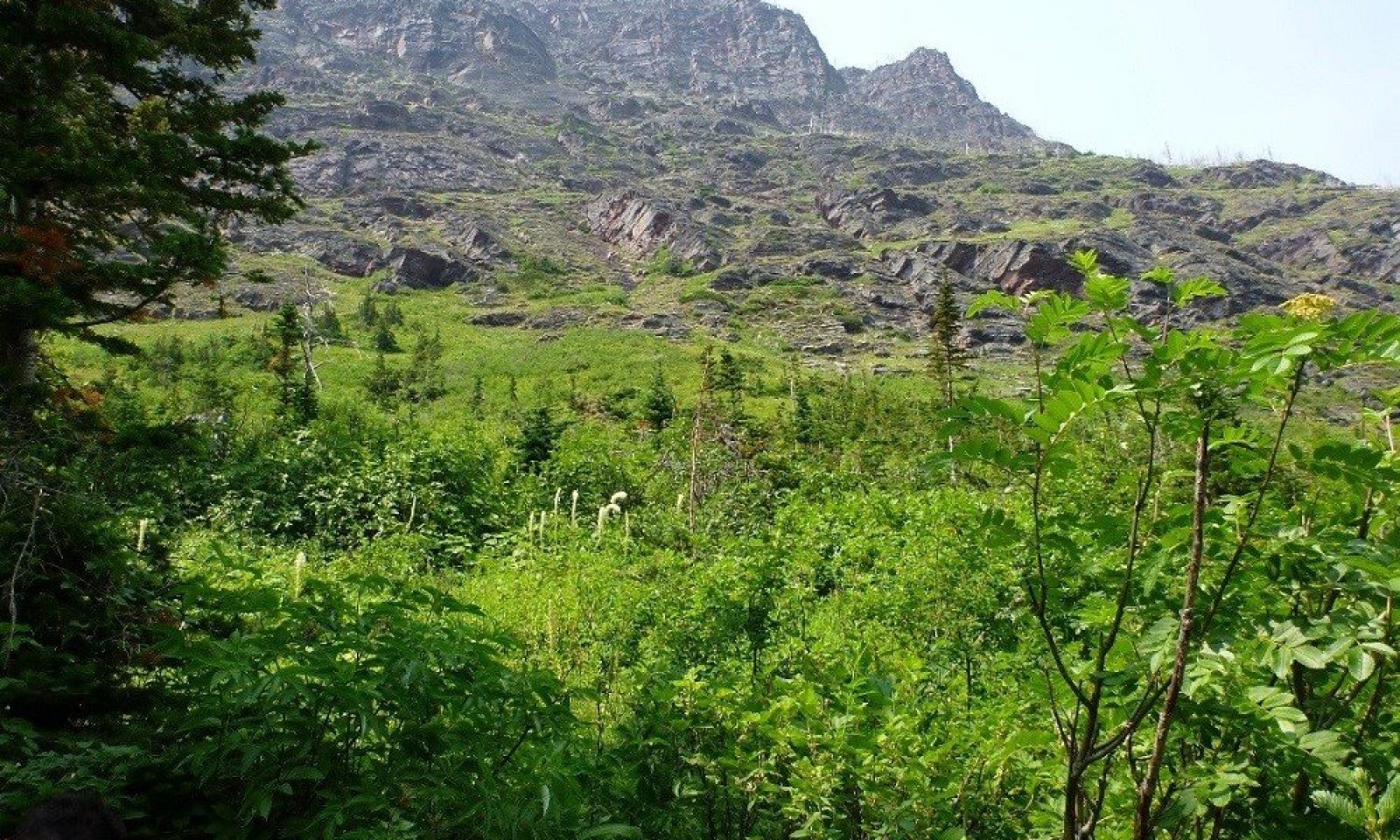
Figure 2. Landscape of this ecological site.
Table 2. Representative physiographic features
Landforms (1) Mountains > Avalanche chute
(2) Mountains > Avalanche debris
(3) Mountains > Avalanche track
Elevation 3937 – 6889 ft Slope 15 – 60 % Aspect W, NW, N, NE, E, SE, S, SW Climatic features
Mean Average Precipitation 39-81 inches
Mean Average Annual Temperature 32-43 degrees
Frost free days: 30-70
Relative Effective Annual Precipitation: 20-24 inches
WEST GLACIER CLIMATE STATION
CLIMATE SUMMARY FOR VALLEY STATIONS ONLY - NO SUBALPINE STATIONS AVAILABLETable 3 Representative climatic features
Frost-free period (characteristic range) 20-60 days Freeze-free period (characteristic range) 80-120 days Precipitation total (characteristic range) 20-30 in Frost-free period (actual range) 10-70 days Freeze-free period (actual range) 70-130 days Precipitation total (actual range) 20-30 in Frost-free period (average) 40 days Freeze-free period (average) 100 days Precipitation total (average) 20 in Characteristic rangeActual rangeBarLineFigure 3. Monthly precipitation range
Characteristic rangeActual rangeBarLineFigure 4. Monthly minimum temperature range
Characteristic rangeActual rangeBarLineFigure 5. Monthly maximum temperature range
BarLineFigure 6. Monthly average minimum and maximum temperature
Figure 7. Annual precipitation pattern
Figure 8 Annual average temperature pattern
Climate stations used
-
(1) POLEBRIDGE 1 N [USC00246618], Essex, MT
-
(2) POLEBRIDGE [USC00246615], Essex, MT
-
(3) WEST GLACIER [USC00248809], Kalispell, MT
">Influencing water features
There are typically very small streams that can be associated with avalanche chutes.
Soil features
This ecological site is found in the cryic soil temperature regime and the udic soil moisture regime. Cryic soils have average annual temperatures of less than 8 degrees C, with less than 5 degrees C difference from winter to summer. The udic soil moisture regime denotes that the rooting zone is usually moist throughout the winter and the majority of summer.
This site has very deep soils with high vegetative production, resulting in an abundance of roots and organic matter accumulation. These soils are dark and fertile due to the regular and continual avalanche disturbances. Pulses of additional water in the form of greater snowpack thicknesses and entrained debris provide inputs which contribute to maintaining the high productivity on this sites. Soils associated with this site are very deep and well drained, and are classified in the Mollisols taxonomic soil order due to the presence of a thick dark surface with high base saturation called a mollic epipedon. Many of these soils have a mollic epipedon that is of greater thickness than what is normally required for a mollic epipedon, these extra thick (greater than 40cm thick) mollic epipedons are referred to in soil taxonomy as Pachic mollic epipedons (Soil Survey Staff, 2015). Correspondingly, soils are classified as either Pachic Haplocryolls or Typic Haplocryolls subgroups. These soils are loamy-skeletal and typically have greater than 35 percent rock fragments throughout the subsoil layers. There are less than 5 percent surface fragments, primarily stone-sized, found on this site. When present, a surface organic layer is thin, typically less than 10 cm. Soil diagnostic features include a mollic epipedon and a cambic subsurface horizon. Soils found in association with herbaceous communities or the deciduous trees aspen and black cottonwood will have darker surface layers within the profile due to increased decomposition of litter than the coniferous areas surrounding these sites. Typically, these sites have very high surface litter and very little large or small rock, wood, or bare soil ground cover. In the chute section of these areas, there can be high amounts of bedrock cover that have been scoured out, as well as areas with many downed trees and associated very high cover of wood depending upon the scale and frequency of disturbance.
For more information on soil taxonomy, please follow this link:
http://http://www.nrcs.usda.gov/wps/portal/nrcs/detail/soils/survey/class/?cid=nrcs142p2_053580
CORRELATED SOIL SERIES & TAXONOMIC CLASS NAME
Boatman Loamy-skeletal, mixed, superactive Pachic Haplocryolls
Ledgefork Sandy-skeletal, mixed Typic Haplocryolls
Waterpeak Sandy-skeletal, mixed Pachic Haplocryolls
Figure 9. Soils associated with this ecological site.

Figure 10. Associated soils of community phase 1.3.

Figure 11. Associated soil of community 1.4.
Table 4. Representative soil features
Parent material (1) Colluvium – metasedimentary rock
Surface texture (1) Very gravelly loam
(2) Very gravelly coarse sandy loam
Family particle size (1) Loamy-skeletal
(2) Sandy-skeletal
Drainage class Well drained to somewhat excessively drained Permeability class Moderate to rapid Soil depth 60 – 100 in Surface fragment cover <=3" 0 – 5 % Surface fragment cover >3" 0 – 5 % Available water capacity
(1-4in)Not specified Soil reaction (1:1 water)
(6.1-7in)Not specified Ecological dynamics
Ecological Dynamics of this Site
This ecological site is defined by its position on the landscape, the avalanche chute, an area of periodic active disturbance and its associated unique soil and vegetation characteristics. The avalanche chute spans numerous elevation zones, has active disturbance which periodically changes successional stages, and can be a vector for seeds and propagules from higher elevations to move to lower ones. As such, avalanche chutes tend to be very diverse in vegetation. It is found on both sides of the Continental Divide and from the montane, lower subalpine and upper subalpine life zones.
STATE 1.0
This ecological site is defined by its position on the landscape, the avalanche chute, an area of periodic active disturbance and its associated unique soil and vegetation characteristics. The avalanche chute spans numerous elevation zones, has active disturbance which periodically changes successional stages, and can be a vector for seeds and propagules from higher elevations to move to lower ones. As such, avalanche chutes tend to be very diverse in vegetation. The frequency and severity of disturbance can vary, but the impact on the vegetation community favors species that can withstand the force of the avalanche. Rigid trunked conifer species rarely are able to withstand the force of the avalanche in the center of the chute, and will either snap at the trunk or have broken tops, or be stunted. If trees are found in the chute, they generally are lower down in elevation in the flatter runout zone, the area with least force of the avalanche. They can be either deciduous resprouting species like quaking aspen or black cottonwood, or conifer species with a maximum 20 percent cover in the lower elevation, lower impact runout zone, and young (25 years old) growing between disturbance events. Shrub species that basally resprout after disturbance or are able to lie prostrate and sprout multiple stems are preferred. The most common species found in avalanche chutes is Rocky Mountain maple. While shrub monocultures can exist, especially of the tall shrubs Sitka alder (Alnus viridis ssp. sinuata) and Rocky Mountain maple (Acer glabrum), a mix of shrubs is more prevalent. Depending upon the vegetation originally at the site and the severity of the disturbance, the post disturbance vegetation can be dominated by herbaceous species as well. This is particularly pertinent in high elevation alpine areas, bedrock areas within the chute or in very moist runout areas of the chute. Montane and subalpine areas with high adjacent conifer cover, will have conifer encroachment along the edges of the avalanche chute. Under low frequency and low severity disturbance regimes, the chute may partially infill. The repetitious disturbance by avalanches does not allow for the establishment of a forested overstory within the chute, but seedlings of tree species such as Douglas-fir (Pseudotsuga menziesii), subalpine fir (Abies lasiocarpa), and western larch (Larix occidentalis) may encroach along the edges. Low elevation runout areas may have up to 20 percent cover of stunted conifer trees with an understory of resprouting shrubs developed between disturbance events. These chutes will return to shrub or herbaceous vegetation with disturbance. There is a mix of shrub species found at this site including the resprouting mesophytic species Rocky Mountain maple, Sitka alder, Saskatoon serviceberry (Amelanchier alnifolia), common snowberry (Symphoricarpos albus), Greene’s mountain ash (Sorbus scopulina), red elderberry (Sambucus racemosa), thimbleberry (Rubus parviflorus), prickly currant (Ribes lacustre), and rose species. The most commonly found tall shrub species are Sitka alder and Rocky Mountain maple. Monocultures of various shrub species do occur including Sitka alder and Drummond’s willow (Salix drummondii). Herbaceous species commonly found are Rainier pleated gentian (Gentiana calycosa), green needlegrass (Nassella viridula), and splitleaf Indian paintbrush (Castilleja rhexifolia). Chutes with aspen (Populus tremuloides) originally present, may become thickets of aspen with a mix of other resprouting shrubs present. Quaking aspen is a prolific resprouter and in certain situations with low disturbance or low frequency of disturbance or lower in the runout zone of the chute, may be able to survive.
This ecological site is very important forage and browse for wildlife species and livestock due to the high production and diversity of species. Hansen et al. (1995) found that Saskatoon serviceberry and common snowberry are fair to good forage palatability for sheep, cattle, and horses. Serviceberry has good palatability for sheep. Rocky mountain maple and thimbleberry are poor forage for cattle and horses, but fair for sheep. These species are considered medium to low in energy and protein values in fall and winter seasons. All are considered fair to poor value for elk, whitetail and mule deer for thermal or feeding cover value, but good value for bird species. Serviceberry is considered good food value for whitetail and mule deer and antelope, but fair for bird species. Common snowberry is considered fair food values for elk, deer, antelope, and bird species. Rocky Mountain maple is good for mule deer, but fair for whitetail deer and antelope and also fair for bird species. Thimbleberry is poor food value for elk, deer, and antelope, and fair for bird species. Redosier dogwood (Cornus sericea) is a faculatative wetland designated species, with medium energy value and low protein value (poor retention of digestible protein value during fall and winter). It is fair for cattle and sheep forage palatability, but poor for horses. It is rated as good food value for mule and whitetail deer (readily to moderately available in the plant’s range and consumed to a high degree). It is fair for antelope and poor for elk (readily to moderately available in the plant’s range but consumed only to a moderate degree). It is fair food value for upland game birds, waterfowl, small non-game birds, and small mammals. It is fair cover value for elk, mule deer, whitetail deer, upland game bird, waterfowl, small non-game birds, and small mammals.
COMMUNITY PHASE 1.1: Rocky mountain maple-redosier dogwood-Saskatoon serviceberry-common snowberry/thimbleberry/fragrant bedstraw-common cowparsnip/wild bluerye.
Acer glabrum-Cornus sericea ssp. sericea-Amelanchier alnifolia-Symphoricarpos albus/Rubus parviflorus/Galium triflorum-Heracleum maximum/elymus glaucus.
This community represents the Reference state that exists within the avalanche chute and sustains that brunt of the force of the avalanche. Foliar cover is very high for this community phase and the ground cover is predominantly litter and duff with very low cover of moss, stones and cobbles. It is a multi-layered structure of tall shrubs 85-105 inches tall including red elderberry, Scouler’s willow, and redosier dogwood. The next layer is 30-40 inches tall and includes prickly currant, thimbleberry, and American red raspberry and common snowberry. The next layer is 10-20 inches and includes common ladyfern, feathery false lily of the valley and western sweetroot. The lower layer is 10 inches tall and includes starry false lily of the valley, Maryland sanicle and yarrow. It is dominated by tall and medium sized shrubs with total shrub cover at each site ranging from 60% to 135% including all canopy layers. It is more typically as a mix of resprouting shrubs such as: Sitka alder, Rocky mountain maple, serviceberry, thimbleberry, prickly current, Greene’s mountain ash, chokecherry (Prunus virginiana), and bitter cherry (Prunus emarginata), and redosier dogwood, but can occur as a monoculture (from literature). The avalanche sites we visited were all mixtures of shrub species with Rocky mountain maple, redosier dogwood, serviceberry and common snowberry forming the top canopy and thimbleberry dominating the lower shrub canopy while the understory had fragrant bedstraw (Galium triflorum), cowparsnip (Heracleum maximum) and blue wildrye (Elymus glaucus) . This community is maintained with fairly frequent avalanches that do not allow trees to establish. Production on two sites ranges from 1954-1978 pounds per acre.
SUMMARY OF DATA
Summarization of canopy cover point data for community phase 1.1, including constancy and canopy cover values (average, minimum and maximum) per species, 5 sites (one NPS original data point include that was revisited and NRCS data collected) . Species with high constancy occur often, those with low constancy are rare. The average canopy cover is the average of the values for which it occurred. Therefore, species that are rare (only occurred once) show the canopy cover value for the one time it was found. Minimum and maximum canopy cover show the range of cover that the species was found. The most frequently occurring species with high canopy cover are redosier dogwood and thimbleberry. Other frequently occurring species with moderate canopy cover include Rocky mountain maple, serviceberry, common snowberry and fragrant bedstraw. Other species that occur infrequently but in moderate cover include blue wildrye and Scouler’s willow.
COMMUNITY PHASE 1.2.
This community represents the runout zone of the chute in which conifer trees have been able to establish between disturbance events. Trees can be up to 40 years old generally and are pole sized. The main understory is Rocky mountain maple and beargrass (Xerophyllum tenax). This community is maintained until another disturbance event decimates the conifers.
Table 5. Summarization of canopy cover per species found in community phase 1.2.
SPECIES NATIVITY CANOPY COVER PERCENT CANOPY HT. MIN CANOPY HT. MAX
ABLA N 10% 2M 5M
ACGL N 37% 0.5M 2M
AMAL2 N 14% 0.5M 2M
XETE N 23%
Community Phase Pathways 1.2A, 1.3A
This pathway represents a disturbance event which would return a community back to the reference community by decimating trees, snapping off trunks.
Community Phase Pathway 1.4A
This pathway represents time between disturbance events that allow resprouting shrubs to establish and return to the reference community.
COMMUNITY PHASE1.3: Quaking aspen-Black cottonwood/Rocky mountain maple-redosier dogwood-common snowberry/lady fern.
Populus tremuloides-Populus balsamifera ssp. trichocarpa/jAcer glabrum-Cornus sericea ssp. sericea-Symphoricarpos albus/Athyrium filix-femina.
This community represents the establishment of deciduous tree species between disturbance events, in which the resprouting quaking aspen and or black cottonwood can grow into stunted thickets. These communities can be very thick with a dense shrub understory. If disturbance events are mild, these communities may be able to survive. Numerous tree species occurred at the sites we visited, but quaking aspen dominated in clumps within the site.
COMMUNITY PHASE 1.4: Thimbleberry/common cowparsnip-splitleaf Indian paintbrush-fireweed-green false hellebore/green needlegrass
Rubus parviflorus/Heracleum maximum-Castilleja rhexifolia-Chamerian angustifolia-Veratrum viride/Nassella viridula
RUPA/HEMA80-CARH4-CHAN9-VEVI/NAVI4
This community phase represents herbaceous areas within the chute and runout zone in which significant cover of shrubs and trees have not established. If the disturbance events are frequent or severe, this community would be maintained.
Community Phase Pathway 1.1.A
This pathway represents an extended time with minimal avalanche disturbance in which seedlings grow to deciduous trees 10-40 years between disturbance events. The deciduous tree species quaking aspen and black cottonwood are most prevalent and this community can be maintained between disturbance events and if the events are mild enough to allow the trees to survive. Trees may be stunted or multi-stemmed in stature.
Community Phase Pathway 1.1B
This pathway represents a particularly powerful avalanche or series of avalanches which reclaim the original extent of the avalanche chute and decimates rigid stemmed trees and shrubs, so that only adventitious herbaceous species can thrive. These herbaceous communities are generally a mix of grass and forb species. The specific species depends on the reproductive propagule availability.
Community Phase Pathway 1.1C
This pathway represents an extended time with minimal avalanche disturbance in which conifer seedlings grow to pole sized conifer trees 10-40 years between disturbance events. This community is mainly found in the avalanche runout zone which receives less powerful effects of the avalanche and has encroachment from neighboring forested areas.State and transition model
More interactive model formats are also available. View Interactive Models
Click on state and transition labels to scroll to the respective textEcosystem states
State 1 submodel, plant communities
State 1
ReferenceThis ecological site is defined by active disturbance of the force of the avalanche within the chute and the lower run out zone. The frequency and severity of disturbance can vary, but the impact on the vegetation community favors species that can withstand the force of the avalanche. Rigid trunked conifer species rarely are able to withstand the force of the avalanche in the center of the chute, and will either snap at the trunk or have broken tops, or be stunted. If trees are found in the chute, they generally are lower down in elevation in the flatter runout zone, the area with least force of the avalanche. They can be either deciduous resprouting species like quaking aspen or black cottonwood, or conifer species with a maximum 20 percent cover in the lower elevation, lower impact runout zone, and young (25 years old) growing between disturbance events. Shrub species that basally resprout after disturbance or are able to lie prostrate and sprout multiple stems are preferred. The most common species found in avalanche chutes is Rocky Mountain maple. While shrub monocultures can exist, especially of the tall shrubs Sitka alder (Alnus viridis ssp. sinuata) and Rocky Mountain maple (Acer glabrum), a mix of shrubs is more prevalent. Depending upon the vegetation originally at the site and the severity of the disturbance, the post disturbance vegetation can be dominated by herbaceous species as well. This is particularly pertinent in high elevation alpine areas, bedrock areas within the chute or in very moist runout areas of the chute. Montane and subalpine areas with high adjacent conifer cover, will have conifer encroachment along the edges of the avalanche chute. Under low frequency and low severity disturbance regimes, the chute may partially infill. The repetitious disturbance by avalanches does not allow for the establishment of a forested overstory within the chute, but seedlings of tree species such as Douglas-fir (Pseudotsuga menziesii), subalpine fir (Abies lasiocarpa), and western larch (Larix occidentalis) may encroach along the edges. Low elevation runout areas may have up to 20 percent cover of stunted conifer trees with an understory of resprouting shrubs developed between disturbance events. These chutes will return to shrub or herbaceous vegetation with disturbance. There is a mix of shrub species found at this site including the resprouting mesophytic species Rocky Mountain maple, Sitka alder, Saskatoon serviceberry (Amelanchier alnifolia), common snowberry (Symphoricarpos albus), Greene’s mountain ash (Sorbus scopulina), red elderberry (Sambucus racemosa), thimbleberry (Rubus parviflorus), prickly currant (Ribes lacustre), and rose species. The most commonly found tall shrub species are Sitka alder and Rocky Mountain maple. Monocultures of various shrub species do occur including Sitka alder and Drummond’s willow (Salix drummondii). Herbaceous species commonly found are Rainier pleated gentian (Gentiana calycosa), green needlegrass (Nassella viridula), and splitleaf Indian paintbrush (Castilleja rhexifolia). Chutes with aspen (Populus tremuloides) originally present, may become thickets of aspen with a mix of other resprouting shrubs present. Quaking aspen is a prolific resprouter and in certain situations with low disturbance or low frequency of disturbance or lower in the runout zone of the chute, may be able to survive.
This ecological site is important forage and browse for wildlife species and livestock due to the high production and diversity of species. Hansen et al. (1995) found that Saskatoon serviceberry and common snowberry are fair to good forage palatability for sheep, cattle, and horses. Serviceberry has good palatability for sheep. Rocky mountain maple and thimbleberry are poor forage for cattle and horses, but fair for sheep. These species are considered medium to low in energy and protein values in fall and winter seasons. All are considered fair to poor value for elk, whitetail and mule deer for thermal or feeding cover value, but good value for bird species. Serviceberry is considered good food value for whitetail and mule deer and antelope, but fair for bird species. Common snowberry is considered fair food values for elk, deer, antelope, and bird species. Rocky Mountain maple is good for mule deer, but fair for whitetail deer and antelope and also fair for bird species. Thimbleberry is poor food value for elk, deer, and antelope, and fair for bird species. Redosier dogwood (Cornus sericea) is a faculatative wetland designated species, with medium energy value and low protein value (poor retention of digestible protein value during fall and winter). It is fair for cattle and sheep forage palatability, but poor for horses. It is rated as good food value for mule and whitetail deer (readily to moderately available in the plant’s range and consumed to a high degree). It is fair for antelope and poor for elk (readily to moderately available in the plant’s range but consumed only to a moderate degree). It is fair food value for upland game birds, waterfowl, small non-game birds, and small mammals. It is fair cover value for elk, mule deer, whitetail deer, upland game bird, waterfowl, small non-game birds, and small mammals.Community 1.1
Reference Community Rocky mountain maple-redosier dogwood-Saskatoon serviceberry-common snowberry/thimbleberry/fragrant bedstraw-common cowparsnip/blue wildrye.Rocky mountain maple-redosier dogwood-Saskatoon serviceberry-common snowberry/thimbleberry/fragrant bedstraw-common cowparsnip/wild bluerye.
Acer glabrum-Cornus sericea ssp. sericea-Amelanchier alnifolia-Symphoricarpos albus/Rubus parviflorus/Galium triflorum-Heracleum maximum/elymus glaucus.
This community represents the Reference state that exists within the avalanche chute and sustains that brunt of the force of the avalanche. Canopy cover is very high (5 sites) and is a mixture of shrub species including redosier dogwood, thimbleberry, Rocky mountain maple, serviceberry, common snowberry, Scouler’s willow. The understory species most commonly found are fragrant bedstraw and blue wildrye. Foliar cover at two sites is very high for this community phase (92%) and the ground cover is predominantly litter with soil beneath (91%) and low cover of moss (7%), stones (4%) and cobbles (2%) and trace bare ground. It is a multi-layered structure of tall shrubs 85-105 inches tall including red elderberry, Scouler’s willow, and redosier dogwood. The next layer is 30-40 inches tall and includes prickly currant, thimbleberry, and American red raspberry and common snowberry. The next layer is 10-20 inches and includes common ladyfern, feathery false lily of the valley and western sweetroot. The lower layer is 10 inches tall and includes starry false lily of the valley, Maryland sanicle and yarrow. It is dominated by tall and medium sized shrubs with total shrub cover at each site ranging from 60% to 135% including all canopy layers. It is more typically as a mix of resprouting shrubs such as: Sitka alder, Rocky mountain maple, serviceberry, thimbleberry, prickly current, Greene’s mountain ash, chokecherry (Prunus virginiana), and bitter cherry (Prunus emarginata), and redosier dogwood, but can occur as a monoculture (from literature). The avalanche sites we visited were all mixtures of shrub species with Rocky mountain maple, redosier dogwood, serviceberry and common snowberry forming the top canopy and thimbleberry dominating the lower shrub canopy while the understory had fragrant bedstraw (Galium triflorum), cowparsnip (Heracleum maximum) and blue wildrye (Elymus glaucus) . This community is maintained with fairly frequent avalanches that do not allow trees to establish. Production on two sites ranges from 1954-1978 pounds per acre. The percent composition for this ecological site plots varied between two types one was: redosier dogwood 38 percent, thimbleberry 19 percent, Rocky mountain maple 14 percent, and American red raspberry 13 percent. The other was dominated by Sitka alder, 34 percent composition, redosier dogwood 18 perecent, thimbleberry 18 percent, common snowberry 10 percent and red elderberry 9 percent.Dominant plant species
-
Rocky Mountain maple (Acer glabrum), shrub
-
redosier dogwood (Cornus sericea ssp. sericea), shrub
-
Saskatoon serviceberry (Amelanchier alnifolia), shrub
-
common snowberry (Symphoricarpos albus), shrub
-
thimbleberry (Rubus parviflorus), shrub
-
blue wildrye (Elymus glaucus), grass
-
fragrant bedstraw (Galium triflorum), other herbaceous
-
common cowparsnip (Heracleum maximum), other herbaceous
Figure 12. Annual production by plant type (representative values) or group (midpoint values)
Table 5. Soil surface cover
Tree basal cover 0% Shrub/vine/liana basal cover 0-20% Grass/grasslike basal cover 0-0% Forb basal cover 0-10% Non-vascular plants 0-10% Biological crusts 0-0% Litter 60-90% Surface fragments >0.25" and <=3" 0-10% Surface fragments >3" 0-10% Bedrock 0% Water 0% Bare ground 0-10% Table 6. Canopy structure (% cover)
Height Above Ground (ft) Tree Shrub/Vine Grass/
GrasslikeForb <0.5 – 0-20% – – >0.5 <= 1 – 0-30% – – >1 <= 2 – 0-30% – – >2 <= 4.5 – 0-20% – – >4.5 <= 13 – 0-10% – – >13 <= 40 – 0-5% – – >40 <= 80 – – – – >80 <= 120 – – – – >120 – – – – Community 1.2
Subalpine fir/Rocky Mountain maple/Saskatoon serviceberry/beargrass
Figure 13. Landscape view of community phase 1.2.
This community represents the runout zone of the chute in which conifer trees have been able to establish between disturbance events. Trees can be up to 40 years old generally and are pole sized. The main understory is Rocky mountain maple and beargrass (Xerophyllum tenax). This community is maintained until another disturbance event decimates the conifers.
Structure: mosaic of stunted trees, tall, medium and short shrubs with forbs and grasses. Found at lowest, flattest runout areas of chute. Very infrequent or mild disturbance.Community 1.3
Quaking aspen-Black cottonwood/Rocky mountain maple-redosier dogwood-common snowberry/lady fern. Populus tremuloides-Populus balsamifera ssp. trichocarpa/jAcer glabrum-Cornus sericea ssp. sericea-Symphoricarpos albus/Athyrium filix-femina.
Figure 14. Landscape view of community phase 1.3.
This community represents the establishment of deciduous tree species between disturbance events, in which the resprouting quaking aspen and or black cottonwood can grow into stunted thickets. These communities can be very thick with a dense shrub understory. If disturbance events are mild, these communities may be able to survive. Numerous tree species occurred at the sites we visited, but quaking aspen dominated in clumps within the site. Tree species encountered at this community phase include paper birch, black cottonwood, and quaking aspen. The species most frequently occurring in the understory include Rocky mountain maple, redosier dogwood, common snowberry, thimbleberry, serviceberry, lady fern and fragrant bedstraw.
Community 1.4
thimbleberry/cowparsnip-splitleaf Indian paintbrush-fireweed-green fals hellebore/green neadlegrass intermediate wheatgrass.
Figure 15. Landscape view of community phase 1.4.
Thimbleberry/common cowparsnip-splitleaf Indian paintbrush-fireweed-green false hellebore/green needlegrass
Rubus parviflorus/Heracleum maximum-Castilleja rhexifolia-Chamerian angustifolia-Veratrum viride/Nassella viridula
This community phase represents herbaceous areas within the chute and runout zone in which significant cover of shrubs and trees have not established. If the disturbance events are frequent or severe, this community would be maintained.
Structure: Tall grass and forb species. Can be found at tops of chutes or on flat, moist runout areas or within chutes on scoured out bedrock areas.Pathway 1.1C
Community 1.1 to 1.2An extended time with minimal avalanche disturbance in which conifer seedlings grow to pole sized conifer trees 10-40 years between disturbance events.
Pathway 1.1A
Community 1.1 to 1.3This pathway represents an extended time with minimal avalanche disturbance in which seedlings grow to deciduous trees 10-40 years between disturbance events. The deciduous tree species quaking aspen and black cottonwood are most prevalent, and this community can be maintained between disturbance events and if the events are mild enough to allow the trees to survive. Trees may be stunted or multi-stemmed in stature.
Pathway 1.1B
Community 1.1 to 1.4This pathway represents a particularly powerful avalanche or series of avalanches which reclaim the original extent of the avalanche chute and decimates rigid stemmed trees and shrubs, so that only adventitious herbaceous species can thrive.
Pathway 1.2A
Community 1.2 to 1.1This pathway represents a disturbance event which would return a community back to the reference community by decimating trees, snapping off trunks.
Pathway 1.3A
Community 1.3 to 1.1This pathway represents a disturbance event which would return a community back to the reference community by decimating trees, snapping off trunks.
Pathway 1.4A
Community 1.4 to 1.1This pathway represents time between disturbance events that allow resprouting shrubs to establish and return to the reference community.
Additional community tables
Table 7. Community 1.1 plant community composition
Group Common name Symbol Scientific name Annual production () Foliar cover (%) Forb1 Perennial and annual forbs – violet VIOLA Viola – 0–50 common cowparsnip HEMA80 Heracleum maximum – 0–50 roughfruit fairybells PRTR4 Prosartes trachycarpa – 0–35 stinging nettle URDI Urtica dioica – 0–25 fragrant bedstraw GATR3 Galium triflorum – 0–20 goldenrod SOLID Solidago – 0–5 feathery false lily of the valley MARA7 Maianthemum racemosum – 0–3 starry false lily of the valley MAST4 Maianthemum stellatum – 0–3 western sweetroot OSOC Osmorhiza occidentalis – 0–3 western meadow-rue THOC Thalictrum occidentale – 0–3 common yarrow ACMI2 Achillea millefolium – 0–2 American trailplant ADBI Adenocaulon bicolor – 0–2 common ladyfern ATFI Athyrium filix-femina – 0–2 yellow avalanche-lily ERGR9 Erythronium grandiflorum – 0–2 sweetcicely OSBE Osmorhiza berteroi – 0–2 claspleaf twistedstalk STAM2 Streptopus amplexifolius – 0–2 Shrub/Vine2 Shrubs and subshrubs – redosier dogwood COSES Cornus sericea ssp. sericea 0–1350 0–22 Sitka alder ALVIS Alnus viridis ssp. sinuata 0–850 – thimbleberry RUPA Rubus parviflorus 0–750 0–25 American red raspberry RUID Rubus idaeus 0–500 0–8 Rocky Mountain maple ACGL Acer glabrum 0–300 0–12 common snowberry SYAL Symphoricarpos albus 0–250 0–12 red elderberry SARA2 Sambucus racemosa 0–250 0–1 twinberry honeysuckle LOIN5 Lonicera involucrata 0–160 – prickly currant RILA Ribes lacustre 0–50 0–1 Scouler's willow SASC Salix scouleriana 0–35 0–1 Greene's mountain ash SOSC2 Sorbus scopulina 0–25 – rose ROSA5 Rosa 0–20 – Maryland sanicle SAMA2 Sanicula marilandica – 0–1 Table 8. Community 1.1 forest understory composition
Common name Symbol Scientific name Nativity Height (ft) Canopy cover (%) Grass/grass-like (Graminoids)sedge CAREX Carex – – 85 blue wildrye ELGL Elymus glaucus – – 10–37.5 nodding brome BRAN Bromus anomalus – – 20 bluegrass POA Poa – – 15 alpine timothy PHAL2 Phleum alpinum – – 3 green needlegrass NAVI4 Nassella viridula – – 3 roughleaf ricegrass ORAS Oryzopsis asperifolia – – 3 smooth brome BRIN2 Bromus inermis – – 3 spike bentgrass AGEX Agrostis exarata – – 3 mountain brome BRMA4 Bromus marginatus – – 0.5–2 Forb/Herbnorthern bedstraw GABO2 Galium boreale – – 0.5–20 common cowparsnip HEMA80 Heracleum maximum – – 2–20 little larkspur DEBI Delphinium bicolor – – 15 cutleaf daisy ERCO4 Erigeron compositus – – 15 woodland strawberry FRVE Fragaria vesca – – 15 Virginia strawberry FRVI Fragaria virginiana – – 3–15 onion ALLIU Allium – – 3–15 common yarrow ACMI2 Achillea millefolium – – 0.5–15 yellow columbine AQFL Aquilegia flavescens – – 15 heartleaf arnica ARCO9 Arnica cordifolia – – 15 common dandelion TAOF Taraxacum officinale – – 0.5–15 goldenrod SOLID Solidago – – 7 stinging nettle URDI Urtica dioica – – 0.5–5 common mullein VETH Verbascum thapsus – – 3 vetch VICIA Vicia – – 3 pioneer violet VIGL Viola glabella – – 3 violet VIOLA Viola – – 0.5–3 yellow salsify TRDU Tragopogon dubius – – 3 aster ASTER Aster – – 3 bluebell bellflower CARO2 Campanula rotundifolia – – 3 Indian paintbrush CASTI2 Castilleja – – 3 field chickweed CEAR4 Cerastium arvense – – 3 fireweed CHAN9 Chamerion angustifolium – – 3 roundleaf alumroot HECY2 Heuchera cylindrica – – 3 woodland buttercup RAUN Ranunculus uncinatus – – 3 cinquefoil POTEN Potentilla – – 3 Scouler's woollyweed HISC2 Hieracium scouleri – – 3 narrowleaf hawkweed HIUM Hieracium umbellatum – – 3 roughfruit fairybells PRTR4 Prosartes trachycarpa – – 1–2 starry false lily of the valley MAST4 Maianthemum stellatum – – 0.5–1 western sweetroot OSOC Osmorhiza occidentalis – – 1 bracted lousewort PEBR Pedicularis bracteosa – – 1 yellow avalanche-lily ERGR9 Erythronium grandiflorum – – 1 western meadow-rue THOC Thalictrum occidentale – – 0.5–1 alpine leafybract aster SYFO2 Symphyotrichum foliaceum – – 0.5 trillium TRILL Trillium – – 0.5 green false hellebore VEVI Veratrum viride – – 0.5 claspleaf twistedstalk STAM2 Streptopus amplexifolius – – 0.5 bigflower tellima TEGR2 Tellima grandiflora – – 0.5 arrowleaf ragwort SETR Senecio triangularis – – 0.5 bladder campion SILA21 Silene latifolia – – 0.5 fragrant bedstraw GATR3 Galium triflorum – – 0.5 white thistle CIHO Cirsium hookerianum – – 0.5 bride's bonnet CLUN2 Clintonia uniflora – – 0.5 American trailplant ADBI Adenocaulon bicolor – – 0.5 sweetcicely OSBE Osmorhiza berteroi – – 0.5 smallflower miterwort MIST3 Mitella stauropetala – – 0.5 feathery false lily of the valley MARA7 Maianthemum racemosum – – 0.5 feathery false lily of the valley MARAA Maianthemum racemosum ssp. amplexicaule – – 0.5 lettuce LACTU Lactuca – – 0.5 Maryland sanicle SAMA2 Sanicula marilandica – – 0.5 Fern/fern allybrittle bladderfern CYFR2 Cystopteris fragilis – – 3 common ladyfern ATFI Athyrium filix-femina – – 0.5 northern hollyfern POLO4 Polystichum lonchitis – – 0.5 western brackenfern PTAQ Pteridium aquilinum – – 0.5 Shrub/SubshrubWoods' rose ROWO Rosa woodsii – – 85 black hawthorn CRDO2 Crataegus douglasii – – 70 redosier dogwood COSES Cornus sericea ssp. sericea – – 3–45 alderleaf buckthorn RHAL Rhamnus alnifolia – – 40 thimbleberry RUPA Rubus parviflorus – – 2–37.5 Drummond's willow SADR Salix drummondiana – – 20 American red raspberry RUID Rubus idaeus – – 3–15 shrubby cinquefoil DAFR6 Dasiphora fruticosa – – 15 Saskatoon serviceberry AMAL2 Amelanchier alnifolia – – 0.5–15 Scouler's willow SASC Salix scouleriana – – 1–15 common snowberry SYAL Symphoricarpos albus – – 2–6 prickly currant RILA Ribes lacustre – – 3 chokecherry PRVI Prunus virginiana – – 3 Utah honeysuckle LOUT2 Lonicera utahensis – – 3 sticky currant RIVI3 Ribes viscosissimum – – 1 grayleaf red raspberry RUIDS2 Rubus idaeus ssp. strigosus – – 1 red elderberry SARA2 Sambucus racemosa – – 0.5–1 Rocky Mountain elder SARAM4 Sambucus racemosa var. melanocarpa – – 1 whitestem gooseberry RIIN2 Ribes inerme – – 0.5 gray alder ALIN2 Alnus incana – – 0.5 TreeRocky Mountain maple ACGL Acer glabrum – – 3–15 black cottonwood POBAT Populus balsamifera ssp. trichocarpa – – 6 Douglas-fir PSME Pseudotsuga menziesii – – 1 Engelmann spruce PIEN Picea engelmannii – – 0.5 Table 9. Community 1.2 plant community composition
Group Common name Symbol Scientific name Annual production () Foliar cover (%) Table 10. Community 1.3 plant community composition
Group Common name Symbol Scientific name Annual production () Foliar cover (%) Table 11. Community 1.3 forest understory composition
Common name Symbol Scientific name Nativity Height (ft) Canopy cover (%) Grass/grass-like (Graminoids)fowl bluegrass POPA2 Poa palustris – – 0.5–3 Geyer's sedge CAGE2 Carex geyeri – – 0.5–3 blue wildrye ELGL Elymus glaucus – – 3 slender wheatgrass ELTR7 Elymus trachycaulus – – 3 western fescue FEOC Festuca occidentalis – – 3 mountain brome BRMA4 Bromus marginatus – – 0.5–2 Columbia brome BRVU Bromus vulgaris – – 0.5 Smith's melicgrass MESM Melica smithii – – 0.5 Kentucky bluegrass POPR Poa pratensis – – 0.5 Canada bluegrass POCO Poa compressa – – 0.5 mountain brome BRMA4 Bromus marginatus – – 0.5 bluejoint CACA4 Calamagrostis canadensis – – 0.5 timothy PHPR3 Phleum pratense – – 0.5 Forb/Herbfireweed CHAN9 Chamerion angustifolium – – 37.5 fireweed CHANA2 Chamerion angustifolium ssp. angustifolium – – 3–17 drops-of-gold PRHO2 Prosartes hookeri – – 5 bride's bonnet CLUN2 Clintonia uniflora – – 3 common cowparsnip HEMA80 Heracleum maximum – – 2–3 feathery false lily of the valley MARA7 Maianthemum racemosum – – 0.5–3 feathery false lily of the valley MARAA Maianthemum racemosum ssp. amplexicaule – – 0.5–3 stinging nettle URDI Urtica dioica – – 0.5–3 Canadian white violet VICA4 Viola canadensis – – 3 gypsyflower CYOF Cynoglossum officinale – – 0.5–3 starry false lily of the valley MAST4 Maianthemum stellatum – – 0.5–3 tasselflower brickellbush BRGR Brickellia grandiflora – – 0.5–3 sunflower mule-ears WYHE2 Wyethia helianthoides – – 3 common yarrow ACMI2 Achillea millefolium – – 0.5–3 arrowleaf ragwort SETR Senecio triangularis – – 0.5–3 roughfruit fairybells PRTR4 Prosartes trachycarpa – – 2 yellow avalanche-lily ERGR9 Erythronium grandiflorum – – 1 violet VIOLA Viola – – 1 western sweetroot OSOC Osmorhiza occidentalis – – 1 bracted lousewort PEBR Pedicularis bracteosa – – 1 western meadow-rue THOC Thalictrum occidentale – – 0.5–1 naked miterwort MINU3 Mitella nuda – – 0.5 sweetcicely OSBE Osmorhiza berteroi – – 0.5 fragrant bedstraw GATR3 Galium triflorum – – 0.5 small enchanter's nightshade CIAL Circaea alpina – – 0.5 American trailplant ADBI Adenocaulon bicolor – – 0.5 falsegold groundsel PAPSP2 Packera pseudaurea var. pseudaurea – – 0.5 Lyall's beardtongue PELY2 Penstemon lyallii – – 0.5 nodding onion ALCE2 Allium cernuum – – 0.5 wild mint MEAR4 Mentha arvensis – – 0.5 mountain tansymustard DEIN5 Descurainia incana – – 0.5 Brewer's miterwort MIBR6 Mitella breweri – – 0.5 Virginia strawberry FRVI Fragaria virginiana – – 0.5 Engelmann's aster EUEN Eucephalus engelmannii – – 0.5 western pearly everlasting ANMA Anaphalis margaritacea – – 0.5 Canada thistle CIAR4 Cirsium arvense – – 0.5 Maryland sanicle SAMA2 Sanicula marilandica – – 0.5 trillium TRILL Trillium – – 0.5 Fern/fern allywestern brackenfern PTAQ Pteridium aquilinum – – 0.5–10 common ladyfern ATFI Athyrium filix-femina – – 0.5–3 northern hollyfern POLO4 Polystichum lonchitis – – 0.5–3 Aleutian maidenhair ADAL Adiantum aleuticum – – 0.5 Shrub/Subshrubthimbleberry RUPA Rubus parviflorus – – 2–80 redosier dogwood COSES Cornus sericea ssp. sericea – – 3–50 redosier dogwood COSES Cornus sericea ssp. sericea – – 3–45 common snowberry SYAL Symphoricarpos albus – – 6–40 black hawthorn CRDO2 Crataegus douglasii – – 20 Saskatoon serviceberry AMAL2 Amelanchier alnifolia – – 0.5–15 Woods' rose ROWO Rosa woodsii – – 15 Oregon boxleaf PAMY Paxistima myrsinites – – 3–10 Sitka alder ALVIS Alnus viridis ssp. sinuata – – 10 Greene's mountain ash SOSC2 Sorbus scopulina – – 1–3 prickly currant RILA Ribes lacustre – – 0.5–3 American red raspberry RUID Rubus idaeus – – 0.5–3 Scouler's willow SASC Salix scouleriana – – 1–3 Bebb willow SABE2 Salix bebbiana – – 3 Rocky Mountain elder SARAM4 Sambucus racemosa var. melanocarpa – – 1 white spirea SPBE2 Spiraea betulifolia – – 0.5 white sagebrush ARLU Artemisia ludoviciana – – 0.5 red elderberry SARA2 Sambucus racemosa – – 0.5 red baneberry ACRU2 Actaea rubra – – 0.5 creeping barberry MARE11 Mahonia repens – – 0.5 twinberry honeysuckle LOIN5 Lonicera involucrata – – 0.5 TreeRocky Mountain maple ACGL Acer glabrum – – 0.5–40 black cottonwood POBAT Populus balsamifera ssp. trichocarpa – – 0.5–30 quaking aspen POTR5 Populus tremuloides – – 15 paper birch BEPA Betula papyrifera – – 3–7 Engelmann spruce PIEN Picea engelmannii – – 0.5–3 western redcedar THPL Thuja plicata – – 3 Douglas-fir PSME Pseudotsuga menziesii – – 1 subalpine fir ABLA Abies lasiocarpa – – 0.5 Table 12. Community 1.4 plant community composition
Group Common name Symbol Scientific name Annual production () Foliar cover (%) Table 13. Community 1.4 forest understory composition
Common name Symbol Scientific name Nativity Height (ft) Canopy cover (%) Grass/grass-like (Graminoids)green needlegrass NAVI4 Nassella viridula – – 62.5 mountain brome BRMA4 Bromus marginatus – – 3–15 sedge CAREX Carex – – 15 alpine timothy PHAL2 Phleum alpinum – – 3 bluegrass POA Poa – – 3 Forb/Herbaster ASTER Aster – – 37.5 common cowparsnip HEMA80 Heracleum maximum – – 37.5 splitleaf Indian paintbrush CARH4 Castilleja rhexiifolia – – 37.5 fireweed CHAN9 Chamerion angustifolium – – 37.5 green false hellebore VEVI Veratrum viride – – 37.5 vetch VICIA Vicia – – 15 buttecandle CRCE Cryptantha celosioides – – 15 Virginia strawberry FRVI Fragaria virginiana – – 15 northern bedstraw GABO2 Galium boreale – – 15 Rainier pleated gentian GECA Gentiana calycosa – – 15 common yarrow ACMI2 Achillea millefolium – – 15 yellow columbine AQFL Aquilegia flavescens – – 15 Asian forget-me-not MYAS2 Myosotis asiatica – – 15 Lyall's beardtongue PELY2 Penstemon lyallii – – 15 garden sorrel RUAC2 Rumex acetosa – – 15 stonecrop SEDUM Sedum – – 15 stinging nettle URDI Urtica dioica – – 15 western meadow-rue THOC Thalictrum occidentale – – 3 arrowleaf ragwort SETR Senecio triangularis – – 3 sweetcicely OSBE Osmorhiza berteroi – – 3 heartleaf arnica ARCO9 Arnica cordifolia – – 3 field chickweed CEAR4 Cerastium arvense – – 3 roundleaf alumroot HECY2 Heuchera cylindrica – – 3 white thistle CIHO Cirsium hookerianum – – 3 Eschscholtz's buttercup RAES Ranunculus eschscholtzii – – 0 Fern/fern allyhorsetail EQUIS Equisetum – – 15 Shrub/Subshrubthimbleberry RUPA Rubus parviflorus – – 37.5 dwarf red blackberry RUPU Rubus pubescens – – 15 American red raspberry RUID Rubus idaeus – – 3–15 common snowberry SYAL Symphoricarpos albus – – 15 Sitka alder ALVIS Alnus viridis ssp. sinuata – – 15 Interpretations
Supporting information
References
-
Baillie, I.C. 2006. Soil Survey Staff 1999, Soil Taxonomy. Soil Use and Management 17:57–60.
-
Bebi, P., D. Kulakowski, and C. Rixen. 2009. Snow avalanche disturbances in forest ecosystems—State of research and implications for management. Forest Ecology and Management 257:1883–1892.
-
Butler, D.R. 1979. Snow Avalanche Path Terrain and Vegetation, Glacier National Park, Montana. Arctic and Alpine Research, 1 edition. INSTAAR, University of Colorado. 17–32.
-
Jones, G.P. 2004 (Date accessed). U.S. National Vegetation Classification Standard: Terrestrial Ecological Classifications.
-
Rixen, C., S. Haag, D. Kulakowski, and P. Bebi. 2007. Natural avalanche disturbance shapes plant diversity and species composition in subalpine forest belt. Journal of Vegetation Science 18:735–742.
Other references
References
Bebi, P., Kulakowski, D. & Rixen, C. 2009. Snow avalanche disturbances in forest ecosystems-State of research and implications for management. Forest Ecology and Management 257: 1883-1892.
Butler, D. 1979. Snow Avalanche Path Terrain and Vegetation, Glacier National Park, Montana Author(s): David R. Butler Source: Arctic and Alpine Research, Vol. 11, No. 1 (Feb., 1979), pp. 17-32 Published by: INSTAAR, University of Colorado Stable URL: http://www.jstor.org/stable/1550456
Fire Effects Information System (online). U.S. Department of Agriculture, Forest Service, Rocky Mountain Research Station, Fire Sciences Laboratory. http://www.fs.fed.us/database/feis.
Rixen, C., Haag, S., Kulalowski, D. & Bebi, P. 2007. Natural avalanche disturbance shapes plant diversity and species composition in subalpine forest belt. Journal of Vegetation Science 18:735-742.
NatureServe, 2007. U.S. National Vegetation Classification Standard: Terrestrial Ecological Classifications. Waterton-Glacier International Peace Park, Local and Global Association Descriptions.
Soil Survey Staff. 1999. Soil Taxonomy: A basic system of soil classification for making and interpreting soil surveys. 2nd edition. Natural Resources Conservation Service. U.S. Department of Agriculture Handbook 436. http://soils.usda.gov/technical/classification/taxonomy/
Stokes, A., Mine, F., Mao, Z., Brancheriau, L. & Vandvik, V. 2012. Multi-stemming and mechanical traits ensure persistence of subalpine woody plants exposed to a disturbance gradient. Journal of Vegetation Science 23:325.
Soil Survey Staff. 2015. Illustrated guide to soil taxonomy. U.S. Department of Agriculture, Natural Resources Conservation Service, National Soil Survey Center, Lincoln, Nebraska.Approval
Kirt Walstad, 4/10/2025
Rangeland health reference sheet
Interpreting Indicators of Rangeland Health is a qualitative assessment protocol used to determine ecosystem condition based on benchmark characteristics described in the Reference Sheet. A suite of 17 (or more) indicators are typically considered in an assessment. The ecological site(s) representative of an assessment location must be known prior to applying the protocol and must be verified based on soils and climate. Current plant community cannot be used to identify the ecological site.
Author(s)/participant(s) Contact for lead author Date 12/18/2020 Approved by Approval date Composition (Indicators 10 and 12) based on Annual Production Indicators
-
Number and extent of rills:
-
Presence of water flow patterns:
-
Number and height of erosional pedestals or terracettes:
-
Bare ground from Ecological Site Description or other studies (rock, litter, lichen, moss, plant canopy are not bare ground):
-
Number of gullies and erosion associated with gullies:
-
Extent of wind scoured, blowouts and/or depositional areas:
-
Amount of litter movement (describe size and distance expected to travel):
-
Soil surface (top few mm) resistance to erosion (stability values are averages - most sites will show a range of values):
-
Soil surface structure and SOM content (include type of structure and A-horizon color and thickness):
-
Effect of community phase composition (relative proportion of different functional groups) and spatial distribution on infiltration and runoff:
-
Presence and thickness of compaction layer (usually none; describe soil profile features which may be mistaken for compaction on this site):
-
Functional/Structural Groups (list in order of descending dominance by above-ground annual-production or live foliar cover using symbols: >>, >, = to indicate much greater than, greater than, and equal to):
Dominant:
Sub-dominant:
Other:
Additional:
-
Amount of plant mortality and decadence (include which functional groups are expected to show mortality or decadence):
-
Average percent litter cover (%) and depth ( in):
-
Expected annual annual-production (this is TOTAL above-ground annual-production, not just forage annual-production):
-
Potential invasive (including noxious) species (native and non-native). List species which BOTH characterize degraded states and have the potential to become a dominant or co-dominant species on the ecological site if their future establishment and growth is not actively controlled by management interventions. Species that become dominant for only one to several years (e.g., short-term response to drought or wildfire) are not invasive plants. Note that unlike other indicators, we are describing what is NOT expected in the reference state for the ecological site:
-
Perennial plant reproductive capability:
Print Options
Sections
Font
AAAAOther
PrintThe Ecosystem Dynamics Interpretive Tool is an information system framework developed by the USDA-ARS Jornada Experimental Range, USDA Natural Resources Conservation Service, and New Mexico State University.
Accessibility statement


