Natural Resources
Conservation Service
Ecological site F043AY534WA
Warm-Frigid, Aquic, Loamy Footslopes and Flood Plains
(Aspen Low Shrub)
Populus tremuloides/Symphoricarpos albus
Last updated: 4/11/2025
Accessed: 07/24/2026
-
Search


Major Land Resource Area or ecological site by name and/or ID.
PreviousSectionsNextGeneral information
Provisional. A provisional ecological site description has undergone quality control and quality assurance review. It contains a working state and transition model and enough information to identify the ecological site.
MLRA notes
Major Land Resource Area (MLRA): 043A–Northern Rocky Mountains
Major land resource area (MLRA): 043A-Northern Rocky Mountains
Description of MLRAs can be found in: United States Department of Agriculture, Natural Resources Conservation Service. 2006. Land Resource Regions and Major Land Resource Areas of the United States, the Caribbean, and the Pacific Basin. U.S. Department of Agriculture Handbook 296.
Available electronically at:
http://www.nrcs.usda.gov/wps/portal/nrcs/detail/soils/ref/?cid=nrcs142p2_053624#handbookLRU notes
Modal LRU – 43A01 Okanogan Plateau
This LRU is composed predominantly of mid to high elevation mountain slopes. The soils are loamy Xerolls,, Xerands or Xerepts with ashy surfaces. Till from sedimentary or other rock is the dominant parent material. Soil climate is a frigid or cryic temperature regime and xeric moisture regime with average annual precipitation around 470mm (19 inches).
Others where occurring - 43A03 - Columbia-Colville Valleys
43A04 - Selkirk Mountains
44A02 - Pend Oreille-Kootenai ValleysClassification relationships
United States National Vegetation Classification Database, V2.03. 2019. CEGL000609 Populus tremuloides / Symphoricarpos albus
Washington Natural Heritage Program. Ecosystems of Washington State, A Guide to Identification, Rocchio and Crawford, 2015 - Rocky Mountain Aspen Forest and WoodlandEcological site concept
Ecological Site Concept:
The data below describes the physiographic, climatic and other parameters for the Quaking Aspen/ Common Snowberry. This vegetation alliance is geographically widespread though individual stands are often small. It frequently occurs as an inclusion in more extensive ecological types. Soils are loamy with mixed volcanic ash surfaces. Water tables are high (generally within 24 inches of the surface) and available water holding capacity is moderate to high.Table 1. Dominant plant species
Tree (1) Populus tremuloides
Shrub (1) Symphoricarpos albus
Herbaceous Not specified
Physiographic features
Physiographic Features
This ecological site occurs mainly on forested footslopes of mountains, floodplains, backswamps, drainageways and depressions on terraces or valley floors. Parent materials are alluvium or till derived from mixed origins mantled by mixed volcanic ash and loess.
Landscapes: Mountains, Valleys
Landforms: Mountain foot slopes, drainageways, flood plains, backswamps,
stream terraces, valley floors
Elevation:
Total range = 440 to 1450 m
(1.445 to 4,755 feet)
Central tendency – 620 to 950 m
(2,035 to 3,115 feet)
Slope (percent):
Total range = 0 to 33 percent
Central tendency = 0 to 13 percent
Aspect: allTable 2. Representative physiographic features
Landforms (1) Mountains > Mountain slope
(2) Valley > Valley floor
(3) Mountains > Drainageway
(4) Valley > Flood plain
Flooding duration Not specified
Flooding frequency Not specified
Ponding duration Not specified
Ponding frequency Not specified
Elevation 2035 – 3115 ft Slope 0 – 13 % Water table depth 0 in Aspect Aspect is not a significant factor Table 3. Representative physiographic features (actual ranges)
Flooding duration Long (7 to 30 days) Flooding frequency None to frequent Ponding duration Long (7 to 30 days) Ponding frequency None to frequent Elevation 1445 – 4755 ft Slope 0 – 33 % Water table depth 0 – 24 in Climatic features
Climatic Features
During the spring and summer, a circulation of air around a high-pressure center brings a prevailing westerly and northwesterly flow of comparatively dry, cool and stable air into the region. As the air moves inland, it becomes warmer and drier which results in a dry season beginning in the late spring and reaching a peak in mid-summer. In the fall and winter, a circulation of air around two pressure centers over the ocean brings a prevailing southwesterly and westerly flow of air into the Pacific Northwest. This air from over the ocean is moist and near the temperature of the water. Condensation occurs as the air moves inland over the cooler land and rises along the windward slopes of the mountains or highlands. This results in a wet season beginning in October, reaching a peak in winter, then gradually decreasing in the spring.
The elevation within the LRU varies from approximately 1,205 feet in the lower river valleys to over 7,200 feet in the higher terrain. The annual precipitation increases from 14 inches in the valleys to over 45 inches over the higher mountains. Winter season snowfall varies from 30 to 50 inches. Both rainfall and snowfall increase in the higher elevations. Snow can be expected after the first of November and to remain on the ground from the first of December until March or April.
In January, the average maximum temperature is near 31° F and the minimum temperature is 18° F. Minimum temperatures from -10° to -20°F are recorded almost every winter and temperatures ranging to -30° F have been recorded. In July, the average maximum temperature is 85° to 90° and the minimum temperature 45° to 50° F. Maximum temperatures reach 100° F on a few afternoons each summer and temperatures between 105° to 110° F have been recorded. Temperatures in the mountains decrease three to five degrees Fahrenheit with each 1,000 feet increase in elevation. The average date of the last freezing temperatures can be expected by mid-May and before mid-October in the warmer areas.
(Compiled from WRCC: Climate of Washington and available station data)
Frost-free period (days):
Total range = 85 to 145 days
Central tendency = 105 to 120 days
Mean annual precipitation (cm):
Total range = 285 to 1225 mm
(11 to 48 inches)
Central tendency = 375 to 715 mm
(15 to 28 inches)
MAAT (C)
Total range = 3.5 to 9.8
(38 to 50 F)
Central tendency = 6.4 to 8.3
(43 to 47 F)
Climate stations: none">Influencing water features
Water Table Depth:<br />
0 - 62 cm <br />
(0 - 24 inches)<br />
<br />
Flooding:<br />
Frequency: None to Frequent<br />
Duration: None to Long<br />
<br />
Ponding:<br />
Frequency: None to Frequent <br />
Duration: None to LongSoil features
Representative Soil Features
This ecological site is associated the soil components Aquandic Endoaquolls, Bossburg, Longswamp, Medisaprists, Ralsen, Sanpoil, and Uncas. These components are Aquandic Endoaquolls, Cumulic Haplaquolls, Fluvaquentic Haplaquolls, Histic Vitraquands, and Vitrandic Haploxerolls. These soils have developed in mixed Mazama tephra deposits over alluvium or glacial till. The tephra influenced layers are important for forest productivity. Where present in sufficient thickness they can: retain large amounts of water compared to other parent materials, increase cation exchange capacity and have high availability of organically bound plant nutrients.Table 4. Representative soil features
Parent material (1) Volcanic ash
(2) Till
(3) Alluvium
(4) Organic material
Surface texture (1) Ashy silt loam
(2) Muck
(3) Mucky peat
Drainage class Very poorly drained to poorly drained Permeability class Moderate Depth to restrictive layer 80 in Surface fragment cover >3" Not specified Available water capacity
(0-40in)6.6 in Calcium carbonate equivalent
(0-60in)Not specified Electrical conductivity
(0-60in)Not specified Soil reaction (1:1 water)
(0-60in)6.7 Subsurface fragment volume <=3"
(10-60in)10 % Subsurface fragment volume >3"
(10-60in)Not specified Table 5. Representative soil features (actual values)
Drainage class Very poorly drained to moderately well drained Permeability class Slow to moderate Depth to restrictive layer 40 – 80 in Surface fragment cover >3" 0 % Available water capacity
(0-40in)5.2 – 17.7 in Calcium carbonate equivalent
(0-60in)0 % Electrical conductivity
(0-60in)0 mmhos/cm Soil reaction (1:1 water)
(0-60in)6.1 – 7.3 Subsurface fragment volume <=3"
(10-60in)0 – 35 % Subsurface fragment volume >3"
(10-60in)0 – 20 % Ecological dynamics
Ecological Dynamics of the Site
The Quaking Aspen / Common Snowberry site occurs near wet meadows or seeps and commonly next to the Douglas-fir / Common snowberry plant association. Most if not all of this site occurs in the Okanogan Highlands at lower elevations than the aspen /pinegrass plant association. Quaking aspen is the dominant overstory species with a heavy understory coverage of snowberry. Many of the aspen stands occur in conifer plant associations as scattered clumps. The aspen in this site will maintain its dominant position without conifers overtaking them due to the wetness of the site. Mature to old aspen stands can become decadent with stem rot. The aspen here can have good size and height. Any disturbance to the aspen like fire will stimulate aspen regeneration through the roots of the overstory trees. Aspen perpetuates itself through root cloning from a parent tree so aspen stands will come from a single parent tree. One of the largest single organisms in the world is an aspen stand.State and transition model
More interactive model formats are also available. View Interactive Models
Click on state and transition labels to scroll to the respective textEcosystem states
State 1 submodel, plant communities
State 1
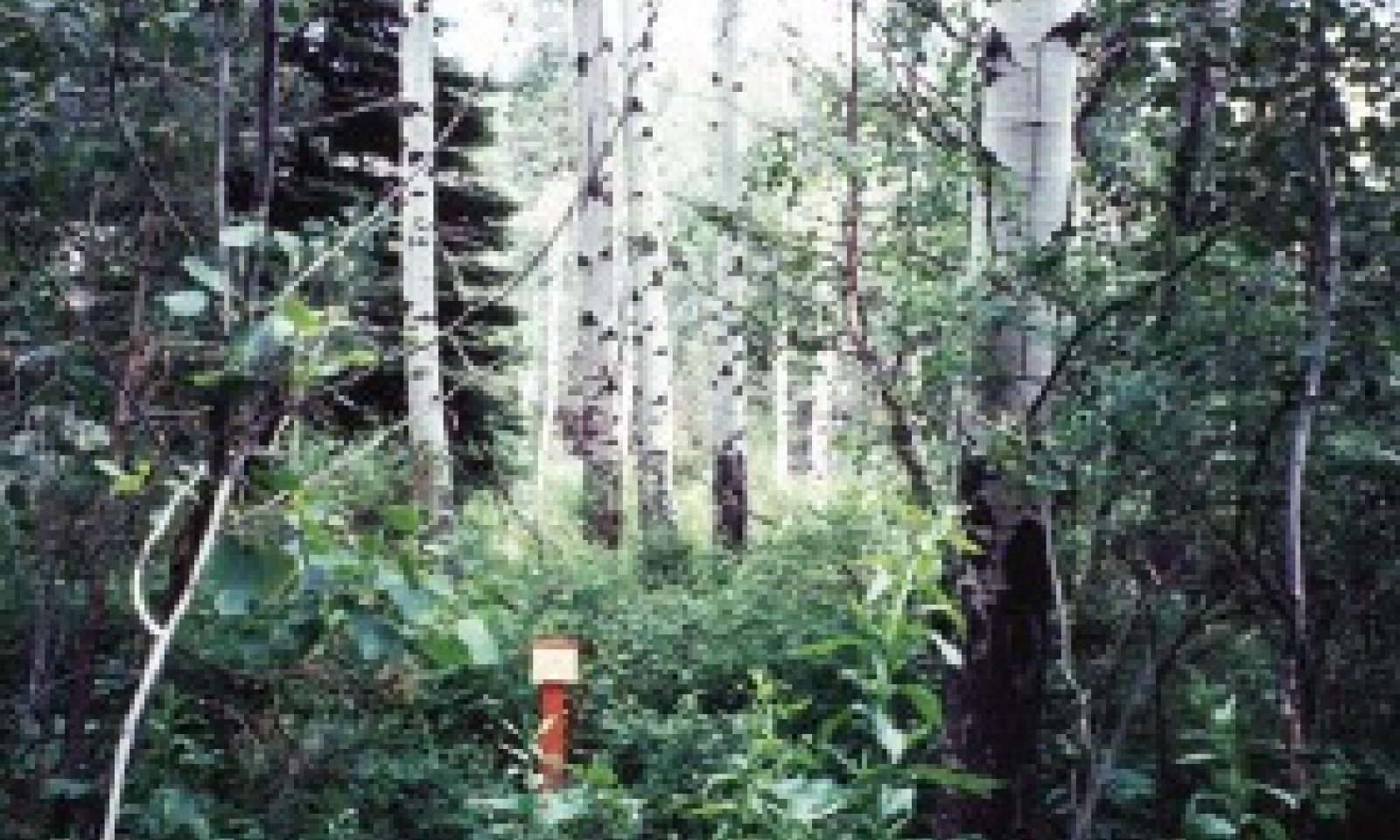
Reference
Figure 1. from Kovalchik et al., 2004
Mature overstory of aspen with an occasional larch, Douglas-fir, or ponderosa pine possible. Heavy coverage of common snowberry and occasional conifer in the understory. The aspen in this reference state are a stable plant community with conifers not able to overtake the site. This site appears sporadically on the landscape adjacent to the Douglas-fir/Common Snowberry plant association. Any severe disturbance will activate aspen regeneration through root sprouting. Many of these sites can be overgrazed which could affect aspen productivity. Aspen can obtain moderate to good size on this site as compared to the aspen/pinegrass site which is located at higher elevations and less moisture.
Community 1.1
Reference PhaseReference Plant community is maintained by reoccurring disturbance (usually wildfire) and root cloning.
1.1A is not a pathway from one community phase to another but an indicator of a disturbance dependent community phase. The community phase usually remains stable until the disturbance regime or return-cycle is disrupted.Dominant plant species
-
quaking aspen (Populus tremuloides), tree
-
ponderosa pine (Pinus ponderosa), tree
-
Rocky Mountain Douglas-fir (Pseudotsuga menziesii var. glauca), tree
-
western larch (Larix occidentalis), tree
-
black cottonwood (Populus balsamifera ssp. trichocarpa), tree
-
paper birch (Betula papyrifera), tree
-
common snowberry (Symphoricarpos albus), shrub
-
Saskatoon serviceberry (Amelanchier alnifolia), shrub
-
thimbleberry (Rubus parviflorus), shrub
-
Rocky Mountain maple (Acer glabrum), shrub
-
gray alder (Alnus incana), shrub
-
redosier dogwood (Cornus sericea), shrub
-
blue wildrye (Elymus glaucus), grass
-
field horsetail (Equisetum arvense), other herbaceous
-
sweetcicely (Osmorhiza berteroi), other herbaceous
-
starry false lily of the valley (Maianthemum stellatum), other herbaceous
-
northern bluebells (Mertensia paniculata var. borealis), other herbaceous
Additional community tables
Table 6. Community 1.1 plant community composition
Group Common name Symbol Scientific name Annual production () Foliar cover (%) Interpretations
Supporting information
References
-
Kovalchik, B.L. and R.R. Clausnitzer. 2004. Classification and Management of Aquatic, Riparian, and Wetland Sites on the National Forests of Eastern Washington: Series Description. General Technical Report PNW-GTR-593. United States Department of Agriculture, Forest Service, Pacific Northwest Research Station. 1–354.
-
Williams, C.K., B.F. Kelley, B.G. Smith, and T.R. Lillybridge. October, 1995. Forested Plant Associations of the Colville National Forest.
-
Williams, C.K. and T.R. Lillybridge. 1983. Forested Plant Associations of the Okanogan National Forest
R6-Ecol-132b-1983.
Approval
Kirt Walstad, 4/11/2025
Rangeland health reference sheet
Interpreting Indicators of Rangeland Health is a qualitative assessment protocol used to determine ecosystem condition based on benchmark characteristics described in the Reference Sheet. A suite of 17 (or more) indicators are typically considered in an assessment. The ecological site(s) representative of an assessment location must be known prior to applying the protocol and must be verified based on soils and climate. Current plant community cannot be used to identify the ecological site.
Author(s)/participant(s) Contact for lead author Date 12/18/2020 Approved by Approval date Composition (Indicators 10 and 12) based on Annual Production Indicators
-
Number and extent of rills:
-
Presence of water flow patterns:
-
Number and height of erosional pedestals or terracettes:
-
Bare ground from Ecological Site Description or other studies (rock, litter, lichen, moss, plant canopy are not bare ground):
-
Number of gullies and erosion associated with gullies:
-
Extent of wind scoured, blowouts and/or depositional areas:
-
Amount of litter movement (describe size and distance expected to travel):
-
Soil surface (top few mm) resistance to erosion (stability values are averages - most sites will show a range of values):
-
Soil surface structure and SOM content (include type of structure and A-horizon color and thickness):
-
Effect of community phase composition (relative proportion of different functional groups) and spatial distribution on infiltration and runoff:
-
Presence and thickness of compaction layer (usually none; describe soil profile features which may be mistaken for compaction on this site):
-
Functional/Structural Groups (list in order of descending dominance by above-ground annual-production or live foliar cover using symbols: >>, >, = to indicate much greater than, greater than, and equal to):
Dominant:
Sub-dominant:
Other:
Additional:
-
Amount of plant mortality and decadence (include which functional groups are expected to show mortality or decadence):
-
Average percent litter cover (%) and depth ( in):
-
Expected annual annual-production (this is TOTAL above-ground annual-production, not just forage annual-production):
-
Potential invasive (including noxious) species (native and non-native). List species which BOTH characterize degraded states and have the potential to become a dominant or co-dominant species on the ecological site if their future establishment and growth is not actively controlled by management interventions. Species that become dominant for only one to several years (e.g., short-term response to drought or wildfire) are not invasive plants. Note that unlike other indicators, we are describing what is NOT expected in the reference state for the ecological site:
-
Perennial plant reproductive capability:
Print Options
Sections
Font
AAAAOther
PrintThe Ecosystem Dynamics Interpretive Tool is an information system framework developed by the USDA-ARS Jornada Experimental Range, USDA Natural Resources Conservation Service, and New Mexico State University.
Accessibility statement