Natural Resources
Conservation Service
Ecological site F043AX955MT
Subalpine Coniferous Cool Moist
subalpine fir (Abies lasiocarpa)-Engelmann spruce (Picea engelmannii)
Last updated: 3/11/2025
Accessed: 06/03/2026
-
Search


Major Land Resource Area or ecological site by name and/or ID.
PreviousSectionsNextGeneral information
Provisional. A provisional ecological site description has undergone quality control and quality assurance review. It contains a working state and transition model and enough information to identify the ecological site.
MLRA notes
Major Land Resource Area (MLRA): 043A–Northern Rocky Mountains
This MLRA is located in Montana (43 percent), Idaho (34 percent), and Washington (23 percent). It makes up about 31,435 square miles (81,460 square kilometers). It has no large cities or towns. It has many national forests, including the Okanogan, Colville, Kootenai, Lolo, Flathead, Coeur d’Alene, St. Joe, Clearwater, and Kaniksu National Forests.
This MLRA is in the Northern Rocky Mountains Province of the Rocky Mountain System. It is characterized by rugged, glaciated mountains; thrust- and block-faulted mountains; and hills and valleys. Steep-gradient rivers have cut deep canyons. Natural and manmade lakes are common.
The major Hydrologic Unit Areas (identified by four-digit numbers) that make up this MLRA are: Kootenai-Pend Oreille-Spokane (1701), 67 percent; Upper Columbia (1702), 18 percent; and Lower Snake (1706), 15 percent. Numerous rivers originate in or flow through this area, including, the Sanpoil, Columbia, Pend Oreille, Kootenai, St. Joe, Thompson, and Flathead Rivers.
This area is underlain primarily by stacked slabs of layered sedimentary or metasedimentary bedrock. The bedrock formations range from Precambrian to Cretaceous in age. The rocks consist of shale, sandstone, siltstone, limestone, argillite, quartzite, gneiss, schist, dolomite, basalt, and granite. The formations have been faulted and stacked into a series of imbricate slabs by regional tectonic activity. Pleistocene glaciers carved a rugged landscape that includes sculpted hills and narrow valleys filled with till and outwash. Continental glaciation over road the landscape in the northern half of the MLRA while glaciation in the southern half was confined to montane settings.
The average annual precipitation is 25 to 60 inches (635 to 1,525 millimeters) in most of this area, but it is as much as 113 inches (2,870 millimeters) in the mountains and is 10 to 15 inches (255 to 380 millimeters) in the western part of the area. Summers are dry. Most of the precipitation during fall, winter, and spring is snow. The average annual temperature is 32 to 51 degrees F (0 to 11 degrees C) in most of the area, decreasing with elevation. In most of the area, the freeze-free period averages 140 days and ranges from 65 to 215 days. It is longest in the low valleys of Washington, and it decreases in length with elevation. Freezing temperatures occur every month of the year on high mountains, and some peaks have a continuous cover of snow and ice.
The dominant soil orders in this MLRA are Andisols, Inceptisols, and Alfisols. Many of the soils are influenced by Mount Mazama ash deposits. The soils in the area have a frigid or cryic soil temperature regime; have an ustic, xeric, or udic soil moisture regime; and dominantly have mixed mineralogy. They are shallow to very deep, are very poorly drained to well drained, and have most of the soil texture classes. The soils at the lower elevations include Udivitrands, Vitrixerands and Haplustalfs. The soils at the higher elevations include Dystrocryepts, Eutrocryepts, Vitricryands , and Haplocryalfs. Cryorthents, Cryepts, and areas of rock outcrop are on ridges and peaks above timberline
This area is in the northern part of the Northern Rocky Mountains. Grand fir, Douglas-fir, western red cedar, western hemlock, western larch, lodgepole pine, subalpine fir, ponderosa pine, whitebark pine, and western white pine are the dominant overstory species, depending on precipitation, temperature, elevation, and landform aspect. The understory vegetation varies, also depending on climatic and landform factors. Some of the major wildlife species in this area are whitetailed deer, mule deer, elk, moose, black bear, grizzly bear, coyote, fox, and grouse. Fish, mostly in the trout and salmon families, are abundant in streams, rivers, and lakes.
More than one-half of this area is federally owned and administered by the U.S. Department of Agriculture, Forest Service. Much of the privately-owned land is controlled by large commercial timber companies. The forested areas are used for wildlife habitat, recreation, watershed, livestock grazing, and timber production. Meadows provide summer grazing for livestock and big game animals. Less than 3 percent of the area is cropland.LRU notes
This ecological site resides in MLRA 43A in the Livingston-Lewis-Apgar Mountains which includes the bulk of Glacier National Park (GNP) and the lower western valley portions along the Flathead River. The landscape is mountains and landforms include glaciated mountains with associated features such as U-shaped valleys, mountain slopes, alpine ridges, cirques, valley floors and moraines. Glaciation of this area was in the form of alpine, icecaps and valley outlet glaciers. It also includes associated alluvium and outwash features. This area includes low valleys to tall mountains with elevation ranging 989-2,762 m (3,250-9,050 ft.). The climate is cold and wet with mean annual air temperature of 3 degrees Celsius (37 degrees F)., mean frost free days of 65 days and mean annual precipitation of 1295 mm (51 in.) and relative effective annual precipitation is 169 cm (66 in.). The soil temperature regime is cryic and the soil moisture regime is udic. The geology of this area is dominated by metasedimentary rocks of the Belt Supergroup (Grinnell argillite and Siyeh limestone) with minor Tertiary sediments. Soils are generally weakly developed on mountain slopes within U-shaped valleys. Parent materials are commonly of colluvium, till, and residuum from metasedimentary rocks. Limestone bedrock within this part of the Belt Supergroup is not highly calcareous and due to high precipitation received in this area most carbonates at mid and upper elevations have been leached from the soil profiles. Bedrock depth varies greatly with location, landform and slope position. Volcanic ash is often found in the soil surface with various degrees of mixing. Thicker volcanic ash can be found on more stable positions on mid and upper elevation slopes that are protected from wind erosion. Volcanic ash is not typically found in low elevation areas on stream and outwash terraces associated with streams and rivers. There are numerous large lakes including St. Mary, Bowman, Kintla, Lake Sherburne, Logging, Upper Waterton and numerous creeks.
Classification relationships
This ecological site relates to the USFS Habitat Type ABLA/MEFE. This site relates to the USFS Habitat Type Group 7 and Fire Group 9. Both of these classification guides are specifically for the western Montana and northern Idaho region.
This ecological site relates to the NatureServe classification Abies lasiocarpa-Picea engelmannii/Menziesia ferruginea-Vaccinium scaprium Forest (CEGL005894) and Abies lasiocarpa-Picea engelmannii/Menziesia ferruginea/Xerophyllum tenax Forest (CEGL005895).Ecological site concept
Ecological Site Concept
This site is found in cool, moist mid-elevations that span the lower subalpine. It is found on mountain slope and glacial valley wall landforms, on back, foot and toeslope positions on moderate to steep slopes (35-60%) at elevations ranging 1,300-2,000 meters with all aspects. Subalpine fir (Abies lasiocarpa) and Engelmann spruce (Picea engelmannii) are the dominant overstory species with co-occurring Douglas-fir (Pseudotsuga menziesii) and lodgepole pine (Pinus contorta). The main understory species are the medium-sized shrub rusty menziesia that is patchy or dense, the tall height shrub thinleaf alder and other medium-sized shrubs such as thinleaf huckleberry and grouse whortleberry with an understory of beargrass, broadleaf arnica, sidebells wintergreen, and darkwoods violet. The soils associated with this ecological site are very deep and well drained. The subsurface parent material of these soils is glacial till or colluvium. Depending on landform position, slope aspect and slope shape the soils have varying amounts of volcanic ash as a surface layer of the soil profile over the underlying parent material. Typically, south-facing convex slopes will have little or no volcanic ash. Conversely, more north-facing slope aspects on linear to concave positions will have some amount of volcanic ash. Sites in concave accumulation zones in foot slope and toe slope positions often have the greatest thicknesses of volcanic ash. Although significant mixing of the ash with local soil materials can occur, subsoils below the volcanic ash tend to have a greater quantity of rock fragments than the volcanic ash surface layers. These soils are classified as Inceptisols or Andisols depending on the presence and thickness of volcanic ash in the profile. More specifically, they classify at the subgroup level of soil taxonomy as either Andic or Typic Humicryepts or Typic Haplocryands.Associated sites
F043AX952MT Lower Subalpine Cool Moist Coniferous subalpine fir-Engelmann spruce/Rocky Mountain maple-thinleaf huckleberry/thimbleberry
The 43A Lower Subalpine Coniferous Cool Moist Ashy Very Deep, (ABLA/CLUN2-ARNU2) is found in cool, moister mid-elevations that span the lower subalpine to subalpine. This ecological site is found on back, foot and toeslope positions, on glacial valley wall and moraine landforms, on all slopes, at elevations ranging 1,000 to 2,100 meters (3,300-6,900 feet). The 43A Lower Subalpine Coniferous Cool Moist Ashy Very Deep, (ABLA/CLUN2-ARNU2) has soils associated with this Ecological Site that are very deep, well drained or somewhat excessively drained and have subsoils with abundant rock fragments. The parent material is volcanic ash over glacial till from metasedimentary rock. In Soil Taxonomy, these soils classify primarily as Inceptisols soil order and more specifically as the Andic Haplocryepts taxonomic subgroup. The 43A Lower Subalpine Coniferous Cool Moist Ashy Very Deep, (ABLA/CLUN2-ARNU2) has a reference vegetation community of Subalpine fir-Engelmann spruce overstory and an understory of Rocky Mountain maple, thinleaf huckleberry, thimbleberry, wild Sarsaparilla, threeleaf foamflower and queencup bead lily.
R043AX968MT Montane Stable Colluvial Slope Saskatoon serviceberry-common snowberry/Sitka alder/ Rocky mountain maple/thimbleberry/mountain brome-Geyer’s sedge
The 43A Montane Stable Colluvial Slope ecological site is found on steep slopes (35-60 percent), on back, foot and toeslope positions on glacial valley wall landforms at elevations ranging from 1,150-2,100 meters (3,775-6,900 feet).The 43A Montane Steep Stable Colluvial Slope has soils that are very deep and well drained soils from till or colluvium from metasedimentary rock parent material. There is a high volume of fragments (50 to 67 percent by volume) within the soil profile. The predominant texture in the surface is very gravelly sandy loam and the subsurface is sandy skeletal. There are no redoximorphic features in the soil and there is rarely an argillic or mollic layer. There is a thin organic layer, usually less than 5 cm thick. The 43A Upper Subalpine Cold Coniferous (ABLA/LUGLH) has soils associated with this ecological site that are moderately deep, well drained and derived from glacial till or colluvium over residuum weathered from metasedimentary rock. Moderately deep depth class indicates that these soils are greater than 50 cm (20 inches) deep, but less than 100 cm (40 inches). These soils classify in the Inceptisols soil order and in the Typic Haplocryepts taxonomic subgroup. The 43A Montane Steep Stable Colluvial Slope ecological site is found on steep slopes with vegetation cover ranging from impenetrable shrubs to open canopy of medium statured shrubs with lush understory of grass and forb species. Steep sites on valley walls. The thick vegetative growth contributes to the dark surface horizon colors in these soils. The reference vegetation community is Saskatoon serviceberry (Amelancheir alnifolia), common snowberry (Symphoricarpos albus), Sitka alder (Alnus viridis ssp. sinuata), Rocky mountain maple (Acer glabrum), thimbleberry (Rubus parviflorus), mountain brome (Bromus marginatus) and Geyer’s sedge (Carex geyeri).
F043AX954MT Upper Subalpine Cold Coniferous subalpine fir (Engelmann spruce) /thinleaf huckleberry-rusty menziesia/ Hitchcock’s smooth woodrush-beargrass/yellow avalanche lily.
The 43A Upper Subalpine Cold Coniferous (ABLA/LUGLH) ecological site is found along the continental divide in cold, and moist to moderately dry, high elevations in the upper subalpine. It is primarily on cirque platform and headwall landforms, on backslope and shoulder positions at elevations ranging 1,700 to 2,600 meters (5,575-8,500 feet) with moderate to steep slopes ranging 10% to 80%.The 43A Upper Subalpine Cold Coniferous (ABLA/LUGLH) ecological site has a reference vegetation community of subalpine fir (and minor Engelmann spruce) with an understory of thinleaf huckleberry, rusty menziesia, Hitchcock’s smooth woodrush-beargrass and yellow avalanche lily.
Table 1. Dominant plant species
Tree (1) Abies lasiocarpa
(2) Picea engelmanniiShrub (1) Vaccinium membranaceum
(2) Menziesia ferrugineaHerbaceous (1) Arnica latifolia
(2) Xerophyllum tenaxPhysiographic features
This site is found in cool, moist mid-elevations that span the lower subalpine to subalpine. It is found on mountain slope and glacial valley wall landforms, on back, foot and toeslope positions on moderate to steep slopes (35-60%) at elevations ranging 1,300-2,000 meters (4,275-6,550 feet) with all aspects.

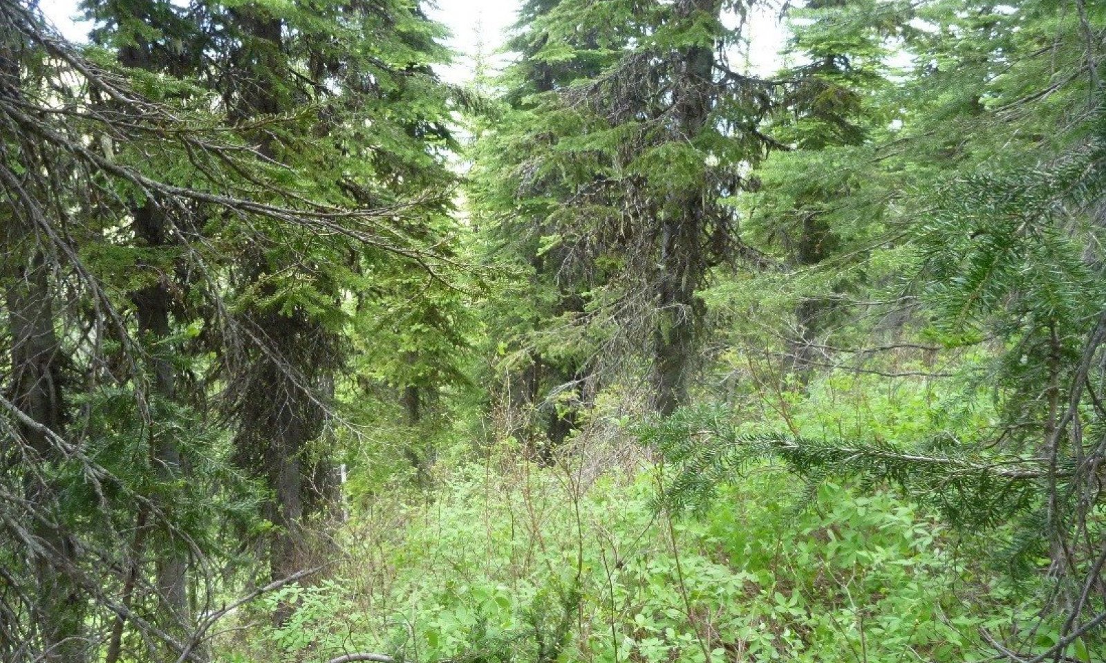
Figure 1. Landscape views of this ecological site.

Figure 2. Landscape views of this ecological site.
Table 2. Representative physiographic features
Landforms (1) Mountains > Glacial-valley wall
(2) Mountains > Mountain slope
(3) Mountains > Glacial-valley wall > Closed depression
Elevation 4265 – 6561 ft Slope 40 – 60 % Aspect W, NW, N, NE, E, SE, S, SW Table 3. Representative physiographic features (actual ranges)
Elevation 0 ft Slope 35 – 65 % Climatic features
This ecological site is found in the cryic soil temperature regime and the udic soil moisture regime. Cryic soils have average annual temperature of less than 8 degrees C. (46 degrees F.), with less than 5 degrees C. (41 degrees F.) difference from winter to summer. The udic soil moisture regime denotes that the rooting zone is usually moist throughout the winter and the majority of summer. This site is found on the west side of the Continental Divide and has more maritime weather influences.
Climate Summary for West Glacier:
Mean Average Precipitation: 84-216cm 33-85 inches
Mean Average Annual Temperature: 0-6 degrees Celsius 32-43 degrees F
Frost-Free Days: 30-70
Relative Effective Precipitation: 127-254 cm 50-100 inches
SUMMARY TABLES ARE FOR AVAILABLE CLIMATE STATIONS WHICH ARE ALL LOCATED IN VALLEYS.Table 4 Representative climatic features
Frost-free period (characteristic range) 20-60 days Freeze-free period (characteristic range) 80-120 days Precipitation total (characteristic range) 20-30 in Frost-free period (actual range) 10-70 days Freeze-free period (actual range) 70-130 days Precipitation total (actual range) 20-30 in Frost-free period (average) 40 days Freeze-free period (average) 100 days Precipitation total (average) 20 in Characteristic rangeActual rangeBarLineFigure 3. Monthly precipitation range
Characteristic rangeActual rangeBarLineFigure 4. Monthly minimum temperature range
Characteristic rangeActual rangeBarLineFigure 5. Monthly maximum temperature range
BarLineFigure 6. Monthly average minimum and maximum temperature
Figure 7. Annual precipitation pattern
Figure 8 Annual average temperature pattern
Climate stations used
-
(1) POLEBRIDGE 1 N [USC00246618], Essex, MT
-
(2) POLEBRIDGE [USC00246615], Essex, MT
-
(3) WEST GLACIER [USC00248809], Kalispell, MT
">Influencing water features
Soil features
The soils associated with this ecological site are very deep and well drained. The subsurface parent material of these soils is glacial till or colluvium. Depending on landform position, slope aspect and slope shape the soils have varying amounts of volcanic ash as a surface layer in the soil profile over the underlying parent material. Typically, south-facing convex slopes will have little or no volcanic ash. Conversely, more north-facing slope aspects on linear to concave positions will have some amount of volcanic ash. Sites in concave accumulation zones in foot slope and toe slope positions often have the greatest thicknesses of volcanic ash. Although significant mixing of the ash with local soil materials can occur, subsoils below the volcanic ash tend to have a greater quantity of rock fragments than the volcanic ash surface layers. These soils are classified as Inceptisols or Andisols depending on the presence and thickness of volcanic ash in the profile. More specifically, they classify at the subgroup level of soil taxonomy as either Andic or Typic Humicryepts or Typic Haplocryands. Diagnostic features include an ochric or umbric epipedon, cambic horizon and andic soil properties if ash is present and has the required thickness to make the Andic subgroup (18 cm to 37 cm thick) or the Andisols soil order (greater than 37 cm thick) (Soil Survey Staff, 2015). Underneath a closed tree canopy these sites may have a surface layer of the organic material up to 7 cm in thickness.
For more information on soil taxonomy, please follow this link:http://http://www.nrcs.usda.gov/wps/portal/nrcs/detail/soils/survey/class/?cid=nrcs142p2_053580
CORRELATED SOIL SERIES & SOIL TAXONOMIC NAME
Garlet Loamy-skeletal, mixed, superactive Typic Haplocryepts
Goathaunt Ashy-skeletal, amorphic Typic Haplocryands
Muddycreek Loamy-skeletal, isotic Andic HumicryeptsTable 5. Representative soil features
Parent material (1) Volcanic ash – metasedimentary rock
(2) Colluvium – metasedimentary rock
(3) Till – metasedimentary rock
Surface texture (1) Very gravelly, ashy loam
(2) Gravelly, ashy loam
(3) Very gravelly loam
Family particle size (1) Loamy-skeletal
(2) Ashy-skeletal
Drainage class Well drained Permeability class Moderate to moderately rapid Soil depth 60 – 100 in Surface fragment cover <=3" Not specified Surface fragment cover >3" Not specified Available water capacity
(1.6-5.2in)Not specified Soil reaction (1:1 water)
(4.5-6.5in)Not specified Ecological dynamics
Ecological Dynamics of the Site
This ecological site is found in cool, moist mid-elevations that span the lower subalpine through the subalpine zone. While primary data was collected in Glacier National Park (NP), this ecological site also occurs on the adjacent US Forest Service (USFS) Flathead National Forest (NF) land and in limited areas of the Kootenai NF. Associated sites to the 43A SUBALPINE COOL MOIST CONFEROUS ecological site include subalpine fir/queencup beadlily-rusty menziesia (ABLA/CLUN2-MEFE) at lower elevations, subalpine fir/Hitchcock’s smooth woodrush (ABLA/LUGLH) at higher elevations, subalpine fir/beargrass (ABLA/XETE) in drier areas, and subalpine fir/bluejoint (ABLA/CACA4) in very wet sites or wetland areas.
Management
Various management strategies can be employed for the 43A SUBALPINE COOL MOIST CONFEROUS ecological site, depending upon the ownership of the particular land and which value is prioritized. The management of the forest determines the composition of the stand and the amount of fuel loading. A stand will be managed differently and look differently if it is managed for timber or ecological services like water quality and quantity, old growth, or endangered species. If a stand is managed for timber, it may be missing certain attributes necessary for lynx habitat. If a stand is managed for lynx habitat, it may have increased fuels and therefore an increased risk of wildfires.
The USFS Habitat Type guide states that the basal area on the West side of the Continental Divide for ABLA/MEFE is 172+/- ft2 per acre and the site index at 50 years for Picea is 60 +/- 10 and for Abies 57+/-9. Timber production on these sites vary from moderate to high. Intensive management for timber production can have problems including partial cutting, which can increase shade-tolerant subalpine fir or lack of regeneration under the dense shrubs of rusty menziesia and Sitka alder. Site preparation by dozer scarification or prescribed burning on steep areas is essential. Prescribed burning can be accomplished only when fuels are dry on this rather moist site. Watershed values are high for this site. The management of USFS lands is encompassed in the management plan for each National Forest. The management plan for the Flathead NF also has an Appendix B that gives specific management guidelines for habitat types (which relate to our forested ecological sites) found on the forest in relation to current and historic data on forest conditions (Flathead NF Plan, 1998 amended 2001 and Appendix B). Another guiding USFS document is the Green et al. document, 1992 amended (2005) which defines “Old Growth” forest for the northern Rocky Mountains. This document provides an ecologically-based classification of old growth based on forest stand attributes including numbers of large trees, snags, downed logs, structural canopy layers, canopy cover, age, and basal area. While this document finds that the bulk of the pre-settlement upland old growth in the northern Rockies was in the lower elevation areas, ground fire-maintained ponderosa pine/western larch/Douglas-fir types (Losensky, 1992), it does not mean that other types were not common or not important. This could apply to some of the areas of this ecological site.
The USFS Habitat Type ABLA/MEFE is common on the Flathead NF, located just west of Glacier NP. The following is a personal communication with a silvicultural forester on management of subalpine fir/rusty menziesia (ABLA/MEFE) on the Flathead NF (Reichenberg, 1/2016):
This habitat type (HT) is common, but colder types dominate the Flathead NF This is managed to promote western larch and western white pine. These species are tolerant or resistant to root disease and insect outbreaks (much more so than subalpine fir, Engelmann spruce or Douglas-fir). Site preparation is key! Rapid and aggressive shrub response to sunlight. Planting is important to establish favored seral species before shrubs occupy site. Use large scalps (area of bare mineral soil created by the tree planter with hoedad) when planting to deter competing vegetation. This HT can grow some great picea species. I try to mix some in with the planting prescription. Currently, there is an uptick of western spruce budworm potentially brought on by the current drier weather conditions. Another reason to promote western white pine is that it is expected to be adaptable in the face of climate change and to restore this species to the landscape after the significant mortality caused by the introduction of white pine blister rust. The current generation of resistant western white pine seedling stock shows up to 60 percent survival against white pine blister rust. Historically, this habitat type was managed using traditional even age strategies on the FNF. Management also needed to employ intense methods to allow for scarification of the soil which is a regeneration requirement of western larch. These methods included harvesting using skid trails and prescribed burns for site preparation. These methods are constrained because of soil and air quality concerns. Therefore, planting of western larch is employed instead and there is competition by Canada thistle and grass. As well, management on this habitat type is further constrained by concerns for Lynx habitat. Unless a unit is classified as WUI or is managed for western white pine, there is no pre-commercial thinning allowed in this habitat type. This inability to thin stands could cause forest stand health issues with root disease or insect outbreaks if the stand has significant density of the vulnerable species of subalpine fir, Engelmann spruce or Douglas-fir. The inability to thin also greatly affects the diameter growth of individual trees. Traditional even-aged management on this type consists of pre-commercial thinning followed by commercial thinning to grow older larger western larch. A seed tree harvest leaving western larch and western white pine and large diameter Douglas fir and western larch snags for wildlife is used to regenerate a new stand. If a stand has sufficient subalpine fir, then it might trip the snowshoe hare screen for the Lynx Amendment and then left alone. Multi-story structure of a stand and minimum cutting unit size is important for lynx habitat. As well, if a unit is deemed old growth then it is left alone even if these conditions make it susceptible to root rot or insect damage because these conditions are consistent with forest succession on this habitat type.
Associated Sites
43A Montane Steep Stable Colluvial Slope
43A Lower Subalpine Coniferous Cool Moist Ashy Very Deep, (ABLA/CLUN2-ARNU2)
43A Upper Subalpine Cold Coniferous, ABLA/LUGLH)
The 43A Montane Steep Stable Colluvial Slope ecological site is found on steep slopes with vegetation cover ranging from impenetrable shrubs to open canopy of medium statured shrubs with lush understory of grass and forb species. Steep sites on valley walls. The thick vegetative growth contributes to the dark surface horizon colors in these soils. The reference vegetation community is Saskatoon serviceberry (Amelancheir alnifolia), common snowberry (Symphoricarpos albus), Sitka alder (Alnus viridis ssp. sinuata), Rocky mountain maple (Acer glabrum), thimbleberry (Rubus parviflorus), mountain brome (Bromus marginatus) and Geyer’s sedge (Carex geyeri).
The 43A Lower Subalpine Coniferous Cool Moist Ashy Very Deep, (ABLA/CLUN2-ARNU2) has a reference vegetation community of Subalpine fir-Engelmann spruce overstory and an understory of Rocky Mountain maple, thinleaf huckleberry, thimbleberry, wild Sarsaparilla, threeleaf foamflower and queencup bead lily.
The 43A Upper Subalpine Cold Coniferous (ABLA/LUGLH) ecological site has a reference vegetation community of subalpine fir (and minor Engelmann spruce) with an understory of thinleaf huckleberry, rusty menziesia, Hitchcock’s smooth woodrush-beargrass and yellow avalanche lily.
State 1.0
Western white pine (Pinus monticola)/(subalpine fir (Abies lasiocarpa)-Engelmann spruce (Picea engelmannii)/Sitka alder (Alnus viridis ssp. sinuata)/rusty menziesia (Menziesia ferruginea)-thinleaf huckleberry (Vaccinium membranaceum)/common beargrass (Xerophyllum tenax).
Historically western white pine would have been within Flathead County which encompasses the Flathead NF and in lower elevations, west of the Continental Divide in Glacier NP. The historic extent of western white pine in Glacier National Park was primarily along the western border. Originally, western white pine covered 5 million acres in the Inland Northwest. Western white pine is incredibly productive for timber with a very high growth rate, tall and deep rooted, and competes best on highly variable, high resource sites. As well, it is tolerant to the native root rot diseases and other native forest pests, susceptible to Armillaria root disease only when young, and to mountain pine beetle largely at advanced ages (over 140 years). It also has the capability to thrive in a wide variety of sites and environments, which means it has high ecological flexibility. It is a long-living seral species that tolerated intense timber harvesting practices and severe fire disturbance by its ability to regenerate heavily on mineral soil and full sunlight. Fire greatly influences the composition, structure, and function of vegetation across the landscape. Historically, the area had mixed severity fires in between severe stand-replacement fires. Western larch and western white pine are long-lived, fire-adapted, shade-intolerant tree species that thrived historically. Also present in significant amounts particularly in young stands, but declined through time due to effects of insects and pathogens, were shorter-lived, shade-intolerant, fire-adapted tree species such as Douglas-fir and lodgepole pine. Shade-tolerant, fire-intolerant tree species such as western cedar, western hemlock, grand fir, Engelmann spruce, and subalpine fir were present but rarely survived long enough to dominate stands, except where the interval between fires was unusually long and where root disease was not severe. Western white pine was a major component in forested ecosystems of the inland northwest U.S. prior to the 20th century, but has been greatly reduced in distribution and abundance by white pine blister rust, mountain pine beetles, and anthropogenic fire exclusion (Tomback and Achuff, 2010). Western white pine has been replaced by Douglas-fir, grand fir, and western hemlock. Douglas-fir and grand fir are susceptible to a greater variety of insect and disease problems, and hemlock is more sensitive to drought and decay. More stands have also progressed to the climax species-dominated phase, which previously were rarely achieved due to the fire rotations and susceptibility of these species to disease and forest pests. In a study of pathogens and insects effects on forests within the Inland Empire found that, excluding fire, there were more than 90 percent of sample stands changed to a different cover type, structure stage, or both during a 40-year period that was coincident with the blister rust epidemic and fire suppression policy. Root pathogens, white pine blister rust, and bark beetle were the cause of most changes, and this accelerated succession of western white pine, ponderosa pine, and lodgepole pine to later successional, more shade-tolerant species. Structure was reduced in stand density or prevented canopy closure. Grand fir, Douglas-fir, and subalpine fir were the predominant cover types at the end of the period and were highly susceptible to root diseases, bark beetles, fire, and drought. It is estimated that there will be greater accumulations occurring in low-density mature and younger pole-sized stands that result from root disease and bark beetle-caused mortality (Byler and Hagel, 2000). These stands are also less productive in terms of timber. They also are dominated by species with high nutrient demands, in areas where nutrient storage and cycling rates are increasingly depressed. This will likely lead to ever-increasing stress and destabilization by pests and diseases. Drought can further exacerbate the situation by stressing trees. The Inland Empire Tree Improvement Cooperative and the USFS have a breeding program for blister-resistant western white pine. There has been a total of approximately 5 percent of the original acre range planted with rust-resistant stock. Currently, the modified stock shows about 60 percent resistance to blister rust. A study modeling the effects of climate change found that warming temperatures would favor increased abundance of western white pine over existing climax and shade-tolerant species in Glacier NP, mainly because warmer conditions potentiate fire dynamics, including increased wildfire frequency and extent, which facilitates regeneration (Loehman et al., 2011).
State 2: Subalpine fir (Douglas fir) /Greene’s mountain ash/rusty menziesia-thinleaf huckleberry/beargrass.
State 2 is different than State 1 in that western white pine no longer plays a significant role in the seral communities as it once did. Western white pine has been dramatically reduced in numbers and area by the epidemics of white pine blister rust, western spruce budworm, and dramatic fire suppression. Therefore, climax species have been able to fill the seral role that western white pine held. As well, more forests are progressing to the climax or Reference phase than historically when most forests were in the fire-maintained western white pine-dominated seral phase. Forests are now dominated by these shade-tolerant climax species subalpine fir and Engelmann spruce. While there is a tremendous effort to bolster the numbers of western white pine, it currently covers only 5 percent of its historic range.
Subalpine fir (Abies lasiocarpa) and Engelmann spruce (Picea engelmannii) are the dominant overstory species with co-occurring Douglas-fir (Pseudotsuga menziesii) and lodgepole pine (Pinus contorta). The main understory species are the medium-sized shrub rusty menziesia that is patchy or dense, the tall height shrub Greene’s mountain ash and Utah honeysuckle, and other medium-sized shrubs such as thinleaf huckleberry with an understory of beargrass, sidebells wintergreen, threeleaf foamflower and darkwoods violet. Subalpine fir, Engelmann spruce, western larch, Douglas-fir, western white pine, and lodgepole pine are present in order of decreasing abundance. The rusty menziesia (MEFE) indicated type specifically represents areas that are cold and moist. It is more common on cool northern and eastern exposures, and where rusty menziesia and broadleaf arnica (ARLA8) are abundant. Historically, this site would have had western white pine before this species was decimated by the white pine blister rust epidemic (Mcdonald et al., 2000).
This ecological site is described as having cool and moist site conditions and high species diversity in the overstory. Sites after stand-replacement fires can be dominated by lodgepole pine. Sites are too cool for western redcedar and western hemlock, and not cold enough for whitebark pine in any major way. The historic fire regime of these forests is one of low frequency (about 128 years) and high intensity, and therefore there is an increased chance of stand-replacement fire when it does occur due to moist site conditions and relatively high loadings of live and dead fuels, combined with periodic summer drought. Stand-replacement fires occur in patches of 200 to 2,000 hectares (McDonald et al., 2000). The general post-disturbance successional phases include the stand initiation phase dominated by herbaceous and shrub species and conifer seedlings, the competitive exclusion phase of dense pole-sized mixed conifer or single seral species, the maturing forest of overstory mixed conifer trees with or without patches of regeneration, and the Reference Phase dominated by subalpine fir and Engelmann spruce with small gap dynamics. Understory burns, which effect the understory shrub and herbaceous species and conifer regeneration the most, can occur and maintain any community phase. A stand-replacement fire in the mature forest or Reference Phase would result in the stand initiation phase, with species composition of seedlings varying with site conditions. Moderate fires (or mixed severity fires) in the competitive exclusion phase would favor the more fire-resistant Douglas-fir, western larch, or western white pine over lodgepole pine, Engelmann spruce, and subalpine fir. Therefore, these species would dominate the maturing forest phase for longer periods of time. After a stand-replacement fire at this stage with serotinous lodgepole present, these seedlings would dominate the seedling and competitive exclusion phases. Absence of fire will transition the competitive exclusion phase to a mature forest, dominated in the overstory by a mix of conifer species. Moderate or severe fire at this stage could remove much of the Douglas-fir, leaving the site to be regenerated by either serotinous lodgepole or remnant western larch. Severe fires that remove even western larch will return to the treeless stand initiation phase. If fire does not occur in the forest maturing phase, then this will continue into the Reference Phase. Significant fires that have occurred on the west side of the Continental Divide and affected this ecological site are the 1994 Starvation Creek fire, which burned 4,001 acres in Glacier NP and 7,202 in total, caused by lightning. The Wedge Canyon fire in 2003 burned 30,314 acres in Glacier NP, 53,359 total acres, and was caused by lightning. The 1988 Red Bench fire burned 27,500 acres in Glacier NP, and a total of 36,037 acres, also caused by lightning. In 2001, the Moose fire burned 27,194 acres in Glacier NP and 70,605 total acres, caused by lightning. The 2003 Robert fire burned 39,384 acres in Glacier NP, 52,747 total acres, and was caused by humans; while lightning caused the Harrison fire that same year, burning 5,864 acres in Glacier NP and the Rampage fire, which burned 21,630 acres in Glacier NP.
Both subalpine fir and Engelmann spruce are subjected to a variety of diseases and insect pests including root rot, stem decay, bark beetles, and wood borers and defoliators. These can weaken and or kill trees and result in small openings scattered throughout the forest, or major mortality during an outbreak such as western spruce budworm (Choristoneura occidentalis). The patterns of damage from endemic populations of insects and disease creates small openings, whereas epidemic patterns are extensive throughout the landscape. Windthrow commonly can cause additional damage to stands following disease and pest disturbance. Subalpine fir is most commonly susceptible to Armillaria and Annosus root disease, pouch, Indian paint, and red belt fungi which cause stem decay, metallic, roundheaded, and Western balsam bark beetle, fir canker, and defoliators such as Delphinella shoot blight, black mildew, brown felt blight, fir needlecast, snow blight, and fir-blueberry rust. Engelmann spruce is most commonly susceptible to Annosus and Schweinitzii root disease and butt rot, pini rot, stem decays by red belt fungus, metallic and roundheaded borers, spruce beetle, blue stain of sapwood, spruce broom rust, spruce canker, and brown felt blight.
Aerial photography is a good tool to use to discern the level of insect and disease and the damage patterns and whether these are at endemic or epidemic levels. These maps capture only moments in time, and infestations grow and move from location to location following their preferred habitat, so repeated photography can be necessary. Specifically for the northern region, the USFS Stand Health map shows that the major impact is defoliation by western spruce budworm. The defoliation was categorized as mostly low severity (equal to or less than 50 percent defoliation) and some as high (with greater than 50 percent defoliation) on Abies species, and the damage is contiguous or nearly continuous. The forest type was categorized as western Fir-Spruce type. There was also defoliation by Western Spruce budworm on Douglas-fir, but to a much lesser degree. Larch casebearer, a defoliator of western larch, and generalized needlecast of larch was also found to a much lesser degree. Scattered small areas were found throughout the region including mortality from mountain pine beetle on lodgepole pine, Douglas-fir beetle on Douglas-fir, spruce beetle on Engelmann spruce, fir engravers and woolly adelgid on Abies species, and general Abies species mortality. All of these would affect this ecological site and field notes corroborate these findings.
Community Phase 2.1
Structure: multistory with small gap dynamics
The overstory is dominated by subalpine fir and Engelmann spruce, with small gap dynamics in which small numbers of trees are dead and conifer regeneration is infilling. The canopy cover ranges from 40-60 percent. The understory is dominated by a shrub layer in which the indicator species, rusty menziesia, is present and may be dominant. Species with high frequency of occurrence in 7 canopy cover sites include: thinleaf huckleberry, beargrass, Greene’s mountain ash and rusty menziesia. Foliar cover (taken at three sites) is high at this community phase, and the ground cover predominantly consists of very high cover of duff (86%) with a low amount (State and transition model
More interactive model formats are also available. View Interactive Models
Click on state and transition labels to scroll to the respective textEcosystem states
State 1 submodel, plant communities
Communities 1 and 5 (additional pathways)
State 2 submodel, plant communities
Communities 1, 5 and 2 (additional pathways)
State 3 submodel, plant communities
State 1
Historic ReferenceState 1.0
Western white pine (Pinus monticola)/(subalpine fir (Abies lasiocarpa)-Engelmann spruce (Picea engelmannii)/Sitka alder (Alnus viridis ssp. sinuata)/rusty menziesia (Menziesia ferruginea)-thinleaf huckleberry (Vaccinium membranaceum)/common beargrass (Xerophyllum tenax).Community 1.1
Reference CommunitySubalpine fir-Engelmann spruce overstory
Minor white pine-western larch
Structure: Multistory with small gap dynamics
Rare phase due to disturbance rotationsFigure 9. Annual production by plant type (representative values) or group (midpoint values)
Table 6. Annual production by plant type
Plant type Low
(lb/acre)Representative value
(lb/acre)High
(lb/acre)Grass/Grasslike – – – Total – – – Community 1.2
SeedlingsWhite pine-western larch-(lodgepole pine) seedlings.
Structure: patchy clumps, single story.
Time spent in this phase: 1-50 yearsCommunity 1.3
Pole Sized PhaseWhite pine-western larch-(subalpine fir-Engelmann spruce-Douglas fir)
Structure: dense single story with diminished understory.
Time spent in this phase: 50-140 yearsCommunity 1.4
Vertical Differentiation in StandWhite pine-(western larch-subalpine fir-Engelmann spruce-Douglas fir).
Structure: some vertical differentiation in stand.
Time spent in this phase: 140 years- centuriesCommunity 1.5
White Pine Mature StandWhite pine-(western larch-Douglas fir-subalpine fir-PIEN).
Structure: Mature stand with patches.
Time spent in this phase: 140 years- centuriesPathway 1.1A
Community 1.1 to 1.2A major stand-replacement fire disturbance such as a high-intensity fire, large-scale wind event, or major insect infestation.
Pathway 1.2A
Community 1.2 to 1.3Growth over time with no further significant disturbance.
Pathway 1.3A
Community 1.3 to 1.4No further major disturbance. Continued growth over time, as well as ongoing mortality, leads to continued vertical diversification.
Pathway 1.3B
Community 1.3 to 1.5A larger disturbance, such as an insect infestation, wind storm, or rot pocket that would create this forest structure.
Pathway 1.4A
Community 1.4 to 1.1Growth over time with no further significant disturbance, leading to the reference phase.
Pathway 1.5A
Community 1.5 to 1.1Growth over time with no further significant disturbance, leading to the reference phase.
State 2
Current PotentialState 2: Subalpine fir (Douglas fir) /Greene’s mountain ash/rusty menziesia-thinleaf huckleberry/beargrass.
State 2 is different than State 1 in that western white pine no longer plays a significant role in the seral communities as it once did. Western white pine has been dramatically reduced in numbers and area by the epidemics of white pine blister rust, western spruce budworm, and dramatic fire suppression. Therefore, climax species have been able to fill the seral role that western white pine held. As well, more forests are progressing to the climax or Reference phase than historically when most forests were in the fire-maintained western white pine-dominated seral phase. Forests are now dominated by these shade-tolerant climax species subalpine fir and Engelmann spruce. While there is a tremendous effort to bolster the numbers of western white pine, it currently covers only 5 percent of its historic range.Community 2.1
Reference Community


Plant Community 2.1 Reference Community
Subalpine fir (Engelmann spruce) /Greene’s mountain ash/rusty menziesia-thinleaf huckleberry/beargrass/moss.
Structure: Multistory with small gap dynamics
Tree Age: 150+ yearsForest overstory.The forest overstory composition is dominated by subalpine fir with less Engelmann spruce. There are few if any seral trees in the overstory such as Douglas fir, lodgepole pine, western larch.
Forest understory. The forest understory is predominantly fool's huckleberry shrubs along with other moderately statured shrubs such as thinleaf huckleberry and Greene's mountain ash. There is a diverse herbaceous and subshrub layer including beargrass.
Dominant plant species
-
subalpine fir (Abies lasiocarpa), tree
-
Engelmann spruce (Picea engelmannii), tree
-
rusty menziesia (Menziesia ferruginea), shrub
-
Greene's mountain ash (Sorbus scopulina), shrub
-
thinleaf huckleberry (Vaccinium membranaceum), shrub
-
common beargrass (Xerophyllum tenax), other herbaceous
-
western rattlesnake plantain (Goodyera oblongifolia), other herbaceous
-
sidebells wintergreen (Orthilia secunda), other herbaceous
-
arrowleaf ragwort (Senecio triangularis), other herbaceous
Figure 10. Annual production by plant type (representative values) or group (midpoint values)
Table 7. Soil surface cover
Tree basal cover 0-10% Shrub/vine/liana basal cover 10-20% Grass/grasslike basal cover 0-0% Forb basal cover 0-10% Non-vascular plants 0-10% Biological crusts 0% Litter 50-60% Surface fragments >0.25" and <=3" 0-10% Surface fragments >3" 0-10% Bedrock 0% Water 0% Bare ground 0-10% Table 8. Canopy structure (% cover)
Height Above Ground (ft) Tree Shrub/Vine Grass/
GrasslikeForb <0.5 0-5% 5-10% 0-2% 0-5% >0.5 <= 1 0-5% 5-10% 0-2% 5-10% >1 <= 2 0-5% 5-15% – – >2 <= 4.5 0-5% 5-10% – – >4.5 <= 13 0-5% 5-10% – – >13 <= 40 0-5% 0-5% – – >40 <= 80 10-30% – – – >80 <= 120 20-40% – – – >120 0-10% – – – Community 2.2
Mature Stand with Open PatchesPlant Community 2.2
Subalpine fir-Engelmann spruce(Lodgepole pine)/ Rusty menziesia-thinleaf huckleberry/beargrass.
Sturcture: Mature stand with patches.
Tree Age: 0-10 and 150+ years.Community 2.3
Patchy Clumps, Single StoryPlant Community 2.3
Structure: patchy clumps, single story.
Time spent in this phase: 20-40 years.Community 2.4
Dense Single Story with Diminished Understory

Plant Community 2.4
Structure: dense single story with diminished understory.
Time spent in this phase: 25-60 yearsForest overstory.The forest overstory composition at this phase is dominated by lodgepole pine generally at all stratum. The main overstory is an even-aged stand with lodgepole pine dominant and some subalpine fir in low cover. Emergent from the main canopy is Douglas fir and lodgepole pine. The subcanopy has subalpine fir and Engelmann spruce.
Forest understory. The forest understory has moderate cover (average 30 percent) of medium statured shrubs, namely fool's huckleberry with a low cover of herbaceous forbs (10 percent average).
Dominant plant species
-
lodgepole pine (Pinus contorta), tree
-
subalpine fir (Abies lasiocarpa), tree
-
Douglas-fir (Pseudotsuga menziesii), tree
-
rusty menziesia (Menziesia ferruginea), shrub
-
thinleaf huckleberry (Vaccinium membranaceum), shrub
-
grouse whortleberry (Vaccinium scoparium), shrub
-
common beargrass (Xerophyllum tenax), other herbaceous
Table 9. Soil surface cover
Tree basal cover 0-10% Shrub/vine/liana basal cover 0-10% Grass/grasslike basal cover 0-0% Forb basal cover 0-10% Non-vascular plants 0-10% Biological crusts 0% Litter 60-80% Surface fragments >0.25" and <=3" 0-10% Surface fragments >3" 0-10% Bedrock 0% Water 0% Bare ground 0-10% Table 10. Canopy structure (% cover)
Height Above Ground (ft) Tree Shrub/Vine Grass/
GrasslikeForb <0.5 0-5% 0-5% 0-2% 0-5% >0.5 <= 1 0-5% 5-10% 0-2% 0-5% >1 <= 2 0-5% 10-15% – 0-5% >2 <= 4.5 0-5% 0-10% – – >4.5 <= 13 0-5% 0-5% – – >13 <= 40 10-20% 0-5% – – >40 <= 80 20-40% – – – >80 <= 120 10-20% – – – >120 0-10% – – – Community 2.5
Vertical Differentiation in Mature Stand
Plant Community 2.5
Subalpine fir-Engelmann spruce(Lodgepole pine)/ Rusty menziesia-thinleaf huckleberry/beargrass.
Structure: some vertical differentiation in stand.
Time spent in this phase: 20-50 years.Forest overstory.The forest overstory is predominantly a mature, tall, older stand of subalpine fir and to a less degree Engelmann spruce with pockets of lodgepole pine in low cover.
Forest understory. The understory is predominantly moderate stature shrubs, namely fool's huckleberry, Greene's mountain ash and Utah honeysuckle and thinleaf huckleberry. Commonly, the understory can be dominated by just fool's huckleberry. There is a diverse, lush herbaceous and subshrub layer under the taller shrubs.
Dominant plant species
-
subalpine fir (Abies lasiocarpa), tree
-
Engelmann spruce (Picea engelmannii), tree
-
lodgepole pine (Pinus contorta), tree
-
rusty menziesia (Menziesia ferruginea), shrub
-
Utah honeysuckle (Lonicera utahensis), shrub
-
Greene's mountain ash (Sorbus scopulina), shrub
-
thinleaf huckleberry (Vaccinium membranaceum), shrub
-
common beargrass (Xerophyllum tenax), other herbaceous
-
sidebells wintergreen (Orthilia secunda), other herbaceous
-
threeleaf foamflower (Tiarella trifoliata), other herbaceous
Table 11. Soil surface cover
Tree basal cover 0-10% Shrub/vine/liana basal cover 10-20% Grass/grasslike basal cover 0-0% Forb basal cover 0-10% Non-vascular plants 0-10% Biological crusts 0% Litter 60-80% Surface fragments >0.25" and <=3" 0-10% Surface fragments >3" 10% Bedrock 0% Water 0% Bare ground 0-10% Table 12. Canopy structure (% cover)
Height Above Ground (ft) Tree Shrub/Vine Grass/
GrasslikeForb <0.5 0-5% 0-10% 0-2% 0-5% >0.5 <= 1 0-5% 0-10% 0-2% 0-5% >1 <= 2 0-5% 10-20% – 0-5% >2 <= 4.5 0-5% 10-20% – 0-5% >4.5 <= 13 5-10% 0-10% – – >13 <= 40 5-10% – – – >40 <= 80 5-20% – – – >80 <= 120 10-20% – – – >120 5-15% – – – Pathway 2.1A
Community 2.1 to 2.2This pathway represents a larger disturbance, such as an insect infestation, wind storm, or rot pocket that would create this forest structure. Areas of regeneration would range from approximately 2 to 5 acres.
Pathway 2.1B
Community 2.1 to 2.3This pathway represents a major stand-replacement fire disturbance such as a high-intensity fire, large-scale wind event, or major insect infestation.
Pathway 2.2A
Community 2.2 to 2.1This pathway represents growth over time with no further significant disturbance. The areas of regeneration pass through the typical stand phases-competitive exclusion, maturation, and understory reinitiation until they resemble the old-growth structure of the Reference Community.
Pathway 2.2B
Community 2.2 to 2.3This pathway represents a major stand-replacement fire disturbance such as a high-intensity fire, large-scale wind event, or major insect infestation.
Pathway 2.3A
Community 2.3 to 2.4This pathway represents continued growth over time with no further major disturbance.
Pathway 2.4B
Community 2.4 to 2.3This pathway represents a major stand-replacement fire disturbance, such as a major insect outbreak, or major fire event which leads to the stand initiation phase of forest development.
Pathway 2.4A
Community 2.4 to 2.5
Dense Single Story with Diminished Understory
Vertical Differentiation in Mature StandThis pathway represents no further major disturbance. Continued growth over time
Pathway 2.5A
Community 2.5 to 2.1
Vertical Differentiation in Mature Stand
Reference CommunityThis pathway represents no further major disturbance. Continued growth over time, as well as ongoing mortality, leads to continued vertical diversification. The community begins to resemble the structure of the Reference Community, with small pockets of regeneration and a more diversified understory.
Pathway 2.5C
Community 2.5 to 2.2This pathway represents no further major disturbance. Continued growth over time,
Pathway 2.5B
Community 2.5 to 2.3This pathway represents a major stand-replacement fire disturbance, leading to the stand initiation phase of forest development.
State 3
Root RotAnother disease affecting the 43A SUBALPINE COOL MOIST CONFEROUS ecological site is root rot. Armillaria root disease is the most common root disease fungus in this region, especially prevalent west of the Continental Divide. It may be difficult to detect until it has killed enough trees to create large root disease pockets or centers, ranging in size from a fraction of an acre to hundreds of acres. The root disease spreads from an affected tree to its surrounding neighbors through root contact. The root disease affects the most susceptible tree species first, leaving less susceptible tree species that mask its presence. When root rot is severe, the pocket has abundant regeneration or dense brush growth in the center. In western Montana and northern Idaho, Armillaria is present in most stands with diffuse mortality and large and small root disease centers. The disease pattern is one of multiple clones merging to form essentially continuous coverage of sites. Grouped as well as dispersed mortality can occur throughout the stand. A mosaic of brushy openings, patches of dying trees, and apparently unaffected trees may cover large areas. There can be highly significant losses, usually requiring species conversion in the active management approach. Management tactics include to identify the type of Armillaria root disease present and manage for pines and larch. Pre-commercial thinning may improve growth and survival of pines and larch. Avoid harvests that leave susceptible species (usually Douglas-fir or true firs) as crop trees (Hagle, 2010). A link has been determined between parent material and susceptibility to root disease, and metasedimentary parent material is thought to increase the risk of root disease. Glacier NP is dominated by metasedimentary parent material, and therefore may be more at risk than other areas to root disease (Kimsey et al., 2012). If a stand sustains very high levels of root disease mortality, then a coniferous stand could cross a threshold and become a shrubland, once all conifers are gone (Kimsey et al., 2012).
Community 3.1
Armillaria Root RotCommunity- Metasedimentary and quartzite parent material (vitrandic soils on south and west aspects). Shrubland with no trees.
Time=50 yearsTransition T1A
State 1 to 2Epidemics of white pine blister rust, western spruce budworm, and dramatic fire suppression.
Restoration pathway R2A
State 2 to 1Infilling of shrubland with conifer seedlings, usually root rot resistant species.
Transition T2B
State 2 to 3High density fir becomes infected.
Restoration pathway R3A
State 3 to 2Active management and seedling of true pine and larch species.
Additional community tables
Table 13. Community 1.1 plant community composition
Group Common name Symbol Scientific name Annual production () Foliar cover (%) Table 14. Community 1.2 plant community composition
Group Common name Symbol Scientific name Annual production () Foliar cover (%) Table 15. Community 1.3 plant community composition
Group Common name Symbol Scientific name Annual production () Foliar cover (%) Table 16. Community 1.4 plant community composition
Group Common name Symbol Scientific name Annual production () Foliar cover (%) Table 17. Community 1.5 plant community composition
Group Common name Symbol Scientific name Annual production () Foliar cover (%) Table 18. Community 2.1 plant community composition
Group Common name Symbol Scientific name Annual production () Foliar cover (%) Forb1 Perennial and annual forbs – common beargrass XETE Xerophyllum tenax – 0–30 fireweed CHAN9 Chamerion angustifolium – 0–5 Shrub/Vine2 Shrubs and subshrubs – rusty menziesia MEFE Menziesia ferruginea – 0–40 thinleaf huckleberry VAME Vaccinium membranaceum – 0–10 white spirea SPBE2 Spiraea betulifolia – 0–5 Oregon boxleaf PAMY Paxistima myrsinites – 0–5 Table 19. Community 2.1 forest overstory composition
Common name Symbol Scientific name Nativity Height ft Canopy cover (%) Diameter in Basal area (square ft/acre) Treesubalpine fir ABLA Abies lasiocarpa Native 50-120 20-60 15-45 0 Engelmann spruce PIEN Picea engelmannii Native 50-120 1-15 15-45 0 lodgepole pine PICO Pinus contorta Native – 0-5 – 0 Douglas-fir PSME Pseudotsuga menziesii Native – 0-5 – 0 whitebark pine PIAL Pinus albicaulis Native – 0-1 – 0 Table 20. Community 2.1 forest understory composition
Common name Symbol Scientific name Nativity Height (ft) Canopy cover (%) Grass/grass-like (Graminoids)mountain brome BRMA4 Bromus marginatus – – 3 Forb/Herbcommon beargrass XETE Xerophyllum tenax – – 3–37.5 western meadow-rue THOC Thalictrum occidentale – – 15 heartleaf arnica ARCO9 Arnica cordifolia – – 3–15 aster ASTER Aster – – 3 common cowparsnip HEMA80 Heracleum maximum – – 3 fireweed CHAN9 Chamerion angustifolium – – 3 pipsissewa CHUM Chimaphila umbellata – – 3 Brewer's miterwort MIBR6 Mitella breweri – – 3 sidebells wintergreen ORSE Orthilia secunda – – 0.5–3 arrowleaf ragwort SETR Senecio triangularis – – 3 alpine leafybract aster SYFO2 Symphyotrichum foliaceum – – 3 claspleaf twistedstalk STAM2 Streptopus amplexifolius – – 0.5 scentbottle PLDI3 Platanthera dilatata – – 0.5 northwestern twayblade LICA10 Listera caurina – – 0.5 fragrant bedstraw GATR3 Galium triflorum – – 0.5 western rattlesnake plantain GOOB2 Goodyera oblongifolia – – 0.5 Fern/fern allycommon ladyfern ATFI Athyrium filix-femina – – 3 Shrub/Subshrubrusty menziesia MEFE Menziesia ferruginea – – 15–62.5 thinleaf huckleberry VAME Vaccinium membranaceum – – 3–37.5 grouse whortleberry VASC Vaccinium scoparium – – 15 thimbleberry RUPA Rubus parviflorus – – 15 rose meadowsweet SPSP2 Spiraea splendens – – 15 Sitka alder ALVIS Alnus viridis ssp. sinuata – – 0.5–15 Oregon boxleaf PAMY Paxistima myrsinites – – 3–15 Utah honeysuckle LOUT2 Lonicera utahensis – – 3 alderleaf buckthorn RHAL Rhamnus alnifolia – – 3 Greene's mountain ash SOSC2 Sorbus scopulina – – 0.5–3 white spirea SPBE2 Spiraea betulifolia – – 0.5 NonvascularMoss 2MOSS Moss – – 3–37.5 Table 21. Community 2.2 plant community composition
Group Common name Symbol Scientific name Annual production () Foliar cover (%) Table 22. Community 2.3 plant community composition
Group Common name Symbol Scientific name Annual production () Foliar cover (%) Table 23. Community 2.4 plant community composition
Group Common name Symbol Scientific name Annual production () Foliar cover (%) Table 24. Community 2.4 forest overstory composition
Common name Symbol Scientific name Nativity Height ft Canopy cover (%) Diameter in Basal area (square ft/acre) Treelodgepole pine PICO Pinus contorta Native 30-120 15-65 15-35 0 subalpine fir ABLA Abies lasiocarpa Native 50-100 5-40 15-45 0 Douglas-fir PSME Pseudotsuga menziesii Native 80-120 10-30 15-45 0 Engelmann spruce PIEN Picea engelmannii Native 30-50 1-10 15-25 0 Table 25. Community 2.4 forest understory composition
Common name Symbol Scientific name Nativity Height (ft) Canopy cover (%) Grass/grass-like (Graminoids)mountain brome BRMA4 Bromus marginatus – – 3 sedge CAREX Carex – – 0.5 Forb/Herbcommon beargrass XETE Xerophyllum tenax – – 15–62.5 sidebells wintergreen ORSE Orthilia secunda – – 0.5–15 sweetcicely OSBE Osmorhiza berteroi – – 3 heartleaf arnica ARCO9 Arnica cordifolia – – 3 pipsissewa CHUM Chimaphila umbellata – – 0.5–3 western rattlesnake plantain GOOB2 Goodyera oblongifolia – – 0.5–3 white hawkweed HIAL2 Hieracium albiflorum – – 3 darkwoods violet VIOR Viola orbiculata – – 0.5–3 threeleaf foamflower TITR Tiarella trifoliata – – 0.5–3 wormleaf stonecrop SEST2 Sedum stenopetalum – – 3 arrowleaf ragwort SETR Senecio triangularis – – 0.5–3 western meadow-rue THOC Thalictrum occidentale – – 0.5 narrowleaf hawkweed HIUM Hieracium umbellatum – – 0.5 northwestern twayblade LICA10 Listera caurina – – 0.5 heartleaf twayblade LICO6 Listera cordata – – 0.5 broadleaf arnica ARLA8 Arnica latifolia – – 0.5 Shrub/Subshrubgrouse whortleberry VASC Vaccinium scoparium – – 0.5–37.5 rusty menziesia MEFE Menziesia ferruginea – – 3–15 thimbleberry RUPA Rubus parviflorus – – 15 Oregon boxleaf PAMY Paxistima myrsinites – – 3–15 sticky currant RIVI3 Ribes viscosissimum – – 3 Utah honeysuckle LOUT2 Lonicera utahensis – – 3 Greene's mountain ash SOSC2 Sorbus scopulina – – 0.5–3 white spirea SPBE2 Spiraea betulifolia – – 3 common snowberry SYAL Symphoricarpos albus – – 0.5–3 thinleaf huckleberry VAME Vaccinium membranaceum – – 3 whortleberry VAMY2 Vaccinium myrtillus – – 3 red elderberry SARA2 Sambucus racemosa – – 0.5 TreeSaskatoon serviceberry AMAL2 Amelanchier alnifolia – – 3 Rocky Mountain maple ACGL Acer glabrum – – 0.5 NonvascularMoss 2MOSS Moss – – 3–15 Table 26. Community 2.5 plant community composition
Group Common name Symbol Scientific name Annual production () Foliar cover (%) Table 27. Community 2.5 forest overstory composition
Common name Symbol Scientific name Nativity Height ft Canopy cover (%) Diameter in Basal area (square ft/acre) Treesubalpine fir ABLA Abies lasiocarpa Native 30-100 15-60 15-35 0 Engelmann spruce PIEN Picea engelmannii Native 30-100 0-15 15-35 0 lodgepole pine PICO Pinus contorta Native 30-100 0-10 15-35 0 Douglas-fir PSME Pseudotsuga menziesii Native 30-100 0-10 15-35 0 Table 28. Community 2.5 forest understory composition
Common name Symbol Scientific name Nativity Height (ft) Canopy cover (%) Grass/grass-like (Graminoids)mountain brome BRMA4 Bromus marginatus – – 3 Geyer's sedge CAGE2 Carex geyeri – – 3 Forb/Herbcommon beargrass XETE Xerophyllum tenax – – 0.5–37.5 green false hellebore VEVI Veratrum viride – – 15 western meadow-rue THOC Thalictrum occidentale – – 3–15 threeleaf foamflower TITR Tiarella trifoliata – – 0.5–3 fireweed CHAN9 Chamerion angustifolium – – 3 pipsissewa CHUM Chimaphila umbellata – – 3 heartleaf arnica ARCO9 Arnica cordifolia – – 3 common cowparsnip HEMA80 Heracleum maximum – – 3 sidebells wintergreen ORSE Orthilia secunda – – 0.5–3 liverleaf wintergreen PYAS Pyrola asarifolia – – 0.5–3 arrowleaf ragwort SETR Senecio triangularis – – 0.5 narrowleaf hawkweed HIUM Hieracium umbellatum – – 0.5 fragrant bedstraw GATR3 Galium triflorum – – 0.5 western rattlesnake plantain GOOB2 Goodyera oblongifolia – – 0.5 darkwoods violet VIOR Viola orbiculata – – 0.5 Fern/fern allyPacific oakfern GYDI2 Gymnocarpium disjunctum – – 3 common ladyfern ATFI Athyrium filix-femina – – 3 Shrub/Subshrubrusty menziesia MEFE Menziesia ferruginea – – 0.5–62.5 thinleaf huckleberry VAME Vaccinium membranaceum – – 0.5–37.5 Utah honeysuckle LOUT2 Lonicera utahensis – – 3–15 Oregon boxleaf PAMY Paxistima myrsinites – – 3 Greene's mountain ash SOSC2 Sorbus scopulina – – 0.5–3 sumac RHUS Rhus – – 3 prickly currant RILA Ribes lacustre – – 3 velvetleaf huckleberry VAMY Vaccinium myrtilloides – – 3 NonvascularMoss 2MOSS Moss – – 3–15 Table 29. Community 3.1 plant community composition
Group Common name Symbol Scientific name Annual production () Foliar cover (%) Interpretations
Supporting information
Other references
References
Arno, S. Forest Regions of Montana. USDA Forest Service Research Paper INT-218. USFS. USDA.
Arno, S. and R. Hammerly. Northwest Trees, by Stephen F. Arno and Ramona P. Hammerly. Anniversary Edition, the Mountaineers Books, 2007.
Arno S., D. Parsons and R. Keane. Mixed-Severity Fire Regimes in the Northern Rocky Mountains: Consequences of Fire Exclusion and Options for the Future. USDA Forest Service Proceedings RMRS-P-15-VOL-5.2000.
Barrett, S., S. Arno and C. Key. Fire regimes of western larch-lodgepole pine forests in Glacier National Park, Montana. 1991.
Byler, James and Hagle, Susan. 2000. Succession functions of pathogens and insects. FHP Report No. 00-09.
Fischer W., A. Bradley. Fire Ecology of Western Montana Forest Habitat Types. US Department of Agriculture. Forest Service. Intermountain Research Station. GTR-INT-223.
Garrison-Johnston, R. Lewis, L. Johnson. 2007. Northern Idaho and Western Montana Nutrition Guidelines by Rock Type. Intermountain Forest Tree Nutrition Cooperative. Forest Resources Department, University of Idaho.
Green, P., J. Joy, D. Sirucek, W. Hann, A. Zack and B. Naumann. Old-Growth forest types of the Northern Region. 1992. Northern Region, USDA Forest Service. R-1 SES 4/92.
Hagle S., USFS, Forest Health Protection and State Forestry Organizations. Management Guide for Armillaria Root Disease. February 2008. WEB July 2010.
Kimsey M., T. Shaw, M. Johnston, P. McDaniel. Intermountain Forest Tree Nutrition Cooperative. Ecological and physiological overview of volcanic soils and their influence on tree growth and vegetation, 2012.
Kimsey M. Intermountain Forest Tree Nutrition Cooperative. Geospatial tools for estimating and maintaining soil-site productivity. Northwest Forest Soils Council Meeting, February 28, 2012.
Losensky, B. J. 1992. Canyon Creek Fire Report, Scapegoat Wilderness. Unpublished data on file at USDA Forest Service, Lolo National Forest, Missoula, Montana, USA.
McDonald, Geral I., A. E. Harvey, and J. R. Tonn. "Fire, competition and forest pests: Landscape treatment to sustain ecosystem function." The joint fire science conference and workshop. Vol. 2. 2000.
McKenzie, D. and D. Tinker. 2012. Fire-induced shifts in overstory tree species composition and associated understory plant composition in Glacier National Park, Montana. Plant Ecology 2012: 213:207-224.
NatureServe, 2007. U.S. National Vegetation Classification Standard: Terrestrial Ecological Classifications. Waterton-Glacier International Peace Park, Local and Global Association Descriptions.
N.P.S. Fire Ecology Annual Report, Calendar Year 2014.
Pfister, R., B. Kovalchik, S. Arno, R. Presby. Forest Habitat Types of Montana. USDA Forest Service General Technical Report INT-34. Intermountain Forest and Range Experiment Station, US Department of Agriculture. May 1977.
Soil Survey Staff. 2015. Illustrated guide to soil taxonomy. U.S. Department of Agriculture, Natural Resources Conservation Service, National Soil Survey Center, Lincoln, Nebraska.
USDA Forest Service. 1998. Flathead National Forest Plan Amendment 21, Final Environmental Impact Statement: Management Direction Related to Old Growth Forests. Flathead National Forest, Kalispell, MT.
Zack, A. Region One, Vegetation Classification, mapping, inventory and analysis report. U.S. Department of Agriculture, US Forest Service, Northern Region. Report 09-08 v1.0. 1997, revised 2005.Approval
Kirt Walstad, 3/11/2025
Rangeland health reference sheet
Interpreting Indicators of Rangeland Health is a qualitative assessment protocol used to determine ecosystem condition based on benchmark characteristics described in the Reference Sheet. A suite of 17 (or more) indicators are typically considered in an assessment. The ecological site(s) representative of an assessment location must be known prior to applying the protocol and must be verified based on soils and climate. Current plant community cannot be used to identify the ecological site.
Author(s)/participant(s) Contact for lead author Date 12/18/2020 Approved by Approval date Composition (Indicators 10 and 12) based on Annual Production Indicators
-
Number and extent of rills:
-
Presence of water flow patterns:
-
Number and height of erosional pedestals or terracettes:
-
Bare ground from Ecological Site Description or other studies (rock, litter, lichen, moss, plant canopy are not bare ground):
-
Number of gullies and erosion associated with gullies:
-
Extent of wind scoured, blowouts and/or depositional areas:
-
Amount of litter movement (describe size and distance expected to travel):
-
Soil surface (top few mm) resistance to erosion (stability values are averages - most sites will show a range of values):
-
Soil surface structure and SOM content (include type of structure and A-horizon color and thickness):
-
Effect of community phase composition (relative proportion of different functional groups) and spatial distribution on infiltration and runoff:
-
Presence and thickness of compaction layer (usually none; describe soil profile features which may be mistaken for compaction on this site):
-
Functional/Structural Groups (list in order of descending dominance by above-ground annual-production or live foliar cover using symbols: >>, >, = to indicate much greater than, greater than, and equal to):
Dominant:
Sub-dominant:
Other:
Additional:
-
Amount of plant mortality and decadence (include which functional groups are expected to show mortality or decadence):
-
Average percent litter cover (%) and depth ( in):
-
Expected annual annual-production (this is TOTAL above-ground annual-production, not just forage annual-production):
-
Potential invasive (including noxious) species (native and non-native). List species which BOTH characterize degraded states and have the potential to become a dominant or co-dominant species on the ecological site if their future establishment and growth is not actively controlled by management interventions. Species that become dominant for only one to several years (e.g., short-term response to drought or wildfire) are not invasive plants. Note that unlike other indicators, we are describing what is NOT expected in the reference state for the ecological site:
-
Perennial plant reproductive capability:
Print Options
Sections
Font
AAAAOther
PrintThe Ecosystem Dynamics Interpretive Tool is an information system framework developed by the USDA-ARS Jornada Experimental Range, USDA Natural Resources Conservation Service, and New Mexico State University.
Accessibility statement