
Natural Resources
Conservation Service
-
Search


Major Land Resource Area or ecological site by name and/or ID.
PreviousSectionsNextGeneral information
Provisional. A provisional ecological site description has undergone quality control and quality assurance review. It contains a working state and transition model and enough information to identify the ecological site.
Click to explore map
Figure 1. Mapped extent
Areas shown in blue indicate the maximum mapped extent of this ecological site. Other ecological sites likely occur within the highlighted areas. It is also possible for this ecological site to occur outside of highlighted areas if detailed soil survey has not been completed or recently updated.
Associated sites
F042CY020TX Limestone Mountain (North Aspect) 20-26" PZ
Limestone Mountain (North Aspect) is on steep north facing slopes mostly above 2,286 m in elevation. Soils are mostly shallow to limestone bedrock and clayey. The reference plant community is a mixed conifer forest.
F042CY021TX Limestone Mountain (South Aspect) 20-26" PZ
The Limestone Mountain (South Aspect) occurs on mountain slopes and ridgetops, at elevations generally above 2,286 m. Aspects are predominantly south facing or neutral. Soils are mostly shallow to limestone bedrock, gravelly, and loamy. The reference plant community is a ponderosa pine savanna.
R042CY102NM Shallow Limestone
Shallow Limestone occurs on limestone hills with 10 to 50 percent slope gradient. Soils are shallow to limestone bedrock. HCPC is mixed prairie grassland with scattered forbs, shrubs, and trees.
R042CY109NM Loamy
Loamy is a flood plain, stream terrace, arroyo, or basin floor with nongravelly or cobbly soils. HCPC is mixed prairie grassland with scattered shrubs, forbs, and trees.
R042CY115NM Breaks
Breaks are escarpments with slopes ranging 40-95 percent gradient. Soils are shallow to bedrock. HCPC is a mountain shrubland with few scattered trees.
Similar sites
R042CY109NM Loamy
Loamy is a flood plain, stream terrace, arroyo, or basin floor with nongravelly or cobbly soils. HCPC is mixed prairie grassland with scattered shrubs, forbs, and trees.
Table 1. Dominant plant species
Tree Not specified
Shrub Not specified
Herbaceous Not specified
Physiographic features
The site occurs on nearly level mountain canyons and drainageways that are occasionally to frequently flooded. Runoff is negligible on 0 to 1 percent slopes and low on slopes over 1 percent. Elevation ranges from 5000 to 6400 feet. The site is occasionally to frequently flooded.
Table 2. Representative physiographic features
Landforms (1) Canyon
(2) Drainageway
Flooding frequency Occasional to frequent Ponding frequency None Elevation 1524 – 1951 m Slope 0 – 3 % Water table depth 183 cm Aspect Aspect is not a significant factor Climatic features
The climate of the area is "semi-arid continental."
The average annual precipitation ranges from 13 to 16 inches. Variations of 5 inches, more or less, are not uncommon. Seventy-five percent of the precipitation falls from April to October. Most of the summer precipitation comes in the form of high intensity-short duration thunderstorms.
Temperatures are characterized by distinct seasonal changes and large annual and diurnal temperature changes. The average annual temperature is about 50 degrees F with extremes of -29 degrees F in the winter and 103 degrees F in the summer.
The average frost-free season is 130 to 160 days. The last killing frost falling in early May and the first killing frost in early October.
Both temperature and precipitation favor warm-season perennial species. However, about 40 percent of the annual precipitation falls at a time favorable to cool-season plant growth. The soils of this site can store water from winter and early spring moisture for use by cool-season species. This allows the cool-season species to occupy an important component of this site. Strong wind from the west and southwest that blow from February to June can rapidly dry the soil profile during a critical period for cool-season plant growth.
Climate data was obtained from http://www.wrcc.sage.dri.edu/summary/climsmnm.html web site using 50% probability for freeze-free and frost-free seasons using 28.5 degrees F and 32.5 degrees F respectively.
Table 3 Representative climatic features
Frost-free period (average) 170 days Freeze-free period (average) 190 days Precipitation total (average) 410 mm BarLineFigure 2. Monthly precipitation range
BarLineFigure 3. Monthly average minimum and maximum temperature
">Influencing water features
Soil features
The site consists of very deep and well drained soils that formed in gravelly alluvium derived mostly from limestone. Permeability is moderately rapid. Typically, the surface layer is dark grayish brown gravelly sandy loam. Riverwash consists of areas of cobbles and gravels in the main stream channel. These areas typically have little to no vegetation and undergo repeated high intensity flash flooding.
Table 4. Representative soil features
Parent material (1) Alluvium – limestone
Surface texture (1) Gravelly sandy loam
Family particle size (1) Loamy
Drainage class Well drained Permeability class Moderately slow Soil depth 41 – 157 cm Surface fragment cover <=3" Not specified Surface fragment cover >3" 0 – 20 % Calcium carbonate equivalent
(0-101.6cm)0 – 25 % Electrical conductivity
(0-101.6cm)0 – 1 mmhos/cm Sodium adsorption ratio
(0-101.6cm)Not specified Soil reaction (1:1 water)
(0-101.6cm)6.6 – 7.3 Subsurface fragment volume <=3"
(Depth not specified)0 – 15 % Subsurface fragment volume >3"
(Depth not specified)0 – 10 % Ecological dynamics
The reference plant community for this site is a riparian woodland that consists of mixed hardwoods, pines, shrubs, and both mid and tall grasses. The vegetation of this site occurs on the banks of a streambed and its first terrace or active floodplain. The riverwash, or streambed, is a component of the map unit but it is not correlated with an ecological site because it lacks stable vegetation. However, vegetation does begin to establish once alluvial deposits begin to stabilize.
Vegetation within this site is a dynamic complex of discontinuous plant communities responding to numerous environment controls such as watershed area, terrace shape and width, nature and relative position of depositional features such as terraces, gravel bars, frequency and amount of runoff, alluvial fragment size, depth of bedrock, and presence of perennial water sources. With the exception of perennial springs in some locations, canyon bottomlands are dry most of the year. They are subject to flash floods during the summer rainy season. It may be reasonable to assume that during pre-settlement times, plant communities along arroyos existed as a shifting mosaic.
The most significant natural disturbance that has historically and currently is still shaping the plant communities is flash floods. The severity of these floods and their effects vary. Generally, there is very little fire activity in this riparian zone due to high moisture levels (NPS 2005). The natural breaks present in wetter, rockier canyon bottoms limit the extent of fires when they do move in from neighboring communities (NPS 2005).
Many types of wildlife utilize this site currently and most likely did so in the past. Mule deer is probably the most frequently seen native grazer/browser utilizing this site.
The following diagram suggests general pathways that the vegetation on this site might follow. There are other plant communities and states not shown on the diagram. This information is intended to show what might happen in a given set of circumstances; it does not mean that this would happen the same way in every instance. Local professional guidance should always be sought before pursuing a treatment scenario.
State and transition model
Custom diagramStandard diagram
More interactive model formats are also available. View Interactive Models
More interactive model formats are also available. View Interactive Models
Click on state and transition labels to scroll to the respective textEcosystem states
State 1 submodel, plant communities
State 1
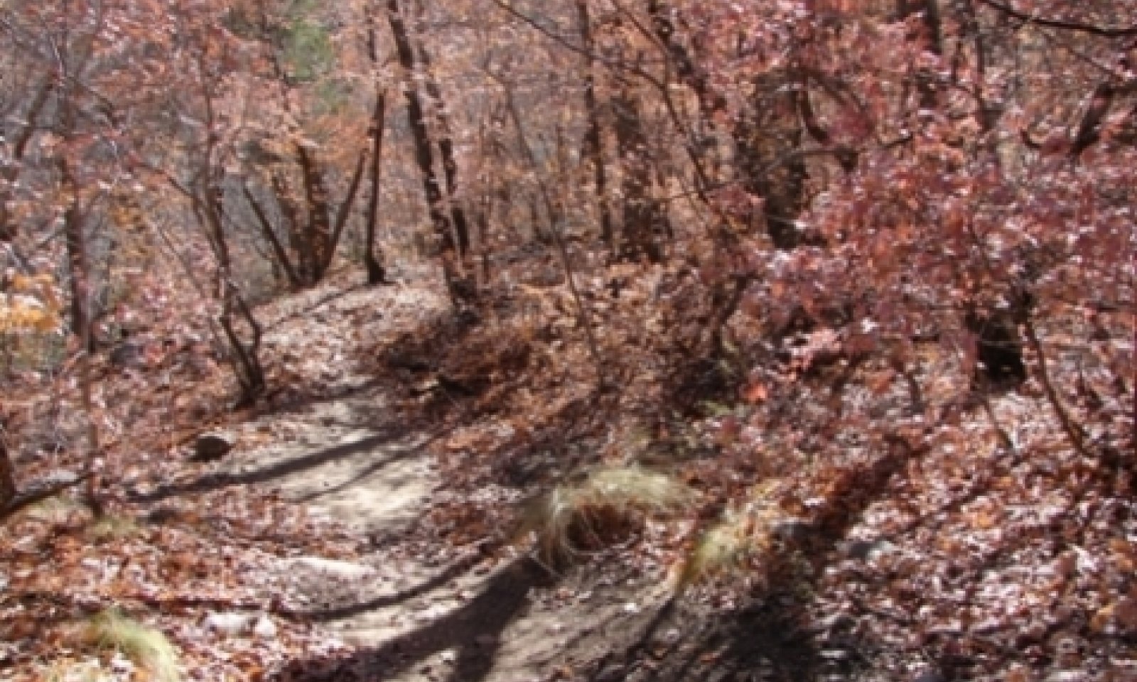
Woodland StateThe Trees-Shrubs/Tallgrass Community is characterized by several plant community potentials resulting from different plant environments. Narrow canyon bottoms will have limited daily sunlight and will typically have a high canopy cover percentages of trees such as bigtooth maple, chinkapin oak, alligator juniper, and ponderosa pine. Shade tolerant grasses will coexist. As the bottomland widens, tree canopy cover decreases and shade intolerant grasses increase. Scouring flash floods and small wildfires will maintain a discontinuous mosaic of plant communities. Annual production ranges from 2450 to 5250 pounds per acre.
The Trees-Shrubs/Mid-Shortgrass Community is characterized by a herbaceous component that consists mostly of unpalatable mid and shortgrasses such as hairy grama and perennial threeawns. Tallgrasses such as yellow indiangrass, big bluestem, and littlebluestem will be subdominants. In some areas, shrubs such as sotol and catclaw mimosa will increase.
Community 1.1
Trees-Shrubs/Tallgrass Community
Figure 4. 1.1 Bigtooth maple with few grasses

Figure 5. 1.1 Bigtooth maple, chinkapin oak, pine muhly and

Figure 6. 1.1 Stream with Jamaica sawgrass and mixed shrubs

Figure 7. 1.1 Little bluestem/muhly with oak, juniper, and p
This site is characterized by several plant community potentials resulting from different plant environments. Narrow canyon bottoms will have limited daily sunlight and will typically have a high canopy cover percentages of trees such as bigtooth maple, chinkapin oak, alligator juniper, and ponderosa pine. Shade tolerant grasses will coexist. As the bottomland widens, tree canopy cover decreases and shade intolerant grasses increase such as littlebluestem, big bluestem, yellow indiangrass, bull muhly, pine muhly, and sideoats grama. Common shrubs include sotol, desert ceanothus, cliff fendlerbush, Mexican orange, apache plume, skunkbush sumac, and New Mexico agave. Grass-likes such as Jamaica sawgrass and bottlebrush sedge grow along the banks of perennial streams or areas with a very shallow groundwater depth. Scouring flash floods and small wildfires will maintain a discontinuous mosaic of plant communities.
Figure 8. Annual production by plant type (representative values) or group (midpoint values)
Table 5. Annual production by plant type
Plant type Low
(kg/hectare)Representative value
(kg/hectare)High
(kg/hectare)Tree 1121 2242 3363 Grass/Grasslike 897 1121 1345 Shrub/Vine 673 897 1121 Forb 56 112 168 Total 2747 4372 5997 Figure 9. Plant community growth curve (percent production by month). NM4325 , Trees-Shrubs/Tallgrass Community. Mixture of oaks, junipers, and pines with tallgrasses such as big bluestem, little bluestem, and indiangrass..
Jan Feb Mar Apr May Jun Jul Aug Sep Oct Nov Dec J F M A M J J A S O N D 2 2 4 6 9 14 24 24 7 4 2 2 Community 1.2
Trees-Shrubs/Mid-Shortgrass CommunityThis plant community phase is characterized by a herbaceous component that consists mostly of unpalatable mid and shortgrasses such as hairy grama and perennial threeawns. Tall grasses such as yellow indiangrass, big bluestem, and littlebluestem will be subdominants. In some areas, shrubs such as sotol and catclaw mimosa will increase.
Figure 10. Annual production by plant type (representative values) or group (midpoint values)
Table 6. Annual production by plant type
Plant type Low
(kg/hectare)Representative value
(kg/hectare)High
(kg/hectare)Tree 1121 2242 3363 Grass/Grasslike 897 1121 1345 Shrub/Vine 673 897 1121 Forb 56 112 168 Total 2747 4372 5997 Figure 11. Plant community growth curve (percent production by month). NM4326 , Trees-Shrubs/Mid/Shortgrass Community. Mixture of oaks, junipers, and pines with shortgrasses such as hairy grama and threeawn species..
Jan Feb Mar Apr May Jun Jul Aug Sep Oct Nov Dec J F M A M J J A S O N D 1 1 5 7 9 14 24 24 8 5 1 1 Pathway 1.1A
Community 1.1 to 1.2Heavy continuous grazing by domestic cattle will shift the grass dominance from the palatable tall grasses to the less palatable mid and shortgrasses such as perennial threeawn and hairy grama. Overutilization by goats can potentially limit the reproduction of maples, Texas madrone, mountain mahogany, and other palatable browse.
Pathway 1.2A
Community 1.2 to 1.1The Trees-Shrubs/Mid-Shortgrass Community can be restored back to the Trees-Shrubs/Tallgrass Community with Prescribed grazing or no grazing which will allow the tallgrasses to recover.
Conservation practices
Prescribed Grazing Additional community tables
Table 7. Community 1.1 plant community composition
Group Common name Symbol Scientific name Annual production () Foliar cover (%) Grass/Grasslike1 Warm-season Tallgrasses 448–673 big bluestem ANGE Andropogon gerardii 112–336 – bullgrass MUEM Muhlenbergia emersleyi 112–336 – little bluestem SCSC Schizachyrium scoparium 112–336 – Indiangrass SONU2 Sorghastrum nutans 112–336 – 2 Midgrasses 235–336 sideoats grama BOCU Bouteloua curtipendula 56–112 – blue grama BOGR2 Bouteloua gracilis 56–112 – pine muhly MUDU Muhlenbergia dubia 56–112 – New Mexico muhly MUPA2 Muhlenbergia pauciflora 56–112 – plains lovegrass ERIN Eragrostis intermedia 34–67 – cane bluestem BOBA3 Bothriochloa barbinodis 34–67 – curlyleaf muhly MUSE Muhlenbergia setifolia 28–56 – 3 Shortgrasses 34–67 purple threeawn ARPU9 Aristida purpurea 17–34 – hairy grama BOHI2 Bouteloua hirsuta 17–34 – western panicgrass DIACF Dichanthelium acuminatum var. fasciculatum 17–34 – hairy woollygrass ERPI5 Erioneuron pilosum 17–34 – common wolfstail LYPH Lycurus phleoides 17–34 – Hall's panicgrass PAHA Panicum hallii 17–34 – 4 Cool-season grasses 135–202 New Mexico feathergrass HENE5 Hesperostipa neomexicana 28–56 – squirreltail ELEL5 Elymus elymoides 17–34 – pinyon ricegrass PIFI Piptochaetium fimbriatum 17–34 – Arizona fescue FEAR2 Festuca arizonica 11–28 – threeflower melicgrass MENI Melica nitens 11–28 – 5 Grasslikes 45–67 bottlebrush sedge CAHY4 Carex hystericina 22–45 – Jamaica swamp sawgrass CLMAJ Cladium mariscus ssp. jamaicense 22–45 – Shrub/Vine6 Shrubs 471–785 desert ceanothus CEGR Ceanothus greggii 39–84 – alderleaf mountain mahogany CEMO2 Cercocarpus montanus 39–84 – Mexican orange CHDU Choisya dumosa 39–84 – damianita CHME3 Chrysactinia mexicana 39–84 – javelina bush COER5 Condalia ericoides 39–84 – Apache plume FAPA Fallugia paradoxa 39–84 – cliff fendlerbush FERU Fendlera rupicola 39–84 – eggleaf silktassel GAOV Garrya ovata 39–84 – western white honeysuckle LOAL Lonicera albiflora 39–84 – catclaw mimosa MIACB Mimosa aculeaticarpa var. biuncifera 39–84 – pungent oak QUPU Quercus pungens 39–84 – skunkbush sumac RHTR Rhus trilobata 39–84 – evergreen sumac RHVI3 Rhus virens 39–84 – arroyo willow SALA6 Salix lasiolepis 39–84 – 7 Fibrous/Succulents 168–280 green sotol DALE2 Dasylirion leiophyllum 39–112 – Texas sacahuista NOTE Nolina texana 28–84 – pricklypear OPUNT Opuntia 28–84 – slimfoot century plant AGGR4 Agave gracilipes 28–84 – Parry's agave AGPAN6 Agave parryi ssp. neomexicana 28–84 – 8 Vines 34–56 bluebill CLPIP Clematis pitcheri var. pitcheri 17–34 – canyon grape VIAR2 Vitis arizonica 17–34 – Tree9 Trees 1121–3363 bigtooth maple ACGR3 Acer grandidentatum 112–560 – ponderosa pine PIPO Pinus ponderosa 112–560 – gray oak QUGR3 Quercus grisea 112–560 – chinquapin oak QUMU Quercus muehlenbergii 112–560 – twoneedle pinyon PIED Pinus edulis 112–448 – alligator juniper JUDE2 Juniperus deppeana 112–448 – little walnut JUMI Juglans microcarpa 84–168 – common hoptree PTTR Ptelea trifoliata 84–168 – black cherry PRSE2 Prunus serotina 84–168 – Texas madrone ARXA80 Arbutus xalapensis 84–168 – velvet ash FRVE2 Fraxinus velutina 84–168 – Pinchot's juniper JUPI Juniperus pinchotii 28–112 – Rocky Mountain juniper JUSC2 Juniperus scopulorum 17–84 – oneseed juniper JUMO Juniperus monosperma 17–84 – Rocky Mountain Douglas-fir PSMEG Pseudotsuga menziesii var. glauca 17–84 – Forb10 Perennials 56–168 Forb, perennial 2FP Forb, perennial 11–28 – golden columbine AQCH Aquilegia chrysantha 6–17 – butterfly milkweed ASTU Asclepias tuberosa 6–17 – greeneyes BERLA Berlandiera 6–17 – Mexican cancer-root COALM Conopholis alpina var. mexicana 6–17 – buckwheat ERIOG Eriogonum 6–17 – needleleaf bluet HOACA2 Houstonia acerosa var. acerosa 3–17 – menodora MENOD Menodora 6–17 – beardtongue PENST Penstemon 6–17 – polygala POLYG Polygala 3–17 – noseburn TRAGI Tragia 3–17 – 11 Annuals 3–11 Forb, annual 2FA Forb, annual 3–11 – Table 8. Community 1.2 plant community composition
Group Common name Symbol Scientific name Annual production () Foliar cover (%) Interpretations
Animal community
Some portions of the site can be suited for conservative livestock grazing. Riparian areas, however, can be very sensitive to overutilization. A reduction in herbaceous composition can make the site more susceptible erosion especially when flash floods occur.
Mule deer are one of the most common animals seen in this site. Nocturnal mammals such as skunks and raccoons can also be found here. Long-ear sunfish can be seen in some of the springs in the park, as well as in McKittrick Canyon. The stream through McKittrick Canyon is also home to a small population of rainbow trout. Although amphibians are rare in the desert, the Rio Grande leopard frog can occasionally be encountered near spring fed pools in McKittrick Canyon, or at Manzanita and Smith Springs. Rocky canyons are home to ringtails, rock squirrels, and a variety of reptiles including rock and black-tailed rattlesnakes, mountain patchnose snakes, and tree lizards (NPS).
Plant Preference by Animal Kind:
These preferences are somewhat general in nature as the preferences for plants is dependent upon grazing experience, time of year, availability of choices, and total forage supply.
Legend: P=Preferred D=Desirable U=Undesirable N=Not Consumed T=Toxic X=Used, but not degree of utilization unknown
Preferred – Percentage of plant in animal diet is greater than it occurs on the land
Desirable – Percentage of plant in animal diet is similar to the percentage composition on the land
Undesirable – Percentage of plant in animal diet is less than it occurs on the land
Not Consumed – Plant would not be eaten under normal conditions. Only consumed when other forages not available.
Toxic – Rare occurrence in diet and, if consumed in any tangible amounts results in death or severe illness in animal
Hydrological functions
The site is located in both a surface water run-in and runoff position. Depth to groundwater effects species composition.
Recreational uses
The site can be used for hiking.
Wood products
None.
Other products
None.
Other information
None.
Supporting information
Inventory data references
Information presented here has been developed from NRCS clipping, composition, plant cover, soils data and ecological interpretations gained by field observation.
Contributors
Michael Margo
Michael Margo, RMS, NRCS, Marfa, TexasRangeland health reference sheet
Interpreting Indicators of Rangeland Health is a qualitative assessment protocol used to determine ecosystem condition based on benchmark characteristics described in the Reference Sheet. A suite of 17 (or more) indicators are typically considered in an assessment. The ecological site(s) representative of an assessment location must be known prior to applying the protocol and must be verified based on soils and climate. Current plant community cannot be used to identify the ecological site.
Author(s)/participant(s) Contact for lead author Date Approved by Approval date Composition (Indicators 10 and 12) based on Annual Production Indicators
-
Number and extent of rills:
-
Presence of water flow patterns:
-
Number and height of erosional pedestals or terracettes:
-
Bare ground from Ecological Site Description or other studies (rock, litter, lichen, moss, plant canopy are not bare ground):
-
Number of gullies and erosion associated with gullies:
-
Extent of wind scoured, blowouts and/or depositional areas:
-
Amount of litter movement (describe size and distance expected to travel):
-
Soil surface (top few mm) resistance to erosion (stability values are averages - most sites will show a range of values):
-
Soil surface structure and SOM content (include type of structure and A-horizon color and thickness):
-
Effect of community phase composition (relative proportion of different functional groups) and spatial distribution on infiltration and runoff:
-
Presence and thickness of compaction layer (usually none; describe soil profile features which may be mistaken for compaction on this site):
-
Functional/Structural Groups (list in order of descending dominance by above-ground annual-production or live foliar cover using symbols: >>, >, = to indicate much greater than, greater than, and equal to):
Dominant:
Sub-dominant:
Other:
Additional:
-
Amount of plant mortality and decadence (include which functional groups are expected to show mortality or decadence):
-
Average percent litter cover (%) and depth ( in):
-
Expected annual annual-production (this is TOTAL above-ground annual-production, not just forage annual-production):
-
Potential invasive (including noxious) species (native and non-native). List species which BOTH characterize degraded states and have the potential to become a dominant or co-dominant species on the ecological site if their future establishment and growth is not actively controlled by management interventions. Species that become dominant for only one to several years (e.g., short-term response to drought or wildfire) are not invasive plants. Note that unlike other indicators, we are describing what is NOT expected in the reference state for the ecological site:
-
Perennial plant reproductive capability:
Print Options
Sections
Font
AAAAOther
PrintThe Ecosystem Dynamics Interpretive Tool is an information system framework developed by the USDA-ARS Jornada Experimental Range, USDA Natural Resources Conservation Service, and New Mexico State University.
Accessibility statement


