
Natural Resources
Conservation Service
-
Search


Major Land Resource Area or ecological site by name and/or ID.
PreviousSectionsNextGeneral information
Provisional. A provisional ecological site description has undergone quality control and quality assurance review. It contains a working state and transition model and enough information to identify the ecological site.
Click to explore map
Figure 1. Mapped extent
Areas shown in blue indicate the maximum mapped extent of this ecological site. Other ecological sites likely occur within the highlighted areas. It is also possible for this ecological site to occur outside of highlighted areas if detailed soil survey has not been completed or recently updated.
Table 1. Dominant plant species
Tree Not specified
Shrub Not specified
Herbaceous Not specified
Physiographic features
This site series consists of very deep, moderately slowly permeable soils that formed in calcareous alluvium. These gently sloping soils are on inset fans, alluvial fan and fan remnents. Slope ranges from 2 to 5 percent. Mean annual precipitation is about 13 inches and the mean annual temperature is about 60 degrees F.
Table 2. Representative physiographic features
Landforms (1) Alluvial fan
Flooding frequency None Ponding frequency None Elevation 4700 – 6000 ft Slope 2 – 5 % Aspect Aspect is not a significant factor Climatic features
Average precipitation for this site is approximately 12 to 14 inches. Variations of 5 inches are not uncommon. Approximately 75 percent occurs from May through October with most of the rainfall occurring from July to September. Most of the summer precipitation comes in the form of high intensity, short duration thunderstorms. Rain and snow of low intensity characterize the limited winter precipitation.
Temperatures are mild. Freezing temperatures are common at night from December through April, however, temperatures during the day are frequently above 50 degrees F. Occasionally in December to February brief periods of 0 degrees F. temperatures may be expected. During June to August some days may exceed 100 degrees F.
The mean annual precipitation figures are derived from rain gauge data collected by the BLM (1971 to 1990), and NOAA weather maps utilizing prism model estimation techniques. There are no permanent weather stations within the boundaries of the Land Resource Unit.Table 3 Representative climatic features
Frost-free period (average) 180 days Freeze-free period (average) 190 days Precipitation total (average) 10 in BarLineFigure 2. Monthly precipitation range
BarLineFigure 3. Monthly average minimum and maximum temperature
">Influencing water features
This site is not influenced by water from wetland or stream.
Soil features
Soils are deep or verry deep. Surface textures are silt loams. Underlying layers are loam, silt loam, silty clay loam or clay loam with Clay content ranging from 27 to 35 percent and 0 to 5 percent course fragments. The soils are well drained and have a moderately slow permeability. Available water holding capacity to a depth of 40 inches is moderate. The site usually receives some extra water from higher, surrounding terrain. If unprotected by adequate vegetative cover soils become susceptible to water erosion.
Minimum and maximum values listed below represent the characteristic soils for this site.
Characteristic soils:
Double
Table 4. Representative soil features
Surface texture (1) Sandy loam
Family particle size (1) Loamy
Drainage class Well drained to moderately well drained Permeability class Moderately slow Soil depth 60 in Surface fragment cover <=3" 0 – 2 % Surface fragment cover >3" Not specified Available water capacity
(0-40in)7 – 8 in Calcium carbonate equivalent
(0-40in)0 – 15 % Electrical conductivity
(0-40in)0 – 2 mmhos/cm Sodium adsorption ratio
(0-40in)0 – 1 Soil reaction (1:1 water)
(0-40in)7.9 – 8.4 Subsurface fragment volume <=3"
(Depth not specified)0 – 5 % Subsurface fragment volume >3"
(Depth not specified)Not specified Ecological dynamics
The Clay Loam Upland site is associated with the Limestone Hills ecological site. The Clay loam Upland site is positioned down slope from the Limestone hills site from which it receives run-on water. This site can also occur adjacent to the Gravelly, Shallow Sandy, and Limy ecological sites.
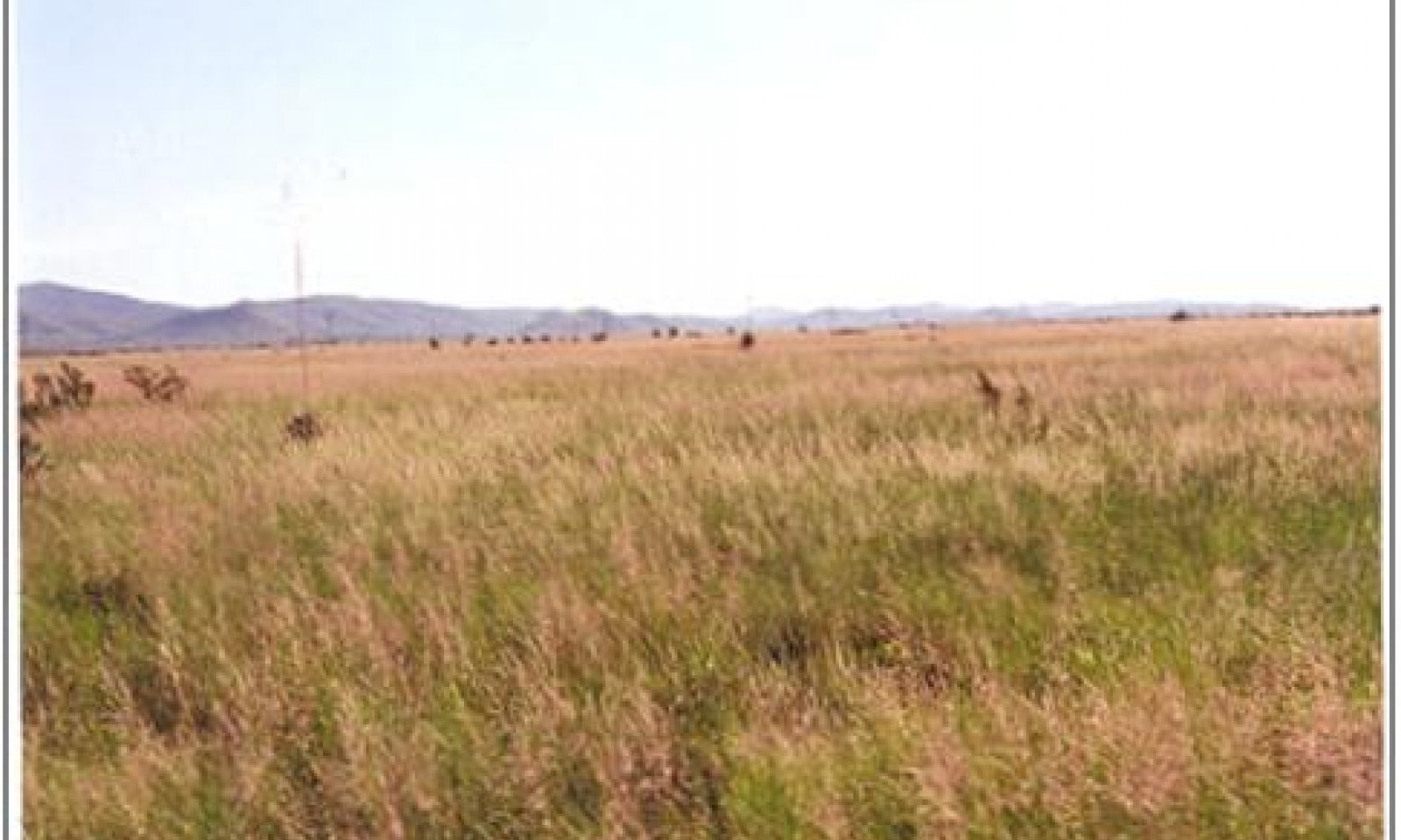
The aspect of the site is that of open grassland sparsely dotted with shrubs. Warm season perennial grasses dominate this community. Alkali sacaton and blue grama are the dominant plants both in aspect and composition. Forb production and composition fluctuate from year to year. Some of the more common forbs include grassland croton, bladderpod and desert holly.
Characteristic shrubs include soaptree yucca, winterfat, four-wing saltbush and prickly pear. This site is resistant to state change and shrub invasion due to the extra run-on water it receives. If the hydrology is altered and the extra run-on water is diverted, the site dries and more drought tolerant species eventually dominate. As the site dries plant community dominance shifts from alkali sacaton to one dominated by tobosa or tobosa and burrograss. Drought and overgrazing can expedite this state change by reducing grass cover and organic matter and increasing the amount of bare ground.State and transition model
Custom diagramStandard diagram
Figure 4. MLRA42, SD4, Clay Loam Upland
More interactive model formats are also available. View Interactive Models
More interactive model formats are also available. View Interactive Models
Click on state and transition labels to scroll to the respective textEcosystem states
State 1 submodel, plant communities
State 2 submodel, plant communities
State 1
HCPCThe historic community for this site is characterized by a dominance of alkali sacaton. Blue grama is secondary and is evenly dispersed throughout the community. A fair amount of tobosa appears in patches scattered across the site. Other common grass species include sand muhly, ear muhly and burrograss. Forb composition varies seasonally and yearly, but bladderpod and croton are two of the more consistent forbs. Shrubs are only a minor component, and occur as widely spaced individuals. Soaptree yucca is the most common shrub on this site; others include winterfat, four-wing saltbush, prickly pear and cholla. Grazing induced retrogression can cause an increase in tobosa and a decrease in alkali sacaton and more palatable species such as blue grama and vine mesquite. Drought or heavy continuous use on alkali sacaton will cause it to thin out and form clumps or tussocks with bare areas in between, thereby decreasing cover and increasing the amount of bare ground. This site however, is resistant to change if the hydrology remains intact and recovers rapidly during years of adequate precipitation.
Community 1.1
Grassland
Figure 5. Grassland
Alkali sacaton and blue grama are the dominant species. Grass cover is uniformly distributed with few large bare areas. There is little evidence of active rills and no gully formation if plant cover remains intact. Litter movement associated with overland flow is limited to smaller size class litter and short distances. Shrubs are a minor component of the site.
The aspect of this site is open grassland sparsely dotted with shrubs. Warm season perennial grasses dominate this site. Alkali sacaton and blue grama are the dominant plants both in aspect and composition. Forb production fluctuates from year to year and season to season.Figure 6. Annual production by plant type (representative values) or group (midpoint values)
Table 5. Annual production by plant type
Plant type Low
(lb/acre)Representative value
(lb/acre)High
(lb/acre)Grass/Grasslike 920 1330 1700 Forb 65 56 82 Shrub/Vine 15 14 18 Total 1000 1400 1800 Figure 7. Plant community growth curve (percent production by month). NM5805 , R042XD005NM Clay Loam Upland HCPC Grassland State. R042XD005NM Clay Loam Upland Warm Season Grassland - Average rainfall year.
Jan Feb Mar Apr May Jun Jul Aug Sep Oct Nov Dec J F M A M J J A S O N D 0 0 3 3 8 7 18 28 25 6 2 0 State 2
Dry Grassland StateThis state is characterized by a change in hydrology. Historic vegetation is supported by run-on water from higher adjacent sites. When a road, trail, or other natural or man-made disturbances cause an obstruction or diversion of natural flow patterns the hydrology is altered. Without the run-on water the site dries. Alkali sacaton and blue grama decrease and tobosa and burrograss increase. Alkali sacaton cover is no longer uniformly distributed, the plants clump up forming tussocks with interconnected bare areas between plants. Physical crusts form in the bare areas when soil particles dislodged by erosion plug the pores in the soil, reducing infiltration. These physical crusts discourage grass seedling establishment and provide pathways for the redistribution of surface litter and organic matter. The decline of alkali sacaton and blue grama may be accelerated by decreased infiltration, drought or overgrazing.
Diagnosis: Tobosa is the dominant grass. Alkali sacaton cover is reduced and if it continues to decline becomes patchy. Burrograss cover increases and may become co-dominant with tobosa. Large connected bare patches are evident. Production is reduced compared with the sacaton grassland state.
Community 2.1
Dry Grassland
Figure 8. Dry Grassland
Tobosa is the dominant grass. Alkali sacaton cover is reduced and if it continues to decline becomes patchy. Burrograss cover increases and may become co-dominant with tobosa. Large connected bare patches are evident. Production is reduced compared with the sacaton grassland state.
Transition 1a
State 1 to 2Key indicators of approach to transition: Reduction in alkali sacaton and blue grama cover and increase in size and frequency of bare patches. Increase in tobosa and or burrograss cover. The formation of roads, gullies or other features (on or off site) that disrupts natural overland flow on site. Formation of physical crusts—indicating loss of organic matter and decrease in soil aggregate stability and reduced infiltration.1 Evidence of litter movement—indicating loss or redistribution of organic matter.
Transition 1b
State 2 to 1Restoration of natural hydrologic processes is necessary to reverse the transition back to the Sacaton Grassland State. Prescribed grazing will help to restore cover, increase organic matter, and infiltration.
Additional community tables
Table 6. Community 1.1 plant community composition
Group Common name Symbol Scientific name Annual production () Foliar cover (%) Grass/Grasslike1 560–700 alkali sacaton SPAI Sporobolus airoides 560–700 – 2 210–350 blue grama BOGR2 Bouteloua gracilis 210–350 – 3 112–210 tobosagrass PLMU3 Pleuraphis mutica 112–210 – 4 42–70 vine mesquite PAOB Panicum obtusum 30–70 – burrograss SCBR2 Scleropogon brevifolius 30–60 – ear muhly MUAR Muhlenbergia arenacea 30–60 – sand muhly MUAR2 Muhlenbergia arenicola 30–60 – Forb5 15–20 croton CROTO Croton 15–20 – bladderpod LESQU Lesquerella 15–20 – 6 3–8 dwarf desertpeony ACNA2 Acourtia nana 3–8 – broadleaved pepperweed LELA2 Lepidium latifolium 3–8 – 7 10–14 Forb, perennial 2FP Forb, perennial 10–14 – 8 10–14 Forb, annual 2FA Forb, annual 10–14 – herb sophia DESO2 Descurainia sophia 10–14 – Shrub/Vine9 5–7 fourwing saltbush ATCA2 Atriplex canescens 5–7 – winterfat KRLA2 Krascheninnikovia lanata 5–7 – 10 5–7 American tarwort FLCE Flourensia cernua 5–7 – creosote bush LATR2 Larrea tridentata 5–7 – pricklypear OPUNT Opuntia 5–7 – soaptree yucca YUEL Yucca elata 5–7 – Table 7. Community 2.1 plant community composition
Group Common name Symbol Scientific name Annual production () Foliar cover (%) Interpretations
Animal community
The open grassland aspect of this site attracts pronghorn antelope. Mule deer occasionally use the site in conjunction with adjacent sites. This site also supports black-tailed jackrabbits, meadowlark, mourning dove, and scaled quail and provides nesting, hiding and thermal cover for a variety of small rodents, birds and reptiles and their associated predators.
Hydrological functions
Most summer rainfall occurs as brief sometimes-heavy thunderstorms. Runoff is medium, and the hazard of water erosion is moderate.
Soil Name Hydrologic Group
Double BRecreational uses
This site offers good potential for antelope and predator hunting, wildlife observation and photography. Scenic beauty of this site will especially appeal to those who value wide open prairie grasslands.
Wood products
This site has no significant value for wood products.
Other products
Grazing: This site is suitable for grazing by all kinds and classes of livestock during all seasons of the year. Currently the majority of the livestock use on this site is with mother cows in cowcalf operations. Historic use has been sheep and cattle. As the site deteriorates there will be an increase in bare ground leaving the exposed soil susceptible to wind and water erosion. This site responds best to a system of management that rotates the season of use. This site is suitable for artificial revegetation depending on slope and amount of extra run-on water.
Initial starting stocking rates will be determined with the landowner or decision-maker. They will be based on past use histories and type and condition of the vegetation. Calculations used to determine initial starting stocking rate will also be based on forage preference ratings.Supporting information
Inventory data references
Supporting information includes limited clipping data, soil survey investigations, aerial photographs, and personal observations.
Other references
1. U.S. Department of Agriculture, Natural Resources Conservation Service. 2001. Soil Quality Information Sheet. Rangeland Soil Quality—Organic Matter, Aggregate Stability, Infiltration. Rangeland Sheets 6,3,5 [Online]. Available:
http://www.statlab.iastate.edu/survey/SQI/range.html
Contributors
David Trujillo
Jason S. MartinRangeland health reference sheet
Interpreting Indicators of Rangeland Health is a qualitative assessment protocol used to determine ecosystem condition based on benchmark characteristics described in the Reference Sheet. A suite of 17 (or more) indicators are typically considered in an assessment. The ecological site(s) representative of an assessment location must be known prior to applying the protocol and must be verified based on soils and climate. Current plant community cannot be used to identify the ecological site.
Author(s)/participant(s) Contact for lead author Date Approved by Approval date Composition (Indicators 10 and 12) based on Annual Production Indicators
-
Number and extent of rills:
-
Presence of water flow patterns:
-
Number and height of erosional pedestals or terracettes:
-
Bare ground from Ecological Site Description or other studies (rock, litter, lichen, moss, plant canopy are not bare ground):
-
Number of gullies and erosion associated with gullies:
-
Extent of wind scoured, blowouts and/or depositional areas:
-
Amount of litter movement (describe size and distance expected to travel):
-
Soil surface (top few mm) resistance to erosion (stability values are averages - most sites will show a range of values):
-
Soil surface structure and SOM content (include type of structure and A-horizon color and thickness):
-
Effect of community phase composition (relative proportion of different functional groups) and spatial distribution on infiltration and runoff:
-
Presence and thickness of compaction layer (usually none; describe soil profile features which may be mistaken for compaction on this site):
-
Functional/Structural Groups (list in order of descending dominance by above-ground annual-production or live foliar cover using symbols: >>, >, = to indicate much greater than, greater than, and equal to):
Dominant:
Sub-dominant:
Other:
Additional:
-
Amount of plant mortality and decadence (include which functional groups are expected to show mortality or decadence):
-
Average percent litter cover (%) and depth ( in):
-
Expected annual annual-production (this is TOTAL above-ground annual-production, not just forage annual-production):
-
Potential invasive (including noxious) species (native and non-native). List species which BOTH characterize degraded states and have the potential to become a dominant or co-dominant species on the ecological site if their future establishment and growth is not actively controlled by management interventions. Species that become dominant for only one to several years (e.g., short-term response to drought or wildfire) are not invasive plants. Note that unlike other indicators, we are describing what is NOT expected in the reference state for the ecological site:
-
Perennial plant reproductive capability:
Print Options
Sections
Font
AAAAOther
PrintThe Ecosystem Dynamics Interpretive Tool is an information system framework developed by the USDA-ARS Jornada Experimental Range, USDA Natural Resources Conservation Service, and New Mexico State University.
Accessibility statement


