Natural Resources
Conservation Service
-
Search


Major Land Resource Area or ecological site by name and/or ID.
PreviousSectionsNextGeneral information
Provisional. A provisional ecological site description has undergone quality control and quality assurance review. It contains a working state and transition model and enough information to identify the ecological site.
Click to explore map
Figure 1. Mapped extent
Areas shown in blue indicate the maximum mapped extent of this ecological site. Other ecological sites likely occur within the highlighted areas. It is also possible for this ecological site to occur outside of highlighted areas if detailed soil survey has not been completed or recently updated.
Associated sites
R042AB733TX Loamy Bottomland, Hot Desert Shrub
This site is located at a lower position and receives runoff from the Arroyo site.
R042AB735TX Gravelly, Hot Desert Shrub
This site is located on older terraces above the flood plain.
Similar sites
R042AB735TX Gravelly, Hot Desert Shrub
The terrace of the Arroyo site is similar to the Gravelly site, but is more productive and has plant species that require extra water.
Table 1. Dominant plant species
Tree Not specified
Shrub Not specified
Herbaceous Not specified
Physiographic features
The site occurs on nearly level to moderately sloping drainageways, arroyos, stream terraces, and alluvial fans. Slopes range from 0 to 8 percent. The drainageways are incised from 1 to 15 feet into piedmont slopes. The degree of incision on this site depends on the intensity of summer rainfall events and the size of the watershed in the surrounding mountains that can cause flash floods that last for short periods.
Table 2. Representative physiographic features
Landforms (1) Arroyo
(2) Drainageway
(3) Terrace
Flooding duration Very brief (4 to 48 hours) Flooding frequency Occasional to frequent Ponding frequency None Elevation 1900 – 3900 ft Slope 0 – 8 % Aspect Aspect is not a significant factor Climatic features
The average annual precipitation ranges from 10 to 13 inches and highly variable from 2 to 21 inches. Most of the precipitation occurs as widely scattered thunderstorms of high intensity and short duration during the summer. Occasional precipitation occurs as light rainfall during the cool season. Negligible amounts of precipitation falls in the form of sleet or snow.
Mean annual air temperature is 70° F. Daytime temperatures exceeding 100° F are common from May through September. Frost free period ranges from 254 to 295 days.
The average relative humidity in mid-afternoon is about 25 percent. Relative humidity is higher at night, and the average at dawn is about 57 percent. The sun shines 81 percent of the time in summer and 75 percent in winter. The prevailing wind is from the southwest. Average wind speed is highest, around 11 miles per hour, in March and April.
The combination of low rainfall and relative humidity, warm temperatures, and high solar radiation creates a significant moisture deficit. The annual Class-A pan evaporation is approximately 94 inches.
Table 3 Representative climatic features
Frost-free period (average) 300 days Freeze-free period (average) 330 days Precipitation total (average) 10 in BarLineFigure 2. Monthly precipitation range
BarLineFigure 3. Monthly average minimum and maximum temperature
">Influencing water features
Soil features
The site consists of very deep, well-drained, calcareous, highly permeable soils. These soils formed in Young (Holocene) Quaternary aged loamy and gravelly alluvium from igneous and sedimentary rock. Permeability is moderately rapid to rapid. Available water capacity is low. Potential for wind and water erosion is slight. Typically, the surface layer is light brownish gray, very gravelly sandy loam about 15 inches thick. The underlying material to a depth of 60 inches is pale brown, stratified, very gravelly sandy loam. Gravels cover between 35-80 percent of the surface. Subsurface fragment volume was determined to a depth 15 inches. Representative soils include Pantera and Chillon.
Table 4. Representative soil features
Parent material (1) Alluvium – rhyolite
Surface texture (1) Very gravelly sandy loam
(2) Extremely gravelly fine sandy loam
(3) Very gravelly loamy sand
Drainage class Well drained Permeability class Moderately rapid to rapid Soil depth 72 in Surface fragment cover <=3" 35 – 80 % Surface fragment cover >3" 10 – 40 % Available water capacity
(0-40in)0.04 – 0.08 in Calcium carbonate equivalent
(0-40in)1 – 5 % Electrical conductivity
(0-40in)0 – 2 mmhos/cm Sodium adsorption ratio
(0-40in)0 – 30 Soil reaction (1:1 water)
(0-40in)7.9 – 8.4 Subsurface fragment volume <=3"
(Depth not specified)20 – 50 % Subsurface fragment volume >3"
(Depth not specified)4 – 18 % Ecological dynamics
The reference plant community on the Arroyo, Hot Desert Shrub site consists of bunch and stoloniferous grasses along with a variety of perennial forbs and woody shrubs.
The boundary of the site includes a dynamic arroyo channel and its first terrace, or active floodplain. The riverwash, or streambed, is a component of the arroyo and is not correlated with an ecological site because it lacks stable vegetation. However, vegetation does begin to establish once alluvial deposits begin to stabilize. Vegetation is then interspersed within and along the arroyo. Vegetation along arroyos is a dynamic complex of discontinuous plant communities responding to numerous environment controls such as watershed area, arroyo channel shape, width, and location, nature and relative position of depositional features such as terraces, gravel bars, frequency and amount of runoff, alluvial fragment size, depth of bedrock, and presence of perennial water sources. With the exception of perennial springs in some locations, arroyos within the Hot Desert Shrub Land Resource Unit are dry most of the year. Arroyos are subject to flash floods during the summer rainy season. It may be reasonable to assume that during pre-settlement times, plant communities along arroyos existed as a shifting mosaic. Common species within the arroyo channels include burrobrush, catclaw acacia, shrubby poreleaf, desert willow, sideoats grama, tanglehead, and annual forbs/grasses.
The terrace immediately adjacent to the channel has the potential to flood, but generally receives run-on water in a braided overland flow pattern from the surrounding landscape. Since water availability can be less within the terrace than in the arroyo channel, plant species able to withstand drier conditions become established. Plants that have intermediate water requirements become established on the terrace and banks of the channel. Existing plant species composition and production varies with the interaction of yearly weather conditions, location, aspect, elevation, watershed area, and the natural variability of the soils. A higher density of woody plant cover exists along the banks of the arroyo channel than on the adjacent terrace. Production is higher in an Arroyo Ecological Site than associated ecological sites (i.e. Gravelly) because the site is in a water receiving position on the landscape.
Present climatic and vegetation regimes of the region were established about 8000 years ago when a trend of increased aridity developed and may possibly be continuing today. Overutilization of rangelands during the past 150 years by early settlers may have accentuated a trend toward greater aridity already in existence. Early records suggest cattle, sheep, and horses were introduced into the southwest from Mexico in the mid-1500's. Livestock numbers peaked in the late 1880’s following the arrival of railroads. Historical accounts document ranches with stocking rates as high as one animal unit per four acres; this was far from sustainable in this environment.
The impact of improper grazing within this site specifically will lead to the loss of mostly grasses, reduction of litter, increased stream bank instability, and soil erosion. Vegetation on the terrace will shift from a mixed shrub / grama grass community (1.1) to a mixed shrub/shortgrass community (1.2).
Probably the factor that most influenced the historic vegetative composition of the site was extended dry weather. High rainfall events did occur but were episodic. Fire is not considered to have had a significant influence in shaping current plant communities mostly due to the inherently low fine fuels needed to carry a widespread fire and the presence of fire intolerant species such as black grama and ocotillo. In addition, bison were not considered to have had an influence on vegetation mostly due to rough terrain, scarce water, and less grass cover than the Great Plains. Native herbivory is currently limited to mule deer and small mammals.
The following diagram suggests general pathways that the vegetation on this site might follow. There may be other states not shown on the diagram. This information is intended to show what might happen in a given set of circumstances; it does not mean that this would happen the same way in every instance. Local professional guidance should always be sought before pursuing a treatment scenario.State and transition model
Custom diagramStandard diagram
More interactive model formats are also available. View Interactive Models
More interactive model formats are also available. View Interactive Models
Click on state and transition labels to scroll to the respective textEcosystem states
State 1 submodel, plant communities
State 2 submodel, plant communities
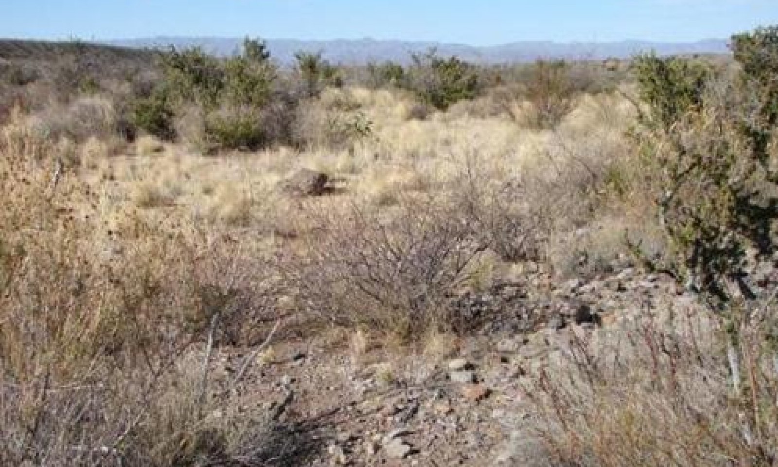
State 1
Mixed Shrub-Grassland (Terrace)A diversity of mixed shrubs with mid and short grasses characterized this state. Natural disturbances are rainfall events with and wildlife grazing and browsing. Overgrazing by cattle will lead to shifts in grass composition.
Community 1.1
Mixed Shrubs / Diverse Mid and Shortgrasses
Figure 4. 1.1 Shrubs / Midgrass Community
The Mixed shrubs / Midgrass plant community (1.1) is the reference plant community for Arroyo Ecological Site. The plant community exists on the first terrace or active floodplain of an associated arroyo channel. The size and or dimensions of the terrace can vary based on the watershed. Woody plants in the HCPC total approximately 50% of the species composition by air dry weight, while grasses and forbs account for 35% and 15% respectively. The plant community is in a water receiving and shedding position. As a result, there is a high diversity of bunch and stoloniferous grasses and shrubs within this plant community. Most shrubs listed in the plant composition list can occur on the terrace. However, woody plants requiring extra water such as desert willow, burrobrush, baccharis, cottonwood, western soapberry, and shrubby poreleaf are usually restricted to the arroyo channel. Ecological process (water cycle, nutrient cycle, and energy flow) are functioning with optimum efficiency due to the adequate amount of organic materials and surface fragments that cover the soil surface. The species diversity of this plant community provides excellent food and cover for wildlife.
Extended dry weather causes an overall decline in grass cover and production and can cause some retrogression. However, the HCPC evolved with plants that have drought tolerance. Long term retrogression is triggered primarily by abusive grazing which causes an immediate decrease and eradication of the most palatable plants such as bush muhly, Arizona cottontop, black grama, menodora, and ratany. Chino grama will initially increase with grazing followed by a decline with further grazing pressure. Improper grazing management will transition the site to a Creosote-mixed shrub / shortgrass community (1.2).
Conservation practices such as prescribed grazing can help maintain ecological resilience of this plant community by maintaining adequate plant cover, size, and appropriate density. Stocking rates need to be flexible and adjusted to carrying capacity because of sporadic rainfall.Figure 5. Annual production by plant type (representative values) or group (midpoint values)
Table 5. Annual production by plant type
Plant type Low
(lb/acre)Representative value
(lb/acre)High
(lb/acre)Grass/Grasslike 240 360 480 Shrub/Vine 210 315 420 Tree 90 135 180 Forb 60 90 120 Total 600 900 1200 Table 6. Canopy structure (% cover)
Height Above Ground (ft) Tree Shrub/Vine Grass/
GrasslikeForb <0.5 – 0-1% 1-3% 1-2% >0.5 <= 1 – 1-3% 5-15% 2-5% >1 <= 2 – 5-15% 10-25% – >2 <= 4.5 – 20-50% 0-2% – >4.5 <= 13 – 5-10% – – >13 <= 40 0-2% – – – >40 <= 80 – – – – >80 <= 120 – – – – >120 – – – – Figure 6. Plant community growth curve (percent production by month). TX0018 , Mixed Shrub Dominated Community (Mid & Shortgrasses/Shrubs). Drought tolerant mixed shrubs dominate with mid and shortgrasses..
Jan Feb Mar Apr May Jun Jul Aug Sep Oct Nov Dec J F M A M J J A S O N D 1 1 2 2 2 8 8 20 25 15 15 1 Community 1.2
Mixed Shrubs / Shortgrasses – Isolated Midgrasses
Figure 7. 1.2 Creosotebush – mixed shrubs / shortgrasses
A combination of severe grazing and drought transitions the reference plant community to this plant community. Overgrazing will begin to reduce the most palatable midgrasses, halfshrubs, and forbs. Non-palatable plants such as creosotebush, prickleleaf dogweed, lechuguilla, and fluffgrass will increase. Isolated midgrasses are still present and can potentially increase with prescribed grazing and favorable rainfall. Soil erosion is accelerated compared to the reference community mainly because in the decrease of grass cover and litter. Surface rock fragments help lessen the impact of erosion to some degree.
Prescribed grazing and a series of wet years will help maintain the current plant community and can potentially help return the community to an assemblage similar to the reference community.Figure 8. Annual production by plant type (representative values) or group (midpoint values)
Table 7. Annual production by plant type
Plant type Low
(lb/acre)Representative value
(lb/acre)High
(lb/acre)Shrub/Vine 270 405 540 Grass/Grasslike 180 270 360 Tree 90 135 180 Forb 50 90 120 Total 590 900 1200 Figure 9. Plant community growth curve (percent production by month). TX0015 , Shrub/Shortgrass Community. Shrubs dominant with few shortgrasses present..
Jan Feb Mar Apr May Jun Jul Aug Sep Oct Nov Dec J F M A M J J A S O N D 1 1 2 2 2 8 8 20 25 15 15 1 Pathway 1.1A
Community 1.1 to 1.2
Mixed Shrubs / Diverse Mid and Shortgrasses
Mixed Shrubs / Shortgrasses – Isolated MidgrassesOvergrazing will lead to Mixed Shrubs/Shortgrass Community.
Pathway 1.2A
Community 1.2 to 1.1
Mixed Shrubs / Shortgrasses – Isolated Midgrasses
Mixed Shrubs / Diverse Mid and ShortgrassesPrescribed grazing and favorable rainfall can help restore the more palatable midgrasses.
Conservation practices
Prescribed Grazing State 2
Arroyo ChannelThis state consists of the arroyo channel (riverwash soil map unit component) that is usually without vegetation because of scouring flash floods. With time some areas of the channel can begin supporting riparian vegetation, however it can easily be washed away during the rainy season. It is not recommended to base stocking rate decisions based on this unstable plant community.
Community 2.1
Shifting mosaic of riparian vegetation
Figure 10. Arroyo channel with riparian vegetation

Figure 11. Arroyo channel
The arroyo channel is a shifting mosaic of plant communities resulting from the naturally occurring seasonal flash floods. Soil is deposited usually behind debris, boulders, and other plants during flooding events. Typical vegetation growing within and along the channel include tanglehead, sideoats grama, shrubby poreleaf, burrobrush, baccharis, desert willow, catclaw acacia, skeletonleaf goldeneye, and western honey mesquite. Other species listed in the reference plant community composition table can also occur within the arroyo channel. Varied stages of plant succession can be seen throughout the entire range of the arroyos. Portions of the channel can be high in plant production compared to the surrounding landscape. The arroyo is invaluable for wildlife as habitat and as a traveling corridor.
Improper grazing management can dramatically reduce the grass component thereby creating a less stable system. In most cases, these arroyos will be preferred grazing site by livestock because of the plant composition and the extra moisture. Resulting from mainly hay distribution and pasture seeding, introduced species such as Bermudagrass (Cynodon dactylon) and buffelgrass (Pennisetum ciliare) have been encroaching within the lower elevation range of the site. To maintain desirable composition, mitigating activities will include correct stocking rates, prescribed grazing, seasonal rest, and where feasible, development of off-site water. Reduced stocking rates alone may not remove the grazing impact on these preferred sites.Transition T1A
State 1 to 2A scouring flash flood can incise portions of the terrace and develop a dynamic arroyo channel.
Transition T1A
State 1 to 2A scouring flash flood can incise portions of the terrace and develop a dynamic arroyo channel.
Additional community tables
Table 8. Community 1.1 plant community composition
Group Common name Symbol Scientific name Annual production () Foliar cover (%) Grass/Grasslike1 Midgrasses - Bunchgrass 60–120 tanglehead HECO10 Heteropogon contortus 30–95 – sideoats grama BOCU Bouteloua curtipendula 30–85 – 2 Shortgrasses - Stoloniferous 48–96 black grama BOER4 Bouteloua eriopoda 20–45 – false grama CAER2 Cathestecum erectum 18–35 – bush muhly MUPO2 Muhlenbergia porteri 10–20 – 3 Midgrasses - Bunchgrass 36–72 sand dropseed SPCR Sporobolus cryptandrus 15–45 – mesa dropseed SPFL2 Sporobolus flexuosus 12–35 – spike dropseed SPCO4 Sporobolus contractus 9–20 – 4 Midgrass - Bunchgrass 24–48 Chino grama BORA4 Bouteloua ramosa 24–48 – 5 Midgrasses - Bunchgrass 30–60 cane bluestem BOBA3 Bothriochloa barbinodis 15–60 – whiplash pappusgrass PAVA2 Pappophorum vaginatum 5–15 – alkali sacaton SPAI Sporobolus airoides 5–15 – false Rhodes grass TRCR9 Trichloris crinita 5–15 – 6 Mid/Shortgrasses - Bunchgrass 18–36 nineawn pappusgrass ENDE Enneapogon desvauxii 4–15 – streambed bristlegrass SELE6 Setaria leucopila 4–10 – slim tridens TRMU Tridens muticus 5–10 – fall witchgrass DICO6 Digitaria cognata 4–10 – 7 Mid/Shortgrass - Bunchgrass 12–24 threeawn ARIST Aristida 4–12 – low woollygrass DAPU7 Dasyochloa pulchella 4–10 – red grama BOTR2 Bouteloua trifida 4–8 – 8 Annuals 0–12 Grass, annual 2GA Grass, annual 0–12 – Shrub/Vine9 Tall Shrubs 54–108 catclaw acacia ACGR Acacia greggii 10–45 – desert willow CHLI2 Chilopsis linearis 0–25 – stretchberry FOPU2 Forestiera pubescens 5–20 – Texas lignum-vitae GUAN Guaiacum angustifolium 5–20 – Berlandier's wolfberry LYBE Lycium berlandieri 5–20 – catclaw mimosa MIACB Mimosa aculeaticarpa var. biuncifera 5–20 – littleleaf sumac RHMI3 Rhus microphylla 5–15 – Torrey's yucca YUTO Yucca torreyi 5–15 – Texas persimmon DITE3 Diospyros texana 0–15 – whitebrush ALGR2 Aloysia gratissima 5–15 – spiny hackberry CEEH Celtis ehrenbergiana 5–15 – baccharis BACCH Baccharis 0–10 – willow SALIX Salix 0–10 – soaptree yucca YUEL Yucca elata 3–10 – Warnock's snakewood COWA Condalia warnockii 3–10 – 10 Mid Shrubs 42–84 creosote bush LATR2 Larrea tridentata 10–30 – American tarwort FLCE Flourensia cernua 5–25 – resinbush VIST Viguiera stenoloba 8–20 – Texas barometer bush LEFR3 Leucophyllum frutescens 5–15 – singlewhorl burrobrush HYMO Hymenoclea monogyra 0–15 – shortleaf jefea JEBR Jefea brevifolia 5–15 – viscid acacia ACNE4 Acacia neovernicosa 3–10 – Wright's beebrush ALWR Aloysia wrightii 3–10 – fourwing saltbush ATCA2 Atriplex canescens 0–10 – desert myrtlecroton BEOB Bernardia obovata 0–10 – splitleaf brickellbush BRLA Brickellia laciniata 0–10 – rough jointfir EPAS Ephedra aspera 3–10 – Apache plume FAPA Fallugia paradoxa 0–10 – yellow trumpetbush TEST Tecoma stans 3–10 – Mexican bladdersage SAME Salazaria mexicana 2–8 – 11 Half Shrubs 36–72 Trans-Pecos poreleaf POSC6 Porophyllum scoparium 0–15 – American threefold TRCA8 Trixis californica 3–10 – Trans-Pecos ayenia AYFI Ayenia filiformis 2–10 – Rio Grande stickpea CACO Calliandra conferta 3–10 – featherplume DAFO Dalea formosa 3–10 – black prairie clover DAFR2 Dalea frutescens 3–10 – littleleaf ratany KRER Krameria erecta 4–10 – white ratany KRGR Krameria grayi 4–10 – Arizona blackfoot MELO Melampodium longicorne 4–10 – rough menodora MESC Menodora scabra 4–10 – mariola PAIN2 Parthenium incanum 4–10 – glandleaf milkwort POMA7 Polygala macradenia 3–10 – 12 Short Shrubs 24–48 ocotillo FOSP2 Fouquieria splendens 5–25 – leatherstem JADI Jatropha dioica 5–20 – lechuguilla AGLE Agave lechuguilla 5–15 – green sotol DALE2 Dasylirion leiophyllum 3–10 – candelilla EUAN3 Euphorbia antisyphilitica 1–5 – 13 Succulents 24–48 pricklypear OPUNT Opuntia 5–20 – tree cholla CYIMI Cylindropuntia imbricata var. imbricata 5–15 – Christmas cactus CYLE8 Cylindropuntia leptocaulis 5–10 – pitaya ECEN2 Echinocereus enneacanthus 3–10 – Tree14 Trees 90–180 western honey mesquite PRGLT Prosopis glandulosa var. torreyana 25–135 – desert willow CHLI2 Chilopsis linearis 0–45 – Fremont cottonwood POFR2 Populus fremontii 0–15 – western soapberry SASAD Sapindus saponaria var. drummondii 0–10 – Forb15 Perennials 60–120 croton CROTO Croton 15–35 – Forb, perennial 2FP Forb, perennial 5–15 – prairie clover DALEA Dalea 5–10 – pricklyleaf dogweed THAC Thymophylla acerosa 5–10 – buckwheat ERIOG Eriogonum 3–8 – pygmy bluet HOWR Houstonia wrightii 3–8 – lacy tansyaster MAPIP Machaeranthera pinnatifida ssp. pinnatifida 3–8 – broom milkwort POSC2 Polygala scoparioides 3–8 – Durango senna SEDUD Senna durangensis var. durangensis 3–8 – pelotazo ABIN Abutilon incanum 3–8 – hairyseed bahia BAAB Bahia absinthifolia 3–8 – 16 Annuals 0–10 Forb, annual 2FA Forb, annual 0–5 – Havard's ipomopsis IPHA Ipomopsis havardii 0–3 – bladderpod LESQU Lesquerella 0–3 – Table 9. Community 1.2 plant community composition
Group Common name Symbol Scientific name Annual production () Foliar cover (%) Table 10. Community 2.1 plant community composition
Group Common name Symbol Scientific name Annual production () Foliar cover (%) Interpretations
Animal community
The site is suitable for properly managed (appropriate stocking rates) livestock grazing. Abusive grazing causes a gradual decline in range health reducing livestock nutrition and habitat quality for wildlife. Livestock should be stocked at carrying capacity in proportion to the grazeable grass, forbs, and browse. Vegetative growth is episodic mirroring the rainfall. For this reason, stocker type livestock operations may be more suitable than year-round stocking.
The site is important for wildlife because it provides access to both seasonal and perennial water and it contains diverse habitat structure. Invertebrates, reptiles, birds, and mammals either use the site as their primary habitat or visit from adjacent sites. Common mammals include mule deer, black-tailed jackrabbit, cottontail rabbit, javelina, coyote, skunk, woodrats, many nocturnal mice, and occasionally mountain lions. Game birds include scaled quail, Gambel's quail, and dove. Numerous songbirds and raptors also occur in the area. Diversity in both plant species and plant communities over short distances is important for healthy wildlife populations.
Plant Preference by Animal Kind:
This rating system provides general guidance as to animal preference for plant species. Grazing preference varies between animal kinds and classes, and changes over time, especially between seasons. It also depends upon the grazing experience of the animals. Grazing preference does not necessarily reflect the ecological status of the plant within the plant community.
Legend: P=Preferred D=Desirable U=Undesirable N=Not Consumed T=Toxic X=Used, but not degree of utilization unknown
Preferred – Percentage of plant in animal diet is greater than it occurs on the land
Desirable – Percentage of plant in animal diet is similar to the percentage composition on the land
Undesirable – Percentage of plant in animal diet is less than it occurs on the land
Not Consumed – Plant would not be eaten under normal conditions. Only consumed when other forages not available.
Toxic – Rare occurrence in diet and, if consumed in any tangible amounts results in death or severe illness in animal
Hydrological functions
The Arroyo ecological site is located low on the landscape and drains surrounding watersheds toward the Rio Grande. Scouring flash floods are a natural and common feature of the arroyos during the rainy season. The runoff water that is retained within the site becomes available for plant growth. Water flow patterns, rills, pedestals and/or terracettes, and areas of bare ground are common features throughout the site. The reference plant community (1.1) provides optimal hydrologic function for the site.
The shortgrass dominated community (1.2) will have increased soil erosion and decreased stability of the arroyo channel. This results from a decrease in grass cover, mostly from improper grazing management. Deeper rooted perennial midgrasses provide enhanced soil stability compared to shallower rooted shortgrasses and annuals.
Recreational uses
The site provides limited recreational use. The unpredictable nature of flash floods create dangerous conditions for hikers or campers.
Wood products
Mesquite trees are used for fence posts, firewood, and furniture.
Supporting information
Inventory data references
Information presented here has been developed from NRCS clipping, composition, plant cover, and soils data.
Other references
Reviewers:
Rusty Dowell, Resource Soil Scientist, NRCS, San Angelo, TX
Chad Evans, Soil Conservationist, NRCS, Pecos, TX
Preston Irwin, Rangeland Management Specialist, NRCS, Fort Stockton, TX
Cole Jacoby, Rangeland Management Specialist, NRCS, Alpine, TX
Laurie Meadows, Soil Conservation Technician, NRCS, Marfa, TX
Mark Moseley, Rangeland Management Specialist, NRCS, San Antonio, TX
Wayne Seipp, Resource Team Leader, NRCS, Alpine, TX
Craig Thomas, Rangeland Management Specialist, NRCS, Alpine, TX
Dr. Bonnie Warnock, Associate Professor, Sul Ross State University, Alpine, TX
Other References:
Briske, D.D., B.T. Bestelmeyer, T.K. Stringham, and P.L. Shaver. 2008. Recommendations for development of resilience-based state and transition models. Rangeland Ecology & Management 61:359-367.
Briske, D.D., S. D. Fuhlendorf, F. E. Smeins. 2005. State-and-transition models, thresholds, and rangeland health: A synthesis of ecological concepts and perspectives. Rangeland Ecology & Management 58: 1-10.
Briske, D.D., J.D. Derner, J.R. Brown, S.D. Fuhlendorf, W.R. Teague, K.M. Havstad, R.L. Gillen, A.J. Ash, and W.D. Willms. 2008. Rotational grazing on rangelands: Reconciliation of perception and experimental evidence. Rangeland Ecology and Management 61: 3-17.
Gould, F.W. 1978. Common Texas grasses. Texas A&M University Press, College Station.
Hatch, S. L., J. Pluhar. 1993. Texas Range Plants. Texas A&M University Press, College Station.
Henklein, D.C. 2003. Vegetation alliances and associations of the Bofecillos Mountains and plateau. Thesis, Sul Ross State University, Alpine, TX.
Krausman P.R. 1978. Forage relationships between two deer species in Big Bend National Park, Texas. Journal of Wildlife Management 42: 101-107.
Taylor, R., J. Rutledge, and J.G. Herrera. 1997. A field guide to common south Texas shrubs. Texas Parks and Wildlife Press, Austin, TX.
Texas Parks and Wildlife Department, s.v. “West Texas Wildlife Management,” http://www.tpwd.state.tx.us/landwater/land/habitats/trans_pecos/ (accessed January 2008).
Taylor, R., J. Rutledge, and J.G. Herrera. 1997. A field guide to common south Texas shrubs. Texas Parks and Wildlife Press, Austin, TX.
Powell, M.A. 2000. Grasses of the Trans-Pecos and Adjacent Areas. Iron Mountain Press, Marathon, TX.
Powell, M.A. 1998. Trees and shrubs of the Trans-Pecos and adjacent areas. University of Texas Press, Austin.
Smeins, F.E. 1984. Origin of the brush problem – a geological and ecological perspective of contemporary distributions. In Brush Management Symposium, edited by Kirk McDaniel, pages 5-16. Texas Tech Press, Lubbock, Texas.
USDA, National Water and Climate Center, “Climate Reports,” http://www.wcc.nrcs.usda.gov/climate/ (accessed January 2007).
USDA, Natural Resources Conservation Service, “Plants Database,” http://plants.usda.gov/ (accessed July 2008).
Warnock, B. H. 1970. Wildflowers of the Big Bend Country. Sul Ross State University, Alpine, TX.
Contributors
Michael Margo, RMS, NRCS, Marfa, Texas
Rangeland health reference sheet
Interpreting Indicators of Rangeland Health is a qualitative assessment protocol used to determine ecosystem condition based on benchmark characteristics described in the Reference Sheet. A suite of 17 (or more) indicators are typically considered in an assessment. The ecological site(s) representative of an assessment location must be known prior to applying the protocol and must be verified based on soils and climate. Current plant community cannot be used to identify the ecological site.
Author(s)/participant(s) Michael Margo, RMS, NRCS, Marfa, TX Contact for lead author Zone RMS, San Angelo, TX 325-944-0147 Date 04/16/2012 Approved by Approval date Composition (Indicators 10 and 12) based on Annual Production Indicators
-
Number and extent of rills:
Active rill formation is slight at infrequent intervals, mostly in exposed areas within the stream terrace. The site is located within a drainage area subject to flash floods. Scoured areas within the stream channel is natural. -
Presence of water flow patterns:
Flow patterns are stable and short. -
Number and height of erosional pedestals or terracettes:
None -
Bare ground from Ecological Site Description or other studies (rock, litter, lichen, moss, plant canopy are not bare ground):
5-10 percent bare ground -
Number of gullies and erosion associated with gullies:
None -
Extent of wind scoured, blowouts and/or depositional areas:
None -
Amount of litter movement (describe size and distance expected to travel):
In drainages, there can be significant amounts of litter moved long distances. On the stream terrace, minimal and short distance (<5ft) of litter movement associated with high intense rainfall. -
Soil surface (top few mm) resistance to erosion (stability values are averages - most sites will show a range of values):
Stability values range from 3-4 in the interspaces and 4-5 under plant canopies. -
Soil surface structure and SOM content (include type of structure and A-horizon color and thickness):
0-3 inches thick, brown surface horizon with a weak medium subangular structure. Data from Pantera soil series description -
Effect of community phase composition (relative proportion of different functional groups) and spatial distribution on infiltration and runoff:
A high canopy cover of bunch, rhizomatous, and stoliniferous grasses will help minimize runoff and maximize infiltration. Grasses should comprise approximately 35% of total plant compostion by weight. Shrubs will comprise about 50% by weight. -
Presence and thickness of compaction layer (usually none; describe soil profile features which may be mistaken for compaction on this site):
None. -
Functional/Structural Groups (list in order of descending dominance by above-ground annual-production or live foliar cover using symbols: >>, >, = to indicate much greater than, greater than, and equal to):
Dominant:
Sub-dominant:
Other:
Shrubs = dominant stoloniferous = dominant bunchgrasses > subdominant grasses > half shrubs = forbs > succulents > annual forbs = annual grassesAdditional:
-
Amount of plant mortality and decadence (include which functional groups are expected to show mortality or decadence):
All grasses will show some mortality and decadence in addition to annual forbs. Mid/tall perennial shrubs will show some mortality or decadence only after prolonged and severe droughts. Subshrubs will be less resistant to severe droughts than mid/tall perennial shrubs. -
Average percent litter cover (%) and depth ( in):
-
Expected annual annual-production (this is TOTAL above-ground annual-production, not just forage annual-production):
600-1200 lbs/ac depending on annual rainfall. -
Potential invasive (including noxious) species (native and non-native). List species which BOTH characterize degraded states and have the potential to become a dominant or co-dominant species on the ecological site if their future establishment and growth is not actively controlled by management interventions. Species that become dominant for only one to several years (e.g., short-term response to drought or wildfire) are not invasive plants. Note that unlike other indicators, we are describing what is NOT expected in the reference state for the ecological site:
Buffelgrass and bermudagrass in some locations. -
Perennial plant reproductive capability:
All species should be capable of reproducing.
Print Options
Sections
Font
AAAAOther
PrintThe Ecosystem Dynamics Interpretive Tool is an information system framework developed by the USDA-ARS Jornada Experimental Range, USDA Natural Resources Conservation Service, and New Mexico State University.
Accessibility statement