
Natural Resources
Conservation Service
Ecological site R040XD006CA
Hyper-Arid Abandoned Fans
2-4" p.z.
Last updated: 3/11/2025
Accessed: 10/15/2026
-
Search


Major Land Resource Area or ecological site by name and/or ID.
PreviousSectionsNextGeneral information
Provisional. A provisional ecological site description has undergone quality control and quality assurance review. It contains a working state and transition model and enough information to identify the ecological site.
MLRA notes
Major Land Resource Area (MLRA): 040X–Sonoran Basin and Range
MLRA Description:
Major land resource area (MLRA) 31 is the Lower Colorado Desert. This area is in the extreme southeastern part of California, in areas along the Colorado River, and in Western Arizona. The area is comprised of rough, barren, steep, and strongly dissected mountain ranges, generally northwest to southwest trending that are separated by intermontane basins. Elevation ranges from approximately 275 feet below sea level at the lowest point in the Salton Trough to 2700 feet along low northwest to southeast trending mountain ranges. The average annual precipitation is 2 to 6 inches with high temporal and spatial variability. Winter temperatures are mild, summer temperatures are hot, and seasonal and diurnal temperature fluctuations are large. Monthly minimum temperature averages range from 40 to 80 degrees F (4 to 27 degrees C). Monthly maximum temperature averages range from 65 to 110 degrees F (18 to 43 degrees C) (WRCC 2002). Temperatures are rarely below 28 degrees F, and extremely rarely fall below 24 degrees F. Precipitation is bimodal, with approximately 20 to 40 percent of annual precipitation falling between July and September. This summer rainfall, in combination with very hot temperatures and very few to no days of hard freeze are what characterize this MLRA and distinguish it from the Mojave Desert (MLRA 30).
XD LRU concept:
The XD LRU is an extremely hot and dry portion of the MLRA. Mean annual precipitation is about 4 inches or less where the majority of the precipitation can arrive in only a couple storm events during any given year. The very few hard freezing days allows this region to have Plant Hardiness Zones of 9b or warmer. This LRU covers most of the Lower Colorado Desert except elevations above 500 m where Plant Hardiness Zones are less than 9b.Classification relationships
Mojave Creosote Bush (Holland, 1986).
Larrea tridentata Shrubland Alliance (Sawyer et al. 2009).Ecological site concept
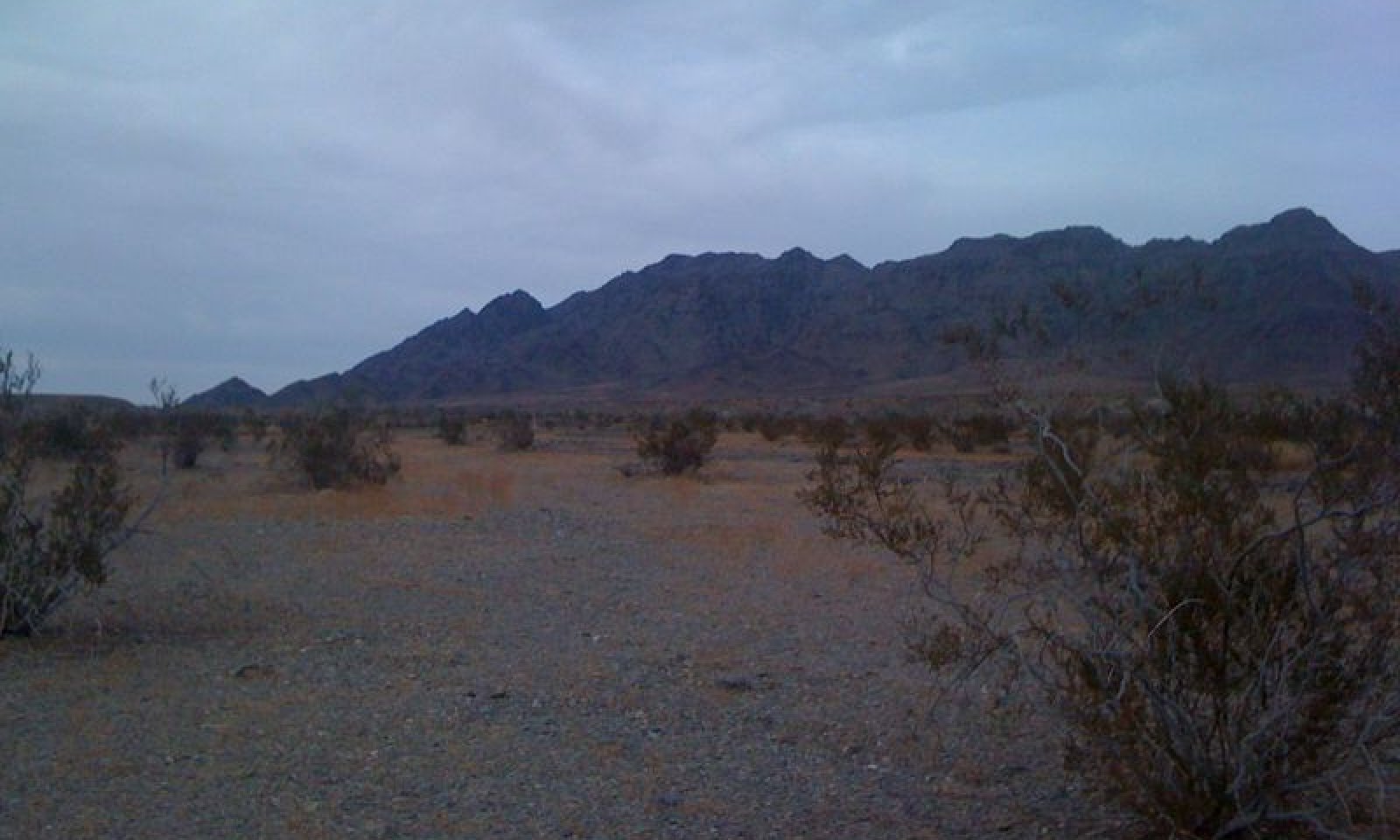
This ecological site occurs on gently sloping fan remnants, alluvial fans, and inset fans at elevations of 440 to 1770 feet. The soils associated with this ecological site are generally very deep, well to somewhat excessively drained soils. A hyperthermic, very arid climate with stable landforms and deep soils with minimal additional run-on drives the vegetation community of this ecological site.
Production reference value (RV) is 62 pounds per acre, and depending on precipitation and annual forb production, ranges from 25 to 169 pounds per acre. The reference plant community is dominated almost entirely by creosote bush (Larrea tridentata); this deep-rooted species is the only shrub capable of tolerating the extremely arid conditions of this site. White ratany (Krameria grayi), burrobush (Ambrosia dumosa), and big galleta (Pleuraphis rigida) may be present as very minor species. Annual forbs contribute 20 to 40 percent of annual production during year of average to above average precipitation.
Data ranges in the physiographic data, climate data, water features, and soil data sections of this Ecological Site Description are based on major components only (15 percent of map unit or greater).Associated sites
R040XD009CA Gravelly Fan Remnants And Fan Aprons
This ecological site occurs on stony fan remnants. Creosote bush (Larrea tridentata) and Schott's dalea (Psorothamnus schottii) are dominant.
R040XD015CA Limy 4-6" p.z.
This site occurs on adjacent alluvial fans that receive significantly higher runoff. Creosote bush (Larrea tridentata) and burrobush (Ambrosia dumosa) are dominant.
R040XD200CA Rarely Flooded Fans
This ecological site occurs on fan aprons that receive greater moisture. Creosote bush (Larrea tridentata) and brittlebush (Encelia farinosa) are dominant.
Similar sites
R040XD015CA Limy 4-6" p.z.
This ecological site receives more moisture, has much higher production, and burrobush (Ambrosia dumosa) is co-dominant with creosote bush (Larrea tridentata).
R040XD009CA Gravelly Fan Remnants And Fan Aprons
This ecological site occurs on stony fan remnants. High surface rock fragment cover increases run-on. Production is higher, and Schott's dalea (Psorothamnus schottii) is co-dominant with creosote bush (Larrea tridentata).
Table 1. Dominant plant species
Tree Not specified
Shrub (1) Larrea tridentata
Herbaceous (1) Plantago ovata
Physiographic features
This site occurs on fan remnants, alluvial fans, and inset fans. Slopes range from 0 to 15 percent, but slopes of 2 to 8 percent are more common. Elevations range from 440 to 1770 feet.
Table 2. Representative physiographic features
Landforms (1) Alluvial fan
(2) Fan remnant
(3) Inset fan
Flooding duration Extremely brief (0.1 to 4 hours) Flooding frequency None to very rare Elevation 440 – 1770 ft Slope 0 – 15 % Aspect Aspect is not a significant factor Climatic features
The Colorado Desert of California represents the northwesternmost portion of the Sonoran Desert. The subtropical Colorado Desert results from the descent of cold air which is heated by compression and arrives hot and dry at the earth's surface. Precipitation is frontal in nature during the winter and convectional in the summer. Reduced summer rainfall and high potential evapotranspiration make the Colorado Desert one of the most arid regions in North America. Summer temperatures frequently exceed 105 degrees F. The average annual precipitation ranges from 2 to 6 inches with most falling as rain. Snowfall is rare. Approximately 35% of the annual precipitation occurs from July to September as a result of intense convection storms. Spring months are the windiest.
Table 3 Representative climatic features
Frost-free period (average) 370 days Freeze-free period (average) 370 days Precipitation total (average) 10 in BarLineFigure 1. Monthly precipitation range
BarLineFigure 2. Monthly average minimum and maximum temperature
">Influencing water features
This is a dry upland site.
Soil features
The soils associated with this ecological site are generally very deep, well to somewhat excessively drained, nad formed in alluvium from granitoid or igneous and metamorphic rock. They typically have calcic horizons and/or argillic horizons, but may be weakly developed sandy-skeletal soils. Surface textures include non-gravelly to very gravelly fine sandy loam, sandy loam, loamy sand, loam, or loamy coarse sand. Subsurface textures are most commonly gravelly to very gravelly sandy loams, but may be non-gravelly to extremely gravelly loams, clay loam, loamy coarse sand, or sandy loam. Surface gravels (< 3 mm in diameter) range from 35 to 95 percent, and larger fragments range from 0 to 15 percent. Subsurface gravels by volume (for a depth of 0 to 59 inches) range from 3 to 80 percent and larger fragments by volume range from 0 to 15 percent.
This ecological site is associated with the following soil components: Catfishbay (coarse-loamy, mixed, superactive, hyperthermic Typic Calciargids), Chemeheuvi (loamy-skeletal, mixed, superactive, hyperthermic Typic Haplocalcids), Chemwash (sandy-skeletal, mixed, hyperthermic Typic Torriorthents), Garywash (coarse-loamy, mixed, superactive, hyperthermic Typic Haplocalcid), Havasulake (loamy-skeletal, mixed, superactive, hyperthermic Typic Calciargids), Rizzo (sandy-skeletal, mixed, hyperthermic Typic Torriorthents), roostertail (loamy-skeletal, mixed, superactive, hyperthermic Duric Petroargids), and Snaggletooth (fine-loamy, mixed, superactive, hyperthermic Typic Calciargids).
The Catfishbay, Garywash, Havasulake, Roostertail, and Snaggletooth soils are very deep soils with calcic horizons. The Catfishbay, Havasulake, and Snaggletooth soils also have argillic horizons, and have loam and clay loam subsurface textures. The Roostertail soils have a duripan at 59 inches. The Garywash soils have relatively high salt and sodium accumulation. The Chemwash and Rizzo soils have little horizon development and differ in the size of gravels.
This ecological site is correlated with the following map units and major soil components in the Colorado Desert Area Soil Survey (CA803):
Mapunit; Mapunit name; Component; Phase; Percent
2001; Emptygun-Chemehuevi association, 2 to 30 percent slopes;Chemehuevi;; 30
2010; Chemehuevi-Rizzo-Emptygun complex, 2 to 30 percent slopes;Chemehuevi;; 35
2030; Garywash gravelly fine sandy loam, 4 to 15 percent slopes; Garywash;; 85
2031; Garywash-Chemehuevi complex, 2 to 8 percent slopes; 2031; Garywash-Chemehuevi complex, 2 to 8 percent slopes; Garywash; sandy substratum; 60 and
Chemehuevi; stony; 25
2400; Rizzo-Chemwash association, 2 to 8 percent slopes; Chemwash;; 35
2401; Rizzo-Chemwash association, eroded, 2 to 8 percent slopes;Chemwash;; 25
2050; Havasulake-Rizzo association, 1 to 8 percent slopes; Havasulake; eroded; 40
2055; Catfishbay association, 0 to 8 percent slopes; Catfishbay; ; 55 and Catfishbay; moderately sloping; 35
2056; Catfishbay loamy fine sand, 4 to 15 percent slopes; Catfishbay ;moderately sloping; 85
This ecological site is associated with an additional 21 minor components of the same soil series listed above in the Colorado Desert Soil Survey Area.
This ecological site is correlated with the following map units and soil components in the Joshua Tree National Park Soil Survey (CA794):
Mapunit; Mapunit name; Component; Phase; Percent
2091; Deprave-Roostertail association, 0 to 4 percent slopes; Roostertail;; 15
2120; Rizzo-Deprave complex, 2 to 8 percent slopes; Rizzo; very rarely flooded; 10
2402; Rizzo-Rizzo, frequently flooded complex, 2 to 8 percent slopes; Catfishbay;; 1
Table 4. Representative soil features
Surface texture (1) Gravelly sand
(2) Very gravelly sandy loam
(3) Gravelly loamy sand
Family particle size (1) Sandy
Drainage class Well drained to excessively drained Permeability class Slow to moderately rapid Soil depth 56 – 0 in Surface fragment cover <=3" 35 – 95 % Surface fragment cover >3" 0 – 15 % Available water capacity
(0-40in)0.8 – 5.8 in Calcium carbonate equivalent
(0-40in)1 – 35 % Electrical conductivity
(0-40in)0 – 16 mmhos/cm Sodium adsorption ratio
(0-40in)0 – 12 Soil reaction (1:1 water)
(0-40in)6.8 – 9 Subsurface fragment volume <=3"
(Depth not specified)3 – 80 % Subsurface fragment volume >3"
(Depth not specified)0 – 15 % Ecological dynamics
Abiotic Factors
This ecological site occurs on gently sloping fan remnants, alluvial fans, and inset fans at elevations of 440 to 1770 feet. The soils associated with this ecological site are generally very deep, well to somewhat excessively drained soils. Soils typically have calcic horizons and/or argillic horizons. A hyperthermic climate with deep to very deep?(aren’t some loamy?) soils with no additional run-on from sheet flooding drives the vegetation community of this ecological site. The deep-rooted creosote bush is the only shrub capable of tolerating the extremely arid conditions of this site.
Creosote bush shrublands dominate fan piedmont landscapes at elevations below 4000 feet in the Mojave Desert (Rundel and Gibson 1996). In arid regions, the availability of moisture is the key resource driving the productivity and composition of vegetation (Noy-Meir 1973, McAuliffe 1994, Hamerlynk et al. 2000, Martre et al. 2002, Austin et al. 2004). Where soil temperature regimes are thermic (above approximately 2800 feet) and soil moisture availability is higher, shrub production, cover, density and diversity are higher (Bedford et al. 2009). Where the soil temperature regime is hyperthermic and moisture becomes more limiting such as this ecological site, shrub production, cover, density and diversity decline. When soil moisture become even more limiting, due to factors such as very low elevations and hot temperatures, absence of sheet-flow, restrictive surface cover such as desert pavement, or the presence of subsurface horizons that limit infiltration, the shrub community typically becomes even sparser, and is restricted to widely spaced, small creosote bush.
Disturbance dynamics
The primary disturbances influencing this ecological site are drought and invasion by non-native annual plants. Drought is an important shaping force in Mojave Desert plant communities (Webb et al. 2003, Bowers 2005, Hereford et al. 2006, Miriti et al. 2007). Short-lived perennial shrubs and perennial grasses demonstrate the highest rates of mortality (Webb et al. 2003, Bowers 2005, Hereford et al. 2006, Miriti et al. 2007), and annual species remain dormant in the soil seedbank (Beatley 1969, 1974, 1976). Long-lived shrubs and trees are more likely to exhibit branch-pruning, and or limited recruitment during drought (e.g. Hereford et al. 2006, Miriti et al. 2007), leading to reduced cover and biomass in drought-afflicted communities.
Non-native annual species such as red brome (Bromus rubens), Mediterranean grass (Schismus barbatus), redstem stork’s bill (Erodium cicutarium) and Asian mustard (Brassica tournefortii) have become naturalized throughout the Mojave Desert over the past century (Rickard and Beatley 1965, D'Antonio and Vitousek 1992, Brooks 1999, Reid et al. 2006, Norton et al. 2007). At lower elevations, where soil temperature regimes are hyperthermic and soil moisture is more limiting, Mediterranean grass is the dominant non-native grass (Brooks and Berry 2006). Like native annuals, nonnative annual cover and production is directly related to winter precipitation (Beatley 1969, Brooks and Berry 2006, Barrows et al. 2009).
Invasion by non-native annual grasses has increased the flammability of Mojave Desert vegetation communities by providing a continuous fine fuel layer between widely spaced shrubs (Brown and Minnich 1986, Brooks 1999, Brooks et al. 2004, Rao and Allen 2010, Rao et al. 2010). However, the low potential for high biomass of annual species limits the continuity of fine fuels in this site, and means that this site is very unlikely to burn.State and transition model
Custom diagramStandard diagram
Figure 3. R031XY006CA
More interactive model formats are also available. View Interactive Models
More interactive model formats are also available. View Interactive Models
Click on state and transition labels to scroll to the respective textEcosystem states
Land use 2 submodel, ecosystem states
State 2 submodel, plant communities
State 1
Historic StateState 1 represents the historic range of variability for this ecological site. This state no longer exists due to the ubiquitous naturalization of non-native species in the Mojave Desert. Periodic drought and rare fire were the natural disturbances influencing this ecological site. Fire would have been a very rare occurrence due to the lack of a continuous fine fuel layer between shrubs.
Data for this State does not exist, but dynamics and composition would have been similar to State 2, except with only native species present. See State 2 narrative for more detailed information.
State 2
Reference StateState 2 represents the current range of variability for this site. Non-native annuals, including Mediterranean grass, red-stem stork’s bill, and Asian mustard are naturalized in this plant community. Their abundance varies with precipitation, but they are at least sparsely present (as current year’s growth or present in the soil seedbank).
Community 2.1
Reference Plant Community
Figure 4. Community Phase 2.1

Figure 5. Community Phase 2.1
The reference plant community is dominated almost entirely by creosote bush. White ratany, burrobush, and big galleta may be present as very minor species. Annual forbs may contribute 20 to 40 percent of annual production during year of average to above average precipitation. Common species include desert Indianwheat (Plantago ovata), pincushion flower (Chaenactis fremontii), and cryptantha species (Cryptantha). This site can sometimes appear like a young desert patina, which is what it may become if the site continues to remain stable for many years.
Figure 6. Annual production by plant type (representative values) or group (midpoint values)
Table 5. Annual production by plant type
Plant type Low
(lb/acre)Representative value
(lb/acre)High
(lb/acre)Shrub/Vine 25 50 97 Forb 0 12 70 Grass/Grasslike 0 0 2 Total 25 62 169 Table 6. Ground cover
Tree foliar cover 0% Shrub/vine/liana foliar cover 0-10% Grass/grasslike foliar cover 0-10% Forb foliar cover 10-30% Non-vascular plants 0% Biological crusts 0% Litter 0% Surface fragments >0.25" and <=3" 0% Surface fragments >3" 0% Bedrock 0% Water 0% Bare ground 0% Table 7. Soil surface cover
Tree basal cover 0% Shrub/vine/liana basal cover 10-10% Grass/grasslike basal cover 0% Forb basal cover 0-10% Non-vascular plants 0% Biological crusts 0-0% Litter 10-10% Surface fragments >0.25" and <=3" 70-80% Surface fragments >3" 0% Bedrock 0% Water 0% Bare ground 10-10% Table 8. Canopy structure (% cover)
Height Above Ground (ft) Tree Shrub/Vine Grass/
GrasslikeForb <0.5 – – 0-3% 5-25% >0.5 <= 1 – – – – >1 <= 2 – 2-3% – – >2 <= 4.5 – – – – >4.5 <= 13 – 7-10% – – >13 <= 40 – – – – >40 <= 80 – – – – >80 <= 120 – – – – >120 – – – – Community 2.2
Drought ResponseThis community phase is characterized by an overall decline in cover due to branch-pruning and lack of recruitment of creosote bush and white ratany, mortality of burrobush and big galleta, and lack of emergence of annual forbs. Creosote bush is an evergreen species capable of utilizing moisture at any time of the year. This ability buffers populations from the effects of drought that occur as the absence of the winter rains (the primary source of moisture for this ecological site). Further, creosote bush germinates in response to moisture during the warm season, so may still recruit if warm season rains occur during winter drought (Hereford et al. 2006). Creosote bush exhibits branch-pruning during severe drought, but mortality during drought in the Mojave Desert is very low (Webb et al. 2003, Hereford et al. 2006). Nevertheless, during severe drought, creosote bush mortality may occur.
Pathway 2.1a
Community 2.1 to 2.2This pathway occurs with prolonged or severe drought.
Pathway 2.2a
Community 2.2 to 2.1This pathway occurs with time and a return to average or above average climatic conditions.
Transition 1
State 1 to 2This transition occurred with the naturalization of non-native species in this ecological site. Non-native species were introduced with settlement of the Southwest Desert region in the 1860s. Post-settlement cattle and sheep grazing, as well as dryland farming, helped to spread and facilitate their establishment (Brooks and Pyke 2000, Brooks et al. 2007).
Additional community tables
Table 9. Community 2.1 plant community composition
Group Common name Symbol Scientific name Annual production () Foliar cover (%) Shrub/Vine1 Native shrubs 25–97 creosote bush LATR2 Larrea tridentata 10–97 2–5 white ratany KRGR Krameria grayi 0–10 0–1 burrobush AMDU2 Ambrosia dumosa 0–5 0–1 teddybear cholla CYBI9 Cylindropuntia bigelovii 0–2 0–1 Forb2 Forbs 0–70 pincushion flower CHFR Chaenactis fremontii 0–38 0–15 desert Indianwheat PLOV Plantago ovata 0–20 0–13 cryptantha CRYPT Cryptantha 0–12 0–1 Grass/Grasslike3 Annual Grass 0–1 sixweeks threeawn ARAD Aristida adscensionis 0–1 0–1 4 Perennial Grass 0–1 big galleta PLRI3 Pleuraphis rigida 0–1 0 Table 10. Community 2.2 plant community composition
Group Common name Symbol Scientific name Annual production () Foliar cover (%) Interpretations
Animal community
This ecological site provides critical habitat for the threatened desert tortoise (Gopherus agassizii agassizii). Creosote bush shrublands provides a home for an abundance of specialist insect species, for example, creosote bush flowers provide nutrition for over twenty species of bees, and the creosote bush grasshopper (Bootettix argentatus) feeds solely on creosote leaves (Pavlik 2008).
Recreational uses
This site is highly valued for open space and those interested in desert ecology. Uses include mountain biking, hiking, bird watching and botanizing. Desert tortoise and annual wildflowers may also attract visitors during the spring.
Other information
Creosote bush is an important medicinal plant for Native Americans. It has a very wide range of uses from treatment for consumption, bowl complaints, and menstrual cramps, to induce vomiting, relief for arthritis, rheumatism, aching bones and sprains, congestion and cold, as an antiseptic and disinfectant, dandruff, antispasmodic, to induce urination, gonorrhea, and to cancer treatment. (This list is not exhaustive). http://herb.umd.umich.edu/herb/search.pl?searchstring=Larrea+tridentata.
Creosote bush stems are used to make weapons, digging tools, and basket handles, and creosote gum is used for knife and awl handles. Creosote bush branches are used as thatch in dwelling construction. http://herb.umd.umich.edu/herb/search.pl?searchstring=Larrea+tridentata.
Supporting information
Inventory data references
CA794 Range Inventory Plots: 1248014701 AM054 EOVP-07
Type locality
Location 1: San Bernardino County, CA UTM zone N UTM northing 3815268 UTM easting 728762 Latitude 34° 27′ 13″ Longitude 114° 30′ 35″ General legal description The type locality for Limy 2-4 is located several miles south of Lake Havasu rd. on the Needles-Parker trail (dirt), in the Chemehuevi Wash OHV area. Other references
Austin, A. T., L. Yahdjian, J. M. Stark, J. Belnap, A. Porporato, U. Norton, D. A. Ravetta, and S. M. Scheaeffer. 2004. Water pulses and biogeochemical cycles in arid and semiarid ecosystems. Oecologia 141:221-235.
Barrows, C. W., E. B. Allen, M. L. Brooks, and M. F. Allen. 2009. Effects of an invasive plant on a desert sand dune landscape. Biological Invasions 11:673-686.
Beatley, J. C. 1969. Dependence of desert rodents on winter annuals and precipitation. Ecology 50:721-724.
Beatley, J. C. 1974. Effects of rainfall and temperature on the distribution and behavior of Larrea tridentata (Creosote-bush) in the Mojave Desert of Nevada. Ecology 55:245-261.
Beatley, J. C. 1976. Rainfall and fluctuating plant populations in relation to distributions and numbers of desert rodents in southern Nevada. Oecologia 24:21-42.
Bedford, D. R., D. M. Miller, K. M. Schmidt, and G. A. Phelps. 2009. Landscape-scale relationships between surficial geology, soil texture, topography, and creosote bush size and density in the eastern Mojave Desert of California. Pages 252-277 in R. H. Webb, L. F. Fenstermaker, J. S. Heaton, D. L. Hughson, E. V. McDonald, and D. H. Miller, editors. The Mojave Desert: ecosystem processes and sustainability. University of Nevada Press, Reno, NV.
Bowers, J. E. 2005. Effects of drought on shrub survival and longevity in the northern Sonoran Desert. Journal of the Torrey Botanical Society 132:421-431.
Brooks, M. L. 1999. Habitat invasibility and dominance by alien annual plants in the western Mojave Desert. Biological Invasions 1:325-337.
Brooks, M. L. and K. H. Berry. 2006. Dominance and environmental correlates of alien annual plants in the Mojave Desert, USA. Journal of Arid Environments 67:100-124.
Brooks, M. L., C. M. D'Antonio, D. M. Richardson, J. B. Grace, J. E. Keeley, J. M. DiTomaso, R. J. Hobbs, M. Pellant, and D. Pyke. 2004. Effects of invasive alien plants on fire regimes. Bioscience 54:677-689.
Brooks, M. L., T. C. Esque, and T. Duck. 2007. Creosotebush, blackbrush, and interior chaparral shrublands. RMRS-GTR-202.
Brooks, M. L. and D. A. Pyke. 2000. Invasive plants and fire in the deserts of North America. Pages 1-14 in Fire conference 2000: the first national congress on fire ecology, prevention, and management. Tall Timbers Research Station, Tallahassee, FL.
Brown, D. E. and R. A. Minnich. 1986. Fire and Changes in Creosote Bush Scrub of the Western Sonoran Desert, California. American Midland Naturalist 116:411-422.
D'Antonio, C. M. and P. M. Vitousek. 1992. Biological invasions by exotic grasses, the grass/fire cycle, and global change. Annual Review of Ecology and Systematics 23:63-87.
Hamerlynk, E. P., J. R. McAuliffe, and S. D. Smith. 2000. Effects of surface and sub-surface soil horizons on the seasonal performance of Larrea tridentata (creosotebush). Functional Ecology 14:596-606.
Hereford, R., R. H. Webb, and C. I. Longpre. 2006. Precipitation history and ecosystem response to multidecadal precipitation variability in the Mojave Desert region, 1893-2001. Journal of Arid Environments 67:13-34.
Holland, R. F. 1986. Preliminary descriptions of the terrestrial natural communities of California. State of California Department of Fish and Game, Sacramento, CA.
Martre, P., G. B. North, E. G. Bobich, and P. S. Nobel. 2002. Root deployment and shoot growth for two desert species in response to soil rockiness. American Journal of Botany 89:1933-1939.
McAuliffe, J. R. 1994. Landscape evolution, soil formation, and ecological patterns and processes in Sonoran Desert bajadas. Ecological Monographs 64:112-148.
Miriti, M. N., S. Rodriguez-Buritica, S. J. Wright, and H. F. Howe. 2007. Episodic death across species of desert shrubs. Ecology 88:32-36.
Norton, J. B., T. A. Monaco, and U. Norton. 2007. Mediterranean annual grasses in western North America: kids in a candy store. Plant Soil 298:1-5.
Noy-Meir, I. 1973. Desert ecosystems: environment and producers. Annual Review of Ecology and Systematics 4:25-51.
Pavlik, B. M. 2008. The California Deserts: an ecological rediscovery. University of California Press, Ltd., Berkeley and Los Angeles, California.
Rao, L. E. and E. B. Allen. 2010. Combined effects of precipitation and nitrogen deposition on native and invasive winter annual production in California deserts. Oecologia 162:1035-1046.
Rao, L. E., E. B. Allen, and T. M. Meixner. 2010. Risk-based determination of critical nitrogen deposition loads for fire spread in southern California deserts. Ecological Applications 20:1320-1335.
Reid, C. R., S. Goodrich, and J. E. Bowns. 2006. Cheatgrass and red brome: history and biology of two invaders. Pages 27-32 in Shrublands under fire: disturbance and recovery in a changing world. U.S. Department of Agriculture, Forest Service, Rocky Mountain Research Station, Cedar City, Utah.
Rickard, W. H. and J. C. Beatley. 1965. Canopy-coverage of the desert shrub vegetation mosaic of the Nevada test site. Ecology 46:524-529.
Rundel, P. W. and A. C. Gibson. 1996. Ecological communities and processes in a Mojave Desert Ecosystem: Rock Valley Nevada. Cambridge University Press, Cambridge, England.
Sawyer, J. O., T. Keeler-Woolf, and J. M. Evans. 2009. A manual of California vegetation. 2nd edition. California Native Plant Society, Sacramento, California.
Webb, R. H., M. B. Muroy, T. C. Esque, D. E. Boyer, L. A. DeFalco, D. F. Haines, D. Oldershaw, S. J. Scoles, K. A. Thomas, J. B. Blainey, and P. A. Medica. 2003. Perennial vegetation data from permanent plots on the Nevada Test Site, Nye County, Nevada. U.S. Geological Society, Tucson, AZ.
Approval
Kendra Moseley, 3/11/2025
Rangeland health reference sheet
Interpreting Indicators of Rangeland Health is a qualitative assessment protocol used to determine ecosystem condition based on benchmark characteristics described in the Reference Sheet. A suite of 17 (or more) indicators are typically considered in an assessment. The ecological site(s) representative of an assessment location must be known prior to applying the protocol and must be verified based on soils and climate. Current plant community cannot be used to identify the ecological site.
Author(s)/participant(s) P. Novak-Echenique; Dustin Detweiler Contact for lead author State Rangeland Management Specialist Date 07/14/2009 Approved by Approval date Composition (Indicators 10 and 12) based on Annual Production Indicators
-
Number and extent of rills:
Rills are none to rare. Rock fragments armor the soil surface against erosion. -
Presence of water flow patterns:
Water flow patterns are none to few. This is an abandoned alluvial fan which no longer receives sheet flow from higher elevations. Any water flow patterns which may develop are dependent on the very little bit of on-site precipitation this site may receive. Also, rock fragments armor the soils and prevent water flow patterns from developing. -
Number and height of erosional pedestals or terracettes:
Pedestals and terracettes are none. -
Bare ground from Ecological Site Description or other studies (rock, litter, lichen, moss, plant canopy are not bare ground):
Bare ground is variable (5-10%) depending on surface rock fragments. -
Number of gullies and erosion associated with gullies:
These site is usually on small relict fans which stand up above active alluvial fans. There should be no gullies on this site, however; channel avulsion and head ward erosion from nearby washes could lead to the formation of gullies (or wash expansion) on this site. -
Extent of wind scoured, blowouts and/or depositional areas:
None -
Amount of litter movement (describe size and distance expected to travel):
Litter typically remains in place or is trapped under the first plant encountered. Persistent litter (large woody material) will remain in place except during large rainfall events. -
Soil surface (top few mm) resistance to erosion (stability values are averages - most sites will show a range of values):
Soil stability values should be 3 to 6 on most soil textures and varies depending on canopy cover. -
Soil surface structure and SOM content (include type of structure and A-horizon color and thickness):
Soil surface structure is typically medium to thick platy or weak fine granular. Soil surface colors are light and the soils have an ochric epipedon. Organic matter of the surface 2 to 3 inches is less than 1 percent. -
Effect of community phase composition (relative proportion of different functional groups) and spatial distribution on infiltration and runoff:
Sparse shrub canopy and associated litter break raindrop impact. -
Presence and thickness of compaction layer (usually none; describe soil profile features which may be mistaken for compaction on this site):
None. Subangular blocky structure, or massive or calcic sub-surface horizons are not to be interpreted as compacted layers. -
Functional/Structural Groups (list in order of descending dominance by above-ground annual-production or live foliar cover using symbols: >>, >, = to indicate much greater than, greater than, and equal to):
Dominant:
CreosotebushSub-dominant:
annual forbs > desert shrubs > perennial and annual grassesOther:
Additional:
-
Amount of plant mortality and decadence (include which functional groups are expected to show mortality or decadence):
Dead branches within individual shrubs are common and standing dead shrub canopy material may be as much as 25% of total woody canopy. -
Average percent litter cover (%) and depth ( in):
Litter is concentrated under shrubs and generally stays in place. -
Expected annual annual-production (this is TOTAL above-ground annual-production, not just forage annual-production):
For normal or average growing season ~60 lbs/ac -
Potential invasive (including noxious) species (native and non-native). List species which BOTH characterize degraded states and have the potential to become a dominant or co-dominant species on the ecological site if their future establishment and growth is not actively controlled by management interventions. Species that become dominant for only one to several years (e.g., short-term response to drought or wildfire) are not invasive plants. Note that unlike other indicators, we are describing what is NOT expected in the reference state for the ecological site:
Red brome, red-stem filaree, mustards, and Mediterranean grass are invaders on this site. -
Perennial plant reproductive capability:
All functional groups should reproduce in normal and above-normal rainfall years.
Print Options
Sections
Font
AAAAOther
PrintThe Ecosystem Dynamics Interpretive Tool is an information system framework developed by the USDA-ARS Jornada Experimental Range, USDA Natural Resources Conservation Service, and New Mexico State University.
Accessibility statement


