Natural Resources
Conservation Service
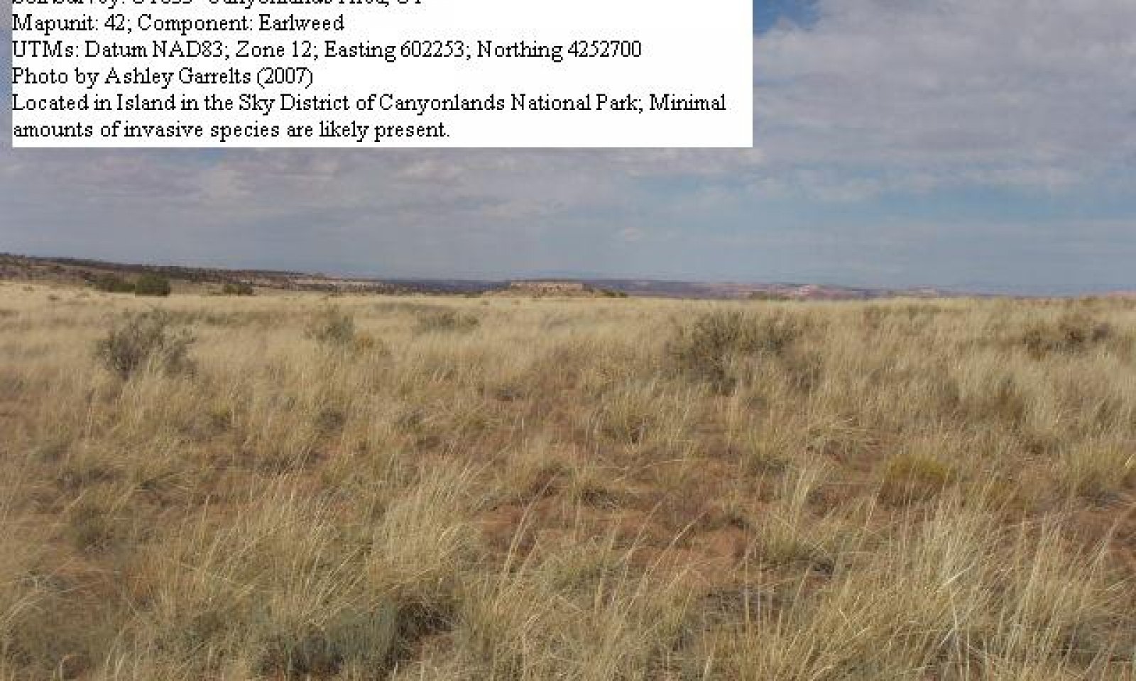
-
Search


Major Land Resource Area or ecological site by name and/or ID.
PreviousSectionsNextGeneral information
Provisional. A provisional ecological site description has undergone quality control and quality assurance review. It contains a working state and transition model and enough information to identify the ecological site.
Click to explore map
Figure 1. Mapped extent
Areas shown in blue indicate the maximum mapped extent of this ecological site. Other ecological sites likely occur within the highlighted areas. It is also possible for this ecological site to occur outside of highlighted areas if detailed soil survey has not been completed or recently updated.
MLRA notes
Major Land Resource Area (MLRA): 035X–Colorado Plateau
This ecological site occurs in the northern portion of MLRA 35, Colorado Plateau Province. It is found principally in the Canyon Lands and High Plateaus of Utah sections within that MLRA. This area has been stucturally uplifted over time while rivers flowing across it were cutting down into it's bedrock. Areas of shale, sandstone, limestone, dolomite, and volcanic rock outcrop are found throughout the region.
Classification relationships
Semiarid Benchlands and Canyonlands, 20-c and Arid Canyonlands, 20-d. (Woods et al. 2001)
Colorado Plateau Semidesert Province (arid grassland zone), 313. (Baily 1995)
Associated sites
R035XY015UT Sandy Bottom
R035XY209UT Semidesert Loam (Wyoming Big Sagebrush)
R035XY215UT Semidesert Sandy Loam (4-Wing Saltbush)
R035XY216UT Semidesert Sandy Loam (Wyoming Big Sagebrush)
R035XY218UT Semidesert Sandy Loam (Blackbrush)
R035XY221UT Semidesert Shallow Loam (Utah Juniper-Pinyon)
R035XY224UT Semidesert Shallow Sand (Blackbrush)
R035XY225UT Semidesert Shallow Sand (Cutler''s Jointfir)
R035XY227UT Semidesert Shallow Sand (Utah Juniper-Pinyon)
R035XY233UT Semidesert Shallow Sandy Loam (Blackbrush)
R035XY236UT Semidesert Shallow Sandy Loam (Utah Juniper, Blackbrush)
Similar sites
R035XY215UT Semidesert Sandy Loam (4-Wing Saltbush)
R035XY118UT Desert Sandy Loam (Fourwing Saltbush)
R035XY211UT Semidesert Sand (Dune)
Table 1. Dominant plant species
Tree Not specified
Shrub (1) Atriplex canescens
(2) Artemisia filifoliaHerbaceous (1) Achnatherum hymenoides
(2) Muhlenbergia pungensPhysiographic features
This site occurs on dunes, structural benches, plateaus, alluvial fans, mesas, sandsheets, and cuestas. Vegetated dunes are very common. Depending up on plant community and the presences or absence of disturbance (see the community phase section of this report), active dunes can become more prevalent. Runoff potential is very low to low.
Table 2. Representative physiographic features
Landforms (1) Dune
(2) Sand sheet
(3) Structural bench
Flooding duration Extremely brief (0.1 to 4 hours) to very brief (4 to 48 hours) Flooding frequency None to very rare Ponding frequency None Elevation 4200 – 6700 ft Slope 0 – 30 % Ponding depth 0 in Aspect Aspect is not a significant factor Climatic features
The climate is characterized by hot summers and cool winters, which can be slightly modified by local topographic conditions, such as aspect. Large fluctuations in daily temperature are common. Mean annual high temperatures range from 61-71 degrees Fahrenheit and mean annual low temperatures range from 33-43 degrees Fahrenheit. Approximately 70-75% of moisture occurs as rain from October-March as convection thunderstorms and snow. Precipitation is extremely variable from month to month and from year to year but averages between 7-12 inches. Snow packs are generally light and not persistent.
Table 3 Representative climatic features
Frost-free period (average) 160 days Freeze-free period (average) 200 days Precipitation total (average) 10 in BarLineFigure 2. Monthly precipitation range
BarLineFigure 3. Monthly average minimum and maximum temperature
">Influencing water features
There are no water features influencing this site.
Soil features
This sites soils are classified as moderately to very deep torripsamments and are excessively drained. The dry surface color is typically a reddish brown. Runoff is low or very low on flatter slopes, however, sites with slopes greater than 20% have a medium runoff potential. These soils have a high wind and water erosion potential and are subject to blowing and drifting even when the site is in the reference state. The soil temperature and moisture regimes are mesic and ustic aridic respectively. Surface and subsurface textures are generally fine sands, sands, and loamy sands. Soils are nonsaline and the water holding capacity is generally low. Surface and subsurface rock fragments are unusual. This site has been used in the following soil surveys and has been correlated to the following components:
UT624 – Grand County – Mido
UT631 – Henry Mountains – Mido
UT633 – Canyonlands Area – Mido, Ustic Torripsamments
UT636 – Panguitch Area – Mespun
UT638 – San Juan County, Central Part – Mido
UT643 – San Juan County, Navaho Indian Reservation – Mespun, Sheppard
UT685 – Capital Reef National Park – Henrieville, Mido
UT686 – Escalante Grand Staircase National Monument – Bispen, Earlweed, Mespun, Mido
Typical soil profile:
A--0-2 inches; loamy fine sand; non to slightly calcareous; moderately alkaline.
C--2-60+ inches; fine sand; slightly to moderately calcareous; moderately alkaline.
Table 4. Representative soil features
Parent material (1) Alluvium – sandstone
Surface texture (1) Sand
(2) Fine sand
(3) Loamy fine sand
Family particle size (1) Sandy
Drainage class Somewhat excessively drained to excessively drained Permeability class Moderately rapid to rapid Soil depth 40 – 60 in Surface fragment cover <=3" 0 – 2 % Surface fragment cover >3" Not specified Available water capacity
(0-40in)3.5 – 6 in Calcium carbonate equivalent
(0-40in)2 – 20 % Electrical conductivity
(0-40in)0 – 2 mmhos/cm Sodium adsorption ratio
(0-40in)0 – 5 Soil reaction (1:1 water)
(0-40in)7.5 – 8.6 Subsurface fragment volume <=3"
(Depth not specified)0 – 5 % Subsurface fragment volume >3"
(Depth not specified)Not specified Ecological dynamics
This ecological site occurs on moderately deep to very deep, poorly developed soils found on vegetated dunes, structural benches, plateaus, mesas, sandsheets, and cuestas in Major Land Resource Area (MLRA) 35-The Colorado Plateau. Fourwing saltbush or winterfat typically forms the dominant visual aspect. Small areas within this ecological site may be subject to blowing; these areas are sparsely vegetated with dune vegetation including species such as purple sage, resin bush, and sandhill muhly. Utah juniper (0-5% canopy cover) may be found invading these plant communities when the site is in close proximity to a juniper stand.
This site developed under Colorado Plateau climatic conditions and included natural influences of herbivory, fire, and climate. The natural disturbance regime consisted of fairly infrequent fires ignited by both natural causes and Native Americans. Fires are normally infrequent due to broken topography (i.e.,large expanses exposed rock in the landscape), the fact that warm season grasses are usually green during the thunderstorm season, and that few lightning strikes actually occur. This ecological site is commonly described as a desert grassland plant community. It is estimated that the historic fire return interval was 35-100+ years depending on fine fuel accumulations (Howard, 2003).
This ecological site has been grazed by domestic livestock since they were first introduced into the area. This livestock introduction, with its the use of fencing and the development of reliable water sources have influenced the disturbance regime historically associated with this ecological site. Fires would typically only carry on this site after several good moisture years created continuous fine fuels, however, the introduction of domestic livestock reduced these fine fuels, reducing fires periods. In addition to influencing this sites fire regime, improperly managed livestock grazing (i.e., continuous season long grazing, heavy stocking rates, etc.) can cause this site to depart for the reference plant community. When this occurs, native perennial grasses and shrubs will decrease while invasive forbs and annual grasses will increase. Continued improper domestic livestock grazing will likely remove the native perennial grasses and shrubs from the system and create large bare interspaces, which can increase erosion, active duning, and opportunities for invasive plants to establish.
Other disturbance mechanisms include extended drought, changes in the site’s drainage patterns, alluvial deposits, insect herbivory, poorly managed off road vehicle (OHV) use, and prolonged rodent activity. These disturbances can either facilitate the transition into different plant communities or the transition from one stable state to another, depending on severity, duration, and ecological site resilience.
As vegetation communities respond to changes in management or natural influences that move them to different ecological states, a return to previous states may not be possible without major energy inputs. The amount of energy needed to affect vegetative shifts depends on present biotic and abiotic features and the desired results.
The following State and Transition diagram describes the most common plant communities found on this site. They do not represent every possibility, but they are the most prevalent and repeatable. As more data are collected, some of these plant communities may be revised or removed, and new ones may be added. This model was developed using range data collected in 2006 and 2007 in Arches and Canyonlands National Park in Southeastern Utah. Both ocular and measured data was collected and utilized. Data collected by the Soil Conservation Service in 1999 and GAP Analysis data collected by the RS/GIS Laboratory at USU (2000-2004) was also used.State and transition model
Custom diagramStandard diagram
More interactive model formats are also available. View Interactive Models
More interactive model formats are also available. View Interactive Models
Click on state and transition labels to scroll to the respective textEcosystem states
States 2 and 5 (additional transitions)
State 1 submodel, plant communities
Communities 1, 5 and 2 (additional pathways)
State 2 submodel, plant communities
State 3 submodel, plant communities
State 4 submodel, plant communities
State 5 submodel, plant communities
State 1
Reference StateThe reference state has been determined by the study of rangeland relic areas and areas protected from excessive disturbance such as improper livestock grazing and high impact recreation. Literature reviews, trends in plant community dynamics, and historical accounts have also been considered.
This state represents the natural range of variability that dominates the dynamics of this ecological site. This state includes the biotic communities that would become established if all successional sequences were completed under the natural disturbance regime. The state is dominated by perennial warm and cool season grasses and a diverse shrub community. Utah juniper has been known to invade this site when it is in close proximity to a juniper stand. Due to the aggressive competitiveness of Utah juniper, blowout areas are common where these species occur. Primary disturbance mechanisms for this site include fire, grazing by native herbivores, prolonged rodent activity, insect herbivory, alluvial deposits and changes in the sites drainage patterns. These disturbances coupled with weather events dictate the dynamics that occur within the natural range of variability. The reference state is self sustaining and resistant to change due to high resistance to natural disturbances and high resilience after natural disturbances. When natural disturbances occur, the rate of recovery is relatively rapid due to niches being filled with highly adapted native vegetation.
Reference State: Community phases influenced by infrequent fire, native herbivore grazing, insect herbivory, alluvial deposits, time without disturbance, and climate.
Indicators: A well developed native perennial warm and cool season grass community with a diverse shrub overstory, when present.
Feedbacks: Establishment of non-native invasive species in the understory. Infrequent but regular fires that maintain the perennial bunch grass understory and the establishment of shrubs.
At-risk Community Phase: All communities are at risk for invasion by non-native plants; however plant community 1.3 and 1.4 are most at risk due to decreased species cover and diversity in the understory. 1.4 also is at risk due to changes in disturbance regime.
Trigger: Establishment of non-native plant species
Community 1.1
Perennial Grassland
Figure 4. Perennial Grassland
This community phase is characterized by perennial grasses where needle-and-thread is the dominant plant species. Indian ricegrass, sand dropseed, sandhill muhly, blue grama, and James galleta may also be present. Perennial warm and cool season grasses (30-50% cover) are very common while shrubs make up only 1-9% of the canopy cover, measured as first raindrop impact. Fourwing saltbush and/or winterfat form the dominant visual aspect, and generally cutler mormontea is present. Other grass, shrubs, and forbs may or may not be present and cover is variable. Biological crusts are common (20-30% cover) are characterized by continuous moss and lichen pinnacles, and bare ground (10-20% cover) is minimal.
The following tables present a typical example of the vegetative floristics of a community phase 1.1 plant community.Figure 5. Annual production by plant type (representative values) or group (midpoint values)
Table 5. Annual production by plant type
Plant type Low
(lb/acre)Representative value
(lb/acre)High
(lb/acre)Grass/Grasslike 200 300 400 Shrub/Vine 60 80 140 Forb 30 40 50 Tree 1 5 10 Total 291 425 600 Table 6. Soil surface cover
Tree basal cover 0-10% Shrub/vine/liana basal cover 0-10% Grass/grasslike basal cover 30-50% Forb basal cover 0-20% Non-vascular plants 0% Biological crusts 20-30% Litter 10-10% Surface fragments >0.25" and <=3" 0-10% Surface fragments >3" 0% Bedrock 0% Water 0% Bare ground 10-40% Table 7. Canopy structure (% cover)
Height Above Ground (ft) Tree Shrub/Vine Grass/
GrasslikeForb <0.5 – 1-10% 0-10% 0-5% >0.5 <= 1 – 1-5% 5-10% 0-5% >1 <= 2 – 1-7% 5-20% 0-5% >2 <= 4.5 – 1-5% 5-20% 0-5% >4.5 <= 13 0-5% 1-3% – – >13 <= 40 – – – – >40 <= 80 – – – – >80 <= 120 – – – – >120 – – – – Community 1.2
Perennial Grassland/Shrubland
Figure 6. Perennial Grassland/Shrubland
This plant community is characterized by both native shrubs and perennial warm and cool season grasses. Needle-and-thread, Indian ricegrass, sand dropseed, blue grama, and James galleta may be present. Perennial warm and cool season grasses (20-45% cover) are common and shrubs make up 10-14% of the canopy cover, measured as first raindrop impact. Fourwing saltbush and/or winterfat form the dominant visual aspect, and generally cutler mormontea and sand sagebrush are present. Other grass, shrubs, and forbs may or may not be present and cover is variable. Biological crusts are common (20-30% cover) and characterized by continuous moss and lichen pinnacles. Bare ground (10-20% cover) is minimal.
The following tables present a typical example of the vegetative floristics of a community phase 1.2 plant community.Figure 7. Annual production by plant type (representative values) or group (midpoint values)
Table 8. Annual production by plant type
Plant type Low
(lb/acre)Representative value
(lb/acre)High
(lb/acre)Grass/Grasslike 100 250 300 Shrub/Vine 100 150 200 Forb 30 40 50 Tree 1 5 10 Total 231 445 560 Table 9. Soil surface cover
Tree basal cover 0-10% Shrub/vine/liana basal cover 10-10% Grass/grasslike basal cover 20-50% Forb basal cover 0-20% Non-vascular plants 0% Biological crusts 20-30% Litter 10-10% Surface fragments >0.25" and <=3" 0-10% Surface fragments >3" 0% Bedrock 0% Water 0% Bare ground 10-20% Table 10. Canopy structure (% cover)
Height Above Ground (ft) Tree Shrub/Vine Grass/
GrasslikeForb <0.5 – 1-10% 0-10% 0-5% >0.5 <= 1 – 1-5% 5-10% 0-5% >1 <= 2 – 1-10% 5-20% 0-5% >2 <= 4.5 – 1-5% 5-20% 0-5% >4.5 <= 13 0-5% 1-3% – – >13 <= 40 – – – – >40 <= 80 – – – – >80 <= 120 – – – – >120 – – – – Community 1.3
Perennial Shrubland
Figure 8. Perennial Shrubland
This plant community is characterized by a dominance of native perennial shrubs, where warm and cool season perennial grasses are still present in the understory. Needle-and-thread, Indian ricegrass, sand dropseed, blue grama, and James galleta may be present. Perennial warm and cool season grasses (10-45% cover) are variable and shrubs make up 15-30% of the canopy cover, measured as first raindrop impact. Fourwing saltbush and/or winterfat form the dominant visual aspect, and generally Cutler's jointfir and sand sagebrush are present. Other grass, shrubs, and forbs may or may not be present and cover is variable. Biological crusts are common (20-30% cover) are characterized by continuous moss and lichen pinnacles, and bare ground (10-20% cover) is minimal. This plant community is more at risk that other plant communities in the reference state due to the lack of understory.
The following tables present a typical example of the vegetative floristics of a community phase 1.3 plant community.Figure 9. Annual production by plant type (representative values) or group (midpoint values)
Table 11. Annual production by plant type
Plant type Low
(lb/acre)Representative value
(lb/acre)High
(lb/acre)Shrub/Vine 100 200 300 Grass/Grasslike 75 200 250 Forb 30 40 50 Tree 1 5 10 Total 206 445 610 Table 12. Soil surface cover
Tree basal cover 0-10% Shrub/vine/liana basal cover 20-30% Grass/grasslike basal cover 10-50% Forb basal cover 0-20% Non-vascular plants 0% Biological crusts 20-30% Litter 10-10% Surface fragments >0.25" and <=3" 0-10% Surface fragments >3" 0% Bedrock 0% Water 0% Bare ground 10-20% Table 13. Canopy structure (% cover)
Height Above Ground (ft) Tree Shrub/Vine Grass/
GrasslikeForb <0.5 – 1-10% 0-10% 0-5% >0.5 <= 1 – 1-5% 5-10% 0-10% >1 <= 2 – 1-15% 5-20% 0-10% >2 <= 4.5 – 1-5% 5-20% 0-5% >4.5 <= 13 0-5% 1-3% – – >13 <= 40 – – – – >40 <= 80 – – – – >80 <= 120 – – – – >120 – – – – Community 1.4
Sand Sagebrush ShrublandThis plant community is characterized by a dominance of sand sagebrush with a perennial grass understory. Due to sand sagebrush’s resilience and ability to establish after a disturbance this community phase may be very persistent. This shrub is an avid resprouter and thus after disturbances, such as fire or alluvial sand deposits, it is able to reestablish relatively fast when compared to other vegetation (McWilliams, 2003). Once established it can proliferate and dominate the site reducing the ability of other perennial shrubs to obtain the nutrients needed for survival. Needle-and-thread, Indian ricegrass, sand dropseed, blue grama, and James galleta may be present. Other grass, shrubs, and forbs may or may not be present and cover is variable. Biological crusts (0-15% cover) are classified as crustless or by light cyanobacteria in the interspaces, with occasional lichen and moss pinnacles with little to no continuity, depending on severity and age of the alluvial deposit. Bare ground is more common in this community phase (10-40% cover).
The following tables present a typical example of the vegetative floristics of a community phase 1.4 plant community.Figure 10. Annual production by plant type (representative values) or group (midpoint values)
Table 14. Annual production by plant type
Plant type Low
(lb/acre)Representative value
(lb/acre)High
(lb/acre)Shrub/Vine 100 250 350 Grass/Grasslike 75 200 250 Forb 30 40 50 Total 205 490 650 Table 15. Soil surface cover
Tree basal cover 0% Shrub/vine/liana basal cover 20-30% Grass/grasslike basal cover 10-20% Forb basal cover 0-20% Non-vascular plants 0% Biological crusts 0-20% Litter 10-10% Surface fragments >0.25" and <=3" 0-10% Surface fragments >3" 0% Bedrock 0% Water 0% Bare ground 10-40% Table 16. Canopy structure (% cover)
Height Above Ground (ft) Tree Shrub/Vine Grass/
GrasslikeForb <0.5 – 1-5% 0-10% 0-5% >0.5 <= 1 – 1-5% 5-10% 0-10% >1 <= 2 – 1-15% 5-20% 0-10% >2 <= 4.5 – 1-10% 5-20% 0-5% >4.5 <= 13 – 1-3% – – >13 <= 40 – – – – >40 <= 80 – – – – >80 <= 120 – – – – >120 – – – – Community 1.5
Active Dunes
Figure 11. Active Dunes
This plant community is characterized by dune vegetation. Dominant perennial shrubs include Cutler mormontea, sand buckwheat, resinbush, and purple sage. Dominant perennial cool season grasses include Indian ricegrass and dominant perennial warm season grasses include sandhill muhly. Other perennial grasses, shrubs, and forbs may or may not be present and cover is variable. This community is typically represented by small patches where localized surfaces disturbances have occurred within one of the other reference state plant communities. Bare ground (30-60% cover) is common, and biological crust (0-25%) cover is typically characterized as crustless to light cyanobacteria in the interspaces.
The following tables present a typical example of the vegetative floristics of a community phase 1.5 plant community.Figure 12. Annual production by plant type (representative values) or group (midpoint values)
Table 17. Annual production by plant type
Plant type Low
(lb/acre)Representative value
(lb/acre)High
(lb/acre)Grass/Grasslike 75 300 550 Shrub/Vine 60 100 180 Forb 25 50 75 Tree 1 5 10 Total 161 455 815 Table 18. Soil surface cover
Tree basal cover 0-10% Shrub/vine/liana basal cover 10-20% Grass/grasslike basal cover 10-30% Forb basal cover 10-20% Non-vascular plants 0% Biological crusts 0-30% Litter 0-10% Surface fragments >0.25" and <=3" 0-0% Surface fragments >3" 0% Bedrock 0% Water 0% Bare ground 30-60% Table 19. Canopy structure (% cover)
Height Above Ground (ft) Tree Shrub/Vine Grass/
GrasslikeForb <0.5 – 1-10% 0-10% 0-5% >0.5 <= 1 – 1-5% 5-20% 0-5% >1 <= 2 – 1-5% 5-10% 0-5% >2 <= 4.5 – 0-5% 0-5% – >4.5 <= 13 0-5% 0-3% – – >13 <= 40 – – – – >40 <= 80 – – – – >80 <= 120 – – – – >120 – – – – Pathway 1.1a
Community 1.1 to 1.2
Perennial Grassland
Perennial Grassland/ShrublandThis pathway occurs as natural events favor the increased establishment of shrubs, including drought and/or time without disturbances. Drought favors the establishment of shrubs due to their ability to out-compete native perennial grasses for moisture. Time allows shrubs, which have longer recovery periods, to establish.
Pathway 1.1b
Community 1.1 to 1.4This pathway occurs when events favor the establishment of sand sagebrush. Events typically include a flood with alluvial deposits. This changes the water drainage patterns of a site and results in a dominance of sand sagebrush due to its ability to establish and flourish on sites with shorter disturbance regimes (McWilliams, 2003.
Pathway 1.1c
Community 1.1 to 1.5
Perennial Grassland
Active DunesThis pathway occurs when events favor an increase in active dunes and common dune vegetation. Events could include any type of natural surface disturbance that would increase erosion and soil movement, such as prolonged rodent activity, a severe drought that reduces plant cover, excessive trampling by wildlife, etc.
Pathway 1.2a
Community 1.2 to 1.1
Perennial Grassland/Shrubland
Perennial GrasslandThis pathway occurs as events favor the increased establishment of perennial warm and cool season grasses with a decrease in shrub cover. Events typically include fire, which reduces shrub cover and allows for increased establishment of grasses, and insect herbivory. Orthoptera, Lepidoptera, and Hemiptera are known to feed on fourwing saltbush and have been associated with shrub die-offs in the late 1980’s (Howard, 2003).
Pathway 1.2b
Community 1.2 to 1.3
Perennial Grassland/Shrubland
Perennial ShrublandThis pathway occurs as events favor the increased establishment of shrubs. Events may include drought or time without fire disturbances. Drought favors the establishment of shrubs due to its ability to out-compete native perennial grasses for moisture. Time without fire allows shrubs, which have longer recovery periods, to establish.
Pathway 1.2c
Community 1.2 to 1.4This pathway occurs when events favor the establishment of sand sagebrush. Events typically include a flood with alluvial deposits. This changes the water drainage patterns of a site and results in a dominance of sand sagebrush due to its ability to establish and flourish on sites with shorter disturbance regimes.
Pathway 1.2d
Community 1.2 to 1.5
Perennial Grassland/Shrubland
Active DunesThis pathway occurs when events favor an increase in active dunes and common dune vegetation. Events could include any type of natural surface disturbance that would increase erosion and soil movement, such as prolonged rodent activity, a severe drought that reduces plant cover, excessive trampling by wildlife, etc.
Pathway 1.3d
Community 1.3 to 1.1
Perennial Shrubland
Perennial GrasslandThis pathway occurs when a fire completely removes the shrub overstory and results in an increase in the perennial grasses and forbs.
Pathway 1.3a
Community 1.3 to 1.2
Perennial Shrubland
Perennial Grassland/ShrublandThis pathway occurs as natural events favor the increased establishment of perennial warm and cool season grasses with a decrease in shrub cover. Events typically include patchy fire, which reduces shrub cover and allows for increased establishment of grasses, and insect herbivory. Orthoptera, Lepidoptera, and Hemiptera are known to feed on fourwing saltbush and have been associated with shrub die-offs in the late 1980’s (Howard, 2003).
Pathway 1.3b
Community 1.3 to 1.4This pathway occurs when events favor the establishment of sand sagebrush. Events typically include a flood with alluvial deposits. This changes the water drainage patterns of a site and results in a dominance of sand sagebrush due to its ability to establish and flourish on sites with shorter disturbance regimes.
Pathway 1.3c
Community 1.3 to 1.5
Perennial Shrubland
Active DunesThis pathway occurs when events favor an increase in active dunes and common dune vegetation. Events could include any type of natural surface disturbance that would increase erosion and soil movement, such as prolonged rodent activity, a severe drought that reduces plant cover, excessive trampling by wildlife, etc.
Pathway 1.4a
Community 1.4 to 1.2This pathway occurs as time without disturbances or a change in water drainage patterns stabilize the site and allow for the increased establishment of fourwing saltbush, winterfat, and perennial warm and cool season grasses.
Pathway 1.5a
Community 1.5 to 1.2
Active Dunes
Perennial Grassland/ShrublandThis pathway occurs as natural events such as time without surface disturbances favors the stabilization of the site and increased establishment of fourwing saltbush, winterfat, and perennial warm and cool season grasses.
State 2
Current Potential StateThis state is similar to the reference state except that non-native plants are now present in all plant community phases. The primary disturbance mechanisms can be natural or human induced. Events, such as improper livestock grazing, prolonged rodent activity, changes in historic fire regimes, OHV overuse, insect herbivory, or drought may influence this site. A shift in species composition will affect the nutrient cycling, soil-water relationships, hydrology, and soil stability. Dominant grasses include both warm and cool season; however many times heavy spring grazing will remove the cool season grasses and heavy late summer and early fall grazing will remove the warm season grasses. Utah juniper is also still a common invader of the shallow soil components, creating blowout areas and increasing erosion. This state is losing resistance to disturbances and resilience after disturbance. Invasive plants are beginning to fill the niches and establish on the site.
Current Potential State: Plant communities influenced by both natural and man influenced events, including rodent activity, OHV overuse, livestock grazing, insect herbivory, fire, time with out disturbances, and climatic fluctuations.
Indicators: A perennial cool and warm season grass understory with fourwing saltbush forming the dominant visual aspect, when present. Non-native species are now present in all plant communities.
Feedbacks: Extended drought, improper livestock grazing, or other disturbance that changes the ecological dynamics of the site. Infrequent but regular fires or properly managed domestic livestock grazing to maintain the understory and the establishment of shrubs.
At-risk Community Phase: All communities are at risk; however plant community 2.3 is most at risk due to its limited understory.
Trigger: Disturbance that facilitates the dominance of invasive forbs and/or grasses.Community 2.1
Perennial Grassland
Figure 13. Perennial Grassland
This community phase is characterized by perennial grassland where needle-and-thread is the dominant plant species. Indian ricegrass, sand dropseed, blue grama, and James galleta may also be present. Perennial warm and cool season grasses (20-45% cover) are very common while shrubs make up only 1-9% of the canopy cover, measured as first raindrop impact. Fourwing saltbush and/or winter fat form the dominant visual aspect, and generally Cutler's jointfir is present. Commonly seen invasive plant species include cheatgrass, Russian thistle, annual Cryptantha, annual stickseed, and tansy mustard. Other grasses, shrubs, and forbs may or may not be present and cover is variable. Biological crusts are less common than in the reference state (0-25% cover) and are characterized by light cyanobacteria and isolated moss and lichen pinnacles. Bare ground (10-40% cover) is variable.
The following tables present a typical example of the vegetative floristics of a community phase 2.1 plant community.Figure 14. Annual production by plant type (representative values) or group (midpoint values)
Table 20. Annual production by plant type
Plant type Low
(lb/acre)Representative value
(lb/acre)High
(lb/acre)Forb 20 100 150 Shrub/Vine 60 80 140 Grass/Grasslike 200 300 100 Tree 1 5 10 Total 281 485 400 Table 21. Soil surface cover
Tree basal cover 0-10% Shrub/vine/liana basal cover 0-10% Grass/grasslike basal cover 20-50% Forb basal cover 10-30% Non-vascular plants 0% Biological crusts 0-30% Litter 10-10% Surface fragments >0.25" and <=3" 0-10% Surface fragments >3" 0% Bedrock 0% Water 0% Bare ground 10-40% Table 22. Canopy structure (% cover)
Height Above Ground (ft) Tree Shrub/Vine Grass/
GrasslikeForb <0.5 – 1-10% 0-10% 0-5% >0.5 <= 1 – 1-5% 5-10% 0-10% >1 <= 2 – 1-7% 5-20% 0-10% >2 <= 4.5 – 1-5% 5-20% 0-5% >4.5 <= 13 0-5% 1-3% – – >13 <= 40 – – – – >40 <= 80 – – – – >80 <= 120 – – – – >120 – – – – Community 2.2
Perennial Grassland/Shrubland
Figure 15. Perennial Grassland/Shrubland
This plant community is characterized by both native shrubs and perennial warm and cool season grasses. Needle-and-thread, Indian ricegrass, sand dropseed, blue grama, and James galleta may be present. Perennial warm and cool season grasses (10-30% cover) are variable and shrubs make up 10-14% of the canopy cover, measured as first raindrop impact. Fourwing saltbush and/or winterfat form the dominant visual aspect, and generally Cutler's jointfir and sand sagebrush are present. Commonly seen invasive plant species include cheatgrass, Russian thistle, annual Cryptantha, annual stickseed, and tansy mustard. Other grass, shrubs, and forbs may or may not be present and cover is variable. Biological crusts are variable (5-30% cover) and characterized by cyanobacteria and isolated lichen and moss pinnacles with little to no continuity. Bare ground (10-40% cover) is variable.
The following tables present a typical example of the vegetative floristics of a community phase 2.2 plant community.Figure 16. Annual production by plant type (representative values) or group (midpoint values)
Table 23. Annual production by plant type
Plant type Low
(lb/acre)Representative value
(lb/acre)High
(lb/acre)Grass/Grasslike 100 250 300 Shrub/Vine 100 150 200 Forb 50 100 150 Tree 1 5 10 Total 251 505 660 Table 24. Soil surface cover
Tree basal cover 0-10% Shrub/vine/liana basal cover 10-10% Grass/grasslike basal cover 10-40% Forb basal cover 10-30% Non-vascular plants 0% Biological crusts 10-30% Litter 10-10% Surface fragments >0.25" and <=3" 0-10% Surface fragments >3" 0% Bedrock 0% Water 0% Bare ground 10-40% Table 25. Canopy structure (% cover)
Height Above Ground (ft) Tree Shrub/Vine Grass/
GrasslikeForb <0.5 – 1-10% 0-10% 0-5% >0.5 <= 1 – 1-5% 5-10% 0-5% >1 <= 2 – 1-10% 5-20% 0-5% >2 <= 4.5 – 1-5% 5-20% 0-5% >4.5 <= 13 0-5% 1-3% – – >13 <= 40 – – – – >40 <= 80 – – – – >80 <= 120 – – – – >120 – – – – Community 2.3
Perennial Shrubland
Figure 17. Perennial Shrubland
This plant community is characterized by a dominance of native perennial shrubs, where warm and cool season perennial grasses are still present in the understory. Needle-and-thread, Indian ricegrass, sand dropseed, blue grama, and James galleta may be present. Perennial warm and cool season grasses (20-45% cover) are fairly common and shrubs make up 15-30% of the canopy cover, measured as first raindrop impact. Fourwing saltbush and/or winterfat form the dominant visual aspect, and generally Cutler's jointfir is present. Commonly seen invasive plant species include cheatgrass, Russian thistle, annual Cryptantha, annual stickseed, and tansy mustard. Other grass, shrubs, and forbs may or may not be present and cover is variable. Biological crusts are variable (5-40% cover) are characterized by light cyanobacteria and isolated moss the lichen pinnacles with little to no continuity and bare ground (5-30% cover) is variable.
The following tables present a typical example of the vegetative floristics of a community phase 2.3 plant community.Figure 18. Annual production by plant type (representative values) or group (midpoint values)
Table 26. Annual production by plant type
Plant type Low
(lb/acre)Representative value
(lb/acre)High
(lb/acre)Shrub/Vine 100 200 300 Grass/Grasslike 75 200 250 Forb 50 100 150 Tree 1 5 10 Total 226 505 710 Table 27. Soil surface cover
Tree basal cover 0-10% Shrub/vine/liana basal cover 20-30% Grass/grasslike basal cover 20-50% Forb basal cover 10-30% Non-vascular plants 0% Biological crusts 10-40% Litter 10-10% Surface fragments >0.25" and <=3" 0-10% Surface fragments >3" 0% Bedrock 0% Water 0% Bare ground 10-30% Table 28. Canopy structure (% cover)
Height Above Ground (ft) Tree Shrub/Vine Grass/
GrasslikeForb <0.5 – 1-10% 0-10% 0-5% >0.5 <= 1 – 1-5% 5-10% 0-10% >1 <= 2 – 1-15% 5-20% 0-10% >2 <= 4.5 – 1-5% 5-20% 0-5% >4.5 <= 13 0-5% 1-3% – – >13 <= 40 – – – – >40 <= 80 – – – – >80 <= 120 – – – – >120 – – – – Community 2.4
Active Dunes
Figure 19. Active Dunes
This plant community is characterized by dune vegetation. Dominant perennial shrubs include Cutler's jointfir , sand buckwheat, resinbush, and purple sage. Dominant perennial cool season grasses include Indian ricegrass and dominant perennial warm season grasses include sandhill muhly. Commonly seen invasive plant species include cheatgrass, Russian thistle, annual Cryptantha, annual stickseed, and tansy mustard. Other perennial grasses, shrubs, and forbs may or may not be present and cover is variable. This community is typically represented by small patches where localized surfaces disturbances have occurred within the other current potential plant communities. Bare ground (30-60% cover) is common, and biological crust (0-25%) cover is typically characterized as crustless to light cyanobacteria in the interspaces.
The following tables present a typical example of the vegetative floristics of a community phase 2.4 plant community.Figure 20. Annual production by plant type (representative values) or group (midpoint values)
Table 29. Annual production by plant type
Plant type Low
(lb/acre)Representative value
(lb/acre)High
(lb/acre)Grass/Grasslike 75 300 550 Shrub/Vine 60 100 180 Forb 75 100 125 Tree 1 5 10 Total 211 505 865 Table 30. Soil surface cover
Tree basal cover 0-10% Shrub/vine/liana basal cover 10-20% Grass/grasslike basal cover 10-30% Forb basal cover 10-20% Non-vascular plants 0% Biological crusts 0-30% Litter 0-10% Surface fragments >0.25" and <=3" 0-0% Surface fragments >3" 0% Bedrock 0% Water 0% Bare ground 30-60% Table 31. Canopy structure (% cover)
Height Above Ground (ft) Tree Shrub/Vine Grass/
GrasslikeForb <0.5 – 1-10% 0-10% 0-5% >0.5 <= 1 – 1-5% 5-20% 0-5% >1 <= 2 – 1-5% 5-10% 0-5% >2 <= 4.5 – 0-5% 0-5% – >4.5 <= 13 0-5% 0-3% – – >13 <= 40 – – – – >40 <= 80 – – – – >80 <= 120 – – – – >120 – – – – Pathway 2.1a
Community 2.1 to 2.2
Perennial Grassland
Perennial Grassland/ShrublandThis pathway occurs as events favor the increased establishment of shrubs, including drought time with out fire disturbances, and grazing livestock in such a way that removes the perennial grass and forb understory and facilitates the increased establishment of shrubs.
Pathway 2.1b
Community 2.1 to 2.4
Perennial Grassland
Active DunesThis pathway occurs when events favor an increase in active dunes and common dune vegetation. Events could include any type of natural surface disturbance that would increase erosion and soil movement, such as prolonged rodent activity, a severe drought that reduces plant cover, excessive trampling by wildlife and livestock, OHV overuse, etc.
Pathway 2.2b
Community 2.2 to 2.1
Perennial Grassland/Shrubland
Perennial GrasslandThis pathway occurs as natural events favor the increased establishment of shrubs. Events may include drought, time without a fire disturbance, and grazing livestock in such a way that removes the grass and forb understory and causes an increase in shrub cover and production.
Pathway 2.2a
Community 2.2 to 2.3
Perennial Grassland/Shrubland
Perennial ShrublandThis pathway occurs as natural events favor the increased establishment of perennial warm and cool season grasses with a decrease in shrub cover. Events typically include fire, insect herbivory, and grazing in such a way to reduce shrub cover and production, resulting in an increase in the grass and forb understory.
Pathway 2.2c
Community 2.2 to 2.4
Perennial Grassland/Shrubland
Active DunesThis pathway occurs when events favor an increase in active dunes and common dune vegetation. Events could include any type of natural surface disturbance that would increase erosion and soil movement, such as prolonged rodent activity, a severe drought that reduces plant cover, excessive trampling by wildlife or livestock, OHV overuse, etc.
Pathway 2.3c
Community 2.3 to 2.1
Perennial Shrubland
Perennial GrasslandThis pathway occurs as a fire or other disturbances completely removes the shrub canopy and allows for a subsequent increase in the grass and forb plant community diversity, cover, and production.
Pathway 2.3a
Community 2.3 to 2.2
Perennial Shrubland
Perennial Grassland/ShrublandThis pathway occurs as events, such as fire, insect herbivory, or grazing livestock in such a way to decrease shrub cover and production, favor the increased establishment of perennial warm and cool season grasses with a decrease in shrub cover.
Pathway 2.3b
Community 2.3 to 2.4
Perennial Shrubland
Active DunesThis pathway occurs when events favor an increase in active dunes and common dune vegetation. Events could include any type of natural surface disturbance that would increase erosion and soil movement, such as prolonged rodent activity, a severe drought that reduces plant cover, excessive trampling by wildlife or livestock, OHV overuse, etc.
Pathway 2.4a
Community 2.4 to 2.2
Active Dunes
Perennial Grassland/ShrublandThis pathway occurs as natural events such as time without disturbance favors the stabilization of the site and increased establishment of fourwing saltbush, winterfat, and perennial warm and cool season grasses.
State 3
Sand Sagebrush StateThis state is characterized by the dominance of sand sagebrush, where invasive and desirable species may or may not be present in the understory. Primary disturbance mechanisms include improper livestock grazing and drought which reduces the understory limiting it to occurring directly under the shrub canopy. This creates large bare interspaces which are susceptible erosion. Time without disturbances may cause this site to reestablish some of its understory. Due to sand sagebrush’s resilience and ability to establish after a disturbance this state may be very persistent. This shrub is an avid resprouter and thus after disturbances, such as fire or alluvial sand deposits, it is able to reestablish relatively fast when compared to other vegetation (McWilliams, 2003). Once established it can proliferate and dominate the site reducing the ability of other perennial shrubs to obtain the nutrients needed for survival.
Sand Sagebrush State: Plant communities influenced by time without disturbances, drought, and livestock grazing.
Indicators: A site dominated by sand sagebrush, where invasive and desirable species may or may not be present in the understory.
Feedbacks: Extended drought, improperly managed livestock grazing, or other disturbance that result in a reduction of the understory and subsequent increased occurrence of invasive plant species. Properly managed livestock grazing and normal precipitation fluctuations that allow for the maintenance of the understory and shrub canopy.
At risk Community: All communities are at risk; however these sites may be very stable do to the behavior of sand sagebrush and its resilience after disturbances. Plant community 3.2 is most at risk due to absence of a developed understory and its increased erosion potential.
Trigger: Cheatgrass invasion, creating a decrease in the fire return interval (every 5-10 years)
Community 3.1
Sand Sagebrush with Understory
Figure 21. Sand Sagebrush with Understory
This plant community phase is characterized by a dominance of sand sagebrush where invasive plants are dominating the understory. Native desirable vegetation is usually present in minimal amounts. Needle-and-thread, Indian ricegrass, sand dropseed, blue grama, and James galleta may be present. Commonly seen invasive plant species include cheatgrass, Russian thistle, annual Cryptantha, annual stickseed, and tansy mustard. Other grass, shrubs, and forbs may or may not be present and cover is variable. Biological crusts (0-20% cover) are classified as crustless or by light cyanobacteria in the interspaces, with occasional lichen and moss pinnacles with little to no continuity, depending on severity and age of the alluvial deposit.
The following tables present a typical example of the vegetative floristics of a community phase 3.1 plant community.Figure 22. Annual production by plant type (representative values) or group (midpoint values)
Table 32. Annual production by plant type
Plant type Low
(lb/acre)Representative value
(lb/acre)High
(lb/acre)Shrub/Vine 100 200 300 Grass/Grasslike 75 200 250 Forb 50 150 200 Total 225 550 750 Table 33. Soil surface cover
Tree basal cover 0% Shrub/vine/liana basal cover 10-20% Grass/grasslike basal cover 10-20% Forb basal cover 10-30% Non-vascular plants 0% Biological crusts 0-20% Litter 10-10% Surface fragments >0.25" and <=3" 0-10% Surface fragments >3" 0% Bedrock 0% Water 0% Bare ground 10-40% Table 34. Canopy structure (% cover)
Height Above Ground (ft) Tree Shrub/Vine Grass/
GrasslikeForb <0.5 – 1-5% 0-10% 0-5% >0.5 <= 1 – 1-5% 5-10% 0-10% >1 <= 2 – 1-15% 5-20% 0-10% >2 <= 4.5 – 1-10% 5-20% 0-5% >4.5 <= 13 – 1-3% – – >13 <= 40 – – – – >40 <= 80 – – – – >80 <= 120 – – – – >120 – – – – Community 3.2
Sand Sagebrush with No Understory
Figure 23. Sand Sagebrush without Understory
This plant community phase is characterized by a dominance of sand sagebrush with very little understory. Many times the only understory species present in cheatgrass. Other grass, shrubs, and forbs may or may not be present and cover is variable, and plants are typically found under the shrub canopy. Biological crusts (0-20% cover) are classified as crustless or by light cyanobacteria in the interspaces, with occasional lichen and moss pinnacles with little to no continuity, depending on severity and age of the alluvial deposit. Bare ground is more common in this community phase (30-50% cover).
The following tables present a typical example of the vegetative floristics of a community phase 3.2 plant community.Figure 24. Annual production by plant type (representative values) or group (midpoint values)
Table 35. Annual production by plant type
Plant type Low
(lb/acre)Representative value
(lb/acre)High
(lb/acre)Shrub/Vine 100 200 300 Forb 50 100 150 Grass/Grasslike 50 100 150 Total 200 400 600 Table 36. Soil surface cover
Tree basal cover 0% Shrub/vine/liana basal cover 10-30% Grass/grasslike basal cover 10-20% Forb basal cover 10-20% Non-vascular plants 0% Biological crusts 0-20% Litter 10-10% Surface fragments >0.25" and <=3" 0-10% Surface fragments >3" 0% Bedrock 0% Water 0% Bare ground 30-50% Table 37. Canopy structure (% cover)
Height Above Ground (ft) Tree Shrub/Vine Grass/
GrasslikeForb <0.5 – 1-5% 0-15% 0-5% >0.5 <= 1 – 1-5% 5-10% 0-5% >1 <= 2 – 1-15% 0-10% 0-5% >2 <= 4.5 – 1-10% 0-5% 0-5% >4.5 <= 13 – 1-3% – – >13 <= 40 – – – – >40 <= 80 – – – – >80 <= 120 – – – – >120 – – – – Pathway 3.1a
Community 3.1 to 3.2
Sand Sagebrush with Understory
Sand Sagebrush with No UnderstoryThis pathway occurs as events favor the increased establishment of sand sagebrush with a marked decrease in the understory vegetation. Events may include improper livestock grazing, drought, or continued surface disturbances such as alluvial deposits.
Pathway 3.2a
Community 3.2 to 3.1
Sand Sagebrush with No Understory
Sand Sagebrush with UnderstoryThis pathway occurs as time without disturbances favor the reestablishment of the understory.
State 4
Invasive Forb StateThis state is characterized by the dominance of invasive forbs/shrubs. These species may include, but are not limited to Russian thistle, cheatgrass, tansy mustard, broom snakeweed, annual stickseed, or annual Cryptantha. One or more invasive species has increased to a point where they influence or drive the disturbance regime and nutrient cycle. Russian thistle and/or cheatgrass are the most likely of these species to establish and dominate. Russian thistle is a prolific reproducer—one plant can produce up to 250,000 seeds, which are dispersed by the wind causing the dead plant to “tumble” across the landscape. While generally considered an unwanted weed, Russian thistle may actually help disturbed sites recover more quickly. If topsoil is present, Russian thistle roots are invaded by mycorrhizal fungi and because this plant does not form associations with the fungi the root and plant are killed. This causes increased mycorrhizal fungi in the soil and an increased chance for other plants to establish through the aid of these fungi associations. Yet, managers must be aware that that without proper management other invasive annuals, such is cheatgrass may become established instead of the desirable native species. If topsoil is missing the mycorrhizal fungi, Russian thistle can persist for relatively long periods of time (Howard, 1992). Cheatgrass has an entirely other effect on the soil/plant/water relationships. Research has shown that plant species differ substantially in the effects on soil water content and temperature, and in their effects on the frequency and intensity of disturbance. After cheatgrass has invaded a site fundamental nutrient cycling processes, root pores, mycorrhizal associations, microbial species, and soil organic material changes (Chapin et al. 1997; Belnap and Phillips, 2001). These alterations may eventually create ecologically impoverished sites that are very difficult to restore to functionally diverse perennial herbaceous and woody communities. The competitiveness of the invasive species and the ability of these species to quickly establish after a disturbance make this state extremely resistance to change and resilient after a disturbance.
Invasive Forb State: Community phases influenced by improper grazing and weather cycles.
Indicators: A complete understory of invasive forbs and/or broom snakeweed where native perennial shrubs, grasses, and forbs are minimally present.
Feedbacks: Improper livestock grazing and weather cycles that maintain the dominance of invasive forbs/shrubs with minimal decrease in occurring native perennial grasses, shrubs, and forbs. Increased occurrence of cheatgrass, decreasing the fire return interval. Flooding and alluvial deposits that facilitates the establishment of sand sagebrush.
Trigger: The increased establishment of cheatgrass, caused by a decrease in the fire return interval, which facilitates the continued removal of other grasses, shrubs, and forbs.Community 4.1
Invaded Grasslands and Shrublands
Figure 25. Invaded Grasslands and Shrublands
This plant community is characterized by a shrub overstory with an invasive forb and grass understory. The native and/or introduced perennial grass canopy cover is minimal. Invasive forbs make up a large portion of the understory. Russian thistle is present and the most productive species on the site. Other invasive species include stickseed, annual Cryptantha, tansy mustard, and broom snakeweed. Minimal amounts of cheatgrass are present. Bare ground (10-25% cover) is moderate, and biological crusts (25-30% cover) are characterized by light cyanobacteria and/or isolated lichen and moss pinnacles. Litter deposition (10-15% cover) is typically greater than in the previous states.
The following tables present a typical example of the vegetative floristics of a community phase 4.1 plant community.Figure 26. Annual production by plant type (representative values) or group (midpoint values)
Table 38. Annual production by plant type
Plant type Low
(lb/acre)Representative value
(lb/acre)High
(lb/acre)Forb 150 250 350 Grass/Grasslike 50 100 200 Shrub/Vine 50 100 150 Total 250 450 700 Table 39. Soil surface cover
Tree basal cover 0% Shrub/vine/liana basal cover 10-10% Grass/grasslike basal cover 10-20% Forb basal cover 20-30% Non-vascular plants 0% Biological crusts 30-30% Litter 10-20% Surface fragments >0.25" and <=3" 0-0% Surface fragments >3" 0% Bedrock 0% Water 0% Bare ground 20-30% Table 40. Canopy structure (% cover)
Height Above Ground (ft) Tree Shrub/Vine Grass/
GrasslikeForb <0.5 – 0-5% 1-5% 5-10% >0.5 <= 1 – 5-10% 1-5% 5-15% >1 <= 2 – 5-10% 1-5% 1-5% >2 <= 4.5 – 1-5% 1-5% – >4.5 <= 13 – – – – >13 <= 40 – – – – >40 <= 80 – – – – >80 <= 120 – – – – >120 – – – – State 5
Annual Grass StateThis state’s ecological processes are driven by the dominance of cheatgrass, where native and invasive plant species may or may not be present. Cheatgrass dramatically affects the soil/plant/water relationships of a site. Research has shown that plant species differ substantially in the effects on soil water content and temperature, and in their effects on the frequency and intensity of disturbance. After cheatgrass has invaded a site the fundamental nutrient cycling processes, root pores, mycorrhizal associations, microbial species, and soil organic material changes (Chapin et al. 1997; Belnap and Phillips, 2001). These alterations may eventually create ecologically impoverished sites that are very difficult to restore to functionally diverse perennial herbaceous and woody communities. The competitiveness of cheatgrass and its ability to quickly establish after a disturbance make this state extremely resistance to change and resilient after a disturbance.
Annual Grass State: Community phases maintained, in a self-sustaining manner, by frequent fire.
Indicators: A site where ecological processes are driven by cheatgrass
Feedbacks: A self sustaining disturbance regime of frequent fire.Community 5.1
Cheatgrass Dominated
Figure 27. Cheatgrass Dominated
This plant community is characterized by dominance of cheatgrass, where other native species are present but no longer drive the ecological dynamics of the site. Bare ground is minimal (5-15% cover) due to the increase in litter and cheatgrass’ dense establishment. Fire can carry through this community. Biological crusts (1-5% cover) are characterized by light cyanobacteria in the interspaces.
The following tables present a typical example of the vegetative floristics of a community phase 5.1 plant community.Figure 28. Annual production by plant type (representative values) or group (midpoint values)
Table 41. Annual production by plant type
Plant type Low
(lb/acre)Representative value
(lb/acre)High
(lb/acre)Grass/Grasslike 200 500 800 Shrub/Vine 50 100 200 Forb 50 75 100 Total 300 675 1100 Table 42. Soil surface cover
Tree basal cover 0% Shrub/vine/liana basal cover 0-20% Grass/grasslike basal cover 60-80% Forb basal cover 10-10% Non-vascular plants 0% Biological crusts 0-10% Litter 10-10% Surface fragments >0.25" and <=3" 0-10% Surface fragments >3" 0% Bedrock 0% Water 0% Bare ground 10-20% Table 43. Canopy structure (% cover)
Height Above Ground (ft) Tree Shrub/Vine Grass/
GrasslikeForb <0.5 – – 0-40% 0-5% >0.5 <= 1 – 0-5% 0-50% 0-5% >1 <= 2 – 0-10% 0-5% 0-5% >2 <= 4.5 – 0-15% 0-5% – >4.5 <= 13 – – – – >13 <= 40 – – – – >40 <= 80 – – – – >80 <= 120 – – – – >120 – – – – Community 5.2
Cheatgrass Monoculture
Figure 29. Cheatgrass Monoculture
This plant community is characterized by a complete monoculture of cheatgrass, where other grasses and shrubs do not occur. Invasive annual forbs may or may not be present, depending on current climatic conditions. This plant community is self-enhancing through frequent fire (every 5-10 years). Bare ground (5-15%) is minimal and biological crusts (1-5%) are characterized by light cyanobacteria in the interspaces.
The following tables present a typical example of the vegetative floristics of a community phase 5.2 plant community.Figure 30. Annual production by plant type (representative values) or group (midpoint values)
Table 44. Annual production by plant type
Plant type Low
(lb/acre)Representative value
(lb/acre)High
(lb/acre)Grass/Grasslike 200 500 800 Forb 10 20 40 Shrub/Vine 0 0 0 Total 210 520 840 Table 45. Soil surface cover
Tree basal cover 0% Shrub/vine/liana basal cover 0% Grass/grasslike basal cover 60-80% Forb basal cover 0-10% Non-vascular plants 0% Biological crusts 0-10% Litter 10-10% Surface fragments >0.25" and <=3" 0-10% Surface fragments >3" 0% Bedrock 0% Water 0% Bare ground 10-20% Table 46. Canopy structure (% cover)
Height Above Ground (ft) Tree Shrub/Vine Grass/
GrasslikeForb <0.5 – – 0-40% 0-5% >0.5 <= 1 – – 0-50% 0-5% >1 <= 2 – – – 0-5% >2 <= 4.5 – – – – >4.5 <= 13 – – – – >13 <= 40 – – – – >40 <= 80 – – – – >80 <= 120 – – – – >120 – – – – Pathway 5.1a
Community 5.1 to 5.2
Cheatgrass Dominated
Cheatgrass MonocultureThis pathway is characterized by frequently occurring fires (every 5-10 years) that allows for establishment of a cheatgrass monoculture.
Transition T1a
State 1 to 2Transition from Reference State (State 1) to Current Potential State (State 2). This transition is from the native perennial bunchgrass understory in the reference state to a state that has non-native invasive plants present in the understory. This transition occurs as natural and/or management actions favor a decline in native perennial grasses and an increase in invasive plant species. Possible events include poorly managed domestic livestock, extended droughts, fire, etc. Cheatgrass, however, has been known to establish in intact perennial vegetation communities that have experienced little disturbances either caused naturally or by human activities. Once non-native plants have established, a threshold had been crossed.
Transition T2a
State 2 to 3Transition from Current Potential State (State 2) to Sand Sagebrush State (State 3). This transition occurs when events favor the establishment and dominance of sand sagebrush. Events typically include a flood with alluvial deposits. This changes the water drainage patterns of a site and results in a dominance of sand sagebrush due to its ability to establish and flourish on sites with shorter disturbance regimes (McWilliams, 2003). This transition results in a new state rather than another plant community like in the reference state, due the presence of invasive species present in the current potential state. This transition causes the site’s ecological dynamics to not only be controlled by sand sagebrush, but also the invasive forbs and grasses that will be present in the understory.
Transition T2b
State 2 to 4Transition from Current Potential State (State 2) to Invaded State (State 4). This transition occurs when events favor the increased establishment and dominance of invasive plant species. Events include any type of surface disturbance, such as fire, improper domestic livestock grazing, OHV overuse, and drought. Once invasive species drive the ecological dynamics a threshold has been crossed.
Transition T2c
State 2 to 5Transition from Current Potential State (State 2) to Annual Grass State (State 5). This transition is from the current potential state into a state dominated by cheatgrass. This transition occurs as events favor the increased establishment and dominance of cheatgrass. Typically this occurs as a series of fires which lead to an increase in cheatgrass and a subsequent decrease in the fire return interval. Once cheatgrass drives the ecological dynamics of the site a threshold has been crossed.
Restoration pathway R3a
State 3 to 2Restoration from Sand Sagebrush State (State 3) to Current Potential State (State2). This restoration pathway occurs as sites stabilize and fourwing saltbush, winterfat, and Cutler mormontea are able to reestablish on the sites. Events triggering this event usually are changes in the sites drainage pathways or time without disturbances. This pathway may take many years to accomplish, and may not be possible with current knowledge.
Transition T3b
State 3 to 4Transition from Sand Sagebrush State (State 3) to Invasive Forb State (State 4). This transition occurs if community 3.1 does not progress into community 3.2. Removal of the sand sagebrush by drought or drainage pattern changes may facilitate a transition into state 4. Once invasive forbs regain control over the ecological dynamics a threshold has been crossed.
Transition T3a
State 3 to 5Transition from Sand Sagebrush State (State 3) to Annual Grass State (State 5). This transition occurs as fire removes the shrub canopy. Cheatgrass typically invades the interspaces and once this species dominates a site, the amount and continuity of fine fuels increases until fire can start to eliminate the shrub/forb/perennial grass component. Once cheatgrass drives the ecological dynamics a threshold has been crossed.
Transition T4b
State 4 to 3Transition from Invasive Forb State (State 4) to Sand Sagebrush State (State 3). This transition occurs when events favor the establishment and dominance of sand sagebrush. Events typically include a flood with alluvial deposits. This changes the water drainage patterns of a site and results in a dominance of sand sagebrush due to its ability to establish and flourish on sites with shorter disturbance regimes (McWilliams, 2003).
Transition T4a
State 4 to 5Transition from Invasive Forb State (State 4) to Annual Grass State (State 5). This transition occurs as events favor the replacement of the invasive forbs with cheatgrass. Sites that are dominated by tansy mustard in the invaded state may actually facilitate this transition, due to its ability to provide the litter needed for the germination of cheatgrass. The fire return interval decreases due to increased fine fuel accumulations facilitating the dominance of cheatgrass. Once cheatgrass dominates and drives the ecological dynamics of the site a threshold has been crossed.
Additional community tables
Table 47. Community 1.1 plant community composition
Group Common name Symbol Scientific name Annual production () Foliar cover (%) Shrub/Vine0 Dominant Shrubs 20–50 fourwing saltbush ATCA2 Atriplex canescens 20–50 – 3 Sub-Dominant Shrubs 30–60 winterfat KRLA2 Krascheninnikovia lanata 0–60 – sand sagebrush ARFI2 Artemisia filifolia 0–30 – Cutler's jointfir EPCU Ephedra cutleri 0–25 – sand buckwheat ERLE9 Eriogonum leptocladon 0–20 – broom snakeweed GUSA2 Gutierrezia sarothrae 0–15 – blackbrush CORA Coleogyne ramosissima 0–10 – plains pricklypear OPPO Opuntia polyacantha 0–10 – Shrub (>.5m) 2SHRUB Shrub (>.5m) 0–10 – Grass/Grasslike0 100–200 needle and thread HECOC8 Hesperostipa comata ssp. comata 100–200 – Indian ricegrass ACHY Achnatherum hymenoides 10–50 – 1 Sub-dominant Grasses 100–200 sand dropseed SPCR Sporobolus cryptandrus 0–120 – spike dropseed SPCO4 Sporobolus contractus 0–50 – blue grama BOGR2 Bouteloua gracilis 0–50 – sandhill muhly MUPU2 Muhlenbergia pungens 0–40 – Grass, perennial 2GP Grass, perennial 0–30 – purple threeawn ARPU9 Aristida purpurea 0–10 – James' galleta PLJA Pleuraphis jamesii 0–10 – Forb2 Forbs 40–50 gooseberryleaf globemallow SPGR2 Sphaeralcea grossulariifolia 0–30 – hoary tansyaster MACA2 Machaeranthera canescens 0–20 – buckwheat ERIOG Eriogonum 0–20 – Forb, annual 2FA Forb, annual 0–10 – Forb, perennial 2FP Forb, perennial 0–10 – snowball sand verbena ABFR2 Abronia fragrans 0–5 – fineleaf hymenopappus HYFI Hymenopappus filifolius 0–5 – pale evening primrose OEPA Oenothera pallida 0–5 – Tree4 Trees 0–5 Utah juniper JUOS Juniperus osteosperma 0–5 – Table 48. Community 1.2 plant community composition
Group Common name Symbol Scientific name Annual production () Foliar cover (%) Shrub/Vine0 Dominant Shrubs 20–100 fourwing saltbush ATCA2 Atriplex canescens 20–100 – 3 Sub-dominant Shrubs 50–100 winterfat KRLA2 Krascheninnikovia lanata 0–75 – sand buckwheat ERLE9 Eriogonum leptocladon 0–30 – sand sagebrush ARFI2 Artemisia filifolia 0–30 – Cutler's jointfir EPCU Ephedra cutleri 0–25 – broom snakeweed GUSA2 Gutierrezia sarothrae 0–15 – plains pricklypear OPPO Opuntia polyacantha 0–10 – blackbrush CORA Coleogyne ramosissima 0–10 – Shrub (>.5m) 2SHRUB Shrub (>.5m) 0–10 – Grass/Grasslike0 Dominant Grasses 50–150 needle and thread HECOC8 Hesperostipa comata ssp. comata 50–100 – Indian ricegrass ACHY Achnatherum hymenoides 10–50 – 1 Sub-dominant Grasses 100–200 sand dropseed SPCR Sporobolus cryptandrus 0–50 – blue grama BOGR2 Bouteloua gracilis 0–40 – Grass, perennial 2GP Grass, perennial 0–30 – spike dropseed SPCO4 Sporobolus contractus 0–25 – James' galleta PLJA Pleuraphis jamesii 0–20 – purple threeawn ARPU9 Aristida purpurea 0–20 – sandhill muhly MUPU2 Muhlenbergia pungens 0–10 – Forb2 Forbs 40–50 gooseberryleaf globemallow SPGR2 Sphaeralcea grossulariifolia 0–30 – hoary tansyaster MACA2 Machaeranthera canescens 0–20 – buckwheat ERIOG Eriogonum 0–20 – Forb, annual 2FA Forb, annual 0–10 – Forb, perennial 2FP Forb, perennial 0–10 – snowball sand verbena ABFR2 Abronia fragrans 0–5 – fineleaf hymenopappus HYFI Hymenopappus filifolius 0–5 – pale evening primrose OEPA Oenothera pallida 0–5 – Tree4 Trees 0–5 Utah juniper JUOS Juniperus osteosperma 0–5 – Table 49. Community 1.3 plant community composition
Group Common name Symbol Scientific name Annual production () Foliar cover (%) Shrub/Vine0 Dominant Shrubs 80–100 fourwing saltbush ATCA2 Atriplex canescens 80–100 – 3 Sub-Dominant Shrubs 100–120 winterfat KRLA2 Krascheninnikovia lanata 0–100 – sand sagebrush ARFI2 Artemisia filifolia 0–30 – sand buckwheat ERLE9 Eriogonum leptocladon 0–30 – Cutler's jointfir EPCU Ephedra cutleri 0–25 – broom snakeweed GUSA2 Gutierrezia sarothrae 0–20 – blackbrush CORA Coleogyne ramosissima 0–10 – plains pricklypear OPPO Opuntia polyacantha 0–10 – Shrub (>.5m) 2SHRUB Shrub (>.5m) 0–10 – Grass/Grasslike0 Dominant Grasses 50–150 needle and thread HECOC8 Hesperostipa comata ssp. comata 50–100 – Indian ricegrass ACHY Achnatherum hymenoides 10–50 – 1 Sub-dominant Grasses 50–150 sand dropseed SPCR Sporobolus cryptandrus 0–50 – blue grama BOGR2 Bouteloua gracilis 0–40 – Grass, perennial 2GP Grass, perennial 0–30 – spike dropseed SPCO4 Sporobolus contractus 0–25 – purple threeawn ARPU9 Aristida purpurea 0–20 – James' galleta PLJA Pleuraphis jamesii 0–20 – Forb2 Forbs 40–50 gooseberryleaf globemallow SPGR2 Sphaeralcea grossulariifolia 0–30 – hoary tansyaster MACA2 Machaeranthera canescens 0–20 – buckwheat ERIOG Eriogonum 0–20 – Forb, annual 2FA Forb, annual 0–10 – Forb, perennial 2FP Forb, perennial 0–10 – snowball sand verbena ABFR2 Abronia fragrans 0–5 – fineleaf hymenopappus HYFI Hymenopappus filifolius 0–5 – pale evening primrose OEPA Oenothera pallida 0–5 – Tree4 Trees 0–5 Utah juniper JUOS Juniperus osteosperma 0–5 – Table 50. Community 1.4 plant community composition
Group Common name Symbol Scientific name Annual production () Foliar cover (%) Shrub/Vine0 Dominant Shrubs 100–250 sand sagebrush ARFI2 Artemisia filifolia 75–200 – fourwing saltbush ATCA2 Atriplex canescens 5–30 – 3 Sub-dominant Shrubs 0–75 broom snakeweed GUSA2 Gutierrezia sarothrae 0–25 – winterfat KRLA2 Krascheninnikovia lanata 0–25 – plains pricklypear OPPO Opuntia polyacantha 0–10 – Shrub (>.5m) 2SHRUB Shrub (>.5m) 0–10 – Cutler's jointfir EPCU Ephedra cutleri 0–10 – sand buckwheat ERLE9 Eriogonum leptocladon 0–10 – Grass/Grasslike0 Dominant Grasses 50–150 needle and thread HECOC8 Hesperostipa comata ssp. comata 50–100 – Indian ricegrass ACHY Achnatherum hymenoides 10–50 – 1 Sub-dominant Grasses 50–150 sand dropseed SPCR Sporobolus cryptandrus 0–50 – blue grama BOGR2 Bouteloua gracilis 0–40 – Grass, perennial 2GP Grass, perennial 0–30 – spike dropseed SPCO4 Sporobolus contractus 0–25 – purple threeawn ARPU9 Aristida purpurea 0–20 – James' galleta PLJA Pleuraphis jamesii 0–20 – Forb2 Forbs 40–50 gooseberryleaf globemallow SPGR2 Sphaeralcea grossulariifolia 0–30 – hoary tansyaster MACA2 Machaeranthera canescens 0–20 – buckwheat ERIOG Eriogonum 0–20 – Forb, annual 2FA Forb, annual 0–10 – Forb, perennial 2FP Forb, perennial 0–10 – snowball sand verbena ABFR2 Abronia fragrans 0–5 – fineleaf hymenopappus HYFI Hymenopappus filifolius 0–5 – pale evening primrose OEPA Oenothera pallida 0–5 – Utah juniper JUOS Juniperus osteosperma 0–2 – Table 51. Community 1.5 plant community composition
Group Common name Symbol Scientific name Annual production () Foliar cover (%) Shrub/Vine0 Dominant Shrubs 5–20 Cutler's jointfir EPCU Ephedra cutleri 5–20 – 3 Sub-dominant Shrubs 180–200 sand sagebrush ARFI2 Artemisia filifolia 0–100 – frosted mint POIN3 Poliomintha incana 0–60 – fourwing saltbush ATCA2 Atriplex canescens 0–50 – blackbrush CORA Coleogyne ramosissima 0–50 – pillar false gumweed VAST3 Vanclevea stylosa 0–20 – Shrub (>.5m) 2SHRUB Shrub (>.5m) 0–10 – sand buckwheat ERLE9 Eriogonum leptocladon 0–10 – Grass/Grasslike0 Dominant Grasses 55–275 Indian ricegrass ACHY Achnatherum hymenoides 40–200 – sandhill muhly MUPU2 Muhlenbergia pungens 15–75 – 1 Sub-dominant Grasses 25–245 purple threeawn ARPU9 Aristida purpurea 0–130 – needle and thread HECOC8 Hesperostipa comata ssp. comata 0–130 – spike dropseed SPCO4 Sporobolus contractus 0–50 – Grass, perennial 2GP Grass, perennial 0–20 – sand dropseed SPCR Sporobolus cryptandrus 0–10 – Forb2 Forbs 30–60 hoary tansyaster MACA2 Machaeranthera canescens 0–50 – pale evening primrose OEPA Oenothera pallida 0–40 – fineleaf hymenopappus HYFI Hymenopappus filifolius 0–25 – Forb, annual 2FA Forb, annual 0–20 – Forb, perennial 2FP Forb, perennial 0–20 – snowball sand verbena ABFR2 Abronia fragrans 0–5 – Wright's bird's beak COWR2 Cordylanthus wrightii 0–5 – Brenda's yellow cryptantha CRFL5 Cryptantha flava 0–5 – Tree4 Trees 0–5 Utah juniper JUOS Juniperus osteosperma 0–5 – Table 52. Community 2.1 plant community composition
Group Common name Symbol Scientific name Annual production () Foliar cover (%) Shrub/Vine0 Dominant Shrubs 20–50 fourwing saltbush ATCA2 Atriplex canescens 20–50 – 3 Sub-dominant Shrubs 30–60 winterfat KRLA2 Krascheninnikovia lanata 0–60 – sand sagebrush ARFI2 Artemisia filifolia 0–30 – Cutler's jointfir EPCU Ephedra cutleri 0–25 – sand buckwheat ERLE9 Eriogonum leptocladon 0–20 – broom snakeweed GUSA2 Gutierrezia sarothrae 0–15 – plains pricklypear OPPO Opuntia polyacantha 0–10 – blackbrush CORA Coleogyne ramosissima 0–10 – Shrub (>.5m) 2SHRUB Shrub (>.5m) 0–10 – Grass/Grasslike0 Dominant Grasses 100–200 needle and thread HECOC8 Hesperostipa comata ssp. comata 100–200 – Indian ricegrass ACHY Achnatherum hymenoides 10–150 – cheatgrass BRTE Bromus tectorum 5–10 – 1 Sub-dominant Grasses 100–200 sand dropseed SPCR Sporobolus cryptandrus 0–120 – spike dropseed SPCO4 Sporobolus contractus 0–50 – blue grama BOGR2 Bouteloua gracilis 0–50 – sandhill muhly MUPU2 Muhlenbergia pungens 0–40 – Grass, perennial 2GP Grass, perennial 0–30 – purple threeawn ARPU9 Aristida purpurea 0–10 – Grass, annual 2GA Grass, annual 0–10 – James' galleta PLJA Pleuraphis jamesii 0–10 – Forb2 Forbs 50–100 gooseberryleaf globemallow SPGR2 Sphaeralcea grossulariifolia 0–30 – prickly Russian thistle SATR12 Salsola tragus 0–20 – buckwheat ERIOG Eriogonum 0–20 – hoary tansyaster MACA2 Machaeranthera canescens 0–20 – cryptantha CRYPT Cryptantha 0–15 – tansymustard DESCU Descurainia 0–10 – Forb, annual 2FA Forb, annual 0–10 – Forb, perennial 2FP Forb, perennial 0–10 – stickseed LAPPU Lappula 0–10 – pale evening primrose OEPA Oenothera pallida 0–5 – snowball sand verbena ABFR2 Abronia fragrans 0–5 – Tree4 Trees 0–5 Utah juniper JUOS Juniperus osteosperma 0–5 – Table 53. Community 2.2 plant community composition
Group Common name Symbol Scientific name Annual production () Foliar cover (%) Shrub/Vine0 Dominant Shrubs 50–150 fourwing saltbush ATCA2 Atriplex canescens 50–150 – 3 Sub-dominant Shrubs 30–100 winterfat KRLA2 Krascheninnikovia lanata 0–90 – sand sagebrush ARFI2 Artemisia filifolia 0–30 – Cutler's jointfir EPCU Ephedra cutleri 0–25 – sand buckwheat ERLE9 Eriogonum leptocladon 0–20 – broom snakeweed GUSA2 Gutierrezia sarothrae 0–15 – blackbrush CORA Coleogyne ramosissima 0–10 – plains pricklypear OPPO Opuntia polyacantha 0–10 – Shrub (>.5m) 2SHRUB Shrub (>.5m) 0–10 – Grass/Grasslike0 Dominant Grasses 75–150 needle and thread HECOC8 Hesperostipa comata ssp. comata 75–100 – Indian ricegrass ACHY Achnatherum hymenoides 10–50 – cheatgrass BRTE Bromus tectorum 5–10 – 1 Sub-dominant Grasses 100–200 sand dropseed SPCR Sporobolus cryptandrus 0–120 – spike dropseed SPCO4 Sporobolus contractus 0–50 – blue grama BOGR2 Bouteloua gracilis 0–40 – sandhill muhly MUPU2 Muhlenbergia pungens 0–40 – Grass, perennial 2GP Grass, perennial 0–20 – purple threeawn ARPU9 Aristida purpurea 0–10 – James' galleta PLJA Pleuraphis jamesii 0–10 – Grass, annual 2GA Grass, annual 0–10 – Forb2 Forbs 50–100 gooseberryleaf globemallow SPGR2 Sphaeralcea grossulariifolia 0–30 – prickly Russian thistle SATR12 Salsola tragus 0–20 – hoary tansyaster MACA2 Machaeranthera canescens 0–20 – buckwheat ERIOG Eriogonum 0–20 – cryptantha CRYPT Cryptantha 0–15 – tansymustard DESCU Descurainia 0–10 – stickseed LAPPU Lappula 0–10 – Forb, annual 2FA Forb, annual 0–10 – Forb, perennial 2FP Forb, perennial 0–10 – snowball sand verbena ABFR2 Abronia fragrans 0–5 – pale evening primrose OEPA Oenothera pallida 0–5 – Tree4 Trees 0–5 Utah juniper JUOS Juniperus osteosperma 0–5 – Table 54. Community 2.3 plant community composition
Group Common name Symbol Scientific name Annual production () Foliar cover (%) Shrub/Vine0 Dominant Shrubs 100–150 fourwing saltbush ATCA2 Atriplex canescens 100–150 – 3 Sub-dominant Shrubs 50–100 winterfat KRLA2 Krascheninnikovia lanata 0–90 – sand sagebrush ARFI2 Artemisia filifolia 0–30 – Cutler's jointfir EPCU Ephedra cutleri 0–25 – sand buckwheat ERLE9 Eriogonum leptocladon 0–20 – broom snakeweed GUSA2 Gutierrezia sarothrae 0–15 – plains pricklypear OPPO Opuntia polyacantha 0–10 – blackbrush CORA Coleogyne ramosissima 0–10 – Shrub (>.5m) 2SHRUB Shrub (>.5m) 0–10 – Grass/Grasslike0 Dominant Grasses 75–150 needle and thread HECOC8 Hesperostipa comata ssp. comata 75–100 – Indian ricegrass ACHY Achnatherum hymenoides 10–50 – cheatgrass BRTE Bromus tectorum 5–10 – 1 Sub-dominant Grasses 50–100 blue grama BOGR2 Bouteloua gracilis 0–50 – spike dropseed SPCO4 Sporobolus contractus 0–50 – sand dropseed SPCR Sporobolus cryptandrus 0–50 – sandhill muhly MUPU2 Muhlenbergia pungens 0–40 – James' galleta PLJA Pleuraphis jamesii 0–10 – Grass, annual 2GA Grass, annual 0–10 – Grass, perennial 2GP Grass, perennial 0–10 – purple threeawn ARPU9 Aristida purpurea 0–10 – Forb2 Forbs 50–100 gooseberryleaf globemallow SPGR2 Sphaeralcea grossulariifolia 0–30 – prickly Russian thistle SATR12 Salsola tragus 0–20 – buckwheat ERIOG Eriogonum 0–20 – hoary tansyaster MACA2 Machaeranthera canescens 0–20 – cryptantha CRYPT Cryptantha 0–15 – tansymustard DESCU Descurainia 0–10 – Forb, annual 2FA Forb, annual 0–10 – stickseed LAPPU Lappula 0–10 – pale evening primrose OEPA Oenothera pallida 0–5 – snowball sand verbena ABFR2 Abronia fragrans 0–5 – Tree4 Trees 0–5 Utah juniper JUOS Juniperus osteosperma 0–5 – Table 55. Community 2.4 plant community composition
Group Common name Symbol Scientific name Annual production () Foliar cover (%) Shrub/Vine0 Dominant Shrubs 5–20 Cutler's jointfir EPCU Ephedra cutleri 5–20 – 3 Sub-dominant Shrubs 180–200 sand sagebrush ARFI2 Artemisia filifolia 0–100 – frosted mint POIN3 Poliomintha incana 0–60 – fourwing saltbush ATCA2 Atriplex canescens 0–50 – blackbrush CORA Coleogyne ramosissima 0–50 – pillar false gumweed VAST3 Vanclevea stylosa 0–20 – sand buckwheat ERLE9 Eriogonum leptocladon 0–10 – Shrub (>.5m) 2SHRUB Shrub (>.5m) 0–10 – Grass/Grasslike0 Dominant Grasses 55–275 Indian ricegrass ACHY Achnatherum hymenoides 40–200 – sandhill muhly MUPU2 Muhlenbergia pungens 15–75 – cheatgrass BRTE Bromus tectorum 5–10 – 1 Sub-dominant Grass 25–245 purple threeawn ARPU9 Aristida purpurea 0–130 – needle and thread HECOC8 Hesperostipa comata ssp. comata 0–130 – spike dropseed SPCO4 Sporobolus contractus 0–50 – Grass, perennial 2GP Grass, perennial 0–20 – Grass, annual 2GA Grass, annual 0–10 – sand dropseed SPCR Sporobolus cryptandrus 0–10 – Forb2 Forbs 50–100 prickly Russian thistle SATR12 Salsola tragus 0–30 – Forb, annual 2FA Forb, annual 0–20 – Forb, perennial 2FP Forb, perennial 0–20 – hoary tansyaster MACA2 Machaeranthera canescens 0–20 – pale evening primrose OEPA Oenothera pallida 0–10 – cryptantha CRYPT Cryptantha 0–10 – tansymustard DESCU Descurainia 0–10 – fineleaf hymenopappus HYFI Hymenopappus filifolius 0–10 – stickseed LAPPU Lappula 0–10 – snowball sand verbena ABFR2 Abronia fragrans 0–5 – Tree4 Trees 0–5 Utah juniper JUOS Juniperus osteosperma 0–5 – Table 56. Community 3.1 plant community composition
Group Common name Symbol Scientific name Annual production () Foliar cover (%) Shrub/Vine0 Dominant Shrubs 100–200 sand sagebrush ARFI2 Artemisia filifolia 75–200 – fourwing saltbush ATCA2 Atriplex canescens 5–30 – 3 Sub-dominant Shrubs 0–75 broom snakeweed GUSA2 Gutierrezia sarothrae 0–25 – winterfat KRLA2 Krascheninnikovia lanata 0–25 – plains pricklypear OPPO Opuntia polyacantha 0–10 – Shrub (>.5m) 2SHRUB Shrub (>.5m) 0–10 – Cutler's jointfir EPCU Ephedra cutleri 0–10 – sand buckwheat ERLE9 Eriogonum leptocladon 0–10 – Grass/Grasslike0 Dominant Grasses 50–150 needle and thread HECOC8 Hesperostipa comata ssp. comata 50–100 – Indian ricegrass ACHY Achnatherum hymenoides 10–50 – cheatgrass BRTE Bromus tectorum 5–10 – 1 Sub-dominant Grasses 50–150 sand dropseed SPCR Sporobolus cryptandrus 0–50 – blue grama BOGR2 Bouteloua gracilis 0–40 – spike dropseed SPCO4 Sporobolus contractus 0–25 – James' galleta PLJA Pleuraphis jamesii 0–20 – Grass, perennial 2GP Grass, perennial 0–20 – purple threeawn ARPU9 Aristida purpurea 0–20 – Grass, annual 2GA Grass, annual 0–10 – Forb2 Forbs 75–150 prickly Russian thistle SATR12 Salsola tragus 0–100 – cryptantha CRYPT Cryptantha 0–60 – gooseberryleaf globemallow SPGR2 Sphaeralcea grossulariifolia 0–30 – tansymustard DESCU Descurainia 0–20 – buckwheat ERIOG Eriogonum 0–20 – hoary tansyaster MACA2 Machaeranthera canescens 0–20 – Forb, annual 2FA Forb, annual 0–10 – Forb, perennial 2FP Forb, perennial 0–10 – snowball sand verbena ABFR2 Abronia fragrans 0–5 – pale evening primrose OEPA Oenothera pallida 0–5 – stickseed LAPPU Lappula 0–5 – Table 57. Community 3.2 plant community composition
Group Common name Symbol Scientific name Annual production () Foliar cover (%) Shrub/Vine0 Dominant Shrubs 100–200 sand sagebrush ARFI2 Artemisia filifolia 75–200 – fourwing saltbush ATCA2 Atriplex canescens 5–30 – 3 Sub-dominant Shrubs 0–75 broom snakeweed GUSA2 Gutierrezia sarothrae 0–25 – winterfat KRLA2 Krascheninnikovia lanata 0–25 – plains pricklypear OPPO Opuntia polyacantha 0–10 – Shrub (>.5m) 2SHRUB Shrub (>.5m) 0–10 – Cutler's jointfir EPCU Ephedra cutleri 0–10 – sand buckwheat ERLE9 Eriogonum leptocladon 0–10 – Grass/Grasslike0 Dominant Grasses 25–100 cheatgrass BRTE Bromus tectorum 25–100 – 1 Sub-dominant Grasses 0–75 Indian ricegrass ACHY Achnatherum hymenoides 0–20 – needle and thread HECOC8 Hesperostipa comata ssp. comata 0–20 – sand dropseed SPCR Sporobolus cryptandrus 0–20 – James' galleta PLJA Pleuraphis jamesii 0–10 – spike dropseed SPCO4 Sporobolus contractus 0–10 – blue grama BOGR2 Bouteloua gracilis 0–10 – Grass, annual 2GA Grass, annual 0–10 – Grass, perennial 2GP Grass, perennial 0–10 – purple threeawn ARPU9 Aristida purpurea 0–5 – Forb2 Forbs 0–100 cryptantha CRYPT Cryptantha 0–50 – prickly Russian thistle SATR12 Salsola tragus 0–50 – gooseberryleaf globemallow SPGR2 Sphaeralcea grossulariifolia 0–10 – tansymustard DESCU Descurainia 0–10 – buckwheat ERIOG Eriogonum 0–10 – hoary tansyaster MACA2 Machaeranthera canescens 0–10 – stickseed LAPPU Lappula 0–5 – Forb, annual 2FA Forb, annual 0–5 – Forb, perennial 2FP Forb, perennial 0–5 – snowball sand verbena ABFR2 Abronia fragrans 0–5 – Table 58. Community 4.1 plant community composition
Group Common name Symbol Scientific name Annual production () Foliar cover (%) Shrub/Vine0 Dominant Shrubs 25–100 fourwing saltbush ATCA2 Atriplex canescens 25–100 – 3 Sub-dominant Shrubs 0–50 sand sagebrush ARFI2 Artemisia filifolia 0–30 – broom snakeweed GUSA2 Gutierrezia sarothrae 0–30 – Shrub (>.5m) 2SHRUB Shrub (>.5m) 0–20 – plains pricklypear OPPO Opuntia polyacantha 0–10 – Cutler's jointfir EPCU Ephedra cutleri 0–10 – blackbrush CORA Coleogyne ramosissima 0–5 – Grass/Grasslike0 Dominant Grasses 5–30 cheatgrass BRTE Bromus tectorum 5–30 – 1 Sub-dominant Grasses 75–100 sand dropseed SPCR Sporobolus cryptandrus 0–65 – spike dropseed SPCO4 Sporobolus contractus 0–45 – Indian ricegrass ACHY Achnatherum hymenoides 0–45 – needle and thread HECOC8 Hesperostipa comata ssp. comata 0–10 – Grass, perennial 2GP Grass, perennial 0–10 – Grass, annual 2GA Grass, annual 0–5 – Forb0 Dominant Forbs 75–200 prickly Russian thistle SATR12 Salsola tragus 75–200 – 2 Sub-dominant Forbs 50–175 tansymustard DESCU Descurainia 0–40 – cryptantha CRYPT Cryptantha 0–30 – hoary tansyaster MACA2 Machaeranthera canescens 0–15 – woolly plantain PLPA2 Plantago patagonica 0–10 – gooseberryleaf globemallow SPGR2 Sphaeralcea grossulariifolia 0–10 – common sunflower HEAN3 Helianthus annuus 0–10 – Forb, annual 2FA Forb, annual 0–10 – Forb, perennial 2FP Forb, perennial 0–10 – Table 59. Community 5.1 plant community composition
Group Common name Symbol Scientific name Annual production () Foliar cover (%) Grass/Grasslike0 Dominant Grasses 400–500 cheatgrass BRTE Bromus tectorum 400–500 – 1 Other Grasses 5–100 Indian ricegrass ACHY Achnatherum hymenoides 0–50 – James' galleta PLJA Pleuraphis jamesii 0–50 – needle and thread HECOC8 Hesperostipa comata ssp. comata 0–40 – sand dropseed SPCR Sporobolus cryptandrus 0–10 – Grass, annual 2GA Grass, annual 0–5 – Grass, perennial 2GP Grass, perennial 0–5 – Forb2 Forbs 60–75 prickly Russian thistle SATR12 Salsola tragus 0–50 – tansymustard DESCU Descurainia 0–50 – stickseed LAPPU Lappula 0–20 – cryptantha CRYPT Cryptantha 0–20 – Forb, annual 2FA Forb, annual 0–10 – Forb, perennial 2FP Forb, perennial 0–10 – tall tumblemustard SIAL2 Sisymbrium altissimum 0–10 – Shrub/Vine3 Shrubs 0–100 winterfat KRLA2 Krascheninnikovia lanata 0–50 – fourwing saltbush ATCA2 Atriplex canescens 0–50 – Cutler's jointfir EPCU Ephedra cutleri 0–20 – Shrub (>.5m) 2SHRUB Shrub (>.5m) 0–5 – Table 60. Community 5.2 plant community composition
Group Common name Symbol Scientific name Annual production () Foliar cover (%) Grass/Grasslike1 Grasses 300–500 cheatgrass BRTE Bromus tectorum 300–500 – Forb2 Forbs 0–20 prickly Russian thistle SATR12 Salsola tragus 0–20 – tansymustard DESCU Descurainia 0–10 – Forb, annual 2FA Forb, annual 0–5 – tall tumblemustard SIAL2 Sisymbrium altissimum 0–5 – Interpretations
Animal community
--Wildlife Interpretation--
Small herds of mule deer, pronghorn antelope, and elk can be seen grazing/browsing on these sites, especially when near water sources and in winter months. The hot climate and lack of water favors small mammals, which have an easier time finding shelter, food, and water. Many species of rats, mice, squirrels, bats, and chipmunks can be observed, along with coyotes and foxes. On sites where Utah juniper is invading or where Utah juniper sites are adjacent, birds are the most visible wildlife species that can be observed; however sightings may be rare due to the sparseness of tree canopies. Species may include juniper titmice, scrub jays, pinyon jays, and black throated gray warblers, and sparrows. Lizards are the most visible and can be observed during the day. Species may include the northern whiptail, desert spiny, and the colorful western collard lizard (NPS.gov, 2008). Plant Community 5.1 (cheatgrass monoculture) is especially difficult for wildlife use because forage and structural diversity is limited.
--Grazing Interpretations--
This site provides good year round grazing conditions for livestock due accessibility and available nutritious forage. Yet, this site may lack natural perennial water sources, which will influence the suitability for livestock grazing. The plant communities in state 1,2,and 3 are primarily perennial grasses, with the majority being attributed to Indian ricegrass, needleandthread, James galleta, sandhill muhly, and sand dropseed. These grasses provide good forage year round for all classes of livestock. Shrubs, including fourwing saltbush, Cutler jointfir, and sand sagebrush provide livestock with browse year round. Cutler's jointfir is typically only grazed in the fall and winter due to its poor nutritional value in the spring and summer. Sand sagebrush is typically used by livestock in the winter when other forage can not meet the animals nutritional demands, it also has poor nutritional quality. Forb composition and annual forage production depend primarily on precipitation amounts and thus create challenges for those making livestock grazing management decisions. Forb composition should be monitored for species diversity, as well as poisonous or injurious plant communities which may be detrimental to livestock if grazed. Before making specific grazing management recommendations, an onsite evaluation must be made. Plant community 5.1 (cheatgrass monoculture) is difficult to graze with domestic livestock because the forage availability is dependant on a single species response to time and amount of precipitation, as well as is dominated by species with low nutritional value.
Hydrological functions
The soils associated with this ecological site are generally in Hydrological Soil Group A. On these sites runoff potential is low and infiltration rates are high, depending on slope and ground cover/health (National Engineering Handbook). Hydrological groups are used in equations that estimate runoff from rainfall. These estimates are needed for solving hydrologic problems that arise in planning watershed-protection and flood-prevention projects and for designing structures for the use, control and disposal of water. In areas similar to the reference state where ground cover is adequate infiltration is greater and runoff potential is lower. In areas where ground cover is less than 50%, infiltration is reduced and runoff potential is increased. Heavy use by domestic livestock affects hydrology in two ways. Heavy grazing can alter the hydrology by decreasing plant cover and increasing bare ground. Fire can also affect hydrology, but its impact is variable. Fire intensity, fuel type, soil, climate, and topography can each have different influences. Fires can increase areas of bare ground and hydrophobic layers that reduce infiltration and increase runoff. (National Range and Pasture Handbook, 2003)
Recreational uses
Recreation activities include aesthetic value and good opportunities for hiking, horseback riding, hunting, and off-road vehicle use. Due to the high erosion potential after a surface disturbance, care should be taken when planning recreational activities. Camp sites are usually limited due to lack of sheltering trees or rock outcrop.
Wood products
None
Other information
--Threatened and Endagered Species--
This section will be populated as more information becomes available.
--Poisonous/Toxic Plant Species--
The toxic plant associated with this site include broom snakeweed and Russian thistle.
Broom snakeweed contains steroids, terpenoids, saponins, and flavones that can cause abortions or reproductive failure in sheep and cattle, however cattle are most susceptible. These toxins are most abundant during active growth and leafing stage. Cattle and sheep will typically only graze broom snakeweed when other forage is unavailable and generally in winter when toxicity levels are at their lowest (Knight and Walter, 2001).
Russian thistle can cause nitrate and to a lesser extent oxalate poisoning, which affects all classes of livestock. The buildup of nitrates in these plants is highly dependent upon environmental factors, such as after a rain storm during a drought, cool/cloudy days, and soils high in nitrogen and low in sulfur and phosphorus, all which cause increased nitrate accumulation. Nitrate collects in the stems and can persist throughout the growing season. Clinical signs of nitrate poisoning include drowsiness, weakness, muscular tremors, increased heart and respiratory rates, staggering gait, and death. Conversely, oxalate poisoning causes kidney failure; clinical signs include muscle tremors, tetany, weakness, and depression. Poisoning generally occurs when livestock consume and are not accustomed to grazing oxalate-containing plants. Animals with prior exposure to oxalates have increased numbers of oxalate-degrading rumen microflora and thus are able to degrade the toxin before clinical poisoning can occur. (Knight and Walter, 2001)
Sand sagebrush is potentially toxic to horses, but not to cattle, sheep, goats, and wild ruminants. Sand sagebrush contains both sesquiterpene lactones and monoterpenes that affect the nervous systems, similar to locoweed poisoning. Horses which consume sand sagebrush for several days will exhibit ataxia, the tendency to fall down, and other abnormal behaviors. Horses will recover one to two months after they stop consuming sand sagebrush and are fed a nutritious diet. Some horses may be able to gradually adapt to sagebrush consumption. The principle toxins in sagebrush vary considerably in quantity, they are found to be greater in the fall and winter months, when this plant is most likely consumed by horses when other, more palatable, forage is not available. (Knight and Walter, 2001)
--Invasive Plant Communities--
Generally, as ecological conditions deteriorate and perennial vegetation decreases due to disturbance (fire, over grazing, drought, off road vehicle overuse, erosion, etc.) annual forbs and grasses will invade the site. Of particular concern in semi-arid environments are cheatgrass, Russian thistle, kochia, halogeton, and annual mustards. The presence of these species depends on soil properties and moisture availability; however, these invaders are highly adaptive and can flourish in many locations. Once established, complete removal is difficult but suppression may possible.
Cheatgrass and Russian thistle are common invaders to this site, especially in lower areas that concentrate nutrients and moisture. In some cases cheatgrass has been able to establish into an intact perennial grass and shrub community, but disturbed communities are more susceptible to invasion and domination. If growing conditions are conducive to invaders and the disturbance is not removed, these plants can create dense monocultures that can alter the nutrient cycling, erosion rates, and the fire regime of the area.
Fire Ecology
The ability for an ecological site to carry fire depends primarily on the present fuel load and plant moisture content. Fire was a typical disturbance in the historic climax plant community for this ecological site. The natural fire return interval is 30-100 years, where fires typically occur in the fall. When the natural plant community is burned, perennial shrubs decrease and many successional stages can occur. Refer to the “Community Phase Data” section of this report. When the site is degraded by the presence of invasive plants, the fire return interval may be shortened due to increased flashy fuels. The shortened fire return interval in the presence of invasive annual species is often sufficient to suppress the native plant community.
Supporting information
Inventory data references
The data collected in 2005-2007 were in conjunction with the soil survey update for Arches and Canyonlands National Park. The vegetation data was collected in associated with a soil pit and geo-referenced. All the data is stored as hard copy files and in electronic format in the NRCS Utah State Office.
Other references
Baily, R.G. 1995. Description of the ecoregions of the United Sates. Available http://www.fs.fed.us/land/ecosysmgmt/ecoreg1_home.html. Accessed February 27, 2008.
Belnap, J. and S.L. Phillips. 2001. Soil biota in an ungrazed grassland: response to annual grass (Bromus tectorum) invasion. Ecological Applications. 11:1261-1275
Chapin, S.F., B.H. Walker, R.J. Hobbs, D.U. Hooper, J.H. Lawton, O.E. Sala, and D. Tilman. 1997. Biotic control over the functioning of ecosystems. Science. 277:500-504
Cox R.D. and V.J. Anderson. 2004. Increasing native diversity of cheatgrass-dominated rangeland through assisted succession. Journal of Range Management. 57:203-210,
Howard, Janet L. 2003. Atriplex canescens. In: Fire Effects Information System. U.S. Department of Agriculture, Forest Service, Rocky Mountain Research Station, Fire Sciences Laboratory (Producer). Available: http://www.fs.fed.us/database/feis/. Accessed on February 25, 2008.
Howard, Janet L. 1992. Salsola kali. In: Fire Effects Information System.
U.S. Department of Agriculture, Forest Service, Rocky Mountain Research Station, Fire Sciences Laboratory (Producer). Available: http://www.fs.fed.us/database/feis/. Accessed on March 3, 2008.
Knight, A.P. and R.G. Walter. 2001. A guide to plant poisoning of animals in North America. Teton NewMedia. Jackson, WY.
National Engineering Handbook. US Department of Agriculture, Natural Resources Conservation Service. Available: http://www.info.usda.gov/CED/Default.cfm#National%20Engineering%20Handbook. Accessed February 25, 2008.
NRCS. 2003. National Range and Pasture Handbook. Fort Worth, TX, USA: US Department of Agriculture, Natural Resources Conservation Service, 190-VI-NRPH.
NPS.gov. 2008. Canyonlands National Park. Nature and Science. Available: http://www.nps.gov/cany/naturescience/. Accessed on January 4, 2008.
Tilley, D.J. 2007. Reintroducing native plants to the American West. Aberdeen Plant Materials Center, Aberdeen, ID, USA: US Department of Agriculture. Available: http://plant-materials.nrcs.usda.gov/idpmc/publications.html. Accessed February 22, 2008.
Utah Climate Summaries. 2008. Available: http://www.wrcc.dri.edu/summary/climsmut.html. Accessed on February 25, 2008.
Utah Division of Wildlife Resources. 2007. Utah’s federally (US F&WS) listed threatened, endangered, and candidate species. Available: http://dwrcdc.nr.utah.gov/ucdc/ViewReports/te_list.pdf. Accessed on February 25, 2008.
Woods, A.J., D.A. Lammers, S.A. Bryce, J.M. Omernik, R.L. Denton, M. Domeier, and J.A. Comstock. 2001. Ecoregions of Utah (color poster with map, descriptive text, summary tables, and photographs). Reston, Virginia, U.S. Geological Survey (map scale 1:1,175,000).
Contributors
Ashley Garrelts
George S. Cook
Susan Mayne, Tom Simper
V. Keith Wadman, Jacob OwensRangeland health reference sheet
Interpreting Indicators of Rangeland Health is a qualitative assessment protocol used to determine ecosystem condition based on benchmark characteristics described in the Reference Sheet. A suite of 17 (or more) indicators are typically considered in an assessment. The ecological site(s) representative of an assessment location must be known prior to applying the protocol and must be verified based on soils and climate. Current plant community cannot be used to identify the ecological site.
Author(s)/participant(s) Paul Curtis (BLM), Randy Beckstrand (BLM), Dana Truman (NRCS), Robert Stager (BLM), Shane A. Green (NRCS). Contributors to 3/2008 revisions included: Ashley Garrelts (NRCS), Shane A. Green (NRCS) Contact for lead author shane.green@ut.usda.gov Date 03/03/2008 Approved by Approval date Composition (Indicators 10 and 12) based on Foliar Cover Indicators
-
Number and extent of rills:
Rills are not present in the reference state on the gentler slopes. Very few rills present on slopes exceeding 10% and likely to form below adjacent exposed bedrock or water flow patterns where sufficient water accumulates to cause erosion. Rills present should be less than 6 feet in length. The number of rills can increase immediately following large storm events but should not persist more than one or two seasons due to coarse soil textures and frost-heave recovery. In areas of active duning (plant community phase 1.1), rills should not be present due to increased soil movement activity by wind. -
Presence of water flow patterns:
The occurrence of water flow patterns is rare (0-3% cover) on all slopes in the reference state, and are typically less than 6 feet long. As slopes increase (>10%) water flow pattern occurrence (3-8%) and length (3-5ft) also increases. An increase in water flow patterns is also expected after disturbance events such as major precipitation events or increased wildlife use, which increases the percent of bare ground and erosion potential. However as erosion increases, active duning may also increase and water flow patterns would quickly disappear due to increased soil movement by wind. -
Number and height of erosional pedestals or terracettes:
The occurrence of pedestalling or terracetting in the reference state is rare; however 1-3 inch pedestalling of shrubs is possible and usually due to natural wind erosion or accumulation. Interspaces with well developed biological crusts may resemble pedestals, but they are actually a characteristic of the crust formation. These well developed biological soil crusts, when present, are typically seen only in plant community 1.1, and are not present in the dune plant community phase of the reference state. -
Bare ground from Ecological Site Description or other studies (rock, litter, lichen, moss, plant canopy are not bare ground):
In the reference state bare ground is moderate, typically ranging from 10-40%. Plant community phase 1.2, which is described as active dunes, has the most occurrence of bare ground (30-60%). Most bare ground is associated with water flow patterns and rodent activity. Areas with developed biological soil crust should not be counted as bare ground. Areas with poorly developed biological soils crust that are interpreted as functioning as bare ground (therefore they would be susceptible to raindrop splash erosion) should be recorded as bare ground. This site can have up to 5% surface rock cover. Ground cover is based on first raindrop impact, and bare ground is the opposite of ground cover. Ground cover + bare ground = 100%. -
Number of gullies and erosion associated with gullies:
Gullies are generally not present in the reference state. Stable gullies may occur in landscape settings where increased runoff may have accumulated from adjacent sites (such as areas below exposed bedrock). Gully development is expected to be limited to steep slopes, show little sign of accelerated erosion, and be stabilized with perennial vegetation. -
Extent of wind scoured, blowouts and/or depositional areas:
Wind generated soil movement is normal (especially in the dune plant community phase (1.2) of the reference state) but wind caused blowouts and depositions in the other plant communities are mostly stable or have healed over. Wind caused deposition at the base of shrubs and trees is stabilized by biological soil crusts, when present, or litter. Increased wind generated soil movement can occur after severe (multi-year) drought or severe wind events. Areas that are invaded with scattered Utah juniper are more susceptible to blowouts, which may persist for long periods due to the aggressive competitive nature of the juniper, which limits immediately adjacent plant growth. -
Amount of litter movement (describe size and distance expected to travel):
Most litter resides in place with some redistribution caused by water movement and wind. Fine litter (<2.5 inch in diameter) may be moved up to 2-3 ft and usually occurs in water flow patterns and rills, with deposition occurring at obstructions. Sites with well developed crust cover, may exhibit litter being trapped by the crust pinnacles. The majority of litter accumulates at the base of plants or in soil depression adjacent to the plant. Woody stems (those greater than .25 inch in diameter) are not likely to move under normal conditions. Litter movement by wind is slightly greater in plant community 1.2; however it usually will not move more than 4 ft. -
Soil surface (top few mm) resistance to erosion (stability values are averages - most sites will show a range of values):
This site should have a soil stability rating of 2-3 throughout the site. Surface texture varies from fine sand to sand. As sites depart from the reference state to a state dominated by invasive annuals soil surfaces textures are expected to become siltier. -
Soil surface structure and SOM content (include type of structure and A-horizon color and thickness):
Soil surface is 2-5 inches deep and structure is weak. The A-horizon color ranges from a reddish brown (5YR 5/4) to reddish yellow (7.5YR 6/6). The A-horizon would be expected to be more strongly developed under plant canopies. It is important if you are sampling to observe the A-horizon under plant canopies as well as the interspaces. Use the specific information for the soil you are assessing found in the published soil survey to supplement this description. -
Effect of community phase composition (relative proportion of different functional groups) and spatial distribution on infiltration and runoff:
The presence of perennial grasses, shrubs, and any well developed biological soil crusts (moss, pinnacled lichen, and light cyanobacteria) will break raindrop impact and splash erosion. The spatial distribution of vascular plants, non-vascular communities (when present), and interspaces provide detention storage and surface roughness that slows down runoff, allowing time for infiltration. -
Presence and thickness of compaction layer (usually none; describe soil profile features which may be mistaken for compaction on this site):
None. A few soils have bedrock at 30+ inches. -
Functional/Structural Groups (list in order of descending dominance by above-ground annual-production or live foliar cover using symbols: >>, >, = to indicate much greater than, greater than, and equal to):
Dominant:
10-20% cool season perennial grasses (e.g. Indian ricegrass and needleandthread) 15-40% warm season perennial grasses (e.g. Sand muhly, blue grama, galleta, and dropseeds)Sub-dominant:
5-20% sprouting shrubs (e.g. Fourwing saltbush, and sand buckwheat) 1-10% sprouting or rhizomatous shrubs (e.g. Cutler mormontea)Other:
Other forbs, shrubs, grasses, biological soil crusts, and trees (e.g. Utah Juniper)Additional:
Factors contributing to temporal variability include wildlife use, drought, and insects. Factors contributing to special variability include soil texture, depth, rock fragments, slope, aspect, and micro-topography. These groups are based on community phase 1.1 of the reference community which is generally considered the reference plant community for this ecological site. Perennial and annual forbs can be expected to vary widely in their expression in the plant community based upon departures from average growing conditions. Biological crusts (lichen, moss, and cyanobacteria) should be present but are variable based on plant community and state, refer to the community phase section of the ecological site description. Functional/structural groups may appropriately contain non-native species if their ecological function is the same as the native species in the reference state. -
Amount of plant mortality and decadence (include which functional groups are expected to show mortality or decadence):
During years with average to above average precipitation, there should be very little mortality or decadence apparent in either shrubs or grasses. During and following drought fourwing saltbush may appear dead, due to leaf drop and many plant may die during a multi-year drought. Extended insect herbivory may also cause fourwing saltbush to show mortality. Some perennial bunch grass mortality is expected during severe drought. -
Average percent litter cover (%) and depth ( in):
Litter cover (including under plants) ranges from 5-10%, nearly all of which should fine litter. Depth is generally 1 leaf thickness in the interspaces and up to ¼ inch under plant canopies. Litter can increase up to 20% immediate following leaf drop or after favorable conditions increase native annual forb production. -
Expected annual annual-production (this is TOTAL above-ground annual-production, not just forage annual-production):
Annual production ranges from 200-400 lbs/acre in an average year. -
Potential invasive (including noxious) species (native and non-native). List species which BOTH characterize degraded states and have the potential to become a dominant or co-dominant species on the ecological site if their future establishment and growth is not actively controlled by management interventions. Species that become dominant for only one to several years (e.g., short-term response to drought or wildfire) are not invasive plants. Note that unlike other indicators, we are describing what is NOT expected in the reference state for the ecological site:
Known invasive species include Russian thistle (Salsola tragus), cheatgrass (Bromus tectorum), broom snakeweed (Gutierrezia sarothrae), tansy mustard (Descurainia pinnata), annual stickseed (Lappula sp.), and annual Cryptantha (Cryptantha sp.). -
Perennial plant reproductive capability:
All perennial plants should have the ability to reproduce sexually or asexually in most years, except during drought. -
Supporting Data::
NRCS (Dana Truman/Ashley Garrelts) 2006/2007 ESD data from Arches and Canyonlands National Parks.
Print Options
Sections
Font
AAAAOther
PrintThe Ecosystem Dynamics Interpretive Tool is an information system framework developed by the USDA-ARS Jornada Experimental Range, USDA Natural Resources Conservation Service, and New Mexico State University.
Accessibility statement