Natural Resources
Conservation Service
-
Search


Major Land Resource Area or ecological site by name and/or ID.
PreviousSectionsNextGeneral information
Provisional. A provisional ecological site description has undergone quality control and quality assurance review. It contains a working state and transition model and enough information to identify the ecological site.
Click to explore map
Figure 1. Mapped extent
Areas shown in blue indicate the maximum mapped extent of this ecological site. Other ecological sites likely occur within the highlighted areas. It is also possible for this ecological site to occur outside of highlighted areas if detailed soil survey has not been completed or recently updated.
MLRA notes
Major Land Resource Area (MLRA): 035X–Colorado Plateau
This ecological site occurs in Common Resource Area 35.2 - the Colorado Plateau Shrub – Grasslands
Elevations range from 3800-5800 feet and precipitation averages 6 to 10 inches per year. Vegetation includes shadscale, fourwing saltbush, Mormon tea, blackbrush, Indian ricegrass, galleta, blue grama, and black grama. The soil temperature regime is mesic and the soil moisture regime is typic aridic. This unit occurs within the Colorado Plateau Physiographic Province and is characterized by a sequence of flat to gently dipping sedimentary rocks eroded into plateaus, valleys and deep canyons. Sedimentary rock classes dominate the plateau with volcanic fields occurring for the most part near its margin.
Associated sites
R035XB282AZ Tephra Upland 6-10" p.z. Sodic
Cinder Hills 6-10" p.z.
Similar sites
R035XB282AZ Tephra Upland 6-10" p.z. Sodic
Cinder Hills 6-10" p.z.
Table 1. Dominant plant species
Tree Not specified
Shrub (1) Atriplex confertifolia
(2) Atriplex canescensHerbaceous Not specified
Physiographic features
This ecological site occurs on summits and slopes of lava flows and footslopes of hills. Slopes are generally 0 to 15 percent, but occasional steeper slopes to 30 percent on edges of lava flows. The soils are shallow (<20") to basalt bedrock. Deeper soils occur in small drainages as inclusions within this site.
Table 2. Representative physiographic features
Landforms (1) Lava flow
(2) Terrace
Flooding frequency None Ponding frequency None Elevation 3800 – 5800 ft Slope 0 – 15 % Aspect Aspect is not a significant factor Climatic features
The 35.2 Colorado Plateau Cold Desert Shrub - Grassland common resource area has a very dry and windy climate that is hot in the summer and cold in the winter. The annual precipitation averages between 6 and 10 inches. The soil moisture regime is typic aridic and the soil temperature regime is mesic. A slight majority of the precipitation arrives during the late fall, winter, and early spring. This winter season moisture originates in the Pacific Ocean and arrives as rain, or sometimes snow, during widespread frontal storms of generally low intensity. The majority of the snow (average range of 1 to 17 inches) falls from December through February, but rarely lasts more than a few days. A seasonal drought occurs from late May through early July. Summer rains occur from July through September during brief intense local thunderstorms. The rain is sporadic in intensity and location. The moisture originates from the Gulf of Mexico in the early summer and the Gulf of California in the late summer/early fall. Windy conditions are common year round, but the winds are strongest and most frequent during the spring.
Table 3 Representative climatic features
Frost-free period (average) 180 days Freeze-free period (average) 210 days Precipitation total (average) 10 in BarLineFigure 2. Monthly precipitation range
BarLineFigure 3. Monthly average minimum and maximum temperature
">Influencing water features
The soil moisture on this ecological site comes from precipitation. The site does not benefit significantly from run-on moisture. Shallow bedrock areas will concentrate water in deeper soil pockets, where more vegetation production occurs. Because of the shallow soils, larger rainfall events will not be entirely captured by the site. This site contributes runoff to other sites.<br />
Soil features
These soils formed from residum alluvium, and residuum from pyroclastic basalt flows. These soils are shallow (<20")to basalt rubble and bedrock. Surface textures range from loam to clay loam and are gravelly. The subsurface texture is silt loam. The soil is strongly effervescent and increases with depth.
Soil survey map unit components that have been correlated to this ecological site include:
Little Colorado River Area (AZ707) Map Unit 4-Berto.Table 4. Representative soil features
Parent material (1) Residuum – basalt
(2) Alluvium – pyroclastic rock
Surface texture (1) Extremely gravelly loam
(2) Clay loam
(3) Extremely gravelly fine sandy loam
Family particle size (1) Loamy
Drainage class Well drained Permeability class Slow to very slow Soil depth 5 – 20 in Surface fragment cover <=3" 10 – 60 % Surface fragment cover >3" 5 – 35 % Available water capacity
(0-40in)2 – 3 in Soil reaction (1:1 water)
(0-40in)8.4 – 9.4 Subsurface fragment volume <=3"
(Depth not specified)5 – 30 % Subsurface fragment volume >3"
(Depth not specified)Not specified Ecological dynamics
An ecological site is not a precise assemblage of species for which the proportions are the same from place to place or from year to year. In all plant communities, variability is apparent in productivity and occurrence of individual species. Spatial boundaries of the communities; however, can be recognized by characteristic patterns of species composition, association, and community structure. The historic climax plant community for this ecological site has been described by sampling relict or relatively undisturbed sites and/or reviewing historic records. The historic climax plant community is the plant community that evolved over time with the soil forming process and long term changes in climatic conditions of the area. It is the plant community that was best adapted to the unique combination of environmental factors associated with the site.
Natural disturbances, such as drought, fire, grazing of native fauna, and insects, are inherent in the development and maintenance of these plant communities. The effects of these disturbances are part of the range of characteristics of the ecological site. Fluctuations in plant community structure and function caused by the effects of natural disturbances help establish the boundaries and characteristics of an ecological site. They are accounted for as part of the range of characteristics of the ecological site. Recognizable plant community phases are identified in the reference state of the ecological site. Some sites may have a small range of variation, while others have a large range. Some plant community phases may exist for long periods of time, while others may only occur for a couple of years after a disturbance.
Deterioration of the plant community, hydrology, or soil site stability on an ecological site can result in crossing a threshold or potentially irreversible boundary to another state, or equilibrium. This can occur as a result of the loss of soil surface through erosion, the loss of the stability of the site due to disturbances that cause active erosion on the site, increases in the amounts and/or patterns or runoff from rainstorms, changes in availability of surface and subsurface water, significant changes in plant structural and functional types, or the introduction of non-native species. When these thresholds are crossed, the potential of the ecological site to return to the historic climax plant community can be lost, or restoration will require significant inputs . There may be multiple states possible for an ecological site, determined by the type and or severity of disturbance.
The known states and transition pathways for this ecological site are described in the state and transition model. Within each state, there may be one or more known plant community phases. These community phases describe the different plant community that can be recognized and mapped across this ecological site. The state and transition model is intended to help land users recognize the current plant community on the ecological site, and the management options for improving the plant community to the desired plant community.
Plant production information in this site description is standardized to the annual production on an air-dry weight basis in near normal rainfall years.
This site occurs on basin floor remnants and originated from stream deposits and reworked alluvium. Lava flowed over the site and was then occasionally flooded by adjacent washes and rivers. Over time, eolian deposits and alluvial deposits have contributed to the site, giving it a “mixed material volcanic” parent material. This is considered a volcanic-bedrock controlled site.State and transition model
Custom diagramStandard diagram
Figure 4. STM - R035XB231AZ
More interactive model formats are also available. View Interactive Models
More interactive model formats are also available. View Interactive Models
Click on state and transition labels to scroll to the respective textEcosystem states
State 1 submodel, plant communities
State 1
Reference StateThis ecological site is characterized as a sparse shrubland with scattered perennial grasses and forbs. Non-native annuals species occur on the site.
Community 1.1
Reference Plant Community
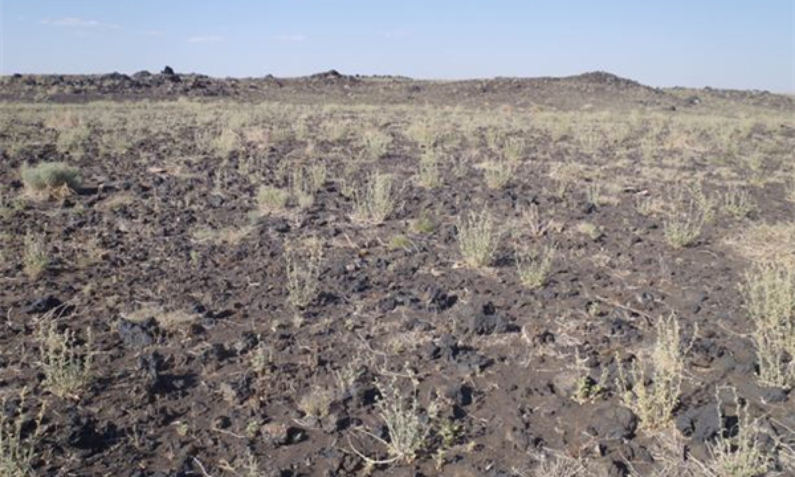
Figure 5. 35.2 Basalt Upland 6-10" p.z.
This plant community is a shrubland with scattered forbs and perennial grasses. The dominant shrubs are shadscale saltbush, fourwing saltbush and rubber rabbitbrush. Galleta is the most common grass and globemallow the most common forb. Russian thistle and other non-native annuals can occur on the site.
Figure 6. Annual production by plant type (representative values) or group (midpoint values)
Table 5. Annual production by plant type
Plant type Low
(lb/acre)Representative value
(lb/acre)High
(lb/acre)Shrub/Vine 50 140 230 Forb 25 60 100 Grass/Grasslike 5 30 60 Total 80 230 390 Table 6. Soil surface cover
Tree basal cover 0% Shrub/vine/liana basal cover 0-10% Grass/grasslike basal cover 0-0% Forb basal cover 0-10% Non-vascular plants 0% Biological crusts 0% Litter 0-10% Surface fragments >0.25" and <=3" 10-60% Surface fragments >3" 10-40% Bedrock 0-10% Water 0% Bare ground 20-40% Figure 7. Plant community growth curve (percent production by month). AZ3521 , 35.2 6-10" p.z. all sites. Growth begins in the spring and continues through the summer. Most growth in this CRA occurs in the spring using stored winter moisture..
Jan Feb Mar Apr May Jun Jul Aug Sep Oct Nov Dec J F M A M J J A S O N D 0 1 9 20 27 14 10 11 5 3 0 0 Additional community tables
Table 7. Community 1.1 plant community composition
Group Common name Symbol Scientific name Annual production () Foliar cover (%) Grass/Grasslike1 Grasses 5–60 James' galleta PLJA Pleuraphis jamesii 10–50 – black grama BOER4 Bouteloua eriopoda 0–30 – Grass, perennial 2GP Grass, perennial 0–20 – Indian ricegrass ACHY Achnatherum hymenoides 0–20 – low woollygrass DAPU7 Dasyochloa pulchella 5–10 – Grass, annual 2GA Grass, annual 0–10 – Forb2 Forbs 25–100 globemallow SPHAE Sphaeralcea 20–60 – phacelia PHACE Phacelia 0–20 – Forb, annual 2FA Forb, annual 0–20 – Forb, perennial 2FP Forb, perennial 0–20 – desert trumpet ERIN4 Eriogonum inflatum 0–20 – whitestem blazingstar MEAL6 Mentzelia albicaulis 0–10 – rose heath CHER2 Chaetopappa ericoides 0–10 – Shrub/Vine3 Shrubs 40–180 shadscale saltbush ATCO Atriplex confertifolia 20–60 – rubber rabbitbrush ERNAC2 Ericameria nauseosa ssp. consimilis 0–40 – fourwing saltbush ATCA2 Atriplex canescens 10–30 – Torrey's jointfir EPTO Ephedra torreyana 0–20 – Subshrub (<.5m) 2SUBS Subshrub (<.5m) 0–20 – broom snakeweed GUSA2 Gutierrezia sarothrae 5–20 – winterfat KRLA2 Krascheninnikovia lanata 0–10 – water jacket LYAN Lycium andersonii 0–10 – threadleaf ragwort SEFL3 Senecio flaccidus 0–10 – 4 Cacti 10–50 Shrub, succulent 2SS Shrub, succulent 0–20 – Whipple cholla CYWH Cylindropuntia whipplei 0–20 – Interpretations
Hydrological functions
There are no hydrologic features associated with this site.
Wood products
There is no potential for the production of wood on this site.
Supporting information
Type locality
Location 1: Coconino County, AZ Latitude 35° 59′ 39″ Longitude 111° 27′ 16″ General legal description Navajo Reservation. NE foothills of Shadow Mountain. Location 2: Coconino County, AZ UTM zone N UTM northing 3936642 UTM easting 474618 General legal description Wupatki National Monument, near Flagstaff, Arizona in Coconino County. Other references
Type location is moved from Shadow Mountain on the Navajo Reservation to Wupatki National Monument in Coconino County, Arizona.
Updates and revisions for this ESD were conducted as part of a 2007-2012 Interagency Technical Assistance Agreement between the Bureau of Indian Affairs–Navajo Region and the NRCS-Arizona.Contributors
Karlynn Huling
Ken Gishi
Larry D. EllicottRangeland health reference sheet
Interpreting Indicators of Rangeland Health is a qualitative assessment protocol used to determine ecosystem condition based on benchmark characteristics described in the Reference Sheet. A suite of 17 (or more) indicators are typically considered in an assessment. The ecological site(s) representative of an assessment location must be known prior to applying the protocol and must be verified based on soils and climate. Current plant community cannot be used to identify the ecological site.
Author(s)/participant(s) Jennifer Puttere, Kenneth Gishi Contact for lead author NRCS State Rangeland Management Specialist, Phoenix, AZ Date 06/04/2012 Approved by Approval date Composition (Indicators 10 and 12) based on Annual Production Indicators
-
Number and extent of rills:
None on this site. -
Presence of water flow patterns:
Water flow patterns occur on this site wherever there is no protective tephra covering on the surface. There is also evidence of soil collapse on these bare areas from the presence and dissolution of gypsum. -
Number and height of erosional pedestals or terracettes:
No pedestals or terracettes on this site. -
Bare ground from Ecological Site Description or other studies (rock, litter, lichen, moss, plant canopy are not bare ground):
Bare ground is from 20 to 40 percent. -
Number of gullies and erosion associated with gullies:
No gullies on this site. -
Extent of wind scoured, blowouts and/or depositional areas:
Eolian and alluvial depositional material under most shrubs; eolian litter under shrubs remains where it was dropped. -
Amount of litter movement (describe size and distance expected to travel):
Litter movement occurs throughout the site due to instability and occasional flooding from the nearby river. -
Soil surface (top few mm) resistance to erosion (stability values are averages - most sites will show a range of values):
This site makes a 1 or 2 for stability. The mounds of basalt on the site stabilize the area and provide nutrients and stability for vegetation. -
Soil surface structure and SOM content (include type of structure and A-horizon color and thickness):
Single grain and thin platy structure with very low organic matter. -
Effect of community phase composition (relative proportion of different functional groups) and spatial distribution on infiltration and runoff:
Widely scattered shrubs and grasses with surface crust prevents water from infiltrating; slight slope increases runoff into nearby washes and river channels. -
Presence and thickness of compaction layer (usually none; describe soil profile features which may be mistaken for compaction on this site):
No compaction layer on this site. -
Functional/Structural Groups (list in order of descending dominance by above-ground annual-production or live foliar cover using symbols: >>, >, = to indicate much greater than, greater than, and equal to):
Dominant:
Low Shrubs > Large Shrubs > ForbsSub-dominant:
Cacti & Succulents = Warm season grassesOther:
Additional:
-
Amount of plant mortality and decadence (include which functional groups are expected to show mortality or decadence):
Plant motality on this site is high due during drought. -
Average percent litter cover (%) and depth ( in):
5 to 15% litter cover on this site. -
Expected annual annual-production (this is TOTAL above-ground annual-production, not just forage annual-production):
150-250 lb/acre average on this site. -
Potential invasive (including noxious) species (native and non-native). List species which BOTH characterize degraded states and have the potential to become a dominant or co-dominant species on the ecological site if their future establishment and growth is not actively controlled by management interventions. Species that become dominant for only one to several years (e.g., short-term response to drought or wildfire) are not invasive plants. Note that unlike other indicators, we are describing what is NOT expected in the reference state for the ecological site:
Broom snakeweed, rabbitbrush, Russian thistle and cheatgrass can increase on this site. -
Perennial plant reproductive capability:
Normal reproduction on this site except during severe drought conditions.
Print Options
Sections
Font
AAAAOther
PrintThe Ecosystem Dynamics Interpretive Tool is an information system framework developed by the USDA-ARS Jornada Experimental Range, USDA Natural Resources Conservation Service, and New Mexico State University.
Accessibility statement