
Natural Resources
Conservation Service
Ecological site R030XC047CA
Bi-Modal Semi-Arid Order 3 Ephemeral Wash
Last updated: 2/25/2025
Accessed: 10/03/2026
-
Search


Major Land Resource Area or ecological site by name and/or ID.
PreviousSectionsNextGeneral information
Provisional. A provisional ecological site description has undergone quality control and quality assurance review. It contains a working state and transition model and enough information to identify the ecological site.
MLRA notes
Major Land Resource Area (MLRA): 030X–Mojave Basin and Range
Major Land Resource Area (MLRA) 30, Mojave Desert, is found in southern California, southern Nevada, the extreme southwest corner of Utah and northwestern Arizona within the Basin and Range Province of the Intermontane Plateaus. The climate of the area is hot and dry. Hyperthermic and thermic soil temperature regimes are common with exceptions at higher elevations (generally above 5000 feet) where mesic, cryic and frigid soil temperature regimes may occur. Typic aridic soil moisture regimes are common and widespread throughout the MLRA. Elevations range from below sea level to over 12,000 feet in the higher mountain areas found within the MLRA. Due to the extreme elevational range found within this MLRA, Land Resource Units (LRUs) were designated to group the MLRA into similar land units.
LRU Description:
The "XY" LRU is found throughout the Mojave Desert MLRA. These sites are driven by environmental or chemical features that override the climatic designations of the other LRU’s or are atypical compared to the surrounding landscape. Common overriding XY characteristics within this MLRA include: ephemeral streams subject to flash flood events, riparian areas or other water features, and soils with strong chemical influence (Na, Ca, etc).
Classification relationships
Ericameria paniculata Shrubland Alliance (Sawyer et al. 2009).
Chilopsis linearis/Ericameria paniculata Association (Sawyer et al. 2009).
Prunus fasciculata/Ambrosia eriocentra Association (Sawyer et al. 2009).Ecological site concept
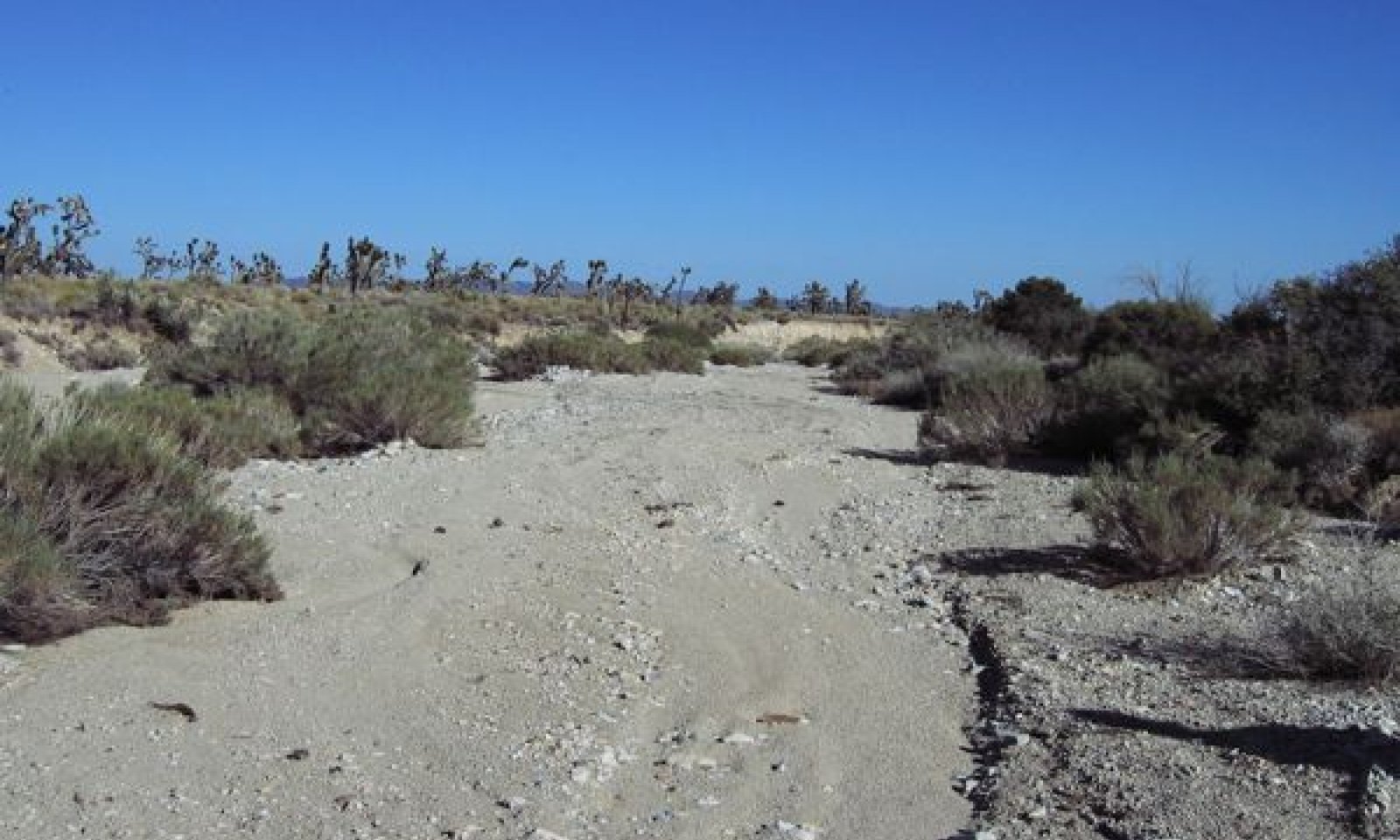
This site occurs on large sized (typically order 3) ephemeral drainageways with braided channels at elevations of approximately 4,000 to 6,000 feet. These drainageways run through eroded fan remnants, and occur close to the mountain front that supplies the major source of run-on and sediment. Soils are very deep sands formed from limestone, sedimentary, igneous and metamorphic rock. They have an ustic aridic soil moisture regime. Drainageways are 100 to several hundred feet wide and have approximately 10-foot banks. The site is a complex of landforms and vegetation communities that are dictated by flooding intensity and frequency. It encompasses very rarely to rarely flooded stream terraces, rarely to occasionally flooded inset fans, bars and stream margins, and frequently flooded stream margins and channels. The most frequently flooded positions are occupied by a Mojave rabbitbrush (Ericameria paniculata) community, with patches of desert willow (Chilopsis linearis). Occasionally flooded positions are occupied by a woolly fruit bur ragweed (Ambrosia eriocentra), desert almond (Prunus fasciculata) and purple sage (Salvia dorrii) community, with a high diversity of other shrubs, forbs and grasses. Rarely to very rarely flooded positions are occupied by a perennial grass dominated community, with black grama (Bouteloua eriopoda), big galleta (Pleuraphis rigida) and galleta (Pleruaphis jamesii), and a mixture of short-lived shrub species. Mojave rabbitbrush is supported by the large drainage size, with frequently occurring and relatively high intensity flooding. These drainages provide a relatively consistent deep-water source, which supports desert willow communities.
Associated sites
R030XY220CA Ustic Ephemeral Drainageways Order 2
Occurs on adjacent smaller sized drainageways. Desert willow is not present, and vegetation communities are not as ecological complex.
R030XY222CA Typic Aridic Ephemeral Drainageway Order 3 4-7" p.z.
Occurs on lower elevation large ephemeral drainageways. Black grama (Bouteloua eriopoda) is not present and creosote bush (Larrea tridenata) is an important species.
R030XB014NV SHALLOW GRAVELLY LOAM 7-9 P.Z.
Occurs on adjacent fan remnants with very deep loamy soils. Reference plants include blackbrush (Coleogyne ramosissima), black grama (Bouteloua eriopoda), and big galleta (Pleuraphis rigida).
R030XB015NV SHALLOW GRAVELLY SLOPE 7-9 P.Z.
Occurs on adjacent steep fan remnants and mountain slopes with shallow soils. Reference plants include blackbrush (Coleogyne ramosissima), black grama (Bouteloua eriopoda), and big galleta (Pleuraphis rigida).
Similar sites
R030XY220CA Ustic Ephemeral Drainageways Order 2
Occurs on smaller sized drainageways. Desert willow (Chilopsis linearis) is not present and ecological complexity is reduced.
R030XB051NV UPLAND WASH
This site occurs over a lower elevation range on soils that have a predominately typic aridic soil moisture regime. The size of the drainageways that it occurs on is unknown. Mojave rabbitbrush and desert willow are not listed as occurring on the site. Black grama is a minor species.
R030XY222CA Typic Aridic Ephemeral Drainageway Order 3 4-7" p.z.
Occurs at lower elevations on soils with a typic aridic soil moisture regime. Black grama (Bouteloua eriopoda) is not present and creosote bush (Larrea tridentata) is an important species.
Table 1. Dominant plant species
Tree (1) Chilopsis linearis
Shrub (1) Ericameria paniculata
(2) Ambrosia eriocentraHerbaceous (1) Bouteloua eriopoda
(2) Pleuraphis rigidaPhysiographic features
This ecological site is found on large (typically order 3) braided ephemeral streams and associated landforms. Elevations range from 4,150 to 5,870 feet, and slopes range from 1 to 8 percent, but slopes of 1 to 4 percent are typical. The site is a complex dictated by flash flooding intensity and frequency, and encompasses very rarely flooded stream terraces, rarely to occasionally flooded inset fans and stream margins, and frequently flooded stream margins and channels.
Table 2. Representative physiographic features
Landforms (1) Drainageway
(2) Inset fan
Flooding frequency Very rare to frequent Elevation 4150 – 5870 ft Slope 1 – 8 % Climatic features
The climate of this ecological site is characterized by hot temperatures, aridity, and a bimodal precipitation pattern. Precipitation falls as rain, with 40 percent falling in summer between July and October, and 49 percent falling in winter between November and March. The mean annual precipitation is 10.5 inches and mean annual air temperature ranges from 55 to 63 degrees F.
Table 3 Representative climatic features
Frost-free period (average) 250 days Freeze-free period (average) 310 days Precipitation total (average) 10 in BarLineFigure 1. Monthly precipitation range
BarLineFigure 2. Monthly average minimum and maximum temperature
Figure 3. Annual precipitation pattern
Figure 4 Annual average temperature pattern
Climate stations used
-
(1) MITCHELL CAVERNS [USC00045721], Baker, CA
-
(2) SEARCHLIGHT [USC00267369], Searchlight, NV
">Influencing water features
This ecological site is associated with large sized ephemeral stream systems, and includes associated channels, bars, stream terraces, and inset fans.
Soil features
The soils associated with this ecological site are moderately to very deep, excessively drained sands that formed in alluvium from limestone, igneous, sedimentary and metamorphic rock. The soil moisture regime is ustic-aridic. Surface textures are loamy sand, very gravelly loamy sand, gravelly, extremely and very gravelly sand and loamy fine sand. Subsurface horizon textures (1 to 59 inches) include loamy sand, very gravelly sand, cemented loamy sand and cemented very gravelly loamy sand, gravelly sand, fine sand and extremely gravelly coarse sand. Surface rock fragments less than 3 inches in diameter range from 19 to 70 percent cover, and larger fragments range from 1 to 11 percent cover. Subsurface percent by volume of rock fragments less than 3 inches ranges from 10 to 38, and larger fragments range from 0 to 1.
Soils associated with this ecological site include Rocksalad (Sandy-skeletal, mixed, thermic Ustic Torriorthents), Boomerang (Sandy, mixed, thermic Ustic Torriorthents), and a minor component of Ustic Torripsamments. Rocksalad and Boomerang are associated with all vegetation community components, while the Ustic Torripsamments are associated with rarely flooded terraces.
This ecological site is correlated with the following map units and soil components in the Mojave National Preserve Soil Survey: (Map unit number; Map unit name; Component; phase; component percent)
4306; Stonekey-Rosshorse complex, 2 to 8 percent slopes; Rocksalad; occasionally flooded; 5
4305; Stonekey-Sagamore complex, 2 to 8 percent slopes; Rocksalad; frequently flooded; 1; Rocksalad; occasionally flooded; 1; Ustic Torripsamments; rarely flooded; 1
4300; Sagamore-Stonekey complex, 4 to 30 percent slopes; Rocksalad; frequently flooded; 2
4310; Fairlan sandy loam, 2 to 8 percent slopes; Boomerang; very rarely flooded; 2
4310; Fairlan sandy loam, 2 to 8 percent slopes; Boomerang; frequently flooded; 1
103; Willowspring-Parched complex, 15 to 50 percent slopes; Rocksalad; occasionally flooded; 1Table 4. Representative soil features
Parent material (1) Alluvium – limestone
(2) Alluvium – basalt
(3) Alluvium – granite
Surface texture (1) Loamy sand
(2) Very gravelly loamy sand
(3) Gravelly sand
Family particle size (1) Sandy
Drainage class Somewhat excessively drained Permeability class Rapid Soil depth 22 – 0 in Surface fragment cover <=3" 19 – 70 % Surface fragment cover >3" 1 – 11 % Available water capacity
(0-40in)0.4 – 3.2 in Calcium carbonate equivalent
(0-40in)Not specified Electrical conductivity
(0-40in)0 – 2 mmhos/cm Sodium adsorption ratio
(0-40in)0 – 4 Soil reaction (1:1 water)
(0-40in)6.6 – 9 Subsurface fragment volume <=3"
(Depth not specified)10 – 38 % Subsurface fragment volume >3"
(Depth not specified)0 – 1 % Ecological dynamics
This site describes the dynamics of a large sized (typically order 3) eastern Mojave ephemeral sream system. drainageways with braided channels at elevations of approximately 4,000 to 6,000 feet. Drainageways run through eroded fan remnants, and occur close to the mountain front that supplies the major source of run-on and sediment. Soils are very deep sands formed from limestone, sedimentary, igneous and metamorphic rock. They have a typic aridic bordering on ustic soil moisture regime. Drainageways are 100 to several hundred feet wide and have approximately 10-foot banks. The site is a complex of landforms and vegetation communities that are dictated by flooding intensity and frequency; it encompasses very rarely to rarely flooded stream terraces, rarely to occasionally flooded inset fans, bars and stream margins, and frequently flooded stream margins and channels.
The most frequently flooded positions are occupied by a Mojave rabbitbrush community, with patches of desert willow. Occasionally flooded positions are occupied by a woolly fruit bur ragweed, desert almond and purple sage community, with a high diversity of other shrubs, forbs and grasses. Rarely to very rarely flooded positions are occupied by a perennial grass dominated community, with black grama, big galleta and galleta, and a mixture of short-lived shrub species. Mojave rabbitbrush is supported by the large drainage size, with frequently occurring and relatively high intensity flooding. These drainages provide a relatively consistent deep-water source, which supports desert willow communities. Desert almond is a long-lived deep-rooted species diagnostic of episodic flooding (Stein et al. 2011). In the eastern Mojave Desert it is associated with the cooler temperatures and higher precipitation of upper fan piedmont positions, and gravelly soils (Evens 2000, Sawyer et al. 2009). Purple sage and woolly fruit bur ragweed are shorter-lived, shallow-rooted species also diagnostic of episodic disturbance (Stein et al. 2011). Relatively high summer precipitation supports woolly fruit bur ragweed and black grama. Higher elevations and intermittent disturbance support purple sage. The relative composition of these communities across the drainageway is determined by time since disturbance and the intensity of disturbance events.
Although ephemeral stream processes are much more variable than perennial streams, a properly functioning ephemeral drainageway will provide similar hydrological and biological functions as perennial streams (Hild et al. 2007, Levick et al. 2008, Vyverberg 2010). Ephemeral streams maintain water quality by allowing energy dissipation during high water flow. They transport nutrients and sediments, store sediments and nutrients in deposition zones, provide temporary storage of surface water, and longer duration storage of subsurface water. They also support a disproportionate share of biodiversity (Hild et al. 2007, Levick et al. 2008, Vyverberg 2010). The drought-tolerant vegetation that occurs within ephemeral streams is referred to as xeroriparian vegetation. It is distinct from the surrounding landforms due to a difference in species composition, size, and production (Johnson et al. 1984, Levick et al. 2008). Xeroriparian vegetation is present because of the increased availability of water and flood disturbances in these drainageways. This vegetation protects soils from erosion and influences flow by providing bank and channel roughness, and initiates formation and maintenance of channel bars (Levick et al. 2008, Vyverberg 2010, Stein et al. 2011). The structure and forage provided by xeroriparian vegetation, and the availability of water, although brief, significantly increases animal abundance along ephemeral streams relative to upland areas. The open channels provide important migration corridors for wildlife (Levick et al. 2008).
Soil disturbance from flash flood events is the primary driver of plant community dynamics within this ecological site. Ephemeral streams flow only in response to rainfall events, and flow may last only minutes or days (Bull 1997, Levick et al. 2008, Vyverberg 2010). Extreme and rapid variations in flooding regime, and a high degree of temporal and spatial variability in hydrologic processes is characteristic (Bull 1997, Stanley et al. 1997, Levick et al. 2008, Shaw and Cooper 2008, Vyverberg 2010). Episodic high magnitude events that may occur only a few times a decade or century function to ‘reset’ vegetation and channel form (Levick et al. 2008, Stein et al. 2011). Smaller more frequent flood events deposit sediment, leading to channel infilling and eventually channel avulsion (defined as the “diversion of the majority of the surface flow to a different channel, with total or partial abandonment of the original channel” (Field 2001) dynamics. As sediment deposits in the main channel of the depositional zone, and as vegetation colonizes stream channels, banks and bars, the likelihood of channel avulsion increases because of decreased channel volume (Levick et al. 2008).
Extreme temporal and spatial variability in disturbance events, water availability, sediment flux, and channel migrations result in a dynamic complex of hydrologically and disturbance determined plant communities that does not conform to an equilibrium model of vegetation community dynamics (Vyverberg 2010, Stein et al. 2011). Physical disturbance of soils and vegetation as a result of flash flooding makes predictability of temporary channel development and configuration very low except when considered at a coarse scale. Typical runoff events may result in an apparently stable mosaic of plant species distribution and channel configuration, while more extreme events may completely reconfigure the mosaic and establish the foundation of a new or modified plant community mosaic until the next extreme runoff event occurs. Vegetation communities reflect the time in the recurrence interval, or time between large magnitude ‘reset’ events. Early on in the recurrence interval there is lower diversity in the communities present, with dominance by short-lived species. For the majority of the interval, a mixture of long-lived and short-lived species is present. The late phase of the cycle is characterized by abundant vegetation with narrowing of the channel, making it more susceptible to resetting by a large flood as flow capacity diminishes.
Other disturbances such as drought, climate change, fire, grazing, mining, and land development can affect community composition and/or hydrologic processes. Cycles of drought are inherent to the desert, and can cause significant mortality or die-back of vegetation (e.g. Hereford et al. 2006). Decreased vegetative cover can lead to an increase in erosion and change sediment deposition patterns, possibly increasing the chance of channel migration. Global climate change models for the desert southwest predict increased drought intensity, increased warming and drying, and greater variability in precipitation (Levick et al. 2008). These changes could lead to a decline in xeroriparian vegetation with greater intensity floods and erosion.
Large fires are likely to have been more common near this ecological site than at lower elevation sites (Brooks et al. 2007). The loss of vegetation cover in adjacent hills can contribute to increased flooding and sediment deposition in this ecological site. This could have a number of effects, including increased scouring of xeroriparian vegetation within the drainage channels; widening of channels, which would increase the complexity of plant communities in the ecological site (areas receiving different flooding intensity or frequency would be dominated by different suites of species); and sediment deposition and channel avulsion.
Livestock grazing has also impacted this ecological site. Ranching was established in the eastern Mojave desert in approximately 1875 (Nystrom 2003). Grazing occurred unregulated in the area until the passage of the Taylor Grazing Act in 1934, which divided public land into allotments that were regulated by the Bureau of Land Management (BLM), and among other things, called for fenced ranges and multiple developed water sources (http://www.blm.gov/wy/st/en/field_offices/Casper/range/taylor.1.html). The Federal Land Policy and Management Policy Act of 1976 (FLPMA) brought further regulations, including 10-year grazing permits. In 1994 the California Desert Protection Act created the Mojave National Preserve, and the National Park Service took over management of grazing allotments in much of the eastern Mojave.
Most of the area occupied by this ecological site within the Mojave National Preserve was retired from grazing in 2000, and ecological communities are still recovering. Cattle and burros preferentially use riparian habitat because of access to water, shade, and productive vegetation (e.g. Kauffman and Kruegger 1984, Kie and Boroski 1996, Belsky et al. 1999). Livestock grazing can alter riparian vegetation by altering species composition by selective grazing, plant cover removal, trampling stream banks, and compacting soil (e.g. Kauffman and Kruegger 1984, Trimble and Mendel 1995, Belsky et al. 1999). Increased runoff resulting from compacted soil and/or loss of vegetation may lead to channel incision, more intense erosion during flood events, and a loss of sheet flow, leading to the decline and potential loss of xeroriparian communities. Grazing in adjacent upland communities may further increase runoff, erosion, and incision (Trimble and Mendel 1995, Belsky et al. 1999). Although these ephemeral streams rarely have water present, they do support productive xeroriparian vegetation. Since ungrazed examples or detailed historical data of this system do not exist, it is not possible to quantify these impacts.
Altered hydrological processes such as surface flow diversions, ground water depletion, and loss of the xeroriparian vegetation can have irreversible impacts such as headward erosion, increased flooding and sediment deposition, and/or channel abandonment (Nishikawa et al. 2004, Levick et al. 2008, and Stein et al. 2011). Impermeable surfaces (such as pavement, homes, malls, etc.) reduces soil water infiltration, creates higher runoff, greater peak flows, and more frequent high intensity flooding events (Levick et al. 2008). Stream channelization also increases flood intensity and sediment transport within some reaches, while reducing flow to other reaches. Dams and improperly constructed roads and railroads can cause aggradation and flooding upstream, channel incision and channel abandonment downstream (Levick et al. 2008). Channel abandonment, incision and/or significant reductions in flow can convert xeroriparian vegetation communities to upland communities by altering traditional flow patterns. Channel incision may also scour channel features and lead to more frequent high intensity floods, reduce channel vegetation diversity and create a community dominated by short-lived species that can withstand the new flooding regime.
When disturbances such as those describe above affect the hydrologic function of this ephemeral stream system, this ecological site has the potential to transition to hydrologically altered states (States 2 and 3). Data are not available to describe State 2, and it is described in general terms as provisional states in the state-and-transition model.
All tabular data listed for a specific community phase within this ecological site description represent a summary of one or more field data collection plots taken in communities within the community phase. Although such data are valuable in understanding the phase (kinds and amounts of ground and surface materials, canopy characteristics, community phase overstory and understory species, production and composition, and growth), it typically does not represent the absolute range of characteristics nor an exhaustive listing of species for all the dynamic communities within each specific community phase.
State and transition model
Custom diagramStandard diagram
Figure 5. R030XY219CA
More interactive model formats are also available. View Interactive Models
More interactive model formats are also available. View Interactive Models
Click on state and transition labels to scroll to the respective textEcosystem states
State 1 submodel, plant communities
State 3 submodel, plant communities
State 1
ReferenceState one is maintained by unimpaired hydrologic function. It is characterized by a high degree of natural variability, with infrequent large magnitude flooding events periodically 'resetting' channel morphology and vegetation communities. More frequent smaller scale events interact with channel vegetation to increase channel complexity with time since a large event. This state develops with frequent moderate intensity flows, and consistent larger floods within 10-20 year time periods. Changes in flooding frequency over the extent of the landform affect vegetation composition.
Community 1.1
Reference
Figure 6. Community Component 1

Figure 7. Community Component 2 Mojave Rabbitbrush

Figure 8. Community Component 2 - Emergent Desert Willow

Figure 9. Community Component 3

Figure 10. Community Component 4
Although equilibrium conditions and a traditional climax community do not occur within this ecological site, this community phase is most typical for the majority of the recovery period between large high magnitude flood events. At any given point along the stream the following community components are generally present. The relative spatial extent of these communities varies as the channel morphology fluctuates from flooding events, and with time since flood events. Steeper reaches may be more incised with less chance of sheet flow out of the main channel; these reaches tend to have a higher abundance of bare gravels and sparser vegetation, with less of the rarely flooded community component (community component 4). In lower slope reaches sediment fills the main channel, increasing the chance of sheet flow across the area. A broader area of disturbance supports more xeroriparian vegetation. Stable terraces are more likely to occur on the inside of meanders and along the banks of straight channel reaches.
Community Component 1 (CC1), Frequently Flooded Active Channels
This area is dominated by barren gravels and sand. There is very little vegetation in this zone due to frequent scouring from floods. Multiple active channels may be present in the large watercourses of this site. These gravels may support a high diversity of native annual forbs during high precipitation years, but these have not been adequately inventoried (due to a lack of high winter precipitation during the data collection period) to describe here.
Community Component 2 (CC2), Frequently Flooded Channels and Channel Margins
A Mojave rabbitbrush community with emergent desert willow establishes in areas receiving frequent relatively high intensity flow. Mojave rabbitbrush is associated with larger drainageways that flood every few years (Sawyer et al. 2009). Large flooding events will remove the majority of this community, but seeds dispersed by the flood will readily establish and quickly colonize newly barren areas (Sawyer et al. 2009). Initially after a flood this community has low diversity, with strong dominance by Mojave rabbitbrush. With increasing time without recurrent disturbance, the community becomes more diverse with a mixture of long- and short-lived species (Community component 3). Alternatively, with a long period of time without disturbance, this community may be overtopped by desert willow (Sawyer et al. 2009). Desert willow is a long-lived (>100 years), winter deciduous phreatophyte. It reproduces sexually by wind-dispersed seed, as well as asexually by crown-sprouting following mechanical disturbance (Uchytil 1990). Seedlings establish in freshly deposited sediment, and require moisture for establishment (Uchytil 1990). Seeds are dispersed in the fall and winter and probably do not remain viable beyond the spring after dispersal (Magill 1974). Fruit production may be inhibited during drought (DePree and Ludwig 1978, Petersen et al. 1982). Desert willow may colonize freshly deposited sediment, and then act to trap further sediments, thereby creating islands within the active channel (Gardner 1951), and it also acts to stabilize stream banks (Uchytil 1990). Stands of desert willow are often absent from apparently suitable washes, indicating that this community can come and go (Sawyer et al. 2009). Long periods of drought and/or water diversion will cause a dying off of desert willow. Secondary shrubs found in this component are all pioneering, disturbance-adapted species and may include woollyfruit bur ragweed, purple sage, desert almond, burrobush (Hymenoclea salsola), threadleaf snakeweed (Gutierrezia microcephala), and Stansbury cliffrose. A diversity of perennial and annual forbs may be present in this component. Perennial forbs recorded include desert globemallow (Sphaeralcea ambigua), northwestern Indian paintbrush (Castilleja angustifolia), whitemargin sandmat (Chamaecye albomarginata), desert beardtongue (Penstemon pseudospectabilis), Fendler’s groundcherry (Physalis hederifolia var. fendleri), tufted evening primrose (Oenothera caespitossa), and sacred thorn-apple (Datura wrightii). Annual species include arid tansyaster (Machaeranthera arida), Sonoran sandmat (Chamaesyce micromera), Davidson’s buckwheat (Eriogonum davidsonii), Palmer’s buckwheat (Eriogonum palmeri), threadstem sandmat (Chamaecyce revoluta), manybristle chinchweed (Pectis papposa), and the non-native redstem stork’s bill (Erodium cicutarium), but many other species could be present. The annual grass sixweeks grama (Bouteloua barbata) may be relatively abundant after summer rains. Perennial grasses may be sparsely present and include bush muhly (Muhlenbergia porter), squirreltail (Elymus elymoides), spike dropseed (Sporobolus contractus), desert needle grass (Achnatherum speciosum), and low woollygrass (Dasyochloa pulchella).
Community Component 3 (CC3), Occasionally Flooded Bars/Channel Margins/Inset Fans
This component is dominated by woolly fruit bur ragweed, desert almond, and purple sage. Stansbury cliffrose (Purshia stansburiana) is often locally abundant. It occurs on occasionally flooded channel margins and bars within the channel. This community component has high diversity, with a mixture of disturbance adapted and upland shrubs and grasses occurring with the dominant species. It becomes more diverse with time without disturbance. The dominant shrubs in this component are all adapted to regular soil disturbance. Woolly fruit bur ragweed occurs in ephemeral stream systems in the eastern Mojave Desert into northern Arizona and southern Utah (Baldwin et al. 2002). Desert almond is characteristic of Mojave Desert washes, canyons, arroyos and disturbed upland sites (Sawyer et al. 2009). Higher elevations, regular disturbance and well-drained soils support purple sage, which also occurs in disturbed upland sites in the Mojave Desert (Baldwin et al. 2002). Burrobush is a secondary shrub. This pioneer species can quickly colonize disturbed areas, and may establish in ephemeral washes and upland sites (Sawyer et al. 2009). In this ecological site it is found across the range of flooding frequencies. Mojave rabbitbrush is often present at lower amounts in this component; seeds are dispersed by wind and may establish in bare soil patches, or plants are relicts from a formerly more homogenous stand (community component 2). Upland shrubs recorded in this component include Nevada jointfir (Ephedra nevadensis), Cooper’s goldenbush (Ericameria cooperi), Eastern Mojave buckwheat (Eriogonum fasciculatum), threadleaf snakeweed, water jacket (Lycium andersonii), buckhorn cholla (Cylindropuntia acanthocarpa), yellow rabbitbrush (Chrysothamnus viscidiflorus), Mexican bladdersage (Salazaria mexicana), desert polygala (Polygala acanthoclada), Fremont’s mahonia (Mahonia fremontii), and banana yucca (Yucca baccata). Other species may be present. Jaeger’s Joshua tree (Yucca brevifolia var. jaegeriana), Utah juniper (Juniperus osteosperma), and/or singleleaf pinyon (Pinus monophylla) are often sparsely present. The conifers are more common at the higher elevations of this site, but are able to persist at lower elevations because of increased water availability. Perennial grasses, although generally sparsely distributed, are a significant component of this community phase. Bush muhly (Muhlenbergia porter) is the most abundant, and desert needle grass (Achnatherum speciosum), black grama (Bouteloua eriopoda), big galleta (Pleuraphis rigida), and spike dropseed (Sporobolus contractus) may be significant. The annual grass sixweeks grama (Bouteloua barbata) may be relatively abundant after summer rains. The non-native invasive red brome is often sparsely present. Forbs make up a minor component of this community, perennial species recorded include desert globemallow (Sphaeralcea ambigua), desert marigold (Baileya multiradiata), tufted evening primrose (Oenothera caespitossa), sacred thorn-apple (Datura wrightii) Annual species include arid tansyaster (Machaeranthera arida), Sonoran sandmat (Chamaesyce micromera), Davidson’s buckwheat (Eriogonum davidsonii), and the non-native redstem stork’s bill (Erodium cicutarium).
Community Component 4 (CC4), Rarely Flooded Bars and Terraces
This component has high diversity and variability, as it strongly reflects adjacent upland communities, as well as more disturbance adapted species. This component is typically dominated by a productive perennial grass community, with black grama, big galleta and/or galleta dominant.Bush muhly is often an important species, and desert needlegrass, spike dropseed, and low woollygrass are secondary. Red brome may be abundant. Burrobush and desert almond are important shrubs in this community, while woolly fruit bur ragweed and purple sage are secondary species. Nevada jointfir (Ephedra nevadensis) is an important upland shrub. Apache plume (Fallugia paradoxa) is locally abundant at higher elevations. Apache plume vigorously resprouts after mechanical damage, and is commonly associated with higher elevation washes and canyons in the Mojave Desert (McWilliams 2000). Stansbury cliffrose is also locally abundant. A diversity of minor upland shrubs is also present, the composition of which is highly variable. Trees are more abundant in this more stable component, with Utah juniper and Joshua tree more abundant than singleaf pinyon. Forbs are sparse in this component, with desert globemallow, desert trumpet (Eriogonum inflatum), whitemargin sandmat, and spreading fleabane (Erigeron divergens) recorded, along with the non-native redstem stork’s bill.Figure 11. Annual production by plant type (representative values) or group (midpoint values)
Community 1.2
Channel infilling [Provisional]This community phase is characterized by channel infilling and narrowing by increases in stream vegetation. It typically occurs late in the recurrence interval between large flooding events, when repeated smaller floods have resulted in sediment deposition. Long-lived species like desert almond become more dominant while species requiring frequent disturbance and barren gravels such as Mojave rabbitbrush become less important. Desert willow may overtop Mojave rabbitbrush. Upland species may become more prevalent. This phase is susceptible to the effects of large magnitude floods because narrower channels have reduced flow capacity. The following community components are present:
CC1, Frequently Flooded Active Channel
The active channel has narrowed in this phase.
CC2, Frequently Flooded Channels and Channel Margins
This component becomes decadent and declines. Desert willow may overtop Mojave rabbitbrush.
CC3, Occasionally Flooded Bars/Channel Margins/Inset Fans
This component increases into the formerly more active parts of the channel, and becomes dominant in this phase.
CC4, Rarely Flooded Bars and Terraces
This component is relatively stable, but may expand into more stabilized outer streambanks.Community 1.3
Large magnitude flood [Provisional]This community phase occurs after a large magnitude flood event that clears most of the channel vegetation and in channel features. Data are not available to determine the range of frequency of these events, but they are likely decadal or longer. A channel dominated by barren gravels characterizes this community phase. The following community components are present:
CC1, Frequently Flooded Active Channel
The newly scoured channel dominates the drainageway, and very little vegetation is present due to recent scouring and/or sediment deposition. These gravels contain a seedbank for colonizing vegetation (Stromberg et al. 2009), which thrive in freshly deposited sediment. These gravels may support a high diversity of native annual forbs during high precipitation years, but these have not been adequately inventoried to describe here.
CC2, Frequently Flooded Channels and Channel Margins
This component is absent or very small in this phase. A few shrubs are likely to remain in scattered locations along streambanks. Desert willow trees are likely to survive, and damaged trees will resprout. Desert willow and Mojave rabbitbrush will colonize freshly deposited sediments.
CC3, Occasionally Flooded Bars/Channel Margins/Inset Fans
This component is absent or rare in this phase, with the community and structures that it occurs on largely removed by flooding. Isolated patches of plants will survive, and will aid in recolonization.
CC4, Very Rarely to Rarely Flooded Terraces
This component is relatively stable, but if the flood was large enough it may decline due to scouring or sediment deposition.Pathway 1.1a
Community 1.1 to 1.2Occurs with a long period of time without a large magnitude flood event. Recurrent cycles of deposition from smaller more frequent flood events leads to vegetation colonization and channel infilling.
Pathway 1.1b
Community 1.1 to 1.3Occurs with a large magnitude flood event that removes the majority of channel vegetation and structures.
Pathway 1.2a
Community 1.2 to 1.3Occurs with a large magnitude flood event that removes the majority of channel vegetation and structures.
Pathway 1.3a
Community 1.3 to 1.1This pathway occurs with time without a large magnitude flood event.
State 2
Channel Incision (Provisional)A confined channel, lowering of the complexity of ecological communities with dominance by short-lived pioneering species, and a decline in vigor on rarely flooded terraces characterizes this state.
Fire in upland communities, especially on the adjacent mountain slopes that provide run-off and sediment to this site, is likely to increase the severity and frequency of high magnitude flood events, and result in increased sediment deposition (Stein et al. 2011). Grazing in upland communities may also increase flooding and sediment deposition (Trimble and Mendel 1995, Belsky et al. 1999). Both fire and grazing may also result in channel incision in different reaches, especially those that are higher in elevation and/or narrow.
State 3
Water DiversionAn abandoned channel and the conversion of xeroriparian vegetation to an upland community characterize this state. Modifications such as dam building, railroads, roads, and drainage ditches will impact the function of these drainageways (Levick et al. 2008, Stein et al. 2011). Railroads established in the Mojave Desert in the early 1900’s impacted thousands of smaller drainageways, causing aggradation on upslope positions (Griffiths et al. 2006), and channel abandonment and loss or decline of xeroriarian vegetation on downslope positions.
Community 3.1
Water Diversion
Figure 12. Community Phase 3.1 - Loss of CC2

Figure 13. Community Phase 3.1 - Loss of CC2

Figure 14. Community Phase 3.1 - CC5
The following community components are present in this community phase:
CC1, Frequently Flooded Active Channel
The active channel disappears as vegetation infills it.
CC2, Frequently Flooded Channels and Channel Margins
This component dies back and eventually disappears.
CC3, Occasionally Flooded Bars/Channel Margins/Inset Fans
This component declines and merges with community component 4.
CC4, Very Rarely to Rarely Flooded Terraces
This component expands and dominates the site. This component is likely to persist because these low points will still receive some flow.
Figure 15. Annual production by plant type (representative values) or group (midpoint values)
Transition 1
State 1 to 2This transition may occur with severe flooding due to loss of soil stability from fire, grazing, global climate change, and hydrological modifications that concentrate flow.
Transition 2
State 1 to 3This transition may occur with hydrological modifications that divert flow (roads, railways, dams); channel aggradation from excess sediment deposition due to upland erosion; global climate change; or ongoing drought.
Additional community tables
Table 5. Community 1.1 plant community composition
Group Common name Symbol Scientific name Annual production () Foliar cover (%) Tree2 CC2 Trees 0–35 3 CC3 Trees 0–25 4 CC4 Trees 65–250 Shrub/Vine2 CC2 Shrubs 145–290 Mojave rabbitbrush ERPA29 Ericameria paniculata 100–230 10–18 woolly fruit bur ragweed AMER Ambrosia eriocentra 20–60 1–6 desert willow CHLI2 Chilopsis linearis 0–35 0–2 redstem stork's bill ERCI6 Erodium cicutarium 0–25 0–1 sixweeks grama BOBA2 Bouteloua barbata 0–15 0–10 bush muhly MUPO2 Muhlenbergia porteri 0–15 0–1 purple sage SADO4 Salvia dorrii 0–10 0–1 desert almond PRFA Prunus fasciculata 0–8 0–1 Stansbury cliffrose PUST Purshia stansburiana 0–5 0–2 threadleaf snakeweed GUMI Gutierrezia microcephala 0–5 0–1 burrobrush HYSA Hymenoclea salsola 0–5 0–1 desert needlegrass ACSP12 Achnatherum speciosum 0–5 0–1 Darrow's buckwheat ERDA Eriogonum darrovii 0–5 0–1 Palmer's buckwheat ERPA11 Eriogonum palmerianum 0–5 0–1 arid tansyaster MAAR5 Machaeranthera arida 0–5 0–1 manybristle chinchweed PEPA2 Pectis papposa 0–5 0–1 desert penstemon PEPS Penstemon pseudospectabilis 0–5 0–1 Fendler's groundcherry PHHEF Physalis hederifolia var. fendleri 0–5 0–1 desert globemallow SPAM2 Sphaeralcea ambigua 0–5 0–1 northwestern Indian paintbrush CAAN7 Castilleja angustifolia 0–5 0–1 whitemargin sandmat CHAL11 Chamaesyce albomarginata 0–5 0–1 threadstem sandmat CHRE4 Chamaesyce revoluta 0–5 0–1 Wright's prairie clover DAWR Dalea wrightii 0–5 0–1 spike dropseed SPCO4 Sporobolus contractus 0–3 0–1 low woollygrass DAPU7 Dasyochloa pulchella 0–3 0–1 squirreltail ELEL5 Elymus elymoides 0–3 0–1 3 CC3 Shrubs 950–1300 4 CC4 Shrubs 225–450 Grass/Grasslike2 CC2 Grasses 15–30 Stansbury cliffrose PUST Purshia stansburiana 0–250 0–12 desert almond PRFA Prunus fasciculata 50–245 3–7 woolly fruit bur ragweed AMER Ambrosia eriocentra 15–235 3–8 purple sage SADO4 Salvia dorrii 10–200 1–9 yellow rabbitbrush CHVIV4 Chrysothamnus viscidiflorus ssp. viscidiflorus var. viscidiflorus 0–70 0–2 bush muhly MUPO2 Muhlenbergia porteri 20–60 3–9 burrobrush HYSA Hymenoclea salsola 4–60 1–4 Nevada jointfir EPNE Ephedra nevadensis 1–45 1–4 Mojave rabbitbrush ERPA29 Ericameria paniculata 20–30 2–3 Utah juniper JUOS Juniperus osteosperma 0–25 0–1 singleleaf pinyon PIMO Pinus monophylla 0–25 0–1 Joshua tree YUBR Yucca brevifolia 0–25 0–1 sixweeks grama BOBA2 Bouteloua barbata 0–20 0–25 desert needlegrass ACSP12 Achnatherum speciosum 0–20 0–1 spike dropseed SPCO4 Sporobolus contractus 0–15 0–2 big galleta PLRI3 Pleuraphis rigida 0–15 0–1 water jacket LYAN Lycium andersonii 0–15 0–1 black grama BOER4 Bouteloua eriopoda 0–15 0–1 desert trumpet ERIN4 Eriogonum inflatum 0–15 0–1 desert polygala POAC2 Polygala acanthoclada 0–15 0–1 curvenut combseed PERE Pectocarya recurvata 0–10 0–1 desert globemallow SPAM2 Sphaeralcea ambigua 0–10 0–1 threadleaf snakeweed GUMI Gutierrezia microcephala 0–10 0–1 red brome BRRU2 Bromus rubens 0–5 0–3 low woollygrass DAPU7 Dasyochloa pulchella 0–5 0–1 Indian ricegrass ACHY Achnatherum hymenoides 0–5 0–1 desert Indianwheat PLOV Plantago ovata 0–5 0–1 Palmer's buckwheat ERPA11 Eriogonum palmerianum 0–5 0–1 Parish's bedstraw GAPA4 Galium parishii 0–5 0–1 arid tansyaster MAAR5 Machaeranthera arida 0–5 0–1 tufted evening primrose OECA10 Oenothera caespitosa 0–5 0–1 desert marigold BAMU Baileya multiradiata 0–5 0–1 Sonoran sandmat CHMI7 Chamaesyce micromera 0–5 0–1 sacred thorn-apple DAWR2 Datura wrightii 0–5 0–1 redstem stork's bill ERCI6 Erodium cicutarium 0–5 0–1 Davidson's buckwheat ERDA4 Eriogonum davidsonii 0–5 0–1 miniature woollystar ERDI2 Eriastrum diffusum 0–5 0–1 Fremont's mahonia MAFR3 Mahonia fremontii 0–5 0–1 Mexican bladdersage SAME Salazaria mexicana 0–5 0–1 banana yucca YUBA Yucca baccata 0–5 0–1 Eastern Mojave buckwheat ERFA2 Eriogonum fasciculatum 0–5 0–1 buck-horn cholla CYAC8 Cylindropuntia acanthocarpa 0–5 0–1 sand dropseed SPCR Sporobolus cryptandrus 0–5 0–1 floating bur-reed SPFL Sparganium fluctuans 0–5 0–1 3 CC3 Grasses 75–150 4 CC4 Grasses 320–650 Forb2 CC2 Forbs 11–22 black grama BOER4 Bouteloua eriopoda 0–415 0–15 big galleta PLRI3 Pleuraphis rigida 0–400 0–22 James' galleta PLJA Pleuraphis jamesii 0–300 0–15 Apache plume FAPA Fallugia paradoxa 0–300 0–10 Utah juniper JUOS Juniperus osteosperma 0–250 0–10 burrobrush HYSA Hymenoclea salsola 4–200 1–6 desert almond PRFA Prunus fasciculata 15–175 1–5 Nevada jointfir EPNE Ephedra nevadensis 0–145 0–5 bush muhly MUPO2 Muhlenbergia porteri 0–135 0–7 Joshua tree YUBR Yucca brevifolia 0–100 0–5 Stansbury cliffrose PUST Purshia stansburiana 0–80 0–3 red brome BRRU2 Bromus rubens 0–50 0–13 singleleaf pinyon PIMO Pinus monophylla 0–50 0–2 water jacket LYAN Lycium andersonii 0–30 0–4 desert needlegrass ACSP12 Achnatherum speciosum 0–30 0–2 Mexican bladdersage SAME Salazaria mexicana 0–25 0–5 purple sage SADO4 Salvia dorrii 0–20 0–2 desert trumpet ERIN4 Eriogonum inflatum 0–18 0–4 banana yucca YUBA Yucca baccata 0–15 0–3 redstem stork's bill ERCI6 Erodium cicutarium 0–12 0–3 woolly fruit bur ragweed AMER Ambrosia eriocentra 0–10 0–2 threadleaf snakeweed GUMI Gutierrezia microcephala 0–5 0–3 Cooper's goldenbush ERCO23 Ericameria cooperi 0–5 0–1 low woollygrass DAPU7 Dasyochloa pulchella 0–5 0–1 spike dropseed SPCO4 Sporobolus contractus 0–5 0–1 spreading fleabane ERDI4 Erigeron divergens 0–5 0–1 whitemargin sandmat CHAL11 Chamaesyce albomarginata 0–5 0–1 3 CC3 Forbs 8–14 4 CC4 Forbs 25–50 Table 6. Community 1.2 plant community composition
Group Common name Symbol Scientific name Annual production () Foliar cover (%) Table 7. Community 1.3 plant community composition
Group Common name Symbol Scientific name Annual production () Foliar cover (%) Table 8. Community 3.1 plant community composition
Group Common name Symbol Scientific name Annual production () Foliar cover (%) Tree1 CC6 Trees 0–10 woolly fruit bur ragweed AMER Ambrosia eriocentra 235–475 13–26 purple sage SADO4 Salvia dorrii 25–190 1–7 sixweeks grama BOBA2 Bouteloua barbata 0–100 0–10 bush muhly MUPO2 Muhlenbergia porteri 20–60 1–3 desert almond PRFA Prunus fasciculata 0–60 0–2 burrobrush HYSA Hymenoclea salsola 0–55 0–4 spike dropseed SPCO4 Sporobolus contractus 0–25 0–3 red brome BRRU2 Bromus rubens 0–15 0–7 Sonoran sandmat CHMI7 Chamaesyce micromera 0–10 0–3 redstem stork's bill ERCI6 Erodium cicutarium 0–10 0–3 Mojave rabbitbrush ERPA29 Ericameria paniculata 0–10 0–2 desert willow CHLI2 Chilopsis linearis 0–5 0–2 Joshua tree YUBR Yucca brevifolia 0–5 0–2 threadleaf snakeweed GUMI Gutierrezia microcephala 0–5 0–1 grizzlybear pricklypear OPPOE Opuntia polyacantha var. erinacea 0–5 0–1 banana yucca YUBA Yucca baccata 0–5 0–1 southwestern mock vervain GLGO Glandularia gooddingii 0–5 0–1 Colorado four o'clock MIMU Mirabilis multiflora 0–5 0–1 silkcotton purslane POHA5 Portulaca halimoides 0–5 0–1 desert globemallow SPAM2 Sphaeralcea ambigua 0–5 0–1 desert needlegrass ACSP12 Achnatherum speciosum 0–5 0–1 Cooper's dogweed ADCO2 Adenophyllum cooperi 0–5 0–1 fringed amaranth AMFI Amaranthus fimbriatus 0–5 0–1 northwestern Indian paintbrush CAAN7 Castilleja angustifolia 0–5 0–1 whitemargin sandmat CHAL11 Chamaesyce albomarginata 0–5 0–1 mesa dropseed SPFL2 Sporobolus flexuosus 0–5 0–1 black grama BOER4 Bouteloua eriopoda 0–5 0–1 buck-horn cholla CYAC8 Cylindropuntia acanthocarpa 0–5 0–1 Virgin River brittlebush ENVI Encelia virginensis 0–5 0–1 Nevada jointfir EPNE Ephedra nevadensis 0–5 0–1 Cooper's goldenbush ERCO23 Ericameria cooperi 0–5 0–1 Shrub/Vine1 CC6 Shrubs 360–720 Grass/Grasslike1 CC6 Grass 70–140 Forb1 CC6 Forbs 15–35 Interpretations
Animal community
Small animals live in this ecological site. Animal diversity in this ecological site is likely high relative to upland areas due to the heterogeneity of the site and the availability of forage and water. Streambanks provide habitat for burrows. Ephemeral drainages are important wildlife migration corridors.
Hydrological functions
Ephemeral drainages provide some similar hydrologic functions as perennial streams. A properly functioning system will maintain water quality by allowing energy dissipation during high water flow. These systems transport nutrients and sediments, and store sediments and nutrients in deposition zones. Ephemeral drainages provide temporary storage of surface water, and longer duration storage of subsurface water (Levick et al. 2008).
Recreational uses
These drainageways provide open travel corridors for cross-country hiking. Wildflower displays may be abundant after adequate precipitation.
Supporting information
Inventory data references
High intensity sampling (Caudle et al. 2013) was used to describe this ecological site. Site characteristics such as aspect, slope, elevation and UTMS were recorded for each plot, along with complete species inventory by ocular percent cover. The line-point intercept method was used to measure foliar cover, groundcover, and vegetation structure. At either 300 or 100 points along a 600- or 400-foot step transect, ground cover and intercepted plant species were recorded by height. The first hit method (Herrick et al. 2009) was used to generate the foliar cover values entered in the community phase composition tables. Annual production was estimated using the double-weight sampling method outlined in the National Range and Pasture Handbook and in Sampling Vegetation Attributes (NRCS 2003 and Interagency Technical Reference 1999 pgs. 102 - 115). For herbaceous vegetation, ten 9.6 square foot circular sub-plots were evenly distributed along a 200 foot transect. For woody and larger herbaceous species production was estimated in four 21’X21’ square plots along the same transect. Weight units were collected for each species encountered in the production plots. The number of weight units for each species is then estimated for all plots. Community Phase 1.1 CC2 11CA795140-Freq 11CA795150 11CA795214 2011CA795002-Freq 2012CA795166-Freq CC3 11CA795140-Occ 2011CA795002-Occ 2012CA795166-Occ CC4 11CA795140-Rare 11CA795263 2011CA795002-Rare State 3 2011CA795038-Freq 2011CA795038-Rare 11CA795150
Other references
Baldwin, B. G., S. Boyd, B. J. Ertter, R. W. Patterson, T. J. Rosatti, and D. H. Wilken. 2002. The Jepson Desert Manual. University of California Press, Berkeley and Los Angeles, California.
Belsky, A. J., A. Matzke, and S. Uselman. 1999. Survey of livestock influence on stream and riparian ecosystems in the western United States. Journal of Soil and Water Conservation 54:419-431.
Brooks, M. L., T. C. Esque, and T. Duck. 2007. Creosotebush, blackbrush, and interior chaparral shrublands. RMRS-GTR-202.
Bull, W. B. 1997. Discontinuous ephemeral streams. Geomorphology 19:227-276.
DePree, E. and J. A. Ludwig. 1978. Vegetative and Reproductive Growth Patterns in Desert Willow (Chilopsis linearis (Cav.). The Southwestern Naturalist 23:239-245.
Evens, J. M. 2000. Water course vegetation on granitic and calcareous substrates in the eastern Mojave Desert, California. M.A. Humboldt State University.
Field, J. 2001. Channel avulsion on alluvial fans in southern Arizona. Geomorphology 37:93-104.
Gardner, J. L. 1951. Vegetation of the creosotebush area of the Rio Grande Valley in New Mexico. Ecological Monographs 21:379-403.
Griffiths, P. G., R. Hereford, and R. H. Webb. 2006. Sediment yield and runoff frequency of small drainage basins in the Mojave Desert, U.S.A. Geomorphology 74:232-244.
Hereford, R., R. H. Webb, and C. I. Longpre. 2006. Precipitation history and ecosystem response to multidecadal precipitation variability in the Mojave Desert region, 1893-2001. Journal of Arid Environments 67:13-34.
Hild, A. L., J. M. Muscha, and N. L. Shaw. 2007. Emergence and growth of four winterfat accessions in the presence of the exotic annual cheatgrass. Pages 147-152 in Shrubland dynamics - fire and water. U.S. Department of Agriculture, Forest Service, Rocky Mountain Research Station, Lubbock, TX.
Johnson, R. R., P. S. Bennet, L. T. Haight, S. W. Carothers, and J. M. Simpson. 1984. A riparian classification system. Pages 375-383 in R. E. Warner and K. M. Hendrix, editors. California riparian systems. University of California Press, Berkeley, CA.
Kauffman, J. B. and W. C. Kruegger. 1984. Livestock impacts on riparian ecosystems and streamside management implications...a review. Journal of Range Management:430-438.
Kie, J. G. and B. B. Boroski. 1996. Cattle distribution, habitats, and diets in the Sierra Nevada of California. Journal of Range Management 49:482-488.
Kim, C. B. 2004. Draft livestock management plan for the Mojave National Preserve. Unpublished report.
Levick, L., J. .Fonseca, D. Goodrich, M. Hernandez, D. Semmens, J. Stromberg, R. Leidy, M. Scianni, D. P. Guertin, M. Tluczek, and W. Kepner. 2008. The ecological and hydrological significance of ephemeral and intermittent streams in the arid and semi-arid American Southwest.
Magill, A. W. 1974. Chilopsis linearis (Cav.) Sweet desertwillow. U.S. Department of Agriculture, Forest Service, Washington, DC.
McWilliams, J. 2000. Fallugia paradoxa. In: Fire Effects Information System. U.S. Department of Agriculture, Forest Service, Rocky Mountain Research Station, Fire Sciences Laboratory.
Nishikawa, T., J. A. Izbicki, C. L. Stamos, and P. Martin. 2004. Evaluation of geohydrologic framework, recharge estimates, and ground-water flow of the Joshua Tree area, San Bernardino County, California., U.S. Geological Survey.
Nystrom, E. C. 2003. From neglected space to protected place: an administrative history of the Mojave National Preserve. USDOI National Park Service Mojave National Preserve.
Petersen, C., J. H. Brown, and A. Kodric-Brown. 1982. An experimental study of floral display and fruit set in Chilopsis linearis (Bignoniaceae). Oecologia 55:7-11.
Sawyer, J. O., T. Keeler-Woolf, and J. M. Evans. 2009. A manual of California vegetation. 2nd edition. California Native Plant Society, Sacramento, California.
Shaw, J. R. and D. J. Cooper. 2008. Linkages among watersheds, stream reaches, and riparian vegetation in dryland ephemeral stream networks. Journal of Hydrology 350:69-73.
Stanley, E. H., S. G. Fisher, and N. B. Grimm. 1997. Ecosystem expansion and contraction in streams. Bioscience 47:427-439.
Stein, E. D., K. Vyverberg, G. M. Kondolf, and K. Janes. 2011. Episodic stream channels: imperatives for assessment and environmental planning in California Page 87 Proceedings of a special technical workshop, Southern California Coastal Water Research Project Report. No. 0645.
Trimble, S. W. and A. C. Mendel. 1995. The cow as a geomorphic agent - A critical review. Geomorphology 13:233-253.
Uchytil, R. J. 1990. Chilopsis linearis. In: Fire Effects Information System. U.S. Department of Agriculture, Forest Service, Rocky Mountain Research Station, Fire Sciences Laboratory.
Vyverberg, K. 2010. A review of stream processes and forms in dryland watersheds. California Department of Fish and Game.
Approval
Sarah Quistberg, 2/25/2025
Rangeland health reference sheet
Interpreting Indicators of Rangeland Health is a qualitative assessment protocol used to determine ecosystem condition based on benchmark characteristics described in the Reference Sheet. A suite of 17 (or more) indicators are typically considered in an assessment. The ecological site(s) representative of an assessment location must be known prior to applying the protocol and must be verified based on soils and climate. Current plant community cannot be used to identify the ecological site.
Author(s)/participant(s) Contact for lead author Date 10/03/2026 Approved by Approval date Composition (Indicators 10 and 12) based on Annual Production Indicators
-
Number and extent of rills:
-
Presence of water flow patterns:
-
Number and height of erosional pedestals or terracettes:
-
Bare ground from Ecological Site Description or other studies (rock, litter, lichen, moss, plant canopy are not bare ground):
-
Number of gullies and erosion associated with gullies:
-
Extent of wind scoured, blowouts and/or depositional areas:
-
Amount of litter movement (describe size and distance expected to travel):
-
Soil surface (top few mm) resistance to erosion (stability values are averages - most sites will show a range of values):
-
Soil surface structure and SOM content (include type of structure and A-horizon color and thickness):
-
Effect of community phase composition (relative proportion of different functional groups) and spatial distribution on infiltration and runoff:
-
Presence and thickness of compaction layer (usually none; describe soil profile features which may be mistaken for compaction on this site):
-
Functional/Structural Groups (list in order of descending dominance by above-ground annual-production or live foliar cover using symbols: >>, >, = to indicate much greater than, greater than, and equal to):
Dominant:
Sub-dominant:
Other:
Additional:
-
Amount of plant mortality and decadence (include which functional groups are expected to show mortality or decadence):
-
Average percent litter cover (%) and depth ( in):
-
Expected annual annual-production (this is TOTAL above-ground annual-production, not just forage annual-production):
-
Potential invasive (including noxious) species (native and non-native). List species which BOTH characterize degraded states and have the potential to become a dominant or co-dominant species on the ecological site if their future establishment and growth is not actively controlled by management interventions. Species that become dominant for only one to several years (e.g., short-term response to drought or wildfire) are not invasive plants. Note that unlike other indicators, we are describing what is NOT expected in the reference state for the ecological site:
-
Perennial plant reproductive capability:
Print Options
Sections
Font
AAAAOther
PrintThe Ecosystem Dynamics Interpretive Tool is an information system framework developed by the USDA-ARS Jornada Experimental Range, USDA Natural Resources Conservation Service, and New Mexico State University.
Accessibility statement


