
Natural Resources
Conservation Service
-
Search


Major Land Resource Area or ecological site by name and/or ID.
PreviousSectionsNextGeneral information
Provisional. A provisional ecological site description has undergone quality control and quality assurance review. It contains a working state and transition model and enough information to identify the ecological site.
Click to explore map
Figure 1. Mapped extent
Areas shown in blue indicate the maximum mapped extent of this ecological site. Other ecological sites likely occur within the highlighted areas. It is also possible for this ecological site to occur outside of highlighted areas if detailed soil survey has not been completed or recently updated.
MLRA notes
Major Land Resource Area (MLRA): 028B–Central Nevada Basin and Range
MLRA 28B occurs entirely in Nevada and comprises about 23,555 square miles (61,035 square kilometers). More than nine-tenths of this MLRA is federally owned. This area is in the Great Basin Section of the Basin and Range Province of the Intermontane Plateaus. It is an area of nearly level, aggraded desert basins and valleys between a series of mountain ranges trending north to south. The basins are bordered by long, gently sloping to strongly sloping alluvial fans. The mountains are uplifted fault blocks with steep sideslopes. Many of the valleys are closed basins containing sinks or playas. Elevation ranges from 4,900 to 6,550 feet (1,495 to 1,995 meters) in the valleys and basins and from 6,550 to 11,900 feet (1,995 to 3,630 meters) in the mountains.
The mountains in the southern half are dominated by andesite and basalt rocks that were formed in the Miocene and Oligocene. Paleozoic and older carbonate rocks are prominent in the mountains to the north. Scattered outcrops of older Tertiary intrusives and very young tuffaceous sediments are throughout this area. The valleys consist mostly of alluvial fill, but lake deposits are at the lowest elevations in the closed basins. The alluvial valley fill consists of cobbles, gravel, and coarse sand near the mountains in the apex of the alluvial fans. Sands, silts, and clays are on the distal ends of the fans.
The average annual precipitation ranges from 4 to 12 inches (100 to 305 millimeters) in most areas on the valley floors. Average annual precipitation in the mountains ranges from 8 to 36 inches (205 to 915 millimeters) depending on elevation. The driest period is from midsummer to midautumn. The average annual temperature is 34 to 52 degrees F (1 to 11 degrees C). The freeze-free period averages 125 days and ranges from 80 to 170 days, decreasing in length with elevation.
The dominant soil orders in this MLRA are Aridisols, Entisols, and Mollisols. The soils in the area dominantly have a mesic soil temperature regime, an aridic or xeric soil moisture regime, and mixed or carbonatic mineralogy. They generally are well drained, loamy or loamyskeletal, and shallow to very deep.
Nevada’s climate is predominantly arid, with large daily ranges of temperature, infrequent severe storms and heavy snowfall in the higher mountains. Three basic geographical factors largely influence Nevada’s climate: continentality, latitude, and elevation. The strong continental effect is expressed in the form of both dryness and large temperature variations. Nevada lies on the eastern, lee side of the Sierra Nevada Range, a massive mountain barrier that markedly influences the climate of the State. The prevailing winds are from the west, and as the warm moist air from the Pacific Ocean ascend the western slopes of the Sierra Range, the air cools, condensation occurs and most of the moisture falls as precipitation. As the air descends the eastern slope, it is warmed by compression, and very little precipitation occurs. The effects of this mountain barrier are felt not only in the West but throughout the state, as a result the lowlands of Nevada are largely desert or steppes.
The temperature regime is also affected by the blocking of the inland-moving maritime air. Nevada sheltered from maritime winds, has a continental climate with well-developed seasons and the terrain responds quickly to changes in solar heating. Nevada lies within the midlatitude belt of prevailing westerly winds which occur most of the year. These winds bring frequent changes in weather during the late fall, winter and spring months, when most of the precipitation occurs.
To the south of the mid-latitude westerlies, lies a zone of high pressure in subtropical latitudes, with a center over the Pacific Ocean. In the summer, this high-pressure belt shifts northward over the latitudes of Nevada, blocking storms from the ocean. The resulting weather is mostly clear and dry during the summer and early fall, with occasional thundershowers. The eastern portion of the state receives noteworthy summer thunderstorms generated from monsoonal moisture pushed up from the Gulf of California, known as the North American monsoon. The monsoon system peaks in August and by October the monsoon high over the Western U.S. begins to weaken and the precipitation retreats southward towards the tropics (NOAA 2004).
Ecological site concept
This site occurs on lake plains. Slope gradients of 0 to 2 percent are typical. Elevations range from 5400 to 6000 feet.
Soils associated with this site are very deep, moderately well drained, and are formed in lacustrine sediments. Soils are characterized by an ochric epipedon, calcareous minerology, and fine textures throughout.
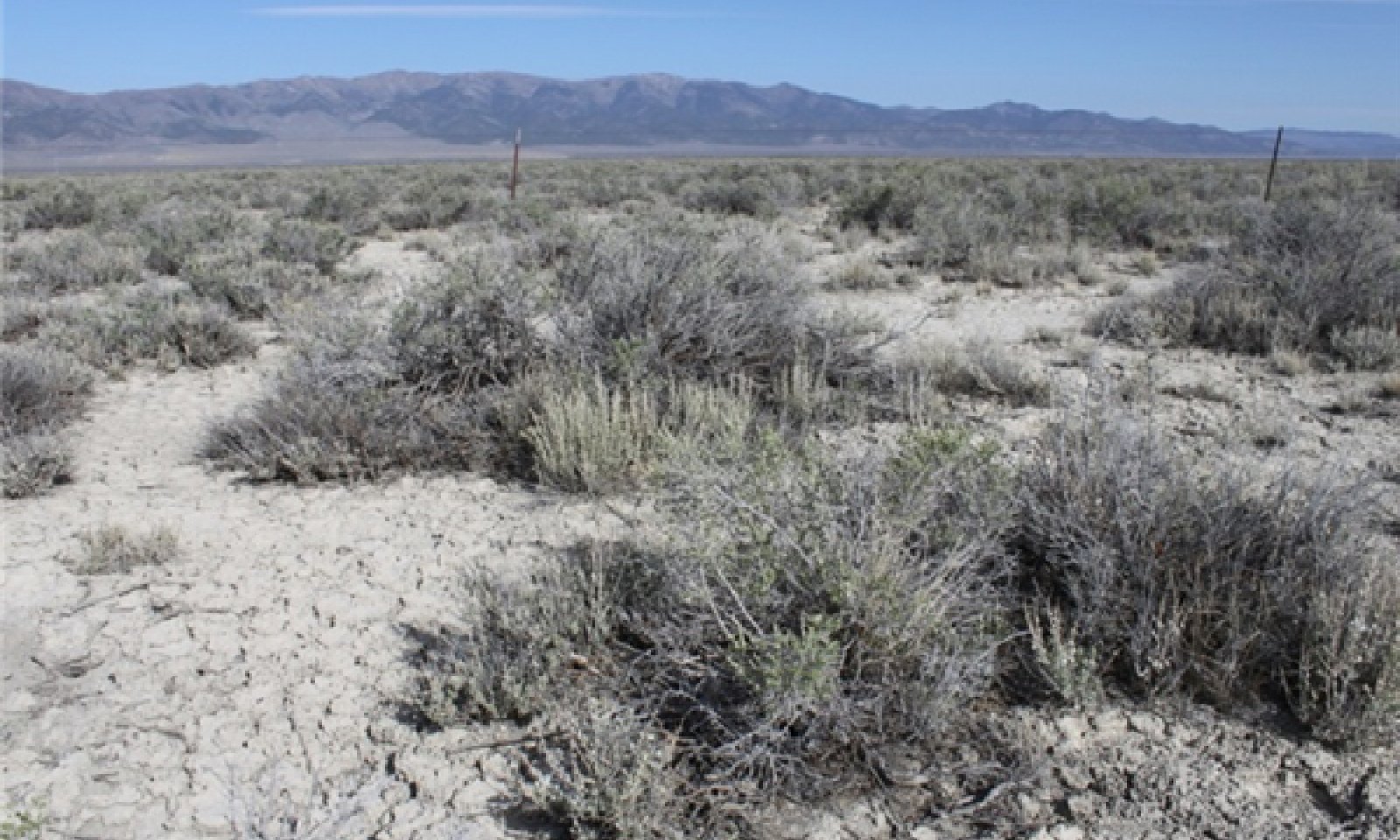
The reference state is dominated by sickle saltbush, although black greasewood is common and may dominate the visual aspect. Average annual production ranges from 200 to 500 pounds per acre.
Associated sites
R028BY020NV SODIC FLAT 5-8 P.Z.
R028BY047NV SALINE TERRACE 5-8 P.Z.
R028BY074NV SODIC TERRACE 5-8 P.Z.
Similar sites
R028BY065NV SALINE TERRACE 8-10 P.Z.
ACHY dominant grass; more productive site
R028BY047NV SALINE TERRACE 5-8 P.Z.
PASM dominant grass; SAVE4 minor shrub on site, if present
R028AY020NV ALKALI SILT FLAT
KOAM a major shrub on site
Table 1. Dominant plant species
Tree Not specified
Shrub (1) Atriplex falcata
(2) Sarcobatus vermiculatusHerbaceous (1) Elymus elymoides
Physiographic features
This site occurs on lake plains. Slope gradients of 0 to 2 percent are typical. Elevations range from 5400 to 6000 feet.
Table 2. Representative physiographic features
Landforms (1) Lake plain
Elevation 5400 – 6000 ft Slope 0 – 2 % Aspect Aspect is not a significant factor Climatic features
The climate associated with this site is semiarid, characterized by cold, moist winters and warm, dry summers.
Average annual precipitation ranges from 5 to 8 inches. Mean annual air temperature is about 46 to 53 degrees F. The average growing season is about 90 to 120 days.
Mean annual precipitation across the range in which this ES occurs is 7.83". Monthly mean precipitation: January 0.685; February 0.61; March 0.70; April 0.845; May .97; June 0.68; July 0.50; August 0.395; September 0.50; October 0.745; November 0.60; December 0.60.
*The above data is averaged from the Beowawe and Lages WRCC climate stations.Table 3 Representative climatic features
Frost-free period (average) 90 days Freeze-free period (average) 120 days Precipitation total (average) 10 in BarLineFigure 2. Monthly precipitation range
BarLineFigure 3. Monthly average minimum and maximum temperature
Figure 4. Annual precipitation pattern
Figure 5 Annual average temperature pattern
Climate stations used
-
(1) LAGES [USC00264341], Ely, NV
-
(2) BEOWAWE 49S U OF N RCH [USC00260800], Eureka, NV
">Influencing water features
Influencing water features are not associated with this site.
Soil features
Soils associated with this site are very deep, moderately well drained, and formed in lacustrine deposits derived from mixed alluvium. Soils are characterized by an ochric epipedon and calcareous minerology. These soils are moderately to strongly alkaline with pH increasing with depth. The soil moisture regime is typic aridic and the soil temperature regime is mesic. Water intake rates are slow and available water holding capacity is reduced by salinity. These soils are often ponded early in the spring with runoff from higher landscapes. The soil series associated with this site include: Ragtown.
The representative soil series is Ragtown, a Fine, smectitic, calcareous, mesic Typic Torriorthents. Diagnostic horizons include an ochric epipedon from the soil surface to 18cm and identifiable secondary carbonates from 58-107cm. Clay content in the particle size control section averages 35 to 45 percent. Reaction is moderately alkaline to very strongly alkaline. Soils are slightly effervescent through strongly effervescent.Table 4. Representative soil features
Surface texture (1) Sandy clay loam
Family particle size (1) Loamy
Drainage class Moderately well drained Permeability class Slow Soil depth 64 – 84 in Surface fragment cover <=3" Not specified Surface fragment cover >3" Not specified Available water capacity
(0-40in)4 – 7 in Calcium carbonate equivalent
(0-40in)10 – 40 % Electrical conductivity
(0-40in)0 – 32 mmhos/cm Sodium adsorption ratio
(0-40in)13 – 90 Soil reaction (1:1 water)
(0-40in)8.5 – 9.6 Subsurface fragment volume <=3"
(Depth not specified)Not specified Subsurface fragment volume >3"
(Depth not specified)Not specified Ecological dynamics
An ecological site is the product of all the environmental factors responsible for its development and it has a set of key characteristics that influence a site’s resilience to disturbance and resistance to invasives. Key characteristics include 1) climate (precipitation, temperature), 2) topography (aspect, slope, elevation, and landform), 3) hydrology (infiltration, runoff), 4) soils (depth, texture, structure, organic matter), 5) plant communities (functional groups, productivity), and 6) natural disturbance regime (fire, herbivory, etc.) (Caudle et al. 2013). Biotic factors that influence resilience include site productivity, species composition and structure, and population regulation and regeneration (Chambers et al. 2013).
The Great Basin shrub communities have high spatial and temporal variability in precipitation, both among years and within growing seasons. Nutrient availability is typically low but increases with elevation and closely follows moisture availability. The moisture resource supporting the greatest amount of plant growth is usually the water stored in the soil profile during the winter. The invasibility of plant communities is often linked to resource availability. Disturbance can decrease resource uptake due to damage or mortality of the native species and depressed competition or can increase resource pools by the decomposition of dead plant material following disturbance.
These salt-desert shrub communities are dominated by plants belonging to the family Chenopodiaceae. Chenopods possess morphological and physiological traits that permit accommodation of both climatological drought resulting from low levels of precipitation, and physiological drought caused by high salt content of soils.
Atriplex species are considered medium to short-lived shrubs and possess a number of morphological and physiological traits that enable them to cope with drought. Some of these traits include: a) photosynthesis through the C4 carboxylation pathway; b) production of leaf trichomes and accumulation of salt crystals on the leaf surface to increase reflectance; c) accumulation and synthesis of inorganic and organic solutes to maintain turgor; and 4) root association with endomycorrhizae that allows absorption of soil moisture at very low water potentials (Cibils, et al. 1998, Dobrowolski 1990, Newton and Goodin 1989). Two Atriplex species occur on this site: sickle saltbush and shadscale (Atriplex confertifolia). Sickle saltbush is a low-growing, evergreen, subshrub which is woody at the base and herbaceous above (Mozingo 1987). Shadscale is an evergreen, rigidly branched, spiny, compact rounded shrub (Perryman 2014).
Black greasewood is a deciduous, intricately branched, spreading or erect shrub (Mozingo 1987). It is classified as a phreatophyte (Eddleman 2002), and its distribution is well correlated with the distribution of groundwater (Mozingo 1987). Meinzer (1927) discovered that the taproots of black greasewood could penetrate from 20 to 57 feet below the surface. Romo (1984) found water tables ranging from 3.5-15 m under black greasewood dominated communities in Oregon. Black greasewood stands develop best where moisture is readily available, either from surface or subsurface runoff (Brown 1965). It is commonly found on floodplains that are either subject to periodic flooding, have a high water table at least part of the year, or have a water table less than 34 feet deep (Harr and Price 1972, Blauer et al. 1976, Branson et al. 1976, Blaisdell and Holmgren 1984, Eddleman 2002). Ganskopp (1986) reported that water tables within 9.8 to 11.8 inches of the surface had no effect on black greasewood in Oregon. However, a study, conducted in California, found that black greasewood did not survive six months of continuous flooding (Groeneveld and Crowley 1988, Groeneveld 1990). Black greasewood is usually a deep rooted shrub but has some shallow roots near the soil surface; the maximum rooting depth can be determined by the depth to a saturated zone (Harr and Price 1972).
The herbaceous component is sparse and depends on annual precipitation. This component includes both perennial deep-rooted and shallow-rooted bunchgrasses, perennial rhizomatous grasses and perennial forbs. The soils have low to negligible surface runoff and typically have a well-developed vesicular crust, thus vegetation productivity is enhanced in wet years when flooding and ponding can occur.
The ecological site has low resilience to disturbance and resistance to invasion. The primary disturbance on these sites is drought, inappropriate grazing and soil disturbance (off-road vehicles, etc). Halogeton (Halogeton glomeratus), Russian thistle (Salsola tragus) and cheatgrass (Bromus tectorum) are most likely to invade disturbed sites. Four possible stable states have been identified for this site.
Fire Ecology:
Historically, salt-desert shrub communities had sparse understories and bare soil in intershrub spaces, making these communities somewhat resistant to fire (Young 1983, Paysen et al. 2000). They may burn only during high fire hazard conditions; for example, years with high precipitation can result in almost continuous fine fuels from the herbaceous component, increasing the fire hazard (West 1994, Paysen et al. 2000).
Sickle saltbush sprouts from the root and shows an ability to reproduce by root sprouts where soil is loose and friable (Nord et al. 1969) which may allow it to sprout after fire. Sickle saltbush has also been observed to have stem layering where branches are partially covered by soil (Nord et al. 1969, Blaisdell and Holmgren 1984) and the conditions are favorable. These plants have been observed to recover quickly after roadside burning (Nord et al. 1969), but the research is inconclusive on its response to wildfire. Shadscale, however, is intolerant of fire and is typically killed. Reestablishment is from seed (Simonin 2001).
Black greasewood may be killed by severe fires, but can resprout after low to moderate severity fires (Robertson 1983, West 1994). Sheeter (1968) reported that following a Nevada wildfire, black greasewood sprouts reached approximately 2.5 feet within 3 years. Grazing and other disturbance may result in increased biomass production due to sprouting and increased seed production, also leading to greater fuel loads (Sanderson and Stutz 1994, Paysen et al. 2000).
Bottlebrush squirreltail the dominant grass on this site, is considered more fire tolerant than other bunchgrasses due to its small size, coarse stems, and sparse leafy material (Britton et al. 1990a). Postfire regeneration occurs from surviving root crowns and from on- and off-site seed sources. Bottlebrush squirreltail has the ability to produce large numbers of highly germinable seeds, with relatively rapid germination (Young and Evans 1977) when exposed to the correct environmental cues. Early spring growth and ability to grow at low temperatures contribute to the persistence of bottlebrush squirreltail among cheatgrass dominated ranges (Hironaka and Tisdale 1973).
Western wheatgrass, the sub-dominant grass on this site, is a coarse-leaved, sod forming perennial grass (Wasser and Shoemaker 1982). It has good fire tolerance, likely due to its coarse leaves and rhizomatous growing structure (Wasser and Shoemaker 1982). In a study by White and Currie (1983), fall burning increased western wheatgrass but clipping and spring burning basal cover was similar to the untreated control plot.State and transition model
Custom diagramStandard diagram
Figure 6. State and Transition Model

Figure 7. Legend
More interactive model formats are also available. View Interactive Models
More interactive model formats are also available. View Interactive Models
Click on state and transition labels to scroll to the respective textState 1 submodel, plant communities
State 2 submodel, plant communities
State 3 submodel, plant communities
State 4 submodel, plant communities
State 1
Reference StateThe Reference State 1.0 is a representative of the natural range of variability under pristine conditions. This state has two community phases, one dominated by shrubs and grasses and the other dominated by shrubs. State dynamics are maintained by interactions between climatic patterns and disturbance regimes. Negative feedbacks enhance ecosystem resilience and contribute to the stability of the state. These include the presence of all structural and functional groups, low fine fuel loads, and retention of organic matter and nutrients. This site is very stable, with little variation in plant community composition. Plant community changes would be reflected in production in response to drought or abusive grazing. Wet years will increase grass production, while drought years will reduce production. Shrub production will also increase during wet years. Management should focus on maintaining high species diversity of desired species to promote site resiliency.
Community 1.1
Community Phase
Figure 8. Alkali Silt Flat (R028BY097NV) T.Stringham May 2012

Figure 9. Alkali Silt Flat (R028BY097NV) T.Stringham May 2012

Figure 10. Alkali Silt Flat (R028BY097NV) T.Stringham May 2012
This community is dominated by sickle saltbush. Bottlebrush squirreltail is also an important species on this site. Black greasewood may be a significant component or dominant species. Community phase changes are primarily a function of chronic drought. Fire is infrequent and patchy due to low fuel loads. Potential vegetative composition is about 15% grasses, 5% forbs and 80% shrubs. Approximate ground cover (basal and crown) is 10 to 15 percent.
Figure 11. Annual production by plant type (representative values) or group (midpoint values)
Table 5. Annual production by plant type
Plant type Low
(lb/acre)Representative value
(lb/acre)High
(lb/acre)Shrub/Vine 160 280 400 Grass/Grasslike 30 52 75 Forb 10 18 25 Total 200 350 500 Community 1.2
Community PhaseDrought will favor shrubs over perennial bunchgrasses. However, long-term drought will result in an overall decline in the plant community, regardless of functional group. Sickle saltbush and other shrubs dominate the overstory, squirreltail and other grasses are reduced to trace amounts.
Pathway a
Community 1.1 to 1.2Drought and/or herbivory would reduce the perennial grasses on this site.
Pathway a
Community 1.2 to 1.1Time, lack of disturbance and recovery from drought would allow the vegetation to increase and bare ground would eventually decrease.
State 2
Current Potential StateThis state is similar to the Reference State 1.0 with two similar community phases. Ecological function has not changed, however the resiliency of the state has been reduced by the presence of invasive weeds. Non-natives may increase in abundance but will not become dominant within this State. Negative feedbacks enhance ecosystem resilience and contribute to the stability of the state. These feedbacks include the presence of all structural and functional groups, low fine fuel loads, and retention of organic matter and nutrients. Positive feedbacks decrease ecosystem resilience and stability of the state. These include the non-natives’ high seed output, persistent seed bank, rapid growth rate, ability to cross pollinate, and adaptations for seed dispersal. Management would be to maintain high diversity of desired species to promote organic matter inputs and prevent the dispersal and seed production of the non-native invasive species.
Community 2.1
Community PhaseThis community is dominated by sickle saltbush. Bottlebrush squirreltail is also an important species on this site. Black greasewood may be a significant component of the plant community. Community phase changes are primarily a function of chronic drought. Fire is infrequent and patchy due to low fuel loads. Non-native annual species are present in minor amounts
Community 2.2
Community PhaseDrought will initially favor shrubs over bunchgrasses; however long-term drought will result in an overall decline in the plant community regardless of functional group. Unpalatable shrubs such as sickle saltbush increase with inappropriate grazing while squirreltail and shadscale decline. Bare ground increases along with annual non-native species.
Pathway a
Community 2.1 to 2.2Inappropriate grazing and/or drought would decrease the production on these sites.
Pathway a
Community 2.2 to 2.1Release from drought and/or growing season grazing pressure allows recovery of bunchgrasses.
State 3
Shrub StateThis state consists of one community phase. This site has crossed a biotic threshold and site processes are being controlled by shrubs.
Community 3.1
Community PhasePerennial grasses like bottlebrush squirreltail and western wheatgrass are reduced and the site is dominated by sickle saltbush, black greasewood, shadscale and other shrubs. Annual non-native species may be present to increasing. Bare ground is significant.
State 4
Eroded StateThis site consists of one community phase. Abiotic factors including soil redistribution and erosion, soil temperature, soil crusting and sealing are primary drivers of ecological condition within this state. Soil moisture, soil nutrients and soil organic matter distribution and cycling are severely altered due to degraded soil surface conditions.
Community 4.1
Community PhaseSickle saltbush and other shrubs may be the dominant species but are only present in patches, and are not contributing to site function. Regeneration of herbaceous species is not evident. Invasive plants (halogeton, Russian thistle) are sporadic and associated on mounds bordering playettes. Bare ground may be abundant, especially during low precipitation years. Soil erosion, soil temperature and wind are driving factors in site function.
Transition A
State 1 to 2Trigger: This transition is caused by the introduction of non-native annual plants, such as halogeton and cheatgrass. Slow variables: Over time the annual non-native species will increase within the community. Threshold: Any amount of introduced non-native species causes an immediate decrease in the resilience of the site. Annual non-native species cannot be easily removed from the system and have the potential to significantly alter disturbance regimes from their historic range of variation.
Transition A
State 2 to 3Trigger: Repeated, heavy, growing season grazing will decrease or eliminate deep rooted perennial bunchgrasses and decrease sickle saltbush. Slow variables: Long term decrease in deep-rooted perennial grass density. Threshold: Loss of deep-rooted perennial bunchgrasses changes nutrient cycling, nutrient redistribution, and reduces soil organic matter.
Transition B
State 2 to 4Trigger: Contiguous inappropriate grazing management and/or soil disturbing treatments. Slow variables: Increased bare ground and/or increase amount of non-native annual species. Threshold: Loss of deep-rooted perennial bunchgrasses and shrubs truncates, spatially and temporally, nutrient capture and cycling within the community.
Transition A
State 3 to 4Trigger: Contiguous inappropriate grazing management and/or soil disturbing treatments. Slow variables: Increase in bare ground, increased production and cover of non-native annual species. Threshold: Changes in plant community composition and spatial variability of vegetation due to the loss of perennial bunchgrasses and saltbush truncate energy capture spatially and temporally thus impacting nutrient cycling and distribution.
Additional community tables
Table 6. Community 1.1 plant community composition
Group Common name Symbol Scientific name Annual production () Foliar cover (%) Grass/Grasslike1 Primary Perennial Grasses 25–53 squirreltail ELEL5 Elymus elymoides 18–35 – western wheatgrass PASM Pascopyrum smithii 7–18 – 2 Secondary Perennial Grasses 1–18 Indian ricegrass ACHY Achnatherum hymenoides 2–7 – Sandberg bluegrass POSE Poa secunda 2–7 – Forb3 Perennial 7–28 Shrub/Vine4 Primary Shrubs 235–316 sickle saltbush ATFA Atriplex falcata 175–210 – greasewood SAVE4 Sarcobatus vermiculatus 53–88 – shadscale saltbush ATCO Atriplex confertifolia 7–18 – 5 Secondary Shrubs 7–28 seepweed SUAED Suaeda 4–7 – Table 7. Community 1.2 plant community composition
Group Common name Symbol Scientific name Annual production () Foliar cover (%) Table 8. Community 2.1 plant community composition
Group Common name Symbol Scientific name Annual production () Foliar cover (%) Table 9. Community 2.2 plant community composition
Group Common name Symbol Scientific name Annual production () Foliar cover (%) Table 10. Community 3.1 plant community composition
Group Common name Symbol Scientific name Annual production () Foliar cover (%) Table 11. Community 4.1 plant community composition
Group Common name Symbol Scientific name Annual production () Foliar cover (%) Interpretations
Animal community
Livestock Interpretations:
This site has limited value for livestock grazing, due to the low forage production. Bottlebrush squirreltail is very palatable winter forage for domestic sheep of Intermountain ranges. Domestic sheep relish the green foliage. Overall, bottlebrush squirreltail is considered moderately palatable to livestock. Western wheatgrass provides important forage for domestic sheep. Fall regrowth cures well on the stem, so western wheatgrass is good winter forage for domestic livestock. Sickle saltbush provides nutritious forage for livestock. Overgrazing may reduce plant vigor. Black greasewood is an important winter browse plant for domestic sheep and cattle. It also receives light to moderate use by domestic sheep and cattle during spring and summer months. Black greasewood contains soluble sodium and potassium oxalates that may cause poisoning and death in domestic sheep and cattle if large amounts are consumed in a short time. Shadscale is a valuable browse species, providing a source of palatable, nutritious forage for a wide variety of livestock. Shadscale provides good browse for domestic sheep. Shadscale leaves and seeds are an important component of domestic sheep and cattle winter diets.
Stocking rates vary over time depending upon season of use, climate variations, site, and previous and current management goals. A safe starting stocking rate is an estimated stocking rate that is fine tuned by the client by adaptive management through the year and from year to year.
Wildlife Interpretations:
Sickle saltbush provides nutritious forage for wildlife. Black greasewood is an important winter browse plant for big game animals and a food source for many other wildlife species. It also receives light to moderate use by mule deer and pronghorn during spring and summer months. Shadscale is a valuable browse species, providing a source of palatable, nutritious forage for a wide variety of wildlife particularly during spring and summer before the hardening of spiny twigs. It supplies browse, seed, and cover for birds, small mammals, rabbits, deer, and pronghorn antelope. Bottlebrush squirreltail is a dietary component of several wildlife species. Elk consume western wheatgrass during the fall, winter, spring, and summer. Western wheatgrass is used by various small mammals.
Livestock/Wildlife Grazing Interpretations:
Productivity and grazing capacities are typically low for salt-desert shrub communities and these sites are typically used for winter range. Sickle saltbush, fourwing saltbush and shadscale provide valuable winter forage for livestock and wildlife on salt-desert rangelands (Ansley and Abernethy 1983). Black greasewood is browsed by cattle when green, but contains soluble oxalates that may cause poisoning and death if large quantities are consumed in a short time period (Blaisdell and Holmgren).
Bottlebrush squirreltail generally increases in abundance when moderately grazed or protected (Hutchings and Stewart 1953). In addition, moderate trampling by livestock in big sagebrush rangelands of central Nevada enhanced bottlebrush squirreltail seedling emergence compared to untrampled conditions. Heavy trampling however was found to significantly reduce germination sites (Eckert et al. 1987). Squirreltail is more tolerant of grazing than other perennial bunchgrasses but all bunchgrasses are sensitive to over utilization within the growing season.
Western wheatgrass is considered one of the most valuable wheatgrasses on rangelands. It often inhabits sites with high salinity and few other grass species (Dayton 1937). It is valuable forage for sheep, especially as a winter feed; it is also rated as a choice forage for elk and deer (Dayton 1937).
Repeated spring and early summer grazing will decrease the cover of the more palatable species and increase the potential for serious soil erosion. Undesirable perennial species will increase and non-native annuals such as halogeton, Russian thistle and cheatgrass will invade. With grazing, saltbush will initially increase in the community and native perennial bunchgrasses will decrease. In a study by Fisser and Joyce (1983), saltbush remained the dominant vegetation in an exclosure protected from grazing for seven years. After sixteen years of protection from grazing the same exclosures exhibited an increase in perennial bunchgrasses and a subsequent decrease in sickle saltbush which was significantly correlated with precipitation combined with protection from grazing. They also found that 35 percent shrub removal during winter was acceptable for maintenance of the population, but severe overuse can cause a decrease in sickle saltbush and allow an increase in halogeton.
Inappropriate grazing during the winter while soils are wet may lead to soil compaction and reduced infiltration. Prolonged inappropriate grazing during any season leads to abundant bare ground, destruction of microbiotic crusts, and active wind and water erosion (Blaisdell and Holmgren 1984).
Salt-desert shrub communities are relatively simple in terms of structure and species diversity but they serve as habitat for several wildlife species including reptiles, small mammals, birds and large herbivores (Blaisdell and Holmgren 1984).
Hydrological functions
Runoff is high. Permeability is slow.
Recreational uses
Aesthetic value is derived from the diverse floral and faunal composition and the colorful flowering of wild flowers and shrubs during the spring and early summer. This site offers rewarding opportunities to photographers and for nature study. This site is used for camping and hiking and has potential for upland and big game hunting.
Other products
The leaves, seeds and stems of black greasewood are edible. Seeds of shadscale were used by Native Americans for bread and mush.
Other information
Black greasewood is useful for stabilizing soil on wind-blown areas. It successfully revegetates eroded areas and sites too saline for most plant species. Bottlebrush squirreltail is tolerant of disturbance and is a suitable species for revegetation. Western wheatgrass is a good soil binder and is well suited for reclamation of disturbed sites.
Supporting information
Type locality
Location 1: Elko County, NV Township/Range/Section T34N R67E S9 Latitude 40° 50′ 36″ Longitude 114° 24′ 26″ General legal description About 1 mile southeast of Shafter in Goshute Valley, Elko County, Nevada. Other references
Ansley, J. R. and R. H. Abernethy. 1983. Overcoming seed dormancy in Gardner saltbush (Atriplex gardneri (moq.) D. Dietr) as a strategy for increasing establishment by direct seeding. Pp 152-158. In Tiedemann, Arthur R.; McArthur, Durrant E.; Stutz, Howard C.; Stevens, Richard; Johnson, Kendall L., compilers. Proceedings- Symposium on the Biology of Atriplex and Related Chenopods. U.S. Department of Agriculture, Forest Service, Intermountain Forest and Range Experiment Station, Provo, Utah.
Blaisdell, J. P. and R. C. Holmgren. 1984. Managing Intermountain Rangelands - Salt-desert Shrub Ranges. General Technical Report INT-163, USDA Forest Service, Intermountain Forest and Range Experiment Station, Ogden, UT.
Caudle, D.J., M. DiBenedetto, M. Karl, H. Sanchez, and C. Talbot. 2013. Interagency Ecological Site Handbook for Rangelands. Available at: http://jornada.nmsu.edu/sites/jornada.nmsu.edu/files/InteragencyEcolSiteHandbook.pdf. Accessed 4 October 2013.
Chambers, J., B. Bradley, C. Brown, C. D’Antonio, M. Germino, J. Grace, S. Hardegree, R. Miller, and D. Pyke. 2013. Resilience to stress and disturbance, and resistance to Bromus tectorum L. Invasion in Cold Desert Shrublands of Western North America. Ecosystems:1-16.
Cibils, A.F., D.M. Swift, and E.D. McArthur. 1998. Plant Herbivore Interactions in Atriplex: Current State of Knowledge. U.S. Department of Agriculture, Forest Service, Rocky Mountain Research Station. Gen. Tech. Rept. RMRS-GTR-14. 31pp.
Clark, W.R., "Population Limitation of Jackrabbits: an Examination of the Food Hypothesis" (1979). All Graduate Thesis and Dissertations. Paper 3502. http://digitalcommons.usu.edu/etd/3502.
Cook, C. W. and L.A. Stoddart, L. A., "Bulletin No. 364 - The Halogeton Problem in Utah" (1953). UAES Bulletins. Paper 322. http://digitalcommons.usu.edu/uaes_bulletins/322.
Dayton, W. 1937. Range Plant Handbook. USDA, Forest Service. Bull.
Dobrowolski, J.P., M.M. Caldwell, and J.H. Richards. 1990. Basin Hydrology and Plant Root Systems. In: Osmond, C.B., L.F. Pitelka, and G.M. Hidy (eds). Plant Biology of the Basin and Range. Berlin, Heidelberg, Springer-Verlag: 243-292.
Eckert, R. E., Jr., F. F. Peterson, and F. L. Emmerich. 1987. A study of factors influencing secondary succession in the sagebrush [Artemisia spp. L.] type. Pp 149-168 in Proceedings: Seed and Seedbed Ecology of Rangeland Plants. U. S. Department of Agriculture, Agricultureal Research Service, Tucson, A.Z.
Esplin, A. C., J.E. Greaves, and L.A. Stoddart. "Bulletin No. 277 - A Study of Utah's Winter Range: Composition of Forage Plants and Use of Supplements" (1937). UAES Bulletins. Paper 239.
http://digitalcommons.usu.edu/uaes_bulletins/239.
Fire Effects Information System (Online; http://www.fs.fed.us/database/feis/plants/).
Fisser, H. G. and L. A. Joyce. 1983. Atriplex/Grass and forb relationships under no grazing and shifting precipitation patterns in north-central Wyoming. Page 87 in Tiedemann, Arthur R.; McArthur, Durrant E.; Stutz, Howard C.; Stevens, Richard; Johnson, Kendall L., compilers. Proceedings- Symposium on the Biology of Atriplex and Related Chenopods. U.S. Department of Agriculture, Forest Service, Intermountain Forest and Range Experiment Station, Provo, Utah.
Hodgkinson, H. S. 1987. Relationship of saltbush species to soil chemical properties. Journal of Range Management 40:23-26.
Houghton, J.G., C.M. Sakamoto, and R.O. Gifford. 1975. Nevada’s Weather and Climate, Special Publication 2. Nevada Bureau of Mines and Geology, Mackay School of Mines, University of Nevada, Reno, NV.
Hutchings, S. S. and G. Stewart. 1953. Increasing forage yields and sheep production on Intermountain winter ranges. Circular No. 925. U.S. Department of Agriculture, Washington, D.C.
Mozingo, H.N. 1987. Shrubs of the Great Basin. University of Nevada Press, Reno, NV. 342p.
National Oceanic and Atmospheric Administration. 2004. The North American Monsoon. Reports to the Nation. National Weather Service, Climate Prediction Center. Available online: http://www.weather.gov/.
Newton, R.J. and J.R. Goodin. 1989. Moisture stress adaptation in shrubs. In: McKell, C.M., ed. The Biology and Utilization of Shrubs. New York: Academic Press: 365-378.
Nord, E. C., D. R. Christensen, and A. P. Plummer. 1969. Atriplex species [or Taxa] that spread by root sprouts, stem layers, and by seed. Ecology 50:324-326.
Paysen, T. E., R. J. Ansley, J. K. Brown, G. J. Gottfried, S. M. Haase, M. G. Harrington, M. G. Narog, S. S. Sackett, and R. C. Wilson. 2000. Fire in western shrubland, woodland, and grassland ecosystems. Wildland fire in ecosystems: Effects of Fire on Flora. Gen. Tech. Rep. RMRS-GTR-42-vol 2:121-159.
Perryman, B. 2014. A Field Guide to Nevada Shrubs. Indigenous Rangeland Management Press. Lander, Wyoming
Robertson, J. 1983. Greasewood (Sarcobatus vermiculatus (Hook.) Torr.). Phytologia 54:309-324.
Sanderson, S. C. and H. C. Stutz. 1994. Woody chenopods useful for rangeland reclamation in western North America. Pages 374-378 in Proceedings-- ecology and management of annual rangelands. Gen. Tech. Rep. INT-GTR-313. U.S. Department of Agriculture, Forest Service, Intermountain Research Station, Boise, ID.
Sheeter, G. R. 1968. Secondary succession and range improvements after wildfire in northeastern Nevada. Thesis, University of Nevada, Reno, Nevada, USA.
Simonin, Kevin A. 2001. Atriplex confertifolia. In: Fire Effects Information System, [Online]. U.S. Department of Agriculture, Forest Service, Rocky Mountain Research Station, Fire Sciences Laboratory (Producer). Available: http://www.fs.fed.us/database/feis/.
Stringham, T.K., P. Novak-Echenique, P. Blackburn, C. Coombs, D. Snyder and A. Wartgow. 2015. Final Report for USDA Ecological Site Description State-and-Transition Models, Major Land Resource Area 28A and 28B Nevada. University of Nevada Reno, Nevada Agricultural Experiment Station Research Report 2015-01. p. 1524.
USDA-NRCS Plants Database (Online; http://www.plants.usda.gov).
Wasser, C. H. and J. W. Shoemaker. 1982. Ecology and culture of selected species useful in revegetating disturbed lands in the West. FWS/OBS-82/56. Fish and Wildlife Service, US Department of the Interior.
West, N. E. 1994. Effects of fire on salt-desert shrub rangelands. In: Proceedings--Ecology and Management of Annual Rangelands, General Technical Report INT-313. USDA Forest Service, Intermountain Research Station, Boise, ID.
White, R. S. and P. O. Currie. 1983. Prescribed burning in the Northern Great Plains: Yield and cover responses of 3 forage Species in the mixed grass prairie. Journal of Range Management 36:179-183.
Young, R. P. 1983. Fire as a vegetation management tool in rangelands of the Intermountain Region. Pages 18-31 in Managing Intermountain Rangelands - Improvement of Range and Wildlife Habitats. General Technical Report INT-157.USDA, Forest Service.
Contributors
RK
T. Stringham/P.Novak-Echenique
E. HourihanRangeland health reference sheet
Interpreting Indicators of Rangeland Health is a qualitative assessment protocol used to determine ecosystem condition based on benchmark characteristics described in the Reference Sheet. A suite of 17 (or more) indicators are typically considered in an assessment. The ecological site(s) representative of an assessment location must be known prior to applying the protocol and must be verified based on soils and climate. Current plant community cannot be used to identify the ecological site.
Author(s)/participant(s) P NOVAK-ECHENIQUE Contact for lead author State Rangeland Management Specialist Date 03/31/2014 Approved by Approval date Composition (Indicators 10 and 12) based on Annual Production Indicators
-
Number and extent of rills:
None to rare - this site is essentially flat. -
Presence of water flow patterns:
Water flow patterns are rare to common dependent on site location relative to major inflow areas. Water flow patterns are typically somewhat long <10 feet) and meandering, ending in depressional areas where water ponds. -
Number and height of erosional pedestals or terracettes:
None to rare. A few may occur in water flow paths. -
Bare ground from Ecological Site Description or other studies (rock, litter, lichen, moss, plant canopy are not bare ground):
Bare Ground ± 80% -
Number of gullies and erosion associated with gullies:
None -
Extent of wind scoured, blowouts and/or depositional areas:
None -
Amount of litter movement (describe size and distance expected to travel):
Fine litter (foliage of grasses and annual & perennial forbs) expected to move distance of slope length during periods of intense summer convection storms or run in of early spring snow melt flows. Persistent litter (large woody material) will remain in place except during unusual flooding (ponding) events. -
Soil surface (top few mm) resistance to erosion (stability values are averages - most sites will show a range of values):
Soil stability values will range from 1 to 4. (To be field tested.) -
Soil surface structure and SOM content (include type of structure and A-horizon color and thickness):
Structure of soil surface is fine subangular blocky structure and a vesicular crust is present. Soil surface colors are light browns and soils are typified by an ochric epipedon. Organic matter is typically less than 1 percent. -
Effect of community phase composition (relative proportion of different functional groups) and spatial distribution on infiltration and runoff:
This site is typically ponded for short periods in the late winter/early spring and runoff is not significant. In areas, with herbaceous cover (sparse) of deep-rooted perennial herbaceous bunchgrasses and/or rhizomatous grasses (western wheatgrass), these plants can increase infiltration. Moderately fine to fine surface textures and physical crusts result in limited infiltration rates. The surface layer will normally crust and bake upon drying, inhibiting water infiltration and seedling emergence. Ponding occurs in late winter/early spring in many areas. Ponding may also occur after heavy summer convection storms. -
Presence and thickness of compaction layer (usually none; describe soil profile features which may be mistaken for compaction on this site):
Compacted layers are none. Platy or massive subsurface layers are normal for this site and are not to be interpreted as compaction. -
Functional/Structural Groups (list in order of descending dominance by above-ground annual-production or live foliar cover using symbols: >>, >, = to indicate much greater than, greater than, and equal to):
Dominant:
Reference State: salt-desert shrubs (sickle saltbush)Sub-dominant:
shallow-rooted cool season, perennial bunchgrasses (bottlebrush squirreltail) > other shrubs > deep-rooted, cool season, perennial bunchgrasses = = deep-rooted, cool season, perennial forbs = fibrous, shallow-rooted, cool season, perennial and annual forbs.Other:
Additional:
-
Amount of plant mortality and decadence (include which functional groups are expected to show mortality or decadence):
Dead branches within individual shrubs common and standing dead shrub canopy material may be as much as 35% of total woody canopy -
Average percent litter cover (%) and depth ( in):
Between plant interspaces (10-15%) and depth (<¼ in.) -
Expected annual annual-production (this is TOTAL above-ground annual-production, not just forage annual-production):
For normal or average growing season (thru Jun) ± 350 lbs/ac; Favorable years ± 500 lbs/ac and unfavorable years ±200 lbs/ac -
Potential invasive (including noxious) species (native and non-native). List species which BOTH characterize degraded states and have the potential to become a dominant or co-dominant species on the ecological site if their future establishment and growth is not actively controlled by management interventions. Species that become dominant for only one to several years (e.g., short-term response to drought or wildfire) are not invasive plants. Note that unlike other indicators, we are describing what is NOT expected in the reference state for the ecological site:
Potential invaders include annual mustards, annual kochia, Russian thistle, halogeton, cheatgrass, and knapweeds. -
Perennial plant reproductive capability:
All functional groups should reproduce in average (or normal) and above average growing season years. Reduced growth and reproduction occurs during extended or extreme drought conditions.
Print Options
Sections
Font
AAAAOther
PrintThe Ecosystem Dynamics Interpretive Tool is an information system framework developed by the USDA-ARS Jornada Experimental Range, USDA Natural Resources Conservation Service, and New Mexico State University.
Accessibility statement


