
Natural Resources
Conservation Service
-
Search


Major Land Resource Area or ecological site by name and/or ID.
PreviousSectionsNextGeneral information
Draft. A draft ecological site description is either incomplete or has not undergone quality control and quality assurance review.
MLRA notes
Major Land Resource Area (MLRA): 028B–Central Nevada Basin and Range
MLRA 28B occurs entirely in Nevada and comprises about 23,555 square miles (61,035 square kilometers). More than nine-tenths of this MLRA is federally owned. This area is in the Great Basin Section of the Basin and Range Province of the Intermontane Plateaus. It is an area of nearly level, aggraded desert basins and valleys between a series of mountain ranges trending north to south. The basins are bordered by long, gently sloping to strongly sloping alluvial fans. The mountains are uplifted fault blocks with steep sideslopes. Many of the valleys are closed basins containing sinks or playas. Elevation ranges from 4,900 to 6,550 feet (1,495 to 1,995 meters) in the valleys and basins and from 6,550 to 11,900 feet (1,995 to 3,630 meters) in the mountains.
The mountains in the southern half are dominated by andesite and basalt rocks that were formed in the Miocene and Oligocene. Paleozoic and older carbonate rocks are prominent in the mountains to the north. Scattered outcrops of older Tertiary intrusives and very young tuffaceous sediments are throughout this area. The valleys consist mostly of alluvial fill, but lake deposits are at the lowest elevations in the closed basins. The alluvial valley fill consists of cobbles, gravel, and coarse sand near the mountains in the apex of the alluvial fans. Sands, silts, and clays are on the distal ends of the fans.
The average annual precipitation ranges from 4 to 12 inches (100 to 305 millimeters) in most areas on the valley floors. Average annual precipitation in the mountains ranges from 8 to 36 inches (205 to 915 millimeters) depending on elevation. The driest period is from midsummer to midautumn. The average annual temperature is 34 to 52 degrees F (1 to 11 degrees C). The freeze-free period averages 125 days and ranges from 80 to 170 days, decreasing in length with elevation.
The dominant soil orders in this MLRA are Aridisols, Entisols, and Mollisols. The soils in the area dominantly have a mesic soil temperature regime, an aridic or xeric soil moisture regime, and mixed or carbonatic mineralogy. They generally are well drained, loamy or loamyskeletal, and shallow to very deep.
Nevada’s climate is predominantly arid, with large daily ranges of temperature, infrequent severe storms and heavy snowfall in the higher mountains. Three basic geographical factors largely influence Nevada’s climate: continentality, latitude, and elevation. The strong continental effect is expressed in the form of both dryness and large temperature variations. Nevada lies on the eastern, lee side of the Sierra Nevada Range, a massive mountain barrier that markedly influences the climate of the State. The prevailing winds are from the west, and as the warm moist air from the Pacific Ocean ascend the western slopes of the Sierra Range, the air cools, condensation occurs and most of the moisture falls as precipitation. As the air descends the eastern slope, it is warmed by compression, and very little precipitation occurs. The effects of this mountain barrier are felt not only in the West but throughout the state, as a result the lowlands of Nevada are largely desert or steppes.
The temperature regime is also affected by the blocking of the inland-moving maritime air. Nevada sheltered from maritime winds, has a continental climate with well-developed seasons and the terrain responds quickly to changes in solar heating. Nevada lies within the midlatitude belt of prevailing westerly winds which occur most of the year. These winds bring frequent changes in weather during the late fall, winter and spring months, when most of the precipitation occurs.
To the south of the mid-latitude westerlies, lies a zone of high pressure in subtropical latitudes, with a center over the Pacific Ocean. In the summer, this high-pressure belt shifts northward over the latitudes of Nevada, blocking storms from the ocean. The resulting weather is mostly clear and dry during the summer and early fall, with occasional thundershowers. The eastern portion of the state receives noteworthy summer thunderstorms generated from monsoonal moisture pushed up from the Gulf of California, known as the North American monsoon. The monsoon system peaks in August and by October the monsoon high over the Western U.S. begins to weaken and the precipitation retreats southward towards the tropics (NOAA 2004).
Ecological site concept
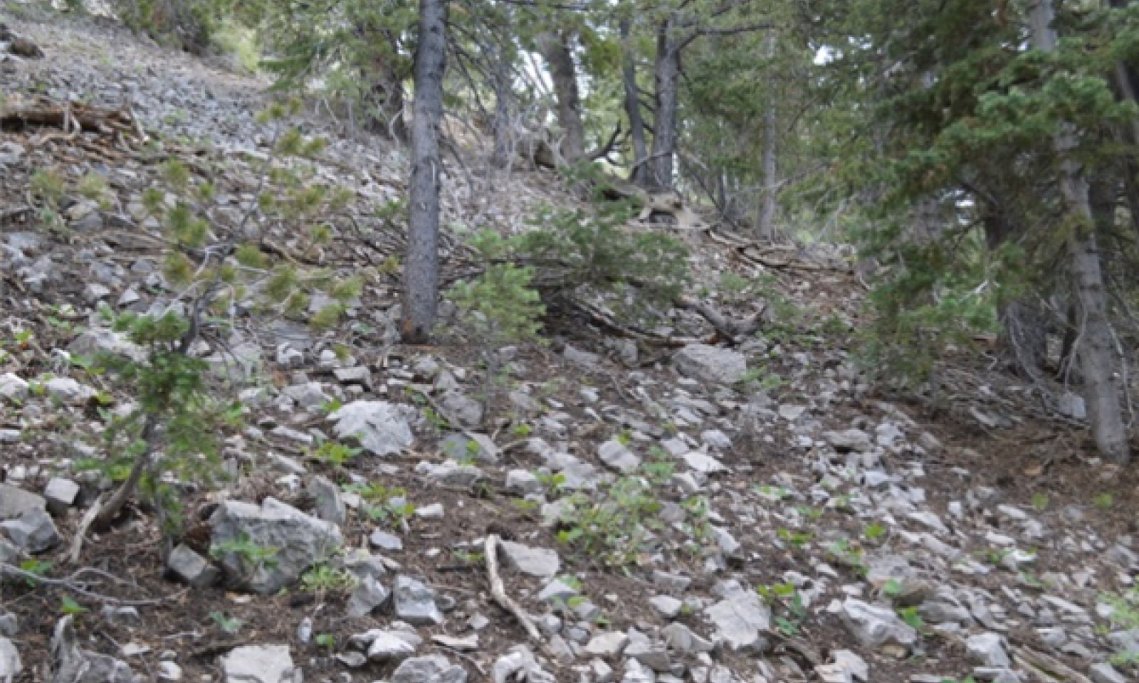
This forest site occurs on smooth to slightly concave mountain sideslopes. Slopes are typically 30 to 50 percent. Elevations range from 8500 to over 10,700 feet.
Soils associated with this site are deep, well drained, and formed in residuum/colluvium from calcareous shale. Soils are characterized by an argillic horizon and have less than 50% rock fragments on the surface.
The plant community is dominated by white fir. An overstory canopy of 30 to 40 percent is assumed to be representative. Dominant understory species are spike-fescue and creeping barberry. Common juniper, serviceberry, snowberry and goldenweed are also present. Overstory tree canopy composition is about 50 to 70 percent white fir, 15 to 25 percent limber pine and less than 10 percent bristlecone pine. Understory production ranges from 150 to 500 pounds per acre.
Important abiotic factors associated with this site include the high elevations and cool soil temperatures. Understory species composition and productivity are limited by the short growing season and competition from the overstory.
Similar sites
F028BY049NV Rocky Convex Mountain Slopes
Understory is less productive, SI is lower. Soils are mod deep and have a calcic horizon.
Table 1. Dominant plant species
Tree (1) Abies concolor
(2) Pinus flexilisShrub (1) Mahonia repens
Herbaceous (1) Leucopoa kingii
Physiographic features
This forest site occurs on smooth to slightly concave mountain backslopes. Slopes range from 15 to 75 percent, but are typically 30 to 50 percent. Elevations are 8500 to over 10,700 feet.
Table 2. Representative physiographic features
Landforms (1) Mountain
(2) Mountain slope
Elevation 8500 – 10700 ft Slope 30 – 50 % Aspect Aspect is not a significant factor Climatic features
This site’s climate is semi-arid. In general it is characterized by cold, moist winters and warm, dry summers. Much of the moisture that falls on this site is in the form of snow.
Average annual precipitation is about 20 inches. Mean annual air temperature is about 40 to 43 degrees F. The average growing season is 50 to 70 days. Weather stations with a long term data record are currently not available for this ecological site. Associated climate data will be updated when information becomes available.Table 3 Representative climatic features
Frost-free period (average) 60 days Freeze-free period (average) 0 days Precipitation total (average) 20 in BarLineFigure 1. Monthly precipitation range
BarLineFigure 2. Monthly average minimum and maximum temperature
Figure 3. Annual precipitation pattern
Figure 4 Annual average temperature pattern
">Influencing water features
Influencing water features are not associated with this site.
Soil features
Soils associated with this site are moderately deep, well drained and formed in residuum/colluvium derived from calcareous shale. Soils have an argillic horizon within 3cm and less than 50% rock fragments on the surface. Soils have high to very high runoff and have moderately slow permeability. The soil temperature regime is cryic and the soil moisture regime is xeric.
Soil series associated with this site include: Crethers, Hardzem, and Murial.
The representative soil series is Hardzem, a Loamy-skeletal, mixed, superactive Xeric Haplocryalfs. Diagnostic horizons include an ochric epipedon from the soil surface to 3 cm and an argillic horizon from 3 to 53 cm. Paralithic contact ranges from 50 to 100 cm to underlying soft bedrock. Clay content in the particle size control section averages 20 to 30 percent. Rock fragments range from 60 to 80 percent, dominantly channers, with some flagstones. Reaction is neutral or slightly alkaline. Lithology consists of hard sedimentary rocks such as limestone and shale.Table 4. Representative soil features
Parent material (1) Residuum – shale
(2) Colluvium – limestone
Surface texture (1) Channery loam
(2) Stony loam
Family particle size (1) Loamy
Drainage class Well drained to somewhat excessively drained Permeability class Very slow to moderately rapid Soil depth 20 – 60 in Surface fragment cover <=3" 5 – 10 % Surface fragment cover >3" 20 – 30 % Available water capacity
(0-40in)1 – 2 in Calcium carbonate equivalent
(0-40in)0 – 5 % Electrical conductivity
(0-40in)0 – 2 mmhos/cm Sodium adsorption ratio
(0-40in)Not specified Soil reaction (1:1 water)
(0-40in)6.6 – 7.8 Subsurface fragment volume <=3"
(Depth not specified)20 – 30 % Subsurface fragment volume >3"
(Depth not specified)60 – 80 % Ecological dynamics
An ecological site is the product of all the environmental factors responsible for its development and it has a set of key characteristics that influence a site’s resilience to disturbance and resistance to invasives. Key characteristics include 1) climate (precipitation, temperature), 2) topography (aspect, slope, elevation, and landform), 3) hydrology (infiltration, runoff), 4) soils (depth, texture, structure, organic matter), 5) plant communities (functional groups, productivity), and 6) natural disturbance regime (fire, herbivory, etc.) (Caudle et al. 2013). Biotic factors that influence resilience include site productivity, species composition and structure, and population regulation and regeneration (Chambers et al. 2013).
This site is characterized by a Rocky Mountain white fir dominated overstory with a component of limber pine and minor about of Great Basin bristlecone pine. Rocky mountain White fir is fairly drought resistant and is a strong competitor with associated species (Maul 1958). White fir is slow growing and can persist for decades of suppression under a closed canopy, but trees are capable of growing rapidly once released. It is subject to windthrow and typically has a shallow root system. White fir reproduces solely by seed. It has good seed years at irregular intervals of two to four years. Seed bearing continues for many years but is more abundant during the period of rapid height growth (ages 50 to 100 years). Seeds are mostly disseminated by wind and to minor extent by rodents. Seed dissemination occurs from September through October later depending on elevation. The greatest number of seeds fall close to the base of the tree with wind dissemination influenced by height of tree, surrounding forest canopy, terrain, updrafts, air turbulence and direction of prevailing winds (Maul 1958). Seed germination requires available surface soil moisture and suitable temperatures. Pole-size trees in dense stands usually bear seeds only when their leaders reach full sunlight (Maul, 1958). Any tree-top damage caused by insects, diseases, and mechanical agents such as ice, snow or wind directly reduces cone production. Rocky Mountain white fir occurs in 31 mountain ranges in Nevada, in ten counties it is relatively uncommon (Charlet 1996).
Limber pine is a slow growing, long-lived species that is tolerant of a wide range of ecological conditions. Trees have deep taproots and are very windfirm (Johnson 2001). It is reported to grow on various soils and parent materials. Limber pine occurs throughout the successional process. It co-adaptation for seed dispersal by the Clark’s nutcracker allows it to ‘maintain climax communities or initiate succession’ (Tomback and Linhart 1990).
Great Basin bristlecone pine is highly drought tolerant and can subsist throughout the successional process. While these trees have low requirements for nutrients and moisture they are intolerant of shady conditions and prefer exposed slopes and ridges. High light requirements preclude the establishment of bristlecone pine under dense canopies (Beasley 1972). Great Basin bristlecone pine has a highly branched, shallow root system. Few large branching roots provide structural support and maximize water absorption. Tolerance of dry conditions is increased by waxy needles and thick needle cuticles, which help regulate water loss (Fryer 2004). Bristlecone pine is also able to withstand relatively high internal water stress, plant-water potential values as low as -32 bars have been measured (Beasley 1972).
Creeping barberry is a perennial, evergreen, rhizomatous subshrub. Creeping barberry reproduces from rhizomes and seeds, individual stems live for 10 years or more (Ulev 2006). It grows rapidly following disturbance and persists throughout all successional stages. Creeping barberry persists under dense canopy, but growth and establishment is reduced by overstory competition.
This is a very stable site. Fire is the main disturbance but will be rare and low severity due to low fuel loads. Common dandelion is the most common species to invade these sites, non-native species have only been found in trace amounts.
Disturbance Ecology:
At higher elevations and fire safe zones where this site occurs fire is infrequent and of low intensity due to low fuel loads. Fires in these zones are more likely related to El Nino events and higher production years (Sherriff et al. 2001). In the more productive sites, white fir, bristlecone pine and limber pine may be dependent on infrequent stand replacing fires which reduce competition by other tree species and create open areas that promote regeneration (Coop and Schoettle 2009). Fire increases limber pine and bristlecone pine seedling establishment but the regeneration of these species is slow (Coop and Schoettle 2009).
Traits that allow coniferous species to persist in high fire frequency areas are 1) traits that allow species to survive fire such as thick bark, and high crowns, and 2) traits that allow species to repopulate an area rapidly after fire such as serotinous cones, persistent seed banks and increased flowering after fire. (Russell 1994). Prolonged absence of fire in fire-type communities can allow for an increase in fine fuels (Russell 1994). The development of shrubs and young trees in the understory can act as ladder fuels increasing the probability of crown fires. The number of fires was shown to be higher where fire was not suppressed but the average size of fires was significantly higher where fire was suppressed (Russell 1994).
Fire suppression has aided an increase in the population of the white fir. Where fires were more frequent young plants were killed in the understory, with fire suppression these shade tolerant species have been allowed to mature. They act as “fire ladders” which conduct flames into the canopies of other trees, chiefly pines. Pine trees are not tolerant of shade and do not become established under canopies of white fir, thus the transition of pine dominated forests to firs (Lanner 2002). Burning in areas where white fir is undesired may be the best management practice to control its populations (Laacke 1990).
Limber pine has been noted to be the first to colonize areas after burn. This is in part due to the seed dispersal mechanism; which is mainly by Clark’s nutcracker which prefers to cache in open burn sites (Lanner and Vander Wall 1980, Rebertus et al. 1991). Limber pine decreases in later succession with the increase of more shade tolerant species (Donnegan and Rebertus 1999).
Creeping barberry typically survives fire due to its well-developed rhizomes. However, severe fires may kill plants with rhizomes above the mineral soil (Ulev 2006). Spike fescue is top killed by fire, but typically survives and may even increase following fire due to surviving rhizomes (Anderson 2005). Muttongrass is top killed by fire but will resprout after low to moderate severity fires. A study by Vose and White (1991) in an open sawtimber site, found minimal difference in overall effect of burning on mutton grass.
Rocky mountain white fir may experience crown decadence caused by fir mistletoe (Phoradendron pauciflorum), western dwarfmistletoe (Arceuthobium campylopodum), and the fir engraver beetle (Scolytus ventralis). Fir-cone moths (Barbara spp.) often seriously injure cones and seed chalcids (Megastigumus spp.) often damage white fir seeds (Maul 1958).
A common insect pest of the Great Basin bristlecone pine and limber pine is mountain pine beetle (Dendroctonus ponderosae) (Lanner 2007). Heavy infestations are often fatal and affect many trees over large areas. White pine blister rust (WPBR) is of great concern to Great Basin bristlecone pine and limber pine. It is caused by the fungus Cronartium ribicola and spreads to five-needled white pines from its host plant, Ribes. White pine blister rust has not yet been discovered in Great Basin bristlecone pine (Schoettle and Sniezko 2007). However, WPBR was not discovered in Rocky Mountain bristlecone pine until almost 100 years after its first detection in North America and there is no biological or environmental reason to expect Great Basin bristlecone pine is resistant to infection. Life history traits of Great Basin bristlecone pine promote susceptibility to WPBR. All North American five-needle pines have some resistance to WPBR, although frequency of resistance is low in all species. High elevation white pines have adaptive traits that allow them to persist for hundreds to thousands of years on harsh sites. This longevity is also contributed to a lack of stand-replacing disturbances. As a result, even where trees with rust-resistance are present, without regeneration opportunities the number of individuals with this resistance will not increase (Schottle and Sniezko 2007). Management options to protect uninfected populations or increase resistance may include managing forest composition, increasing host vigor, introduction of resistant container stock and diversifying age class structure.State and transition model
Custom diagramStandard diagram
Figure 5. State and Transition Model

Figure 6. Legend
More interactive model formats are also available. View Interactive Models
More interactive model formats are also available. View Interactive Models
Click on state and transition labels to scroll to the respective textEcosystem states
State 1 submodel, plant communities
State 2 submodel, plant communities
State 1
Reference StateThe Reference State 1.0 is representative of the natural range of variability under pristine conditions. State dynamics are maintained by interactions between climatic patterns and disturbance regimes. Negative feedbacks enhance ecosystem resilience and contribute to the stability of the state. These include the presence of all structural and functional groups, low fine fuel loads, and retention of organic matter and nutrients. Plant community phase changes are primarily driven by periodic drought, insect or disease attack and occasionally fire.
Community 1.1
Community Phase
Figure 7. ABCOC-PIFL2-PILO F028BY063NV T. Stringham July 2013
The plant community is dominated by white fir, limber pine and bristlecone pine. The understory is dominated by spike fescue and creeping barberry. Muttongrass, Letterman’s needlegrass, sedges, common juniper and Utah serviceberry are also found in the understory. An overstory canopy of 30 to 40 percent is assumed to be representative of tree dominance on this site in the natural environment. Overstory is typically more than 50% white fir, limber pine and bristlecone pine make up lesser components of the overstory.
Forest overstory.The visual aspect and vegetal structure are dominated by white fir that have reached or are near maximal heights for the site. Limber pine and bristlecone pine are also found in the tree canopy, but account for a much smaller percentage of the total tree conver. Overstory canopy is about 30-40%.
Forest understory. Understory vegetation is strongly influenced by tree competition, overstory shading, duff accumulation, etc. Seedlings and/or saplings of white fir are common in the understory. Few seedling of limber pine or bristlecone pine occur in the understory. Understory vegetative composition is about 35 percent grasses, 15 percent forbs and 50 percent shrubs and trees <13’ when the average overstory canopy is medium (30 to 40 percent). Average understory production ranges from 150 to 500 pounds per acre. Understory production includes the total annual production of all species within 13 feet of the ground surface.
Figure 8. Annual production by plant type (representative values) or group (midpoint values)
Table 5. Annual production by plant type
Plant type Low
(lb/acre)Representative value
(lb/acre)High
(lb/acre)Shrub/Vine 60 120 200 Grass/Grasslike 52 105 175 Forb 23 45 75 Tree 15 30 50 Total 150 300 500 Community 1.2
Community PhaseThis community phase is representative of an early seral community. Creeping barberry and spike fescue increase following fire due to reduced competition from the overstory for sunlight, nutrients and moisture. Sprouting shrubs and perennial grasses such as serviceberry, snowberry, muttongrass, and Letterman’s needlegrass are also present. Conifers may be present in patches and fire safe zones. Remaining mature trees are important for the recovery of this ecological site and will provide seeds for regeneration.
Community 1.3
Community PhaseRocky Mountain white fir & limber pine seedlings and saplings increase in size and density. The herbaceous understory decreases due to competition from maturing seedlings and saplings.
Community 1.4
Community Phase
Figure 9. ABCOC-PIFL2-PILO F028BY063NV Phase 1.4 T. Stringham July 2013
This community phase is characterized by mosaic pattern with patches of mature trees and open patches of regeneration. Rocky Mountain white fir and limber pine may be reduced but remain a major component of the overstory. Bristlecone pine may show some fire damage but will most likely survive a low intensity fire. Common juniper is killed by fire and may take many years to reestablish. Sprouting shrubs such as creeping barberry and Utah serviceberry are the first to dominate disturbed patches. Perennial bunchgrasses such as spike fescue may be reduced immediately after fire but will likely increase in cover and density due to the reduced competition from shrubs and trees.
Pathway a
Community 1.1 to 1.2High severity, stand replacing fire would drastically reduce or eliminate tree cover and allowing herbaceous plants and sprouting shrubs to initially dominate. The chances of this happening are very low. The combination of long lived trees, cool temperatures, and a short growing season result in a stable forest community that seldom experiences stand replacing disturbances.
Pathway b
Community 1.1 to 1.4
Community Phase
Community PhaseA lightning strike, low severity fire and/or disease and insects removes single trees or patches of trees releasing the understory and allowing regeneration and seedling establishment.
Pathway a
Community 1.2 to 1.3Absence from disturbance allows conifers and mountain big sagebrush to recover and mature.
Pathway a
Community 1.3 to 1.1Absence from disturbance such as fire, drought or disease allows trees to reach maturity.
Pathway b
Community 1.3 to 1.2Fire removes young thin barked trees returning to a herbaceous dominated community phase.
Pathway a
Community 1.4 to 1.1
Community Phase
Community PhaseAbsence of disturbance allows conifers to regenerate and dominate disturbed patches.
State 2
Current Potential StateThis state is similar to the Reference State 1.0 and has two similar community phases. Ecological function has not changed in this state, but the resiliency of the state has been reduced by the presence of invasive weeds. These non-native species can be highly flammable, and promote fire where historically fire had been infrequent. Negative feedbacks enhance ecosystem resilience and contribute to the stability of the state. These include the presence of all structural and functional groups, low fine fuel loads and retention of organic matter and nutrients. Positive feedbacks decrease ecosystem resilience and stability of the state. These include the non-natives high seed output, persistent seed bank, rapid growth rate, ability to cross pollinate and adaptations for seed dispersal.
Community 2.1
Community PhaseThis community phase is characterized by mature Rocky Mountain white fir, bristlecone pine trees, and limber pine trees. Dominant understory species include spike fescue and creeping barberry. Muttongrass, Letterman’s needlegrass and sedges are common. Common juniper and Utah serviceberry are also found in the understory. Non-native species such as common dandelion are present in minor amounts.
Forest overstory.The visual aspect and vegetal structure are dominated by white fir, limber pine and bristlecone pine that have reached or are near maximal heights for the site. Overstory canopy is dominated by white fir, limber pine and bristlecone pine make up minor amount of the total canopy cover Tree canopy cover ranges from 30 to 40 percent.
Forest understory. Understory vegetative composition is about 35 percent grasses, 15 percent forbs and 50 percent shrubs and trees <13’ tall. Average understory production ranges from 150 to 500 pounds per acre. Understory production includes the total annual production of all species within 13 feet of the ground surface. Understory vegetation is strongly influenced by tree competition, overstory shading, duff accumulation, etc. Seedlings and/or saplings of white fir are common in the understory. Few seedlings/saplings of limber pine or bristlecone pine occur in the understory.
Community 2.2
Community PhaseHerbaceous understory increases. Sprouting shrubs such as serviceberry and creeping barberry increase. Perennial grasses like, spike fescue, muttongrass, and Letterman’s needlegrass also increase due to reduced competition from the overstory for sunlight and nutrient and moisture resources. Conifers may be present in patches and fire safe zones. Non-native species such as common dandelion are present in minor amounts.
Community 2.3
Community PhaseThe herbaceous understory decreases due to competition from maturing conifer seedlings and saplings. Limber pine and Rocky Mountain white fir seedlings and saplings increase in size and density. Non-native species present.
Community 2.4
Community PhaseSmall fires or other disturbance removes individual trees or patches of trees. Limber pine and Rocky Mountain white fir may be reduced but remain a major component of the overstory. Bristlecone pine may show some fire damage but will most likely survive a low intensity fire. Common juniper is killed by fire and may take many years to reestablish. Sprouting shrubs such as creeping barberry and serviceberry may increasing in open patches. Perennial bunchgrasses such as spike fescue may be reduced the first season after fire but will increase in cover and density due to the reduced competition from shrubs and trees. Non-native species such as common dandelion are present.
Pathway a
Community 2.1 to 2.2High severity, stand replacing fire would reduce tree cover and allow for the herbaceous understory to increase.
Pathway b
Community 2.1 to 2.4A lightning strike, low severity fire and/or disease and insects would eliminate individual trees or patches of trees allowing shrubs and perennial bunchgrasses to increase.
Pathway a
Community 2.2 to 2.3Time without disturbance such as fire, drought or disease will allow for the trees and shrubs to increase in height and density.
Pathway a
Community 2.3 to 2.1Time without disturbance such as fire, drought or disease will allow for the trees and shrubs to mature.
Pathway b
Community 2.3 to 2.2Fire removes young thin barked trees returning to a herbaceous dominated community phase.
Pathway a
Community 2.4 to 2.1Time without disturbance such as fire, drought or disease will allow for the trees to mature in canopy openings.
Transition A
State 1 to 2Trigger: This transition is caused by the introduction of non-native annual plants, such as common dandelion may occur. Slow variables: Over time the annual non-native species will increase within the community. Threshold: Any amount of introduced non-native species causes an immediate decrease in the resilience of the site. Annual non-native species cannot be easily removed from the system and have the potential to significantly alter disturbance regimes from their historic range of variation.
Additional community tables
Table 6. Community 1.1 plant community composition
Group Common name Symbol Scientific name Annual production () Foliar cover (%) Grass/Grasslike1 Primary Perennial Grasses 45–100 spike fescue LEKI2 Leucopoa kingii 30–72 – muttongrass POFE Poa fendleriana 15–27 – 2 Secondary Perennial Grasses/Grasslikes 10–45 Letterman's needlegrass ACLE9 Achnatherum lettermanii 3–15 – sedge CAREX Carex 3–15 – bluebunch wheatgrass PSSP6 Pseudoroegneria spicata 3–15 – Forb3 Perennial 10–45 beardtongue PENST Penstemon 3–15 – phlox PHLOX Phlox 3–15 – goldenweed PYRRO Pyrrocoma 3–15 – Shrub/Vine4 Primary Shrubs 45–100 creeping barberry MARE11 Mahonia repens 30–72 – common juniper JUCO6 Juniperus communis 15–27 – 5 Secondary Shrubs 10–45 serviceberry AMELA Amelanchier 3–15 – mountain big sagebrush ARTRV Artemisia tridentata ssp. vaseyana 3–15 – snowberry SYMPH Symphoricarpos 3–15 – Tree6 Evergreen 20–60 limber pine PIFL2 Pinus flexilis 3–15 – Great Basin bristlecone pine PILO Pinus longaeva 3–15 – Table 7. Community 1.2 plant community composition
Group Common name Symbol Scientific name Annual production () Foliar cover (%) Table 8. Community 1.3 plant community composition
Group Common name Symbol Scientific name Annual production () Foliar cover (%) Table 9. Community 1.4 plant community composition
Group Common name Symbol Scientific name Annual production () Foliar cover (%) Table 10. Community 2.1 plant community composition
Group Common name Symbol Scientific name Annual production () Foliar cover (%) Table 11. Community 2.2 plant community composition
Group Common name Symbol Scientific name Annual production () Foliar cover (%) Table 12. Community 2.3 plant community composition
Group Common name Symbol Scientific name Annual production () Foliar cover (%) Table 13. Community 2.4 plant community composition
Group Common name Symbol Scientific name Annual production () Foliar cover (%) Interpretations
Animal community
Livestock Interpretations:
This site has limited value for livestock grazing due to steep slopes. Livestock will often concentrate on this site taking advantage of the shade and shelter offered by the tree overstory. Many areas are not used because of steep slopes or lack of adequate water. Attentive grazing management is required due to steep slopes and erosion hazards.
Stocking rates vary with such factors as kind and class of grazing animal, season of use and fluctuations in climate. Actual use records for individual sites, a determination of the degree to which the sites have been grazed, and an evaluation of trend in site condition offer the most reliable basis for developing initial stocking rates.
Selection of initial stocking rates for given grazing units is a planning decision. This decision should be made ONLY after careful consideration of the total resources available, evaluation of alternatives for use and treatment, and establishment of objectives by the decisionmaker.
Wildlife Interpretations:
This ecological site provides shelter and forage for numerous wildlife species(Kris 2001). Mammals including, mule deer (Odocoileus hemionus), elk (Cervus elaphus), black bear (Ursus americanus), moose (Alces alces) and mountain goat (Oreamnos americanus) use white fir habitats for cover and forage (Kris 2001 and references therein). Mule deer are especially fond of succulent, new white fir growth in the spring (Lanner 1983, Laacke 1990). Porcupines prefer the bark of white fir, and have been known to forage so enthusiastically that they destroy saplings (Hayward 1945).
White fir seeds are eaten by several species of small mammals Indications of small rodents feeding on the cambial tissue of white fir were noticed in a study by Hayward (1945) Rodents trapped in the study area where white fir trees occur include: deer mouse(Peromvscus maniculatus), Meadow vole (Microtus mordax mordax), Montane vole (Microtus montanus nanus), Hidden forest chipmunk (Tamias umbrinus) yellow-pine chipmunk (Tamias amoenus), jumping mouse (Zapus pinceps) and montane shrew, (Sorex monticolus). Pocket gophers (Thomomys monticola), flying squirrels (Glaucomys sabrinus), and Ground squirrels (Otospermophilus beecheyi) also occur in subalpine habitat and are known to utilize white fir habitat (Lanner 1984, Laacke 1990, Waters and Zabel 1995).
Several other mammals, although do not actively use the trees for food or shelter, inhabit the same ecosystems (subalpine, montane, timberline and limberpine) in which white fir trees occur in Nevada. Yellow bellied marmot (Marmota flaviventris) found in meadows, valleys, and foothills, where forests and meadows form a mosaic will also inhabit subalpine communities above 6500 feet (Great Basin National Park, Listing Sensitive and Extirpated Species 2006, Linzey and Hammerson 2008). The water shrew (Sorex palustris) although restricted to riparian environments occurs in montane communities where white fir trees are known to grow (Great Basin National park, Listing Sensitive and Extirpated Species 2006). Inyo shrew (Sorex tennellus) is confirmed to occur in subalpine communities at 9900 feet. The ringtail (Bassaricus atutus), ermine (Mustela ermine), long-tailed weasel (Mustela frenata), and striped skunk (Mephitis mephitis) all have a wide ranging habitat including high-elevation, forested subalpine uplands and are documented as occurring above 9,000 feet (Goldberg 2003, Great Basin National Park, Listing Sensitive and Extirpated Species 2006, Zevit 2012, Kiiskila 2014).
Several bat species occur within subalpine habitat, adding to the community’s diversity. The fringed myotis (Myotis thysanodes), Long-eared myotis (Myotis evotis), Long-legged myotis (Myotis volans), Silver-haired bat (Lasionycteris noctivagans), townsend’s big-eared bat (Corynorhinus townsendii), all are documented as occurring in coniferous, subalpine forests above 9000 feet (Keinath 2003, Arroyo-Calbrales and Alvares-Castneda 2008, Warner and Czaplewski 1984, Armstrong 2007, Sullivan 2009, Great Basin National Park, Listing Sensitive and Extirpated Species 2006).
Many species of birds also use the subalpine habitat for shelter and food. The bald eagle (Haliaeetus leucocephalus) and western yellow-billed cuckoo (Coccyzus americanus) use mature trees for nesting and foraging (Wildlife Action Plan Team 2012). The burrowing owl will utilize surrounding meadows of subalpine habitat for burrowing (Wildlife Action Plan Team 2012). Censuses determined the broad-tailed hummingbird (Selasphorus platycereus), northern flicker (Colaptes auratus), willow flycatcher (Empidonax oberholseri), mountain chickadee (Parus gambeli), White-breasted nuthatch (Sitta carolinensis), rock wren (Salpinctes obsoletus), American robin (Turdus migratorius), hermit thrush (Catharus guttatus), mountain bluebird (Sialia currucoides), Townsend’s solitaire (Myadestes townsendi), yellow-rumped warbler (Dendroica coronata), Cassin’s finch (Carpodacus cassinii), pine siskin (Carduelis pinus), dark-eyed junco (Junco hyemalis) and Clark’s nutcracker (Nucifraga columbiana) use subalpine habitat for nesting (Wildlife Action Plan Team 2012, Medin 1984, Fryer 2004).
Habitat distribution of reptiles and amphibians is not as widely studied as other animals and few reptiles and amphibians are found at such elevations where white fir trees occur. However; the Sonoran mountain kingsnake (Lampropeltis pyromelana), a highly secretive reptile, which prefers ponderosa pine habitat has been captured at elevations upwards of 9000 feet; suggesting that this snake could occur in habitats shared with Great Basin bristlecone pine (Brennan 2008, Great Basin National Park, Listing Sensitive and Extirpated Species 2006). Also, the western toad (Anaxyrus boreos) has a very wide ranging habitat throughout Nevada, and, if it is near vernal pools the western toad’s habitat could also overlap with Great Basin bristlecone pine habitat. It has been trapped at elevations of 9000 feet (Lindsdale 1940). The distribution of most of herpetafuana present in these high-elevation woodlands is poorly understood and more research and management are needed.
Hydrological functions
Permeability is very slow to moderately rapid. Runoff is high to very high. Hydrologic soil groups include A, B, C, and D.
Recreational uses
This site has moderate aesthetic value and provides a variety of recreational opportunities, such as hiking and hunting. Steep slopes and the fragile soil-vegetation complex, however, inhibit many forms of recreation.
Wood products
Principle uses of white fir are poles, fuelwood, and some lumber. The wood produced from this site is generally of poor quality; however, this tree has a good potential for the production of pulp, possibly boxwood, and other manufactured wood items.
Limber pine has been used for mine props, railroad ties, and fuelwood. Since the limbs cling to the trunk for many years, the lumber cut from this tree is characteristically knotty. This tree has little commercial value at present. As demands increase for lumber, it may be used for knotty pine lumber and paneling.
There are few records that indicate extensive use of bristlecone pine by man. It probably has been used locally for fuel-wood and mine props. This tree is most important today for its longevity and growth characteristics. Bristlecone pine is very slow growing and long lived and considered to be one of the oldest living things on earth.
PRODUCTIVE CAPACITY
This is a low quality site for tree production. Site index for white fir are about 30 (Schumacher, F.X. 1926). Traditional products are fuelwood and low yields of saw wood.
Productivity Class: VII
CMAI*: 48 to 52 cu ft/ac/yr;
3.3 to 3.6 cu m/hr/yr.
*CMAI: is the culmination of mean annual increment or highest average growth rate of the stand in the units specified, for white fir this occurs at age 70.
Fuelwood Production: 40 to 50 cords per acre for stands averaging 30 to 40 feet in height and 70 years of age. There are about 210,000 gross British Thermal Units (BTUs) heat content per cubic foot of mixed white fir, limber pine, and bristlecone pine wood. Firewood is commonly measured in cords, or a stacked unit equivalent to 128 cubic feet. Assuming an average of 75 cubic feet of solid volume wood per cord, there are about 16 million (BTUs) of heat value in a cord of mixed fir and pine wood from this site.
Tree volume per acre: 3600 to about
4500 ft3/ac for stands averaging 30 to 40 feet in height and 70 years of age.
MANAGEMENT GUIDES AND INTERPRETATIONS
1. LIMITATIONS AND CONSIDERATIONS
a. Potential for sheet and rill erosion is severe.
b. Severe equipment limitations due to steep slopes.
c. Proper spacing is the key to a well managed, multiple use and multi-product woodland.
2. ESSENTIAL REQUIREMENTS
a. Adequately protect from uncontrolled burning.
b. Protect soils from accelerated erosion.
c. Apply proper grazing management.
3. SILVICULTURAL PRACTICES
a. Harvest cut selectively or in small patches size dependent upon site conditions) to enhance forage production.
1) Thinning and improvement cutting - Removal of poorly formed, diseased and low vigor trees.
2) Harvest cutting - Selectively harvest surplus trees to achieve desired spacing. Save large, healthy, full-crowned trees. Do not select only "high grade" trees during harvest.
b. Prescription burning program to maintain desired canopy cover and manage site reproduction.
c. Selective tree removal on suitable sites to enhance forage production and manage site reproduction.
d. Pest control - Use necessary and approved control for specific pests or diseases.
e. Fire hazard - Fire is usually not a problem in mature grazed stands.Other products
White fir is a valuable ornamental tree. It is often used for ornamental plantings in rural and urban landscapes in northern US cities, because it is attractive and frost-hardy. White fir is used extensively in the Christmas tree industry. White fir needles were used to make tea by Native Americans. Native Americans used big sagebrush leaves and branches for medicinal teas, and the leaves as a fumigant. Bark was woven into mats, bags and clothing.
Supporting information
Type locality
Location 1: White Pine County, NV Township/Range/Section T21N R63E S5 Latitude 39° 43′ 5″ Longitude 114° 52′ 27″ General legal description Projected SW¼, Approximately 2 miles northeast of Telegraph Peak, Egan Range, White Pine County, Nevada. Other references
Anderson, E. W. and R. J. Scherzinger. 1975. Improving quality of winter forage for elk by cattle grazing. Journal of Range Management:120-125.
Arroyo-Cabrales, J. & Álvarez-Castañeda, S.T. 2008. Myotis evotis. The IUCN Red List of Threatened Species. Version 2014.3. Available at: www.iucnredlist.org. Downloaded on 23 January 2015.
Blaisdell, J. P. 1953. Ecological effects of planned burning of sagebrush-grass range on the upper Snake River Plains. US Dept. of Agriculture.
Blaisdell, J. P., R. B. Murray, and E. D. McArthur. 1982. Managing intermountain rangelands-sagebrush-grass ranges. Gen. Tech. Rep. INT-134. U.S. Department of Agriculture, Forest Service, Intermountain Forest and Range Experiment Station, Ogden, UT.
Blaisdell, J. P. and J. F. Pechanec. 1949. Effects of Herbage Removal at Various Dates on Vigor of Bluebunch Wheatgrass and Arrowleaf Balsamroot. Ecology 30:298-305.
Brennan, T. 2008. Online field guide to amphibians and reptiles of Arizona. Available at: http://www.reptilesofaz.org/index.html. Accessed 23 January 2015.
Britton, C. M., G. R. McPherson, and F. A. Sneva. 1990. Effects of burning and clipping on five bunchgrasses in eastern Oregon. Great Basin Naturalist 50:115-120.
Bunting, S. C., B. M. Kilgore, and C. L. Bushey. 1987. Guidelines for prescribed burning sagebrush-grass rangelands in the northern Great Basin. US Department of Agriculture, Forest Service, Intermountain Research Station Ogden, UT, USA.
Laacke R. J. 1990. Abies Concolor. In: R. M. Burns and B. H. Honkala [technical coordinators]. Silvics of North America Vol. 1, Conifers. Agriculture Handbook 654. Forest Service, U.S. Department of Agriculture. Washington D.C. p. 36-46
Busso, C. A. and J. H. Richards. 1995. Drought and clipping effects on tiller demography andgrowth of two tussock grasses in Utah. Journal of Arid Environments 29:239-251.
Caudle, D., J. DiBenedetto, M. Karl, H. Sanchez, and C. Talbot. 2013. Interagency ecological site handbook for rangelands. Available at: http://jornada.nmsu.edu/sites/jornada.nmsu.edu/files/InteragencyEcolSiteHandbook.pdf. Accessed 4 October 2013.
Chambers, J., B. Bradley, C. Brown, C. D’Antonio, M. Germino, J. Grace, S. Hardegree, R. Miller, and D. Pyke. 2013. Resilience to Stress and Disturbance, and Resistance to Bromus tectorum L. Invasion in Cold Desert Shrublands of Western North America. Ecosystems:1-16.
Charlet, D. A. 1996. Atlas of Nevada Conifers. University of Nevada Press, Reno, NV, USA.
Conrad, C. E. and C. E. Poulton. 1966. Effect of a wildfire on Idaho fescue and bluebunch wheatgrass. Journal of Range Management:138-141.
Coop, J. D. and A. W. Schoettle. 2009. Regeneration of Rocky Mountain bristlecone pine (Pinus aristata) and limber pine (Pinus flexilis) three decades after stand-replacing fires. Forest Ecology and Management 257:893-903.
Donnegan, J. A. and A. J. Rebertus. 1999. Rates and mechanisms of subalpine forest succession along an environmental gradient. Ecology 80:1370-1384.
Erdman, J. A. 1970. Pinyon-juniper succession after natural fires on residual soils of Mesa Verde, Colorado. Brigham Young University Science Bulletin-Biological Series 11:1-26.
Eyre, F.H., editor. 1980. Forest Cover Types of the United States and Canada. Society of American Foresters, Washington, D.C.
Farjon, A. 2013. Abies concolor. The IUCN Red List of Threatened Species. Version 2014.3. Available at: www.iucnredlist.org Downloaded on 27 January 2015.
Fire Effects Information System (Online; http://www.fs.fed.us/database/feis/plants/).
Fryer, Janet L. 2004. Pinus longaeva. In: Fire Effects Information System, [Online]. U.S. Department of Agriculture, Forest Service, Rocky Mountain Research Station, Fire Sciences Laboratory (Producer). Available at: http://www.fs.fed.us/database/feis/. Accessed: 2015, January 22
Johnson, K. A. 2001. Pinus flexilis. Fire Effects Information System [Online]. U.S. Department of Agriculture, Forest Service, Rocky Mountain Research Station, Fire Science Laboratory (Producer). Available: http://www.fs.fed.us/database/feis/ Accessed: 2015, January 22
Houghton, J.G., C.M. Sakamoto, and R.O. Gifford. 1975. Nevada’s Weather and Climate, Special Publication 2. Nevada Bureau of Mines and Geology, Mackay School of Mines, University of Nevada, Reno, NV.
Hayward, C.L. 1945. Biotic communities of the southern Wasatch and Unita mountains, Utah. Great Basin Naturalist. 6:1-40
Laacke, Robert J. 1990. Abies concolor (Gord. & Glend.) Lindl. ex Hildebr. white fir. In: Burns, Russell M.; Honkala, Barbara H., technical coordinators. Silvics of North America. Volume 1. Conifers. Agric. Handb. 654. Washington, DC: U.S. Department of Agriculture, Forest Service: 36-46. 0 p.
Langor, D. W. 1989. Host effects on the phenology, development, and motality of field populations of the mountain pine beetle, Dendroctonus ponderosae Hopkins (Coleoptera: Scolytidae). The Canadian Entomologist 121:149-157.
Lanner, R. M. 1988. Dependence of Great Basin Bristlecone Pine on Clark's Nutcracker for Regeneration at High Elevations. Arctic and Alpine Research 20:358-362.
Lanner, R. M. 2002. Conifers of California. Cachuma Press, Los Olivos, CA, USA.
Lanner, R.M. 1984. Trees of the Great Basin: A Natural History. Reno: University of Nevada Press.
Lanner, R. M. and S. B. Vander Wall. 1980. Dispersal of Limber Pine Seed by Clark's Nutcracker. Journal of Forestry 78:637-639.
Laycock, W. A. 1967. How heavy grazing and protection affect sagebrush-grass ranges. Journal of Range Management:206-213.
Lindsdale, J.M. 1940. Amphibians and Reptiles in Nevada. Proceedings of the American Academy of Arts and Sciences. 73:197-257
Markstrom, D.C. and S. E. McElderry. 1984. White fir, an American wood. FS-237. U. S. Department of Agriculture, Forest Service, Rocky Mountain Forest and Range Experiment Station, Fort Collins, CO. p. 11.
Maul, D.C. 1958. Silvical Characteristics of White Fir. Technical Paper No. 25. California Forest and Range Experiment Station. U.S. Department of Agriculture, Forest Service, Berkeley, CA. 21pp.
Miller, R. F. and E. K. Heyerdahl. 2008. Fine-scale variation of historical fire regimes in sagebrush-steppe and juniper woodland: an example from California, USA. International Journal of Wildland Fire 17:245-254.
Monsen, S. B., R. Stevens, and N. L. Shaw. 2004. Grasses. Pages 295-424 In: S. B. Monsen, R. Stevens [eds.]. Restoring western ranges and wildlands, vol. 2. Gen. Tech. Rep. RMRS-GTR-136-vol-2. U.S. Department of Agriculture, Forest Service, Rocky Mountain Research Station, Fort Collins, CO.
Mueggler, W. F. 1975. Rate and Pattern of Vigor Recovery in Idaho Fescue and Bluebunch Wheatgrass. Journal of Range Management 28:198-204.
National Oceanic and Atmospheric Administration. 2004. The North American Monsoon. Reports to the Nation. National Weather Service, Climate Prediction Center. Available online: http://www.weather.gov/.
Neuenschwander, L. 1980. Broadcast burning of sagebrush in the winter. Journal of Range Management:233-236.
Nevada Division of Forestry. Fir Engraver Beetle (Scolytus vetralis). Available at: http://forestry.nv.gov /forestry-resources/forest-health/fir-engraver-beetle/. Accessed 27 January 2015.
Noy-Meir, I. 1973. Desert Ecosystems: Environment and Producers. Annual Review of Ecology and Systematics 4:25-51.
Rebertus, A. J., B. R. Burns, and T. T. Veblen. 1991. Stand dynamics of Pinus flexilis-dominated subalpine forests in the Colorado Front Range. Journal of Vegetation Science 2:445-458.
Robberecht, R. and G. Defossé. 1995. The relative sensitivity of two bunchgrass species to fire. International Journal of Wildland Fire 5:127-134.
Schumacher, F.X. 1926. Normal Yield Tables for White Fir. California Ag Ext Sta Bulletin No. 407, Berkeley, CA.
Sherriff, R. L., T. T. Veblen, and J. S. Sibold. 2001. Fire history in high elevation subalpine forests in the Colorado Front Range. Ecoscience 8:369-380.
Stringham, T.K., P. Novak-Echenique, P. Blackburn, C. Coombs, D. Snyder and A. Wartgow. 2015. Final Report for USDA Ecological Site Description State-and-Transition Models, Major Land Resource Area 28A and 28B Nevada. University of Nevada Reno, Nevada Agricultural Experiment Station Research Report 2015-01. p. 1524.
Stuever, Mary C.; Hayden, John S. 1996. Plant associations (habitat types) of the forests and woodlands of Arizona and New Mexico. Final report: Contract R3-95-27. Placitas, NM: Seldom Seen Expeditions, Inc. p. 52
Tappeiner, J. C., II and J. A. Helms. 1971. Natural Regeneration of Douglas Fir and White Fir on Exposed Sites in the Sierra Nevada of California. American Midland Naturalist 86:358-370.
Uresk, D. W., J. F. Cline, and W. H. Rickard. 1976. Impact of wildfire on three perennial grasses in south-central Washington. Journal of Range Management 29:309-310.
USDA-NRCS. National Forestry Manual - Part 537. Washington, D.C.
USDA-NRCS Plants Database (Online; http://www.plants.usda.gov).
Vose, J. M. and A. S. White. 1991. Biomass response mechanisms of understory species the first year after prescribed burning in an Arizona ponderosa-pine community. Forest Ecology and Management 40:175-187.
Waters, J.R. and C.J. Zabel. 1995. Northern flying squirrel densities in fir forests of northeastern California. Journal of Range Management. 59:858-866.
Wildlife Action Plan Team. 2012. Nevada Wildlife Action Plan. Nevada Department of Wildlife, Reno, NV.
Young, R. P. 1983. Fire as a vegetation management tool in rangelands of the intermountain region. Pages 18-31 In: S. B. Monsen, N. Shaw [eds.] Managing intermountain rangelands - improvement of range and wildlife habitats INT-GTR-157. U.S. Department of Agriculture, Forest Service, Intermountain Forest and Range Experiment Station.
Ziegenhagen, L. L. 2003. Shrub reestablishment following fire in the mountain big sagebrush (Artemisia tridentata Nutt. ssp. vaseyana (Rydb.) Beetle) alliance. M.s. Oregon State University.
Ziegenhagen, L. L. and R. F. Miller. 2009. Postfire Recovery of Two Shrubs in the Interiors of Large Burns in the Intermountain West, USA. Western North American Naturalist 69:195-205.
Contributors
RK
T. Stringham/P.Novak-Echenique
E. HourihanRangeland health reference sheet
Interpreting Indicators of Rangeland Health is a qualitative assessment protocol used to determine ecosystem condition based on benchmark characteristics described in the Reference Sheet. A suite of 17 (or more) indicators are typically considered in an assessment. The ecological site(s) representative of an assessment location must be known prior to applying the protocol and must be verified based on soils and climate. Current plant community cannot be used to identify the ecological site.
Author(s)/participant(s) Contact for lead author Date Approved by Approval date Composition (Indicators 10 and 12) based on Annual Production Indicators
-
Number and extent of rills:
-
Presence of water flow patterns:
-
Number and height of erosional pedestals or terracettes:
-
Bare ground from Ecological Site Description or other studies (rock, litter, lichen, moss, plant canopy are not bare ground):
-
Number of gullies and erosion associated with gullies:
-
Extent of wind scoured, blowouts and/or depositional areas:
-
Amount of litter movement (describe size and distance expected to travel):
-
Soil surface (top few mm) resistance to erosion (stability values are averages - most sites will show a range of values):
-
Soil surface structure and SOM content (include type of structure and A-horizon color and thickness):
-
Effect of community phase composition (relative proportion of different functional groups) and spatial distribution on infiltration and runoff:
-
Presence and thickness of compaction layer (usually none; describe soil profile features which may be mistaken for compaction on this site):
-
Functional/Structural Groups (list in order of descending dominance by above-ground annual-production or live foliar cover using symbols: >>, >, = to indicate much greater than, greater than, and equal to):
Dominant:
Sub-dominant:
Other:
Additional:
-
Amount of plant mortality and decadence (include which functional groups are expected to show mortality or decadence):
-
Average percent litter cover (%) and depth ( in):
-
Expected annual annual-production (this is TOTAL above-ground annual-production, not just forage annual-production):
-
Potential invasive (including noxious) species (native and non-native). List species which BOTH characterize degraded states and have the potential to become a dominant or co-dominant species on the ecological site if their future establishment and growth is not actively controlled by management interventions. Species that become dominant for only one to several years (e.g., short-term response to drought or wildfire) are not invasive plants. Note that unlike other indicators, we are describing what is NOT expected in the reference state for the ecological site:
-
Perennial plant reproductive capability:
Print Options
Sections
Font
AAAAOther
PrintThe Ecosystem Dynamics Interpretive Tool is an information system framework developed by the USDA-ARS Jornada Experimental Range, USDA Natural Resources Conservation Service, and New Mexico State University.
Accessibility statement


