
Natural Resources
Conservation Service
-
Search


Major Land Resource Area or ecological site by name and/or ID.
PreviousSectionsNextGeneral information
Draft. A draft ecological site description is either incomplete or has not undergone quality control and quality assurance review.
MLRA notes
Major Land Resource Area (MLRA): 028A–Ancient Lake Bonneville
MLRA 28A occurs in Utah (82%), Nevada (16%), and Idaho (2%). It makes up about 36,775 square miles (95,300 square kilometers). About three-fifths of this area is federally owned land, large tracts of which are used for military training and testing purposes by the. A large area west and southwest of Great Salt Lake is a salty playa. This area is the farthest eastern extent of the Great Basin Section of the Basin and Range Province of the Intermontane Plateaus. It is an area of nearly level basins between widely separated mountain ranges trending north to south. The basins are bordered by long, gently sloping alluvial fans. The mountains are uplifted fault blocks with steep side slopes. They are not well dissected because of low rainfall in the MLRA. Most of the valleys are closed basins containing sinks or playa lakes. Elevation ranges from 3,950 to 6,560 feet (1,205 to 2,000 meters) in the basins and from 6,560 to 11,150 feet (2,000 to 3,400 meters) in the mountains.
Most of this area has alluvial valley fill and playa lakebed deposits at the surface. Great Salt Lake is all that remains of glacial Lake Bonneville, which covered this area during the most recent ice age. A level line on some mountain slopes indicates the former extent of this glacial lake. The uplifted mountains have exposed some Precambrian rocks at their margins. Most of the mountains in the interior of this area consist of tilted blocks of marine sediments from Cambrian to Mississippian age. Scattered outcrops of Tertiary continental sediments and volcanic rocks are throughout the area.
The average annual precipitation is 5 to 12 inches (125 to 305 millimeters) in the valleys and is as much as 49 inches (1,245 millimeters) in the mountains. Most of the rainfall occurs as high-intensity, convective thunderstorms during the growing season. The driest period is from midsummer to early autumn. Precipitation in winter typically occurs as snow. The average annual temperature is 39 to 53 degrees F (4 to 12 degrees C). The freeze-free period averages 165 days and ranges from 110 to 215 days, decreasing in length with elevation.
The dominant soil orders in this MLRA are Aridisols, Entisols, and Mollisols. The soils in the area dominantly have a mesic or frigid soil temperature regime, an aridic or xeric soil moisture regime, and mixed mineralogy. They generally are well drained or somewhat excessively drained, loamy or loamy-skeletal, and very deep.
Ecological site concept
This forest site occurs on concave positions on upper sideslopes of mountains on all aspects. Slopes range from 30 to 75 percent. Elevations are 8500 to over 11,000 feet.
Average annual precipitation is over 20 inches. Mean annual air temperature is 35 to 39 degrees F. The average growing season is 30 to 50 days.
The soils associated with this site are deep and well drained. These soils have formed in highly calcareous residuum and colluvium from limestone and calcareous shale. When there is an organic horizon present, it is generally more than 1 inch thick. There are high amounts of gravels, cobbles and/or stones on the soil surface and throughout the soil profile.
The reference state is dominated by Great Basin bristlecone pine (Pinus longaeva) and limber pine (Pinus flexilis). Ross sedge and bluegrasses are the principal understory grasses. Gooseberry, whitestem goldenweed and common juniper (Juniperus communis var. depressa) are the principal understory shrubs. An overstory canopy cover of 20 to 35 percent is assumed to be representative of tree dominance on this site in the pristine environment. The overstory canopy is about 80 to 95 percent bristlecone pine, 5 to 20 percent limber pine, and 10 percent, or less, other conifers such as white fir, Douglas fir, and Engelmann spruce. Production ranges from 100 to 300 pounds per acre.
Associated sites
F028AY080NV ABCOC-PSMEG (White Fir-Douglas Fir)
F028AY081NV PILO-PIFL2/RIBES-JUCO6/CARO5-POA
F028AY084NV PIEN WSG:3R0907
R028AY070NV CALCAREOUS ALPINE RIDGE
Similar sites
F028AY081NV PILO-PIFL2/RIBES-JUCO6/CARO5-POA
Lower production.
Table 1. Dominant plant species
Tree (1) Pinus longaeva
(2) Pinus flexilisShrub (1) Ribes
(2) Juniperus communisHerbaceous (1) Carex rossii
(2) PoaPhysiographic features
This forest site occurs on concave positions on upper sideslopes of mountains on all aspects. Slopes range from 30 to 75 percent. Elevations are 8500 to over 11,000 feet.
Table 2. Representative physiographic features
Landforms (1) Mountain
Elevation 8500 – 11000 ft Slope 30 – 75 % Aspect Aspect is not a significant factor Climatic features
Nevada’s climate is predominantly arid, with large daily ranges of temperature, infrequent severe storms, heavy snowfall in the higher mountains, and great location variations with elevation. Three basic geographical factors largely influence Nevada’s climate: continentality, latitude, and elevation. Continentality is the most important factor. The strong continental effect is expressed in the form of both dryness and large temperature variations. Nevada lies on the eastern, lee side of the Sierra Nevada Range, a massive mountain barrier that markedly influences the climate of the State. The prevailing winds are from the west, and as the warm moist air from the Pacific Ocean ascend the western slopes of the Sierra Range, the air cools, condensation occurs and most of the moisture falls as precipitation. As the air descends the eastern slope, it is warmed by compression, and very little precipitation occurs. The effects of this mountain barrier are felt not only in the West but throughout the state, with the result that the lowlands of Nevada are largely desert or steppes. The temperature regime is also affected by the blocking of the inland-moving maritime air. Nevada sheltered from maritime winds, has a continental climate with well-developed seasons and the terrain responds quickly to changes in solar heating.
Nevada lies within the mid-latitude belt of prevailing westerly winds which occur most of the year. These winds bring frequent changes in weather during the late fall, winter and spring months, when most of the precipitation occurs. To the south of the mid-latitude westerlies, lies a zone of high pressure in subtropical latitudes, with a center over the Pacific Ocean. In the summer, this high-pressure belt shifts northward over the latitudes of Nevada, blocking storms from the ocean. The resulting weather is mostly clear and dry during the summer and early fall, with scattered thundershowers. The eastern portion of the state receives significant summer thunderstorms generated from monsoonal moisture pushed up from the Gulf of California, known as the North American monsoon. The monsoon system peaks in August and by October the monsoon high over the Western U.S. begins to weaken and the precipitation retreats southward towards the tropics (NOAA 2004).
Average annual precipitation is over 20 inches. Mean annual air temperature is 35 to 39 degrees F. The average growing season is 30 to 50 days.
Mean annual precipitation at the GREAT BASIN NATL PARK,NEVADA climate station (263340) is 14.36 inches.
monthly mean precipitation is:
January 1.05; February 1.18; March 1.37; April 1.21;
May 1.24; June 0.87; July 0.97; August 1.18;
September 1.08; October 1.24;
November 0.97; December 0.96.Table 3 Representative climatic features
Frost-free period (average) 40 days Freeze-free period (average) 40 days Precipitation total (average) 10 in BarLineFigure 1. Monthly precipitation range
BarLineFigure 2. Monthly average minimum and maximum temperature
Figure 3. Annual precipitation pattern
Figure 4 Annual average temperature pattern
Climate stations used
-
(1) GREAT BASIN NP [USC00263340], Baker, NV
">Influencing water features
There are no influencing water features associated with this site.
Soil features
The soils associated with this site are deep and well drained. These soils have formed in highly calcareous colluvium and residuum from limestone and shale. When there is an organic horizon present, it is generally more than 1 inch thick. There are high amounts of gravels, cobbles and/or stones on the soil surface and throughout the soil profile. Available water capacity is very low and the soils are well drained. The soil temperature regime is cryic and the soil moisture regime is xeric. The soils are usually moist in winter, spring and early summer and dry at least 45 consecutive days following the summer solstice. They are intermittently moist in the upper part of the profile 10 to 20 days cumulative due to summer convection storms between July and September. The soils are mostly snow covered from November through April and may be saturated for 15 to 20 days during snowmelt. The soil series associated with this site include: Piar.
The representative soil component is Piar (NV708, MU 5250), classified as a Loamy-skeletal, carbonatic Xeric Calcicryepts. Diagnostic horizons include an organic soil material from the soil surface to 1 inch, an ochric epipedon from the soil surface to 7 inches, a cambic horizon from 7 to 13 inches, and a calcic horizon from 13 to 53 inches. Depth to bedrock is 39 to 59 inches. Clay content in the particle control section averages 12 to 18 percent. Rock fragments range from 50 to 75 percent gravel and 0 to 10 percent cobbles. Reaction is neutral through moderately alkaline. Effervescence is violently effervescent. Lithology consists of limestone.Table 4. Representative soil features
Parent material (1) Colluvium – limestone and shale
(2) Residuum – calcareous shale
Surface texture (1) Very gravelly loam
(2) Extremely gravelly loam
Family particle size (1) Loamy
Drainage class Well drained Permeability class Moderate Soil depth 39 – 59 in Surface fragment cover <=3" 35 – 50 % Surface fragment cover >3" 0 – 10 % Available water capacity
(0-40in)3 – 3.2 in Calcium carbonate equivalent
(0-40in)15 – 55 % Electrical conductivity
(0-40in)0 – 2 mmhos/cm Sodium adsorption ratio
(0-40in)Not specified Soil reaction (1:1 water)
(0-40in)7.8 – 8 Subsurface fragment volume <=3"
(Depth not specified)50 – 75 % Subsurface fragment volume >3"
(Depth not specified)0 – 10 % Ecological dynamics
An ecological site is the product of all the environmental factors responsible for its development and it has a set of key characteristics that influence a site’s resilience to disturbance and resistance to invasives. Key characteristics include 1) climate (precipitation, temperature), 2) topography (aspect, slope, elevation, and landform), 3) hydrology (infiltration, runoff), 4) soils (depth, texture, structure, organic matter), 5) plant communities (functional groups, productivity), and 6) natural disturbance regime (fire, herbivory, etc.) (Caudle et al. 2013). Biotic factors that influence resilience include site productivity, species composition and structure, and population regulation and regeneration (Chambers et al. 2013).
Great Basin bristlecone pines are generally found on thin, rocky substrates derived from limestone or dolomite in Nevada, Utah and California (Beasley 1972). It is one of the most widely distributed high-elevation pines in Nevada, second to the limber pine. In geologic time, it has shown the greatest population expansion with cool temperatures. During the Pleistocene, Great Basin bristlecone pine forests extended far down mountain slopes toward the shoreline of ancient Lake Bonneville.
It has been found in 20 of Nevada’s mountain ranges in eight counties (Charlet 1996). These pines grow in harsh climates characterized by strong winds, intense solar radiation, and limited soil moisture. In the White Mountains of California, for example, the Great Basin bristlecone withstands temperatures well below freezing to just 50 degrees F in the summer. The longevity and harsh growing conditions of Great Basin bristlecone pine often make the trees sensitive to climatic fluctuations (Beasley and Klemmedson 1973). Measurements of leaf water potential indicate that bristlecone pine may be adapted to maintain lower internal water stress than some of its associated plants. This may allow the tree to be more resistant to winter desiccation as well as summer drought (Beasley and Klemmedson 1973). Precipitation averages 18 inches annually, and year-to-year fluctuations are reflected in the widths of annual growth rings; narrow rings reflect unusually dry years and the widest rings are formed during unusually moist years (Beasley and Klemmedson 1973).
This species is of unique biological and dendrological interest because of the great age attained by some individuals. Trees over 4,900 years old have been found on Wheeler Peak in the Snake Range of Nevada. Bristlecone pine needles can live up to 40 years of age and remain functional throughout (Lanner 2002).
Great Basin bristlecone pine is a native conifer of highly variable growth form. Low-elevation trees are tall and upright in dense stands, while at high-elevations they become twisted and contorted in open communities (Fryer 2004, Lanner 2007). Most trees reach a height of 30 feet, but pines in the White Mountains have been measured as tall as 60 feet with five foot diameter trunks.
Great Basin bristlecone pine is highly drought-tolerant and can subsist throughout the successional process. While these trees have low requirements for nutrients and moisture, they are intolerant of shady conditions and prefer exposed slopes and ridges. High light requirements preclude the establishment of bristlecone pine under dense canopies (Beasley 1972). Great Basin bristlecone pine has a highly branched, shallow root system. Few large branching roots provide structural support and maximize water absorption. Tolerance of dry conditions is increased by waxy needles and thick needle cuticles, which help regulate water loss (Fryer 2004). Bristlecone pine is also able to withstand relatively high internal water stress, plant-water potential values as low as -32 bars have been measured (Beasley 1972).
Climate change may be hindering regeneration of Great Basin bristlecone pines on sites in the interior Great Basin, though these changes are difficult to predict. In many places, population shifts occur upslope of existing populations, indicating a potential to accommodate a warming climate.
A common insect pest of the Great Basin bristlecone pine is the mountain pine beetle (Dendroctonus ponderosae) (Lanner 2007). Heavy infestations are often fatal and can affect many trees over large areas. White pine blister rust (WPBR) is also of great concern to Great Basin bristlecone pines. It is caused by the fungus Cronartium ribicola and spreads to five-needled white pines from its host plant, Ribes. White pine blister rust has not yet been discovered in Great Basin bristlecone pine (Schoettle and Sniezko 2007), though it should be noted WPBR was not discovered in Rocky Mountain bristlecone pine until almost 100 years after its first detection in North America and there is no biological or environmental reason to expect Great Basin bristlecone pine is resistant to infection. Life history traits of Great Basin bristlecone pine promote susceptibility to WPBR. All North American five-needle pines have some resistance to WPBR, though frequency of resistance is low in all species. High elevation white pines have adaptive traits that allow them to persist for hundreds to thousands of years on harsh sites. This longevity is also contributed to a lack of stand-replacing disturbances. As a result, even where trees with rust-resistance are present, without regeneration opportunities the number of individuals with this resistance will not increase (Schottle and Sniezko 2007). Management options to protect uninfected populations or increase resistance may include managing forest composition, increasing host vigor, introduction of resistant container stock and diversifying age class structure.
Limber pine ranges from 6,000 to 11,500 ft. in elevation, it has been found in 51 mountain ranges in Nevada and 11 counties. These trees often exhibit a stunted growth form also known as krummholz where they exceed 10,800 ft. in elevation (Lanner 2002).
Primary natural disturbance mechanisms affecting this ecological site are periodic drought, infrequent wildfire, disease and insect attack. Logging and other ground disturbance can cause an increase in Ribes species such as gooseberry. This is in part due to the exposure of mineral soil, the removal of forest canopy which increases sunlight, and alterations in the soil moisture (Benedict and Harris 1931).
The plant community phases of this state can last for extended periods of time. Non-native plant species have not been found in these sites, therefore this state and transition model consists of one state: the reference state.
Fire Ecology:
Fire is very infrequent in high-elevation forests dominated by Great Basin bristlecone pine forests, due to low herbaceous production and widely spaced trees. Fires in these zones are more likely related to El Nino events and higher production years (Sherriff et al. 2001). In more productive sites, bristlecone pine and limber pine may be dependent on infrequent stand replacing fires which reduce competition by other tree species and create open areas that promote regeneration (Coop and Schoettle 2009). Fire increases limber pine and bristlecone pine seedling establishment but the regeneration of these species is slow (Coop and Schoettle 2009).
The spread of wildfire from lightning is unlikely, but individual trees may ignite. As a thin-barked pine, Great Basin bristlecone pine is only able to survive low–severity fires. Stand dynamics are more heavily influenced by climate and seed dispersal patterns than fire. Great Basin bristlecone pine seeds can colonize burns through wind dispersal.
Limber pine is often killed by fire because of its relatively thin bark. Mature trees with thicker bark can survive low-severity fires. Terminal buds are somewhat protected from the heat associated with crown scorch by the tight clusters of needles around them. The vulnerability of this species to fire is reduced by open stand structure, sparse fuels, and sparse undergrowth of limber pine communities. Limber pine has been noted to be the first to colonize areas after burn. This is in part due to the seed dispersal mechanism; which is mainly by Clark’s nutcracker which prefers to cache in open burn sites (Lanner and Vander Wall 1980, Rebertus et al. 1991). Limber pine decreases in later succession with the increase in other more shade tolerant species (Donnegan and Rebertus 1999).
As a thin-barked pine, Great Basin bristlecone pine is adapted to survive only low-severity surface fires. Great Basin bristlecone pine seeds can colonize burns through wind dispersal.
Fire kills gooseberry, however, regeneration is favored by fire because scarification of soil-stored seed generally enhances germination in gooseberry.
Common juniper is generally described as "susceptible" to fire. Foliage is resinous and very flammable. The degree of damage received increases with progressively greater fire severity. Some fire regimes allow common juniper to survive several fires. Where common juniper is killed by fire, some seeds may survive in the soil on-site and germinate when conditions become favorable. Other seed is brought to the site by bird or, less commonly, mammal dispersers. These factors contribute to slow postfire reestablishment on many sites.
Muttongrass is tolerant of low severity fire, but may be killed by more severe fires. Post-fire regeneration occurs from surviving root crowns and from seed. Ross' sedge survives fire through buried seed with long term viability. These seeds germinate after heat treatment.
Ross' sedge is top-killed by fire, with rhizomes protected by insulating soil. The rhizomes of Ross' sedge may be killed by high-severity fires that remove most of the soil organic layer. Ross' sedge survives fire through buried seed with long term viability. These seeds germinate after heat treatment. Reestablishment after fire occurs by seed establishment and/or rhizomatous spread.
Bluegrass is generally unharmed by fire. It produces little litter, and its small bunch size and sparse litter reduces the amount of heat transferred to perennating buds in the soil. Its rapid maturation in the spring also reduces fire damage, since it is dormant when most fires occur.State and transition model
Custom diagramStandard diagram
Figure 5. T. Stringham
More interactive model formats are also available. View Interactive Models
More interactive model formats are also available. View Interactive Models
Click on state and transition labels to scroll to the respective textEcosystem states
State 1 submodel, plant communities
State 1
Reference StateThe Reference State 1.0 is representative of the natural range of variability under pristine conditions. This Reference State has two general community phases: a dominant tree/shrub phase and a dominant tree/grass phase. State dynamics are maintained by interactions between climatic patterns and disturbance regimes. Negative feedbacks enhance ecosystem resilience and contribute to the stability of the state. These include the presence of all structural and functional groups, low fine fuel loads, and retention of organic matter and nutrients. Plant community phase changes are primarily driven by fire, periodic drought and/or insect or disease attack.
Community 1.1
Community Phase
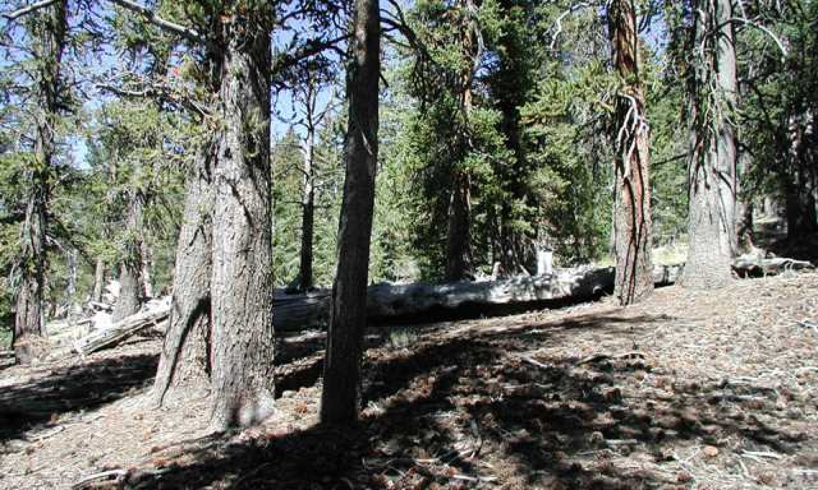
Figure 6. P. Novak-Echenique, 8/2007, NV708, MU5250; Piar soil series
The plant community is dominated by Great Basin bristlecone pine (Pinus longaeva) and limber pine (Pinus flexilis). Ross' sedge and bluegrasses are the principal understory grasses. Gooseberry, whitestem goldenweed and common juniper (Juniperus communis var. depressa) are the principal understory shrubs. An overstory canopy cover of 20 to 35 percent is assumed to be representative of tree dominance on this site in the pristine environment. The overstory canopy is about 80 to 95 percent bristlecone pine, 5 to 20 percent limber pine, and 10 percent, or less, other conifers such as white fir, Douglas fir, and Engelmann's spruce.
Forest overstory.OLD GROWTH: In the absence of wildfire or other naturally occurring disturbances, the bristlecone trees on this site can become very old. This stage is dominated by ancient bristlecone pine trees and standing snags of dead bristlecone trees.
Forest understory. Understory vegetative composition is about 10 percent grasses, 10 percent forbs and 80 percent shrubs and young trees when the average overstory canopy is medium (20 to 35 percent). Average understory production ranges from 100 to 300 pounds per acre with a medium canopy cover. Understory production includes the total annual production of all species within 4½ feet of the ground surface.
Figure 7. Annual production by plant type (representative values) or group (midpoint values)
Table 5. Annual production by plant type
Plant type Low
(lb/acre)Representative value
(lb/acre)High
(lb/acre)Shrub/Vine 70 140 210 Forb 10 20 30 Grass/Grasslike 10 20 30 Tree 10 20 30 Total 100 200 300 Community 1.2
Community phaseBristlecone pine trees may show some fire damage but will most likely survive a low intensity fire. Limber pine may be reduced but remain a major component of the overstory. Juniper is killed by fire and may take many years to reestablish. Sprouting shrubs such as currant and creeping barberry may be sprouting or increasing in the understory. Sedges and perennial bunchgrasses may be reduced the first season after fire but will likely increase in cover and density due to the reduced competition from shrubs and trees.
Forest overstory.OLD GROWTH: In the absence of wildfire or other naturally occurring disturbances, the bristlecone trees on this site can become very old. This stage is dominated by ancient bristlecone pine trees and standing snags of dead bristlecone trees.
Forest understory. Understory vegetative composition is about 10 percent grasses, 10 percent forbs and 80 percent shrubs and young trees when the average overstory canopy is medium (20 to 35 percent). Average understory production ranges from 100 to 300 pounds per acre with a medium canopy cover. Understory production includes the total annual production of all species within 4½ feet of the ground surface.
Pathway a
Community 1.1 to 1.2A low severity, lightning strike would reduce a few trees and the shrubs in the understory and allow the sedges and perennial bunchgrasses to increase.
Pathway a
Community 1.2 to 1.1Time without disturbance such as fire, drought or disease will allow for the trees and shrubs to increase in height and density.
Additional community tables
Table 6. Community 1.1 plant community composition
Group Common name Symbol Scientific name Annual production () Foliar cover (%) Grass/Grasslike1 Primary Perennial Grasses 18–58 Ross' sedge CARO5 Carex rossii 10–18 – Cusick's bluegrass POCUE2 Poa cusickii ssp. epilis 2–10 – muttongrass POFE Poa fendleriana 2–10 – Wheeler's bluegrass POWH2 Poa wheeleri 2–10 – 2 Secondary Perennial Grasses 1–2 Letterman's needlegrass ACLE9 Achnatherum lettermanii 0–1 – bluebunch wheatgrass PSSPS Pseudoroegneria spicata ssp. spicata 0–1 – Forb3 Perennial Forbs 1–20 Shrub/Vine4 Primary Shrubs 92–206 currant RIBES Ribes 50–100 – whitestem goldenbush ERDI14 Ericameria discoidea 20–48 – common juniper JUCO6 Juniperus communis 20–48 – creeping barberry MARE11 Mahonia repens 2–10 – Tree5 Trees 20–36 limber pine PIFL2 Pinus flexilis 10–18 – Great Basin bristlecone pine PILO Pinus longaeva 10–18 – Table 7. Community 1.1 forest overstory composition
Common name Symbol Scientific name Nativity Height ft Canopy cover (%) Diameter in Basal area (square ft/acre) TreeGreat Basin bristlecone pine PILO Pinus longaeva Native – 80-95 – 0 limber pine PIFL2 Pinus flexilis Native – 5-20 – 0 white fir ABCO Abies concolor Native – 0-4 – 0 limber pine PIFL2 Pinus flexilis Native – 0-3 – 0 Rocky Mountain Douglas-fir PSMEG Pseudotsuga menziesii var. glauca Native – 0-3 – 0 Table 8. Community 1.2 plant community composition
Group Common name Symbol Scientific name Annual production () Foliar cover (%) Interpretations
Animal community
Livestock Interpretations:
This site is typically not well suited to cattle or sheep grazing although grazing animals may use this site during the hot summer months. Herbaceous forage production is quite low and the site is not easily accessed because of steep slopes and lack of adequate water.
Stocking rates vary with such factors as kind and class of grazing animal, season of use and fluctuations in climate. Actual use records for individual sites, and a determination of the degree to which the sites have been grazed offer the most reliable basis for developing initial stocking rates.
The forage value rating is not an ecological evaluation of the understory as is the range condition rating for rangeland. The forage value rating is a utilitarian rating of the existing understory plants for use by specific kinds of grazing animals.
Wildlife Interpretations:
Great Basin bristlecone pines and a wide array of other plants, provide shelter and forage for numerous wildlife (Fryer 2004). Bristlecone pine acts as a major source of cover for animals in high-elevation ecosystems (Logan and Powell 2001). Ground squirrels (Otospermophilus beecheyi) that occur in subalpine habitat will use Great Basin bristlecone pines for shelter (Lanner 1984, Fryer 2004). Several other mammals, although do not actively use the tree for food or shelter, inhabit the same ecosystems (subalpine, montane, timberline and limberpine) in which Great Basin bristlecone pines occur in Nevada. Yellow bellied marmot (Marmota flaviventris) found in meadows, valleys, and foothills, where forests and meadows form a mosaic will also inhabit subalpine communities above 6500 feet (Great Basin National Park, Listing Sensitive and Extirpated Species 2006, Linzey and Hammerson 2008). The water shrew (Sorex palustris) although restricted to riparian environments occurs in montane communities where Great Basin bristlecone pines are known to grow (Great Basin National park, Listing Sensitive and Extirpated Species 2006). Inyo shrew (Sorex tennellus) is confirmed to occur in subalpine communities at 9900 feet. The ringtail (Bassaricus atutus), ermine (Mustela ermine), long-tailed weasel (Mustela frenata), and striped skunk (Mephitis mephitis) all have a wide ranging habitat including high-elevation, forested subalpine uplands and are documented as occurring above 9,000 feet (Gold berg 2003, Great Basin National Park, Listing Sensitive and Extirpated Species 2006, Zevit 2012, Kiiskila 2014).
Several bat species occur within Great Basin bristlecone pine habitat, adding to the community’s diversity. The fringed myotis (Myotis thysanodes), long-eared myotis (Myotis evotis), long-legged myotis (Myotis volans), silver-haired bat (Lasionycteris noctivagans), Townsend’s big-eared bat (Corynorhinus townsendii), all are documented as occurring in coniferous, subalpine forests above 9000 feet (Keinath 2003, Arroyo-Calbrales and Alvares-Castneda 2008, Warner and Czaplewski 1984, Armstrong 2007, Sullivan 2009, Great Basin National Park, Listing Sensitive and Extirpated Species 2006).
Many species of birds also use the Great Basin bristlecone pine habitat for shelter and food. Censuses determined the broad-tailed hummingbird (Selasphorus platycereus), northern flicker (Colaptes auratus), dusky flycatcher (Empidonax oberholseri), mountain chickadee (Parus gambeli), White-breasted nuthatch (Sitta carolinensis), rock wren (Salpinctes obsoletus), American robin (Turdus migratorius), hermit thrush (Catharus guttatus), mountain bluebird (Sialia currucoides), Townsend’s solitaire (Myadestes townsendi), yellow-rumped warbler (Dendroica coronata), Cassin’s finch (Carpodacus cassinii), pine siskin (Carduelis pinus) and dark-eyed junco (Junco hyemalis) use the Great Basin bristlecone pine for nesting. (Medin, 1984, Fryer 2004). The Clark’s nutcracker (Nucifraga columbiana) is believed to help with seedling establishment and dispersal (Lanner 1984). The small winged seeds of Great Basin bristlecone pine are not favored by the Clark’s nutcracker, but when limber pines and singleleaf pinyons do not bear seeds, the Clark’s nutcracker will forage on the Great Basin bristlecone (Lanner 1984). The seeds provide food for the Clark’s nutcracker; they remove the seeds of pines from their cones, eat some, and store others in shallow subsurface caches (Lanner 1988). In a study by Lanner (1988), it was indicated that Great Basin bristlecone pine regeneration was dependent on these birds in harsh sites.
Habitat distribution of reptiles and amphibians is not as widely studied as other animals and few reptiles and amphibians are found at such high elevations where Great Basin bristlecone pines occur. However; the Sonoran mountain kingsnake (Lampropeltis pyromelana), a highly secretive reptile, which prefers ponderosa pine habitat has been captured at elevations upwards of 9000 feet; suggesting that this snake could occur in habitats shared with Great Basin bristlecone pine (Brennan 2008, Great Basin National Park, Listing Sensitive and Extirpated Species 2006). Also, the western toad (Anaxyrus boreos) has a very wide ranging habitat throughout Nevada, and, if it is near vernal pools the western toad’s habitat could also overlap with Great Basin bristlecone pine habitat. In fact, it has been trapped at elevations of 9000 feet (Lindsdale 1940). The distribution of most of herpetafuana present in these high-elevation woodlands is poorly understood and more research and management are needed.
Great Basin bristlecone pines are host for two species of bark beetles (Scolytus dentatus, and Carphoborus declivis) that have only been collected in the White Mountains (Bright 1964).
Hydrological functions
Permeability is moderate. Runoff is high. Hydrologic soil group is B.
Recreational uses
This site has high aesthetic value and provides a variety of recreational opportunities such as hiking, camping and deer and upland game bird hunting. Steep slopes and the fragile soil-vegetation complex, however, inhibit many other forms of recreation such as the use of off-road vehicles.
Wood products
Great Basin bristlecone pine is of unique biological and dendrological interest because of the great age attained by some individuals. Trees over 4900 years old have been found on Wheeler Peak in the Snake Range of Nevada. Bristlecone pine has been used locally for mine timbers. The wood of bristlecone pine pine is denser and harder than that of most conifers.
Limber pine has been used for mine props, railroad ties, and fuelwood. As the limbs of limber pine cling to the trunk for many years, the lumber cut from this tree is characteristically knotty. This tree has little commercial value at present. As demand for lumber increases, however, it may be used for knotty pine lumber and paneling.
PRODUCTIVE CAPACITY
Although site productivity and site index information is not available, this is a relatively poor quality site for tree production.
Productivity class: 1.01
CMAI**: 14 to 22 cu ft/ac/yr1;
1.0 to 1.5 cu m/ha/yr1
**CMAI: is the culmination of mean annual increment highest average growth rate of the stand in the units specified.
Basal Area: 250 to 350 sq ft/ac1
100 to 200 trees/acre1
1Based on two woodland transects
MANAGEMENT GUIDES AND INTERPRETATIONS
1. LIMITATIONS AND CONSIDERATIONS
a. Potential for sheet and rill erosion is severe.
b. Severe equipment limitations due to steep slopes.
2. ESSENTIAL REQUIREMENTS
a. Adequately protect from uncontrolled burning.
b. Protect soils from accelerated erosion.
3. SILVICULTURAL PRACTICES
Silvicultural treatments are not reasonably applied on this site due to poor site quality and severe limitations for equipment and tree harvest.Other products
Currants (Ribes spp.) can be used for making jam, jelly, or pie. Some western Indian tribes used currants for making pemmican.
Other information
Management Interpretations:
Climate change may be hindering regeneration of Great Basin bristlecone pines on sites in the interior Great Basin; however these changes are difficult to predict. In many places, populations shift occur upslope of existing populations, indicating a potential to accommodate a warming climate. Concern grows over the susceptibility of Great Basin bristlecone pine to White Pine Blister Rust. Great Basin bristlecone pine is one of the five-needle pines susceptible to the exotic pathogen and populations in the White and Inyo Mountains occur close to moderately high infection centers in the Sierra Nevada. However, the Great Basin bristlecone pine has shown high resistance to blister rust in laboratory tests, in part due to wax-occluded stomata. Great Basin bristlecone pine is susceptible to mountain pine beetle (Dendroctonus ponderosae), dwarf mistletoe, wood-rot basidiomycetes and wood decay fungi. The dry high-elevation sites of most Great Basin Bristlecone Pine currently serve to slow fungal growth and wood decay (Stritch et al. 2011).
Supporting information
Type locality
Location 1: White Pine County, NV Township/Range/Section T12N R68E S14 Latitude 38° 54′ 12″ Longitude 114° 18′ 33″ General legal description Approximately 1¼ miles south of Mount Washington, Snake Range, White Pine County, Nevada. Other references
Armour, Charles D.; Bunting, Stephen C.; Neuenschwander, Leon F. 1984. Fire intensity effects on the understory in ponderosa pine forests. Journal of Range Management. 37(1): 44-48.
Armstrong, D.M. 2007. Rocky Mountain Mammals: A Handbook of Mammals of Rocky Mountain National Park and Vicinity, Third Edition. University Press of Colorado
Arroyo-Cabrales, J. & Álvarez-Castañeda, S.T. 2008. Myotis evotis. The IUCN Red List of Threatened Species. Version 2014.3. Available at: www.iucnredlist.org. Downloaded on 23 January 2015.
Beasley, R.S. Bristlecone pine (Pinus longaeva) in relationship to environmental factors and soil properties in east-central Nevada. PH.D. Thesis, University of Arizona, Tucson, 151 pp.
Beasley, R.S. and J.O. Klemmedson. Water stress in bristlecone pine and associated plants. Soil Science and Plant Analysis 7: 609-618.
Benedict, W. V. and T. H. Harris. 1931. Experimental Ribes eradication on the Stanislaus National Forest. Journal of Forestry 29:709-720.
Brennan, T. 2008. Online field guide to amphibians and reptiles of Arizona. Available at: http://www.reptilesofaz.org/index.html. Accessed 23 January 2015.
Bright, Donald E., Jr. 1964. Descriptions of three new species and new distribution records of California bark beetles. The Pan-Pacific Entomologist. 40(3): 165-170.
Brown, James K.; DeByle, Norbert V. 1989. Effects of prescribed fire on biomass and plant succession in western aspen. Res. Pap. INT-412. Ogden, UT: U.S. Department of Agriculture, Forest Service, Intermountain Research Station. 16 p.
Caudle, D., J. DiBenedetto, M. Karl, H. Sanchez, and C. Talbot. 2013. Interagency Ecological Site Handbook for Rangelands. Available at: http://jornada.nmsu.edu/sites/ jornada.nmsu.edu/files/InteragencyEcolSiteHandbook.pdf. Accessed 4 October 2013.
Chambers, J., B. Bradley, C. Brown, C. D’Antonio, M. Germino, J. Grace, S. Hardegree, R. Miller, and D. Pyke. 2013. Resilience to stress and disturbance, and resistance to Bromus tectorum L. invasion in cold desert shrublands of western North America. Ecosystems 17:1-16.
Charlet, D. A. 1996. Atlas of Nevada Conifers. University of Nevada Press, Reno, NV, USA.
Coop, J. D. and A. W. Schoettle. 2009. Regeneration of Rocky Mountain bristlecone pine (Pinus aristata) and limber pine (Pinus flexilis) three decades after stand-replacing fires. Forest Ecology and Management 257:893-903.
Dayton, W. 1937. Range Plant Handbook. USDA, Forest Service. Bull.
Donnegan, J. A. and A. J. Rebertus. 1999. Rates and mechanisms of subalpine forest succession along an environmental gradient. Ecology 80:1370-1384.
Eyre, F.H., editor. 1980. Forest Cover Types of the United States and Canada. Society of American Foresters, Washington, D.C.
Fire Effects Information System (Online; http://www.fs.fed.us/database/feis/plants/).
Fryer, Janet L. 2004. Pinus longaeva. In: Fire Effects Information System, [Online]. U.S. Department of Agriculture, Forest Service, Rocky Mountain Research Station, Fire Sciences Laboratory (Producer). Available at: http://www.fs.fed.us/database/feis/. Accessed: 22 January 2015
Goldberg, J. 2003. Bassariscus astutus: Available at: ringtail. http://animaldiversity.org/ accounts/Bassariscus_astutus/. Accessed 23 January 2015.
Hill, R. R. 1946. Palatability ratings of Black Hills plants for white-tailed deer. The Journal of Wildlife Management 10:47-54.
Houghton, J.G., C.M. Sakamoto, and R.O. Gifford. 1975. Nevada’s Weather and Climate, Special Publication 2. Nevada Bureau of Mines and Geology, Mackay School of Mines, University of Nevada, Reno, NV.
Keinath, D.A. 2003. Species assessment for fringed Myotis (Myotis thysanodes) in Wyoming. United State Department of the Interior, Bureau of Land Management. Cheyenne, WY.
Kiiskila, J. 2014. Mephitis mephitis, striped skunk. http://animaldiversity.org/ accounts/Mephitis mephitis/. Accessed 23 January 2015
Lanner, R. M. 1988. Dependence of Great Basin Bristlecone Pine on Clark's Nutcracker for Regeneration at High Elevations. Arctic and Alpine Research 20:358-362.
Lanner, R.M. 2007. The Bristlecone Book – A Natural History of the World’s Oldest Trees. Mountain Press Publishing Company, Missoula, MT. 118pp.
Lanner, R. M. 2002. Conifers of California. Cachuma Press, Los Olivos, CA, USA.
Lanner, R. M. and S. B. Vander Wall. 1980. Dispersal of Limber Pine Seed by Clark's Nutcracker. Journal of Forestry 78:637-639.
Lindsdale, J.M. 1940. Amphibians and Reptiles in Nevada. Proceedings of the American Academy of Arts and Sciences. 73:197-257
Linzey, A.V. & Hammerson, G. 2008. Marmota flaviventris. The IUCN Red List of Threatened Species. Version 2014.3. www.iucnredlist.org. Downloaded on 23 January 2015.
Logan, Jesse A.; Powell, James A. 2001. Ghost forests, global warming, and the mountain pine beetle (Coleoptera: Scolytidae). American Entomologist. 47(3): 160-173
Medin, D.E. 1984. Breeding birds of an ancient bristlecone pine stand in east-central Nevada. Great Basin Naturalist. 44:272-276
National Oceanic and Atmospheric Administration. 2004. The North American Monsoon. Reports to the Nation. National Weather Service, Climate Prediction Center. Available online: http://www.weather.gov/
Rebertus, A. J., B. R. Burns, and T. T. Veblen. 1991. Stand dynamics of Pinus flexilis-dominated subalpine forests in the Colorado Front Range. Journal of Vegetation Science 2:445-458.
Schoettle, A.W. and R.A. Sniezko. Proactive intervention to sustain high-elevation pine ecosystems threatened by white pine blister rust. Journal of Forest Research 12: 327-336.
Sherriff, R. L., T. T. Veblen, and J. S. Sibold. 2001. Fire history in high elevation subalpine forests in the Colorado Front Range. Ecoscience 8:369-380.
Stringham, T.K., P. Novak-Echenique, P. Blackburn, C. Coombs, D. Snyder and A. Wartgow. 2015. Final Report for USDA Ecological Site Description State-and-Transition Models, Major Land Resource Area 28A and 28B Nevada. University of Nevada Reno, Nevada Agricultural Experiment Station Research Report 2015-01. p. 1524.
Stritch, L., Mahalovich, M. & Nelson, K.G. 2011. Pinus longaeva. The IUCN Red List of Threatened Species. Version 2014.3. Available at: www.iucnredlist.org. Downloaded on 22 January 2015.
Sullivan, J. 2009. Corynorhinus townsendii: townsend's big-eared bat.
Available at: http://animaldiversity. org/accounts/Corynorhinus_townsendii/ Accessed 23 January 2015.
USDA-NRCS Plants Database (Online; http://www.plants.usda.gov).
Warner, R.M. and N.J. Czaplewski. 1984. Mammalian species No. 224: Myotis volans. The American Society of Mammalogists. 224:1-4
Zevit, P. 2012. BC’s Coast Region: Species & Ecosystems of Conservation Concern
Long-tailed Weasel altifrontalis subspecies (Mustela frenata altifrontalis). Available at: http://ibis.geog.ubc.ca/biodiversity/ factsheets/pdf/Mustela_frenata_altifrontalis.pdf Accessed 23 January 2015.
Contributors
DBP/GKB
T Stringham
P NovakEcheniqueRangeland health reference sheet
Interpreting Indicators of Rangeland Health is a qualitative assessment protocol used to determine ecosystem condition based on benchmark characteristics described in the Reference Sheet. A suite of 17 (or more) indicators are typically considered in an assessment. The ecological site(s) representative of an assessment location must be known prior to applying the protocol and must be verified based on soils and climate. Current plant community cannot be used to identify the ecological site.
Author(s)/participant(s) Contact for lead author Date Approved by Approval date Composition (Indicators 10 and 12) based on Annual Production Indicators
-
Number and extent of rills:
-
Presence of water flow patterns:
-
Number and height of erosional pedestals or terracettes:
-
Bare ground from Ecological Site Description or other studies (rock, litter, lichen, moss, plant canopy are not bare ground):
-
Number of gullies and erosion associated with gullies:
-
Extent of wind scoured, blowouts and/or depositional areas:
-
Amount of litter movement (describe size and distance expected to travel):
-
Soil surface (top few mm) resistance to erosion (stability values are averages - most sites will show a range of values):
-
Soil surface structure and SOM content (include type of structure and A-horizon color and thickness):
-
Effect of community phase composition (relative proportion of different functional groups) and spatial distribution on infiltration and runoff:
-
Presence and thickness of compaction layer (usually none; describe soil profile features which may be mistaken for compaction on this site):
-
Functional/Structural Groups (list in order of descending dominance by above-ground annual-production or live foliar cover using symbols: >>, >, = to indicate much greater than, greater than, and equal to):
Dominant:
Sub-dominant:
Other:
Additional:
-
Amount of plant mortality and decadence (include which functional groups are expected to show mortality or decadence):
-
Average percent litter cover (%) and depth ( in):
-
Expected annual annual-production (this is TOTAL above-ground annual-production, not just forage annual-production):
-
Potential invasive (including noxious) species (native and non-native). List species which BOTH characterize degraded states and have the potential to become a dominant or co-dominant species on the ecological site if their future establishment and growth is not actively controlled by management interventions. Species that become dominant for only one to several years (e.g., short-term response to drought or wildfire) are not invasive plants. Note that unlike other indicators, we are describing what is NOT expected in the reference state for the ecological site:
-
Perennial plant reproductive capability:
Print Options
Sections
Font
AAAAOther
PrintThe Ecosystem Dynamics Interpretive Tool is an information system framework developed by the USDA-ARS Jornada Experimental Range, USDA Natural Resources Conservation Service, and New Mexico State University.
Accessibility statement


