
Natural Resources
Conservation Service
Ecological site R025XY013NV
CHURNING CLAY 8-12 P.Z.
Last updated: 4/24/2024
Accessed: 09/14/2026
-
Search


Major Land Resource Area or ecological site by name and/or ID.
PreviousSectionsNextGeneral information
Provisional. A provisional ecological site description has undergone quality control and quality assurance review. It contains a working state and transition model and enough information to identify the ecological site.
MLRA notes
Major Land Resource Area (MLRA): 025X–Owyhee High Plateau
MLRA Notes 25—Owyhee High Plateau
This area is in Nevada (56 percent), Idaho (30 percent), Oregon (12 percent), and Utah (2 percent). It makes up about 27,443 square miles. MLRA 25 is characteristically cooler and wetter than the neighboring MLRAs of the Great Basin. The western boundary is marked by a gradual transition to the lower and warmer basins of MLRA 24. The boundary to the south-southeast, with MLRA 28B, is marked by gradual changes in geology marked by an increased dominance of singleleaf pinyon and Utah juniper and a reduced presence of Idaho fescue. The boundary to the north, with MLRA 11, is a rapid transition from the lava plateau topography to the lower elevation Snake River Plain.
Physiography:
All of this area lies within the Intermontane Plateaus. The southern half is in the Great Basin section of the Basin and Range province. This part of the MLRA is characterized by isolated, uplifted fault-block mountain ranges separated by narrow, aggraded desert plains. This geologically older terrain has been dissected by numerous streams draining to the Humboldt River.
The northern half of the area lies within the Columbia Plateaus province. This part of the MLRA forms the southern boundary of the extensive Columbia Plateau basalt flows. Most of the northern half is in the Payette section, but the northeast corner is in the Snake River Plain section. Deep, narrow canyons draining into the Snake River have been incised into this broad basalt plain. Elevation ranges from 3,000 to 7,550 feet on rolling plateaus and in gently sloping basins. It is more than 9,840 feet on some steep mountains. The Humboldt River crosses the southern half of this area
Geology:
The dominant rock types in this MLRA are volcanic. They include andesite, basalt, tuff, and rhyolite. In the north and west parts of the area, Cretaceous granitic rocks are exposed among Miocene volcanic rocks in mountains. A Mesozoic igneous and metamorphic rock complex dominates the south and east parts of the area. Upper and Lower Paleozoic calcareous sediments, including oceanic deposits, are exposed with limited extent in the mountains. Alluvial fan and basin fill sediments occur in the valleys.
Climate:
The average annual precipitation in most of this area is typically 11 to 22 inches. It increases to as much as 49 inches at the higher elevations. Rainfall occurs in spring and sporadically in summer. Precipitation occurs mainly as snow in winter. The precipitation is distributed fairly evenly throughout fall, winter, and spring. The amount of precipitation is lowest from midsummer to early autumn. The average annual temperature is 33 to 51 degrees F. The freeze-free period averages 130 days and ranges from 65 to 190 days, decreasing in length with elevation. It is typically less than 70 days in the mountains.
Water:
The supply of water from precipitation and streamflow is small and unreliable, except along the Owyhee, Bruneau, and Humboldt Rivers. Streamflow depends largely on accumulated snow in the mountains. Surface water from mountain runoff is generally of excellent quality and suitable for all uses. The basin fill sediments in the narrow alluvial valleys between the mountain ranges provide some ground water for irrigation. The alluvial deposits along the large streams have the most ground water. Based on measurements of water quality in similar deposits in adjacent areas, the basin fill deposits probably contain moderately hard water. The water is suitable for almost all uses. The carbonate rocks in this area are considered aquifers, but they are little used. Springs are common along the edges of the limestone outcrops.
Soils:
The dominant soil orders in this MLRA are Aridisols and Mollisols. The soils in the area dominantly have a mesic or frigid temperature regime and an aridic, aridic bordering on xeric, or xeric moisture regime. Soils with aquic moisture regimes are limited to drainage or spring areas, where moisture originates or runs on and through. These soils are of a very limited extent throughout the MLRA. They generally are well drained, clayey or loamy, and shallow or moderately deep. Most of the soils formed in mixed parent material. Volcanic ash and loess mantle the landscape. Surface soil textures are loam and silt loam with ashy texture modifiers in some areas. Argillic horizons occur on the more stable landforms. They are exposed nearer the soil surface on convex landforms, where ash and loess deposits are more likely to erode. Soils that formed in carbonatic parent material in areas that receive less than 12 inches of precipitation are characterized by calcic horizons throughout the profile, while soils in areas that receive more than 12 inches of precipitation do not have calcic horizons in the upper part of the profile. Soils that formed on stable landforms at the lower elevations are dominated by ochric horizons. Soils that formed at the middle and upper elevations are characterized by mollic epipedons. Soils in drainage areas at all elevations that receive moisture running on or through them are characterized by thicker mollic epipedons.
Biological Resources:
This MLRA supports shrub-grass vegetation. Lower elevations are characterized by Wyoming big sagebrush associated with bluebunch wheatgrass, western wheatgrass, and Thurber’s needlegrass. Other important plants include bluegrass, squirreltail, penstemon, phlox, milkvetch, lupine, Indian paintbrush, aster, and rabbitbrush. Black sagebrush occurs but is less extensive. Singleleaf pinyon and Utah juniper occur in limited areas. With increasing elevation and precipitation, vast areas characterized by mountain big sagebrush or low sagebrush/early sagebrush in association with Idaho fescue, bluebunch wheatgrass, needlegrasses, and bluegrass become common. Snowberry, curl-leaf mountain mahogany, ceanothus, and juniper also occur. Mountains at the highest elevations support whitebark pine, Douglas-fir, limber pine, Engelmann spruce, subalpine fir, aspen, and curl-leaf mountain mahogany.
Major wildlife species include mule deer, bighorn sheep, pronghorn, mountain lion, coyote, bobcat, badger, river otter, mink, weasel, golden eagle, red-tailed hawk, ferruginous hawk, Swainson’s hawk, northern harrier, prairie falcon, kestrel, great horned owl, short-eared owl, long-eared owl, burrowing owl, pheasant, sage grouse, chukar, gray partridge, and California quail. Reptiles and amphibians include western racer, gopher snake, western rattlesnake, side-blotched lizard, western toad, and spotted frog. Fish species include bull, red band, and rainbow trout.Ecological site concept
This site is on hills and rock pediments. Slopes range from 4 to 15 percent. Elevations range from 5,000 to 6,500 feet (1,524 to 1,981 meters).
The soils of this site are moderately deep and well drained. They have a paralithic contact at approximately 20 to 40 inches (51 to 101cm). The surface soils are fine textured and less than 4 inches (10cm) thick to a fine textured subsoil having moderate or strong structure when dry that becomes mostly massive when moist.
This state includes the plant communities that were best adapted to the unique combination of biotic, abiotic, and climatic factors associated with the ecological site, prior to European settlement. The reference state is the interpretative state for this site. The representative plant community is dominated by basin wildrye although basin big sagebrush is often prevalent enough to dominate the aspect. Potential vegetative composition is about 65 percent grasses, 10 percent forbs and 25 percent shrubs. Approximate ground cover basal and crown is 30 to 45 percent.Associated sites
R025XY014NV LOAMY 10-12 P.Z.
R025XY019NV LOAMY 8-10 P.Z.
Similar sites
R025XY014NV LOAMY 10-12 P.Z.
More productive site; LECI4 not dominant plant
R025XY003NV LOAMY BOTTOM 8-14 P.Z.
More productive stie
R025XY019NV LOAMY 8-10 P.Z.
Less productive site; LECI4 not dominant plant
R024XY007NV SALINE BOTTOM
PSSPS and ACTH7 rarely occur; DISP important grass
R025XY070NV LOAMY FAN 8-10 P.Z.
LECI4-ELMA7 codominant grasses; PSSPS & ACTH7 minor species
Table 1. Dominant plant species
Tree Not specified
Shrub (1) Artemisia tridentata
Herbaceous (1) Leymus cinereus
(2) Pseudoroegneria spicataPhysiographic features
This site is on hills and rock pediments. Slopes range from 4 to 15 percent. Elevations are 5,000 to 6,500 feet (1,524 to 1,981 meters).
Table 2. Representative physiographic features
Landforms (1) Hills > Hill
(2) Pediment
Runoff class High to very high Flooding frequency None Ponding frequency None Elevation 5000 – 6500 ft Slope 4 – 15 % Water table depth 0 – 84 in Aspect Aspect is not a significant factor Table 3. Representative physiographic features (actual ranges)
Runoff class Not specified Flooding frequency Not specified Ponding frequency Not specified Elevation 0 ft Slope 2 – 15 % Water table depth 0 in Climatic features
The climate associated with this site is semiarid, characterized by cold, moist winters and warm, dry summers.
The average annual precipitation ranges from 8 to 10 inches (20 to 25cm). Mean annual air temperature is about 45 to 50 degrees F.
Mean annual precipitation across the range in which this ES occurs is 10 inches (25cm).
Monthly mean precipitation in inches: January 1.00 (2.5cm); February 0.72 (1.8cm); March 0.87 (2.2cm); April 0.79 (2.0cm); May 1.32 (3.3cm); June 1.06 (2.6cm); July 0.47 (1.2cm); August 0.53 (1.3cm); September 0.59 (1.5cm); October 0.70 (1.7cm); November 0.84 (2.1cm); December 0.96 (2.4cm).
Frost free days (less than 32): 90
Freeze free days (less than 28): 120
*The above data is averaged from the Elko AP and Contact WRCC climate stations, NASIS and, the Western Regional Climate Center.Table 4 Representative climatic features
Frost-free period (characteristic range) 80-100 days Freeze-free period (characteristic range) 90-130 days Precipitation total (characteristic range) 10-10 in Frost-free period (actual range) 70-100 days Freeze-free period (actual range) 80-130 days Precipitation total (actual range) 10-10 in Frost-free period (average) 90 days Freeze-free period (average) 120 days Precipitation total (average) 10 in Characteristic rangeActual rangeBarLineFigure 1. Monthly precipitation range
Characteristic rangeActual rangeBarLineFigure 2. Monthly minimum temperature range
Characteristic rangeActual rangeBarLineFigure 3. Monthly maximum temperature range
BarLineFigure 4. Monthly average minimum and maximum temperature
Figure 5. Annual precipitation pattern
Figure 6 Annual average temperature pattern
Climate stations used
-
(1) ELKO RGNL AP [USW00024121], Elko, NV
-
(2) CONTACT [USC00261905], Jackpot, NV
">Influencing water features
No influencing water features are associated with this site.
Soil features
The soils associated with this site are moderately deep and well drained. They have a paralithic contact at approximately 20 to 40 inches (50 to 101cm). Soil textures are clays throughout. The available water capacity is moderate. The soils are moist in winter and spring and dry from June through October. These soils swell when wet and shrink and crack upon drying. During the dry season, deep, wide cracks open at the soil surface. When moist these soils swell and are poorly aerated. The high shrink-swell of these soils causes many small roots to be broken by soil movement - especially of fibrous-rooted grasses and forbs. Pedestalling of grass plants is common during the winter due to frost heave. Infiltration of water is restricted once these soils are wet and the site is subject to considerable water loss due to rapid runoff. The soil temperature regime is mesic and the soil moisture regime is aridic bordering on xeric. Potential for sheet and rill erosion is slight to moderate depending upon slope.
The soil series associated with this site is Pattani.
A representative soil series is Pattani, classified as a fine, smectitic, Leptic Haploxerert. This soil is moderately deep, well drained and formed in residuum derived from tuff. Reaction is neutral to strongly alkaline. Diagnostic horizons include an ochric epipedon that occurs from the soil surface to 7 inches (18cm). Clay content ranges from 35 to 55 percent which results in cracks that close when the soil become moist in late October and opens when the soil becomes dry in early June.Table 5. Representative soil features
Parent material (1) Residuum – welded tuff
Surface texture (1) Clay
Family particle size (1) Fine
Drainage class Well drained Permeability class Very slow Depth to restrictive layer 20 – 40 in Soil depth 20 – 40 in Surface fragment cover <=3" Not specified Surface fragment cover >3" Not specified Available water capacity
(0-40in)3.3 – 6.2 in Calcium carbonate equivalent
(0-40in)0 – 5 % Electrical conductivity
(0-40in)Not specified Sodium adsorption ratio
(0-40in)0 – 5 Soil reaction (1:1 water)
(0-40in)7 – 8.6 Subsurface fragment volume <=3"
(Depth not specified)5 – 11 % Subsurface fragment volume >3"
(Depth not specified)Not specified Ecological dynamics
An ecological site is the product of all the environmental factors responsible for its development and it has a set of key characteristics that influence a site’s resilience to disturbance and resistance to invasives. Key characteristics include 1) climate (precipitation and temperature), 2) topography (aspect, slope, elevation, and landform), 3) hydrology (infiltration and runoff), 4) soils (depth, texture, structure, and organic matter), 5) plant communities (functional groups and productivity), and 6) natural disturbance regime (fire, herbivory, etc.) (Caudle 2013). Biotic factors that that influence resilience include site productivity, species composition and structure, and population regulation and regeneration (Chambers et al. 2013).
This ecological site is dominated by deep-rooted cool season perennial bunchgrasses and long-lived shrubs (50+ years) with high root to shoot ratios. The dominant shrubs usually root to the full depth of the winter-spring soil moisture recharge, which ranges from 1.0 to over 3.0 meters (Dobrowolski et al. 1990). Root length of mature sagebrush plants was measured to a depth of 2 meters in alluvial soils in Utah (Richards and Caldwell 1987). These shrubs have a flexible generalized root system with development of both deep taproots and laterals near the surface (Comstock and Ehleringer 1992).
Periodic drought regularly influences sagebrush ecosystems. Drought duration and severity has increased throughout the 20th century in much of the Intermountain West. Major shifts away from historical precipitation patterns have the greatest potential to alter ecosystem function and productivity. Species composition and productivity can be altered by the timing of precipitation and water availability with the soil profile (Bates et al. 2006).
Disturbance response in this site is most likely driven by soil dynamics. The soils on this site swell when wet and shrink and crack upon drying. The high shrink-swell of these soils causes many small roots to be broken by soil movement. Reestablishment of perennial species from seed may be slowed due to this phenomenon. Disturbance such as wildfire will likely produce an increase in the herbaceous community and a decrease in the big sagebrush. Overgrazing, especially during the growing season, will cause an increase in the shrub species as well as Sandberg bluegrass (Poa secunda), bottlebrush squirreltail (Elymus elemoides), western wheatgrass (Pascopyrum smithii), and thickspike wheatgrass (Elymus lanceolatus). In turn, other species such as basin wildrye and bluebunch wheatgrass will decline. Cheatgrass (Bromus tectorum) and Russian thistle (Salsola tragus) are likely to invade this site but will rarely become dominant in the plant community.
Basin wildrye is weakly rhizomatous and has been found to root to depths of up to 2 meters and to exhibit greater lateral root spread than many other grass species (Abbott et al. 1991, Reynolds and Fraley 1989). Basin wildrye is a large, cool-season perennial bunchgrass with an extensive deep coarse fibrous root system (Reynolds and Fraley 1989). Clumps may reach up to 6 feet in height (Ogle et al 2012). Basin wildrye does not tolerate long periods of inundation; rather, it prefers cycles of wet winters and dry summers and is most commonly found in deep soils with high water holding capacities or seasonally high water tables (Ogle et al 2012, Perryman and Skinner 2007).
Wyoming big sagebrush, the most drought tolerant of the big sagebrushes, is generally long-lived; therefore it is unnecessary for new individuals to recruit every year for perpetuation of the stand. Simultaneous low, continuous recruitment and infrequent large recruitment events are the foundation of population maintenance (Noy-Meir 1973). Survival of the seedlings is depended on adequate moisture conditions.
Western wheatgrass and thickspike wheatgrass are two grasses that are often found on this site. Their rhizomatous growth habit makes these grasses tolerant to grazing and more likely to survive fire. These grasses may become more dominant under heavy grazing conditions.
As ecological condition declines, big sagebrush and rubber rabbitbrush become dominant with increases of arrowleaf balsamroot, bottlebrush squirreltail and Sandberg’s bluegrass in the understory. Cheatgrass and Russian-thistle are species likely to invade this site.
The Churning Clay 8-12” ecological site has moderate to high resilience to disturbance and resistance to invasion. Resilience increases with elevation, aspect, higher precipitation, and higher nutrient availability. Two possible alternative stable states have been identified for this site.
Fire Ecology:
In many basin big sagebrush communities, changes in fire frequency occurs with fire suppression, livestock grazing and off highway vehicle (OHV) use. Few, if any, fire history studies have been conducted on basin big sagebrush; however, Sapsis and Kauffman (1991) suggest that fire return intervals in basin big sagebrush are intermediate between mountain big sagebrush (15 to 25 years) and Wyoming big sagebrush (50 to 100 years). Fire severity in big sagebrush communities is described as "variable" depending on weather, fuels, and topography. However, fire in basin big sagebrush communities are typically stand-replacing (Sapsis and Kauffman 1991). Basin big sagebrush does not sprout after fire; due to the time needed to produce seed, it is eliminated by frequent fires (Bunting et al. 1987). Basin big sagebrush reinvades a site primarily by off-site seed or seed from plants that survive in unburned patches. Approximately 90% of big sagebrush seed is dispersed within 30 feet (9 meters) of the parent shrub (Goodrich et al. 1985) with maximum seed dispersal at approximately 108 feet (33 meters) from the parent shrub (Shumar and Anderson 1986). Regeneration of basin big sagebrush after stand-replacing fires is therefore both difficult and dependent upon proximity of residual mature plants and favorable moisture conditions (Johnson and Payne 1968, Humphrey 1984). Sites higher in production will have experienced fire more frequently than less productive sites. Fire maintains the grass dominance of these ecosystems, therefore increases in the fire return interval favors the shrub component of the plant community, potentially facilitating a rise in bare ground and invasive weeds. Lack of fire combined with excessive herbivory converts these sites to big sagebrush- and rabbitbrush- dominated ones.
The effect of fire on bunchgrasses relates to culm density, culm-leaf morphology, and the size of the plant. The initial condition of bunchgrasses within the site along with seasonality and intensity of the fire all factor into the individual species response. For most forbs and grasses the growing points are located at or below the soil surface providing relative protection from disturbances which decrease above ground biomass, such as grazing or fire. Thus, fire mortality is more correlated to duration and intensity of heat which is related to culm density, culm-leaf morphology, size of plant and abundance of old growth (Young 1983, Wright 1971).
Basin wildrye is relatively resistant to fire, particularly dormant season fire, as plants sprout from surviving root crowns and rhizomes (Zschaechner 1985). Miller et al. 2013 reports fall and spring burning increased total shoot and reproductive shoot densities in the first year, although live basal areas were similar between burn and unburned plants. By year two, however, there was little difference between burned and control treatments. Additionally, natural great basin wildrye seed viability has been found to be low and seedlings lack vigor (Young and Evans 1981). Roundy (1985) found that although basin wildrye is adapted to seasonally dry saline soils, high and frequent spring precipitation is necessary to establish it from seed. This suggests that establishment of natural basin wildrye seedlings occurs only during years of unusually high precipitation and thus reestablishment of a stand that has been lost due to grazing may be episodic.
Bluebunch wheatgrass has coarse stems with little leafy material, therefore the aboveground biomass burns rapidly and little heat is transferred downward into the crowns (Young 1983). Bluebunch wheatgrass was described as fairly tolerant of burning, other than in May in eastern Oregon (Britton et al. 1990). Uresk et al. (1976) reported burning increased vegetative and reproductive vigor of bluebunch wheatgrass and is thus considered to experience slight damage to fire but is more susceptible in drought years (Young 1983). Most authors classify the plant as undamaged by fire (Kuntz 1982).
Thurber needlegrass is classified as moderately resistant, but depending on season of burn, phenology, and fire severity, this perennial bunchgrass is moderately to severely damaged by fire. Burning has been found to decrease the vegetation and reproductive vigor. Early season burning is more damaging to this needlegrass than late season burning.
Squirreltail is considered fire tolerant due to its small size, coarse stems, broad leaves and sparse leafy material (Wright 1971, Britton et al. 1990). Post-fire regeneration occurs from surviving root crowns and from on- and off-site seed sources. Bottlebrush squirreltail has the ability to produce large numbers of highly germinable seeds, with relatively rapid germination (Young and Evans 1977) when exposed to the correct environmental cues. Early spring growth and ability to grow at low temperatures contribute to the persistence of bottle brush squirreltail among cheatgrass dominated ranges (Hironaka and Tisdale 1972).
Sandberg bluegrass, a minor component of this ecological site, has been found to increase following fire, likely due to its low stature and productivity (Daubenmire 1975). Reduced bunchgrass vigor or density provides an opportunity for Sandberg bluegrass expansion and/or cheatgrass and other invasive species to occupy interspaces, leading to increased fire frequency and potentially an annual plant community. Sandberg bluegrass increases under grazing pressure (Tisdale and Hironaka 1981) and is capable of co-existing with cheatgrass.
Basin wildrye is top-killed by fire. Older basin wildrye plants with large proportions of dead material within the perennial crown can be expected to show higher mortality due to fire than younger plants having little debris. Basin wildrye is generally tolerant of fire but may be damaged by early season fire combined with dry soil conditions.
Depending on fire severity, rabbitbrush may increase after fire. Rubber rabbitbrush is top-killed by fire, but can resprout after fire and can also establish from seed (Young 1983). Yellow rabbitbrush is top-killed by fire, but sprouts vigorously after fire (Akinsoji 1988, Kuntz 1982).State and transition model
Custom diagramStandard diagram
Figure 7. T. Stringham 3/2015

Figure 8. Legend
More interactive model formats are also available. View Interactive Models
More interactive model formats are also available. View Interactive Models
Click on state and transition labels to scroll to the respective textEcosystem states
State 1 submodel, plant communities
State 2 submodel, plant communities
State 1
Reference StateThe Reference State 1.0 represents the natural range of variability under pristine conditions. The reference state has 3 general community phases; a shrub-grass dominant phase, a perennial grass dominant phase, and a shrub dominant phase. State dynamics are maintained by interactions between climatic patterns and disturbance regimes. Negative feedbacks enhance ecosystem resilience and contribute to the stability of the state. These include the presence of all structural and functional groups, low fine fuel loads, and retention of organic matter and nutrients. Plant community phase changes are primarily driven by fire, periodic long-term drought and/or insect or disease attack.
Community 1.1
Community PhaseThis state includes the plant communities that were best adapted to the unique combination of biotic, abiotic, and climatic factors associated with the ecological site, prior to European settlement. The reference state is the interpretative state for this site. The representative plant community is dominated by basin wildrye although basin big sagebrush is often prevalent enough to dominate the aspect. Potential vegetative composition is about 65% grasses, 10% forbs and 25% shrubs. Approximate ground cover (basal and crown is 30 to 45 percent. This plant community consists mostly of basin wildrye, Thurber’s needlegrass, and other perennial bunchgrasses. Sagebrush and a small component of rabbitbrush make up the overstory. An assortment of forbs is also common on this site.
Figure 9. Annual production by plant type (representative values) or group (midpoint values)
Table 6. Annual production by plant type
Plant type Low
(lb/acre)Representative value
(lb/acre)High
(lb/acre)Grass/Grasslike 325 520 650 Shrub/Vine 125 200 250 Forb 50 80 100 Total 500 800 1000 Community 1.2
Community PhaseThis community phase is characteristic of a post-disturbance, early-seral community phase. Basin wildrye and other perennial grasses dominate. Rabbitbrush may be sprouting. Thurber’s needlegrass can experience high mortality from fire and may be reduced in the community for several years. Depending on fires severity or intensity of Aroga moth infestations, patches of intact sagebrush may remain.
Community 1.3
Community PhaseSagebrush increases in the absence of disturbance. Decadent sagebrush dominates the overstory and the deep-rooted perennial bunchgrasses in the understory are reduced from competition with shrubs and/or herbivory. Sandberg bluegrass, squirreltail, western wheatgrass, and/or thickspike wheatgrass will likely increase in the understory and may be the dominant grass on the site.
Pathway a
Community 1.1 to 1.2Fire will reduce or eliminate the overstory of sagebrush and allow for the perennial bunchgrasses to dominate the site. Fires will typically be low severity in in this phase due to low fine fuel loads. A fire following an unusually wet spring may be more severe and reduce sagebrush cover to trace amounts. A severe infestation of Aroga moth could also cause a large decrease in sagebrush within the community, giving a competitive advantage to the perennial grasses and forbs.
Pathway b
Community 1.1 to 1.3Time and lack of disturbance such as fire allows for sagebrush to increase and become decadent. Long-term drought, excessive herbivory, or combinations of these will cause a decline in perennial bunchgrasses and fine fuels leading to a reduced fire frequency allowing the sagebrush overstory to increase and dominate the site.
Pathway a
Community 1.2 to 1.1Time and lack of disturbance such as fire will allow the sagebrush to increase.
Pathway a
Community 1.3 to 1.1A low severity fire, Aroga moth infestation, or combinations of these will reduce the sagebrush overstory and create a sagebrush/grass mosaic with sagebrush and perennial bunchgrasses codominant.
Pathway b
Community 1.3 to 1.2Fire will decrease or eliminate the overstory of sagebrush and allow for the perennial bunchgrasses to dominate the site. Fires will typically low severity due to low fine fuel loads. A fire following an unusually wet spring or a change in management may be more severe and reduce sagebrush cover to trace amounts. A severe infestation of Aroga moth could also cause a large decrease in sagebrush within the community, giving a competitive advantage to the perennial grasses and forbs.
State 2
Current Potential StateThis state is similar to the Reference State 1.0 with three similar community phases. Ecological function has not changed, however the resiliency of the state has been reduced by the presence of invasive weeds. Non-natives may increase in abundance but will not become dominant within this state. These non-natives can be highly flammable and can promote fire where historically fire had been infrequent. Negative feedbacks enhance ecosystem resilience and contribute to the stability of the state. These feedbacks include the presence of all structural and functional groups, low fine fuel loads and retention of organic matter and nutrients. Positive feedbacks decrease ecosystem resilience and stability of the state. These include the non-natives’ high seed output, persistent seed bank, rapid growth rate, ability to cross pollinate and adaptations for seed dispersal. Cheatgrass is the weed most likely to invade this site.
Community 2.1
Community PhaseThis community phase is similar to the Reference State Community Phase 1.1, with the presence of non-native species in trace amounts. Basin wildrye, Thurber’s needlegrass and other perennial bunchgrasses dominate the site. Sagebrush and a small component of rabbitbrush make up the overstory. An assortment of forbs is also common on this site. Cheatgrass and/or other invasive weeds are present in minor amounts.
Community 2.2
Community Phase
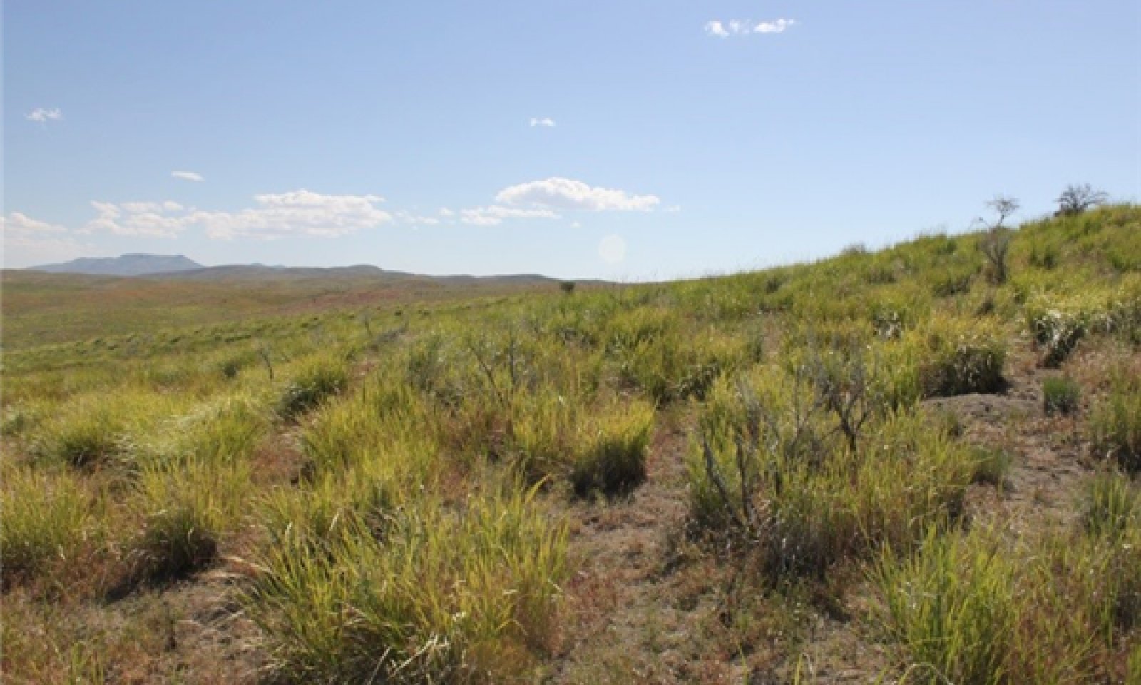
Figure 10. Churning Clay 8-12” (R025XY013NV) Phase 2.2 T. Stringham, June 2011

Figure 11. Churning Clay 8-12” (R025XY013NV) Phase 2.2 T. Stringham, June 2011

Figure 12. Churning Clay 8-12” (R025XY013NV) Phase 2.2 T. Stringham, June 2011
This community phase is characteristic of a post-disturbance, early seral community where annual non-native species are present. Sagebrush is present in trace amounts; perennial bunchgrasses dominate the site. Depending on fire severity or intensity of Aroga moth infestations, patches of intact sagebrush may remain. Rabbitbrush may be sprouting. Perennial forbs may be a significant component for a number of years. Annual non-native species are stable or increasing within the community.
Community 2.3
Community PhaseSagebrush increases in the absence of disturbances such fire or Aroga moth infestation. Decadent sagebrush dominates the overstory and the deep-rooted perennial bunchgrasses in the understory are reduced either from competition with shrubs or from grazing management. Sandberg bluegrass, squirreltail, western wheatgrass, and/or thickspike wheatgrass will likely increase in the understory and may be the dominant grass on the site. Seeded species may be present. Annual non-native species may be stable or increasing due to lack of competition with perennial bunchgrasses.
Pathway a
Community 2.1 to 2.2Fire reduces the shrub overstory and allows for perennial bunchgrasses to dominate the site. Fires will typically be low severity due to low fine fuel loads. A fire following an unusually wet spring or a change in management may be more severe and reduce sagebrush cover to trace amounts. A severe infestation of Aroga moth could also cause a large decrease in sagebrush within the community, giving a competitive advantage to the perennial grasses and forbs. Annual non-native species are likely to increase following fire.
Pathway b
Community 2.1 to 2.3Time and lack of disturbance allows for sagebrush to increase and become decadent. Long-term drought will reduce fine fuels and lead to a reduced fire frequency allowing sagebrush to dominate the site. Inappropriate grazing management will reduce the perennial bunchgrass understory; conversely Sandberg bluegrass may increase in the understory depending on grazing management.
Pathway a
Community 2.2 to 2.1Time and lack of disturbance such as fire and/or inappropriate grazing management that favors the establishment and growth of sagebrush will allow the shrub component to recover. The establishment of big sagebrush may take many years.
Pathway a
Community 2.3 to 2.1A change in grazing management that decreases shrubs will allow for the perennial bunchgrasses in the understory to increase. Heavy late-fall/winter grazing will reduce sagebrush and increase the herbaceous understory. A moderate infestation of Aroga moth may reduce some sagebrush overstory and allow perennial grasses to increase in the community. Brush treatments with minimal soil disturbance will also decrease sagebrush and release the perennial understory. Annual non-native species are present in the community.
Pathway b
Community 2.3 to 2.2Fire will decrease or eliminate the overstory of sagebrush and allow for the perennial bunchgrasses to dominate the site. Fires will typically be low severity due to low fine fuel loads. A fire following an unusually wet spring may be more severe and reduce sagebrush cover to trace amounts. A severe infestation of Aroga moth could also cause a large decrease in sagebrush within the community, giving a competitive advantage to the perennial grasses and forbs. Annual non-native species respond well to fire and may increase post-burn.
Transition A
State 1 to 2Trigger: Introduction of non-native species such as cheatgrass. Slow variables: Over time the annual non-native plants will increase within the community. Threshold: Any amount of introduced non-native species causes an immediate decrease in the resilience of the site. Annual non-native species cannot be easily removed from the system and have the potential to significantly alter disturbance regimes from their historic range of variation.
Additional community tables
Table 7. Community 1.1 plant community composition
Group Common name Symbol Scientific name Annual production () Foliar cover (%) Grass/Grasslike1 Primary Perennial Grasses 320–640 basin wildrye LECI4 Leymus cinereus 240–400 – bluebunch wheatgrass PSSPS Pseudoroegneria spicata ssp. spicata 40–120 – Thurber's needlegrass ACTH7 Achnatherum thurberianum 40–120 – 2 Secondary Perennial Grasses 16–64 squirreltail ELEL5 Elymus elymoides 4–16 – tufted wheatgrass ELMA7 Elymus macrourus 4–16 – Sandberg bluegrass POSE Poa secunda 4–16 – Forb3 Perennial 40–120 arrowleaf balsamroot BASA3 Balsamorhiza sagittata 4–24 – buckwheat ERIOG Eriogonum 4–24 – lupine LUPIN Lupinus 4–24 – phlox PHLOX Phlox 4–24 – tufted wheatgrass ELMA7 Elymus macrourus 5–16 – Shrub/Vine4 Primary Shrubs 120–200 basin big sagebrush ARTRT Artemisia tridentata ssp. tridentata 60–100 – arrowleaf balsamroot BASA3 Balsamorhiza sagittata 5–24 – buckwheat ERIOG Eriogonum 5–24 – lupine LUPIN Lupinus 5–24 – phlox PHLOX Phlox 5–24 – 5 Secondary Shrubs 16–64 rubber rabbitbrush ERNA10 Ericameria nauseosa 4–16 – Table 8. Community 1.2 plant community composition
Group Common name Symbol Scientific name Annual production () Foliar cover (%) Table 9. Community 1.3 plant community composition
Group Common name Symbol Scientific name Annual production () Foliar cover (%) Table 10. Community 2.1 plant community composition
Group Common name Symbol Scientific name Annual production () Foliar cover (%) Table 11. Community 2.2 plant community composition
Group Common name Symbol Scientific name Annual production () Foliar cover (%) Table 12. Community 2.3 plant community composition
Group Common name Symbol Scientific name Annual production () Foliar cover (%) Interpretations
Animal community
Livestock/Wildlife Grazing Interpretations:
This site is suited to cattle and horse use in the late fall, winter and early spring. Considerations in grazing management include timing, intensity and duration of grazing. Livestock traffic should be controlled on this site until soil is dry or frozen to limit soil compaction and puddling.
Overgrazing leads to an increase in sagebrush and a decline in understory plants. Squirreltail or Sandberg bluegrass will increase temporarily with further degradation. Invasion of annual weedy forbs and cheatgrass could occur with further grazing degradation, leading to a decline in squirreltail and bluegrass and an increase in bare ground. A combination of overgrazing and prolonged drought leads to soil erosion, increased bare ground, and a loss in plant production. Wildlife in sites with cheatgrass present could transition to cheatgrass-dominated communities, and without management, cheatgrass and annual forbs are likely to dominate.
Reduced bunchgrass vigor or density provides an opportunity for Sandberg bluegrass expansion and/or cheatgrass and other invasive species to occupy interspaces, leading to increased fire frequency and potentially an annual plant community. Sandberg bluegrass increases under grazing pressure (Tisdale and Hironaka 1981) and is capable of co-existing with cheatgrass. Excessive sheep grazing favors Sandberg bluegrass; however, where cattle are the dominant grazers, cheatgrass often dominates (Daubenmire 1970). Thus, depending on the season of use, the grazer and site conditions, either Sandberg bluegrass or cheatgrass may become the dominant understory with inappropriate grazing management.
Bluebunch wheatgrass is moderately grazing-tolerant but is very sensitive to defoliation during the active growth period (Blaisdell and Pechanec 1949, Laycock 1967, Anderson and Scherzinger 1975, Britton et al. 1990). Herbage and flower stalk production was reduced with clipping at all times during the growing season; however, clipping was most harmful during the boot stage (Blaisdell and Pechanec 1949). Tiller production and growth of bluebunch was greatly reduced when clipping was coupled with drought (Busso and Richards 1995). Mueggler (1975) estimated that low vigor bluebunch wheatgrass may need up to 8 years rest to recover. Although an important forage species, it is not always the preferred species by livestock and wildlife.
Thurber’s needlegrass is an important forage source for livestock and wildlife in the arid regions of the west (Ganskopp 1988). Although the seeds are not injurious, grazing animals avoid them when they begin to mature. Sheep, however, have been observed to graze the leaves closely, leaving stems untouched (Eckert and Spencer 1987). Heavy grazing during the growing season has been shown to reduce the basal area of Thurber’s needlegrass (Eckert and Spencer 1987), suggesting that both seasonality and utilization are important factors in management of this plant. A single defoliation, particularly during the boot stage, was found to reduce herbage production and root mass thus potentially lowering the competitive ability of this needlegrass (Ganskopp 1988). Burning has been found to decrease the vegetative and reproductive vigor of Thurber’s needlegrass (Uresk et al. 1976).
During settlement, many of the cattle in the Great Basin were wintered on extensive basin wildrye stands; due to sensitivity to spring, use many stands were decimated by the early 20th century (Young et al. 1976). Less palatable species, such as big sagebrush and rabbitbrush (Chrysothamnus spp.), increased in dominance along with invasive non-native species such as Russian thistle, mustards, and cheatgrass (Roundy 1985). The early growth and abundant production of basin wildrye make it a valuable source of forage for livestock. It is important forage for livestock and is readily grazed by cattle and horses in early spring and fall. Though coarse-textured during the winter, basin wildrye may be utilized more frequently by livestock and wildlife when snow has covered low shrubs and other grasses. Basin wildrye is used often as a winter feed for livestock and wildlife by not only providing roughage above the snow but also cover in the early spring months (Majerus 1992). Inadequate rest and recovery from defoliation causes a decrease in basin wildrye and an increase in basin big sagebrush and rubber rabbitbrush (Ericameria nauseosa) (Young et al. 1976, Roundy 1985). Spring defoliation of basin wildrye and/or consistent, heavy grazing during the growing season has been found to significantly reduce basin wildrye production and density (Krall et al. 1971). Additionally, native basin wildrye seed viability has been found to be low and seedlings lack vigor (Young and Evans 1981). Roundy (1985) found that although basin wildrye is adapted to seasonally dry saline soils, high and frequent spring precipitation is necessary to establish it from seed. This suggests that establishment of native basin wildrye seedlings occurs only during years of unusually high precipitation; thus, reestablishment of a stand may be episodic.
Livestock browse Wyoming big sagebrush, but may use it only lightly when palatable herbaceous species are available.
Stocking rates vary over time depending upon season of use, climate variations, site, and previous and current management goals. A safe starting stocking rate is an estimated stocking rate that is fine-tuned by the client by adaptive management through the year and from year to year.
Wildlife Interpretations:
This site offers fair food and cover value for deer with use made primarily during migration periods between winter and summer ranges. Antelope use this site yearlong. Small upland game animals such as rabbits, sage-grouse, chukar and Hungarian partridge may use this site. It is also used by various birds, rodents, reptiles and associated predators natural to the area. Feral horses also make use of this site.
Wyoming big sagebrush is preferred browse for wild ungulates; pronghorn usually browse Wyoming big sagebrush heavily. Sagebrush-grassland communities provide critical sage-grouse breeding and nesting habitats. Meadows surrounded by sagebrush may be used as feeding and strutting grounds. Sagebrush is a crucial component of their diet year-round, and sage-grouse select sagebrush almost exclusively for cover. Sage-grouse prefer mountain big sagebrush and Wyoming big sagebrush communities to basin big sagebrush communities. Basin big sagebrush is the least palatable of all the subspecies of big sagebrush. Basin big sagebrush is browsed by mule deer from fall to early spring, but is not preferred.
Hydrological functions
Runoff is very high.
Recreational uses
Aesthetic value is derived from the lush verdure of native grasses backgrounding the colorful flowering of lupine and arrowleaf balsamroot in the spring and early summer. Heavy textured soils inhibit many forms of recreation in the spring when the ground is still wet. This site has limited potential for deer, antelope or upland game hunting.
Wood products
None
Other products
Native Americans made tea from big sagebrush leaves. They used the tea as a tonic, an antiseptic, for treating colds, diarrhea, and sore eyes, and as a rinse to ward off ticks. Big sagebrush seeds were eaten raw or made into meal. Some Native American peoples used the bark of big sagebrush to make ropes and baskets. Basin wildrye was used as bedding for various Native American ceremonies, providing a cool place for dancers to stand.
Other information
Basin wildrye is useful in mine reclamation, fire rehabilitation, and stabilizing disturbed areas. Its usefulness in range seeding, however, may be limited by initially weak stand establishment. Wyoming big sagebrush is used for stabilizing slopes and gullies and for restoring degraded wildlife habitat, rangelands, mine spoils, and other disturbed sites. It is particularly recommended on dry upland sites where other shrubs are difficult to establish. Wyoming big sagebrush has been recommended for seeding on coal mined lands based upon tolerance of germinants to droughty and saline soils. Basin big sagebrush shows high potential for range restoration and soil stabilization. Big sagebrush grows rapidly and spreads readily by seed.
Supporting information
Inventory data references
Soils and physiographic features were gathered from NASIS.
Type locality
Location 1: Elko County, NV Township/Range/Section T35N R52E S16 General legal description Approximately 15 miles north of Carlin, Elko County, Nevada. Other references
Abbott, M. L., L. Fraley Jr., and T. D. Reynolds. 1991. Root profiles of selected cold desert shrubs and grasses in disturbed and undisturbed soils. Environmental and Experimental Botany 31(2): 165-178.
Akinsoji, A. 1988. Postfire vegetation dynamics in a sagebrush steppe in southeastern Idaho, USA. Vegetation 78: 151-155.
Anderson, E.W. and R.J. Scherzinger. 1975. Improving quality of winter forage for elk by cattle grazing. Journal of Range Management 28(2): 120-125.
Bates, J. D., T. Svejcar, R. F. Miller, and R. A. Angell. 2006. The effects of precipitation timing on sagebrush steppe vegetation. Journal of Arid Environments 64: 670-697.
Blaisdell, J.P. and J.F. Pechanec. 1949.Effects of herbage removal at various dates on vigor of bluebunch wheatgrass and arrowleaf balsamroot. Ecology 30(3): 298-305.
Britton, C. M., G. R. McPherson and F. A. Sneva. 1990. Effects of burning and clipping on five bunchgrasses in eastern Oregon. The Great Basin Naturalist 50(2): 115-120.
Bunting, S.C., B.M. Kilgore, and C.L. Bushey. 1987. Guidelines for prescribed burning sagebrush-grass rangelands in the northern Great Basin. Gen. Tech. Rep. INT-231. Ogden, UT: U.S. Department of Agriculture, Forest Service, Intermountain Research Station. 33 p.
Caudle, D., J. DiBenedetto, M. Karl, H. Sanchez, and C. Talbot. 2013. Interagency Ecological Site Handbook for Rangelands. Available at: http://jornada.nmsu.edu/sites/jornada.nmsu.edu/files/InteragencyEcolSiteHandbook.pdf. Accessed 4 October 2013.
Chambers, J., B. Bradley, C. Brown, C. D’Antonio, M. Germino, J. Grace, S. Hardegree, R. Miller, and D. Pyke. 2013. Resilience to stress and disturbance, and resistance to Bromus tectorum L. invasion in cold desert shrublands of western North America. Ecosystems 17:1-16.
Comstock, J. P. and J. R. Ehleringer. 1992. Plant adaptation in the Great Basin and Colorado Plateau. Western North American Naturalist 52:195-215.
Conrad, C.E. and C.E. Poulton. 1966. Effect of a wildfire on Idaho fescue and bluebunch wheatgrass. Journal of Range Management 19(3): 138-141.
Dobrowolski, J. P., M. M. Caldwell, and J. H. Richards. 1990. Basin hydrology and plant root systems. In: C. B. Osmand, L. F. Pitelka, G. M. Hildy [eds]. Plant biology of the great basin and range. Ecological Studies. 80: 243-292.
Fire Effects Information System (online http://www.fs.fed.us/database/feis)
Goodrich, S., E.D. McArthur, and A.H. Winward. 1985. A new combination and a new variety in Artemisia tridentata. The Great Basin Naturalist 45(1): 99-104.
Houghton, J.G., C.M. Sakamoto, and R.O. Gifford. 1975. Nevada’s weather and climate, special publication 2. Nevada Bureau of Mines and Geology, Mackay School of Mines, University of Nevada, Reno, NV.
Humphrey, L.D. 1984. Patterns and mechanisms of plant succession after fire on Artemisia grass sites in southeastern Idaho. Vegetatio 57: 91-101.
Jensen, M.E. 1990. Interpretation of environmental gradients which influence sagebrush community distribution in northeastern Nevada. J. of Range Management 43: 161-166.
Johnson, J.R. and G.F. Payne. 1968. Sagebrush reinvasion as affected by some environmental influences. Journal of Range Management 21: 209-213.
Kuntz, D.E. 1982. Plant response following spring burning in an Artemisia tridentata subsp. vaseyana/Festuca idahoensis habitat type. Moscow, ID: University of Idaho. 73 p. Thesis.
Laycock, W.A. 1967. How heavy grazing and protection affect sagebrush-grass ranges. Journal of Range Management 20: 206-213.
National Oceanic and Atmospheric Administration. 2004. The North American Monsoon. Reports to the Nation. National Weather Service, Climate Prediction Center. Available online: http://www.weather.gov/
Noy-Meir, I. 1973. Desert ecosystems: environment and producers. Annual review of ecology and systematics 4: 25-51.
Ogle, D.G., Tilley, D., and L. St. John. 2012. Plant Guide for Basin Wildrye (Leymus cinereus). USDA-Natural Resources Conservation Service, Aberdeen Plant Materials Center. Aberdeen, Idaho.
Paysen, T.E., R.J. Ansley, and J.K. Brown. 2000. Fire in western shrubland, woodland, and grassland ecosystems. In: Brown, J.K. and J.K. Smith (eds). Wildland fire in ecosystems: Effects of fire on flora. Gen. Tech. Rep. RMRS-GTR-42-Volume 2. Ogden, UT. U.S. Department of Agriculture, Forest Service, Rocky Mountain Research Station. Pgs 121-159.
Perryman, B.L. and Q.D. Skinner. 2007. A Field Guide to Nevada Grasses. Indigenous Rangeland Management Press, Lander, Wyoming. 256 p.
Reynolds, T.D., and L. Fraley Jr. 1989. Root profiles of some native and exotic plant species in southeastern Idaho. Environmental and Experimental Botany 29(2): 241-248.
Richards, J. H. and M. M. Caldwell. 1987. Hydraulic lift: Substantial nocturnal water transport between soil layers by Artemisia tridentata roots. Oecologia 73:486-489.
Robberecht, R. and G.E. Defosse. 1995. The relative sensitivity of two bunchgrass species to fire. International Journal of Wildland Fire 5(3): 127-134.
Roundy, B.A. 1985. Emergence and establishment of basin wildrye and tall wheatgrass in relation to moisture and salinity. Journal of Range Management 38(2): 126-131.
Sapsis, D.B. and J.B. Kauffman. 1991. Fuel consumption and fire behavior associated with prescribed fires in sagebrush ecosystems. Northwest Science 65(4):173-179.
Shumar, M.L. and J.E. Anderson. 1986. Gradient analysis of vegetation dominated by two subspecies of big sagebrush. Journal of Range Management 39(2):156-159.
USDA-NRCS Plants Database (online http://plants.usda.gov/)
Wright, H. A. and J. O. Klemmedson. 1965. Effect of fire on bunchgrasses of the sagebrush-grass region in southern Idaho. Ecology 46:680-688.
Young, J.A. and R.A. Evans. 1981. Germination of Great Basin wildrye seeds collected from native stands. Agronomy Journal 73: 917-920.
Young, R.P. 1983. Fire as a vegetation management tool in rangelands of the intermountain region. In: Monsen, S.B. and N. Shaw (compilers). Managing intermountain rangelands -- Improvement of range and wildlife habitats: Proceedings; 1981 September 15-17; Twin Falls, ID; 1982 June 22-24; Elko, NV. Gen. Tech. Rep. INT-157. Ogden, UT: U.S. Department of Agriculture, Forest Service, Intermountain Forest and Range Experiment Station: Pgs 18-31.
Zschaechner, G.A. 1985. Studying rangeland fire effects: A case study in Nevada. In: Sanders, K. and J. Durham (eds). Rangeland fire effects. Proceedings of the symposium. 1984 November 27-29; Boise, ID. Boise, ID. U.S. Department of the Interior, Bureau of Land Management, Idaho State Office. Pgs 66-84.Contributors
RK/GKB
Approval
Kendra Moseley, 4/24/2024
Rangeland health reference sheet
Interpreting Indicators of Rangeland Health is a qualitative assessment protocol used to determine ecosystem condition based on benchmark characteristics described in the Reference Sheet. A suite of 17 (or more) indicators are typically considered in an assessment. The ecological site(s) representative of an assessment location must be known prior to applying the protocol and must be verified based on soils and climate. Current plant community cannot be used to identify the ecological site.
Author(s)/participant(s) GK BRACKLEY Contact for lead author State Rangeland Management Specialist Date 03/21/2011 Approved by Approval date Composition (Indicators 10 and 12) based on Annual Production Indicators
-
Number and extent of rills:
Rills are none. If rills do develop, they are broken up by the churning action of the soil. -
Presence of water flow patterns:
Water flow patterns are rare. Water flow patterns are broken up by the churning action of the soil. -
Number and height of erosional pedestals or terracettes:
Pedestals are none to rare. Occurrence is usually limited to areas of water flow patterns. -
Bare ground from Ecological Site Description or other studies (rock, litter, lichen, moss, plant canopy are not bare ground):
Bare Ground 25-35% -
Number of gullies and erosion associated with gullies:
None -
Extent of wind scoured, blowouts and/or depositional areas:
None -
Amount of litter movement (describe size and distance expected to travel):
Fine litter (foliage from grasses and annual & perennial forbs) expected to move distance of slope length during intense summer convection storms or rapid snowmelt events. Persistent litter (large woody material) will remain in place except during catastrophic events. -
Soil surface (top few mm) resistance to erosion (stability values are averages - most sites will show a range of values):
Soil stability values should be 3 to 6 on most soil textures found on this site. (To be field tested.) -
Soil surface structure and SOM content (include type of structure and A-horizon color and thickness):
Surface structure is typically strong fine granular. Soil surface colors are grayish-brown and soils have an ochric epipedon. Organic matter of the surface 2 to 4 inches is typically 1.25 to 3 percent dropping off quickly below. Organic matter content can be more or less depending on micro-topography. -
Effect of community phase composition (relative proportion of different functional groups) and spatial distribution on infiltration and runoff:
Perennial herbaceous plants (especially deep-rooted bunchgrasses [i.e., basin wildrye] slow runoff and increase infiltration. Shrub canopy and associated litter break raindrop impact and provide opportunity for snow catch and accumulation on site. -
Presence and thickness of compaction layer (usually none; describe soil profile features which may be mistaken for compaction on this site):
None. Heavy clay or massive horizons are not to be interpreted as compacted. -
Functional/Structural Groups (list in order of descending dominance by above-ground annual-production or live foliar cover using symbols: >>, >, = to indicate much greater than, greater than, and equal to):
Dominant:
Deep-rooted, cool season, perennial bunchgrassesSub-dominant:
tall shrubs (big sagebrush)>>deep-rooted, cool season, perennial forbs>associated shrubs=shallow-rooted, cool season, perennial bunchgrasses> shallow-rooted, cool season, perennial and annual forbsOther:
Additional:
-
Amount of plant mortality and decadence (include which functional groups are expected to show mortality or decadence):
Dead branches within individual shrubs common and standing dead shrub canopy material may be as much as 25% of total woody canopy; some of the mature bunchgrasses (<20%) have dead centers. -
Average percent litter cover (%) and depth ( in):
Between plant interspaces (25-35%) and litter depth is < ½ inch. Fine litter falls or blows into the soil surface cracks -
Expected annual annual-production (this is TOTAL above-ground annual-production, not just forage annual-production):
For normal or average growing season (through mid-June) ± 800 lbs/ac; Spring moisture significantly affects total production -
Potential invasive (including noxious) species (native and non-native). List species which BOTH characterize degraded states and have the potential to become a dominant or co-dominant species on the ecological site if their future establishment and growth is not actively controlled by management interventions. Species that become dominant for only one to several years (e.g., short-term response to drought or wildfire) are not invasive plants. Note that unlike other indicators, we are describing what is NOT expected in the reference state for the ecological site:
Invaders include cheatgrass, halogeton, Russian thistle, annual mustards and knapweeds. -
Perennial plant reproductive capability:
All functional groups should reproduce in average (or normal) and above average growing season years
Print Options
Sections
Font
AAAAOther
PrintThe Ecosystem Dynamics Interpretive Tool is an information system framework developed by the USDA-ARS Jornada Experimental Range, USDA Natural Resources Conservation Service, and New Mexico State University.
Accessibility statement


