Natural Resources
Conservation Service
-
Search


Major Land Resource Area or ecological site by name and/or ID.
General information
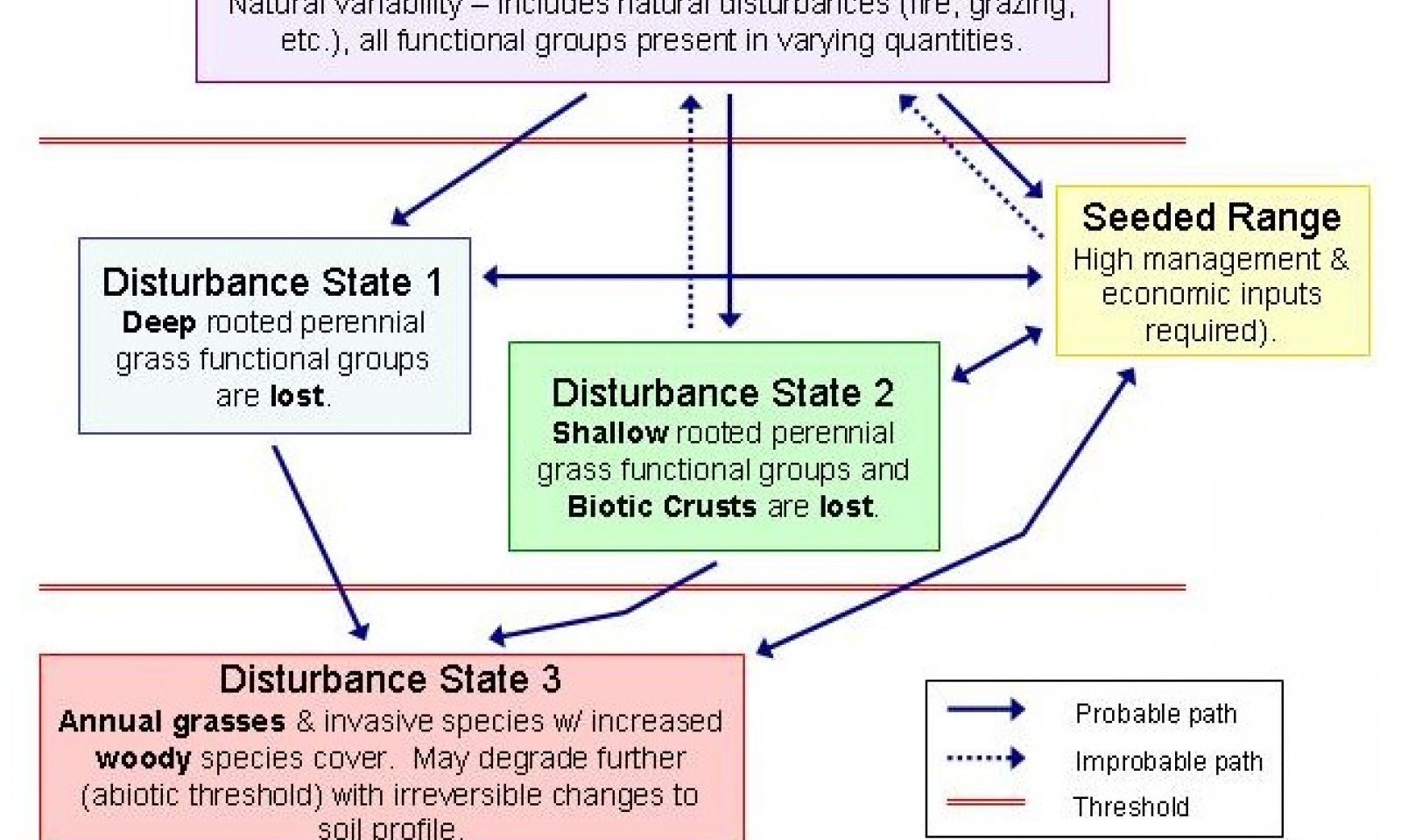
Provisional. A provisional ecological site description has undergone quality control and quality assurance review. It contains a working state and transition model and enough information to identify the ecological site.
Click to explore map
Figure 1. Mapped extent
Areas shown in blue indicate the maximum mapped extent of this ecological site. Other ecological sites likely occur within the highlighted areas. It is also possible for this ecological site to occur outside of highlighted areas if detailed soil survey has not been completed or recently updated.
Associated sites
R023XY216OR CLAYPAN 12-16 PZ
Claypan 12-16" PZ
R023XY302OR SOUTH SLOPES 12-16 PZ
South Slopes 12-16" PZ
R023XY310OR NORTH SLOPES 12-16 PZ
North Slopes 12-16" PZ
Similar sites
R023XY318OR LOAMY 12-16 PZ
Loamy 12-16" PZ (shallower soil)
R023XY310OR NORTH SLOPES 12-16 PZ
North Slopes 12-16" PZ (north aspect)
Table 1. Dominant plant species
Tree Not specified
Shrub Not specified
Herbaceous Not specified

