
Natural Resources
Conservation Service
-
Search


Major Land Resource Area or ecological site by name and/or ID.
PreviousSectionsNextGeneral information
Draft. A draft ecological site description is either incomplete or has not undergone quality control and quality assurance review.
Associated sites
R022AY010NV MOUNTAIN SHOULDERS 30+ P.Z.
R022AY011NV MOUNTAIN RIDGE 30+ P.Z.
R022AY021NV SOUTH SLOPE 30+ P.Z.
Table 1. Dominant plant species
Tree Not specified
Shrub (1) Artemisia tridentata ssp. vaseyana
Herbaceous (1) Achnatherum occidentale ssp. occidentale
(2) Bromus marginatusPhysiographic features
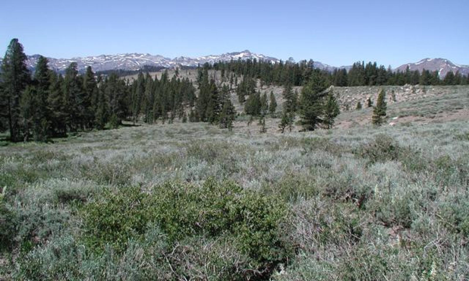
This site occurs on straight to convex mountain sideslopes on all aspects. Slopes range from 4 to 75 percent, but slope gradients of 8 to 30 percent are most typical. Elevations are 7000 to over 10000 feet.
Table 2. Representative physiographic features
Landforms (1) Mountain
(2) Moraine
Flooding frequency None Ponding frequency None Elevation 7000 – 10000 ft Slope 4 – 75 % Ponding depth 0 in Water table depth 0 in Aspect Aspect is not a significant factor Climatic features
The climate on this site is subhumid-continental, characterized by cold, moist winters, and cool dry summers. The average annual precipitation ranges from 20 to 50 inches, mostly occurring as snow. The linear to convex slope shapes associated with this site cause some of the precipitation to be removed from the site because of wind action, thus reducing the moisture available for plant growth. The mean annual air temperature ranges from 36 to 43 degrees F. The average frost free growing season is 30 to 60 days.
Table 3 Representative climatic features
Frost-free period (average) 60 days Freeze-free period (average) 0 days Precipitation total (average) 50 in BarLineFigure 1. Monthly precipitation range
BarLineFigure 2. Monthly average minimum and maximum temperature
">Influencing water features
There are no influencing water features associated with this site.
Soil features
The soils in this ecological site are typically moderately deep to deep and are well to somewhat excessively drained. These soils are formed in glacial till or residuum and colluvium derived from andesite and tuff breccia. The soil series associated with this ecological site are Angelwhine, Dunderberg, Hawkinspeak and Waterpeak. The soil families associated with this ecological site are Angelwhine inclusion, Dunderberg inclusion, Hawkinspeak inclusion and Waterpeak inclusion.
Table 4. Representative soil features
Parent material (1) Residuum – andesite
(2) Colluvium – tuff breccia
Surface texture (1) Extremely gravelly coarse sandy loam
(2) Very gravelly sandy loam
(3) Very bouldery coarse sand
Family particle size (1) Loamy
Drainage class Well drained to somewhat excessively drained Permeability class Moderate to moderately rapid Soil depth 33 – 60 in Surface fragment cover <=3" 20 – 55 % Surface fragment cover >3" 4 – 10 % Available water capacity
(0-40in)2.9 – 3.8 in Calcium carbonate equivalent
(0-40in)Not specified Electrical conductivity
(0-40in)Not specified Sodium adsorption ratio
(0-40in)Not specified Soil reaction (1:1 water)
(0-40in)6.1 – 7.3 Subsurface fragment volume <=3"
(Depth not specified)13 – 41 % Subsurface fragment volume >3"
(Depth not specified)3 – 25 % Ecological dynamics
As ecological condition declines, big sagebrush, snowberry and other woody plants increase in prevalence and forbs decline in the understory.
Fire Ecology:
Presettlement fire return intervals in mountain big sagebrush communities varied from 15 to 25 years. Plants are readily killed in all seasons, even light severity fires. Mountain big sagebrush is highly susceptible to injury from fire. It is often top-killed by fire and will not resprout.
Perennial needlegrasses tend to be among the least fire resistant bunchgrass due to the densely tufted stems. Western needlegrass is only slightly to moderately damaged by fire, because it has relatively few culms per clump which may help to minimize the amount of subsurface heat transfer and subsequent damage. Mountain brome is likely to be top-killed by fire, although the coarse stems and broad leaves may be more fire-resistant than fine-leaved bunchgrasses. Mountain brome is most susceptible to fire damage when it is actively growing in spring and early summer. The effects of fire on slender wheatgrass are dependent on its growth form. Tall, decadent plants with many leaves sustain the most fire damage, while those with short, sparse growth form, is the least likely to sustain damage to the root system during a fire.State and transition model
More interactive model formats are also available. View Interactive Models
Click on state and transition labels to scroll to the respective textEcosystem states
State 1 submodel, plant communities
State 1
Reference StateCommunity 1.1
Reference Plant Community
The reference plant community is characterized by an open canopy of soft-woody shrubs and a dense understory of perennial grasses. The representative plant community is dominated by western needlegrass, mountain brome, slender wheatgrass, and mountain big sagebrush. Potential vegetative composition is about 70% grasses, 10% forbs and 20% shrubs and trees. Approximate ground cover (basal and crown) is 30 to 50 percent.
Figure 3. Annual production by plant type (representative values) or group (midpoint values)
Table 5. Annual production by plant type
Plant type Low
(lb/acre)Representative value
(lb/acre)High
(lb/acre)Grass/Grasslike 560 770 1120 Shrub/Vine 160 220 320 Forb 80 110 160 Total 800 1100 1600 Additional community tables
Table 6. Community 1.1 plant community composition
Group Common name Symbol Scientific name Annual production () Foliar cover (%) Grass/Grasslike1 Primary Perennial Grasses 627–990 western needlegrass ACOCO Achnatherum occidentale ssp. occidentale 440–550 – mountain brome BRMA4 Bromus marginatus 165–330 – slender wheatgrass ELTRT Elymus trachycaulus ssp. trachycaulus 22–110 – 2 Secondary Perennial Grasses/Grasslikes 55–110 sedge CAREX Carex 6–33 – big squirreltail ELMU3 Elymus multisetus 6–33 – Forb3 Perennial Forbs 55–165 lupine LUPIN Lupinus 6–22 – Shrub/Vine4 Primary Shrubs 165–220 mountain big sagebrush ARTRV Artemisia tridentata ssp. vaseyana 165–220 – 5 Secondary Shrubs 16–64 serviceberry AMELA Amelanchier 11–22 – curl-leaf mountain mahogany CELE3 Cercocarpus ledifolius 11–22 – antelope bitterbrush PUTR2 Purshia tridentata 11–22 – roundleaf snowberry SYRO Symphoricarpos rotundifolius 11–22 – Tree6 Evergreen 6–24 white fir ABCO Abies concolor 3–12 – lodgepole pine PICO Pinus contorta 3–12 – Interpretations
Animal community
Livestock Interpretations:
This site is suited to livestock grazing. Grazing management should be keyed to western needlegrass and mountain brome production. Mountain big sagebrush is eaten by domestic livestock but has long been considered to be of low palatability, and a competitor to more desirable species. Western needlegrass is an important forage species for domestic livestock. Mountain brome is one of the most important forage grasses in the quaking aspen zone. Mountain brome is ranked as excellent forage for both cattle and horses and good for domestic sheep. Domestic will graze mountain brome only when it is fairly succulent. Slender wheatgrass is grazed by all classes of livestock.
Stocking rates vary over time depending upon season of use, climate variations, site, and previous and current management goals. A safe starting stocking rate is an estimated stocking rate that is fine tuned by the client by adaptive management through the year and from year to year.
Wildlife Interpretations:
Mountain big sagebrush is highly preferred and nutritious winter forage for mule deer. Mountain brome seedheads and seeds provide food for many birds and small mammals. Pronghorn antelope will consume mountain brome primarily in the spring. The palatability of mountain brome is excellent for deer, particularly during the late spring and early summer. Western needlegrass is another important forage species for several wildlife species. Slender wheatgrass is grazed by sage grouse, deer, elk, moose, and bighorn sheep, mountain goat, pronghorn, various rodents, and all classes of livestock. The seeds are eaten by various seed predators. Slender wheatgrass provides hiding and thermal cover for songbirds, upland game birds, waterfowl, and small mammals.Hydrological functions
Runoff is very low to high and permeability is moderate to moderately rapid.
Other products
Native people used big sagebrush leaves and branches for medicinal teas, and the leaves as a fumigant. Bark was woven into mats, bags and clothing.
Other information
Mountain big sagebrush is easily propagated from seed under greenhouse, nursery, and common garden conditions, and has been successfully seeded directly into field. Slender wheatgrass is widely used for revegetating disturbed lands. Slender wheatgrass is a short-lived perennial with good seedling vigor. It germinates and establishes quickly when seeded making it a good choice for quick cover on disturbed sites. It persists long enough for other, slower developing species to establish. It is especially valuable for use in saline soils. It has been used for rehabilitating mine spoils, livestock ranges, and wildlife habitat and watershed areas.
Supporting information
Type locality
Location 1: Mono County, CA Latitude 38° 4′ 2″ Longitude 119° 13′ 5″ General legal description Toiyabe National Forest, approximately 0.3 miles east of the Virginia Lake Road. Other references
Fire Effects Information System (Online; http://www.fs.fed.us/database/feis/plants).
USDA NRCS Plants Database (Online; http://plants.usda.gov/).
Contributors
ALC/GKB
Rangeland health reference sheet
Interpreting Indicators of Rangeland Health is a qualitative assessment protocol used to determine ecosystem condition based on benchmark characteristics described in the Reference Sheet. A suite of 17 (or more) indicators are typically considered in an assessment. The ecological site(s) representative of an assessment location must be known prior to applying the protocol and must be verified based on soils and climate. Current plant community cannot be used to identify the ecological site.
Author(s)/participant(s) Contact for lead author Date Approved by Approval date Composition (Indicators 10 and 12) based on Annual Production Indicators
-
Number and extent of rills:
-
Presence of water flow patterns:
-
Number and height of erosional pedestals or terracettes:
-
Bare ground from Ecological Site Description or other studies (rock, litter, lichen, moss, plant canopy are not bare ground):
-
Number of gullies and erosion associated with gullies:
-
Extent of wind scoured, blowouts and/or depositional areas:
-
Amount of litter movement (describe size and distance expected to travel):
-
Soil surface (top few mm) resistance to erosion (stability values are averages - most sites will show a range of values):
-
Soil surface structure and SOM content (include type of structure and A-horizon color and thickness):
-
Effect of community phase composition (relative proportion of different functional groups) and spatial distribution on infiltration and runoff:
-
Presence and thickness of compaction layer (usually none; describe soil profile features which may be mistaken for compaction on this site):
-
Functional/Structural Groups (list in order of descending dominance by above-ground annual-production or live foliar cover using symbols: >>, >, = to indicate much greater than, greater than, and equal to):
Dominant:
Sub-dominant:
Other:
Additional:
-
Amount of plant mortality and decadence (include which functional groups are expected to show mortality or decadence):
-
Average percent litter cover (%) and depth ( in):
-
Expected annual annual-production (this is TOTAL above-ground annual-production, not just forage annual-production):
-
Potential invasive (including noxious) species (native and non-native). List species which BOTH characterize degraded states and have the potential to become a dominant or co-dominant species on the ecological site if their future establishment and growth is not actively controlled by management interventions. Species that become dominant for only one to several years (e.g., short-term response to drought or wildfire) are not invasive plants. Note that unlike other indicators, we are describing what is NOT expected in the reference state for the ecological site:
-
Perennial plant reproductive capability:
Print Options
Sections
Font
AAAAOther
PrintThe Ecosystem Dynamics Interpretive Tool is an information system framework developed by the USDA-ARS Jornada Experimental Range, USDA Natural Resources Conservation Service, and New Mexico State University.
Accessibility statement


