
Natural Resources
Conservation Service
-
Search


Major Land Resource Area or ecological site by name and/or ID.
PreviousSectionsNextGeneral information
Provisional. A provisional ecological site description has undergone quality control and quality assurance review. It contains a working state and transition model and enough information to identify the ecological site.
Click to explore map
Figure 1. Mapped extent
Areas shown in blue indicate the maximum mapped extent of this ecological site. Other ecological sites likely occur within the highlighted areas. It is also possible for this ecological site to occur outside of highlighted areas if detailed soil survey has not been completed or recently updated.
MLRA notes
Major Land Resource Area (MLRA): 022A–Sierra Nevada and Tehachapi Mountains
Major Land Resource Area 22A, Sierra Nevada Mountains, is located predominantly in California and a small section of western Nevada. The area lies completely within the Sierra Nevada Section of the Cascade-Sierra Mountains Province. The Sierra Nevada range has a gentle western slope, and a very abrupt eastern slope. The Sierra Nevada consists of hilly to steep mountains and occasional flatter mountain valleys. Elevation ranges between 1,500 and 9,000 ft throughout most of the range, but peaks often exceed 12,000 ft. The highest point in the continental US occurs in this MLRA (Mount Whitney, 14,494 ft). Most of the Sierra Nevada is dominated by granitic rock of the Mesozoic age, known as the Sierra Nevada Batholith. The northern half is flanked on the west by a metamorphic belt, which consists of highly metamorphosed sedimentary and volcanic rocks. Additionally, glacial activity of the Pleistocene has played a major role in shaping Sierra Nevada features, including cirques, arêtes, and glacial deposits and moraines. Average annual precipitation ranges from 20 to 80 inches in most of the area, with increases along elevational and south-north gradients. Soil temperature regime ranges from mesic, frigid, and cryic. Due to the extreme elevational range found within this MLRA, Land Resource Units (LRUs) were designated to group the MLRA into similar land units.
LRU “X” represents ecological sites driven by abiotic features that override the typical soils or climatic features that drive most of the other LRU zones. In the Sierra Nevada these sites are typically driven by water features associated with lotic or lentic riparian systems. Other features maybe shallow bedrock, or unique chemical development which affects the growth of typical vegetation.Ecological site concept
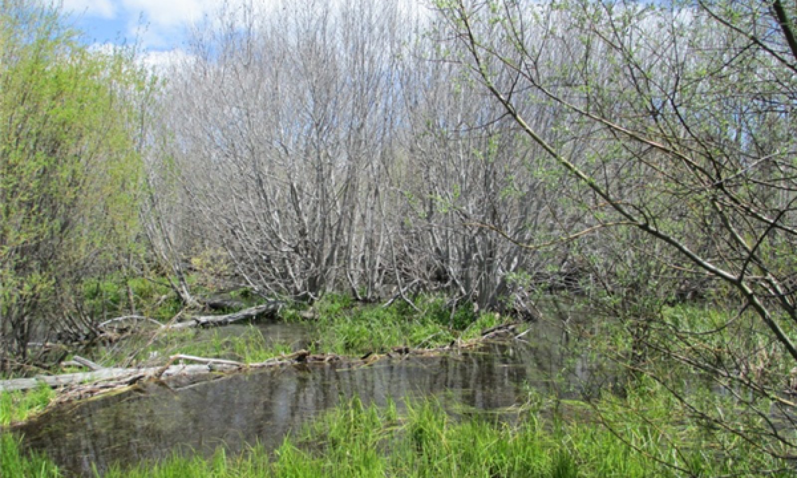
This riparian complex is associated with lacustrine (X) or delta valley (XI) types at elevations of 6,200 to 7,500 feet, and has an anastomosed Da channel type (Rosgen 1996). The channels are typically narrow and deep, but can be highly variable in sinuosity and width to depth ratio. The floodplains are saturated for most of the year, and the stream banks and floodplains have a dense cover of sedges (Carex spp.) and other grasslike specie (Scirpus spp. and Juncus spp.). Willows (Salix spp.) and thinleaf alder (Alnus incana ssp. tenuifolia) are also common. The deep channels and access to deeper waters of the adjacent lakes provide ideal habitat for the North American beaver (Castor canadensis) (Beier and Barrett 1987). Beavers heavily influence the channel morphology with construction of dams, which pond and divert flow. The dominant soils have a histic epipedon, with sandy soils or layers of buried horizons below.
Associated sites
F022AE013CA Frigid, Loamy, Volcanic Mountain Slopes
This is a Jeffrey pine (Pinus jeffreyi)- white fir (Abies concolor) mixed conifer forest found on volcanic soils which occasionally surround this site.
F022AF002CA Frigid, Sandy, Or Loamy Outwash
This is a dry Jeffrey pine (Pinus jeffreyi) forest found on adjacent outwash and occasionally on the barrier beaches.
F022AF004CA Frigid, Shallow To Deep, Sandy Mountain Slopes
This is an open Jeffrey pine (Pinus jeffreyi) woodland with montane shrubs. It occurs on shallow to moderately deep soils on south facing slopes.
F022AF005CA Frigid, Deep To Very Deep, Sandy-Loamy Mountain Slopes
This is a Jeffrey pine (Pinus jeffreyi)- white fir (Abies concolor) forest, which occurs on deep to very deep granitic soils, on north facing mountain slopes.
F022AX100CA Frigid, Sandy, Moist, Outwash Fan
This is a Sierra lodgepole pine (Pinus contorta var. murrayana) forest, similar to community component 7, and occurs on outwash terraces.
R022AX003CA Steep subalpine, valley bottom riverine system
This ecological site has a single thread E-C type channel and has a cryic soil temperature regime.
R022AX004CA Cryic basin peatland
This fen complex occurs in closed basins, and soils are composed of sphagnum moss throughout.
R022AX102CA Frigid E-C Meadow System
This riparian complex has a single thread E-C type channel. It may occur just upstream of this ecological site.
Similar sites
R022AX101CA Frigid Anastomosed System
This is a single thread E-C type channel system. It may occur upstream from this site.
R022AX103CA Cryic E Meadow System
This is a single thread E-C channel system that occurs at higher elevations and has a cryic soil temperature regime.
Table 1. Dominant plant species
Tree (1) Populus tremuloides
Shrub (1) Salix lemmonii
(2) Alnus incana subsp. tenuifoliaHerbaceous (1) Carex utriculata
(2) Scirpus microcarpusPhysiographic features
This site occurs on broad valley bottoms, with a lacustrine (X) or delta (XI) valley type. Glacio-lacustrine deposits are typically deeply buried below more recent river alluvium and organic material. Associated fluvial surfaces include ponds, fens, floodplains, floodplain steps, and outwash terraces. The fens and floodplains are seasonally flooded and ponded, for brief to very long durations from March through June. Ponding depth ranges from 0 to 12 inches. Slopes range from 0 to 5 percent, but the channel gradients are typically less than 0.5 percent. Elevations range from 6,220 feet to 9,420 feet, but are typically between 6,220 and 7,500 feet.
Table 2. Representative physiographic features
Landforms (1) Fen
(2) Flood plain
(3) Outwash terrace
Flooding duration Brief (2 to 7 days) to very long (more than 30 days) Flooding frequency None to frequent Ponding duration Brief (2 to 7 days) to very long (more than 30 days) Ponding frequency None to frequent Elevation 6220 – 9420 ft Slope 0 – 5 % Ponding depth 0 – 12 in Water table depth 0 – 30 in Aspect Aspect is not a significant factor Climatic features
The average annual precipitation ranges from 23 to 55 inches, and falls mostly in the form of snow from November to April. The mean annual air temperature ranges from 40 to 46 degrees Fahrenheit. The frost-free (>32F) season is 20 to 60 days, and the freeze-free (>28F) season is 40 to 90 days.
Climate stations: (1) 048762, Tahoe Valley FFA AP, California. Period of record 1968-2008Table 3 Representative climatic features
Frost-free period (average) 70 days Freeze-free period (average) 40 days Precipitation total (average) 40 in BarLineFigure 2. Monthly precipitation range
BarLineFigure 3. Monthly average minimum and maximum temperature
Figure 4. Annual precipitation pattern
Figure 5 Annual average temperature pattern
">Influencing water features
This ecological site occurs in wetlands and meadows associated with a Da type channel system. Most of the area is saturated for long durations, but some areas have deeper water tables and are only saturated for a brief duration after snow melt.
Soil features
There are several soils associated with this ecological site. They are associated with different fluvial surfaces, and vary in wetness and organic matter accumulation. These soils are all very deep, and formed in organic matter over alluvium or alluvium derived from predominately granitic parent material. In some areas volcanic and metamorphic alluvium is also intermixed. Soils are very poorly drained with moderate permeability. The soil moisture regime is aquic and the soil temperature regime is frigid. Surface rock cover and subsurface rock fragments of all sizes are typically absent, but gravels may be up to 30 percent by volume in the lower horizons of the Watah soil.
Soils by fluvial surface:
Fens, active channel and floodplain:
The Watah (coarse-loamy, mixed, superactive, acid, frigid Histic Humaquepts) soil is the dominant component associated with this ecological site. The Watah soils develop in the wettest locations, in broad low lying areas among braided channels. The Watah soils have 20 to 40 cm of peat or mucky peat, developed primarily from decomposed sedge roots. Below the organic horizons the soil is sandier with gravelly mucky coarse sandy loam and gravelly loamy coarse sand textures. Gleyed soil colors occur below 73 cm. Community components 2 and 3 (CC2 and CC3) are associated with the Watah soils. CC2 occurs along the active channel where more flooding occurs, and CC3 occurs in areas where ponding is more common.
Floodplain step:
The Tahoe (coarse-loamy, mixed, superactive, acid, frigid Cumulic Humaquepts) soil occurs on floodplains typically on the outside of the braided channel network. The surface texture is mucky silt loam and subsurface textures are mucky silt loam and gravelly coarse sand. CC4 is associated with this soil component.
Floodplain step, dry:
The Tahoe gravelly phase (coarse-loamy, mixed, superactive, acid, frigid Cumulic Humaquepts) soil component occurs on floodplain steps, or old gravelly deposition areas. The surface texture is mucky gravelly silt loam. Subsurface textures are gravelly silt loam, gravelly sand, gravelly coarse sand, and gravelly fine sand. CC5 is associated with this soil component.
Outwash terrace:
The Marla (sandy, mixed, frigid Aquic Dystroxerepts) soils occur on outwash terraces that border this site, and are influenced by the ground water hydrology of the meadow. The surface textures are loamy coarse sand and subsurface textures are loamy coarse sand and clay loam. The Marla soils are associated with CC6.
This ecological site has been correlated with the following mapunits and soil components in the Tahoe Basin soil survey area (CA693):
Mapunit, Mapunit name, Component, Phase, percent
7011 Beaches Watah, 7
7051 Oxyaquic Xerorthents-Water association, 0 to 5 percent slopes, Watah, 1
7071 Watah peat, 0 to 2 percent slopes, Watah, 75
7071 Watah peat, 0 to 2 percent slopes, Tahoe, gravelly wet, 9
7071 Watah peat, 0 to 2 percent slopes, Tahoe, silt loam wet, 8
7071 Watah peat, 0 to 2 percent slopes, Marla, 3
9001 Bidart complex, 0 to 2 percent slopes, Watah, 5Table 4. Representative soil features
Surface texture (1) Mucky silt loam
(2) Loamy coarse sand
Family particle size (1) Loamy
Drainage class Very poorly drained Permeability class Moderate Soil depth 160 – 0 in Surface fragment cover <=3" Not specified Surface fragment cover >3" Not specified Available water capacity
(0-40in)4 – 6.2 in Calcium carbonate equivalent
(0-40in)Not specified Electrical conductivity
(0-40in)0 – 20 mmhos/cm Soil reaction (1:1 water)
(0-40in)5.1 – 7.3 Subsurface fragment volume <=3"
(Depth not specified)0 – 30 % Subsurface fragment volume >3"
(Depth not specified)Not specified Ecological dynamics
Abiotic Factors:
This ecological site is a riparian complex associated with lake deltas and lacustrine fringes. The broad, low gradient valleys allow the streams to develop into anastomosed-multi-channel streams, also referred to as a Da channel type (Rosgen 1996). Beaver activity is high in these systems. Several community components (a combination of soil type and associated plant community) related to the depth of water table, micro-topography, and different fluvial surfaces are present. The dominant soils are saturated late into summer, and have developed deep organic surfaces from decomposed sedge roots. A gradation of soil and plant communities exists from the wettest areas, with sedges and organic soils to drier grass and forb communities on poorly developed sandy soils. Willows, thinleaf alder, quaking aspen (Populus tremuloides), and Sierra lodgepole pine (Pinus contorta var. murrayana) have niches within this spectrum.
Hydrologic factors:
This ecological site occurs on low gradient (typically less than 1 percent) deltas of lakes or ponds. A braided network of channels, defined as Da channel type, is the natural stream type for this system. Beaver prefer the deep channels and lake access that this site provides for mobility, safety, and den building (Beier and Barrett 1987) They are abundant and very active in this ecological site. Dam building raises the water table above the dam, causing pond development and flooding across the floodplain. Below the beaver dam, or after dams are removed, the channel may become unstable and scour or widen depending upon the site. Aerial imagery from 1940 shows dendritic-branching patterns, indicating the natural branching Da system prior to that time. The branching system may have developed with historic beaver activity or from the natural tendency for channels to meander and anastomose in these river delta systems.
A properly functioning marsh system is an important filtration system. The broad, low gradient floodplain allows for suspended sediments to settle out of suspension in the slow moving flood waters and ponds. Subsurface flow is filtered as it moves through the thick organic surface. Nutrients such as phosphorus and nitrogen are also deposited with the sediments reducing the load distributed to the lake.
Beavers were once thought to be non-native to the Sierra Nevada, but carbon dating of old beaver dams has shown that beavers were in the Sierra Nevada since AD 580 (James and Lanman 2012, Landman et al. 2012). Beaver trapping and extirpation efforts eliminated beavers from the higher Sierra Nevada by mid-1800s. Beavers were reintroduced into the Lake Tahoe Basin from 1939 to 1949 (Beier and Barrett 1987) after 100 years or more of absence. Nine beavers were introduced from the Snake River in Idaho to the Truckee River. Since then populations have expanded to many watersheds around Lake Tahoe. In 1987 there were 0.72 colonies (3.5 beavers) per km of stream along the Truckee River (Beier and Barrett 1987).
Anastomosed channels can have high variability. They are typically deep and narrow, but wide ponds develop above beaver dams, and some channels, particularly below beaver dams may become wide and shallow. The soils are saturated to the surface for most of the summer. The dominant soils in this ecological site have a 20 to 40 cm thick histic (deep organic) horizon, composed of poorly decomposed peat, primarily from sedge roots and leaf material. Saturated conditions slow the decomposition of the plant material, allowing for accumulation of plant material over time. The thick organic material has high pore capacity and allows for easy surface flow in the upper soil, as well as filtering fine sediments and nutrients. Beaver dams may increase sediment and phosphorous retention during high flows (Muskopf 2007). Soils in higher or drier locations lack the deep histic horizon, but typically have a rich organic surface mixed with mineral soils. In some areas depositional episodes are evident by layers of buried horizons, identified by the organic layers below sandier deposits.
Disturbance Factors:
In addition to beaver activity, these areas have been impacted by dams, historic logging, grazing, road and marina development.
During the mid-1800’s approximately 80 percent of the forests in Tahoe were clear-cut during the Comstock era (Elliott-Fisk et al. 1996). The removal of the trees increased erosion on the mountain slopes and increased the sediment supply to these river systems. The removal of trees would also have reduced water loss to evapotranspiration and increased water flow into the streams. The side effects of the logging era on the stream morphology are unknown, but likely increased sediment supply and stream volume in these systems, and may have caused channel progradation (Elliott-Fisk et al. 1996). Davis (DAVIS 1996) report increased erosion between 1850 and 1900 based on analysis of cores from Lake Tahoe. The erosion was attributed to logging, grazing and road development during this period. During the same period, there was an increase in Pediastrum a genus of algae, and an increase in sedge (Carex spp.) pollen, possibly due to increased nutrient loading into the lake and tributaries.
The meadows in the Lake Tahoe Basin were grazed in the past by cattle and sheep. Over 13 dairy farms were active in the basin, and most meadows were fenced for cattle grazing. Sheep roamed the mountains, and denuded much of the forbs and grasses (Elliott-Fisk et al. 1996). Cattle concentrate in riparian habitats because of the access to water and forage, as well as shade and gently landscapes (Kie and Boroski 1996). The cattle may have affected the present composition of vegetation by selectively grazing species and trampling susceptible species. Grazing can affect channel morphology by removing bank stabilizing vegetation, such as willows, and by trampling the stream banks with their hooves when accessing the stream.
Fine sediment and nutrient loading (which increases algal growth) are currently the primary factors attributed to reduced lake clarity in Lake Tahoe Basin (Lahontan Water Board and Nevada Division of Environmental Protection 2008). Development within many of these river mouths for marinas and housing have channelized and confined these steams and floodplains, creating a rapid transport system for sediments and nutrients, rather than the diffuse and slow depositional environment.
This hydrology of this ecological site is typically influenced by an adjacent lake or pond. The construction of the Lake Tahoe Dam between 1909 and 1913 raised the water level of the lake by a maximum of 6 feet (AECOM and ENTRIX 2013) above the natural rim (6,223’). Many smaller lakes in the area also have small dams. High lake levels can flood into these low marshes. The development of the Tahoe Keys has altered the groundwater gradient in the Truckee Marsh (AECOM and ENTRIX 2013) by shortening distance and increasing the hydrologic gradient from the marsh to lake level. Groundwater flows west to the marina water level rather than to the north to Lake Tahoe (AECOM and ENTRIX 2013).The consequence of these and other hydrological changes in the Truckee Marsh has been a lowering of the ground water table during dry years (when lake levels are low), and the development of an incised highly unstable F channel. Vegetation has shifted to drier upland species in many areas, and the area influenced by saturated conditions and frequent ponding and flooding has decreased.
Ecological sites associated with lotic stream systems are developed using channel evolution models. Stream systems are dynamic and continually evolve to reach a stable equilibrium. Streams develop identifiable stages of development based on channel morphology (Rosgen 1997). These stages are identified using a state and transition model based on stream evolution models.
The reference state is typically the pre-settlement, most successionally advanced and hydrologically stable community phase (numbered 1.1), and the community phases that result from natural and human disturbances. However, the reference state is speculative in this case, and has been altered by conditions mentioned above, and is therefore referred to the representative state. Community phase 1.1 is deemed the phase representative of the most successionally advanced pre-European plant/animal community including beaver activity and hydrologic conditions that influence its composition and production. Because this phase is partly determined from reconstruction and/or historic literature, some speculation is necessarily involved in describing it.
All tabular data listed for a specific community component within this ecological site description represent a summary of one or more field data collection plots taken in modal communities within the community component. Although such data are valuable in understanding the community component (kinds and amounts of ground and surface materials, canopy characteristics, community phase species, production and composition, and growth), they do not represent the absolute range of characteristics or an exhaustive listing of all species that may occur in that phase over the geographic range of the ecological site.State and transition model
Custom diagramStandard diagram
Figure 6. R022AX101CA STM
More interactive model formats are also available. View Interactive Models
More interactive model formats are also available. View Interactive Models
Click on state and transition labels to scroll to the respective textEcosystem states
State 1 submodel, plant communities
State 2 submodel, plant communities
State 3 submodel, plant communities
State 1
Da ChannelThis state is the representative state for this ecological site. It is a Rosgen Da channel type, highly influenced by beaver activity.
Community 1.1
Da Channel
Figure 7. CC2

Figure 8. CC3

Figure 9. CC5

Figure 10. CC6

Figure 11. CC7

Figure 12. CC1
This phase is composed of a stable Da channel type, with several community components.
Community Component 1 (CC1), Lagoons and ponds
This community develops in lagoons and ponds formed by high lake levels, beaver dams, or other obstructions that cause ponding. There is variation among these open water areas. Beaver ponds typically lack aquatic vegetation. Species documented in data transects include yellow pond lily (Nuphar lutea), pondweeds (Potamogeton sp.), Quillwort (Isoetes sp.), white water crowfoot (Ranunculus aquatilis), bur-reed (Sparganium sp.), and lesser bladderwort (Utricularia minor). Other native species observed in these areas include watershield (Brasenia schreberi), and common mare’s-tale (Hippuris vulgaris). Non non-native aquatic species include Eurasian watermilfoil (Myriophyllum spicatum) and curly pondweed (Potamogeton crispus). These non-native aquatic species have established in ponds and lagoons within this ecological site. They are being managed to reduce growth and new infestations, since they release nutrients into the water, which can contribute to algal growth and reduce the clarity of Lake Tahoe (USACE, 2009).
CC2, Active channels and adjacent floodplain
This community develops along the main channel. It is enhanced by beaver activity, and is occurs at the margins of beaver ponds and side drainages. Thinleaf alder (Alnus incana spp. tenuifolia) and Lemmon’s willow (Salix lemmonii) are dominant shrubs. The understory is dominated by a mix of sedges or other grass-like plants including water sedge (Carex aquatilis var. aquatilis), panicled bulrush (Scirpus microcarpus), Northwest Territory sedge (Carex utriculata), blister sedge (Carex vesicaria), lakeshore sedge (Carex lenticularis), slimstem reedgrass (Calamagrostis stricta). These sedges are sometimes intermixed, but more often have distinct patches due to wetness or proximity to flowing or open water. Water sedge, blister sedge, and lakeshore sedge tend to establish along the greenline of the stream channel or along the boundary of the lake and pond. Panicled bulrush is often under the thinleaf alder in high beaver activity areas, while Northwest Territory sedge tends to establish in ponded areas away from the active channel. Forbs have relatively low cover in this community, but may include Pacific onion (Allium validum), fringed willowherb (Epilobium ciliatum), field horsetail (Equisetum arvense), and tinker's penny (Hypericum anagalloides). The Watah soils, when associated with this community component, have a deep histic horizon, up to 40 cm thick. Sometimes the soils have layers of histic horizons inter-mixed with sandy horizons. This may be due to high beaver activity, and associated stream alterations.
CC3, Floodplains and depressions
This community can develop large expanses of sedge dominated meadow. It occurs among the braided channels or low topographic positions, and is dominated by Northwest territory sedge and/or blister sedge. Other sedges and mountain rush (Juncus arcticus ssp. littoralis) are also present. Forbs and shrubs are uncommon. This community is associated with the Watah soils.
CC4, Floodplain step
This community is composed of a drier willow-sedge community. It is found on slightly higher topography than CC3 on soils that do not have a histic epipedon, and has more bare ground and forbs that the CC1 willow-sedge community. Shrubs may compose 15 to 30 percent cover. Lemmon's willow is typically dominant, with Geyer willow (Salix geyeriana) common. Woods' rose (Rosa woodsii) and whitestem gooseberry (Ribes inerme) can be found under or near the willows.
CC5, Floodplain step, dry
This community occurs at the edge of the active floodplain. The water table lowers quickly through the season, reaching depths of 60 to 90 cm in normal water years. This community has lower vegetative cover, and higher cover of bare ground. Mexican rush (Juncus mexicanus), tufted hairgrass (Deschampsia cespitosa), Nebraska sedge, brownhead rush (Juncus phaeocephalus), Kentucky bluegrass (Poa pratensis), Timothy (Phleum pretense) and a diversity of other sedges are present. There is some debate whether Kentucky bluegrass is native to California, and Timothy is a non-native grass. Forbs include upland early pioneer species such as Chamisso arnica (Arnica chamissonis), lupine (Lupinus sp.), slender cinquefoil (Potentilla gracilis), and longstalk clover (Trifolium longipes).
CC6, Floodplain step, wet
This community is not present in all locations, but when present it occurs where the stream meets the meadow, and along the meadow boundary in wet positions. Quaking aspen is dominant with 35 to 70 percent canopy cover. Canopy height is around 40 to 50 feet tall. Black cottonwood (Populus balsamifera ssp. trichocarpa) is occasionally present and overtops the aspen canopy at approximately 90 feet in height. Common understory shrubs include thinleaf alder, redosier dogwood (Cornus sericea), and whitestem gooseberry. Grass and grasslike species include blue wildrye, bentgrass (Agrostis sp.), water sedge, blue wildrye (Elymus glaucus), and mannagrass (Glyceria sp.). Forbs are diverse but typically include Pacific onion, common cowparsnip (Heracleum maximum), common mare's-tail, feathery false lily of the valley (Maianthemum racemosum ssp. racemosum), and California false hellebore (Veratrum californicum). This community component has some similarities to the steeper A-B stream complex, R022AX105CA.
CC7, Outwash terrace
This community component occurs at the edge of the meadow complex or on raised topography within the meadow. Sierra lodgepole pine is characteristic of this community, and can develop a multi-tiered forest with up to 25 percent cover. The understory is dominated by upland species, with some meadow species intermixed. This community develops on drier areas, but can encroach into the wetter soils of the meadow during years of lower precipitation and lower groundwater tables. Fire is important in maintaining open forests at the edge of the meadow, and initiates forest regeneration. This community is similar to F022AX100CA, which may be referred to for more information about the successional dynamics of the Sierra lodgepole pine forest.Figure 13. Annual production by plant type (representative values) or group (midpoint values)
Table 5. Annual production by plant type
Plant type Low
(lb/acre)Representative value
(lb/acre)High
(lb/acre)Grass/Grasslike 50 1800 3500 Shrub/Vine 30 1500 3000 Tree 0 20 350 Forb 0 60 280 Total 80 3380 7130 Table 6. Canopy structure (% cover)
Height Above Ground (ft) Tree Shrub/Vine Grass/
GrasslikeForb <0.5 – – – 1-15% >0.5 <= 1 0-1% – – 1-5% >1 <= 2 0-1% – 10-90% 0-1% >2 <= 4.5 0-1% 0-5% 0-5% – >4.5 <= 13 0-10% 0-25% – – >13 <= 40 0-15% – – – >40 <= 80 0-25% – – – >80 <= 120 – – – – >120 – – – – State 2
G-F ChannelWhen these streams are straightened or confined, velocity and erosive power increase. These streams then head cut or down cut to form an entrenched low gradient “G” type channel. The unstable banks of the “G” type channel erode rapidly into a wider and shallower entrenched “F” type channel.
Community 2.1
G ChannelThis is a transitional channel with steep unstable banks. G channels are entrenched, with low wide to depth ratio, and moderate sinuosity. Plant communities transition from state 2, phase 1 to state 2 phase 2 during this transition. The first notable change is the loss of the channel stabilizing sedge, willow and thinleaf alder roots on the stream banks. Obligate wetland species in CC2 and CC3, further from the channel, decline in cover over time as the water table in the meadow drops to meet the channel bottom.
Community 2.2
F Channel
Figure 14. Straightened Channel by Tahoe Keys
The “F” type channel is entrenched, with moderate to wide depth ratio, and moderate sinuocity. These channels are wide, and shallow with nearly vertical, unstable, poorly vegetated banks. The associated community components are similar to state 1, phase 1, but the composition of the plant communities shifts to dominance by the drier upland communities CC4 and CC5, and species composition is altered within communities. These confined channels maintain high stream velocity, and very rarely overtop the banks to reach the former floodplain. These channels provide poor habitat for beaver. The loss of vegetative cover on the banks leaves beavers exposed and requires farther travel for forage and dam building supplies. The stream velocity can also be too strong and burst the beaver dams.
CC1, Lagoons and ponds
This community declines in this phase. The entrenched stream is less likely to develop natural or beaver ponds, and the area that potentially develops lagoons from lake water is smaller. However, some areas such as Pope Marsh may have become more ponded by development. Pope Marsh has high cover of yellow pond-lily and common mare’s tail.
CC2, Active channels and adjacent floodplain
This community severely declines in this phase since it is dependent upon a high water table and frequent flooding or ponding. Thinleaf alder and panicled bulrush are nearly absent. Lemmon’s willow, Northwest Territory sedge, blister sedge (Carex vesicaria), and lakeshore sedge (Carex lenticularis) establish at low levels along the channel. This community exists in isolated patches along the channel and in old oxbows that are shallower to the ground water table.
CC3, Floodplains and depressions
This community remains extensive in lower areas. Species dominance shifts to Nebraska sedge and Northwest territory sedge.
CC4, Floodplain step
This community increases in extent as it establishes close to the channel, replacing the wetter willow community (CC2).
CC5, Floodplain step, dry
This community increases as it moves into the drier abandoned floodplain. Overall cover and production in this phase is lower than in state 2, phase 2.
CC6, Floodplain step, wet
This community is typically absent when in this phase due to a combination of a lower water table, heavy beaver browse, or grazing.
CC7, Outwash terrace
This community increases in this phase as Sierra lodgepole pine establishes on the drier abandoned floodplains.Pathway 2.1a
Community 2.1 to 2.2With time and continued bank erosion, the "G" channel widens into the wide, shallow, entrenched "F" channel.
State 3
C New FloodplainA “C” type channel is slightly entrenched, with moderate to wide width to depth ratios, and moderate to high sinuosity. Since, these channels are less entrenched than the F channel, bank erosion is less severe, and vegetation can establish on the floodplains and banks, creating more stability. This state may coexists within reaches of state 2 as it develops.
Community 3.1
C Channel New FloodplainData is lacking for this phase, since most of the altered channel presently exists in State 2. However, based on observations in stream sections showing initial signs of C channel development, CC2 is re-establishing along the new channel banks and floodplains. CC3 and CC4 are persisting on the abandoned floodplains. CC5 may decline slightly as the floodplain expands, and CC7 is unchanged.
The development of this state and phase, creates a narrow band of wetter community types, but still has a large abandoned floodplain, which will continue to be dominated by drier community types than were historically in those positions.Transition 1A
State 1 to 2Transition to State 2 occurs with the channelization, straightening or confinement of the stream channel, removal or absence of beavers, or blowout of a beaver dam. The alteration causes the channel to become unstable as the concentration or change in water course causes bank erosion and channel bottom incision. The lowering of the water table causes a decline in wetland obligate species, and loss of vegetative structure along the banks, causing further bank instability. Past influences such as logging and grazing may have caused this transition in some areas. Since this system has braided channels, it is possible that a given meadow may have channels that exhibit both State 1 and State 2 channel types.
Restoration pathway 2a
State 2 to 1The Tahoe Conservancy and other agencies have developed and environment impact report for the Upper Truckee River and Marsh Restoration Project. The plans include several alternatives, but all of them focus on increasing the stream meander, and raising the elevation of the channel bed to increase flooding frequency on the original floodplain (AECOM and ENTRIX 2013).
Transition 2a
State 2 to 3This transition occurs when the stream has reached a relative equilibrium by eroding the banks to a sufficient width to contain regular flows. The bank full flows now erode a new channel deeper within wide F channel, creating a new, slightly-entrenched, C channel with a new floodplain.
Restoration pathway 3a
State 3 to 1The Tahoe Conservancy and other agencies have developed and environment impact report for the Upper Truckee River and Marsh Restoration Project. The plans include several alternatives, but all of them focus on increasing the stream meander, and raising the elevation of the channel bed to increase flooding frequency on the original floodplain (AECOM and ENTRIX 2013).
Additional community tables
Table 7. Community 1.1 plant community composition
Group Common name Symbol Scientific name Annual production () Foliar cover (%) Forb1 Ponds 15–150 yellow pond-lily NULU Nuphar lutea 0 0–30 pondweed POTAM Potamogeton 0 0–5 white water crowfoot RAAQ Ranunculus aquatilis 0 0–3 bur-reed SPARG Sparganium 0 0–2 lesser bladderwort UTMI Utricularia minor 0 0–1 quillwort ISOET Isoetes 0 0–1 2 Fen 0–12 Pacific onion ALVA Allium validum 0–10 0–1 fringed willowherb EPCI Epilobium ciliatum 0–1 0–3 field horsetail EQAR Equisetum arvense 0–1 0–1 tinker's penny HYAN2 Hypericum anagalloides 0–1 0–1 4 Floodplain step 0–130 primrose monkeyflower MIPR Mimulus primuloides 0–110 0–5 curvepod yellowcress ROCU Rorippa curvisiliqua 0–20 0–2 longleaf starwort STLO Stellaria longifolia 0–1 0–1 fringed willowherb EPCI Epilobium ciliatum 0–1 0–1 5 Floodplain step, dry 10–60 Chamisso arnica ARCH3 Arnica chamissonis 1–50 1–5 lupine LUPIN Lupinus 1 1 slender cinquefoil POGR9 Potentilla gracilis 1 1 longstalk clover TRLO Trifolium longipes 1 1 6 Floodplain step, wet 50–280 California false hellebore VECA2 Veratrum californicum 0–120 0–8 Pacific onion ALVA Allium validum 0–100 0–5 feathery false lily of the valley MARAR Maianthemum racemosum ssp. racemosum 0–40 0–3 common cowparsnip HEMA80 Heracleum maximum 0–20 0–1 common mare's-tail HIVU2 Hippuris vulgaris 0–10 0–1 7 Outwash terrace 25–120 slender cinquefoil POGR9 Potentilla gracilis 5–100 1–3 longleaf starwort STLO Stellaria longifolia 0–5 0–1 western mountain aster SYSPS Symphyotrichum spathulatum var. spathulatum 0–5 0–1 Sierra pea LANE3 Lathyrus nevadensis 0–5 0–1 feathery false lily of the valley MARAR Maianthemum racemosum ssp. racemosum 0–5 0–1 sweetcicely OSBE Osmorhiza berteroi 0–5 0–1 fireweed CHANC Chamerion angustifolium ssp. circumvagum 0–5 0–1 willowherb EPILO Epilobium 0 0–1 fleabane ERIGE2 Erigeron 0 0–1 Virginia strawberry FRVI Fragaria virginiana 0 0–1 groundsmoke GAYOP Gayophytum 0 0–1 tinker's penny HYAN2 Hypericum anagalloides 0 0–1 Chamisso arnica ARCH3 Arnica chamissonis 0 0–1 Gray's licorice-root LIGR Ligusticum grayi 0 0–1 lupine LUPIN Lupinus 0 0–1 Shrub/Vine2 Fens 500–1500 thinleaf alder ALINT Alnus incana ssp. tenuifolia 500–1500 10–25 Lemmon's willow SALE Salix lemmonii 10–500 1–5 4 Floodplain step 1200–3000 Lemmon's willow SALE Salix lemmonii 700–4000 3–50 Geyer willow SAGE2 Salix geyeriana 600–2200 5–15 whitestem gooseberry RIIN2 Ribes inerme 0–20 0–1 Woods' rose ROWO Rosa woodsii 0–10 0–1 6 Floodplain step, wet 100–340 thinleaf alder ALINT Alnus incana ssp. tenuifolia 20–250 1–10 whitestem gooseberry RIIN2 Ribes inerme 10–90 1–5 redosier dogwood COSE16 Cornus sericea 10–50 1–2 7 Outwash terrace 30–200 whitestem gooseberry RIIN2 Ribes inerme 10–60 1–5 Woods' rose ROWOU Rosa woodsii var. ultramontana 0–60 0–5 Lemmon's willow SALE Salix lemmonii 0–50 0–3 Saskatoon serviceberry AMAL2 Amelanchier alnifolia 0–30 0–2 hollyleaved barberry MAAQ2 Mahonia aquifolium 0–20 0–1 wax currant RICE Ribes cereum 0–10 0–1 Grass/Grasslike2 Fens 1000–3500 Northwest Territory sedge CAUT Carex utriculata 1300–2800 32–65 panicled bulrush SCMI2 Scirpus microcarpus 75–2700 1–40 blister sedge CAVE6 Carex vesicaria 300–1800 10–48 lakeshore sedge CALE8 Carex lenticularis 0–1000 0–40 water sedge CAAQ Carex aquatilis 0–900 0–30 slimstem reedgrass CAST36 Calamagrostis stricta 1–200 1–10 sedge CAREX Carex 1–10 1–2 3 Floodplain 1000–3000 blister sedge CAVE6 Carex vesicaria 0–2800 0–60 Northwest Territory sedge CAUT Carex utriculata 1000–1800 35–50 mountain rush JUARL Juncus arcticus ssp. littoralis 10–500 1–35 sedge CAREX Carex 1–50 1–2 4 Floodplain step 800–2500 Northwest Territory sedge CAUT Carex utriculata 10–1900 1–45 Nebraska sedge CANE2 Carex nebrascensis 150–1800 5–55 bigleaf sedge CAAM10 Carex amplifolia 0–1000 0–80 rough bentgrass AGSC5 Agrostis scabra 0–488 0–20 fowl mannagrass GLST Glyceria striata 0–100 0–4 5 Floodplain step, dry 500–1500 Mexican rush JUME4 Juncus mexicanus 250–1000 12–45 brownhead rush JUPH Juncus phaeocephalus 0–500 0–30 tufted hairgrass DECE Deschampsia cespitosa 20–350 1–15 Nebraska sedge CANE2 Carex nebrascensis 10–200 1–8 Kentucky bluegrass POPR Poa pratensis 0–200 0–5 sedge CAREX Carex 10–150 1–5 timothy PHPR3 Phleum pratense 0–30 0–2 6 Floodplain step, wet 50–500 water sedge CAAQ Carex aquatilis 0–300 0–20 blue wildrye ELGL Elymus glaucus 10–200 1–10 bentgrass AGROS2 Agrostis 0–30 0–3 mannagrass GLYCE Glyceria 0–10 0–1 7 Outwash terrace 50–400 Kentucky bluegrass POPR Poa pratensis 10–250 1–15 bentgrass AGROS2 Agrostis 0–150 0–30 mountain rush JUARL Juncus arcticus ssp. littoralis 10–100 1–3 Pringle's phacelia PHPR Phacelia pringlei 0–60 0–3 timothy PHPR3 Phleum pratense 0–60 0–3 California brome BRCA5 Bromus carinatus 0–30 0–3 analogue sedge CASI2 Carex simulata 0–20 0–2 meadow barley HOBR2 Hordeum brachyantherum 0–10 0–1 sedge CAREX Carex 0–10 0–1 Tree6 Floodplain step, wet 50–250 quaking aspen POTR5 Populus tremuloides 50–180 5–15 black cottonwood POBAT Populus balsamifera ssp. trichocarpa 0–75 0–3 7 Outwash terrace 10–100 Sierra lodgepole pine PICOM Pinus contorta var. murrayana 10–100 2–10 Table 8. Community 2.1 plant community composition
Group Common name Symbol Scientific name Annual production () Foliar cover (%) Table 9. Community 2.2 plant community composition
Group Common name Symbol Scientific name Annual production () Foliar cover (%) Table 10. Community 3.1 plant community composition
Group Common name Symbol Scientific name Annual production () Foliar cover (%) Interpretations
Animal community
This ecological site is important habitat for beaver. The deep low velocity channels allow beaver to build dams and lodges. The higher velocity and shallow waters of altered channels provide lower quality with a greater chance of dam failures.
A variety of birds nest in the cover of the sedges. Osprey and bald eagles nest in lodgepole pine snags, and are frequently seen in these areas. Coyotes are abundant in the drier areas of this site, and use the willows for cover.
The rivers provide habitat for a variety of fish. Lagoons support native frogs, but the American bullfrog has become an invasive pest in some areas.Hydrological functions
This ecological site provides for water catchment, sediment and nutrient storage.
Recreational uses
These areas are typically wet, but great for viewing wildlife from the edges.
Supporting information
Inventory data references
The following NRCS vegetation plots were used to describe this ecological site. State 1 CT1 094 mh03093 CT2 097 GR02210 GR03104 LO02210 Mh02667 CT3 Mh02670 Mh03092 Mh04003 CT4 Mh02676 Mh03093 Mh04020 Mh04019 CT5 Mh02543 Mh02668 Mh02669 Mh04021 CT6 124 110 (notes) CT7 Mh02673 Mh02675 187 State 2 CT1 Mh02537 CT2 Lo04018Plot17 mh02536- Watah Type location CT3 Lo04018Plot10 Lo04018Plot15 Lo04018Plot16 Lo04018Plot18 Lo04018Plot19 Lo04018Plot20 Lo04018Plot21 Lo04018Plot22 Lo04018Plot9 Mh02672 CT4 Lo04018Plot14 Lo04018Plot23 Mh02666 CT5 Lo04018Plot1 Lo04018Plot2&3 Lo04018Plot4&5 Lo04018Plot6 Lo04018Plot7 Lo04018Plot8 mh02535 Mh02671 Mh02678 CT7 Mh02673 Mh02675
Type locality
Location 1: El Dorado County, CA UTM zone N UTM northing 4313607 UTM easting 758359 General legal description The Watah type location is between Pope Marsh and the Tahoe Keys, in the Lake Tahoe Basin. Other references
AECOM, and C. ENTRIX. 2013. Upper Truckee River and Marsh Restoration Project (EIR).in C. T. Conservancy, editor.
Beier, P., and R. H. Barrett. 1987. Beaver habitat use and impact in Truckee River Basin, California. Journal of Wildlife Management 51:794-799.
Davis, O. K. 1996. Pollen Analysis of a Mid-Lake Core from Lake Tahoe, California: Historic Vegetation Change. Sierra Nevada Ecosystem Project: Final report to Congress, Addendum.
Elliott-Fisk, D. L., T. A. Cahill, O. K. Davis, L. Duan, C. R. Goldman, G. E. Gruell, R. Harris, R. Kattelmann, R. Lacey, D. Leisz, S. Lindstrom, D. Machida, R. A. Rowntree, P. Rucks, D. A. Sharkey, S. L. Stephens, and D. S. Ziegler. 1996. Tahoe Case Study. Sierra Nevada Ecosystem Project: Final Report to Congress.
James, C. D., and R. B. Lanman. 2012. Novel physical evidence that beaver historically were native to the Sierra Nevada. California Fish and Game 98:129-132.
Kie, J. G., and B. B. Boroski. 1996. Cattle distribution, habitats, and diets in the Sierra Nevada of California. Journal of Range Management 49:482-488.
Lahontan Water Board, and Nevada Division of Environmental Protection. 2008. Charting the Course to Clarity.
Landman, R., H. Perryman, D. Brock, and C. D. James. 2012. The historical range of beaver in the Sierra Nevada: a review of the evidence. California Fish and Game 98:65 to 80.
Muskopf, S. 2007. The effect of beaver (Castor canadensis) dam removal on total phosphorus
concentration in Taylor Creek and Wetland, South Lake Tahoe, California. . Natural Resources M.S.:35.
Rosgen, D. L. 1996. Applied river morphology. Wildland Hydrology, Pagosa Springs, Colo.
Rosgen, D. L. 1997. A Geomorphological Approach to Restoration of Incised Rivers in Proceedings of the Conference on Management of Landscapes Disturbed by Channel Incision.
Contributors
Marchel Munnecke
Rangeland health reference sheet
Interpreting Indicators of Rangeland Health is a qualitative assessment protocol used to determine ecosystem condition based on benchmark characteristics described in the Reference Sheet. A suite of 17 (or more) indicators are typically considered in an assessment. The ecological site(s) representative of an assessment location must be known prior to applying the protocol and must be verified based on soils and climate. Current plant community cannot be used to identify the ecological site.
Author(s)/participant(s) Contact for lead author Date Approved by Approval date Composition (Indicators 10 and 12) based on Annual Production Indicators
-
Number and extent of rills:
-
Presence of water flow patterns:
-
Number and height of erosional pedestals or terracettes:
-
Bare ground from Ecological Site Description or other studies (rock, litter, lichen, moss, plant canopy are not bare ground):
-
Number of gullies and erosion associated with gullies:
-
Extent of wind scoured, blowouts and/or depositional areas:
-
Amount of litter movement (describe size and distance expected to travel):
-
Soil surface (top few mm) resistance to erosion (stability values are averages - most sites will show a range of values):
-
Soil surface structure and SOM content (include type of structure and A-horizon color and thickness):
-
Effect of community phase composition (relative proportion of different functional groups) and spatial distribution on infiltration and runoff:
-
Presence and thickness of compaction layer (usually none; describe soil profile features which may be mistaken for compaction on this site):
-
Functional/Structural Groups (list in order of descending dominance by above-ground annual-production or live foliar cover using symbols: >>, >, = to indicate much greater than, greater than, and equal to):
Dominant:
Sub-dominant:
Other:
Additional:
-
Amount of plant mortality and decadence (include which functional groups are expected to show mortality or decadence):
-
Average percent litter cover (%) and depth ( in):
-
Expected annual annual-production (this is TOTAL above-ground annual-production, not just forage annual-production):
-
Potential invasive (including noxious) species (native and non-native). List species which BOTH characterize degraded states and have the potential to become a dominant or co-dominant species on the ecological site if their future establishment and growth is not actively controlled by management interventions. Species that become dominant for only one to several years (e.g., short-term response to drought or wildfire) are not invasive plants. Note that unlike other indicators, we are describing what is NOT expected in the reference state for the ecological site:
-
Perennial plant reproductive capability:
Print Options
Sections
Font
AAAAOther
PrintThe Ecosystem Dynamics Interpretive Tool is an information system framework developed by the USDA-ARS Jornada Experimental Range, USDA Natural Resources Conservation Service, and New Mexico State University.
Accessibility statement


