
Natural Resources
Conservation Service
-
Search


Major Land Resource Area or ecological site by name and/or ID.
PreviousSectionsNextGeneral information
Approved. An approved ecological site description has undergone quality control and quality assurance review. It contains a working state and transition model, enough information to identify the ecological site, and full documentation for all ecosystem states contained in the state and transition model.
Click to explore map
Figure 1. Mapped extent
Areas shown in blue indicate the maximum mapped extent of this ecological site. Other ecological sites likely occur within the highlighted areas. It is also possible for this ecological site to occur outside of highlighted areas if detailed soil survey has not been completed or recently updated.
MLRA notes
Major Land Resource Area (MLRA): 022A–Sierra Nevada and Tehachapi Mountains
Major Land Resource Area 22A, Sierra Nevada Mountains, is located predominantly in California and a small section of western Nevada. The area lies completely within the Sierra Nevada Section of the Cascade-Sierra Mountains Province. The Sierra Nevada range has a gentle western slope, and a very abrupt eastern slope. The Sierra Nevada consists of hilly to steep mountains and occasional flatter mountain valleys. Elevation ranges between 1,500 and 9,000 ft throughout most of the range, but peaks often exceed 12,000 ft. The highest point in the continental US occurs in this MLRA (Mount Whitney, 14,494 ft). Most of the Sierra Nevada is dominated by granitic rock of the Mesozoic age, known as the Sierra Nevada Batholith. The northern half is flanked on the west by a metamorphic belt, which consists of highly metamorphosed sedimentary and volcanic rocks. Additionally, glacial activity of the Pleistocene has played a major role in shaping Sierra Nevada features, including cirques, arêtes, and glacial deposits and moraines. Average annual precipitation ranges from 20 to 80 inches in most of the area, with increases along elevational and south-north gradients. The soil temperature regime ranges from mesic, frigid, and cryic.
LRU "F" Northeast Mixed Conifer: This LRU includes the drier eastside forests of the northern Sierra Nevada that occur north of Bridgeport, the eastern, lower elevations of the Tahoe area, and the northern extent of the Sierra near Susanville, most closely corresponding to EPA ecoregion 5f. Elevations are typically between 5,000 and 8,000 feet. The frost free season is between 50 and 100 days, MAAT is between 40 and 48 degrees F, and MAP is typically between 17 and 35 inches, but may range higher in the northernmost section. This LRU exists in the rain shadow formed by the Sierra Nevada Crest, and consequently has much lower precipitation than equivalent elevations on western slopes. Soil temperature regimes are mostly frigid, with some cryic. Soil moisture regimes are xeric.Ecological site concept
This site occurs on frigid mountain slopes at elevations from approximately 6200 to 8000 feet, primarily in the northeastern Lake Tahoe Basin where precipitation is low relative to similar elevations on the western side of Lake Tahoe. Slopes are typically between 15 and 50 percent. The relatively dry climate supports dominance by Jeffrey pine (Pinus jeffreyi) over other conifers. The site occurs on all aspects, and slopes range from 9 to 70 percent. Soils have fine loamy textures, and developed from metamorphic parent material. The high water holding capacity and relatively high fertility of the soil, combined with a frequent, low to moderate severity natural fire regime, supports an open Jeffrey pine forest with a rich and productive shrub and herbaceous understory. Wax currant (Ribes cereum) and roundleaf snowberry (Symphoricarpos rotundifolius) are the dominant shrubs, and silvery lupine (Lupinus argenteus) and woolly mules-ears (Wyethia mollis) are the most abundant forbs with a natural fire regime. Forbs indicative of moist soils, including Fendler’s meadow-rue (Thalictrum fendleri) and alpine waterleaf (Hydrophyllum capitatum var. alpinum) are typically found in this site.
Associated sites
F022AE013CA Frigid, Loamy, Volcanic Mountain Slopes
Occurs on adjacent slopes receiving higher precipitation, with loamy, moderately deep to deep andesitic soils. The vegetation is a white fir (Abies concolor) - mixed conifer forest.
F022AF004CA Frigid, Shallow To Deep, Sandy Mountain Slopes
Occurs on adjacent slopes with south-facing aspects and sandy soils. An open Jeffrey pine (Pinus jeffreyi) forest dominates and shrub density may be high, with greenleaf manzanita (Arctostaphylos patula) and antelope bitterbrush (Purshia tridentata) the most common shrub species.
F022AF005CA Frigid, Deep To Very Deep, Sandy-Loamy Mountain Slopes
Occurs on adjacent north-facing slopes with coarse sandy soils. A Jeffrey pine (Pinus jeffreyi) - white fir (Abies concolor) forest dominates, and sugar pine (Pinus lambertiana) may be present. Herbaceous diversity is low.
R022AX105CA Steep Mountain Drainageways
Occurs on steep mountain drainageways with very deep, frigid, sandy, aquic, alluvial soils, along Rosgen B or A type channels. A complex of community types is present. Aspen (Populus tremuloides), Lemmon's willow (Salix lemmonii) and thinleaf alder (Alnus incana ssp. tenuifolia) are characteristic species.
Similar sites
F022AF004CA Frigid, Shallow To Deep, Sandy Mountain Slopes
This site occurs on south-facing slopes with sandy soils. A much more open Jeffrey pine (Pinus jeffreyi) forest is present, and white fir (Abies magnifica) is minor. Dominant shrubs are greenleaf manzanita (Arctostaphylos patula) and antelope bitterbrush (Purshia tridentata), and herbaceous cover is low.
F022AF005CA Frigid, Deep To Very Deep, Sandy-Loamy Mountain Slopes
This site occurs in the "AE" lru, which receives higher precipitation, and it is typically found on north-facing aspects on sandy soils. White fir (Abies concolor) is less abundant, and the herbaceous layer is less diverse. Greenleaf manzanita (Arctostaphylos patula) and whitethorn ceanothus (Ceonothus cordulatus) are the dominant shrubs, and squirreltail (Elymus elymoides) is the dominant herb.
F022AE013CA Frigid, Loamy, Volcanic Mountain Slopes
This site occurs in the "AE" lru, which receives higher precipitation. The vegetation is a more diverse white fir (Abies concolor) - mixed conifer forest. Jeffrey pine (Pinus jeffreyi) sugar pine (Pinus lambertiana) and incense cedar (Calocedrus decurrens) are all important species. Greenleaf manzanita (Arctostaphylos patula) and bush chinquapin (Chrysolepis sempervirens) are the dominant shrubs and whiteveined wintergreen (Pyrola picta) is the most common forb.
Table 1. Dominant plant species
Tree (1) Pinus jeffreyi
(2) Abies concolorShrub (1) Ribes cereum
(2) Symphoricarpos rotundifoliusHerbaceous (1) Lupinus argenteus
(2) Wyethia mollisPhysiographic features
This ecological site occurs on mountain and hill slopes that range from 9 to 70 percent, but are typically between 15 and 50 percent. It is found on all aspects, and elevations range from 6,230 to 7,810 feet. Runoff class is medium to high.
Table 2. Representative physiographic features
Landforms (1) Mountain slope
(2) Hill
Flooding frequency None Ponding frequency None Elevation 6230 – 7810 ft Slope 9 – 70 % Climatic features
The average annual precipitation ranges from 23 to 31 inches, mostly in the form of snow in the winter months (November through April). The average annual air temperature ranges from 40 to 45 degrees Fahrenheit. The frost-free (>32F) season is 40 to 90 days, and the freeze-free (>28F) season is 80 to 140 days.
Table 3 Representative climatic features
Frost-free period (average) 110 days Freeze-free period (average) 70 days Precipitation total (average) 30 in BarLineFigure 2. Monthly precipitation range
BarLineFigure 3. Monthly average minimum and maximum temperature
Figure 4. Annual precipitation pattern
Figure 5 Annual average temperature pattern
">Influencing water features
This site is not influenced by water features.
Soil features
The soils associated with this ecological site are moderately to very deep, and formed in colluvium over residuum derived from latite, trachyte, and metavolcanic rock. They are well to excessively drained with slow to rapid permeability. The soil moisture regime is typic xeric and the soil temperature regime is frigid. Surface rock fragments smaller than 3 inches in diameter range from 1 to 75 percent, and larger fragments range from 2 to 21 percent. The surface textures are sandy loam, stony and very gravelly sandy loam, and gravelly fine sandy loam. Layers of partially and moderately decomposed litter (Oi and Oe) horizons overlay the mineral subsurface horizons. Subsurface textures are fine sandy loam, gravelly fine sandy loam, loam, stony sandy loam, gravelly sandy clay loam, very gravelly coarse sandy loam, and extremely paragravelly loam. Subsurface rock fragments smaller than 3 inches in diameter range from 15 to 50 percent by volume, and larger fragments range from 10 to 25 percent (for a depth of 0 to 12 inches). The soils correlated to this site include Deerhill (fine-loamy, isotic, frigid Ultic Palexeralfs), Caverock (coarse-loamy, isotic, frigid Humic Dystroxerepts), Zephyrcove (coarse-loamy, isotic, frigid Ultic Haploxeralfs), and Genoapeak (fragmental, mixed, frigid Dystric Xerorthents). Zephyrcove soils are moderately deep over moderately cemented trachyte bedrock and Caverock soils are moderately deep over moderately cemented latite bedrock. Genoapeak soils are very deep and derived from highly fractured trachyte, and Deerhill soils are very deep and derived from metamorphic parent material.
This ecological site has been correlated with the following mapunits and soil components in the Tahoe Basin soil survey area (CA693):
Mapunit symbol ; Mapunit name ; Component ; Phase ; Percent
7101 ; Caverock sandy loam, 9 to 50 percent slopes ; Caverock ; ; 80; Deerhill ; 3 ; Genoapeak ; 2; Zephyrcove ; 2
7111 ; Deerhill gravelly fine sandy loam, 9 to 30 percent slopes, very stony ; Deerhill ; 80; Genoapeak ; 2; Zephyrcove ; 3
7112 ; Deerhill gravelly fine sandy loam, 30 to 50 percent slopes, very stony ; Deerhill ; 80; Genoapeak ; 2; Zephyrcove ; 3
7211 ; Southcamp very gravelly fine sandy loam, 50 to 70 percent slopes ; Deerhill ; 2; Genoapeak ; 5; Zephyrcove ; 5
7241 ; Zephyrcove-Southcamp-Genoapeak complex, 9 to 30 percent slopes ; ; Zephyrcove ; 50Genoapeak ; 17; Deerhill ; 2
7242 ; Zephyrcove-Southcamp-Genoapeak complex, 30 to 70 percent slopes ; Zephyrcove ; 50 Deerhill ; 2
9151 ; Shakespeare silt loam, 9 to 30 percent slopes ; Genoapeak ; 17; Deerhill ; 5
9152 ; Shakespeare silt loam, 30 to 50 percent slopes, very stony ; Deerhill ; 5
Table 4. Representative soil features
Parent material (1) Colluvium – trachyte
(2) Residuum – metavolcanics
Surface texture (1) Sandy loam
(2) Gravelly fine sandy loam
(3) Stony sandy loam
Family particle size (1) Loamy
Drainage class Well drained to excessively drained Permeability class Slow to rapid Soil depth 29 – 0 in Surface fragment cover <=3" 1 – 75 % Surface fragment cover >3" 2 – 21 % Available water capacity
(0-40in)1.5 – 6.8 in Soil reaction (1:1 water)
(0-40in)5.6 – 7.3 Subsurface fragment volume <=3"
(Depth not specified)2 – 75 % Subsurface fragment volume >3"
(Depth not specified)2 – 70 % Ecological dynamics
Abiotic Factors
This site occurs on frigid mountain slopes at elevations ranging from approximately 6200 to 8000 feet, primarily in the northeastern Lake Tahoe Basin, where precipitation is relatively low. This relatively dry climate supports dominance by Jeffrey pine over other conifers (Vasek 1978, Burns and Honkala 1990, Gray et al. 2005, North et al. 2005). The site occurs on all aspects, and slopes may range from 9 to 70 percent. Soils have fine loamy textures, and developed from metamorphic parent material. The high water holding capacity and relatively high fertility of the soil, combined with a frequent, low to moderate severity natural fire regime, supports an open Jeffrey pine forest with a rich and productive shrub and herbaceous understory. Wax currant and roundleaf snowberry are the dominant shrubs, and silvery lupine and woolly mules-ears are the most abundant forbs with a natural fire regime. Forbs indicative of moist soils, including Fendler’s meadow-rue and alpine waterleaf are typically found in this site.
Ecological factors
Fire and fire suppression, logging, drought and insect pathogens are the primary disturbance factors affecting the dynamics of this ecological site. Pre-European settlement, the most successionally advanced community phase was composed of large, old growth Jeffrey pine with a multiple age class distribution and an open canopy, allowing for a diversity of shrubs, grasses and forbs in the understory (e.g. Beardsley et al. 1999, Murphy and Knopp 2000, Barbour et al. 2002, Taylor 2004, Stephens and Fry 2005, Binkley et al. 2007). Historically, this community phase developed with patchy, frequent, low intensity surface fires that occurred primarily in the fall when fuel moisture was lowest and trees were dormant (Taylor 2004, North et al. 2005) Fire scar analysis indicates the average historic fire return interval was approximately 11 years for this community (Taylor 2004), with a range from 5 to 39 years (Skinner and Chang 1996, Murphy and Knopp 2000, Stephens 2001). These frequent patchily distributed fires kept the understory open and clear of shade-tolerant and fire-intolerant white fir (Abies concolor), while maintaining a diverse and productive shrub and herbaceous understory. Frequent fire also provided bare mineral soil and canopy openings necessary for Jeffrey pine recruitment. This spatially and temporally variable recruitment maintained a multiple age-class forest structure. Frequent fire would have limited ladder fuel development and the accumulation of course woody debris, thus reducing the occurrence of high severity, stand-clearing fire, although such fires did infrequently occur.
The old-growth phase is currently rare due to either fire suppression or clear-cutting. This ecological site was almost entirely clear-cut during the 1870s to 1890s during the period known as the Comstock Era (Elliot-Fisk et al. 1996, Murphy and Knopp 2000, Barbour et al. 2002, Taylor 2004). Young forests that have subsequently developed have higher density and basal area, and are comprised of younger and smaller trees with a more even age-class distribution, with most canopy trees 80 to 120 years old (Taylor 2004, Stephens and Fry 2005). A long-term policy of fire suppression has impacted these second-growth forests, as well as the few contemporary stands of old-growth forest (Barbour et al. 2002, Stephens and Fry 2005). Fire suppression has caused an increase of white fir in the understory, leading to densely stocked forests with increasing canopy closure, and a build-up of coarse woody debris. Increasing canopy cover, and lack of bare ground and nutrient cycling has reduced the abundance and diversity and changed the composition of the understory in forests with a long duration of fire suppression (e.g. Huisinga et al. 2005, Laughlin et al. 2005, Binkley et al. 2007). Understory trees provide ladder fuels, and the accumulation of highly flammable downed wood increases the likelihood of large high severity canopy fire, and reduces the likelihood that the natural fire regime of low severity fire can occur. However, management practices such as thinning with prescribed fire can mimic natural processes and restore these forests back to a more natural condition.
Contemporary forests, with more crowded conditions and a higher frequency of drought (e.g. Jones et al. 2004), are more susceptible to pathogen induced mortality (Barbour et al. 2002). Jeffrey pine bark beetle (Dedroctonus jeffreyi) is the most significant disease agent for Jeffrey pine. Fire damage increases the likelihood of bark beetle infestation and mortality (Bradley and Tueller 2001, Fettig et al. 2010). Drought also increases the likelihood of mortality. Barbour et al. (2002) found that most of the mortality of old-growth Jeffrey pine in the Lake Tahoe Basin was due to severe drought from 1988-1992, and all dead trees were infected by bark beetle. Nitrogen deposition and ozone pollution have been shown to contribute to Jeffrey pine susceptibility to pathogens and mortality in Southern California (e.g. Peterson et al. 1987), but equivalent studies have not been done in the northern Sierra.
The reference state consists of the pre-settlement, most successionally advanced community phase (numbered 1.1), and the community phases that result from natural and human disturbances. Community phase 1.1 is deemed the phase representative of the most successionally advanced pre-European plant/animal community including periodic natural surface fires that influenced its composition and production. Because this phase is determined from reconstruction of stumps (Taylor 2004), comparison of modern day remnant forests to equivalent old-growth forest in Baja that has never been subject to fire suppression (Barbour et al. 2002, Stephens and Fry 2005), and/or historic literature, some speculation is necessarily involved in describing it.
All tabular data listed for a specific community phase within this ecological site description represent a summary of one or more field data collection plots taken in modal communities within the community phase. Although such data are valuable in understanding the phase (kinds and amounts of ground and surface materials, canopy characteristics, community phase overstory and understory species, production and composition, and growth), they do not represent the absolute range of characteristics or an exhaustive listing of all species that may occur in that phase over the geographic range of the ecological site.State and transition model
Custom diagramStandard diagram
Figure 6. F022AF006CA
More interactive model formats are also available. View Interactive Models
More interactive model formats are also available. View Interactive Models
Click on state and transition labels to scroll to the respective textEcosystem states
State 1 submodel, plant communities
Communities 1, 5 and 2 (additional pathways)
State 1
ReferenceCommunity 1.1
Old-growth forestThis community phase represents the most successionally advanced community for this ecological site and is dominated by a multi-story canopy of Jeffrey Pine, with dominant canopy trees over 180 years old, and total canopy cover 30 to 45 percent. This phase is maintained by frequent low severity fire, ranging from 5-39 years. White fir occurs at low levels in the understory and mid-canopy. Canopy openings, and a frequent low severity fire interval support a diverse shrub, forb and grass understory. Wax currant and roundleaf snowberry are the dominant shrubs, and silvery lupine and woolly mules-ears are the most abundant forbs with a natural fire regime. Silvery lupine is often abundant in forests with a short fire return interval (Schoennagel et al. 2004, Dhaemers 2006). Annual forbs including maiden blue-eyed Mary (Collinsia parviflora) and Torrey’s blue-eyed Mary (Collinsia torreyi), may be productive and abundant in bare, open patches in the first several years following fire (Wright 1985, Dhaemers 2006, Wayman and North 2007, Webster 2010).
Because the reference phase was largely either clear-cut during the Comstock era, or is impacted by fire suppression, plot data representing this phase are not available. Community phase composition was likely similar to that described for community phase 1.3, which is also maintained by a frequent low intensity fire regime, except that old-growth trees dominated the canopy, and spatial variability was higher in old-growth forests.Community 1.2
Stand initiationA productive and diverse shrub, forb, and grass community that thrives in the openings created by large fires that burn the forest canopy characterizes the stand initiation phase. Although most canopy trees are killed by canopy fire, occasional remnant mature trees may remain.
Annual and perennial forbs and perennial grasses dominate the first one to three years after severe fire. The annual forbs Maiden and Torrey's blue-eyed Mary are likely to be prolific. Spreading gunsmoke (Gayophytum diffusum) is also often abundant following fire (Schoennagel et al. 2004, Wayman and North 2007). Silvery lupine, rose thistle (Cirsium andersonii), and mountain monordella (Monordella odoratissima) colonize from seed. The perennial silverleaf phacelia (Phacelia hastata) is considered a fire-follower and is likely to be abundant early after fire (Major and Rejmanek 1992, Wayman and North 2007). Perennials that are only top-killed by fire and that spread by rootstocks such as lambstongue ragwort (Senecio intigerrimus), woolly mules-ears, arrowleaf balsamroot (Balsamorhiza sagittata) and dusky onion (Allium campanulatum) will increase in abundance by the second or third season after fire. Woolly mules-ears can greatly increase after fire, sometimes becoming dominant (Parker and Yoder-Williams 1989, Riegel et al. 2002). Ross sedge (Carex rossii) is a colonizer after fire, and can regenerate from surviving rhizomes or from heat-activated seed stored in the soil (Anderson 2008). Squirreltail (Elymus elymoides) is top killed by fire and will resprout from the root crown (Simonin 2001). California brome (Bromus carinatus) is a pioneering species on a variety of sites following fire. It is a prolific seed producer and responds well to disturbance (Tollefson 2006). Immediately following a disturbance such as fire, blue wildrye (Elymus glaucus) will increase dramatically (Johnson 1999).
Shrubs will begin to resprout and germinate from seed as early as the first year post-fire, gaining dominance with time. Wax currant is likely to be killed by high severity fire, but will establish from soil seed reserves that are stimulated to germinate by fire and other soil disturbance (Marshall 1995). Roundleaf snowberry is commonly one of the first species to re-colonize after fire, as it is generally only top killed and regenerates from rhizomes (McWilliams 2000). Fire dependent shrubs such as greenleaf manzanita (Arctostaphylos patula), Saskatoon serviceberry (Amelanchier alnifolia), mountain whitethorn (Ceanothus cordulatus), bush chinquapin (Chyrsolepis sempervirens), and snowbrush ceanothus (Ceanothus velutinus) resprout and/or germinate from seed vigorously after a fire. Greenleaf manzanita resprouts from underground lignotubers, and regenerates from heat scarified seeds that may survive in the soil for more than 400 years (Nagal and Taylor 2005, Hauser 2007). Mountain whitethorn and snowbrush ceanothus are obligate resprouters after low to medium intensity fire, and seeds require heat for germination (Anderson 2001, Reeves 2006). Saskatoon serviceberry may resprout from the root crown or rhizomes after low to moderate severity fire, and from deeply buried rhizomes after high severity fire (Fryer 1997). Fire intolerant shrubs such as antelope bitterbrush (Purshia tridentata) and mountain big sagebrush (Artemisia tridentata ssp. vaseyana) will be killed by fire and are generally not present in the stand initiation phase.
Jeffrey pine requires bare soil and an open canopy to regenerate, and seedlings will sprout following fire, but may take 50 to 60 years to dominate over the shrubland community phase (Smith 1994, Azuma et al. 2004).Community 1.3
Young forest
Figure 7. Community Phase 1.3
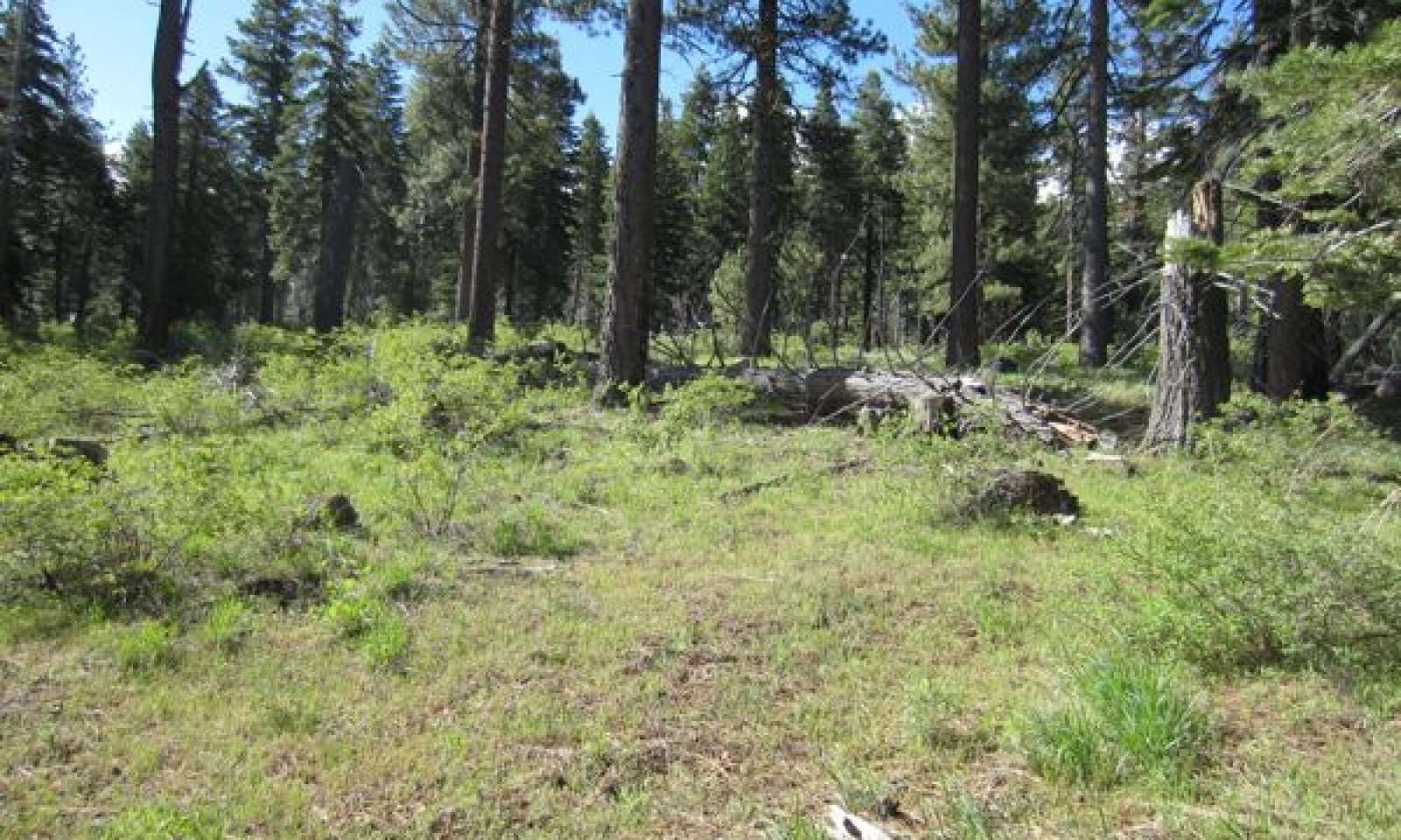
This young forest community phase develops with the natural fire regime, or with manual thinning and prescribed fires. Low to moderate intensity fire clears the understory and removes ladder and downed fuel before they reach hazardous levels, although severe high intensity canopy fires are also possible. This community phase is dominated by an even-aged stand of Jeffrey pine, with low levels of white fir seedlings and saplings in the understory. Canopy cover ranges from 30 to 45 percent, with an average of 40 percent cover.
The understory consists of diverse shrubs and a rich and productive assemblage of forbs and grasses, the composition of which is described in the forest understory narrative section below.
This community phase, and the young forest with infilling due to fire suppression (Community phase 1.4) are currently the most common phases of this ecological site in the Lake Tahoe Basin. This community phase is heavily managed with manual thinning and prescribed burns to reduce the white fir component, reduce fuel loads, and create canopy openings in the forest. Natural fires are typically quickly extinguished in this forest because of its proximity to urban areas.Forest overstory.Jeffrey pine (Pinus jeffreyi) is dominant in the overstory, and white fir occurs in small percentages in the understory and mid-canopy. This community phase begins with 10 to 20-foot tall pole-sized trees and matures to 100-foot tall trees with diameters ranging from 25 to 42 inches. Canopy cover ranges from 30 to 45 percent, with an average of 40 percent cover.
Forest understory. An open forest canopy, and a mixed fire severity regime that includes frequent low to moderate severity fires allow for a relatively high cover and high diversity of shrubs, forbs and grasses in the understory of this community. Shrub cover averages 17 percent, and ranges from 7 to 30 percent. Forb cover averages 18 percent, and ranges from 4 to 30 percent. Grasses and grasslike species cover averages 9 percent, and ranges from 4 to 30 percent. Roundleaf snowberry and wax currant are the dominant shrubs, and greenleaf manzanita, mountain whitethorn, Saskatoon serviceberry, creeping snowberry, bush chinquapin, snowbrush ceanothus, and mountain big sagebrush are common secondary species. Longer fire return intervals favor mountain big sagebrush and antelope bitterbrush. Silvery lupine and woolly mules-ears are dominant and frequent forbs, and maiden blue-eyed Mary, Sierra pea (Lathyrus nevadensis), mountain monardella, lambstongue ragwort, wavyleaf Indian paintbrush (Castilleja applegatei), slim larkspur (Delphinium depauperatum), arrowleaf balsamroot, alpine waterleaf, Fendler’s meadow-rue, rose thistle, and dusky onion are frequently present. A high diversity of other forb species may also be present at a given location, but occur less frequently so are not listed in the table below. Common perennial grasses include California brome, squirreltail, and blue wildrye, and Ross’ sedge is also frequently present.
Figure 8. Annual production by plant type (representative values) or group (midpoint values)
Table 5. Annual production by plant type
Plant type Low
(lb/acre)Representative value
(lb/acre)High
(lb/acre)Forb 80 110 180 Grass/Grasslike 55 75 90 Shrub/Vine 35 45 75 Tree 7 9 15 Total 177 239 360 Table 6. Soil surface cover
Tree basal cover 1.4-7.1% Shrub/vine/liana basal cover 1.1-2.1% Grass/grasslike basal cover 0.3-1.5% Forb basal cover 0.6-3.2% Non-vascular plants 0% Biological crusts 0% Litter 80-90% Surface fragments >0.25" and <=3" 0.5-5.0% Surface fragments >3" 0% Bedrock 0% Water 0% Bare ground 0.5-10.0% Table 7. Canopy structure (% cover)
Height Above Ground (ft) Tree Shrub/Vine Grass/
GrasslikeForb <0.5 0-1% 0-1% 0-1% 10-20% >0.5 <= 1 0-2% 0-3% 10-30% 10-30% >1 <= 2 0-3% 1-6% 1-20% 5-10% >2 <= 4.5 0-3% 6-30% 0-3% 0-5% >4.5 <= 13 0-3% 0-3% – – >13 <= 40 0-17% – – – >40 <= 80 30-45% – – – >80 <= 120 30-45% – – – >120 – – – – Community 1.4
Young forest infilling
Figure 9. Community Phase 1.4
This community phase is characterized by forest infilling, with increasing cover of white fir eventually leading to co-dominance with Jeffrey pine in the canopy. White fir is also more abundant in the understory, leading to higher tree density and basal area. Canopy cover ranges from 50 to 65 percent. Understory cover and production dramatically declines with increasing canopy cover and with the lack of fire-stimulated recruitment. Most of the shrubs that occur under a natural disturbance regime are shade-intolerant, and shrub cover declines to an average of 3 percent. The fire intolerant antelope bitterbrush (Purshia tridentata) may be found in this community phase. Forb species richness is much lower in this community phase, and species indicative of a lack of burning may be present, including milk kelloggia (Kellogia galiodes) and whiteveined wintergreen (Pyrola picta). The lack of fire causes woody debris to accumulate, averaging 20 percent cover in this community phase relative to 8 percent in the open young forest. The presence of ladder fuels and wood accumulation makes this phase high-risk for high severity fire. Increased tree density also makes this phase more susceptible to insect outbreaks, which can increase mortality after fire or during drought.
Forest overstory.Jeffrey pine and white fir eventually co-dominate the forest canopy, which ranges from 50 to 65 percent. White fir is also present in the understory and mid-canopy. Dominant trees are 70 to 90 feet tall with diameters ranging from 18 to 22 inches.
Forest understory. Understory cover and production are low in this community phase. Shrubs average 3 percent cover, ranging from 0 to 6 percent. Forbs average 3 percent cover, ranging from 0 to 8 percent, and grass cover averages 1 percent, ranging from 0 to 2 percent. Forb richness is low, with only 5 species frequently occurring in this phase, including woolly mules-ears, dusky onion, milk kelloggia, whiteveined wintergreen, and spreading dogbane (Apocynum androsaemifolium). Only 3 grass or sedge species are frequently present, and include Ross' sedge, squirreltail, and Sandberg bluegrass (Poa secunda).
Table 8. Soil surface cover
Tree basal cover 10-10% Shrub/vine/liana basal cover 0.3-0.5% Grass/grasslike basal cover 0.1-0.2% Forb basal cover 0.2-0.4% Non-vascular plants 0% Biological crusts 0% Litter 60-80% Surface fragments >0.25" and <=3" 0.5-5.0% Surface fragments >3" 0.5-8.0% Bedrock 0% Water 0% Bare ground 0-20% Table 9. Woody ground cover
Downed wood, fine-small (<0.40" diameter; 1-hour fuels) 1-8% Downed wood, fine-medium (0.40-0.99" diameter; 10-hour fuels) 1-8% Downed wood, fine-large (1.00-2.99" diameter; 100-hour fuels) 1-10% Downed wood, coarse-small (3.00-8.99" diameter; 1,000-hour fuels) 5-25% Downed wood, coarse-large (>9.00" diameter; 10,000-hour fuels) 5-15% Tree snags** (hard***) – Tree snags** (soft***) – Tree snag count** (hard***) Tree snag count** (hard***) * Decomposition Classes: N - no or little integration with the soil surface; I - partial to nearly full integration with the soil surface.
** >10.16cm diameter at 1.3716m above ground and >1.8288m height--if less diameter OR height use applicable down wood type; for pinyon and juniper, use 0.3048m above ground.
*** Hard - tree is dead with most or all of bark intact; Soft - most of bark has sloughed off.
Community 1.5
Old-growth forest infillingThis community phase is characterized by co-dominance of old-growth Jeffrey pine and white fir, with canopy trees over 180 years old. White fir is also present in the understory and mid-canopy, and Jeffrey pine begins to decline with a lack of recruitment opportunities. Canopy cover ranges from 60 to 90 percent. Understory cover, production and diversity are very low in this phase. The abundance of ladder and ground fuels makes this phase high-risk for high severity fire. Increased tree density also makes this phase more susceptible to insect outbreaks, which can increase mortality after fire or during drought.
Pathway 1.1a
Community 1.1 to 1.2In the event of a severe canopy fire or a clear-cut the old-growth forest would transition to stand initiation (Community phase 1.2). Canopy fire would have been a relatively rare occurrence, since frequent low severity fires typically keep the understory clear of fuels.
Pathway 1.1b
Community 1.1 to 1.5Occurs with long-term fire suppression that leads to forest infilling (Community phase 1.5).
Pathway 1.2a
Community 1.2 to 1.3This pathway occurs over time with a natural fire regime with frequent low severity fire ranging from 5 to 39 years. Manual thinning with prescribed burns can imitate the natural cycle and lead to the same young, open Jeffrey pine forest (Community phase 1.3).
Pathway 1.2b
Community 1.2 to 1.4This pathway occurs when fire is excluded from the system, and leads to forest infilling with white fir increasing in the understory and eventually co-dominating the canopy (Community phase 1.4).
Pathway 1.3a
Community 1.3 to 1.1This is the natural pathway for this community phase, which evolved with a historic fire regime of relatively frequent low to moderately severe fires, and occurs with time. Manual thinning or prescribed burning can be implemented to replace the natural disturbances that keep this forest open. This pathway leads to community phase 1.1.
Pathway 1.3b
Community 1.3 to 1.2In the event of a canopy fire this community phase would return to forest stand initiation (Community phase 1.2).
Pathway 1.3c
Community 1.3 to 1.4
Young forest
Young forest infillingIf fire does not occur, the density of the forest increases slowly over time, with the shade-intolerant white fir increasing in the understory and canopy, and Jeffrey pine declining in importance (Community phase 1.4).
Pathway 1.4b
Community 1.4 to 1.2The density of ground and ladder fuels creates conditions for a high intensity canopy fire. A severe fire would initiate stand regeneration (Community phase 1.2). This can shift the community back to its natural state, but further treatments may be needed to eventually achieve the relatively open forest (Community phase 1.3).
Pathway 1.4c
Community 1.4 to 1.3
Young forest infilling
Young forestA naturally occurring moderate or surface fire in this forest is unlikely due to the high fuel load. Considerable management effort would be needed to create the open forest conditions that should exist in this forest with a natural fire regime. Manual treatment or prescribed burns could thin out the white fir, as well as the fuels in the understory. This would shift this forest back to its natural state of a young, relatively open Jeffrey pine forest (Community phase 1.3).
Pathway 1.4a
Community 1.4 to 1.5If fire continues to be excluded from this system, this phase develops into old-growth forest with infilling and co-dominance by Jeffrey pine and white fir (Community phase 1.5).
Pathway 1.5b
Community 1.5 to 1.1A naturally occurring moderate or surface fire in this forest is unlikely due to the high fuel load. Considerable management effort would be needed to create the open forest conditions that should exist in this forest with a natural fire regime. Manual treatment or prescribed burns could thin out the white fir, as well as the fuels in the understory. This would shift this forest back to its natural state of an old-growth, relatively open Jeffrey pine forest (Community phase 1.1).
Pathway 1.5a
Community 1.5 to 1.2At this point a severe fire is likely and would initiate stand regeneration (Community phase 1.2).
Additional community tables
Table 10. Community 1.1 plant community composition
Group Common name Symbol Scientific name Annual production () Foliar cover (%) Table 11. Community 1.2 plant community composition
Group Common name Symbol Scientific name Annual production () Foliar cover (%) Table 12. Community 1.3 plant community composition
Group Common name Symbol Scientific name Annual production () Foliar cover (%) Tree1 Trees 7–15 Jeffrey pine PIJE Pinus jeffreyi 7–12 30–45 white fir ABCO Abies concolor 0–1 0–16 Shrub/Vine2 Shrubs 35–75 roundleaf snowberry SYRO Symphoricarpos rotundifolius 10–45 5–20 wax currant RICEC2 Ribes cereum var. cereum 1–35 1–2 whitethorn ceanothus CECO Ceanothus cordulatus 0–30 0–10 creeping snowberry SYMO Symphoricarpos mollis 0–20 0–8 snowbrush ceanothus CEVE Ceanothus velutinus 0–10 0–3 bush chinquapin CHSE11 Chrysolepis sempervirens 0–10 0–3 mountain big sagebrush ARTRV Artemisia tridentata ssp. vaseyana 0–8 0–2 Saskatoon serviceberry AMAL2 Amelanchier alnifolia 0–5 0–2 greenleaf manzanita ARPA6 Arctostaphylos patula 0–5 0–1 Forb3 Annual Forbs 0–75 maiden blue eyed Mary COPA3 Collinsia parviflora 0–70 0–5 Torrey's blue eyed Mary COTO Collinsia torreyi 0–35 0–2 spreading groundsmoke GADI2 Gayophytum diffusum 0–10 0–1 4 Perennial Forbs 80–120 silvery lupine LUAR3 Lupinus argenteus 0–50 0–10 woolly mule-ears WYMO Wyethia mollis 0–15 0–3 rose thistle CIAN Cirsium andersonii 0–10 0–3 lambstongue ragwort SEIN2 Senecio integerrimus 0–7 0–1 mountain monardella MOOD Monardella odoratissima 0–5 0–3 Sierra pea LANE3 Lathyrus nevadensis 0–5 0–2 Fendler's meadow-rue THFE Thalictrum fendleri 0–5 0–1 slim larkspur DEDE2 Delphinium depauperatum 0–5 0–1 alpine waterleaf HYCAA Hydrophyllum capitatum var. alpinum 0–5 0–1 arrowleaf balsamroot BASA3 Balsamorhiza sagittata 0–5 0–1 wavyleaf Indian paintbrush CAAP4 Castilleja applegatei 0–5 0–1 dusky onion ALCA2 Allium campanulatum 0–3 0–1 Grass/Grasslike5 Grasses and Grasslike 55–90 sedge CAREX Carex 0–35 0–1 California brome BRCA5 Bromus carinatus 0–15 0–5 squirreltail ELEL5 Elymus elymoides 0–15 0–5 blue wildrye ELGL Elymus glaucus 0–15 0–5 Ross' sedge CARO5 Carex rossii 0–8 0–1 Table 13. Community 1.3 forest overstory composition
Common name Symbol Scientific name Nativity Height ft Canopy cover (%) Diameter in Basal area (square ft/acre) TreeJeffrey pine PIJE Pinus jeffreyi Native – 30-45 25-42 0 white fir ABCO Abies concolor Native – 0-16 7-12 0 Table 14. Community 1.3 forest understory composition
Common name Symbol Scientific name Nativity Height (ft) Canopy cover (%) Grass/grass-like (Graminoids)blue wildrye ELGL Elymus glaucus Native – 0–5 California brome BRCA5 Bromus carinatus Native – 0–5 squirreltail ELEL5 Elymus elymoides Native – 0–5 Ross' sedge CARO5 Carex rossii Native – 0–1 sedge CAREX Carex Native – 0–1 Forb/Herbsilvery lupine LUAR3 Lupinus argenteus Native – 0–10 maiden blue eyed Mary COPA3 Collinsia parviflora Native – 0–5 mountain monardella MOOD Monardella odoratissima Native – 0–3 woolly mule-ears WYMO Wyethia mollis Native – 0–3 rose thistle CIAN Cirsium andersonii Native – 0–3 spreading groundsmoke GADI2 Gayophytum diffusum Native – 0–2 Torrey's blue eyed Mary COTO Collinsia torreyi Native – 0–2 Sierra pea LANE3 Lathyrus nevadensis Native – 0–2 lambstongue ragwort SEIN2 Senecio integerrimus Native – 0–1 arrowleaf balsamroot BASA3 Balsamorhiza sagittata Native – 0–1 alpine waterleaf HYCAA Hydrophyllum capitatum var. alpinum Native – 0–1 wavyleaf Indian paintbrush CAAP4 Castilleja applegatei Native – 0–1 Fendler's meadow-rue THFE Thalictrum fendleri Native – 0–1 slim larkspur DEDE2 Delphinium depauperatum Native – 0–1 dusky onion ALCA2 Allium campanulatum Native – 0–1 Shrub/Subshrubroundleaf snowberry SYRO Symphoricarpos rotundifolius Native – 5–20 whitethorn ceanothus CECO Ceanothus cordulatus Native – 0–10 creeping snowberry SYMO Symphoricarpos mollis Native – 0–8 snowbrush ceanothus CEVE Ceanothus velutinus Native – 0–3 bush chinquapin CHSE11 Chrysolepis sempervirens Native – 0–3 mountain big sagebrush ARTRV Artemisia tridentata ssp. vaseyana Native – 0–2 Saskatoon serviceberry AMAL2 Amelanchier alnifolia Native – 0–2 wax currant RICEC2 Ribes cereum var. cereum Native – 1–2 greenleaf manzanita ARPA6 Arctostaphylos patula Native – 0–1 Treewhite fir ABCO Abies concolor Native – 0–2 Jeffrey pine PIJE Pinus jeffreyi Native – 0–0.5 Table 15. Community 1.4 plant community composition
Group Common name Symbol Scientific name Annual production () Foliar cover (%) Table 16. Community 1.4 forest overstory composition
Common name Symbol Scientific name Nativity Height ft Canopy cover (%) Diameter in Basal area (square ft/acre) TreeJeffrey pine PIJE Pinus jeffreyi Native 90- 15-65 15-22 0 white fir ABCO Abies concolor Native 90- 10-30 9-22 0 Table 17. Community 1.4 forest understory composition
Common name Symbol Scientific name Nativity Height (ft) Canopy cover (%) Grass/grass-like (Graminoids)squirreltail ELEL5 Elymus elymoides Native – 0–1 Sandberg bluegrass POSE Poa secunda Native – 0–0.5 Ross' sedge CARO5 Carex rossii Native – 0–0.5 Forb/Herbwoolly mule-ears WYMO Wyethia mollis Native – 0–6 dusky onion ALCA2 Allium campanulatum Native – 0–0.5 milk kelloggia KEGA Kelloggia galioides Native – 0–0.5 whiteveined wintergreen PYPI2 Pyrola picta Native – 0–0.5 spreading dogbane APAN2 Apocynum androsaemifolium Native – 0–0.5 Shrub/Subshrubrimelia lichen RICE2 Rimelia cetrata Native – 0–3 bush chinquapin CHSE11 Chrysolepis sempervirens Native – 0–3 antelope bitterbrush PUTR2 Purshia tridentata Native – 0–3 snowbrush ceanothus CEVE Ceanothus velutinus Native – 0–3 greenleaf manzanita ARPA6 Arctostaphylos patula Native – 0–2 roundleaf snowberry SYRO Symphoricarpos rotundifolius Native – 0–0.5 Treewhite fir ABCO Abies concolor Native – 0.5–2 Jeffrey pine PIJE Pinus jeffreyi Native – 0–1 Table 18. Community 1.5 plant community composition
Group Common name Symbol Scientific name Annual production () Foliar cover (%) Interpretations
Animal community
This forest provides food and shelter for a variety of animals including squirrels, bears, birds and deer. Tree seeds are eaten by birds, and the roots and young stems are eaten by small mammals. The standing dead and downed trees provide habitats for nesting birds and shelter for cavity dwellers (Gucker 2007).
Hydrological functions
The hydrology of this site is characterized by heavy snowmelt in the spring, with very little precipitation in the summer months.
Recreational uses
This ecological site can be a scenic forest. If slopes are appropriate, it provides suitable camping and picnicking areas. Trails for walking, biking and cross-country skiing are found throughout this site.
Wood products
Jeffrey pine is used for high-grade lumber, and is used for molding, cabinets, doors, and windows (Gucker 2007).
Other products
Jeffrey pine cones are used for arts and crafts.
Jeffrey pine pitch was distilled for turpentine early in the century; however the terpenes were found to contain high amounts of the explosive chemical heptane (Gucker 2007).
Other information
Site index documentation:
Schumacher (1926) and Meyer (1961) were used to determine forest site productivity for white fir and Jeffrey pine respectively. Low to High values of Site index and CMAI (culmination of mean annual increment) give an indication of the range of inherent productivity of this ecological site. (CMAI values are not available for incense cedar, so zeros were used to indicate the lack of data.) Site index relates to height of dominant trees over a set period of time and CMAI relates to the average annual growth of wood fiber in the boles/trunks of trees. Site index and CMAI listed in the Forest Site Productivity section are in units of feet and cubic feet/acre/year, respectively. Both site index and CMAI are estimates; on-site investigation is recommended for specific forest management units for each soil classified to this ecological site. The historical and actual basal area of trees within a growing stand will greatly influence CMAI.
Trees appropriate for site index measurement typically occur in stands of community phases 1.3 and 1.4. Site trees are selected according to guidance in reference publications. Please refer to the Tahoe Basin Soil Survey for detailed site index information by soil component.
Table 19. Representative site productivity
Common name Symbol Site index low Site index high CMAI low CMAI high Age of CMAI Site index curve code Site index curve basis Citation white fir ABCO 30 55 51 109 70 030 50TA Schumacher, Francis X. 1926.Yield, stand, and volume tables for white fir in the California pine region. University of California Agricultural Experiment Station Bulletin 407. Jeffrey pine PIJE 60 92 46 88 50 600 100TA Meyer, Walter H. 1961. Yield of even-aged stands of ponderosa pine. USDA Technical Bulletin 630. (1938 version revised in 1961). Supporting information
Inventory data references
The following NRCS TEUI plots were used to describe this ecological site. Community Phase 1.1: WaE04102 - Type location MxF04217 UmF04216 Community Phase 1.4: UmF04057 UmF04205 UmF04215 UmF04221
Type locality
Location 1: Washoe County, NV UTM zone N UTM northing 4333118 UTM easting 765834 General legal description Park across from meadow north of Spooner Summit on Highway 28 and walk upslope at a bearing of 227 degrees for approximately 1/4 mile. Other references
Anderson, M. D. 2001. Ceanothus velutinus. Fire Effects Information System, [Online]. U.S. Department of Agriculture, Forest Service, Rocky Mountain Research Station, Fire Sciences Laboratory.
Barbour, M., E. Kelly, P. Maloney, D. Rizzo, E. Royce, and J. Fites-Kaufmann. 2002. Present and past old-growth forests of the Lake Tahoe Basin, Sierra Nevada, US. Journal of Vegetation Science 13:461-472.
Beardsley, D., C. Bolsinger, and R. Warbington. 1999. Old-growth forest in the Sierra Nevada: By type in 1945 and 1993 and ownership in 1999. PNW-RP-516, USDA Forest Service, Pacific Northwest Research Station.
Binkley, D., T. Sisk, C. Chambers, J. Springer, and W. Block. 2007. The role of old-growth forests in frequent-fire landscapes. Ecology and Society 12:18-35.
Burns, R. M. and B. H. Honkala. 1990. Silvics of North America: 1. Conifers; 2. Hardwoods. U.S Department of Agriculture, Forest Service, Washington, DC.
Dhaemers. 2006. Vegetation recovery following spring prescribed fire in pinyon-juniper woodlands of central Nevada: Effects of elevation and tree cover. M.Sc. Unversity of Nevada, Reno.
Elliot-Fisk, D. L., R. Harris, R. A. Rowntree, T. C. Cahill, R. Kattelmann, P. Rucks, O. K. Davis, R. Lacey, D. A. Sharkey, L. Duan, D. Leisz, S. L. Stephens, C. R. Goldman, S. Lindstrom, D. S. Ziegler, G. E. Gruell, and D. Machida. 1996. Lake Tahoe Case Study. Pages 217-276 Sierra Nevada Ecosystem Project. University of California, Centers for Water and Wildland Resources, Davis, CA.
Gray, A. N., H. S. Zald, R. A. Kern, and M. North. 2005. Stand conditions associated with tree regeneration in Sierran mixed-conifer forests. Forest Science 51:198-210.
Gucker, C. L. 2007. Pinus jeffreyi. Fire Effects Information System, [Online]. U.S. Department of Agriculture, Forest Service, Rocky Mountain Research Station, Fire Sciences Laboratory.
Huisinga, K. D., D. C. Laughlin, P. Z. Fule, J. D. Springer, and C. M. McGlone. 2005. Effects of an intense prescribed fire on understory vegetation in a mixed conifer forest. Journal of the Torrey Botanical Society 132:590-601.
Laughlin, D. C., J. D. Bakker, and P. Z. Fule. 2005. Understorey plant community structure in lower montane and subalpine forests, Grand Canyon National Park, USA. Journal of Biogeography 32:2083-2102.
Murphy, D. D. and C. M. Knopp. 2000. Lake Tahoe Basin Watershed Assessment. PSW-GTR-175, USDA Forest Service, Pacific Southwest Research Station.
North, M., M. Hurteau, R. Fiegener, and M. Barbour. 2005. Influence of fire and El Nino on tree recruitment varies by species in Sierran Mixed Conifer. Forest Science 51:187-197.
Peterson, D. L., M. J. Arbaugh, V. A. Wakefield, and P. R. Miller. 1987. Evidence of growth reduction in Ozone-injured Jeffrey pine (Pinus jeffreyi Grev. and Balf.) in Sequoia and Kings Canyon National Parks. JAPCA 37:906-912.
Reeves, S. L. 2006. Ceanothus cordulatus. Fire Effects Information System, [Online]. U.S. Department of Agriculture, Forest Service, Rocky Mountain Research Station, Fire Sciences Laboratory.
Schoennagel, T., D. M. Waller, M. G. Turner, and W. H. Romme. 2004. The effect of fire interval on post-fire understorey communities in Yellowstone National Park. Journal of Vegetation Science 15:797-806.
Skinner, C. N. and C.-R. Chang. 1996. Fire regimes, past and present. Pages 1041-1069 Status of the Sierra Nevada. Sierra Nevada Ecosystems Project: Final report to Congress. University of California, Centers for Water and Wildland Resources, Davis, CA.
Stephens, S. L. 2001. Fire history differences in adjacent Jeffrey pine and upper montane forests in the eastern Sierra Nevada. International Journal of Wildland Fire 10:161-167.
Stephens, S. L. and D. L. Fry. 2005. Spatial distribution of regeneration patches in an old-growth Pinus jeffrey-mixed conifer forest in northwestern Mexico. Journal of Vegetation Science 16:693-702.
Taylor, E. H. 2004. Identifying forest reference conditions on early cut-over lands, Lake Tahoe Basin, USA. Ecological Applications 14:1903-1920.
Vasek, F. C. 1978. Jeffrey pine [Pinus jeffreyi] and vegetation of the southern Modoc National Forest [California]. Madroño 25:9-30.
Wayman, R. B. and M. North. 2007. Initial response of a mixed-conifer understory plant community to burning and thinning restoration treatments. Forest Ecology and Management 239:32-44.
Webster, K. 2010. Effects of prescribed fire on understory vegetation in mixed-conifer forests of the southern Sierra Nevada, California. M.Sc. University of Washington.
Wright, H. A. 1985. Effects of fire on grasses and forbs in sagebrush-grass communities. Pages 12-21 in Rangeland Fire Effects; A symposium. USDI-Bureau of Land Management, Boise, ID.
Contributors
Alice Miller
Rangeland health reference sheet
Interpreting Indicators of Rangeland Health is a qualitative assessment protocol used to determine ecosystem condition based on benchmark characteristics described in the Reference Sheet. A suite of 17 (or more) indicators are typically considered in an assessment. The ecological site(s) representative of an assessment location must be known prior to applying the protocol and must be verified based on soils and climate. Current plant community cannot be used to identify the ecological site.
Author(s)/participant(s) Contact for lead author Date Approved by Approval date Composition (Indicators 10 and 12) based on Annual Production Indicators
-
Number and extent of rills:
-
Presence of water flow patterns:
-
Number and height of erosional pedestals or terracettes:
-
Bare ground from Ecological Site Description or other studies (rock, litter, lichen, moss, plant canopy are not bare ground):
-
Number of gullies and erosion associated with gullies:
-
Extent of wind scoured, blowouts and/or depositional areas:
-
Amount of litter movement (describe size and distance expected to travel):
-
Soil surface (top few mm) resistance to erosion (stability values are averages - most sites will show a range of values):
-
Soil surface structure and SOM content (include type of structure and A-horizon color and thickness):
-
Effect of community phase composition (relative proportion of different functional groups) and spatial distribution on infiltration and runoff:
-
Presence and thickness of compaction layer (usually none; describe soil profile features which may be mistaken for compaction on this site):
-
Functional/Structural Groups (list in order of descending dominance by above-ground annual-production or live foliar cover using symbols: >>, >, = to indicate much greater than, greater than, and equal to):
Dominant:
Sub-dominant:
Other:
Additional:
-
Amount of plant mortality and decadence (include which functional groups are expected to show mortality or decadence):
-
Average percent litter cover (%) and depth ( in):
-
Expected annual annual-production (this is TOTAL above-ground annual-production, not just forage annual-production):
-
Potential invasive (including noxious) species (native and non-native). List species which BOTH characterize degraded states and have the potential to become a dominant or co-dominant species on the ecological site if their future establishment and growth is not actively controlled by management interventions. Species that become dominant for only one to several years (e.g., short-term response to drought or wildfire) are not invasive plants. Note that unlike other indicators, we are describing what is NOT expected in the reference state for the ecological site:
-
Perennial plant reproductive capability:
Print Options
Sections
Font
AAAAOther
PrintThe Ecosystem Dynamics Interpretive Tool is an information system framework developed by the USDA-ARS Jornada Experimental Range, USDA Natural Resources Conservation Service, and New Mexico State University.
Accessibility statement


