
Natural Resources
Conservation Service
Ecological site F022AF001CA
Frigid Sandy Outwash Plain Gentle Slopes
Accessed: 09/22/2026
-
Search


Major Land Resource Area or ecological site by name and/or ID.
PreviousSectionsNextGeneral information
Approved. An approved ecological site description has undergone quality control and quality assurance review. It contains a working state and transition model, enough information to identify the ecological site, and full documentation for all ecosystem states contained in the state and transition model.
Click to explore map
Figure 1. Mapped extent
Areas shown in blue indicate the maximum mapped extent of this ecological site. Other ecological sites likely occur within the highlighted areas. It is also possible for this ecological site to occur outside of highlighted areas if detailed soil survey has not been completed or recently updated.
MLRA notes
Major Land Resource Area (MLRA): 022A–Sierra Nevada and Tehachapi Mountains
Major Land Resource Area 22A, Sierra Nevada Mountains, is located predominantly in California and a small section of western Nevada. The area lies completely within the Sierra Nevada Section of the Cascade-Sierra Mountains Province. The Sierra Nevada range has a gentle western slope, and a very abrupt eastern slope. The Sierra Nevada consists of hilly to steep mountains and occasional flatter mountain valleys. Elevation ranges between 1,500 and 9,000 ft throughout most of the range, but peaks often exceed 12,000 ft. The highest point in the continental US occurs in this MLRA (Mount Whitney, 14,494 ft). Most of the Sierra Nevada is dominated by granitic rock of the Mesozoic age, known as the Sierra Nevada Batholith. The northern half is flanked on the west by a metamorphic belt, which consists of highly metamorphosed sedimentary and volcanic rocks. Additionally, glacial activity of the Pleistocene has played a major role in shaping Sierra Nevada features, including cirques, arêtes, and glacial deposits and moraines. Average annual precipitation ranges from 20 to 80 inches in most of the area, with increases along elevational and south-north gradients. Soil temperature regime ranges from mesic, frigid, and cryic.
LRU "F" Northeast Mixed Conifer: This LRU includes the drier eastside forests of the northern Sierra Nevada that occur north of Bridgeport, the eastern, lower elevations of the Tahoe area, and the northern extent of the Sierra near Susanville, most closely corresponding to EPA ecoregion 5f. Elevations are typically between 5,000 and 8,000 feet. The frost free season is between 50 and 100 days, MAAT is between 40 and 48 degrees F, and MAP is typically between 17 and 35 inches, but may range higher in the northernmost section. This LRU exists in the rain shadow formed by the Sierra Nevada Crest, and consequently has much lower precipitation than equivalent elevations on western slopes. Soil temperature regimes are mostly frigid, with some cryic. Soil moisture regimes are xeric.Classification relationships
Forest Alliance = Pinus contorta ssp. murrayana – Lodgepole pine forest; Associations = tentatively Pinus contorta ssp. murrayana/Carex rossii and Pinus contorta ssp. murrayana/Carex spp. (Sawyer, John O., Keeler-Wolf, Todd, and Evens, Julie M. 2009. A Manual of California Vegetation. 2nd ed. California Native Plant Society Press. Sacramento, California.)
Ecological site concept
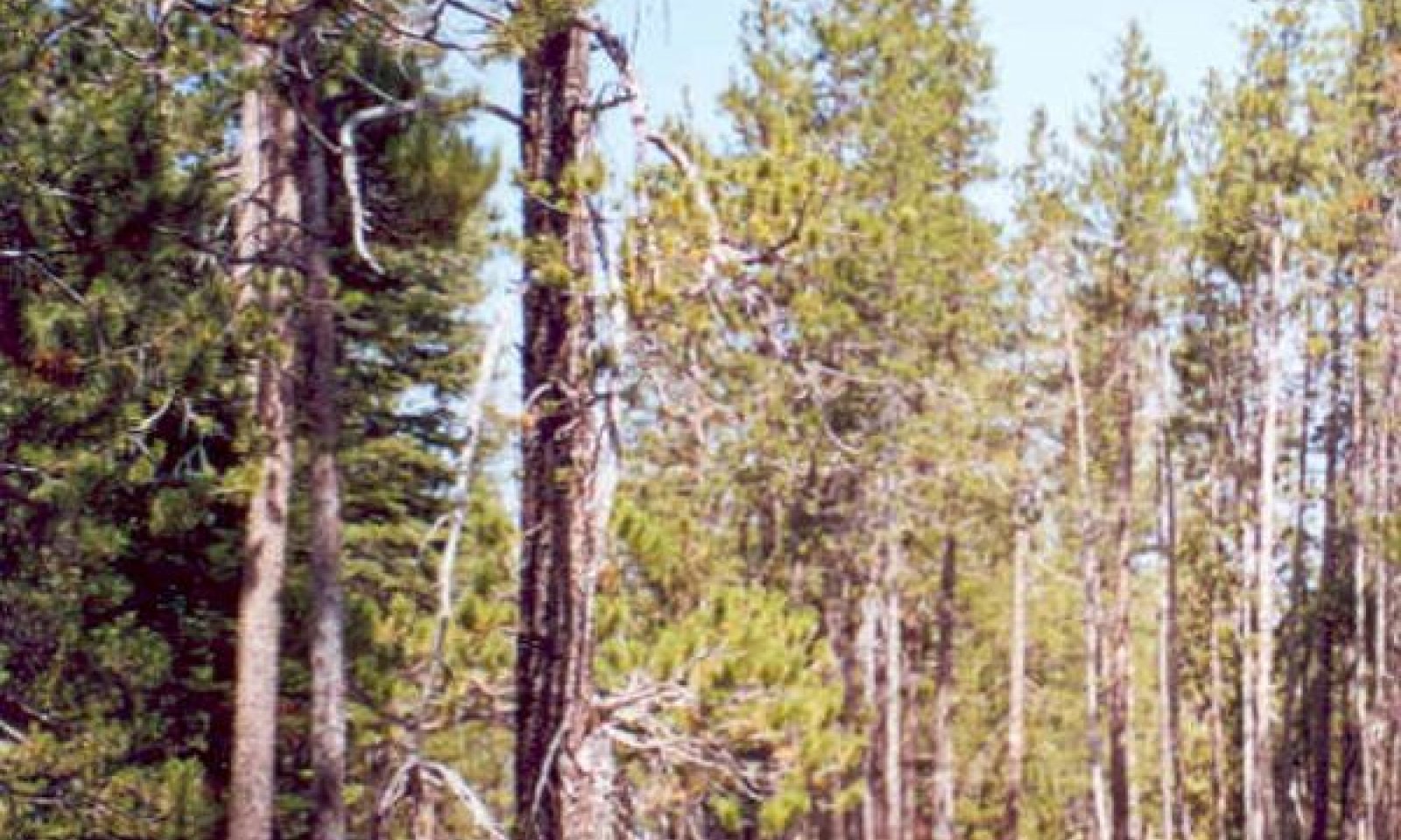
This site is found on undulating, low-sloping glacial outwash over till at elevations of approximately 6000 to 7500 feet. Slopes range from 0 to 5 percent. This site is often found in basins, and along cold air drainages. Soils have sandy-skeletal textures, and are deep to a silica cemented duripan. Redox features begin between 23 to 29 inches. There is perched water table during the wet season, and droughty conditions during the summer dry season. The vegetation is an open forest of Sierra lodgepole pine (Pinus contorta var. murrayana) and western juniper (Juniperus occidentalis), with a relatively sparse understory of shrubs, forbs and grasses. The undulating topography creates variable depth to the duripan, so pockets of extremely droughty shallow soils are interspersed with pockets of moist saturated soils. Sierra lodegepole pine is tolerant of both saturated soils and droughty conditions when moisture is lacking in the summer. Western juniper is shallow rooted and highly drought-tolerant, and does well in the droughty shallower soils on slight rises within this site. The moister soils pockets have a lush sedge and grass community, which may stay permanently wet riparian meadows.
Associated sites
F022AE007CA Frigid, Sandy, Moraines And Hill Slopes
Occurs on adjacent moraines and moderately sloping hills with sandy soils derived from glacial outwash and till from mixed parent materials. Vegetation is a productive Jeffrey pine (Pinus jeffreyi) - white fir (Abies concolor) forest.
F022AX100CA Frigid, Sandy, Moist, Outwash Fan
Occurs on adjacent very deep, poorly drained soils that formed in alluvium from glacial outwash fans. The vegetation is a Sierra lodgepole pine (Pinus contorta var. murrayana) forest with willows and forbs.
R022AX102CA Frigid E-C Meadow System
Occurs on nearby low gradient Rosgen C to E type channels with broad gently sloped floodplains. Vegetation is a wet to dry meadow complex, with Lemmon's (Salix lemmonni) and Geyer willow (Salix geyeriana), sedges, grasses and forbs.
R022AX107CA Frigid C Channel System
Occurs on nearby Rosgen C-B type channels with gravelly to cobbly channel substrates and 2 - 3 percent slopes. A complex of vegetation communities is present, but Lemmon's willow (Salix lemmonii) is a characteristic species.
Similar sites
F022AF003CA Frigid, Loamy, Fragipan, Outwash
Occurs on very deep soils from outwash and alluvium from mixed sources. Soils have a weak fragipan at 12 to 65 inches, and no duripan. The vegetation is dense Sierra lodegepole pine (Pinus contorta var. murrayana) forest with sparse grasses in the understory.
F022AX100CA Frigid, Sandy, Moist, Outwash Fan
Occurs on very deep, poorly drained soils that are near to, but not directly associated with riparian systems. This site is moister, and has a more productive understory characterized by willows (Salix sp.) and wetland grasses and grasslike species.
Table 1. Dominant plant species
Tree (1) Pinus contorta var. murrayana
(2) Juniperus grandisShrub (1) Ribes
Herbaceous (1) Carex rossii
Physiographic features
This ecological site is found on outwash terraces, on all aspects with slopes ranging from 0 to 5 percent. The largest area of this ecological site is found near Meyers around the Upper Truckee River, with elevations ranging from 6,220 to 6,480. Flooding frequency ranges from none to rare, and is of brief duration. Ponding is occasional, is of long duration, occurring from March through June. Runoff class is high.
Table 2. Representative physiographic features
Landforms (1) Outwash terrace
Flooding duration Brief (2 to 7 days) Flooding frequency None to rare Ponding duration Long (7 to 30 days) Ponding frequency Occasional Elevation 6220 – 6480 ft Slope 0 – 5 % Ponding depth 1 – 6 in Water table depth 20 – 80 in Aspect Aspect is not a significant factor Climatic features
The average annual precipitation ranges from 25 to 47 inches, mostly in the form of snow in winter (November through April). The average annual air temperature ranges from 41 to 45 degrees Fahrenheit. The frost-free (>32F) season is 25 to 75 days, and the freeze-free (>28F) season is 50 to 100 days.
Table 3 Representative climatic features
Frost-free period (average) 50 days Freeze-free period (average) 80 days Precipitation total (average) 40 in BarLineFigure 2. Monthly precipitation range
BarLineFigure 3. Monthly average minimum and maximum temperature
Figure 4. Annual precipitation pattern
Figure 5 Annual average temperature pattern
">Influencing water features
This ecological site is seasonally ponded, creating saturated soils within 30 inches of the surface from January to July.
Soil features
The soils associated with this ecological site are deep to a root-restricting silica cemented hardpan, and formed in alluvium and glacial outwash on outwash terraces. These soils are somewhat poorly drained with rapid permeability above the hardpan and slow permeability below. Redoximorphic concentrations are found from 23 to 44 inches. The soil moisture regime is xeric and the soil temperature regime is frigid. Surface rock fragments smaller than 3 inches in diameter average 15 percent and larger fragments are generally absent. Surface textures are loamy coarse sand. Subsurface textures are gravelly loamy coarse sand and extremely gravelly coarse sand. Subsurface rock fragments smaller than 3 inches in diameter average 40 percent by volume, and larger fragments average 9 percent (for a depth of 0 to 59 inches). The soils that are correlated to this ecological site are the Celio soils (Sandy-skeletal, mixed, frigid Oxyaquic Dystroxerepts).
This ecological site has been correlated with the following mapunits and soil components in the Tahoe Basin soil survey area (CA693):
7431 ; Celio loamy coarse sand, 0 to 5 percent slopes ; Celio ; ; 80
7481 ; Meeks gravelly loamy coarse sand, 0 to 5 percent slopes, stony ; Celio ; ; 5
7483 ; Meeks gravelly loamy coarse sand, 0 to 5 percent slopes, very stony ; Celio ; ; 5
7482 ; Meeks gravelly loamy coarse sand, 5 to 15 percent slopes, stony ; Celio ; ; 3
Table 4. Representative soil features
Parent material (1) Outwash – granite
Surface texture (1) Loamy coarse sand
Family particle size (1) Sandy
Drainage class Somewhat poorly drained Permeability class Rapid Soil depth 39 – 59 in Surface fragment cover <=3" 15 % Surface fragment cover >3" Not specified Available water capacity
(0-40in)1.4 – 1.9 in Soil reaction (1:1 water)
(0-40in)5.6 – 6.5 Subsurface fragment volume <=3"
(Depth not specified)40 % Subsurface fragment volume >3"
(Depth not specified)9 % Ecological dynamics
This Sierra lodgepole pine ecological site occurs primarily on glacial outwash plains, and is associated with soils that have a silica-cemented pan which perches water. This creates a high water table during the wet season, and a harsh, dry soil in the summer. This site is often found in basins and along cold air drainages where cold air tends to sink.
The presumed most successionally-advanced community phase is an open Sierra lodgepole pine (Pinus contorta var. murrayana) – western juniper (Juniperus occidentalis) forest. These are multi-aged stands of Sierra lodgepole pine interspersed with western juniper and an occasional white fir (Abies concolor) and Jeffery pine (Pinus jeffreyi). The presence of western juniper in the site indicates harsh summer conditions. Junipers are scattered throughout the open areas and range from very large old trees to young seedlings. The understory is sparse but has a diverse cover of native grasses, forbs and woody plants including tree regeneration. The diversity is due to its proximity to riparian corridors, where fingers of the dry-appearing Sierra lodgepole pine-western juniper forest interlace with lush riparian willow and marsh habitats. This site is also situated in a basin, which creates seasonally high water tables that can influence the area.
Sierra lodgepole pines can tolerate harsher conditions than many other conifers—especially cold, light, heat, drought, saturation, and hardpan soils (Kocher, 2005; Lotan and Critchfield, 1990). They are also moderately shade and competition tolerant. However, the thin bark and shallow root systems make the Sierra lodgepole pines susceptible to fire and windfall (Lotan and Critchfield, 1990). Prolonged drought and flooding can kill the trees or make them vulnerable to disease and pest outbreaks.
Historically, fire played an important role in thinning and renewing Sierra lodgepole pine woodlands. Studies on fire frequency in lodgepole pine forest vary from 20 to 200 years, depending on location, elevation, and precipitation (Cope, 1993; Murphy and Knopp, 2000). This area has moderate precipitation, is at mid elevations, and has seasonal wetness. The fire intervals for moderate and severe fires were most likely between 70 to 100 years, heavily correlated with mountain pine beetle (Dendroctonus ponderosae) infestations and the decline of the overstory trees. In addition to a natural fire regime, it is believed the Washoe Indians used fire to preserve meadow environments and to keep forests open (Murphy and Knopp, 2000).
Human disturbance regimes have altered the historic plant community and its natural cycles. Much of the Sierra lodgepole pine forest terrain was clear-cut during the Comstock era, from the mid-1870s to the mid-1890s, although small-scale logging occurred in sections from 1911 to the 1970s (Murphy and Knopp, 2000). Intense sheep and cattle grazing began as early as 1850, especially in the meadows. Then, in 1924, fire exclusion became national policy (Murphy and Knopp, 2000). This policy led to increased forest density and over- and understory fuel build-up. Consequently, this Sierra lodgepole pine community is younger and likely more overstocked than the pre-European settlement forest.
The reference state consists of the most successionally advanced community phase (numbered 1.1) as well as other community phases that result from natural and human disturbances. Community phase 1.1 is deemed the phase representative of the most successionally advanced pre-European plant/animal community including periodic natural surface fires that influenced its composition and production. Because this phase is determined from the oldest modern day remnant forests and/or historic literature, some speculation is necessarily involved in describing it.
All tabular data listed for a specific community phase within this ecological site description represent a summary of one or more field data collection plots taken in communities within the community phase. Although such data are valuable in understanding the phase (kinds and amounts of ground and surface materials, canopy characteristics, community phase overstory and understory species, production and composition, and growth), it typically does not represent the absolute range of characteristics nor an exhaustive listing of species for all the dynamic communities within each specific community phase.State and transition model
Custom diagramStandard diagram
Figure 6. F022AF001CA
More interactive model formats are also available. View Interactive Models
More interactive model formats are also available. View Interactive Models
Click on state and transition labels to scroll to the respective textEcosystem states
State 1 submodel, plant communities
Communities 1, 5 and 6 (additional pathways)
Communities 2, 5 and 6 (additional pathways)
State 1
ReferenceCommunity 1.1
Mature forestThe most successionally advanced community phase was most likely open older stands of predominantly Sierra lodgepole pine with a few large, scattered western junipers, white fir, and Jeffery pines. Western juniper is usually favored during long, dry summers or cold winters with little moisture. The junipers are scattered throughout the open areas, and range from very large, old trees to young seedlings. The age for this community is estimated to have ranged from 60 to possibly more than 200 years old depending on local disturbances. Stand-replacing fires would have initially established an even-aged forest. However, minor disturbances, such as windfall and insect infestation would have eventually led to an irregular open, more multi-aged forest community. The understory cover was probably moderate in the openings with grasses, forbs, and scattered shrubs and trees including western juniper seedlings and saplings.
Forest overstory.The overstory in this multi-aged woodland is open, rarely exceeding 60 percent canopy cover. Old growth and mature lodgepole pines dominate with a cover range of 25 to 55 percent, with an average of 40 percent. Large old growth specimens of western juniper, white fir and Jeffrey pine are most likely present with low frequency and cover.
Forest understory. Historically, the understory cover was most likely moderate with a range of 5 to 20 percent. The open canopy would have allowed for a diversity of herbaceous and graminoid species. Data is unavailable for this historic community, but the species were most likely similar to the ones listed in young open lodgepole woodland community.
Table 5. Ground cover
Tree foliar cover 30-60% Shrub/vine/liana foliar cover 0-10% Grass/grasslike foliar cover 10-10% Forb foliar cover 0-20% Non-vascular plants 0% Biological crusts 0% Litter 0-0% Surface fragments >0.25" and <=3" 0-10% Surface fragments >3" 0-0% Bedrock 0% Water 0% Bare ground 0-20% Community 1.2
Stand initiationHistorically, regeneration would occur in the event of a severe canopy fire. Today, a carefully planned harvest and prescribed burn could imitate a canopy fire and initiate forest regeneration.
Native cover is generally low, ranging from 5 to 20 percent, leaving the remaining area vulnerable to non-native and noxious weed infestations. These seeds require moist soil and full sun to establish in the first season. Sierra lodgepole pine also readily germinates from seed in the mineral soil exposed by fire and can survive in the frost pockets that define these sites, where other tree seedlings cannot. Dense groves of even-aged lodgepole pine seedlings can establish and grow well following stand replacing fires. Remnant overstory trees may be present in limited numbers.Forest overstory.A small number of older Sierra lodgepole pines may have survived the disturbance to become a seed source for lodgepole pine regeneration. These lodgepole pines would have low cover and little impact on the understory.
Forest understory. Ross’ sedge (Carex rossii), squirreltail (Eymus elymoides) and many other species of grasses and forbs such as grassy tarweed (Madia gracilis), and common yarrow (Achillea millefolium) regenerate from seed after fire and will dominate this community for several years.
Community 1.3
Young forest
Figure 7. Community Phase 1.3
Young Sierra lodgepole pine forests will develop from community phase 1.2. Western juniper and white fir may germinate during this time in the shade of the young Sierra lodgepole pines and small shrubs. The age period for this community is estimated to be from 10 to 60 years. Historically, surface fires, insect outbreaks, and possibly deer browsing maintained this open forest.
Forest overstory.In the young forest phase, the overstory is dominated by sapling and pole-sized trees, maturing to tall small-diameter lodgepole pines within 20 to 60 years. A few western junipers, white firs and Jeffrey pines will also establish. Canopy cover ranges from 20 to 45 percent.
Forest understory. The understory is dominated by grasses and grasslike species, with sparse forbs and shrubs. Understory cover ranges from 5 to 20 percent.
Community 1.4
Dense young forestThis community phase is characterized by a very dense overstory of Sierra lodgepole pine, with canopy cover of up to 80 percent, and increasing cover of western juniper and white fir in the understory. This phase is highly susceptible to severe canopy fire and to insect infestation.
Community 1.5
Dense mature forestThis community phase is a dense mature forest co-dominated by western juniper, white fir and Sierra lodgepole pine. Canopy cover is high, at up to 90 percent, and trees are 60 to over 100 years old. This phase is highly susceptible to severe canopy fire and to insect infestation.
Community 1.6
Mountain pine beetle epidemicStanding dead forests can result following mountain pine beetle epidemics, sometimes in combination with prolonged drought or flooding. Large patches of forest remain standing dead for many years until fire or manual treatment remove the dead trees and surface fuels. If surface fuels are not too high, grasses and forbs may grow in the understory and in openings.
Pathway 1.1a
Community 1.1 to 1.2In the event of a severe canopy fire, or a clear-cut with or without a prescribed burn, phase 1.1 would quickly develop into phase 1.2, the stand initiation phase. Sierra lodgepole pine is susceptible to death from fire at any age because of their thin bark and shallow root systems (Kocher, 2005).
Pathway 1.1c
Community 1.1 to 1.5This pathway occurs with fire suppression.
Pathway 1.1b
Community 1.1 to 1.6Plant community phase 1.1 may develop into phase 1.5 with the infestation of pests. The primary threat to Sierra lodgepole pines from pest invasion is from the mountain pine beetle (Dendroctonus ponderosae). Infestations can lead to a high mortality rate, sometimes leaving a stand of dead trees, and causing high fuel loads. Natural outbreaks of variable severity tend to occur every 20 to 40 years (Cope, 1993).
Pathway 1.2a
Community 1.2 to 1.3Community phase 1.2 will naturally transition to phase 1.3 if given time without severe disturbances. This pathway is followed with a natural fire regime. Reports vary on the natural fire return interval, but this pathway assumes that surface fires were relatively frequent with 20 to 40 year cycles (Cope 1993). Manual thinning with prescribed burns can imitate the natural cycle and lead to the same community phase.
Pathway 1.2b
Community 1.2 to 1.4This pathway occurs with fire suppression that prevents thinning necessary for the natural patchy structure of this ecological site. Lack of ground fire allows white fir to establish and gain maturity in the understory.
Pathway 1.3a
Community 1.3 to 1.1The natural shift for this phase is to grow and develop into community phase 1.1. This pathway evolved with a historic fire regime of occasional surface and moderately severe fires, with occasional pest outbreaks that can lead to partial tree death. Manual thinning or prescribed burning can be implemented to replace the natural disturbances that kept this forest relatively open.
Pathway 1.3b
Community 1.3 to 1.2In the event of a canopy fire, this phase would quickly return to phase 1.2
Pathway 1.3c
Community 1.3 to 1.4This pathway occurs with fire suppression that prevents thinning necessary for the natural patchy structure of this ecological site. Lack of ground fire allows white fir to establish and gain maturity in the understory.
Pathway 1.3d
Community 1.3 to 1.6This phase can transition to phase 1.6 with the infestation of pests. The primary threat to Sierra lodgepole pines from pest invasion is from the mountain pine beetle (Dendroctonus ponderosae). Infestations can lead to a high mortality rate; leaving a forest of standing dead trees, and causing high fuel loads. Natural outbreaks of variable severity tend to occur every 20 to 40 years (Cope, 1993).
Pathway 1.4c
Community 1.4 to 1.2In the event of a severe canopy fire or clear-cut/scarification, phase 1.2 would develop.
Pathway 1.4d
Community 1.4 to 1.3A naturally occurring moderate or surface fire in this forest is unlikely due to the high fuel load. Considerable management effort would be needed to create the open forest conditions that should exist in this forest with a natural fire regime. Manual treatment or prescribed burns could thin out dense Sierra lodgepole pine, western juniper and white fir. This would shift this forest back to its natural state of open, patchily distributed young Sierra lodgepole pine forest (Community phase 1.3).
Pathway 1.4a
Community 1.4 to 1.5With continued fire suppression, this phase will transition to a dense mature forest.
Pathway 1.4b
Community 1.4 to 1.6This phase can transition to phase 1.6 with the infestation of pests. The primary threat to Sierra lodgepole pines from pest invasion is from the mountain pine beetle (Dendroctonus ponderosae). Infestations can lead to a high mortality rate; leaving a forest of standing dead trees, and causing high fuel loads. Natural outbreaks of variable severity tend to occur every 20 to 40 years (Cope, 1993).
Pathway 1.5c
Community 1.5 to 1.1A naturally occurring moderate or surface fire in this forest is unlikely due to the high fuel load. Considerable management effort would be needed to create the open forest conditions that should exist in this forest with a natural fire regime. Manual treatment or prescribed burns could thin out dense Sierra lodgepole pine, western juniper and white fir. This would shift this forest back to its natural state of open, patchily distributed Sierra lodgepole pine forest (Community phase 1.1).
Pathway 1.5a
Community 1.5 to 1.2In the event of a severe canopy fire, or a clear-cut with or without a prescribed burn, this phase would quickly develop into phase 1.2, the stand initiation phase. Sierra lodgepole pine is susceptible to death from fire at any age because of their thin bark and shallow root systems (Kocher, 2005).
Pathway 1.5b
Community 1.5 to 1.6This phase can transition to phase 1.6 with the infestation of pests. The primary threat to Sierra lodgepole pines from pest invasion is from the mountain pine beetle (Dendroctonus ponderosae). Infestations can lead to a high mortality rate; leaving a forest of standing dead trees, and causing high fuel loads. Natural outbreaks of variable severity tend to occur every 20 to 40 years (Cope, 1993).
Pathway 1.6a
Community 1.6 to 1.2After a prolonged period, this phase will progress to phase 1.2. Severe fire will accelerate this transition. Fire is the natural disturbance at this point in the Sierra lodgepole pine cycle and will allow for the regeneration of the lodgepole pine forest seen in phase 1.3. Mechanical removal of the dead trees with partial scarification of the surface or a prescribed burn in the understory can also induce stand regeneration.
Additional community tables
Table 6. Community 1.1 plant community composition
Group Common name Symbol Scientific name Annual production () Foliar cover (%) Table 7. Community 1.1 forest overstory composition
Common name Symbol Scientific name Nativity Height ft Canopy cover (%) Diameter in Basal area (square ft/acre) TreeSierra lodgepole pine PICOM Pinus contorta var. murrayana Native – 30-40 – 0 western juniper JUOC Juniperus occidentalis Native – 2-4 – 0 white fir ABCO Abies concolor Native – 0-2 – 0 Jeffrey pine PIJE Pinus jeffreyi Native – 0-2 – 0 Table 8. Community 1.2 plant community composition
Group Common name Symbol Scientific name Annual production () Foliar cover (%) Table 9. Community 1.3 plant community composition
Group Common name Symbol Scientific name Annual production () Foliar cover (%) Table 10. Community 1.3 forest overstory composition
Common name Symbol Scientific name Nativity Height ft Canopy cover (%) Diameter in Basal area (square ft/acre) TreeSierra lodgepole pine PICOM Pinus contorta var. murrayana Native – 15-35 – 0 white fir ABCO Abies concolor Native – 2-4 – 0 western juniper JUOC Juniperus occidentalis Native – 2-4 – 0 Jeffrey pine PIJE Pinus jeffreyi Native – 1-2 – 0 Table 11. Community 1.3 forest understory composition
Common name Symbol Scientific name Nativity Height (ft) Canopy cover (%) Grass/grass-like (Graminoids)Ross' sedge CARO5 Carex rossii Native – 1–3 squirreltail ELEL5 Elymus elymoides Native – 1–3 bluegrass POA Poa Native – 1–3 brome BROMU Bromus Native – 1–2 sedge CAREX Carex Native – 1–2 Forb/Herbthickstem aster EUIN9 Eurybia integrifolia Native – 1–2 clover TRIFO Trifolium Native – 0–1 Shrub/Subshrubcurrant RIBES Ribes Native – 1–2 whitestem gooseberry RIIN2 Ribes inerme Native – 0–1 Utah serviceberry AMUT Amelanchier utahensis Native – 0–1 big sagebrush ARTR2 Artemisia tridentata Native – 0–1 honeysuckle LONIC Lonicera Native – 0–1 TreeSierra lodgepole pine PICOM Pinus contorta var. murrayana Native – 0–1 white fir ABCO Abies concolor Native – 0–1 western juniper JUOC Juniperus occidentalis Native – 0–1 Jeffrey pine PIJE Pinus jeffreyi Native – 0–0.5 Table 12. Community 1.4 plant community composition
Group Common name Symbol Scientific name Annual production () Foliar cover (%) Table 13. Community 1.5 plant community composition
Group Common name Symbol Scientific name Annual production () Foliar cover (%) Table 14. Community 1.6 plant community composition
Group Common name Symbol Scientific name Annual production () Foliar cover (%) Interpretations
Animal community
These forests provide cover at the edges of meadows and riparian corridors. There are many mammals including bear, deer, and squirrel and almost 50 bird species that use Sierra lodgepole pine forests for food, cover, or habitat. Dead or dying trees provide nesting sites for cavity-nesting birds. The fallen branches from these trees provide sites for ground-nesting birds and mammals. The seeds are a food source for squirrels, chipmunks, birds, and mice (Cope, 1993).
Recreational uses
This site is primarily used for hiking on trails along nearby streams.
Wood products
The wood is suited for common lumber grades, and used for light framing materials, interior paneling, exterior trim, posts, railroad ties, pulp and paper, and has potential for structural particle board. The uniform size of Sierra lodgepole pine makes harvesting efficient (Cope, 1993). In this area, it seems that the pole-sized trees would be most useful as fence material, and that this open lodgepole pine community would not be very productive for commercial harvest.
Other information
Site index documentation:
Alexander (1966), Meyer (1961) and Schumacher (1926) were used to determine forest site productivity for lodgepole pine, Jeffrey pine, and white fir, respectively. Low to High values of Site index and CMAI (culmination of mean annual increment) give an indication of the range of inherent productivity of this ecological site. Site index relates to height of dominant trees over a set period of time and CMAI relates to the average annual growth of wood fiber in the boles/trunks of trees. Site index and CMAI listed in the Forest Site Productivity section are in units of feet and cubic feet/acre/year, respectively. Both site index and CMAI are estimates; on-site investigation is recommended for specific forest management units for each soil classified to this ecological site. The historical and actual basal area of trees within a growing stand will greatly influence CMAI.
Trees appropriate for site index typically occur in stands of community phase 1.4. Site trees are selected according to guidance in their respective reference publications. Please refer to the Tahoe Basin Area Soil Survey for detailed site index information by soil component.Table 15. Representative site productivity
Common name Symbol Site index low Site index high CMAI low CMAI high Age of CMAI Site index curve code Site index curve basis Citation white fir ABCO 55 55 109 109 70 030 50TA Schumacher, Francis X. 1926.Yield, stand, and volume tables for white fir in the California pine region. University of California Agricultural Experiment Station Bulletin 407. Jeffrey pine PIJE 80 80 69 69 40 600 100TA Meyer, Walter H. 1961. Yield of even-aged stands of ponderosa pine. USDA Technical Bulletin 630. (1938 version revised in 1961). Sierra lodgepole pine PICOM 50 50 37 37 90 520 100TA Alexander, Robert R. 1966. Site indexes for Lodgepole pine, with corrections for stand density: instructions for field use. USDA, Forest Service. Rocky Mountain Forest and Range Experiment Station Research Paper RM-24. Supporting information
Inventory data references
The Following NRCS plots were used to describe this ecological site. Co02 Co03013 Co04014 Co04061
Type locality
Location 1: El Dorado County, CA Township/Range/Section T12N R18E SSE 30 UTM zone N UTM northing 4304713 UTM easting 758282 General legal description The type location is in Meyers near Lake Barron. Other references
Agee,James K.1994. The Lodgepole Pine Series in Fire and Weather Disturbances in Terrestrial Ecosystems of the Eastern Cascades. From volume III:Assessment. USDA, Forest Service, Pacific Northwest Research Station. Gen. Tech. Report.
Amman, Gene D., McGregor, Mark D., Dolph Robert E. 1990. Mountain Pine Beetle: Forest Insect and Disease Leaflet 2. USDA, Forest Service, Pacific Northwest Region, Portland OR.
Cope, Amy, B. 1993. Pinus contorta var. murrayana. In: fire Effects Information Systems, U.S. department of Agriculture, Forest Service, Rocky Mountain Research Station, Fire Science Laboratory (Producer). http://www.fs.fed.us/database/feis/
Kocher, Susan D. 2005. Why does Lodgepole Pine Grow Here? In: Working in the Woods: A guide for California’s Landowners. University of California, Berkeley; Division of Agriculture and Natural Resources Cooperative Extension –Forestry. http://www.cnr.berkeley.edu/departments/espm/extension/LODGEPOL.HTM
Lotan, James, E.; Critchfield, William B.1990. Pinus contorta: Lodgepole Pine In: Burns, Russel M., Honkala, Barbara H. eds. Silvics of North America, Vol 1. Conifers.
McCrimmon, Lisa, A. Lodgepole Pine Series. USDA, Siskiyou National Forest Publication. http://www.fs.fed.us/r6/siskiyou/PICO.pdf
Murphy, Dennis D.; Knopp, Christopher M., Eds. 2000. Lake Tahoe Watershed Assessment: Volume 1. Gen. Tech. Rep., USDA, Forest Service, Pacific Southwest Research Station, Albany CA.
Parker, Albert J. 1986. Persistence of lodgepole pine forests in the central Sierra Nevada. Ecology, 67(6):1560-1567.
Peattie, Donald C. 1953. A Natural History of Western Trees. Houghton Mifflen; Boston
Tirmenstein, D. 1999. Juniperus occidentalis. In: Fire Effects Information System, [Online]. U.S. Department of Agriculture, Forest Service, Rocky Mountain Research Station, Fire Sciences Laboratory (Producer). Available: http://www.fs.fed.us/database/feis/ [2006, February 3].
United States Department of Agriculture, Natural Resources Conservation Service. 2007. Soil survey of the Tahoe Basin Area, California and Nevada. Accessible online at: http://soils.usda.gov/survey/printed_surveys/. Accessed on November 5, 2009.Contributors
Alice Miller
J.Crawford, M. Munnecke
Lyn Townsend
Marchel MunneckeRangeland health reference sheet
Interpreting Indicators of Rangeland Health is a qualitative assessment protocol used to determine ecosystem condition based on benchmark characteristics described in the Reference Sheet. A suite of 17 (or more) indicators are typically considered in an assessment. The ecological site(s) representative of an assessment location must be known prior to applying the protocol and must be verified based on soils and climate. Current plant community cannot be used to identify the ecological site.
Author(s)/participant(s) Contact for lead author Date Approved by Approval date Composition (Indicators 10 and 12) based on Annual Production Indicators
-
Number and extent of rills:
-
Presence of water flow patterns:
-
Number and height of erosional pedestals or terracettes:
-
Bare ground from Ecological Site Description or other studies (rock, litter, lichen, moss, plant canopy are not bare ground):
-
Number of gullies and erosion associated with gullies:
-
Extent of wind scoured, blowouts and/or depositional areas:
-
Amount of litter movement (describe size and distance expected to travel):
-
Soil surface (top few mm) resistance to erosion (stability values are averages - most sites will show a range of values):
-
Soil surface structure and SOM content (include type of structure and A-horizon color and thickness):
-
Effect of community phase composition (relative proportion of different functional groups) and spatial distribution on infiltration and runoff:
-
Presence and thickness of compaction layer (usually none; describe soil profile features which may be mistaken for compaction on this site):
-
Functional/Structural Groups (list in order of descending dominance by above-ground annual-production or live foliar cover using symbols: >>, >, = to indicate much greater than, greater than, and equal to):
Dominant:
Sub-dominant:
Other:
Additional:
-
Amount of plant mortality and decadence (include which functional groups are expected to show mortality or decadence):
-
Average percent litter cover (%) and depth ( in):
-
Expected annual annual-production (this is TOTAL above-ground annual-production, not just forage annual-production):
-
Potential invasive (including noxious) species (native and non-native). List species which BOTH characterize degraded states and have the potential to become a dominant or co-dominant species on the ecological site if their future establishment and growth is not actively controlled by management interventions. Species that become dominant for only one to several years (e.g., short-term response to drought or wildfire) are not invasive plants. Note that unlike other indicators, we are describing what is NOT expected in the reference state for the ecological site:
-
Perennial plant reproductive capability:
Print Options
Sections
Font
AAAAOther
PrintThe Ecosystem Dynamics Interpretive Tool is an information system framework developed by the USDA-ARS Jornada Experimental Range, USDA Natural Resources Conservation Service, and New Mexico State University.
Accessibility statement


