
Natural Resources
Conservation Service
-
Search


Major Land Resource Area or ecological site by name and/or ID.
PreviousSectionsNextGeneral information
Draft. A draft ecological site description is either incomplete or has not undergone quality control and quality assurance review.
Classification relationships
Holland, R.F. 1986. Preliminary descriptions of the terrestrial natural communities of California. Unpublished report. State of California, The Resources Agency, Department of Fish and Game, Natural Heritage Division, Sacramento, CA. (Updated September 2003). Element Code: 45.700 - Freshwater Seep
Sawyer, J.O. and T. Keeler-Wolf. 1995. A Manual of California Vegetation. California Native Plant Society, Sacramento, CA. Montane Meadow Habitat.
Associated sites
F021XE234CA Populus tremuloides/Symphoricarpos rotundifolius/Bromus marginatus
R021XE207CA Wet Meadow 16+ P.Z.
R021XE208CA Semi-Wet Meadow 16+ P.Z.
R021XE222CA Loamy Slope 30+ P.Z.
R021XE225CA Willow Thicket
Similar sites
R021XE208CA Semi-Wet Meadow 16+ P.Z.
More species diversity.
R021XE207CA Wet Meadow 16+ P.Z.
More species diversity and a permanently wet site.
Table 1. Dominant plant species
Tree Not specified
Shrub Not specified
Herbaceous (1) Carex
Physiographic features
This site is associated with seeps and springs and occurs on level intermontane basins to steep mountain sideslopes. Slopes range from 2 to 30 percent, but slopes of 2 to 8 percent are most typical. Elevations from 6500 to 8200 feet.
Table 2. Representative physiographic features
Landforms (1) Intermontane basin
(2) Mountain slope
Flooding frequency Rare Ponding duration Long (7 to 30 days) Ponding frequency Occasional to frequent Elevation 6500 – 8200 ft Slope 2 – 30 % Ponding depth 0 – 8 in Water table depth 3 – 84 in Aspect Aspect is not a significant factor Climatic features
The climate of this site is subhumid, characterized by warm, dry summers and cold, moist winters. The area's precipitation comes mostly from winter Pacific cyclonic storms, with a very slight summer monsoonal season that is erratic but can be locally significant. Average annual precipitation ranges from 30 to 50 inches with most occurring during the winter months. Approximately half the precipitation falls as snow; half as rain.
Table 3 Representative climatic features
Frost-free period (average) 70 days Freeze-free period (average) 0 days Precipitation total (average) 50 in BarLineFigure 1. Monthly precipitation range
BarLineFigure 2. Monthly average minimum and maximum temperature
">Influencing water features
This site is associated with seeps and springs.
Soil features
The soils associated with this site are very deep, poorly drained soils formed in residuum and colluvium from volcanic rocks. The soils have a high amount of vitric volcanic ash and glass throughout the soil profile which enhances the waterholding capacity. The soils are classified as ashy, glassy Histic Cryaquolls.
Table 4. Representative soil features
Parent material (1) Residuum – volcanic breccia
Surface texture (1) Ashy loam
Family particle size (1) Loamy
Drainage class Poorly drained Permeability class Moderate Soil depth 72 – 84 in Surface fragment cover <=3" Not specified Surface fragment cover >3" Not specified Available water capacity
(0-40in)8.2 – 8.3 in Calcium carbonate equivalent
(0-40in)Not specified Electrical conductivity
(0-40in)Not specified Sodium adsorption ratio
(0-40in)Not specified Soil reaction (1:1 water)
(0-40in)6.1 – 7.8 Subsurface fragment volume <=3"
(Depth not specified)7 – 28 % Subsurface fragment volume >3"
(Depth not specified)0 – 2 % Ecological dynamics
Because these sites are wet for long periods, livestock usually avoid them and graze drier areas. Misuse of this site will reduce site productivity and change plant community species composition toward more unpalatable plants. Sod may be broken with small, bare areas showing. Conifers will invade this site with increasing site degradation.
Fire effects:
Sedge is generally top-killed by fire. Sedge is a seed-banking species and can colonize recently burned areas through germination of long-lived seed stored in the soil.State and transition model
More interactive model formats are also available. View Interactive Models
Click on state and transition labels to scroll to the respective textEcosystem states
State 1 submodel, plant communities
State 1
Reference StateCommunity 1.1
Reference Plant Community
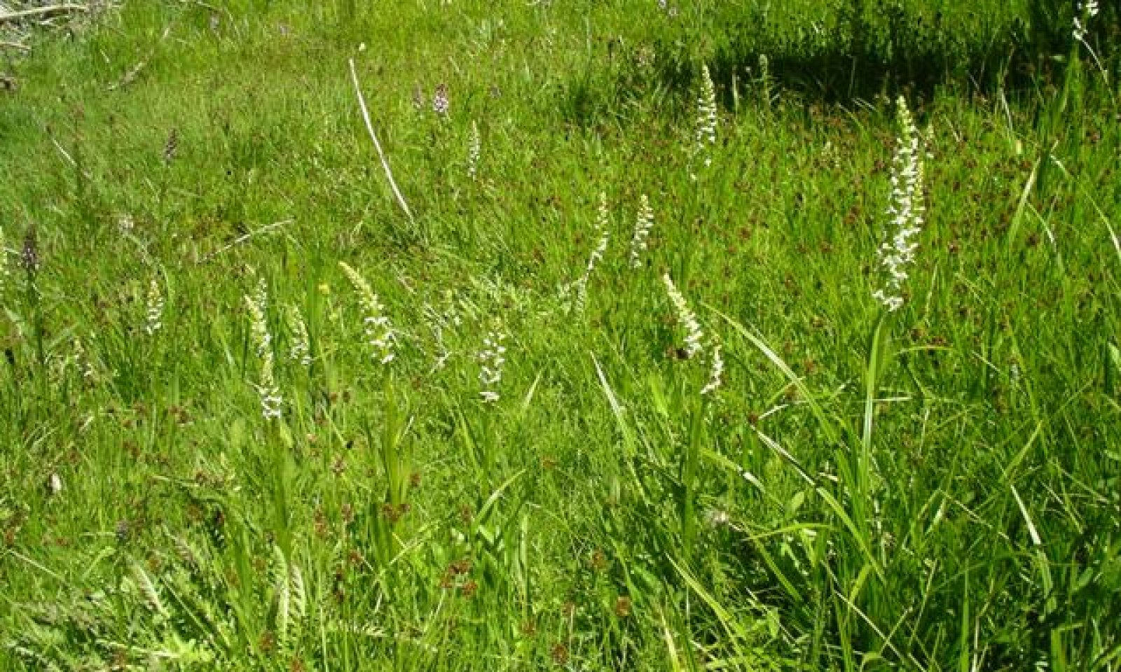
Figure 3. Seep
The reference plant community is dominated by several species of sedge, includes Nebraska sedge, beaked sedge, Jones sedge. Tufted hairgrass and rush species are important plants associated with this site. Potential vegetative composition is about 70% grasses, 20% forbs, 5% sphagnum moss and 5% shrubs/trees. Approximate ground cover (basal and canopy) ranges from 80 to 95 percent.
Figure 4. Annual production by plant type (representative values) or group (midpoint values)
Table 5. Annual production by plant type
Plant type Low
(lb/acre)Representative value
(lb/acre)High
(lb/acre)Grass/Grasslike 1400 2100 2800 Forb 400 600 800 Moss 100 150 200 Shrub/Vine 60 90 120 Tree 40 60 80 Total 2000 3000 4000 Additional community tables
Table 6. Community 1.1 plant community composition
Group Common name Symbol Scientific name Annual production () Foliar cover (%) Grass/Grasslike1 Primary Perennial Grasses 1200–1950 sedge CAREX Carex 1200–1950 – 2 Secondary Perennial Grasses 120–480 creeping bentgrass AGST2 Agrostis stolonifera 15–60 – spikerush ELEOC Eleocharis 15–60 – swordleaf rush JUEN Juncus ensifolius 15–60 – Sierra rush JUNE Juncus nevadensis 15–60 – pullup muhly MUFI2 Muhlenbergia filiformis 15–60 – whitemargin phlox PHAL8 Phlox albomarginata 15–60 – panicled bulrush SCMI2 Scirpus microcarpus 15–60 – Forb3 Perennial Forbs 255–1020 alpine shootingstar DOALA Dodecatheon alpinum ssp. alpinum 15–60 – willowherb EPILO Epilobium 15–60 – horsetail EQUIS Equisetum 15–60 – monkeyflower MIMUL Mimulus 15–60 – lousewort PEDIC Pedicularis 15–60 – slender cinquefoil POGR9 Potentilla gracilis 15–60 – buttercup RANUN Ranunculus 15–60 – yellowcress RORIP Rorippa 15–60 – longleaf starwort STLOL Stellaria longifolia var. longifolia 15–60 – cows clover TRWO Trifolium wormskioldii 15–60 – California false hellebore VECA2 Veratrum californicum 15–60 – small white violet VIMA2 Viola macloskeyi 15–60 – common yarrow ACMI2 Achillea millefolium 15–30 – aster ASTER Aster 15–30 – castilla CASTI Castilla 15–30 – Moss4 Moss 120–210 Shrub/Vine5 Shrubs 60–120 Booth's willow SABO2 Salix boothii 30–60 – arroyo willow SALA6 Salix lasiolepis 30–60 – Tree6 Deciduous Trees 30–90 quaking aspen POTR5 Populus tremuloides 30–90 – Interpretations
Animal community
Livestock Interpretations:
Due to moist soil conditions this site should be protected from excessive grazing. Hoof action on these moist soils will lead to soil compaction causing plant damage and alterations to the proper hydrologic function of this site.
Stocking rates vary over time depending upon season of use, climate variations, site, and previous and current management goals. A safe starting stocking rate is an estimated stocking rate that is fine tuned by the client by adaptive management through the year and from year to year.
Wildlife Interpretations:
This site is utilized by many types of wildlife. Carex species provides valuable forage for elk and mule deer.Hydrological functions
Soil Hydrologic Group B and D. Runoff is high.
Other information
Beaked sedge and Nebraska sedge have a high potential for biomass production and long-term revegetation, and medium potential for erosion control and short-term revegetation.
Supporting information
Type locality
Location 1: Modoc County, CA Township/Range/Section T42N R15E S28 Latitude 41° 27′ 12″ Longitude 120° 14′ 43″ General legal description At Pepperdine Camp, on the Modoc National Forest in the Warner Mountains, Modoc County, CA. Other references
Fire Effects Information System [Online]. http://www.fs.fed.us/feis
Miles, S.R. and C.B. Goudey. 1997. Ecological Subregions of California Section and Subsection Descriptions. United States Department of Agriculture Forest Service, Pacific Southwest Region R5-EM-TP-005. Subsection M261Gf-Warner Mountains.
Modoc Elk Working Group. 2000. The Greater Modoc Area A Strategic Plan for Elk Management. Modoc County, CA
Contributors
P.NOVAK-ECHENIQUE
Rangeland health reference sheet
Interpreting Indicators of Rangeland Health is a qualitative assessment protocol used to determine ecosystem condition based on benchmark characteristics described in the Reference Sheet. A suite of 17 (or more) indicators are typically considered in an assessment. The ecological site(s) representative of an assessment location must be known prior to applying the protocol and must be verified based on soils and climate. Current plant community cannot be used to identify the ecological site.
Author(s)/participant(s) Contact for lead author Date Approved by Approval date Composition (Indicators 10 and 12) based on Annual Production Indicators
-
Number and extent of rills:
-
Presence of water flow patterns:
-
Number and height of erosional pedestals or terracettes:
-
Bare ground from Ecological Site Description or other studies (rock, litter, lichen, moss, plant canopy are not bare ground):
-
Number of gullies and erosion associated with gullies:
-
Extent of wind scoured, blowouts and/or depositional areas:
-
Amount of litter movement (describe size and distance expected to travel):
-
Soil surface (top few mm) resistance to erosion (stability values are averages - most sites will show a range of values):
-
Soil surface structure and SOM content (include type of structure and A-horizon color and thickness):
-
Effect of community phase composition (relative proportion of different functional groups) and spatial distribution on infiltration and runoff:
-
Presence and thickness of compaction layer (usually none; describe soil profile features which may be mistaken for compaction on this site):
-
Functional/Structural Groups (list in order of descending dominance by above-ground annual-production or live foliar cover using symbols: >>, >, = to indicate much greater than, greater than, and equal to):
Dominant:
Sub-dominant:
Other:
Additional:
-
Amount of plant mortality and decadence (include which functional groups are expected to show mortality or decadence):
-
Average percent litter cover (%) and depth ( in):
-
Expected annual annual-production (this is TOTAL above-ground annual-production, not just forage annual-production):
-
Potential invasive (including noxious) species (native and non-native). List species which BOTH characterize degraded states and have the potential to become a dominant or co-dominant species on the ecological site if their future establishment and growth is not actively controlled by management interventions. Species that become dominant for only one to several years (e.g., short-term response to drought or wildfire) are not invasive plants. Note that unlike other indicators, we are describing what is NOT expected in the reference state for the ecological site:
-
Perennial plant reproductive capability:
Print Options
Sections
Font
AAAAOther
PrintThe Ecosystem Dynamics Interpretive Tool is an information system framework developed by the USDA-ARS Jornada Experimental Range, USDA Natural Resources Conservation Service, and New Mexico State University.
Accessibility statement


