
Natural Resources
Conservation Service
-
Search


Major Land Resource Area or ecological site by name and/or ID.
PreviousSectionsNextGeneral information
Draft. A draft ecological site description is either incomplete or has not undergone quality control and quality assurance review.
Similar sites
R019XI101CA Sandy dunes 13-34" p.z.
This ecolgical site is on dunes with deep sand, where as R020XI119 is associated with sand overlying clayey soils with a durapan.
Table 1. Dominant plant species
Tree Not specified
Shrub (1) Isocoma menziesii
(2) Baccharis pilularisHerbaceous (1) Lupinus albifrons
Physiographic features
This ecological site is found on the coastal hill slopes of San Miguel Island and the west end of Santa Rosa Island. It is on all aspects, with slopes ranging from 5 to 80 percent, and elevations from just above sea level to 2624 feet.
Table 2. Representative physiographic features
Landforms (1) Hill
Elevation 0 – 2624 ft Slope 5 – 80 % Aspect Aspect is not a significant factor Climatic features
This ecological site is found on two of the five northern Channel Islands—San Miguel and Santa Rosa. Each island has a different temperature and precipitation range, however for the purposes of this description, they have all been averaged together to capture the entire range of variance.
The average annual precipitation is 29 inches with a range between 21 to 34 inches, mostly in the form of rain in the winter months (November through April). The average annual air temperature is approximately 61 to 66 degrees Fahrenheit, and the frost-free (>32F) season is 365 days.
NOTE: Data collected for monthly precipitation and temperatures is only from one climate station, and may not capture the variance in climates on each of the five islands.Table 3 Representative climatic features
Frost-free period (average) 370 days Freeze-free period (average) 370 days Precipitation total (average) 30 in BarLineFigure 1. Monthly precipitation range
BarLineFigure 2. Monthly average minimum and maximum temperature
">Influencing water features
Soil features
This ecological site is associated primarily with soils developed from residuum weathered from calcareous sandstone (Typic Durixeralfs and Durixerolls). The other soil component associated with this ecosite is Topdeck, which developed from residuum weathered from volcanic rock. The soils have a sandy loam surface texture, with loam, clay, or clay loam subsurface textures. Typic Durixeralfs and Durixerolls have a duripan at varying depths that is impenetrable to most plant roots, and also inhibits water flow, similar to bedrock. Most of this area also shows strong evidence of calcium carbonates in the soils.
This ecological site is found in the following mapunits and soils components:
SSA MU SYM Component
CA688 273 Topdeck - Overblown
CA688 940 Typic Durixeralfs
CA688 273 Typic Durixerolls - Overblown
CA688 920 Typic Durixerolls
CA688 921 Typic Durixerolls
Table 4. Representative soil features
Surface texture (1) Sandy loam
Family particle size (1) Clayey
Drainage class Well drained Permeability class Moderately slow Soil depth 2 – 40 in Available water capacity
(0-40in)0.3 – 3.2 in Calcium carbonate equivalent
(0-40in)1 – 3 % Electrical conductivity
(0-40in)Not specified Sodium adsorption ratio
(0-40in)Not specified Soil reaction (1:1 water)
(0-40in)6.6 – 8.4 Subsurface fragment volume <=3"
(Depth not specified)10 – 20 % Ecological dynamics
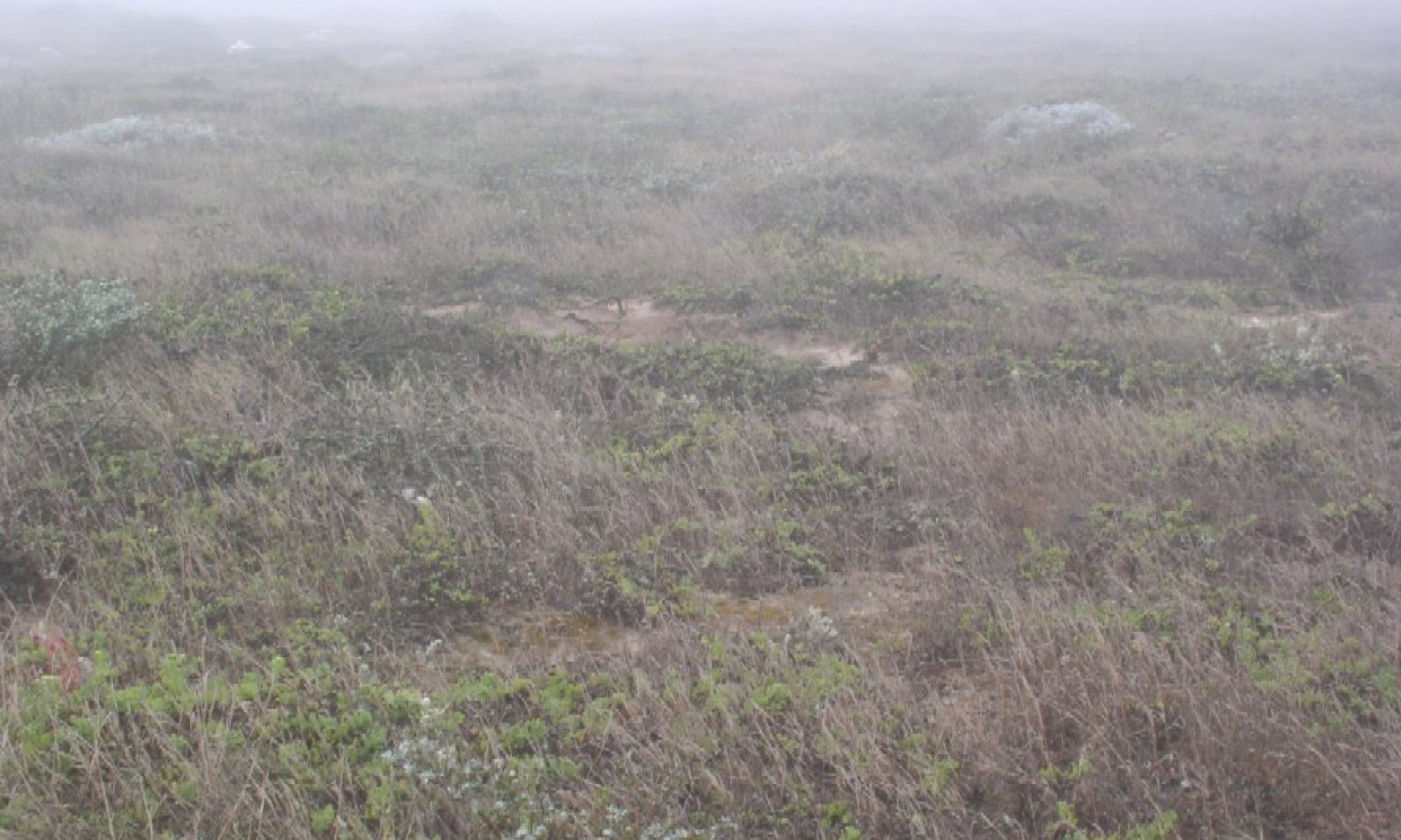
The reference state for this ecological site is a mixed dune scrubland and is found on windblown areas with accumulations of calcium carbonates. The dominant species vary considerably; areas with the densest cover and highest annual production tend to be dominated by prostrate coastal goldenbush (Isocoma menziesii var. sedoides), coyotebrush (Baccharis pilularis), or silver lupine (Lupinus albifrons). The shrubs can form a closed canopy, growing up to three feet in height. This community appears to do its best on the back sides of sand dunes, where there are more sheltered areas. These sheltered areas create a fairly thick layer of sand (~12 inches) over the clayey soils beneath allowing for more substantial root growth.
When this community does not have the shelter of the dunes, the conditions will be more harsh and unproductive, creating a habitat suitable for more uniform stands of prostrate coastal goldenbush (Isocoma menziesii var. sedoides). These less productive areas have less cover in general, with grasses and forbs replacing the silver lupine (Lupinus albifrons) and coyotebrush (Baccharis pilularis). Common species in this area are San Miguel milkvetch (Astragalus miguelensis), common yarrow (Achillea millefolium), inland saltgrass (Distichlis spicata), golden-yarrow (Eriophyllum confertiflorum), redflower buckwheat (Eriogonum grande var. rubescens), dunedelion (Malacothrix incana), seaside fleabane (Erigeron glaucus), and western blue-eyed grass (Sisyrinchium bellum).
Several non-native plants are also invading this plant community. The most abundant is the sea fig (Carpobrotus chilensis), which may out-compete many of the native species. Other non-native include Spanish brome (Bromus madritensis), wild oat (Avena fatua), ripgut brome (Bromus rigidus), and curved sicklegrass (Parapholis incurva).
There is very little data available concerning the successional characteristics, regeneration needs, and fire effects for the species which compose this ecological site. Coyotebrush will resprout after a fire (Steinburg), while the silver lupine and prostrate coastal goldenbush will most likely sprout from seed after a fire, but their re-sprouting ability is unknown.
In the 1850s sheep, cattle, and horses were brought to San Miguel and during the mid-1940s to the mid-1950s it was used as a bombing range. The disturbance by livestock and non-native wildlife created large portions of San Miguel Island that were covered with open and active dunes. Since the removal of grazing animals, vegetation is slowly stabilizing the dunes. Over the many centuries of changes in the dunes and sand deposition, sand has been wind-deposited across almost all of San Miguel Island. This has caused the clayey soils to be buried with varying depths of sand. It seems that the state of vegetative cover is related to the stability and depth of this sand layer, as well as the depth to the cemented duripan. The vegetation may change again if sands are shifted and re-deposited, either depleting an area of sand, leaving a shallower soil with exposed plants, or increasing the sand depth and burying the plants.
State and transition model
More interactive model formats are also available. View Interactive Models
Click on state and transition labels to scroll to the respective textEcosystem states
State 1 submodel, plant communities
State 2 submodel, plant communities
State 3 submodel, plant communities
State 1
Mixed Dune ScrubCommunity 1.1
Mixed Dune ScrubThis ecological site is dominated by the presence of prostrate coastal goldenbush (Isocoma menziesii var. sedoides), coyotebrush (Baccharis pilularis), and/or silver lupine (Lupinus albifrons). The shrubs can form a dense canopy reaching up to three feet in height. Several non-native species are also present.
Figure 3. Annual production by plant type (representative values) or group (midpoint values)
State 2
Stand InitiationCommunity 2.1
Stand InitiationLittle is know about the regeneration of this community due to fire and other disturbances. In the event of heavy grazing, or some other cause which would reactivate the sand dunes, red sand verbena (Abronia maritima), beach-bur (Ambrosia chamissonis), beach saltbush (Atriplex leucophylla), European searocket (Cakile maritima), inland saltgrass (Distichlis spicata), and Menzies' goldenbush(Isocoma menziesii).
Figure 4. Annual production by plant type (representative values) or group (midpoint values)
State 3
Isocoma Dominated ScrubCommunity 3.1
Isocoma Dominated Scrub
Figure 5. Isocoma scrub
This is an intermediate state between stand initiation and the climax community, in terms of stability, cover and production. This state is dominated by prostrate coastal goldenbush (Isocoma menziesii var. sedoides), with a low cover of forbs and grasses. Common species in this area are San Miguel milkvetch (Astragalus miguelensis), common yarrow (Achillea millefolium), inland saltgrass (Distichlis spicata), golden-yarrow (Eriophyllum confertiflorum), redflower buckwheat (Eriogonum grande var. rubescens), dunedelion (Malacothrix incana), seaside fleabane (Erigeron glaucus), and western blue-eyed grass (Sisyrinchium bellum).
Figure 6. Annual production by plant type (representative values) or group (midpoint values)
Additional community tables
Table 5. Community 1.1 plant community composition
Group Common name Symbol Scientific name Annual production () Foliar cover (%) Shrub/Vine1 shrubs 1000–3500 silver lupine LUAL4 Lupinus albifrons 1000–3000 – coyotebrush BAPI Baccharis pilularis 300–1000 – Menzies' goldenbush ISMES Isocoma menziesii var. sedoides 50–1000 – San Miguel milkvetch ASMI6 Astragalus miguelensis 1–50 – Grass/Grasslike2 grasses 100–1000 sea fig CACH38 Carpobrotus chilensis 0–1500 – San Miguel milkvetch ASMI6 Astragalus miguelensis 5–400 – saltgrass DISP Distichlis spicata 10–200 – dunedelion MAIN Malacothrix incana 1–150 – giant coreopsis COGI Coreopsis gigantea 1–100 – seaside fleabane ERGL3 Erigeron glaucus 1–100 – California goosefoot CHCA3 Chenopodium californicum 1–50 – western blue-eyed grass SIBE Sisyrinchium bellum 1–50 – redflower buckwheat ERGRR Eriogonum grande var. rubescens 1–30 – common yarrow ACMI2 Achillea millefolium 1–20 – Forb3 forbs 50–2000 sea fig CACH38 Carpobrotus chilensis 0–2000 – California goosefoot CHCA3 Chenopodium californicum 20–300 – compact brome BRMA3 Bromus madritensis 0–100 – sand verbena ABRON Abronia 10–100 – saltgrass DISP Distichlis spicata 1–100 – beardless wildrye LETR5 Leymus triticoides 0–50 – curved sicklegrass PAIN Parapholis incurva 0–30 – cobwebby thistle CIOC Cirsium occidentale 1–30 – wild oat AVFA Avena fatua 0–30 – Table 6. Community 2.1 plant community composition
Group Common name Symbol Scientific name Annual production () Foliar cover (%) Forb1 forbs 1–200 red sand verbena ABMA2 Abronia maritima 1–100 – silver bur ragweed AMCH4 Ambrosia chamissonis 1–50 – beach saltbush ATLE2 Atriplex leucophylla 1–30 – European searocket CAMA Cakile maritima 1–30 – beach suncup CACHC Camissonia cheiranthifolia ssp. cheiranthifolia 1–10 – Shrub/Vine2 shrubs 1–150 Menzies' goldenbush ISMES Isocoma menziesii var. sedoides 1–100 – San Miguel milkvetch ASMI6 Astragalus miguelensis 1–50 – Grass/Grasslike3 grasses 1–100 saltgrass DISP Distichlis spicata 1–100 – Table 7. Community 3.1 plant community composition
Group Common name Symbol Scientific name Annual production () Foliar cover (%) Shrub/Vine1 shrubs 100–1400 Menzies' goldenbush ISMES Isocoma menziesii var. sedoides 50–1000 – silver lupine LUAL4 Lupinus albifrons 10–300 – coyotebrush BAPI Baccharis pilularis 0–100 – golden-yarrow ERCO25 Eriophyllum confertiflorum 1–30 – cliff desertdandelion MASAI Malacothrix saxatilis var. implicata 1–15 – Forb2 forbs 100–2000 sea fig CACH38 Carpobrotus chilensis 0–1500 – San Miguel milkvetch ASMI6 Astragalus miguelensis 5–400 – dunedelion MAIN Malacothrix incana 1–150 – giant coreopsis COGI Coreopsis gigantea 1–100 – seaside fleabane ERGL3 Erigeron glaucus 1–100 – western blue-eyed grass SIBE Sisyrinchium bellum 1–50 – California goosefoot CHCA3 Chenopodium californicum 1–50 – redflower buckwheat ERGRR Eriogonum grande var. rubescens 1–30 – common yarrow ACMI2 Achillea millefolium 1–20 – Grass/Grasslike3 grasses 30–500 saltgrass DISP Distichlis spicata 1–100 – compact brome BRMA3 Bromus madritensis 0–100 – beardless wildrye LETR5 Leymus triticoides 0–50 – curved sicklegrass PAIN Parapholis incurva 0–30 – wild oat AVFA Avena fatua 0–30 – Interpretations
Supporting information
Inventory data references
The following NRCS sites were used to describe this ecological site. SM-1 % and Lbs Site location. SM-2A % and Lbs SM-4 % and Lbs SM-8 % and Lbs SM-18 Lbs SM-19% and Lbs SM-20 Lbs SM-24 Lbs SM-26A % SM-27 Lbs SR-97 Lbs
Type locality
Location 1: Santa Barbara County, CA Latitude 34° 2′ 31″ Longitude 120° 24′ 45″ General legal description The type location is on San Miguel Island, just south of the Dry Lake Bed near the west side of the island. Other references
Chess, Katherine A.; Halvorson, William L.; and McEachern, Katheryn A. (1996). San Nicolas Island Vegetation Monitoring Report 1993-1996. Technical Report No. 56. United States Geological Survey, Cooperative Park Srudies Unit, The University of Arizona.
Junak, Steve; Ayers, Tina; Scott, Randy; Wilken, Dieter; and Young, David (1995). A Flora of Santa Cruz Island. Santa Barbara Botanic Garden, Santa Barbara, CA.
Steinberg, Peter D. 2002. Baccharis pilularis. In: Fire Effects Information System, [Online]. U.S. Department of Agriculture, Forest Service, Rocky Mountain Research Station, Fire Sciences Laboratory (Producer). Available: http://www.fs.fed.us/database/feis/ [2005, July 15].Contributors
M. Munnecke
Rangeland health reference sheet
Interpreting Indicators of Rangeland Health is a qualitative assessment protocol used to determine ecosystem condition based on benchmark characteristics described in the Reference Sheet. A suite of 17 (or more) indicators are typically considered in an assessment. The ecological site(s) representative of an assessment location must be known prior to applying the protocol and must be verified based on soils and climate. Current plant community cannot be used to identify the ecological site.
Author(s)/participant(s) Contact for lead author Date Approved by Approval date Composition (Indicators 10 and 12) based on Annual Production Indicators
-
Number and extent of rills:
-
Presence of water flow patterns:
-
Number and height of erosional pedestals or terracettes:
-
Bare ground from Ecological Site Description or other studies (rock, litter, lichen, moss, plant canopy are not bare ground):
-
Number of gullies and erosion associated with gullies:
-
Extent of wind scoured, blowouts and/or depositional areas:
-
Amount of litter movement (describe size and distance expected to travel):
-
Soil surface (top few mm) resistance to erosion (stability values are averages - most sites will show a range of values):
-
Soil surface structure and SOM content (include type of structure and A-horizon color and thickness):
-
Effect of community phase composition (relative proportion of different functional groups) and spatial distribution on infiltration and runoff:
-
Presence and thickness of compaction layer (usually none; describe soil profile features which may be mistaken for compaction on this site):
-
Functional/Structural Groups (list in order of descending dominance by above-ground annual-production or live foliar cover using symbols: >>, >, = to indicate much greater than, greater than, and equal to):
Dominant:
Sub-dominant:
Other:
Additional:
-
Amount of plant mortality and decadence (include which functional groups are expected to show mortality or decadence):
-
Average percent litter cover (%) and depth ( in):
-
Expected annual annual-production (this is TOTAL above-ground annual-production, not just forage annual-production):
-
Potential invasive (including noxious) species (native and non-native). List species which BOTH characterize degraded states and have the potential to become a dominant or co-dominant species on the ecological site if their future establishment and growth is not actively controlled by management interventions. Species that become dominant for only one to several years (e.g., short-term response to drought or wildfire) are not invasive plants. Note that unlike other indicators, we are describing what is NOT expected in the reference state for the ecological site:
-
Perennial plant reproductive capability:
Print Options
Sections
Font
AAAAOther
PrintThe Ecosystem Dynamics Interpretive Tool is an information system framework developed by the USDA-ARS Jornada Experimental Range, USDA Natural Resources Conservation Service, and New Mexico State University.
Accessibility statement


