
Natural Resources
Conservation Service
Ecological site F018XC201CA
Thermic Granitic Foothills
Last updated: 4/24/2024
Accessed: 08/30/2026
-
Search


Major Land Resource Area or ecological site by name and/or ID.
PreviousSectionsNextGeneral information
Provisional. A provisional ecological site description has undergone quality control and quality assurance review. It contains a working state and transition model and enough information to identify the ecological site.
MLRA notes
Major Land Resource Area (MLRA): 018X–Sierra Nevada Foothills
Major Land Resource Area (MLRA) 18, Sierra Nevada Foothills is located entirely in California and runs north to south adjacent to and down-slope of the west side of the Sierra Nevada Mountains (MLRA 22A). MLRA 18 includes rolling to steep dissected hills and low mountains, with several very steep river valleys. Climate is distinctively Mediterranean (xeric soil moisture regime) with hot, dry summers, and relatively cool, wet winters. Most of the precipitation comes as rain; average annual precipitation ranges from 15 to 55 inches in most of the area (precipitation generally increases with elevation and from south to north). Soil temperature regime is thermic; mean annual air temperature generally ranges between 52 and 64 degrees F. Geology is rather complex in this region; there were several volcanic flow and ashfall events, as well as tectonic uplift, during the past 25 million years that contributed to the current landscape.
LRU notes
LRU 18XC is located on moderate to steep mountains and hills in the Sierra Nevada Foothills east of Fresno, CA. The major differences between the southern and northern foothills are the dryer climate (12 to 37 inches of annual precipitation), greater summer/winter temperature variation, and steeper topography of the southern foothills. The geology of this region is predominately granitoid. The elevation ranges between 300 and 4100 feet above sea level. Warmer temperatures and lower precipitation (than at higher latititudes) allow for blue oak grasslands to exist at higher elevations. The soil temperature regime is primarily thermic, however some mesic soils are found at higher elevations of 18XC. At these upper elevations, the break in soil temperature regime (between thermic and mesic) is highly aspect dependent. Southern and western aspects at the steep, high elevations promote chamise-yucca plant assemblages. Buckeye is common in the concave positions. Riparian trees that are generally absent from the northern LRU’s include California Sycamore (Plantanus racemosa) and lemon scented gum (Eucalyptus citriodora).
Classification relationships
CLASSIFICATION RELATIONSHIPS
This site is located within M261F, the Sierra Nevada Foothills Section, (McNab et al., 2007) of the National Hierarchical Framework of Ecological Units (Cleland et al., 1997), M261Fc, the Lower Granitic Foothills and M261Fd, Southern Granitic Foothills Subsections.
Level III and Level IV ecoregions systems (Omernik, 1987, and EPA, 2011) are: Level III, Central California Foothills and Coastal Mountains and Level IV, Ecoregion 6c, Southern Sierran Foothills.Ecological site concept
This site is characterized by moderately deep to very deep soils occurring on all hillslope positions except toeslopes on foothills and mountains formed from granitic parent material. Slopes typically range from 6 to 60%. Annual precipitation typically ranges from 23 to 27 inches per year. Elevation typically ranges from 1000 to 4350 feet.
The high available water capacity associated with these moderately deep to very deep soils leads to productive woodlands. However, soils derived from granitic materials tend to be subject to erosion because of their coarse-textured surface horizons. This becomes more apparent in chaparral dominated states, where intense fires are more common. The most representative soil components include Ahwahnee and Sierra. Production can be expected to be lower on the Ahwahnee soils due to the coarse-loamy and relatively shallow soil when compared to Sierra, however both soils would likely respond similarly to disturbance and management, particularly after erosion. Sierra soils may favor slightly larger trees, especially in the undisturbed state and in the lower sloping positions. Ahwahnee soils are moderately deep and are classified as coarse-loamy, mixed, active, thermic Mollic Haploxeralfs. Sierra soils are very deep and are classified as fine-loamy, mixed, active, thermic Ultic Haploxeralfs.
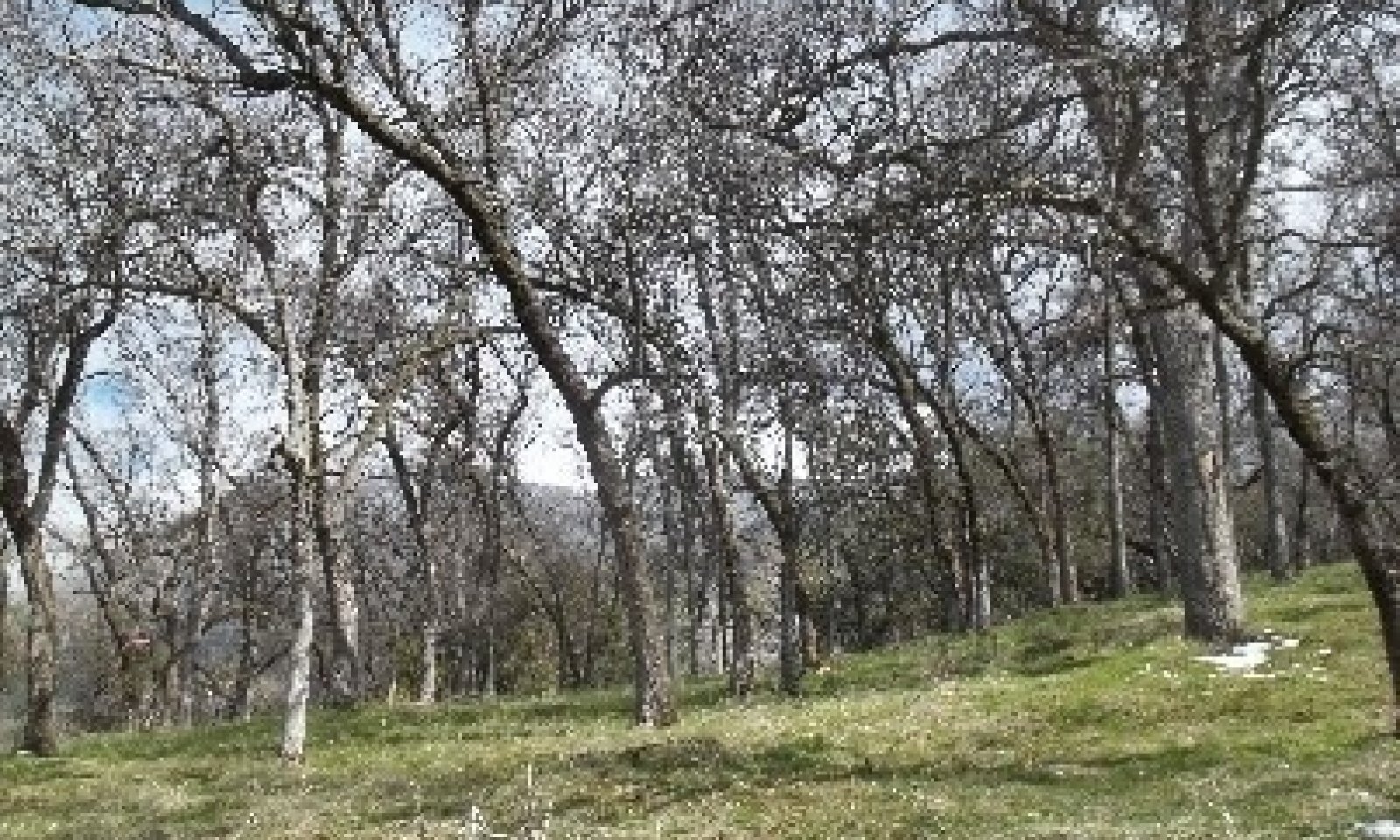
Vegetation includes open oak woodland with scattered California foothill pines (Pinus sabiniana) and buckbrush (Ceanothus cuneatus). Blue oak (Quercus douglasii) tends to be dominant in the overstory component. Scattered interior live oak (Quercus wislizeni) also occurs. Herbaceous annuals such as soft chess (Bromus hordeaceus), ripgut brome (Bromus diandrus), wild oat (Avena fatua), and fillaree (Erodium spp.) tend to dominate in the understory and collectively range from 2000 to 3500 lbs per acre.Associated sites
F018XI201CA Moderately Deep Thermic Foothills
This site commonly occurs nearby.
F018XI202CA Deep Thermic Steep Hillslopes
This site commonly occurs nearby.
Similar sites
F018XC203CA Cool Thermic Slopes
Site relationships being developed.
Table 1. Dominant plant species
Tree (1) Quercus douglasii
(2) Pinus sabinianaShrub (1) Ceanothus cuneatus
Herbaceous (1) Bromus hordeaceus
(2) Avena fatuaPhysiographic features
The landscape position of this site is on all hillslope positions except toeslopes on soils formed from granitic parent material. Elevation typically ranges from 1000 to 4350 feet. Slopes typically range from 6 to 60%.
Table 2. Representative physiographic features
Hillslope profile (1) Summit
(2) Shoulder
(3) Backslope
(4) Footslope
Landforms (1) Foothills > Hillslope
(2) Foothills > Hill
Runoff class High Flooding frequency None Ponding frequency None Elevation 1250 – 3000 ft Slope 10 – 60 % Aspect W, SE, S, SW Table 3. Representative physiographic features (actual ranges)
Runoff class Medium to very high Flooding frequency None Ponding frequency None Elevation 200 – 4900 ft Slope 2 – 75 % Climatic features
This ecological site is characterized by hot, dry summers and cool, wet winters, a typical Mediterranean climate. Mean annual precipitation ranges from 23 to 27 inches and usually falls from October to May. Mean annual temperature is 59 to 62 degrees F with 155 to 193 frost free days.
Table 4 Representative climatic features
Frost-free period (characteristic range) 160-190 days Freeze-free period (characteristic range) 290-370 days Precipitation total (characteristic range) 20-30 in Frost-free period (actual range) 120-200 days Freeze-free period (actual range) 200-370 days Precipitation total (actual range) 20-30 in Frost-free period (average) 170 days Freeze-free period (average) 320 days Precipitation total (average) 30 in Characteristic rangeActual rangeBarLineFigure 1. Monthly precipitation range
Characteristic rangeActual rangeBarLineFigure 2. Monthly minimum temperature range
Characteristic rangeActual rangeBarLineFigure 3. Monthly maximum temperature range
BarLineFigure 4. Monthly average minimum and maximum temperature
Figure 5. Annual precipitation pattern
Figure 6 Annual average temperature pattern
Climate stations used
-
(1) ASH MTN [USC00040343], Three Rivers, CA
-
(2) AUBERRY 2 NW [USC00040379], Auberry, CA
-
(3) THREE RVRS EDISON PH 1 [USC00048917], Three Rivers, CA
-
(4) GLENNVILLE [USC00043463], Glennville, CA
">Influencing water features
Due to the topographic position, this site does not have water features.
Wetland description
N/A
Soil features
The soils in this ecological site are formed from the residuum of granite, diorite, and quartz diorite rock types. The typical depth ranges from moderately to very deep, and the bedrock is a restrictive layer found between 28 and 70 inches of depth. The particle size control section is fine-loamy and surface textures include sandy loam, coarse sandy loam and loam. Gravels (< 3 inch diameter) cover up to 13% of the soil surface, while larger fragments (= 3 inch diameter) only occupy up to 3% percent of the soil surface. Subsurface gravels make up 0 to 7% of the soil volume while larger fragments are virtually absent from the profile. The soils in this ecological site are well drained and the permeability is typically moderate but can be moderately rapid to rapid. The Available Water Capacity (AWC) is between 3.2 and 6.2 inches and soil reaction in the top 10 inches of the soil ranges from 6.1 to 6.7 while in the subsoil the pH ranges from 5.9 to 6.7.
Common soil components in this ecological site include Auberry and Sierra, both of which are fine-loamy ultic haploxeralfs. Auberry is deep and Sierra is deep to very deep. Blasingame components are also common under this ecological site. This soil is moderately deep, fine-loamy, and a typic haploxeralf. These soils are all derived from intrusive igneous parent materials, ranging from acidic (Auberry) to more basic (Blasingame).
Figure 7. Soil profile of a Sierra soil series, taken in Sequoia National Park in 2013.
Table 5. Representative soil features
Parent material (1) Residuum – granite
(2) Residuum – quartz-diorite
(3) Residuum – diorite
Surface texture (1) Sandy loam
(2) Coarse sandy loam
(3) Loam
Family particle size (1) Fine-loamy
Drainage class Well drained Permeability class Moderate Depth to restrictive layer 28 – 72 in Soil depth 28 – 72 in Surface fragment cover <=3" 0 – 13 % Surface fragment cover >3" 0 – 3 % Available water capacity
(0-40in)3.2 – 6.2 in Soil reaction (1:1 water)
(0-10in)6.1 – 6.7 Subsurface fragment volume <=3"
(0-60in)0 – 7 % Subsurface fragment volume >3"
(0-60in)0 – 1 % Table 6. Representative soil features (actual values)
Drainage class Well drained Permeability class Moderate to rapid Depth to restrictive layer 20 – 80 in Soil depth 20 – 80 in Surface fragment cover <=3" 0 – 20 % Surface fragment cover >3" 0 – 10 % Available water capacity
(0-40in)1.9 – 8 in Soil reaction (1:1 water)
(0-10in)5.1 – 7.8 Subsurface fragment volume <=3"
(0-60in)0 – 17 % Subsurface fragment volume >3"
(0-60in)0 – 5 % Ecological dynamics
This ecological site exists along the mid elevations of the Sierra Nevada Foothills and consists of blue oak-foothill pine woodlands dominated by annual grasses and forbs in the understory. Blue oak woodland is the most extended hardwood cover in California (Bolsinger, 1988) distributed primarily around the ranges surrounding the Sacramento and San Joaquin valleys. Historically, many native forbs and some perennial bunchgrasses (Bartolome, 1987) may have been found on this site, but there is a chasm of different opinions concerning which plant lifeform was prevailing at the time that the first Spanish settlers arrived. It is uncertain when exactly most of the introduced herbaceous plants arrived, but Bartolome (1987) estimates that by the mid 1800’s, “most of the annual grasses, filarees, bromes and fescues” from the Mediterranean region had established. In 1850, one traveler in the vicinity of San Jose wrote, “we found ourselves between lofty hills, those to the right (east) being covered by wild oat” (Stewart, 2002). The introduced annuals quickly naturalized to a climate highly similar to their place of origin (i.e. mild, wet winters and dry summers; Bartolome, 1987). This ecological site has open canopy of blue oak and in some areas, the soil depth and presence of rocks may prohibit trees from growing.
Disturbance Dynamics:
Fire: Fire has likely been a shaping landscape force over the Sierra Nevada Foothills. Native indigenous groups among the entire length of the Sierra Nevada Foothills practiced setting fires millennia before European establishment. The diverse array of reasons for burning, included hunting purposes, to maintain vegetation (clearing underbrush), and to improve crop yield (Stewart, 2002). Possibly, the openness of the oak savannah communities could be a consequence of repeated fires. Native Californians may have burnt in selected plots of the grassland/ oak communities to prepare sites for planting of tobacco. Some records indicate that the Maidu People of Northern California set fires annually to maintain open country (safety purposes) and to promote grasses and herbs over brush (Stewart, 2003).
Grazing: Livestock grazing has occurred for at least 200 years and has likely contributed to the spread of Mediterranean annual grasses such as Bromus, Avena genus (Jackson, 1985). Grazing impacts can vary depending on the timing and duration, and livestock type (Keeley et. Al., 2003). A separate disturbance factor that often accompanies domestic livestock operations is mechanical clearing. Clearing is sometimes independent from livestock operations, as it is used to reduce fire danger or to generate firewood.
Disease and Pathogens: Some diseases of blue oak damage the heartwood of the trunk and large limbs (McDonald, 1990). Several fungi cause wood decay in the limbs and trunks of oaks (Hickman et al., 2011). The sulphur conk, (Laetiporus sulphureus), hedgehog fungus (Hydnum erinaceum) and the artist’s fungus (Ganoderma applanatum) can cause significant damage to living oaks (i.e. heartwood rot.). Other diseases such as the shoestring fungus rot (Armillaria mellea) gradually weakens trees at the base until they fall. Diseases of California foothill pine include western gall rust (Periderium harknessii) and dwarf-mistletoe (Arceuthobium occidentale and A. campylopodum forma campylopodum) (Howard, 1992).
Drought: Blue oak is one of the most drought resistant deciduous trees in California (Callaway, 1992; Abrams, 1990).State and transition model
Custom diagramStandard diagramMore interactive model formats are also available. View Interactive Models
Click on state and transition labels to scroll to the respective textEcosystem states
State 2 submodel, plant communities
State 3 submodel, plant communities
State 1
Representative State (Blue oak woodland)Community 1.1
Representative plant community
Open QUDO (10-35% Canopy Cover) with PISA2, and scattered QUWI2. Shrubs (CECU, AECA, TODI, HEAR5, or ARCTO3) may be present. Dense annual grasses and forbs in understory.
Community 1.2
QUDO recruitment community
Dominated by younger cohort of smaller QUDO (10-20 feet tall), Early phases will be dominated by seedlings. Shrub layer may play key role in this phase.
Community 1.3
Post-fire or brushed plant community
QUDO cover up to 15% with very little regeneration. Shrubs usually absent, but sometimes CECU or RHAMN 5-10%. Dense annual grasses and forbs in understory.
Community 1.4
Mixed shrub oak plant community
Closed blue oak woodlands with 1:1 QUDO to QUWI2 ratio. Shrubs such as ARCTO3 or ADFA, are becoming dominant, (> 25 % CC). Fewer annuals due to greater shading.
Pathway 1.1c
Community 1.1 to 1.2
Representative plant community
QUDO recruitment community1.1c This community pathway occurs when favorable conditions such as abundant moisture and/or seeds (acorns) etc. cause oak regeneration. Low intensity fire or clearing can also result in a re-sprouting of oaks.
Pathway 1.1b
Community 1.1 to 1.3
Representative plant community
Post-fire or brushed plant community1.1b This community pathway occurs after a moderate intensity fire which kills some of the trees and shrubs. Alternatively, this community pathway occurs with light mechanical clearing or thinning. Some oaks remain on the site.
Pathway 1.1a
Community 1.1 to 1.4
Representative plant community
Mixed shrub oak plant community1.1a This community pathway occurs when significant time passes without a natural disturbance.
Pathway 1.2a
Community 1.2 to 1.1
QUDO recruitment community
Representative plant community1.2a Normal growth and progression.
Pathway 1.2b
Community 1.2 to 1.3
QUDO recruitment community
Post-fire or brushed plant community1.2b This community pathway occurs after an intense fire, or mechanical treatment of some of the young trees/shrubs.
Pathway 1.3a
Community 1.3 to 1.2
Post-fire or brushed plant community
QUDO recruitment community1.3a This community pathway occurs with time and regeneration of oaks, often following low to moderately intense fire and favorable conditions permitting saplings/seedlings to become established. This assumes that enough seedlings survive insect, rodent, or other types of herbivory to persist into adulthood.
Pathway 1.4a
Community 1.4 to 1.1
Mixed shrub oak plant community
Representative plant community1.4a This community pathway occurs after mortality of older trees/shrubs create canopy gaps, leading to a slightly more open woodland.
State 2
Shrub Chaparral StateCommunity 2.1
Mature shrub chaparral
This community phase is made of ARCTO3, ADFA and/or HEAR5 (> 40 % CC). These shrubs can exceed hts of 15 ft. Some annual grasses and forbs in understory. Very few oaks or if present, suppressed in understory
Community 2.2
Post-fire burn shrub community
Community dominated by sprouting shrubs and new seedlings. Annual grasses and forbs abound.
Pathway 2.1a
Community 2.1 to 2.2
Mature shrub chaparral
Post-fire burn shrub community2.1a This community pathway occurs following a high intensity wildfire.
Pathway 2.2a
Community 2.2 to 2.1
Post-fire burn shrub community
Mature shrub chaparral2.2a This community pathway occurs over time with absence of disturbance.
State 3
Annual Grassland StateCommunity 3.1
Grass-dominated system
This community phase is dominated by annual grasses, such as AVFA, BROMU, HORDE, and VULPI.
Community 3.2
Forb-dominated system
This community phase is dominated by annuals, such as ERODI, GALIU, and TRIFO species.
Pathway 3.1a
Community 3.1 to 3.2
Grass-dominated system
Forb-dominated system3.1a This community pathway occurs as forbs become more dominant, often following low winter precipitation and reduced litter layers.
Pathway 3.2a
Community 3.2 to 3.1
Forb-dominated system
Grass-dominated system3.2a This community pathway occurs as grasses become more dominant, often in response to higher litter levels.
Transition T1.a
State 1 to 2T1.a This transition occurs after decades of little to no disturbance agents (including management), which builds up fuels. There is a shift towards chaparral shrubs and accompanying changes in fire regime will favor species that can sprout and seed after high intensity fires.
Transition T1.b
State 1 to 3T1.b This transition occurs after repeated fires that reduce the competition of woody vegetation. Also, mechanical tree removal and repeated brush management.
Restoration pathway R2.a
State 2 to 1R2.a This restoration pathway occurs after active brush management, chemical treatment, followed up with tree planting.
Transition T2.a
State 2 to 3T2.a This transition occurs after repeated fires that reduce the competition of woody vegetation. Also, mechanical tree removal and repeated brush management can result in annual herbaceous vegetation.
Restoration pathway R3.a
State 3 to 1R3.a This restoration pathway occurs with tree planting, often requires shade screens, and seedling protection from browsers to be successful.
Additional community tables
Table 7. Community 1.1 plant community composition
Group Common name Symbol Scientific name Annual production () Foliar cover (%) Table 8. Community 1.2 plant community composition
Group Common name Symbol Scientific name Annual production () Foliar cover (%) Table 9. Community 1.3 plant community composition
Group Common name Symbol Scientific name Annual production () Foliar cover (%) Table 10. Community 1.4 plant community composition
Group Common name Symbol Scientific name Annual production () Foliar cover (%) Table 11. Community 2.1 plant community composition
Group Common name Symbol Scientific name Annual production () Foliar cover (%) Table 12. Community 2.2 plant community composition
Group Common name Symbol Scientific name Annual production () Foliar cover (%) Table 13. Community 3.1 plant community composition
Group Common name Symbol Scientific name Annual production () Foliar cover (%) Table 14. Community 3.2 plant community composition
Group Common name Symbol Scientific name Annual production () Foliar cover (%) Interpretations
Supporting information
Inventory data references
Inventory data to be collected using future projects based on priorities.
References
-
Natural Resources Conservation Service. . National Ecological Site Handbook.
Other references
Other References
Abrams, M.D. 1990. Adaptations and responses to drought in Quercus species of North America. Tree Physiology 7(1-4): 227-238.
Bartolome, J. W. 1987. California annual grassland and oak savannah. Rangelands 9:122-125.
Bolsinger, C. L. 1988. The hardwoods of Califonia’s timberlands, woodlands, and savannas. Portland, OR: Pacific Northwest Forest and Range Experiment Station, Forest Service, USDA.
Callaway, R.M. 1992. Morphological and physiological responses of three California oak species to shade. International Journal of Plant Science. 153(3): 434-441.
Hickman, G.W., Perry, E.J. and R.M. Davis. 2011. Wood Decay Fungi in Landscape Trees. University of California. Integrated Pest Management Program. Agriculture and Natural Resources. Pest Notes 74109.
Howard, J.L. 1992. Pinus sabiniana. In: Fire Effects Information System. (Online) USDA, Forest Service Rocky Mountain Research Station, Fire Sciences Lab (Producer). Accessed: http://www.fs.fed.us/database/feis/[April 20, 2017]
Jackson, L. 1985. Ecological origins of California’s Mediterranean grasses. Journal of
Biogeography 12:349-361.
Keeley, J. E., Lubin, D. and Fotheringham, C. J. 2003. Fire and grazing impacts on plant diversity and alien plant invasions in the southern Sierra Nevada. Ecological Applications 13:1355-1374.
McDonald, P.M. 1990. Quercus douglasii Hook & Arn. Blue oak. In: Burns, Russell M; Honkala, Barbara H, tech. cords. Silvics of North America. Vol. 2: Hardwoods. Agricultural Handbook 654. Washington DC: USDA, Forest Service: 631-639.
Perakis, S.S. and C.H. Kellogg. 2007. Imprint of oaks on nitrogen availability and delta N-15 in California grassland-savanna: a case of enhanced N inputs? Plant Ecology 191: 209-220.
Stewart, O. C., H. T. Lewis (ed.) and M. K. Anderson (ed.) 2002. Forgotten fires: Native Americans and the transient wilderness. University of Oklahoma Press: Norman, OK.
USDA, Forest Service, Missoula Fire Sciences Laboratory. 2012. Information from LANDFIRE on fire regimes of California oak woodlands. In: Fire Effects Information System, [Online]. U.S. Department of Agriculture, Forest Service, Rocky Mountain Research Station, Missoula Fire Sciences Laboratory (Producer). Available: https://www.fs.fed.us/database/feis/fire_regimes/CA_oak_woodlands/all.html[2018, March 21].Contributors
Nathan Roe
Michael HigginsApproval
Kendra Moseley, 4/24/2024
Rangeland health reference sheet
Interpreting Indicators of Rangeland Health is a qualitative assessment protocol used to determine ecosystem condition based on benchmark characteristics described in the Reference Sheet. A suite of 17 (or more) indicators are typically considered in an assessment. The ecological site(s) representative of an assessment location must be known prior to applying the protocol and must be verified based on soils and climate. Current plant community cannot be used to identify the ecological site.
Author(s)/participant(s) Contact for lead author Date 08/30/2026 Approved by Approval date Composition (Indicators 10 and 12) based on Annual Production Indicators
-
Number and extent of rills:
-
Presence of water flow patterns:
-
Number and height of erosional pedestals or terracettes:
-
Bare ground from Ecological Site Description or other studies (rock, litter, lichen, moss, plant canopy are not bare ground):
-
Number of gullies and erosion associated with gullies:
-
Extent of wind scoured, blowouts and/or depositional areas:
-
Amount of litter movement (describe size and distance expected to travel):
-
Soil surface (top few mm) resistance to erosion (stability values are averages - most sites will show a range of values):
-
Soil surface structure and SOM content (include type of structure and A-horizon color and thickness):
-
Effect of community phase composition (relative proportion of different functional groups) and spatial distribution on infiltration and runoff:
-
Presence and thickness of compaction layer (usually none; describe soil profile features which may be mistaken for compaction on this site):
-
Functional/Structural Groups (list in order of descending dominance by above-ground annual-production or live foliar cover using symbols: >>, >, = to indicate much greater than, greater than, and equal to):
Dominant:
Sub-dominant:
Other:
Additional:
-
Amount of plant mortality and decadence (include which functional groups are expected to show mortality or decadence):
-
Average percent litter cover (%) and depth ( in):
-
Expected annual annual-production (this is TOTAL above-ground annual-production, not just forage annual-production):
-
Potential invasive (including noxious) species (native and non-native). List species which BOTH characterize degraded states and have the potential to become a dominant or co-dominant species on the ecological site if their future establishment and growth is not actively controlled by management interventions. Species that become dominant for only one to several years (e.g., short-term response to drought or wildfire) are not invasive plants. Note that unlike other indicators, we are describing what is NOT expected in the reference state for the ecological site:
-
Perennial plant reproductive capability:
Print Options
Sections
Font
AAAAOther
PrintThe Ecosystem Dynamics Interpretive Tool is an information system framework developed by the USDA-ARS Jornada Experimental Range, USDA Natural Resources Conservation Service, and New Mexico State University.
Accessibility statement


