Natural Resources
Conservation Service
Ecological site R010XC028OR
SR Shrubby Cool
12-16 PZ
Last updated: 3/11/2025
Accessed: 07/22/2026
-
Search


Major Land Resource Area or ecological site by name and/or ID.
General information
Provisional. A provisional ecological site description has undergone quality control and quality assurance review. It contains a working state and transition model and enough information to identify the ecological site.
MLRA notes
Major Land Resource Area (MLRA): 010X–Central Rocky and Blue Mountain Foothills
This MLRA is characterized by gently rolling to steep hills, plateaus, and low mountains at the foothills of the Blue Mountains in Oregon and the Central Rocky Mountains in Idaho. The geology of this area is highly varied and ranges from Holocene volcanics to Cretaceous sedimentary rocks. Mollisols are the dominant soil order and the soil climate is typified by mesic or frigid soil temperature regimes, and xeric or aridic soil moisture regimes. Elevation ranges from 1,300 to 6,600 feet (395 to 2,010 meters), increasing from west to east. The climate is characterized by dry summers and snow dominated winters with precipitation averaging 8 to 16 inches (205 to 405 millimeters) and increasing from west to east. These factors support plant communities with shrub-grass associations with considerable acreage of sagebrush grassland. Big sagebrush, bluebunch wheatgrass, and Idaho fescue are the dominant species. Stiff sagebrush, low sagebrush, and Sandberg bluegrass are often dominant on sites with shallow restrictive layers. Western juniper is one of the few common tree species and since European settlement has greatly expanded its extent in Oregon. Nearly half of the MLRA is federally owned and managed by the Bureau of Land Management. Most of the area is used for livestock grazing with areas accessible by irrigation often used for irrigated agriculture.
Ecological site concept
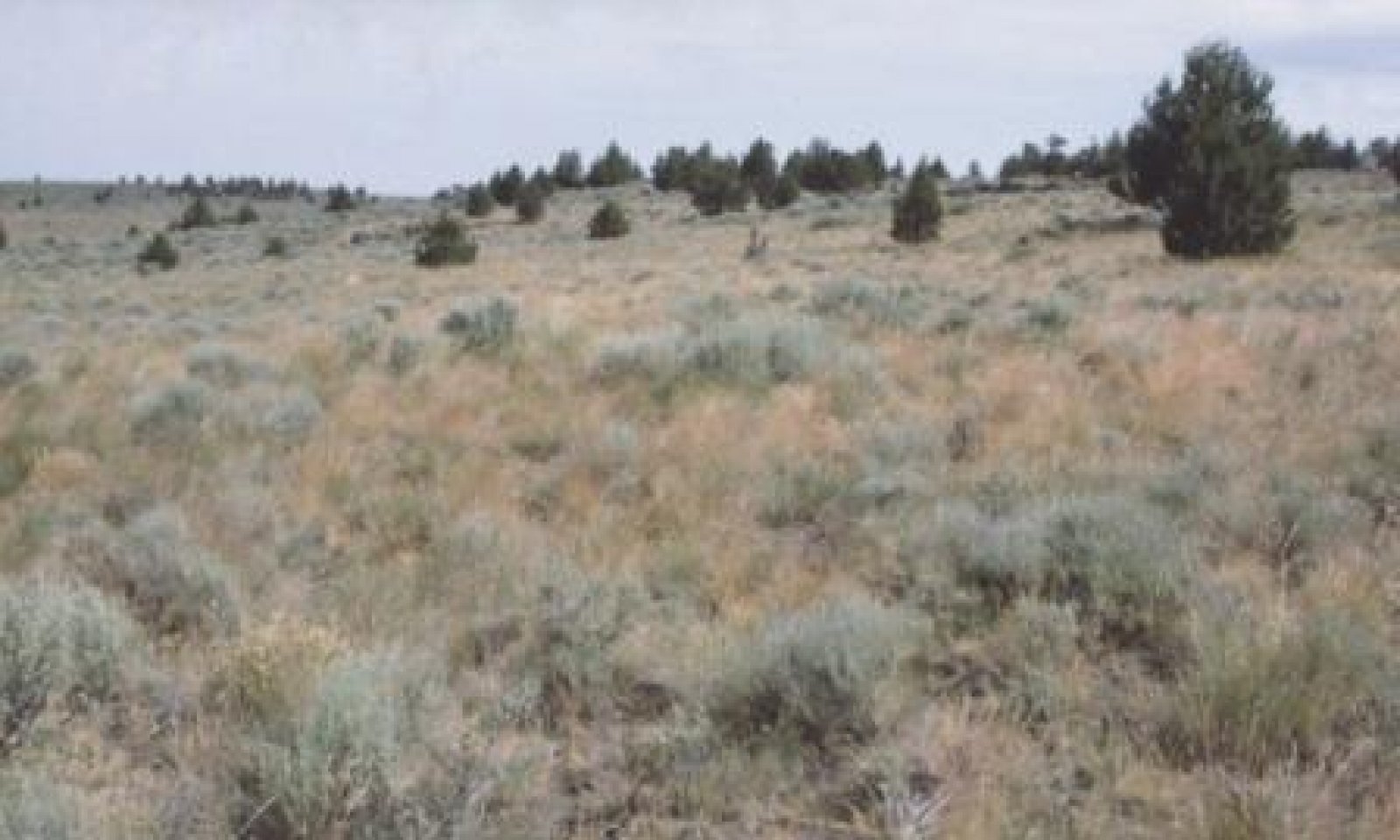
The potential native plant community is dominated by Idaho fescue, antelope bitterbrush and a complex of mountain, xeric and basin big sagebrush. Bluebunch wheatgrass and Sandberg bluegrass are common along with a variety of forbs. Thurber’s needlegrass and wild crab apple occasionally occur. Vegetative composition of the community is approximately 65 percent grasses, 5 percent forbs and 30 percent shrubs. Approximate ground cover is 80 to 90 percent (basal and crown).
The soils of this site are typically moderately deep over fractured granitic or tuffaceous bedrock and well drained.
Antelope bitterbrush increases over loamy subsoils and fractured substratums where deeper subsurface water is available. Idaho fescue increases on silt loam surfaces. Needlegrasses increase on coarser surfaces and over shallower depths. Bluebunch wheatgrass increases on slight south and west exposures. Mountain big sagebrush increases in relationship to xeric and basin big sagebrush with elevation. Deciduous shrubs increase at the upper end of the precipitation zone and over gravelly and fractured substratum’s. Production increases with soil depth and precipitation.Associated sites
R010XC039OR SR Very Shallow 12-16 PZ
SR Very Shallow 12-16 PZ (very shallow soil depth, lower production, different omposition – ARRI2/POSE dominant)
R010XC047OR SR Mountain South 12-16 PZ
SR Mountain South 12-16 PZ (south aspect, lower production, different composition – higher proportion of PSSPS)
R010XC054OR SR Mountain Shallow South 12-16 PZ
SR Mountain Shallow South 12-16 PZ (south aspect, shallower soil depth, different composition – higher proportion of PSSPS)
R010XC068OR SR Cool Mountain North 12-16 PZ
SR Cool Mountain North 12-16 PZ (north aspect, higher production)
R010XC075OR SR Mountain Shallow North 12-16 PZ
SR Mountain Shallow North 12-16 PZ (north aspect, shallower soil depth, lower production)
R010XC082OR SR Dry Pine 14-16 PZ
SR Dry Pine 14-16 PZ (higher production, different composition – scattered ponderosa pine present)
R010XC029OR SR Shallow Cool 12-16 PZ
SR Shallow Cool 12-16 PZ (stony loam surface texture, shallower soil depth, lower production)
R010XC032OR SR Mountain 12-16 PZ
SR Mountain 12-16 PZ (higher elevation, colder site, subsoil with lower permeability, different composition – bitterbrush absent or minor, higher proportion of ARTRV)
R010XC033OR SR Cool 12-16 PZ
SR Cool 12-16 PZ (subsoil with lower permeability and substratum not fractured, deep moisture required for bitterbrush not available, different composition – bitterbrush minor)
Similar sites
R010XC066OR SR Mountain North 12-16 PZ
SR Mountain North 12-16 PZ (higher elevation, north aspect, higher production, different composition – higher proportion of ARTRV)
R010XC032OR SR Mountain 12-16 PZ
SR Mountain 12-16 PZ (higher elevation, colder site, subsoil with lower permeability, different composition – bitterbrush absent or minor, higher proportion of ARTRV)
R010XC037OR SR Mountain Shallow 12-16 PZ
SR Mountain Shallow 12-16 PZ (higher elevation, stony loam surface texture, shallower soil depth, lower production, different composition – higher proportion of ARTRV)
R010XC033OR SR Cool 12-16 PZ
SR Cool 12-16 PZ (subsoil with lower permeability and substratum not fractured, deep moisture required for bitterbrush not available, different composition – bitterbrush minor)
R010XC075OR SR Mountain Shallow North 12-16 PZ
SR Mountain Shallow North 12-16 PZ (north aspect, shallower soil depth, lower production)
R010XC029OR SR Shallow Cool 12-16 PZ
SR Shallow Cool 12-16 PZ (shallower soil depth, lower production)
R010XC068OR SR Cool Mountain North 12-16 PZ
SR Cool Mountain North 12-16 PZ (north aspect, higher production)
R010XC082OR SR Dry Pine 14-16 PZ
SR Dry Pine 14-16 PZ (higher production, different composition – scattered ponderosa pine present)
Table 1. Dominant plant species
Tree Not specified
Shrub (1) Purshia tridentata
(2) Artemisia tridentata ssp. vaseyanaHerbaceous (1) Festuca idahoensis
