
Natural Resources
Conservation Service
Ecological site BX010X00C050
Shallow South
9-12 PZ
Snake River Warm Plains
Last updated: 5/16/2025
Accessed: 09/14/2026
-
Search


Major Land Resource Area or ecological site by name and/or ID.
PreviousSectionsNextGeneral information
Provisional. A provisional ecological site description has undergone quality control and quality assurance review. It contains a working state and transition model and enough information to identify the ecological site.
Click to explore map
Figure 1. Mapped extent
Areas shown in blue indicate the maximum mapped extent of this ecological site. Other ecological sites likely occur within the highlighted areas. It is also possible for this ecological site to occur outside of highlighted areas if detailed soil survey has not been completed or recently updated.
MLRA notes
Major Land Resource Area (MLRA): 010X–Central Rocky and Blue Mountain Foothills
This MLRA is characterized by gently rolling to steep hills, plateaus, and low mountains at the foothills of the Blue Mountains in Oregon and the Central Rocky Mountains in Idaho. The geology of this area is highly varied and ranges from Holocene volcanics to Cretaceous sedimentary rocks. Mollisols are the dominant soil order and the soil climate is typified by mesic or frigid soil temperature regimes, and xeric or aridic soil moisture regimes. Elevation ranges from 1,300 to 6,600 feet (395 to 2,010 meters), increasing from west to east. The climate is characterized by dry summers and snow-dominated winters with precipitation averaging eight to sixteen inches (205 to 405 millimeters) and increasing from west to east. These factors support plant communities with shrub-grass associations with considerable acreage of sagebrush grassland. Big sagebrush (Artemisia tridentata), bluebunch wheatgrass (Pseudoroegneria spicata), and Idaho fescue (Festuca idahoensis) are the dominant species. Scabland sagebrush (Artemisia rigida), little sagebrush (Artemisia arbuscula), and Sandberg bluegrass (Poa secunda) are often dominant on sites with shallow restrictive layers. Western juniper (Juniperus occidentalis) is one of the few common tree species and since European settlement has greatly expanded its extent in Oregon. Nearly half of the MLRA is federally owned and managed by the Bureau of Land Management. Most of the area is used for livestock grazing with areas accessible by irrigation often used for irrigated agriculture (USDA, 2006).
LRU notes
Located between Oregon's Blue and Wallowa Mountains and the northwestern Snake River Plain. This LRU is characterized by rangeland soils on hills and mountains associated with basalt sediments. The combined masses of the Cascade Range and the Blue and Wallowa Mountains block any maritime influence, creating a continental climate. As a result, plants are subject to wide temperature ranges, high evapotranspiration, and high early-season moisture stress. The temperature regime is mesic and the moisture regime is aridic. The mean annual precipitation is nine to twelve inches.
Ecological site concept
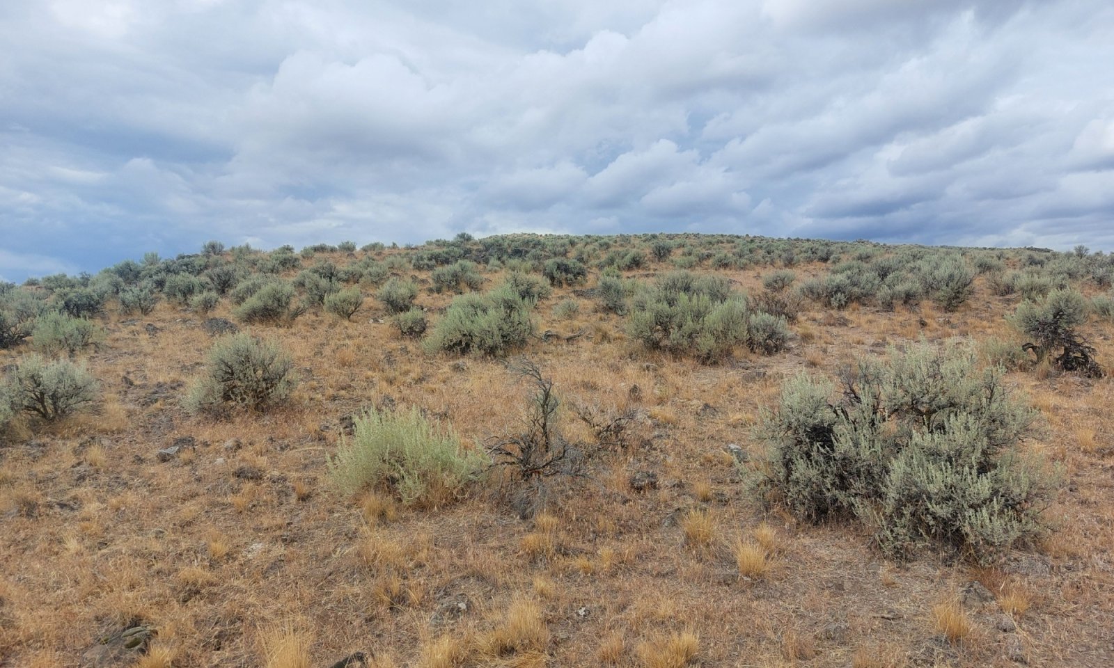
This site occurs on south-facing canyon sideslopes and southerly exposures of terraces and tablelands. Slopes are typically between 20 and 35 percent. Elevations typically range from 2,000 to 4,500 feet. The soils are shallow and typically gravelly loams. In the reference condition, this site supports vegetation communities dominated by Wyoming big sagebrush (Artemisia tridentata ssp. wyomingensis) and bluebunch wheatgrass (Pseudoroegneria spicata) in lower precipitation areas and transitions to basin big sagebrush (Artemisia tridentata ssp. tridentata) in higher precipitation areas. Higher elevation and higher precipitation sites also support mountain big sagebrush (Artemisia tridentata ssp. vaseyana) and Idaho fescue (Festuca idahoensis). The site receives nine to twelve inches of annual precipitation and soil temperature regime is mesic to cool. Resistance and resilience to disturbance are low.
Associated sites
R010XC021OR SR Clayey 9-12 PZ
SR Clayey 9-12 (adjacent landscape positions, deeper soils and higher clay percentage in surface soils)
R010XC035OR SR Shallow 9-12 PZ
SR Shallow 9-12 (adjacent landscape positions, more gentle slopes and higher clay content in the soil profile)
R010XC038OR SR Very Shallow 9-12 PZ
SR Very Shallow 9-12 (adjacent landscape positions, shallower soils and scabland sagebrush dominant)
R010XC043OR SR South 9-12 PZ
SR South 9-12 (adjacent landscape positions, deeper soils and higher annual production)
Similar sites
R010XC043OR SR South 9-12 PZ
SR South 9-12 (deeper soils and higher annual production)
Table 1. Dominant plant species
Tree Not specified
Shrub (1) Artemisia tridentata ssp. wyomingensis
Herbaceous (1) Pseudoroegneria spicata
(2) Achnatherum thurberianumLegacy ID
R010XC050OR
Physiographic features
This site occurs on south-facing canyon sideslopes, escarpments on hillslopes, and southerly exposures of terraces and tablelands. Slopes range from 12 to 70 percent but most often are 20 to 40 percent. Elevations range from 2,000 to 5,000 feet but are typically found between 2,800 and 4,100 feet.
Table 2. Representative physiographic features
Geomorphic position, hills (1) Side Slope
Hillslope profile (1) Backslope
Landforms (1) Canyon
(2) Escarpment
(3) Terrace
Elevation 2000 – 4500 ft Slope 12 – 70 % Aspect SE, S, SW Climatic features
The annual precipitation ranges from nine to twelve inches, most of which occurs in the form of rain and snow from November through March. Localized, occasionally severe, convectional storms occur during the summer. The soil temperature regime is mesic with a mean annual air temperature of 52 degrees Fahrenheit. Temperature extremes range from -20 to 100 degrees Fahrenheit. The freeze-free period ranges from 90 to 120 days. The optimum period for plant growth is from April through June.
Table 3 Representative climatic features
Frost-free period (characteristic range) 40-80 days Freeze-free period (characteristic range) 90-120 days Precipitation total (characteristic range) 10-10 in Frost-free period (actual range) 40-100 days Freeze-free period (actual range) 90-130 days Precipitation total (actual range) 10-10 in Frost-free period (average) 60 days Freeze-free period (average) 110 days Precipitation total (average) 10 in Characteristic rangeActual rangeBarLineFigure 2. Monthly precipitation range
Characteristic rangeActual rangeBarLineFigure 3. Monthly minimum temperature range
Characteristic rangeActual rangeBarLineFigure 4. Monthly maximum temperature range
BarLineFigure 5. Monthly average minimum and maximum temperature
Figure 6. Annual precipitation pattern
Figure 7 Annual average temperature pattern
Climate stations used
-
(1) WESTFALL [USC00359176], Harper, OR
-
(2) DREWSEY [USC00352415], Drewsey, OR
-
(3) RIVERSIDE 7 SSW [USC00357208], Burns, OR
">Influencing water features
This site is not typically associated with riparian or wetland features.
Soil features
The soils of this site are shallow and typically well-drained. Typically, the surface layer is a stony loam to gravelly clay loam about six inches thick. The subsoil is an extremely gravelly clay to stony loam about four to five inches thick. Depth to bedrock is 10 to 20 inches. Permeability is slow to moderate. The available water holding capacity is about two to four inches for the profile. Soils are formed by colluvium over residuum derived from basalt, sedimentary rock, or tuffaceous material. The potential for erosion is moderate to severe. The soil series Haar, Ruckles, and Lickskillet most commonly typify the soils of this site.

Figure 8.
Table 4. Representative soil features
Parent material (1) Colluvium – basalt
(2) Colluvium – sedimentary rock
(3) Colluvium – tuff
Surface texture (1) Stony loam
(2) Gravelly clay loam
Family particle size (1) Clayey-skeletal
(2) Loamy-skeletal
Drainage class Well drained to moderately well drained Permeability class Moderate to slow Soil depth 10 – 20 in Surface fragment cover <=3" 15 – 40 % Surface fragment cover >3" 0 – 5 % Available water capacity
(0-40in)2 – 4 in Clay content
(0-6in)15 – 40 % Soil reaction (1:1 water)
(0-20in)6.8 – 7.2 Ecological dynamics
Indicators and Range of Characteristics:
The potential native plant community is dominated by Wyoming big sagebrush (Artemisia tridentata ssp. wyomingensis) and bluebunch wheatgrass (Pseudoroegneria spicata). Thurber’s needlegrass (Achnatherum thurberianum) is prominent and increases in drier sites and sites with higher surface fragments. Sandberg bluegrass (Poa secunda) is the dominant shallow-rooted perennial grass. As soil surfaces become thinner, Sandberg bluegrass increases in dominance. A variety of forbs and other shrubs may be present. Vegetative composition of the reference community is approximately 80 percent grasses, 10 percent forbs, and 10 percent shrubs. The approximate ground cover is 30 to 50 percent (basal and crown).
Bluebunch wheatgrass is favored on silty surfaces and Thurber’s needlegrass increases on sandy loam surfaces and drier sites. Wyoming big sagebrush is dominant at most sites, but mountain big sagebrush (Artemisia tridentata ssp. vaseyana) becomes more prevalent towards higher elevations. Annual production increases at the upper end of the precipitation zone.
Response to Disturbance:
The ecological dynamics of this site are primarily driven by disturbance regimes including wildfire, grazing, and drought. Traditionally, wildfire was the primary driver of ecological change. These infrequent fires, often greater than a 100-year return, would result in removal of woody species and create perennial grasslands (Pyke et al., 2014; Smith et al. 2023). Differing fuel loads and weather patterns, fires likely burned in mosaic patterns leaving intact sagebrush pockets and intact soil seed banks. Given enough time, sagebrush would expand back into its original territory (Hosna et al., 2023). Forbs at these sites were likely a minor component, and while important for pollinators, did not play a major role in determining ecological outcomes (Pyke et al., 2014).
With the introduction of invasive annual grasses, chiefly cheatgrass (Bromus tectorum) and medusahead (Taeniatherum caput-medusae), the traditional fire cycle changes. These annual grasses fill interspaces and create continuous fine fuels increasing the size, and often frequency, of fire. The invasive annual grasses can recover quickly but Wyoming big sagebrush is killed and may not be able to recolonize before the next fire begins (Smith et al., 2023; Beck et al., 2012). This cycle creates a positive feedback loop in which shrubs and perennial grasses are removed from the system and invasive annual grasses dominate.
In contrast, some areas have seen an increase in fire returns. In these cases, Wyoming big sagebrush and Sandberg bluegrass increase while bluebunch wheatgrass and Thurber’s needlegrass rapidly decrease (Davies et al., 2011). A similar pattern appears due to continued overutilization, since perennial deep-rooted bunchgrasses are preferred forage, through continued grazing pressure they are eventually removed from the system (Pyke et al., 2014).
In addition, biological soil crusts are often removed leading to higher bare soil opening opportunities for annual grass invasion or increased soil erosion. The excessive erosion is most pronounced in drainage areas where deep incised gullies form.
At higher elevations, within its normal range, this site is vulnerable to western juniper (Juniperus occidentalis) encroachment. Due to shallow soils and warm temperatures, juniper encroachment is expected to occur over very long timescales (Miller et al., 2005). As western juniper invades, shrubs are reduced significantly and in shallow soils, grasses are expected to decline as well (USDA, 1997). These decreases in cover and diversity may lead to lowered soil stabilization and higher rates of erosion (Fryer and Tirmenstein, 2019). The reduction of fine fuels limits the site's ability to carry fire which further favors juniper expansion (USDA, 1997).
Within the natural range of variability, this site is considered to have low resistance and resilience to disturbance. This is driven by warm annual temperatures and an aridic soil moisture regime (Chambers et al., 2014) making the site very susceptible to annual grass invasion (Miller et al., 2013).State and transition model
More interactive model formats are also available. View Interactive Models
Click on state and transition labels to scroll to the respective textStates 2 and 5 (additional transitions)
T1A - Introduction of non-native species, inappropriate grazing management T2A - Inappropriate grazing management T2B - Fire, soil disruption, overutilization T2C - Time without disturbance R1A - Shrub removal, possible perennial grass reseeding T3A - Catastrophic fire, soil disturbing treatment, inappropriate grazing management T3B - Time without disturbance R4A - Annual grass treatment, reseeding R5A - Tree thinning, reseeding R5B - Tree thinning, failed seeding R5C - Catastrophic fire State 1 submodel, plant communities
1.1A - Fire 1.2A - Time without disturbance State 2 submodel, plant communities
2.1A - Fire 2.1B - Time without disturbance 2.2A - Time without disturbance 2.3A - Fire State 3 submodel, plant communities
State 4 submodel, plant communities
4.2A - Fire State 5 submodel, plant communities
State 1
Reference
The Reference state is representative of the natural range of variability in pristine conditions (Stringham et al., 2019). This state has no introduced plant species. Disturbance patterns reflect historic return cycles or increased return has not reduced the site's resistance and resilience to disturbance. The Reference state has two communities: a grass shrub community and a perennial grass community. Community dynamics are controlled primarily by fire and time. All functional groups are present, and a diverse forb component exists although it is not the dominant component. At the time of this writing, one site was considered to be in the Reference state so the bulk of community information is inferred from current potential sites and historical data.
Characteristics and indicators. •No introduced plant species •All functional groups present •High plant vigor and reproductive capacity
Resilience management. Reference sites should be prioritized for protection whenever possible. Management should focus on conservation and protection above other uses. Surrounding landscapes should be managed to reduce non-native species introductions and other impacts (Maestas et al., 2022).
Dominant plant species
-
Wyoming big sagebrush (Artemisia tridentata ssp. wyomingensis), shrub
-
bluebunch wheatgrass (Pseudoroegneria spicata), grass
-
Thurber's needlegrass (Achnatherum thurberianum), grass
Community 1.1
Deep-rooted perennial grass and shrubsThe potential native plant community is dominated by Wyoming big sagebrush and bluebunch wheatgrass. Thurber's needlegrass and Sandberg bluegrass are common in the stand. Vegetative composition of the community is approximately 80 percent grasses, 10 percent forbs, and 10 percent shrubs. Approximate ground cover is 30 to 50 percent (basal and crown).
Dominant plant species
-
Wyoming big sagebrush (Artemisia tridentata ssp. wyomingensis), shrub
-
bluebunch wheatgrass (Pseudoroegneria spicata), grass
-
Thurber's needlegrass (Achnatherum thurberianum), grass
Figure 9. Annual production by plant type (representative values) or group (midpoint values)
Table 5. Annual production by plant type
Plant type Low
(lb/acre)Representative value
(lb/acre)High
(lb/acre)Grass/Grasslike 240 400 640 Shrub/Vine 30 50 80 Forb 30 50 80 Total 300 500 800 Table 6. Ground cover
Tree foliar cover 0% Shrub/vine/liana foliar cover 10-20% Grass/grasslike foliar cover 30-50% Forb foliar cover 10-20% Non-vascular plants 0-10% Biological crusts 0-10% Litter 20-40% Surface fragments >0.25" and <=3" 0-10% Surface fragments >3" 0-10% Bedrock 0-0% Water 0% Bare ground 10-20% Table 7. Soil surface cover
Tree basal cover 0% Shrub/vine/liana basal cover 0-10% Grass/grasslike basal cover 10-20% Forb basal cover 0-10% Non-vascular plants 0-10% Biological crusts 0-10% Litter 0% Surface fragments >0.25" and <=3" 10-20% Surface fragments >3" 10-20% Bedrock 0-0% Water 0% Bare ground 40-60% Figure 10. Plant community growth curve (percent production by month). OR3751 , Low Elevation 9-12 Shallow and South Good Condition.
Jan Feb Mar Apr May Jun Jul Aug Sep Oct Nov Dec J F M A M J J A S O N D 0 0 5 10 40 30 5 5 5 0 0 0 Community 1.2
Perennial GrassesThis plant community is dominated by bluebunch wheatgrass and Sandberg bluegrass. This community is the result of low-intensity fire so Wyoming big sagebrush will likely be present but only in an isolated island mosaic distribution. Sprouting shrubs may be present but infrequent. This community is considered at-risk to transition to the Current Potential state since fire would increase bare soil and the opportunity for introduction of non-native species.
Dominant plant species
-
bluebunch wheatgrass (Pseudoroegneria spicata), grass
-
Sandberg bluegrass (Poa secunda), grass
Figure 11. Annual production by plant type (representative values) or group (midpoint values)
Table 8. Annual production by plant type
Plant type Low
(lb/acre)Representative value
(lb/acre)High
(lb/acre)Grass/Grasslike 300 500 700 Forb 40 75 100 Shrub/Vine 10 25 50 Total 350 600 850 Table 9. Ground cover
Tree foliar cover 0% Shrub/vine/liana foliar cover 0-10% Grass/grasslike foliar cover 40-60% Forb foliar cover 10-20% Non-vascular plants 0-10% Biological crusts 0-10% Litter 30-40% Surface fragments >0.25" and <=3" 10-10% Surface fragments >3" 10-10% Bedrock 0% Water 0% Bare ground 20-30% Table 10. Soil surface cover
Tree basal cover 0% Shrub/vine/liana basal cover 0-0% Grass/grasslike basal cover 20-30% Forb basal cover 10-10% Non-vascular plants 0-10% Biological crusts 0-10% Litter 0% Surface fragments >0.25" and <=3" 10-20% Surface fragments >3" 10-20% Bedrock 0% Water 0% Bare ground 40-60% Figure 12. Plant community growth curve (percent production by month). OR3751 , Low Elevation 9-12 Shallow and South Good Condition.
Jan Feb Mar Apr May Jun Jul Aug Sep Oct Nov Dec J F M A M J J A S O N D 0 0 5 10 40 30 5 5 5 0 0 0 Pathway 1.1A
Community 1.1 to 1.2Low-severity fire burns in a mosaic pattern leaving islands of sagebrush with perennial grass-dominated areas in between.
Context dependence.As fire severity increases, the distance between sagebrush islands increases meaning more time for sagebrush to recover in burned areas.
Pathway 1.2A
Community 1.2 to 1.1Time without fire allows sagebrush recruitment to increase and become more common across the landscape.
Context dependence.Sagebrush expansion can occur over very long-time scales so recovery may take decades depending on climate variations and distance to seed sources.
State 2
Current Potential
This state is similar to the Reference state but some amount of nonnative species occur and species composition has been somewhat altered. Ecological functions often remain intact but due to the presence of these non-native species, resistance and resilience to disturbance have been reduced (Stringham et al., 2016). This state has three communities: a grass-shrub community, a shrub-grass community, and a perennial grass community. The latter two represent two different at-risk communities; at risk of converting to the Shrubland state and at risk of converting to the Annual state, respectively.
Characteristics and indicators. •Low cover of introduced plant species (commonly less than fifteen percent total) •Deep-rooted perennial grass cover at or above twenty percent •All functional groups present with no significant decrease in reproductive capability
Resilience management. Sites in the current potential state should be prioritized for protection wherever possible, especially when in good quality condition (Maestas et al., 2022). Management activities should focus on limited seed sources of invasive annual grasses and promote perennial plant vigor and reproduction.
Dominant plant species
-
Wyoming big sagebrush (Artemisia tridentata ssp. wyomingensis), shrub
-
bluebunch wheatgrass (Pseudoroegneria spicata), grass
-
Idaho fescue (Festuca idahoensis), grass
Community 2.1
Deep-rooted Perennial Grass and Shrubs
Deep-rooted perennial grasses, particularly bluebunch wheatgrass and Idaho fescue are dominant and Wyoming big sagebrush is sub-dominant. Invasive annual grasses may be present but are not dominant. Forbs are generally a diverse mix of annual and perennial.
Dominant plant species
-
Wyoming big sagebrush (Artemisia tridentata ssp. wyomingensis), shrub
-
bluebunch wheatgrass (Pseudoroegneria spicata), grass
-
Idaho fescue (Festuca idahoensis), grass
Figure 13. Annual production by plant type (representative values) or group (midpoint values)
Table 11. Annual production by plant type
Plant type Low
(lb/acre)Representative value
(lb/acre)High
(lb/acre)Grass/Grasslike 235 375 625 Shrub/Vine 50 95 135 Forb 15 30 40 Total 300 500 800 Table 12. Ground cover
Tree foliar cover 0% Shrub/vine/liana foliar cover 10-20% Grass/grasslike foliar cover 40-50% Forb foliar cover 0-10% Non-vascular plants 0-0% Biological crusts 0-0% Litter 30-50% Surface fragments >0.25" and <=3" 10-20% Surface fragments >3" 10-10% Bedrock 0-0% Water 0% Bare ground 10-20% Table 13. Soil surface cover
Tree basal cover 0% Shrub/vine/liana basal cover 0-0% Grass/grasslike basal cover 10-20% Forb basal cover 0-10% Non-vascular plants 0-0% Biological crusts 0-0% Litter 0% Surface fragments >0.25" and <=3" 10-20% Surface fragments >3" 10-20% Bedrock 0-0% Water 0% Bare ground 50-60% Figure 14. Plant community growth curve (percent production by month). OR3751 , Low Elevation 9-12 Shallow and South Good Condition.
Jan Feb Mar Apr May Jun Jul Aug Sep Oct Nov Dec J F M A M J J A S O N D 0 0 5 10 40 30 5 5 5 0 0 0 Community 2.2
Perennial Grasses
Shallow-rooted bunchgrasses, particularly Sandberg bluegrass, are increasing. Bluebunch wheatgrass is still present but may be reduced compared to other current potential sites. Depending on fire severity, Wyoming big sagebrush may not be present in high-severity fires or only found in isolated pockets in lower-severity patchy fires. Forbs have reduced diversity. Invasive annual grasses are likely increasing. This community is at risk of transitioning to the Annual state.
Dominant plant species
-
bluebunch wheatgrass (Pseudoroegneria spicata), grass
-
Idaho fescue (Festuca idahoensis), grass
-
Sandberg bluegrass (Poa secunda), grass
Figure 15. Annual production by plant type (representative values) or group (midpoint values)
Table 14. Annual production by plant type
Plant type Low
(lb/acre)Representative value
(lb/acre)High
(lb/acre)Grass/Grasslike 200 400 600 Shrub/Vine 30 40 50 Forb 20 35 50 Total 250 475 700 Table 15. Ground cover
Tree foliar cover 0% Shrub/vine/liana foliar cover 0-0% Grass/grasslike foliar cover 40-50% Forb foliar cover 10-20% Non-vascular plants 0-0% Biological crusts 0-0% Litter 40-60% Surface fragments >0.25" and <=3" 0-10% Surface fragments >3" 0-10% Bedrock 0% Water 0% Bare ground 10-20% Table 16. Soil surface cover
Tree basal cover 0% Shrub/vine/liana basal cover 0% Grass/grasslike basal cover 10-20% Forb basal cover 0-0% Non-vascular plants 0-0% Biological crusts 0-0% Litter 0% Surface fragments >0.25" and <=3" 10-10% Surface fragments >3" 0-10% Bedrock 0% Water 0% Bare ground 60-80% Figure 16. Plant community growth curve (percent production by month). OR3751 , Low Elevation 9-12 Shallow and South Good Condition.
Jan Feb Mar Apr May Jun Jul Aug Sep Oct Nov Dec J F M A M J J A S O N D 0 0 5 10 40 30 5 5 5 0 0 0 Community 2.3
Shrubs and Shallow-rooted Grasses
Wyoming big sagebrush is the dominant shrub species, and perennial grasses are sub-dominant. Sandberg bluegrass increases over deep-rooted perennial species as sagebrush increases to the point of using available deeper resources. Forbs are diverse and widespread. Annual invasive grasses are present but not dominant. This community is at risk of transitioning to the Shrubland state.
Dominant plant species
-
Wyoming big sagebrush (Artemisia tridentata ssp. wyomingensis), shrub
-
basin big sagebrush (Artemisia tridentata ssp. tridentata), shrub
-
bluebunch wheatgrass (Pseudoroegneria spicata), grass
-
Sandberg bluegrass (Poa secunda), grass
Figure 17. Annual production by plant type (representative values) or group (midpoint values)
Table 17. Annual production by plant type
Plant type Low
(lb/acre)Representative value
(lb/acre)High
(lb/acre)Shrub/Vine 140 210 300 Grass/Grasslike 140 210 300 Forb 20 30 50 Total 300 450 650 Table 18. Ground cover
Tree foliar cover 0% Shrub/vine/liana foliar cover 10-20% Grass/grasslike foliar cover 20-30% Forb foliar cover 10-20% Non-vascular plants 0-10% Biological crusts 0-0% Litter 30-50% Surface fragments >0.25" and <=3" 0-10% Surface fragments >3" 0-10% Bedrock 0% Water 0% Bare ground 20-30% Table 19. Soil surface cover
Tree basal cover 0% Shrub/vine/liana basal cover 0-0% Grass/grasslike basal cover 0-10% Forb basal cover 0-0% Non-vascular plants 0-10% Biological crusts 0-0% Litter 0% Surface fragments >0.25" and <=3" 10-10% Surface fragments >3" 0-10% Bedrock 0% Water 0% Bare ground 70-80% Figure 18. Plant community growth curve (percent production by month). OR3751 , Low Elevation 9-12 Shallow and South Good Condition.
Jan Feb Mar Apr May Jun Jul Aug Sep Oct Nov Dec J F M A M J J A S O N D 0 0 5 10 40 30 5 5 5 0 0 0 Pathway 2.1A
Community 2.1 to 2.2
Deep-rooted Perennial Grass and Shrubs
Perennial GrassesFire reduces non-sprouting shrubs allowing grasses to become dominant.
Context dependence.Fire severity or the likelihood of fire may increase following high precipitation years that increase vegetative production.
Pathway 2.1B
Community 2.1 to 2.3
Deep-rooted Perennial Grass and Shrubs
Shrubs and Shallow-rooted GrassesTime without disturbance allows shrubs to become dominant.
Context dependence.Grazing may speed this transition by reducing deep-rooted perennial grass cover.
Pathway 2.2A
Community 2.2 to 2.1
Perennial Grasses
Deep-rooted Perennial Grass and ShrubsTime without fire allows shrubs to be reestablished.
Context dependence.Higher severity fire will increase distance between unburned pockets and increase time for non-sprouting shrubs to reestablish.
Pathway 2.3A
Community 2.3 to 2.2
Shrubs and Shallow-rooted Grasses
Perennial GrassesFire removes shrubs and opens space for deep-rooted perennial grasses to become dominant.
Context dependence.Fire severity or the likelihood of fire may increase following high precipitation years that increase vegetative production.
State 3
Shrubland
This state is dominated by shrubs and shallow-rooted perennial grasses and is a result of overgrazing especially during key growth periods of cool-season bunchgrasses. Deep-rooted perennial grasses have been reduced or completely excluded, rarely exceeding five percent foliar cover. This state consists of one community, the Shrubs and Shallow-rooted Grass community (Hanna and Fulgham, 2015). Although highly variable, invasive annual grass cover is often higher than in the current potential state. Without deep-rooted perennial grasses, this state is more prone to erosion than the Current Potential state.
Characteristics and indicators. •Typically, less than five percent foliar cover of deep-rooted perennial grasses. •High cover of shallow-rooted perennial grass •Increased invasive annual grass but not enough to become a dominant component.
Resilience management. Management actions should focus on reintroduction of deep-rooted perennial grasses. Invasive annual grass control may also be a priority to avoid transitioning to an annual state.
Dominant plant species
-
Wyoming big sagebrush (Artemisia tridentata ssp. wyomingensis), shrub
-
Sandberg bluegrass (Poa secunda), grass
Community 3.1
Shrubs and Shallow-rooted Grasses
Wyoming big sagebrush is dominant with Sandberg bluegrass. Deep-rooted perennial grass is much reduced or missing entirely. Invasive annual grasses may be increasing.
Dominant plant species
-
Wyoming big sagebrush (Artemisia tridentata ssp. wyomingensis), shrub
-
Sandberg bluegrass (Poa secunda), grass
Figure 19. Annual production by plant type (representative values) or group (midpoint values)
Table 20. Annual production by plant type
Plant type Low
(lb/acre)Representative value
(lb/acre)High
(lb/acre)Shrub/Vine 150 225 350 Grass/Grasslike 50 140 250 Forb 25 35 50 Total 225 400 650 Table 21. Ground cover
Tree foliar cover 0% Shrub/vine/liana foliar cover 20-40% Grass/grasslike foliar cover 20-30% Forb foliar cover 10-10% Non-vascular plants 0-0% Biological crusts 0-0% Litter 40-50% Surface fragments >0.25" and <=3" 0-10% Surface fragments >3" 0-10% Bedrock 0% Water 0% Bare ground 10-20% Table 22. Soil surface cover
Tree basal cover 0% Shrub/vine/liana basal cover 0-10% Grass/grasslike basal cover 0-10% Forb basal cover 0-0% Non-vascular plants 0-10% Biological crusts 0-0% Litter 0% Surface fragments >0.25" and <=3" 0-10% Surface fragments >3" 0-10% Bedrock 0% Water 0% Bare ground 70-80% Figure 20. Plant community growth curve (percent production by month). OR3752 , Low Elevation 9-12 Shallow and South Fair Condition.
Jan Feb Mar Apr May Jun Jul Aug Sep Oct Nov Dec J F M A M J J A S O N D 0 0 10 20 40 20 5 0 5 0 0 0 State 4
Annual
This state is dominated by invasive annual grasses. These grasses increase litter amounts which inhibit deep-rooted perennial grass recruitment and increase fire frequency. These two effects create a positive feedback loop that increases invasive annual grass populations (Reisner et al., 2013).
Characteristics and indicators. •Annual grass foliar cover greater than 25 percent •Sagebrush cover is variable but even when common, interspaces dominated by invasive annual grasses. •Herbaceous litter cover can be higher than other states
Resilience management. Any management actions should focus on reducing the annual grass cover and limiting its spread to other areas (Smith et al., 2022).
Dominant plant species
-
cheatgrass (Bromus tectorum), grass
-
medusahead (Taeniatherum caput-medusae), grass
Community 4.1
Shrubs and Invasive Annual Grasses
Introduced annual grasses are the dominant component of this community. Wyoming big sagebrush is still present but annual grasses and shallow-rooting perennial grasses fill all interspaces. This community may be the result of a slow invasion of annual grasses not facilitated by fire (Smith et al., 2022). Invasive annual grasses reduce deep-rooted perennial grasses and fill interspaces between shrubs. If fire occurs, sagebrush may be replaced by sprouting rabbitbrush species.
Resilience management. Any action should focus on reducing the invasive annual grass population to allow the recovery of native species.
Dominant plant species
-
Wyoming big sagebrush (Artemisia tridentata ssp. wyomingensis), shrub
-
rubber rabbitbrush (Ericameria nauseosa), shrub
-
Sandberg bluegrass (Poa secunda), grass
-
cheatgrass (Bromus tectorum), grass
Figure 21. Annual production by plant type (representative values) or group (midpoint values)
Table 23. Annual production by plant type
Plant type Low
(lb/acre)Representative value
(lb/acre)High
(lb/acre)Grass/Grasslike 300 400 500 Shrub/Vine 50 100 150 Forb 25 45 75 Tree 0 5 25 Total 375 550 750 Table 24. Ground cover
Tree foliar cover 0-0% Shrub/vine/liana foliar cover 10-20% Grass/grasslike foliar cover 50-70% Forb foliar cover 10-10% Non-vascular plants 0-0% Biological crusts 0-0% Litter 40-60% Surface fragments >0.25" and <=3" 0-10% Surface fragments >3" 0-10% Bedrock 0% Water 0% Bare ground 0-10% Table 25. Soil surface cover
Tree basal cover 0% Shrub/vine/liana basal cover 0-0% Grass/grasslike basal cover 0-10% Forb basal cover 0-0% Non-vascular plants 0-10% Biological crusts 0-0% Litter 0% Surface fragments >0.25" and <=3" 10-20% Surface fragments >3" 10-20% Bedrock 0% Water 0% Bare ground 50-80% Figure 22. Plant community growth curve (percent production by month). OR3753 , Low Elevation 9-12 Shallow and South Poor Condition.
Jan Feb Mar Apr May Jun Jul Aug Sep Oct Nov Dec J F M A M J J A S O N D 0 0 20 25 35 10 5 0 5 0 0 0 Community 4.2
Invasive Annual Grasses and Forbs
Introduced annual grasses are dominant. This community is usually the result of a high-intensity fire removing many of the non-sprouting shrubs. Invasive annual grasses then form continuous coverage of the landscape. Dominant invasive grasses are cheatgrass and medusahead. Introduced forbs such as prickly lettuce (Lactuca serriola), red stem stork's bill (Erodium cicutarium), and Scotch cottonthistle (Onopordum acanthium) may be common throughout. Basin big sagebrush and Wyoming big sagebrush may be present but only in trace amounts and will likely be removed completely with repeated burns.
Resilience management. Any management actions should focus on the removal of invasive annual grasses. Seedbanks in this community may be depleted of native species so management actions may need to incorporate seeding with desirable plant species.
Dominant plant species
-
Sandberg bluegrass (Poa secunda), grass
-
cheatgrass (Bromus tectorum), grass
Figure 23. Annual production by plant type (representative values) or group (midpoint values)
Table 26. Annual production by plant type
Plant type Low
(lb/acre)Representative value
(lb/acre)High
(lb/acre)Grass/Grasslike 300 450 600 Forb 50 75 100 Shrub/Vine 50 75 100 Total 400 600 800 Table 27. Ground cover
Tree foliar cover 0% Shrub/vine/liana foliar cover 0-10% Grass/grasslike foliar cover 50-70% Forb foliar cover 10-20% Non-vascular plants 0-0% Biological crusts 0-0% Litter 40-60% Surface fragments >0.25" and <=3" 10-10% Surface fragments >3" 0-10% Bedrock 0% Water 0% Bare ground 10-10% Table 28. Soil surface cover
Tree basal cover 0% Shrub/vine/liana basal cover 0-0% Grass/grasslike basal cover 0-10% Forb basal cover 0-0% Non-vascular plants 0-0% Biological crusts 0-0% Litter 0% Surface fragments >0.25" and <=3" 20-30% Surface fragments >3" 10-20% Bedrock 0% Water 0% Bare ground 50-80% Figure 24. Plant community growth curve (percent production by month). OR3753 , Low Elevation 9-12 Shallow and South Poor Condition.
Jan Feb Mar Apr May Jun Jul Aug Sep Oct Nov Dec J F M A M J J A S O N D 0 0 20 25 35 10 5 0 5 0 0 0 Pathway 4.2A
Community 4.1 to 4.2
Shrubs and Invasive Annual Grasses
Invasive Annual Grasses and ForbsFire occurs, eliminating the shrub component. Mechanical shrub removal could cause a similar shift.
Context dependence.High precipitation may lead to higher annual grass biomass and an increase in fine fuels. Fine fuel increases can cause more frequent fire return.
State 5
Encroached
This state is characterized by the co-dominance or dominance of young junipers at the site. Sagebrush and deep-rooted perennial grasses may be present but no longer control site resources and are likely declining. Bare ground is expected to increase and on sites with higher slopes erosion may become a significant issue.
Characteristics and indicators. • Western juniper canopy cover above ten percent • Bare ground increasing possibly showing signs of soil erosion such as grass pedestals • Shrubs showing signs of decreasing
Resilience management. Management should focus on young juniper removal and either preservation or reintroduction of deep-rooted perennial grasses. Before treatment, sites should be examined closely as success or failure depends on many factors (Miller et al. 2005). See state transition pathways for more details.
Dominant plant species
-
western juniper (Juniperus occidentalis), tree
-
mountain big sagebrush (Artemisia tridentata ssp. vaseyana), shrub
-
Idaho fescue (Festuca idahoensis), grass
-
bluebunch wheatgrass (Pseudoroegneria spicata), grass
Community 5.1
Western Juniper
Western juniper is co-dominant with or dominant to sagebrush and deep-rooted perennial grass. Sagebrush is likely decreasing. Sandberg bluegrass may be increasing. Invasive annual grasses and other introduced species may be common.
Dominant plant species
-
western juniper (Juniperus occidentalis), tree
-
bluebunch wheatgrass (Pseudoroegneria spicata), grass
-
Idaho fescue (Festuca idahoensis), grass
Figure 25. Annual production by plant type (representative values) or group (midpoint values)
Table 29. Annual production by plant type
Plant type Low
(lb/acre)Representative value
(lb/acre)High
(lb/acre)Grass/Grasslike 125 200 275 Tree 150 200 250 Forb 25 50 75 Shrub/Vine 0 25 50 Total 300 475 650 Table 30. Ground cover
Tree foliar cover 20-30% Shrub/vine/liana foliar cover 0-10% Grass/grasslike foliar cover 20-30% Forb foliar cover 0-10% Non-vascular plants 0-0% Biological crusts 0-0% Litter 40-60% Surface fragments >0.25" and <=3" 0-10% Surface fragments >3" 0-10% Bedrock 0% Water 0% Bare ground 10-20% Table 31. Soil surface cover
Tree basal cover 0-0% Shrub/vine/liana basal cover 0-0% Grass/grasslike basal cover 0-10% Forb basal cover 0-0% Non-vascular plants 0-10% Biological crusts 0-0% Litter 0% Surface fragments >0.25" and <=3" 20-30% Surface fragments >3" 10-20% Bedrock 0% Water 0% Bare ground 50-70% Figure 26. Plant community growth curve (percent production by month). OR3752 , Low Elevation 9-12 Shallow and South Fair Condition.
Jan Feb Mar Apr May Jun Jul Aug Sep Oct Nov Dec J F M A M J J A S O N D 0 0 10 20 40 20 5 0 5 0 0 0 Transition T1A
State 1 to 2
Reference
Current PotentialIntroduction of non-native species. Over-utilization grazing could also aid in susceptibility of the site to invasion.
Context dependence.Circumstances that increase bare soil such as drought or soil-disturbing activities, may increase opportunities for non-native species to invade.
Transition T2A
State 2 to 3
Current Potential
ShrublandRepeated overgrazing reduces deep-rooted perennial grasses and shifts to shrubs and shallow-rooted grass dominance. This shift increases bare soil and the possibility of soil erosion.
Context dependence.Soil vulnerability to compaction will be highest in spring when the soil is saturated and unfrozen.
Transition T2B
State 2 to 4
Current Potential
AnnualHigh-intensity or frequent fire that removes the sagebrush component from the site. Soil-disturbing treatments or repeated overutilization may also cause this transition.
Context dependence.Transition rate will depend on multiple factors including existing plant cover, biological soil crust integrity, seed bank integrity, and recent weather patterns.
Transition T2C
State 2 to 5
Current Potential
EncroachedTime without fire allows for maturation and spread of the juniper community.
Context dependence.The speed of encroachment depends on the distance to a seed source and available moisture.
Restoration pathway R1A
State 3 to 2
Shrubland
Current PotentialMowing shrubs may allow for perennial grasses to become more dominant.
Context dependence.Actions to remove Wyoming big sagebrush increase the risk of invasive annual grasses becoming prevalent. Recovery may depend on the existing plant understory and the ability to control annual grasses while recovery takes place.
Transition T3A
State 3 to 4
Shrubland
AnnualHigh-intensity or frequent fire. Sagebrush removal activities that disturb the soil.
Context dependence.Transition rate will depend on existing cover and seedbank integrity.
Transition T3B
State 3 to 5
Shrubland
EncroachedTime without fire allows for the maturation and spread of juniper communities.
Context dependence.Speed of encroachment depends on the distance to a seed source and available moisture.
Restoration pathway R4A
State 4 to 3
Annual
ShrublandTargeted shrub planting and fire breaks may keep fire out of the site long enough for shrubs to recover.
Context dependence.Herbicide application can help control invasive annual grass populations to support shrub growth.
Restoration pathway R5A
State 5 to 2
Encroached
Current PotentialTree thinning coupled with a successful seeding of missing functional groups. Invasive annual grass dominance is common following fire so fire as a tree thinning tool should only be used where invasive annual grasses remain in trace amounts.
Context dependence.The success of tree thinning likely relies on pre-treatment plant communities. In sites where all functional groups are still present, tree thinning can result in a restoration to the Current Potential state. The loss of deep-rooted perennials in the pre-treatment community may result in a transition to the Shrubland state. A pre-treatment community dominated by invasive annual grasses will likely result in a transition to the Annual state.
Restoration pathway R5B
State 5 to 3
Encroached
ShrublandGround disturbing mechanical tree thinning coupled with failed or no seed applied restoration attempt. Invasive annual grass dominance is common following fire so fire as a tree thinning tool should only be used where invasive annual grasses remain in trace amounts.
Context dependence.The success of tree thinning likely relies on pre-treatment plant communities. In sites where all functional groups are still present, tree thinning can result in a restoration to the Current Potential state. The loss of deep-rooted perennials in the pre-treatment community may result in a transition to the Shrubland state. A pre-treatment community dominated by invasive annual grasses will likely result in a transition to the Annual state.
Restoration pathway R5C
State 5 to 4
Encroached
AnnualCatastrophic fire or ground disturbing mechanical treatment.
Context dependence.The success of tree thinning likely relies on pre-treatment plant communities. In sites where all functional groups are still present, tree thinning can result in a restoration to the Current Potential state. The loss of deep-rooted perennials in the pre-treatment community may result in a transition to the Shrubland state. A pre-treatment community dominated by invasive annual grasses will likely result in a transition to the Annual state.
Additional community tables
Table 32. Community 1.1 plant community composition
Group Common name Symbol Scientific name Annual production () Foliar cover (%) Grass/Grasslike1 Dominant, perennial, deep rooted bunchgrass 220–570 bluebunch wheatgrass PSSP6 Pseudoroegneria spicata 300–400 10–30 Thurber's needlegrass ACTH7 Achnatherum thurberianum 50–150 5–10 2 Sub-dominant, perennial, shallow-rooted grass 15–45 Sandberg bluegrass POSE Poa secunda 15–40 5–15 3 Other grasses 5–25 Indian ricegrass ACHY Achnatherum hymenoides 0–10 0–5 squirreltail ELEL5 Elymus elymoides 0–10 0–5 Forb7 Dominant, perennial, forb 10–25 arrowleaf balsamroot BASA3 Balsamorhiza sagittata 10–25 2–5 8 Sub-dominant, perennial, forbs 15–30 common yarrow ACMI2 Achillea millefolium 0–10 0–2 onion ALLIU Allium 0–10 0–2 cliff beardtongue PERU Penstemon rupicola 0–10 0–2 9 Other perennial forbs 5–25 pussytoes ANTEN Antennaria 0–3 0–2 milkvetch ASTRA Astragalus 0–3 0–2 tapertip hawksbeard CRAC2 Crepis acuminata 0–3 0–2 fleabane ERIGE2 Erigeron 0–3 0–2 buckwheat ERIOG Eriogonum 0–3 0–2 western stoneseed LIRU4 Lithospermum ruderale 0–3 0–2 desertparsley LOMAT Lomatium 0–3 0–2 lupine LUPIN Lupinus 0–3 0–2 phacelia PHACE Phacelia 0–3 0–2 phlox PHLOX Phlox 0–3 0–2 Shrub/Vine11 Dominant evergreen, shrub 15–40 Wyoming big sagebrush ARTRW8 Artemisia tridentata ssp. wyomingensis 5–25 5–15 13 Other shrubs 15–40 rubber rabbitbrush ERNA10 Ericameria nauseosa 5–10 2–5 wild crab apple PERA4 Peraphyllum ramosissimum 0–10 0–2 antelope bitterbrush PUTR2 Purshia tridentata 0–10 0–2 Table 33. Community 1.2 plant community composition
Group Common name Symbol Scientific name Annual production () Foliar cover (%) Grass/Grasslike1 Perennial, deep-rooted, dominant 250–550 bluebunch wheatgrass PSSP6 Pseudoroegneria spicata 200–400 20–30 Thurber's needlegrass ACTH7 Achnatherum thurberianum 50–150 10–20 2 Perennial, deep-rooted 25–75 Indian ricegrass ACHY Achnatherum hymenoides 0–10 0–5 squirreltail ELEL5 Elymus elymoides 0–10 0–5 needle and thread HECO26 Hesperostipa comata 0–10 0–5 3 Perennial, shallow-rooted 25–75 Sandberg bluegrass POSE Poa secunda 25–75 10–20 Forb5 Perennial forb 30–70 beardtongue PENST Penstemon 0–10 0–5 arrowleaf balsamroot BASA3 Balsamorhiza sagittata 0–10 0–5 common yarrow ACMI2 Achillea millefolium 0–10 0–5 onion ALLIU Allium 0–10 0–5 buckwheat ERIOG Eriogonum 0–10 0–5 lupine LUPIN Lupinus 0–10 0–5 phlox PHLOX Phlox 0–10 0–5 desertparsley LOMAT Lomatium 0–10 0–5 6 Annual forb, native 10–30 annual agoseris AGHE2 Agoseris heterophylla 0–5 0–2 rough eyelashweed BLSC Blepharipappus scaber 0–5 0–2 willowherb EPILO Epilobium 0–5 0–2 tiny trumpet COLI2 Collomia linearis 0–5 0–2 maiden blue eyed Mary COPA3 Collinsia parviflora 0–5 0–2 slender phlox MIGR Microsteris gracilis 0–5 0–2 threadleaf phacelia PHLI Phacelia linearis 0–5 0–2 Shrub/Vine11 Other shrubs 10–50 rubber rabbitbrush ERNA10 Ericameria nauseosa 0–20 0–5 Wyoming big sagebrush ARTRW8 Artemisia tridentata ssp. wyomingensis 0–20 0–5 wild crab apple PERA4 Peraphyllum ramosissimum 0–20 0–5 Table 34. Community 2.1 plant community composition
Group Common name Symbol Scientific name Annual production () Foliar cover (%) Grass/Grasslike1 Perennial, deep-rooted, dominant 150–400 bluebunch wheatgrass PSSP6 Pseudoroegneria spicata 100–300 10–30 Idaho fescue FEID Festuca idahoensis 50–100 10–30 2 Perennial, deep-rooted 40–105 Thurber's needlegrass ACTH7 Achnatherum thurberianum 10–30 0–5 needle and thread HECO26 Hesperostipa comata 0–20 0–5 squirreltail ELEL5 Elymus elymoides 0–20 0–5 3 Perennial, shallow-rooted 15–40 Sandberg bluegrass POSE Poa secunda 15–40 5–15 9 Annual grass, introduced 30–80 cheatgrass BRTE Bromus tectorum 20–40 5–10 soft brome BRHO2 Bromus hordeaceus 0–10 0–5 brome fescue VUBR Vulpia bromoides 0–10 0–2 Forb5 Perennial forb 10–20 arrowleaf balsamroot BASA3 Balsamorhiza sagittata 0–20 0–3 bastard toadflax COUM Comandra umbellata 0–10 0–3 spiny phlox PHHO Phlox hoodii 0–10 0–3 longleaf phlox PHLO2 Phlox longifolia 0–10 0–3 silvery lupine LUAR3 Lupinus argenteus 0–10 0–3 nineleaf biscuitroot LOTR2 Lomatium triternatum 0–10 0–3 6 Annual forb, native 5–15 annual agoseris AGHE2 Agoseris heterophylla 0–5 0–2 rough eyelashweed BLSC Blepharipappus scaber 0–5 0–2 chaparral willowherb EPMI Epilobium minutum 0–5 0–2 trumpet COLLO Collomia 0–5 0–2 7 Annual forb, introduced 0–5 curveseed butterwort CETE5 Ceratocephala testiculata 0–5 0–2 spring draba DRVE2 Draba verna 0–1 0–2 Shrub/Vine10 Shrubs, dominant 40–105 Wyoming big sagebrush ARTRW8 Artemisia tridentata ssp. wyomingensis 60–105 5–15 11 Other shrubs 10–30 rubber rabbitbrush ERNA10 Ericameria nauseosa 0–10 0–10 little sagebrush ARAR8 Artemisia arbuscula 0–10 0–10 basin big sagebrush ARTRT Artemisia tridentata ssp. tridentata 0–10 0–5 Table 35. Community 2.2 plant community composition
Group Common name Symbol Scientific name Annual production () Foliar cover (%) Grass/Grasslike1 Perennial, deep-rooted, dominant 100–350 bluebunch wheatgrass PSSP6 Pseudoroegneria spicata 100–200 10–20 Idaho fescue FEID Festuca idahoensis 50–100 0–15 2 Perennial, deep-rooted 20–50 squirreltail ELEL5 Elymus elymoides 0–20 0–2 Thurber's needlegrass ACTH7 Achnatherum thurberianum 0–20 0–2 3 Perennial, shallow-rooted 60–150 Sandberg bluegrass POSE Poa secunda 60–150 15–30 9 Annual grass, introduced 20–50 cheatgrass BRTE Bromus tectorum 20–40 5–15 medusahead TACA8 Taeniatherum caput-medusae 5–15 – soft brome BRHO2 Bromus hordeaceus 0–10 0–2 Forb5 Perennial forb 10–25 tapertip onion ALAC4 Allium acuminatum 0–5 0–2 hawksbeard CREPI Crepis 0–5 0–2 parsnipflower buckwheat ERHE2 Eriogonum heracleoides 0–5 0–2 bulbous woodland-star LIGL2 Lithophragma glabrum 0–5 0–2 sagebrush false dandelion NOTR2 Nothocalais troximoides 0–5 0–2 longleaf phlox PHLO2 Phlox longifolia 0–5 0–2 Bolander's yampah PEBO2 Perideridia bolanderi 0–5 0–2 6 Annual forb, native 5–15 chaparral willowherb EPMI Epilobium minutum 0–5 0–2 maiden blue eyed Mary COPA3 Collinsia parviflora 0–5 0–2 slender phlox MIGR Microsteris gracilis 0–5 0–2 threadleaf phacelia PHLI Phacelia linearis 0–5 0–2 7 Annual forb, introduced 5–10 yellow salsify TRDU Tragopogon dubius 0–5 0–2 jagged chickweed HOUM Holosteum umbellatum 0–5 0–2 prickly lettuce LASE Lactuca serriola 0–5 0–2 Shrub/Vine11 Other shrubs 30–50 Wyoming big sagebrush ARTRW8 Artemisia tridentata ssp. wyomingensis 10–20 2–5 wild crab apple PERA4 Peraphyllum ramosissimum 0–10 0–2 Table 36. Community 2.3 plant community composition
Group Common name Symbol Scientific name Annual production () Foliar cover (%) Grass/Grasslike2 Perennial, deep-rooted 20–50 bluebunch wheatgrass PSSP6 Pseudoroegneria spicata 10–20 5–10 basin wildrye LECI4 Leymus cinereus 0–20 0–5 Thurber's needlegrass ACTH7 Achnatherum thurberianum 0–10 0–5 Indian ricegrass ACHY Achnatherum hymenoides 0–10 0–5 squirreltail ELEL5 Elymus elymoides 0–10 0–5 3 Perennial, shallow-rooted 100–200 Sandberg bluegrass POSE Poa secunda 75–150 10–20 bulbous bluegrass POBU Poa bulbosa 20–40 5–10 9 Annual grass, introduced 20–50 cheatgrass BRTE Bromus tectorum 15–25 5–15 medusahead TACA8 Taeniatherum caput-medusae 0–10 0–5 Forb5 Perennial forb 10–30 common yarrow ACMI2 Achillea millefolium 0–10 0–3 mountain tansymustard DEIN5 Descurainia incana 0–10 0–3 Blue Mountain buckwheat ERST4 Eriogonum strictum 0–10 0–3 white sagebrush ARLU Artemisia ludoviciana 0–5 0–3 longleaf phlox PHLO2 Phlox longifolia 0–5 0–3 6 Annual forbs, native 5–10 miner's lettuce CLPE Claytonia perfoliata 0–5 0–5 grand collomia COGR4 Collomia grandiflora 0–5 0–2 maiden blue eyed Mary COPA3 Collinsia parviflora 0–5 0–2 slender phlox MIGR Microsteris gracilis 0–5 0–2 stickywilly GAAP2 Galium aparine 0–5 0–2 7 Annual forbs, introduced 5–10 desert madwort ALDE Alyssum desertorum 10–20 0–10 Scotch cottonthistle ONAC Onopordum acanthium 0–10 0–5 prickly lettuce LASE Lactuca serriola 0–10 0–3 curveseed butterwort CETE5 Ceratocephala testiculata 0–5 0–2 jagged chickweed HOUM Holosteum umbellatum 0–5 0–2 Shrub/Vine10 Shrubs, dominant 110–200 Wyoming big sagebrush ARTRW8 Artemisia tridentata ssp. wyomingensis 75–125 10–20 basin big sagebrush ARTRT Artemisia tridentata ssp. tridentata 25–50 5–15 11 Other shrubs 30–100 yellow rabbitbrush CHVI8 Chrysothamnus viscidiflorus 0–20 0–5 antelope bitterbrush PUTR2 Purshia tridentata 0–20 0–5 rubber rabbitbrush ERNA10 Ericameria nauseosa 0–20 0–5 slender buckwheat ERMI4 Eriogonum microthecum 0–20 0–2 wild crab apple PERA4 Peraphyllum ramosissimum 0–10 0–2 Table 37. Community 3.1 plant community composition
Group Common name Symbol Scientific name Annual production () Foliar cover (%) Grass/Grasslike2 Perennial, deep-rooted 0–50 squirreltail ELEL5 Elymus elymoides 10–20 2–10 Thurber's needlegrass ACTH7 Achnatherum thurberianum 0–15 0–5 bluebunch wheatgrass PSSP6 Pseudoroegneria spicata 0–15 0–2 3 Perennial, shallow-rooted 40–150 bulbous bluegrass POBU Poa bulbosa 50–100 5–15 Sandberg bluegrass POSE Poa secunda 20–80 15–25 8 Annual grass, native 0–10 small fescue VUMI Vulpia microstachys 0–5 0–2 9 Annual grass, introduced 10–40 cheatgrass BRTE Bromus tectorum 10–30 5–15 field brome BRAR5 Bromus arvensis 0–5 0–2 Forb5 Perennial forb 15–30 desertparsley LOMAT Lomatium 0–20 0–2 textile onion ALTE Allium textile 0–10 0–2 pussytoes ANTEN Antennaria 0–10 0–2 tapertip hawksbeard CRAC2 Crepis acuminata 0–10 0–2 threadleaf fleabane ERFI2 Erigeron filifolius 0–10 0–2 spiny phlox PHHO Phlox hoodii 0–10 0–2 longleaf phlox PHLO2 Phlox longifolia 0–10 0–2 6 Annual forb, native 5–15 fiddleneck AMSIN Amsinckia 0–10 0–2 tall annual willowherb EPBR3 Epilobium brachycarpum 0–5 0–5 slender phlox MIGR Microsteris gracilis 0–5 0–2 7 Annual forb, introduced 0–5 yellow salsify TRDU Tragopogon dubius 0–10 0–2 curveseed butterwort CETE5 Ceratocephala testiculata 0–5 0–2 spring draba DRVE2 Draba verna 0–5 0–2 jagged chickweed HOUM Holosteum umbellatum 0–5 0–2 Shrub/Vine10 Shrubs, dominant 100–275 Wyoming big sagebrush ARTRW8 Artemisia tridentata ssp. wyomingensis 100–275 15–30 11 Other shrubs 50–75 scabland sagebrush ARRI2 Artemisia rigida 0–30 0–5 basin big sagebrush ARTRT Artemisia tridentata ssp. tridentata 20–30 0–5 rubber rabbitbrush ERNA10 Ericameria nauseosa 0–15 0–5 Table 38. Community 4.1 plant community composition
Group Common name Symbol Scientific name Annual production () Foliar cover (%) Grass/Grasslike2 Perennial, deep-rooted 75–125 bluebunch wheatgrass PSSP6 Pseudoroegneria spicata 20–50 0–10 basin wildrye LECI4 Leymus cinereus 0–50 0–5 Thurber's needlegrass ACTH7 Achnatherum thurberianum 0–20 0–5 squirreltail ELEL5 Elymus elymoides 0–20 0–3 3 Perennial, shallow-rooted 75–125 Sandberg bluegrass POSE Poa secunda 50–100 5–15 bulbous bluegrass POBU Poa bulbosa 25–50 0–5 9 Annual grass, introduced 150–250 cheatgrass BRTE Bromus tectorum 125–175 35–50 medusahead TACA8 Taeniatherum caput-medusae 20–50 2–5 brome fescue VUBR Vulpia bromoides 0–10 0–2 Forb5 Perennial forb 0–10 arrowleaf balsamroot BASA3 Balsamorhiza sagittata 0–10 0–5 tapertip hawksbeard CRAC2 Crepis acuminata 0–5 0–2 spiny phlox PHHO Phlox hoodii 0–5 0–2 longleaf phlox PHLO2 Phlox longifolia 0–5 0–2 tapertip onion ALAC4 Allium acuminatum 0–5 0–2 woollypod milkvetch ASPU9 Astragalus purshii 0–5 0–2 low pussytoes ANDI2 Antennaria dimorpha 0–5 0–2 6 Annual forb, native 5–15 grassy tarweed MAGR3 Madia gracilis 0–5 0–2 spreading groundsmoke GADI2 Gayophytum diffusum 0–5 0–2 slender phlox MIGR Microsteris gracilis 0–5 0–2 maiden blue eyed Mary COPA3 Collinsia parviflora 0–5 0–2 tall annual willowherb EPBR3 Epilobium brachycarpum 0–5 0–2 chaparral willowherb EPMI Epilobium minutum 0–5 0–2 trumpet COLLO Collomia 0–5 0–2 7 Annual forb, introduced 20–50 prickly lettuce LASE Lactuca serriola 0–10 0–5 desert madwort ALDE Alyssum desertorum 0–5 0–10 redstem stork's bill ERCI6 Erodium cicutarium 0–5 0–2 jagged chickweed HOUM Holosteum umbellatum 0–5 0–2 changing forget-me-not MYDI Myosotis discolor 0–5 0–2 tall tumblemustard SIAL2 Sisymbrium altissimum 0–5 0–2 spring draba DRVE2 Draba verna 0–5 0–2 Shrub/Vine10 Shrubs, dominant 50–100 Wyoming big sagebrush ARTRW8 Artemisia tridentata ssp. wyomingensis 50–100 5–15 rubber rabbitbrush ERNA10 Ericameria nauseosa 0–50 0–5 11 Other shrubs 0–50 basin big sagebrush ARTRT Artemisia tridentata ssp. tridentata 0–50 0–5 shadscale saltbush ATCO Atriplex confertifolia 0–20 0–2 antelope bitterbrush PUTR2 Purshia tridentata 0–10 0–5 littleleaf horsebrush TEGL Tetradymia glabrata 0–10 0–2 yellow rabbitbrush CHVI8 Chrysothamnus viscidiflorus 0–10 0–2 wild crab apple PERA4 Peraphyllum ramosissimum 0–10 0–2 Tree12 Tree 0–25 western juniper JUOC Juniperus occidentalis 0–25 0–5 Table 39. Community 4.2 plant community composition
Group Common name Symbol Scientific name Annual production () Foliar cover (%) Grass/Grasslike2 Perennial, deep-rooted 50–75 bluebunch wheatgrass PSSP6 Pseudoroegneria spicata 20–40 2–8 Thurber's needlegrass ACTH7 Achnatherum thurberianum 10–30 0–5 squirreltail ELEL5 Elymus elymoides 5–20 0–2 3 Perennial, shallow-rooted 50–100 Sandberg bluegrass POSE Poa secunda 25–75 5–10 bulbous bluegrass POBU Poa bulbosa 0–50 0–5 8 Annual, native 0–25 small fescue VUMI Vulpia microstachys 0–5 0–2 9 Annual, introduced 200–400 cheatgrass BRTE Bromus tectorum 100–300 25–45 medusahead TACA8 Taeniatherum caput-medusae 50–100 10–20 field brome BRAR5 Bromus arvensis 0–50 0–5 soft brome BRHO2 Bromus hordeaceus 0–50 0–5 brome fescue VUBR Vulpia bromoides 0–20 0–3 Forb5 Perennial forb 25–50 arrowleaf balsamroot BASA3 Balsamorhiza sagittata 0–5 0–2 tapertip onion ALAC4 Allium acuminatum 0–5 0–2 tapertip hawksbeard CRAC2 Crepis acuminata 0–5 0–2 largeflower hawksbeard CROC Crepis occidentalis 0–5 0–2 sagebrush false dandelion NOTR2 Nothocalais troximoides 0–5 0–2 longleaf phlox PHLO2 Phlox longifolia 0–5 0–2 lupine LUPIN Lupinus 0–5 0–2 nineleaf biscuitroot LOTR2 Lomatium triternatum 0–5 0–2 6 Annual forb, native 10–20 slender phlox MIGR Microsteris gracilis 0–5 0–2 tall annual willowherb EPBR3 Epilobium brachycarpum 0–5 0–2 Menzies' fiddleneck AMME Amsinckia menziesii 0–5 0–2 chaparral willowherb EPMI Epilobium minutum 0–5 0–2 common sunflower HEAN3 Helianthus annuus 0–5 0–2 tiny trumpet COLI2 Collomia linearis 0–5 0–2 7 Annual forb, introduced 15–30 desert madwort ALDE Alyssum desertorum 5–15 2–5 prickly lettuce LASE Lactuca serriola 0–10 0–5 tall tumblemustard SIAL2 Sisymbrium altissimum 0–10 0–5 yellow salsify TRDU Tragopogon dubius 0–5 0–2 curveseed butterwort CETE5 Ceratocephala testiculata 0–5 0–2 spring draba DRVE2 Draba verna 0–5 0–2 redstem stork's bill ERCI6 Erodium cicutarium 0–5 0–2 Shrub/Vine11 Other shrubs 50–100 Wyoming big sagebrush ARTRW8 Artemisia tridentata ssp. wyomingensis 10–30 0–5 antelope bitterbrush PUTR2 Purshia tridentata 0–20 0–2 basin big sagebrush ARTRT Artemisia tridentata ssp. tridentata 0–20 0–2 rubber rabbitbrush ERNA10 Ericameria nauseosa 0–10 0–2 scabland sagebrush ARRI2 Artemisia rigida 0–10 0–2 Table 40. Community 5.1 plant community composition
Group Common name Symbol Scientific name Annual production () Foliar cover (%) Grass/Grasslike2 Perennial, deep-rooted 80–150 Idaho fescue FEID Festuca idahoensis 20–70 2–10 bluebunch wheatgrass PSSP6 Pseudoroegneria spicata 20–70 2–10 Thurber's needlegrass ACTH7 Achnatherum thurberianum 0–30 0–2 squirreltail ELEL5 Elymus elymoides 0–20 0–5 needle and thread HECO26 Hesperostipa comata 0–20 0–5 3 Perennial, shallow-rooted 25–75 Sandberg bluegrass POSE Poa secunda 25–75 10–20 9 Annual grass, introduced 20–50 cheatgrass BRTE Bromus tectorum 20–50 5–10 Forb5 Perennial forb 15–40 tapertip hawksbeard CRAC2 Crepis acuminata 0–20 0–2 common yarrow ACMI2 Achillea millefolium 0–10 0–2 milkvetch ASTRA Astragalus 0–10 0–2 buckwheat ERIOG Eriogonum 0–10 0–2 tailcup lupine LUCA Lupinus caudatus 0–10 0–2 6 Annual forb, native 10–25 maiden blue eyed Mary COPA3 Collinsia parviflora 0–5 0–2 Torrey's cryptantha CRTO4 Cryptantha torreyana 0–5 0–2 chaparral willowherb EPMI Epilobium minutum 0–5 0–2 rough eyelashweed BLSC Blepharipappus scaber 0–5 0–2 7 Annual forb, introduced 0–10 prickly lettuce LASE Lactuca serriola 0–10 0–2 Shrub/Vine10 Other shrubs 0–50 little sagebrush ARAR8 Artemisia arbuscula 0–20 0–2 mountain big sagebrush ARTRV Artemisia tridentata ssp. vaseyana 0–20 0–2 Wyoming big sagebrush ARTRW8 Artemisia tridentata ssp. wyomingensis 0–20 0–2 rubber rabbitbrush ERNA10 Ericameria nauseosa 0–20 0–2 purple sage SADO4 Salvia dorrii 0–20 0–2 Tree12 Tree 150–250 western juniper JUOC Juniperus occidentalis 100–200 10–20 ponderosa pine PIPO Pinus ponderosa 0–50 0–5 Interpretations
Animal community
Livestock Grazing:
This site is suitable for livestock grazing use in the spring, early summer, and fall under a planned grazing system. Limitations are clayey soils, steep slopes, and surface stones. Use should be postponed until the soil is firm enough to prevent trampling damage and soil compaction. Grazing management should be keyed for bluebunch wheatgrass. Deferred grazing or rest is recommended at least once every three years.
Native Wildlife Associated with the Potential Climax Community:
This site is commonly used by mule deer, small mammals, upland birds and various predators. Mule deer make excellent use of the site for winter and spring forage. Upland birds make good use of the site for wintering, nesting and rearing.Hydrological functions
The soils are in hydrologic group D. The soils of this site have high runoff potential. They have moderate runoff potential and medium infiltration rates when the hydrologic cover is good. Hydrologic cover is good when the bluebunch wheatgrass deep-rooted bunchgrass component is greater than 70 percent of potential. Under lower seral conditions runoff potential is high. This occurs when deep rooted perennial bunchgrass cover is low and bare ground increases.
Supporting information
Inventory data references
This site was verified using vegetation and soils data summarized across 51 plots collected on this ecological site across MLRA 10 in Oregon from 2008 to 2024. Data was sourced from NRCS ecological site plots, BLM assessment, inventory, and monitoring plots, and NRCS natural resource inventory plots. A list of plots with names, locations, data collection intensity, and associated plant communities is available to users with EDIT developer privileges. For these plots, the locations listed are in WGS84 and decimal degree format. Site IDs included but not in NASIS are preceded by "Oregon_AIM" or "OregonNRI."
References
-
Miller, R.F., J.C. Chambers, D.A. Pyke, F.B. Pierson, and C.J. Williams. 2013. A Review of Fire Effects on Vegetation and Soils in the Great Basin Region: Response and Ecological Site Characteristics. U.S. Department of Agriculture, Forest Service, Rocky Mountain Research Station.
-
Stringham, T.K., D. Snyder, P. Novak-Echenique, A. Wartgow, A. Badertscher, and K. O'Neill. 2019. Great Basin Ecological Site Development Project: State and Transition Models for Major Land Resource Area 23, Nevada and portions of California. Nevada Agricultural Experiment Station Research Report 2019-01. University of Nevada Reno, Reno, Nevada.
-
Stringham, T.k., D. Snyder, and A. Wartgow. 2016. State-and-Transition Models for USFS Crooked River National Grassland Major Land Resource Area B10 Oregon. DRAFT Report.. University of Nevada Reno, Reno, NV.
-
USDA. 1997. Inventorying, Classifying, and Correlating Juniper and Pinyon Communities To Soils in Western United States. Grazing Lands Technology Institute. Natural Resource Conservation Service, Fort Worth, Texas.
-
United States Department of Agriculture, . 2006. Land resource regions and major land resource areas of the United States, the Caribbean, and the Pacific Basin... USDA Handbook 296 1–682.
Other references
Beck, J. L., Connelly, J. W., & Wambolt, C. L. (2012). Consequences of treating Wyoming big sagebrush to enhance wildlife habitats. Rangeland Ecology & Management, 65(5), 444–455. https://doi.org/10.2111/REM-D-10-00123.1
Chambers, J.C., D.A. Pyke, J.D. Maestas, M. Pellant, C.S. Boyd, S. B. Campbell, S. Esipinosa, D.W. Havlina, K.E. Mayer, and A.Wuenschel. (2014) Using resistance and resilience concepts to reduce impacts of invasive annual grasses and altered fire regimes on the sagebrush ecosystem and greater sage-grouse: A strategic multi-scale approach.. Gen. Tech. Rep. RMRS-GTR-326.. U.S. Department of Agriculture, Forest Service, Rocky Mountain Research Station., Fort Collins, CO. 73.
Davies, K. W., Bates, J. D., & Nafus, A. M. (2011). Are there benefits to mowing wyoming big sagebrush plant communities? An evaluation in southeastern oregon. Environmental Management, 48(3), 539–546. https://doi.org/10.1007/s00267-011-9715-3
Fryer, Janet L., Tirmenstein, D. (2019) Juniperus occidentalis. In: Fire Effects Information System, [Online]. U.S. Department of Agriculture, Forest Service, Rocky Mountain Research Station, Fire Sciences Laboratory (Producer). Available: https://www.fs.usda.gov/database/feis/plants/tree/junocc/all.html
Hanna, S. K., & Fulgham, K. O. (2015). Post-fire vegetation dynamics of a sagebrush steppe community change significantly over time. California Agriculture, 69(1), 36–42. https://doi.org/10.3733/ca.v069n01p36
Hosna, R. K., Reed, S. C., & Faist, A. M. (2023). Long‐term relationships between seed bank communities and wildfire across four North American desert sites. Ecosphere, 14(3), e4398. https://doi.org/10.1002/ecs2.4398
Maestas, J. D., Porter, M., Cahill, M., & Twidwell, D. (2022). Defend the core: Maintaining intact rangelands by reducing vulnerability to invasive annual grasses. Rangelands, 44(3), 181–186. https://doi.org/10.1016/j.rala.2021.12.008
Miller, R. F., Bates, J. D., Svejcar, T. J., Pierson, F. B., & Eddlemen, L. E. (2005). Biology, Ecology, and Management of Western Juniper (Technical Bulletin No. 152; pp. 1–77). Oregon State University. https://extension.oregonstate.edu/sites/extd8/files/documents/tb152.pdf
Pyke, D. A., Shaff, S. E., Lindgren, A. I., Schupp, E. W., Doescher, P. S., Chambers, J. C., Burnham, J. S., & Huso, M. M. (2014). Region-wide ecological responses of arid wyoming big sagebrush communities to fuel treatments. Rangeland Ecology & Management, 67(5), 455–467. https://doi.org/10.2111/REM-D-13-00090.1
Reisner, M. D., Grace, J. B., Pyke, D. A., & Doescher, P. S. (2013). Conditions favouring Bromus tectorum dominance of endangered sagebrush steppe ecosystems. Journal of Applied Ecology, 50(4), 1039–1049. https://doi.org/10.1111/1365-2664.12097
Smith, J. T., Allred, B. W., Boyd, C. S., Davies, K. W., Jones, M. O., Kleinhesselink, A. R., Maestas, J. D., Morford, S. L., & Naugle, D. E. (2022). The elevational ascent and spread of exotic annual grass dominance in the Great Basin, USA. Diversity and Distributions, 28(1), 83–96. https://doi.org/10.1111/ddi.13440
Smith, J. T., Allred, B. W., Boyd, C. S., Davies, K. W., Kleinhesselink, A. R., Morford, S. L., & Naugle, D. E. (2023). Fire needs annual grasses more than annual grasses need fire. Biological Conservation, 286, 110299. https://doi.org/10.1016/j.biocon.2023.110299Contributors
A. Bahn, H. Futter, K. Danks, G. Kuehl, H. Barrett
Erik Peterson - Verification Project 2025
M. Parks (OSU)
T.Bloomer, A.BahnApproval
Kirt Walstad, 5/16/2025
Rangeland health reference sheet
Interpreting Indicators of Rangeland Health is a qualitative assessment protocol used to determine ecosystem condition based on benchmark characteristics described in the Reference Sheet. A suite of 17 (or more) indicators are typically considered in an assessment. The ecological site(s) representative of an assessment location must be known prior to applying the protocol and must be verified based on soils and climate. Current plant community cannot be used to identify the ecological site.
Author(s)/participant(s) Jeff Repp and Bruce Frannsen Contact for lead author State Rangeland Management Specialist for NRCS in Oregon Date 08/07/2012 Approved by Approval date Composition (Indicators 10 and 12) based on Annual Production Indicators
-
Number and extent of rills:
None to some, moderate to severe sheet & rill erosion hazard -
Presence of water flow patterns:
None to some -
Number and height of erosional pedestals or terracettes:
None -
Bare ground from Ecological Site Description or other studies (rock, litter, lichen, moss, plant canopy are not bare ground):
10 to 35 percent -
Number of gullies and erosion associated with gullies:
None -
Extent of wind scoured, blowouts and/or depositional areas:
None, slight to moderate wind erosion hazard -
Amount of litter movement (describe size and distance expected to travel):
Fine - limited movement -
Soil surface (top few mm) resistance to erosion (stability values are averages - most sites will show a range of values):
Moderately resistant to erosion: aggregate stability = three to five -
Soil surface structure and SOM content (include type of structure and A-horizon color and thickness):
Shallow well drained gravelly clay loam or gravelly clay, or gravelly sandy clay loam (six inches thick): Moderate OM (two to four percent) -
Effect of community phase composition (relative proportion of different functional groups) and spatial distribution on infiltration and runoff:
Low to moderate ground cover (30 to 50 percent) and moderate to steep slopes (30 to 80 percent) moderately to slightly limit rainfall impact and overland flow -
Presence and thickness of compaction layer (usually none; describe soil profile features which may be mistaken for compaction on this site):
None -
Functional/Structural Groups (list in order of descending dominance by above-ground annual-production or live foliar cover using symbols: >>, >, = to indicate much greater than, greater than, and equal to):
Dominant:
Bluebunch wheatgrass > Thurber needlegrass > shrubs > forbsSub-dominant:
Other:
Additional:
-
Amount of plant mortality and decadence (include which functional groups are expected to show mortality or decadence):
normal decadence and mortality expected -
Average percent litter cover (%) and depth ( in):
5 to 15 percent and less than 0.5 inches -
Expected annual annual-production (this is TOTAL above-ground annual-production, not just forage annual-production):
Favorable: 800, Normal: 500, Unfavorable: 300 pounds per acre per year in the Reference state -
Potential invasive (including noxious) species (native and non-native). List species which BOTH characterize degraded states and have the potential to become a dominant or co-dominant species on the ecological site if their future establishment and growth is not actively controlled by management interventions. Species that become dominant for only one to several years (e.g., short-term response to drought or wildfire) are not invasive plants. Note that unlike other indicators, we are describing what is NOT expected in the reference state for the ecological site:
Western Juniper readily invades the site. Cheatgrass and Medusahead invade sites that have lost deep-rooted perennial grass functional groups. -
Perennial plant reproductive capability:
All species should be capable of reproducing annually
Print Options
Sections
Font
AAAAOther
PrintThe Ecosystem Dynamics Interpretive Tool is an information system framework developed by the USDA-ARS Jornada Experimental Range, USDA Natural Resources Conservation Service, and New Mexico State University.
Accessibility statement


