
Natural Resources
Conservation Service
Ecological site F009XY004WA
Warm-Frigid Xeric Loamy Foothills of Basalt Mountains and Plateaus Douglas-fir Warm Dry Shrub
Last updated: 3/31/2025
Accessed: 10/19/2026
-
Search


Major Land Resource Area or ecological site by name and/or ID.
PreviousSectionsNextGeneral information
Provisional. A provisional ecological site description has undergone quality control and quality assurance review. It contains a working state and transition model and enough information to identify the ecological site.
MLRA notes
Major Land Resource Area (MLRA): 009X–Palouse and Nez Perce Prairies
Almost all of MLRA 9 lies within the Walla Walla Plateau Section of the Columbia Plateaus Province of the Intermontane Plateaus. The area is characterized by an undulating basalt plateau that has been highly dissected. The major streams have cut deep, steep-walled canyons. The plateau is nearly level to steeply sloping, and its surface is moderately dissected or strongly dissected. Slopes are mostly hilly and steep. Some areas in the southeastern portion of this MLRA are in the Blue Mountain Section of the Columbia Plateaus Province. Small areas on the eastern edge of the area are in the Northern Rocky Mountains Province of the Rocky Mountain System.
Classification relationships
Section l: Ecological Site Characteristics Ecological Site Identification and Concept
Site ID: F009XY004WA
Site name: Warm-Frigid, Xeric Loamy, Foothills of Basalt Mountains and Plateaus, Douglas fir/Warm Dry Shrub (“DF-WDS”)
Plant association: PSMEG/PHMA, PSMEG/SYAL and PSMEG/Unknown series
Major land resource area (MLRA): 9 - Palouse & Nez Perce Prairie
LRU – Common Resource Area (CRA):
9.2 - Palouse and Nez Perce Prairies - Palouse Hills
Relationship to other identified classification systems
This ecological site is aligned to the following classification systems:
• U.S. National Vegetation/NatureServe and Washington NHP Classification Matrix:
Plant Association Group* Alliance** Association***
PSME/PHMA (modal) G-215 A-3463 CEGL 000447
PSME/SYAL G-215 A-3462 CEGL 000459
* G-215 is the U.S. National Vegetation Classification (NVC) Standard Middle Rocky Mountain Montane Douglas-fir Forest & Woodland
** Alliance-3463 is the Middle Rocky Mountain Douglas-fir Mesic Wet Forest
Alliance-3462 is the Middle Rocky Mountain Dry Mesic Forest & Woodland
*** CEGL 000447 is the Douglas-fir/Mallow Ninebark Forest
CEGL 000459 is the Douglas-fir/Common Snowberry Forest
• USDA Forest Service Ecological Sub-region M332 “Blue Mountains”.
• LANDFIRE BpS model 10450: Northern Rocky Mountain Dry-Mesic Montane Mixed-Conifer Forest (primary model).
• Ecoclass Code(s): PSME/PHMA-CDS711; PSME/SYAL-CDS624 (both are in the Blue-Ochoco PA, 1991), and PSME/SPBE-CDS634 (Wallowa-Snake PA, 1987).Ecological site concept
The Warm-Frigid Xeric Loamy Foothills of Basalt Mountains and Plateaus, Douglas-fir/Warm Dry Shrub ecological site (ES) is mainly found in Spokane County, but occurs in Whitman County as well. It consists of Douglas-fir/ninebark, Douglas-fir/snowberry, and “Douglas-fir series”: (PSMEG/PHMA, PSMEG/SYAL, and PSMEG/unknown phase).
Associated sites
F009XY005WA Frigid Xeric Loamy Basalt Mountains and Plateaus Douglas-fir Cool Dry Grass
Similar sites
F009XY005WA Frigid Xeric Loamy Basalt Mountains and Plateaus Douglas-fir Cool Dry Grass

Figure 1.
Table 2. Dominant plant species
Tree (1) Pseudotsuga menziesii var. glauca
Shrub (1) Symphoricarpos albus
Herbaceous Not specified
Physiographic features
This site occurs predominately on backslope of hills of basalt plateaus. The landscape is part of the Columbia basalt plateaus and Northern Rocky foothills. They occur on shoulders, backslopes, and summits, in all slope shapes.
Physiographic Division: Intermontane Plateau and Northern Rocky Mountain System
Physiographic Province: Columbia Plateau and Northern Rocky Mountains
Physiographic Sections: Walla Walla Plateau and Blue Mountain Section
Landscapes: hills
Landform: loess hills, buttes and possible earth flowsTable 3. Representative physiographic features
Landforms (1) Hills > Loess hill
(2) Butte
(3) Earthflow
Flooding frequency None Ponding frequency None Elevation 2000 – 4000 ft Slope 8 – 40 % Aspect Aspect is not a significant factor Table 4. Representative physiographic features (actual ranges)
Flooding frequency Not specified Ponding frequency Not specified Elevation 0 ft Slope 3 – 60 % Climatic features
Taxonomic soil climate is primarily a frigid temperature regime and xeric moisture regime.
Table 5 Representative climatic features
Frost-free period (characteristic range) 100-120 days Freeze-free period (characteristic range) 130-160 days Precipitation total (characteristic range) 20-20 in Frost-free period (actual range) 90-130 days Freeze-free period (actual range) 120-170 days Precipitation total (actual range) 20-30 in Frost-free period (average) 90 days Freeze-free period (average) 140 days Precipitation total (average) 20 in Characteristic rangeActual rangeBarLineFigure 1. Monthly precipitation range
Characteristic rangeActual rangeBarLineFigure 2. Monthly minimum temperature range
Characteristic rangeActual rangeBarLineFigure 3. Monthly maximum temperature range
BarLineFigure 4. Monthly average minimum and maximum temperature
Figure 5. Annual precipitation pattern
Figure 6 Annual average temperature pattern
Climate stations used
-
(1) SPOKANE 17 SSW [USW00004136], Cheney, WA
-
(2) DAYTON 1 WSW [USC00452030], Dayton, WA
-
(3) ELGIN [USC00352597], Elgin, OR
">Influencing water features
N/A
Wetland description
N/A
Soil features
This ecological site components are dominantly Vitrandic and Ultic taxonomic subgroups of Argixerolls and Haploxerolls great groups of the Mollisol taxonomic order. Soils are dominantly moderately deep to very deep and have average available water capacity of about 5.0 inches (12.7 cm) in the 0 to 40 inches (0 to 100 cm) depth range.
Soil parent material is dominantly loess over colluvium and residuum from basalt with influence of volcanic ash deposits in upper horizon.
The associated soils are Xerolls, Taney, Scoap and similar soils.
Dominate soil surface is silt loam to gravelly ashy sandy loam.
Dominant particle-size class is fine-silty, but includes loamy-skeletalTable 6. Representative soil features
Parent material (1) Loess – basalt
Surface texture (1) Silt loam
(2) Gravelly, ashy sandy loam
Family particle size (1) Fine-silty
(2) Loamy-skeletal
Drainage class Moderately well drained to well drained Soil depth 60 – 0 in Surface fragment cover <=3" 0 – 25 % Surface fragment cover >3" 0 – 2 % Available water capacity
(Depth not specified)1.8 – 7.1 in Calcium carbonate equivalent
(Depth not specified)Not specified Electrical conductivity
(Depth not specified)Not specified Sodium adsorption ratio
(Depth not specified)Not specified Soil reaction (1:1 water)
(0-10in)6.1 – 7.3 Subsurface fragment volume <=3"
(Depth not specified)0 – 50 % Subsurface fragment volume >3"
(Depth not specified)0 – 15 % Ecological dynamics
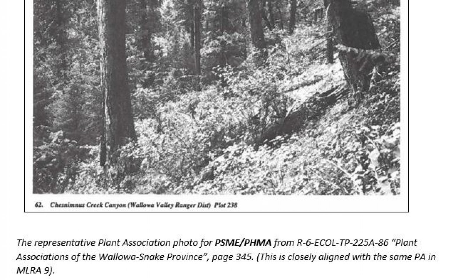
This site is largely composed of the Douglas-fir (Pseudotsuga menziesii)/ninebark (Physocarpus malvaceus) plant association (PSME/PHMA) which is the largest representative plant association in this group. The less abundant Douglas-fir/Common Snowberry (Symphoricarpos albus) (PSME/SYAL) and the “Douglas-fir series” (PSME/unknown) are included in this provisional ESD.
This warm dry Douglas-fir forest type occurs above Ponderosa pine (Pinus ponderosa) forest types on a moisture gradient. The Douglas-fir Warm Dry Shrub ecological site has more favorable effective moisture utilization when compared to the Douglas-fir/pinegrass (Carex rubescens) plant association (PSME/CARU). Douglas-fir/pinegrass is within the same plant association series as the modal plant association for this ecological site.
The ecological site was characterized by a ponderosa pine dominated overstory in the historic, naturally occurring ecological setting. Mature stands typically contained large, widely spaced ponderosa pine along with similar age and size class Douglas-fir. Adapted shrubs and grasses were found in the understory.
Other conifers found in this ecologic site included very limited expressions of grand fir (most likely found on favorable micro-sites), and early seral western larch (Larix occidentalis) which typically persist in the mature stand as scattered remnants. Larch begins to occur in greater proportions compared to the dryer and warmer grass dominated Douglas-fir plant associations (the pinegrass and elk sedge associations) but is still a relatively minor component.
Pre-European frequent, low intensity surface fires (also called “under-burns”) maintained long-lived stands of fire-resistant late seral conifers in the older, more open stands. Less frequent mixed-severity and stand replacement fires resulted in mosaics of older and larger trees, intermingled with younger patches of regenerating forests. The early development (regeneration) plant community phase of this ecological site was dominated by Ponderosa pine seedling development with lesser amounts of larch regeneration, along with fire adapted understory brush species including snowbrush ceanothus (Ceanothus velutinus), Scouler’s willow (Salix scouleriana), and ninebark (found only in the PHMA phase). Understory grass species included pinegrass, elk sedge, western fescue (Festuca occidentalis) and various bromes (Bromus spp.).
Young, newly regenerated stands would normally progress to mid-development phases in time, given an absence of major disturbance impacts which could halt successional progression. The developing stands were dominated by large pole to small and intermediate sawtimber sized individual conifers. The stands expressed varying degrees of canopy closure depending on the initial seedling establishment success and succeeding stocking levels, coupled with the impacts of minor, small scale disturbance events that occurred over the course of development. Mid-development stands could in turn progress to mature stands with the passing of additional time and under favorable conditions. In the absence of significant surface fire, a disproportionate establishment of mid-seral Douglas-fir seedlings and saplings would begin to dominate the understory conifer layer as shade levels increased.
Understory infill of mid and late seral conifers (the occasional grand fir) is now a common and widespread condition across the west, a direct result of a policy of complete fire suppression. This policy of forest fire suppression was implemented in the Post-European era of settlement in the western United States and became progressively effective in extinguishing the majority of wildfires across dry western landscapes. This policy eliminated the beneficial aspects of naturally occurring wildfire (natural thinning, pruning and the reduction of overabundant late seral conifers), and lead to elevated fuel levels and increased present day catastrophic wildfires.
The expressions of the historical stands in this ecological site contained various tree species, ages and sizes. In the context of the large-scale landscape, these unique phases were found in a mosaic pattern across the landscape. Clumps, gaps and individual trees were common at the larger scale.
Although fire was the major disturbance factor in the historic context of this ecological site, insects (such as bark beetles and defoliators) and root diseases impacted and changed the forest over time. Less frequent abiotic disturbances such as high windstorms also occurred, locally altering structural and functional attributes of the stand.
Characteristics of the major tree species:
Ponderosa pine (an early seral species) is resistant to low and moderate severity fires, with resistance developing at a very young growth stage. Thick bark, high and open crowns, and the ability to develop self- and fire-induced pruning of lower branches are among the natural adaptations of this species. Ponderosa pine is a sporadic seed producer, and generally requires mineral soil under open, sunny conditions to germinate and establish. The natural longevity of the species is advantageous. Fire exclusion curtails the necessary recruitment of ponderosa pine seedlings, eliminating much of the younger age and size classes of the species over time.
Ponderosa pine is susceptible to mortality from western and mountain pine beetle at various age and stocking thresholds. Fire impacts that damage the cambial layer of this species will increase the likelihood of bark beetle infestation and mortality as a secondary fire impact.
Western larch (also an early seral species) is the most fire-resistant species in this ecologic site. Younger age and size classes are susceptible to fire kill, developing moderate fire resistance in the late pole size class, but older and larger trees typically survive the various impacts of wildfires of all types.
Western larch shares many of the natural fire adaptations of Ponderosa pine. The species thick bark and self-pruning adaptations are beneficial, and it is also long lived. Larch has an open foliar crown consisting of young, moist deciduous needles, allowing mature larch to survive crown fire events that would be lethal to many other conifer species.
Larch is also well adapted to regenerate under the favorable conditions that typically result from non-lethal fire: Light weight seeds are well dispersed, and establish best under open, sunny conditions on burned mineral soils. After establishment, larch experiences rapid juvenile growth.
Dwarf mistletoe and needlecast are common damaging agents. Insects such as the Western spruce budworm, larch sawfly(s) and occasional bark beetle infestation are biotic sources of disturbance in larch.
Rocky Mountain Douglas-fir (a mid-seral species) becomes resistant to low and moderately severe fires once it passes through the pole size class (which takes longer when compared to Ponderosa pine or Western larch—up to 40 years). Healthy individuals develop thick, corky bark which insulates against cambial scorch under surface fire conditions.
Douglas-fir is susceptible to dwarf mistletoe infestations which develop into dense brooms on the tree branches; these in turn increase the risk of crown and branch torching. Endemic Douglas-fir beetle and root disease impacts can decrease the health and vigor of individual trees and whole stands, increasing the likelihood of direct mortality, or of “secondary fire order” mortality in the period of time closely following the fire (example: where fire weakened trees fall prey to bark beetle attacks, leading to localized epidemic outbreaks).
All three of these conifer species are long-lived and have the potential to persist into the mature and over-mature plant community phases under favorable conditions.State and transition model
More interactive model formats are also available. View Interactive Models
Click on state and transition labels to scroll to the respective textEcosystem states
States 1 and 5 (additional transitions)
T1A - Long-term total fire exclusion (50 to 100 or more years) T1B - A widespread catastrophic fire event T1C - Conversion to annual cropland, pasture, or hayland R2A - Common fuel reduction practices are applied. T2A - Widespread catastrophic fire occurs T2B - In the absence of a catastrophic wildfire, results in increased levels of root disease. R3A - Reforestation R4A - An extended period of time followed by afforestation. R4B - Widespread catastrophic fire occurs R5A - Afforestation State 1 submodel, plant communities
1.1A - Stand replacement or mixed fire of significant size and impact 1.1B - Absence of significant disturbance 1.2A - The absence of larger scale fire disturbance for approximately 40 years 1.3B - Relatively unencumbered by major disturbances 1.3A - Mixed or replacement fire 1.4A - A mixed or replacement severity fire, or another type of significant and widespread disturbance event State 2 submodel, plant communities
State 3 submodel, plant communities
State 4 submodel, plant communities
State 5 submodel, plant communities
State 1
Historic ReferenceThe Historic Reference state had a variable but predictable plant expression across the landscape. These forests tended to be heterogeneous and spatially complex, represented by a combination of patch openings, clumpy (dense or overstocked) trees which were often pole size or smaller, and as well-spaced mature overstory trees encompassing larger stand groups. The wide range of age and structural expression was possible due to the influence of the mixed fire regime, in combination with the more frequent surface under-burns. The ecologic site supported a diverse array of wildlife species which benefited from the edge effects created by numerous spatial intersections within the larger landscape, and from naturally occurring snags and large woody debris. Every stage of development provided value to the watershed--to adapted plants, animals, hydrologic functions, as well as to other valuable ecologic components of the upland forest.
The ecological site was maintained primarily by fire disturbance(s) that initiated changes to the structure, vegetation composition, and structural patterns across the large-scale forested landscape. Longer-term fire-free intervals allow Douglas-fir and a very limited occurrence of grand-fir to increase in relative abundance in the secondary (understory) stands.
Following a replacement fire, the key to conifer re-establishment in the Reference State relied on the recruitment of seed from adjacent sites or from remnant surviving “banked” seed in the soil. A surviving understory component of remnant, young regeneration was also possible. In a replacement fire, the overstory trees that survived tended to be mature early seral species as they are fairly resistant to mortality from fire.
Summary of the historic fire regime of the reference community:
Fire Regime Group Overall Mean Fire Return Interval
I (MFRI, in years) (mixed/low) 20
Replacement Mixed Low *
Fire Severity (% of all fires) 15 18 67
Average Fire Return Interval (AFRI-years) 135 110 30
* Low severity fires occur predominantly in the mid and late “open” plant community phases of the Reference State—(phase(s) 1.1 and 1.4). The AFRI reflects the variable range of occurrence of these two states. If all states are included, the low severity fire frequency interval increases.
Source: BpS model 910450 and FEIS “Fire Regime/Blue Mountains” publication.
The historic regime average size of any given wildfire event was 1,000 acres
Fire Severity Classes: Replacement, greater than 75 percent kill or top kill of the upper canopy layer; Mixed 26 to 75 percent, and low severity, less than 25 percent.
Production and Site Quality Interpretations of the ABGR/CARU Reference State:
Site index (SI) and the resulting derivation of the Culmination of Mean Annual Increment (CMAI) are different indicators of site quality. They serve as well as potential approximations of potential yield, and as a general economic rotation age of the site.
Site index is a common unit of measure for forest trees and stands. It is a simple measure of the age and height of dominant and codominant trees in a stand, usually referenced to 50 or 100 years of age. The site index age is projected either at the “age at breast height” (breast height is four and a half feet above the ground) or is given as the total tree age. The Culmination of Mean Annual Increment, is expressed as the cubic foot volume at that point (age) where periodic and mean annual increment rates intersect—in other words, where the annual incremental volume growth is at a maximum over the lifespan of a (well managed) stand.
Site Index and CMAI values for the Douglas-fir Warm Dry Shrub Ecological Site:
Ponderosa pine site index values range from 68 to 116 within the MLRA (Meyer, 1961-ADP code 600). CMAI values range from 53 to 134 cubic feet per acre per year* at 50 and 40 years respectively. This is a wide span of values.
Douglas-fir site index values range from 60 to 77 (Monserud, 1985-ADP 771), with CMAI values of 54 to 89 cubic feet per acre per year at 100 and 78 years respectively.
Three early Douglas-fir site index values for Tekoa and Gateway soils were projected using King (1966-ADP 795) The values ranged from 67 to 78. CMAI values are not projected for site index values below 70; the CMAI for the site index of 78 is 94 cubic feet per acre per year at 90 years. This particular reference is intended for west side Douglas-fir and is a poor fit for soils in this MLRA.
Western larch site index ranges from 50 to 86 (Schmidt, Shaerer, Roe 1976 ADP 265), with CMAI values of 63 to 132 cubic feet per acre per year at 70 years each.
One additional Western larch site index was calculated using Cochran, 1985 (ADP 261)—That value is 86, with corresponding CMAI value of 95 cubic foot per acre per year at 93 years
* cubic foot per acre per year (ft3/ac/yr.)
Representative Plants list of the Ecological Site:
Trees:
Species Name Scientific Name ADP Code Ecological Interpretation
Western larch Larix occidentalis LAOC Early Seral
Douglas-fir Pesudotsuga menziesii PSME Mid Seral
Ponderosa pine Pinus ponderosa PIPO Early Seral, dominant fire-maintained conifer
Shrubs:
Species Name Scientific Name ADP Code Ecological Interpretation
Serviceberry Amelanchier alnifolia AMAL Sprouts from surviving root crowns, also from seed.
Creeping Oregon grape Berberis repens BERE Sprouts from surviving rhizomes following fire
Snowbrush ceanothus Ceanothus velutinus CEVE Moderately resistant to fire-kill—limited occurrence
Oceanspray Holodiscus discolor HODI Moderately resistant to fire kill, can be enhanced.
Oregon boxwood Pachistima Myrsinites PAMY Moderately resistant to fire-kill
Ninebark Physocarpus malvaceus PHMA Susceptible to fire kill, occupies patch openings (occurs only in the modal PA)
Chokecherry Prunus virginiana PRVI Sprouts from surviving root crowns
Baldhip rose Rosa gymnocarpa ROGY Sprouts from surviving root crowns
Scouler’s willow Salix scouleriana SASC Sprouts vigorously after fire
Common snowberry Symphoricarpos albus SYAL Maintains pre-fire frequency/coverage
Grasses:
Species Name Scientific Name ADP Code Ecological Interpretation
Bromes Bromus spp. Variable fire responses
Pinegrass Calamagrostis rubescens CARU Survives cool to moderately severe fires: rhizomatous
Elk Sedge Carex geyeri CAGE Sprouts from surviving rhizomes
Western fescue Festuca occidentalis FEOC Fire response varies with surface intensity
Wheeler’s bluegrass Poa Nervosa PONE
Forbs:
Species Name Scientific Name ADP Code Ecological Interpretation
Common Yarrow Achillea milleforlium lanulosa ACMIL Survives most fires, can increase rapidly
Heartleaf Arnica Arnica cordifolia ARCO Tolerates sun and shade
Strawberries Fragaria spp. Susceptible to fire kill
Sweetscented Bedstraw Galium triflorum GATR Susceptible to fire kill, can increase following spring or fall fires
Hawkweeds Hieracium spp
Lupines Lupinus spp
Western Meadowrue Thalictrum occidentale THOC Susceptible to fire kill
Estimated total herbage production (in pounds/acre, air dried—this is an approximation from a similar plant association in “Plant Associations of the Blue and Ochoco Mountains” publication) are as follows:
• PSME/PHMA 150-535 (average 273)
• PSME/SYAL 125-1,000 (average 412)Community 1.1
Late Development (Open)

This plant community is a common representation of the Pre-European Reference Community. The class size of the overstory layer is very large, but overall canopy closure is low, and canopy gaps and patches are common. Sites can be single or multi-canopied. Ponderosa pine is well represented in the dominant overstory layer. Mature Douglas-fir and western larch are common as dominant overstory species, occurring as well in mid-layer canopy positions.
These stands are sustained by plant adaptations to naturally occurring non-lethal surface fires. Stand replacement fires were not common. Patch mortality and mixed fire episodes shape this phase.
Note that late development closed stands could also develop in this ecological site. Closed stands will rarely exceed 80 percent canopy closure in the dominant overstory layer. Closed conditions develop from a number of influences, including favorable initial stocking events and the general lack of small-scale disturbance(s) as the stand developed. Dense understory conditions may develop, leading to an elevated possibility of a replacement fire.Community 1.2
Post Disturbance Regeneration (Early Development)Following a widespread disturbance, mature (relict) trees such as mature Ponderosa pine, western larch and Douglas-fir usually survive in sufficient quantities to provide the seed sources for seedling establishment. In other cases, younger patches of seedlings and saplings, along with banked viable conifer seed in the surface of the soil, provide the basis for initial conifer recruitment.
Early seral fire dependent understory plants include snowbrush ceanothus and Scouler’s willow, along with brome and some sedges and grasses.Community 1.3
Mid-Development (Open) Plant CommunityOver time, with a general lack of a widespread disturbance, a mid-development (open) plant community will develop from the early regeneration stage. This phase is characterized by 5 to 20-inch diameter breast height (DBH) size trees, mainly early seral species, with increasing individual tree fire resistance. This phase has a low probability of stand replacement fire due to the open nature of the young canopy. A closed canopy configuration was also possible in the historic, pre-European expression of the ecologic site.
Community 1.4
Mature and Over-mature Old Age Plant CommunityIn the absence of major impacts from a large-scale replacement or mixed fire, or from epidemic insect or disease disturbance(s), the mature phase grows and develops into the “mature and over-mature” phase. The general term of “old growth” may apply to this plant community phase depending on the exact stand attributes.
Pathway 1.1A
Community 1.1 to 1.2Community Pathway 1.1A Low intensity, non-lethal surface fires maintains the open nature of the mature stand. Less common mixed or replacement fire events may result in limited mid-sized openings which will undergo secondary succession. This is a fire-maintained phase. A stand replacement or mixed fire of significant size and impact shift the stand to the early development stage. Viable seed sources of adapted conifers must be present in order for stand initiation to occur.
Pathway 1.1B
Community 1.1 to 1.4Community Pathway 1.1B In the absence of significant disturbance, the stand progresses to very old, over-mature overstory Ponderosa pine and Douglas-fir.
Pathway 1.2A
Community 1.2 to 1.3Community Phase Pathway 1.2A A short return interval to the outbreak of repeat fires (called “reburns”) can eliminate virtually all young conifer reproduction (recruitment is most prone to wildfire mortality in the seedling or sapling stage). Successful conifer reestablishment will increasingly be hindered from the lack of seed sources and regeneration opportunities if successive reburns occur. Long-term persistent grass and shrub communities may develop in severe instances. The circular loop pathway symbol shown on the State and Transition model indicates that reburns can be a short-term and repetitive process. The absence of larger scale fire disturbance for approximately 40 years develops over time to the mid-development community phase. Early seral species establishment of Ponderosa pine and western larch, and lesser amounts of Douglas-fir result in relatively low levels of overall conifer occupancy. Under these conditions, the stand develops to an open, pole and smaller sawtimber sized plant community. Note that closed mid-development stand conditions can also develop in this ecological site under favorable conditions.
Pathway 1.3B
Community 1.3 to 1.1Community Phase Pathway 1.3C The stand develops relatively unencumbered by major disturbances to the mature, open Plant Community 1.1. Similar closed canopy (at 80 percent canopy closure or less) may also occur depending on initial stocking and subsequent disturbances and development along the way.
Pathway 1.3A
Community 1.3 to 1.2Community Phase Pathway 1.3A Periodic wildfires, mainly surface events, maintain and benefit the young developing stands. Mixed or replacement fire eliminates a significant portion of the pole/small sawtimber stand, shifting back to the Regeneration plant community (PC 1.2).
Pathway 1.4A
Community 1.4 to 1.2Community Phase Pathway 1.4A A mixed or replacement severity fire, or another type of significant and widespread disturbance event (i.e. induced mortality resulting from biotic/abiotic sources), occurs in the mature and over-mature overstory canopy, and the stand reverts to early seral development stage. The overall larger scale landscape maintains the mosaic attributes previously described.
State 2
Fire Exclusion


Conditions favorable to the development of this alternative state began to occur within the Reference State around the turn of the twentieth century. The ecological benefits of the low intensity fires were lost, and shifted to a fire regime/condition class with a greater likelihood of stand replacement fires (“lethal” fires).
The overall consequences of the changes to the forest structure and function due to the combined management actions in the last century are:
INCREASED
• Stand Density
• Shift towards mid seral species
• Amount of understory and secondary conifer occupancy
• Fuel loads and elevated risk of catastrophic high severity fires
• Habit for dense-forest wildlife (such as white-tail deer)
• Older aged fire adapted shrub species dominate the area
DECREASED
• Large, old age pine and larch (in both occupancy and phenotypical expression)
• Regeneration of early seral species
• Habit for species dependent on open stands of old pine forests
• Decreased levels of snags and large organic debris
• Reduction in soil quality due to loss of soil wood and organic matter
• Decrease in genetic variation of early seral speciesCommunity 2.1
Long-term Fire ExclusionThis plant community is a result of the impacts of fire exclusion, allowing stands to progress without the natural occurrence of natural fires, including frequent surface fires. Fire suppression shifted the age expression and density of the younger stands and changed the composition of understory vegetation, leading to reduced spatial variation. Fuel levels and the various fuel stratum layers increased, shifting the fire regime and condition class toward a greater likelihood of stand replacement fire episodes (“lethal” fires).
State 3
Stand Replacement FireState 3 represents conditions immediately following a stand replacement fire. These types of fires, when they occurred within the historic context of the Reference State, transitioned the stand to this alternative state when the vast majority of the cone producing conifers were eliminated by the fire, and when other sources of conifer recruitment are also absent (i.e. resulting in un-stocked stand conditions).
Community 3.1
Stand Replacement FirePlant Community 3.1 represents conditions immediately following a stand replacement fire. Plant Community 3.1 would infer a much longer post-fire stand recovery period compared to situations that existed in the Reference State (where older relict, seed producing early and mid-seral seed sources existed). The basic natural resource values (especially soil quality) were generally preserved or quickly restored in these instances.
State 4
Loss of Conifers from High Levels of Root DiseaseThis state may seem to mimic the conditions of Alternative State 3 in that forest stocking is virtually non-existent, but the underlying cause leading to the un-stocked condition and the recovery options are vastly different. In this state, immediate restoration by planting is not feasible because the root mass is still active in the soil, and young developing conifer seedlings will succumb to root disease mortality in a short period of time. Poorer quality sites are at greater risk of root disease occurrence and impacts, and species such as grand fir and Douglas-fir are most susceptible, although grand fir is limited in natural occurrence.
A catastrophic wildfire under these circumstances would transition the site to Alternative State 3, in the same manner as T2A. The risk of catastrophic fire declines as brush levels increase.Community 4.1
Loss of Conifers from High Levels of Root DiseasePlant Community 4.1 is at risk of catastrophic wildfire while fuel levels are in excess in the declining phases of root disease mortality (shown by T2B), and also into the early representation of the alternative state when relict conifer fuel loads are still high.
State 5
ConvertedThis state is limited due to the elevational and topographical nature of the ecological site.
Community 5.1
Conversion to AgricultureThe extent of the plant communities are limited due to the elevational and topographical nature of the ecological site. Where it occurs, the conversion is for hay or pasture use.
Transition T1A
State 1 to 2Long-term total fire exclusion (50 to 100 or more years) results in Alternative State 2.
Transition T1B
State 1 to 3A widespread catastrophic (also referred to as “stand replacing”) fire event occurs as a natural (but relatively rare) event in any phase within the Reference State. Due to the size and intensity of the wildfire, a deficiency of seed source(s) inhibits the re-establishment of the early seral Ponderosa pine and other conifers, resulting in the development of Alternative State 3.
Transition T1C
State 1 to 5Forested site converted to annual cropland, pasture, or hayland, leading to State 5.
Restoration pathway R2A
State 2 to 1Common fuel reduction practices are applied. These practices include low thinning and pruning to reduce ladder fuels. In addition, stands are managed to shift conifer species composition to early seral Ponderosa pine and to improve overall stand health and vigor.
Transition T2A
State 2 to 3Widespread catastrophic fire occurs, similar to that of T1B, but the intensity and impact of the wildfire event is much greater in scope because of the unnatural buildup of fuels in Alternative State 2. The transition results in the development of Alternative State 3, but with a larger degree of resource impact to the site than in T1B.
Transition T2B
State 2 to 4In the absence of a catastrophic wildfire, the long-term site occupancy of mid seral Douglas-fir (and lesser levels of grand fir) results in increased levels of root disease, especially on poor nutritional soils. In time all conifer species are impacted and are eliminated from the site, leading to long-term brush dominated occupancy.
Restoration pathway R3A
State 3 to 1Reforestation (e.g. the planting of Ponderosa pine with limited Douglas-fir) is applied in the short-term aftermath of a catastrophic, stand replacing wildfire. Native fire-adapted understory species rebound naturally.
Restoration pathway R4A
State 4 to 1An extended period of time (up to 100 or more years) is needed for the extensive (infested) below ground root mass to decompose. After this time, afforestation can be applied in order to establish viable forest stands.
Restoration pathway R4B
State 4 to 3Widespread catastrophic fire occurs, similar to that of T1B, but the intensity and impact of the wildfire event is much greater in scope because of the unnatural buildup of fuels in Alternative State 4. This is essentially the same type of event that is described in T2A. Note that a catastrophic wildfire can occur during the shift from Alternative State 2, or in the aftermath of the establishment of Alternative State 4. The threat of wildfire is reduced as the stand changes from dead and dying conifers to persistent brush.
Restoration pathway R5A
State 5 to 1Afforestation is applied on cropland or pasture/haylands in order to reestablish functional forest stands. Site preparation may be necessary prior to planting conifer seedlings.
Additional community tables
Table 7. Community 1.1 plant community composition
Group Common name Symbol Scientific name Annual production () Foliar cover (%) Table 8. Community 1.2 plant community composition
Group Common name Symbol Scientific name Annual production () Foliar cover (%) Table 9. Community 1.3 plant community composition
Group Common name Symbol Scientific name Annual production () Foliar cover (%) Table 10. Community 1.4 plant community composition
Group Common name Symbol Scientific name Annual production () Foliar cover (%) Table 11. Community 2.1 plant community composition
Group Common name Symbol Scientific name Annual production () Foliar cover (%) Table 12. Community 3.1 plant community composition
Group Common name Symbol Scientific name Annual production () Foliar cover (%) Table 13. Community 4.1 plant community composition
Group Common name Symbol Scientific name Annual production () Foliar cover (%) Table 14. Community 5.1 plant community composition
Group Common name Symbol Scientific name Annual production () Foliar cover (%) Interpretations
Other information
Appendix 1
Tree-Size Class
Tree size classes are based on the diameter measurement taken at the “Diameter Breast Height” (abbreviated as DBH). DBH is the diameter of a tree (the bole) measured at 4.5 feet above ground, on the uphill side if on sloping ground. It is a measurement of the outside of the tree bark. The DBH is given in inches.
The following Tree size class(s) are referred to in this ecological site:
Class Name DBH Range
Seedling 0-1”
Sapling 1-5”
Pole 5-9”
Sawtimber: > 9”
Small Sawtimber 9-16”
Large Sawtimber 16-21”
Very Large Sawtimber > 21”
Note: Some classification systems denote “mature and over mature” at 20 to 30” DBH and larger.
This system is likely derived from an economic production basis rather than on forest health size/age thresholds.Supporting information
Inventory data references
Data was collected from forestry references, and vegetative experience from within the NRCS field professionals.
Other references
Cochran, P.H. 1985. Site index, height growth, normal yields, and stocking levels for larch in Oregon and Washington. USDA, Forest Service. Pacific Northwest Forest and Range Experiment Station Research Note PNW-424.
Cochran, P. H., J.M. Geist, D.L Clemens, Rodrick R. Clausnitzer, and David C. Powell. 1994. Suggested Stocking Levels for Forest Stands in Northeastern Oregon and Southeastern Washington. Research Note PNW-RN-513. Bend, OR. U.S. Department of Agriculture, Forest Service. 21 p.
Crane, M. F.; Fischer, William C. 1986. Fire ecology of the forest habitat types of central Idaho. Gen. Tech. Rep. INT-218. Ogden, UT: U.S. Department of Agriculture, Forest Service, Intermountain Research Station. 86 p.
Johnson, CG, Jr.; Clausnitzer, R.R. 1992. Plant Association of the Blue and Ochoco Mountains. Tech. Publ. R6-ERW-TP-036-92. Portland, OR; U.S. Department of Agriculture, Forest Service, Pacific Northwest Region, Wallow-Whitman National Forest. 164 p.
Johnson, CG, Jr.; Simon, Steven A. Plant Association of the Walla-Snake Province, Wallowa-Whitman National Forest. R6-ECOL-TP-225A-86. U.S. Department of Agriculture, Forest Service, Pacific Northwest Region, Wallow-Whitman National Forest. 400 p.
Juran, Ashley G. 2017. Fire regimes of conifer forests in the Blue Mountains. In: Fire Effects Information System, [Online]. U.S. Department of Agriculture, Forest Service, Rocky Mountain Research Station, Missoula Fire Sciences Laboratory. 26 p.
King, James E. 1966. Site index curves for Douglas-fir in the Pacific Northwest. Weyerhaeuser Company, Forestry Research Center. Forestry Paper 8.
LANDFIRE: https://landfire.gov/index.php
Meyer, Walter H. 1938 (rev 1961). Yield of even-aged stands of ponderosa pine. U.S. Department of Agriculture, Forest Service Technical Bulletin 630. 59 p.
Monserud, Robert A. 1985. Applying height growth and site index curves for inland Douglas-fir. USDA, Forest Service. Intermountain Research Station Research Paper INT-347.
NatureServe. 2015. International Ecological Classification Standard: Terrestrial Ecological Classifications. NatureServe Central Databases. Arlington, VA. U.S.A. Data current as of 26 June 2015.
Natural Resources Conservation Service (NRCS). 1999. Soil Taxonomy: A basic system of soil classification for making and interpreting soil surveys. Agriculture Handbook Number 436, second edition. Washington, DC: U.S. Department of Agriculture, Natural Resources Conservation Service. 996 p
Schmidt, Wyman C., Raymond C. Shearer, and Arthur L. Roe. 1976. Ecology and silviculture of western larch forests. USDA, Forest Service Technical Bulletin 1520.
Simpson, Mike; Powell, Dave; Clausnitzer, Rod. 2005 (draft rev. 2017). Biophysical Setting (BpS) Model 10450, Northern Rocky Mountain Dry-Mesic Montane Mixed-Conifer Forest. U.S. Department of Agriculture, Forest Service (LANDFIRE).
Soil Survey of Asotin Cunty Area, Washington (Survey Area # 603). 1991. U.S. Department of Agriculture, Soil Conservation Service.
Soil Survey of Columbia County, Washington (Survey Area # 613). 1973. U.S. Department of Agriculture, Soil Conservation Service.
Soil Survey of Garfield County, Washington (Survey Area # 623). 1974. U.S. Department of Agriculture, Soil Conservation Service.
Soil Survey of Lincoln County, Washington (Survey area # 043). 1982. U.S. Department of Agriculture, Soil Conservation Service.
Soil Survey of Spokane County, Washington (Survey area # 063). 2012. U.S. Department of Agriculture, Natural Resources Conservation Service.
Soil Survey of Whitman County, Washington (Survey area # 075). 1980. U.S. Department of Agriculture, Soil Conservation Service.
Soil Survey of Walla Walla County, Washington (Survey Area # 071). 1964. U.S. Department of Agriculture, Soil Conservation Service.
USNVC [United States National Vegetation Classification]. 2019. United States National Vegetation Classification Database, V2.03. Federal Geographic Data Committee, Vegetation Subcommittee, Washington DC. [http://usnvc.org/ accessed 2/3/2020]
Washington Natural Heritage Program Ecosystems of Washington State, A Guide to Identification, Rocchio and Crawford, 2015Contributors
Gary Kuhn
Carri Gaines
Steve CampbellApproval
Kirt Walstad, 3/31/2025
Rangeland health reference sheet
Interpreting Indicators of Rangeland Health is a qualitative assessment protocol used to determine ecosystem condition based on benchmark characteristics described in the Reference Sheet. A suite of 17 (or more) indicators are typically considered in an assessment. The ecological site(s) representative of an assessment location must be known prior to applying the protocol and must be verified based on soils and climate. Current plant community cannot be used to identify the ecological site.
Author(s)/participant(s) Contact for lead author Date 03/31/2025 Approved by Approval date Composition (Indicators 10 and 12) based on Annual Production Indicators
-
Number and extent of rills:
-
Presence of water flow patterns:
-
Number and height of erosional pedestals or terracettes:
-
Bare ground from Ecological Site Description or other studies (rock, litter, lichen, moss, plant canopy are not bare ground):
-
Number of gullies and erosion associated with gullies:
-
Extent of wind scoured, blowouts and/or depositional areas:
-
Amount of litter movement (describe size and distance expected to travel):
-
Soil surface (top few mm) resistance to erosion (stability values are averages - most sites will show a range of values):
-
Soil surface structure and SOM content (include type of structure and A-horizon color and thickness):
-
Effect of community phase composition (relative proportion of different functional groups) and spatial distribution on infiltration and runoff:
-
Presence and thickness of compaction layer (usually none; describe soil profile features which may be mistaken for compaction on this site):
-
Functional/Structural Groups (list in order of descending dominance by above-ground annual-production or live foliar cover using symbols: >>, >, = to indicate much greater than, greater than, and equal to):
Dominant:
Sub-dominant:
Other:
Additional:
-
Amount of plant mortality and decadence (include which functional groups are expected to show mortality or decadence):
-
Average percent litter cover (%) and depth ( in):
-
Expected annual annual-production (this is TOTAL above-ground annual-production, not just forage annual-production):
-
Potential invasive (including noxious) species (native and non-native). List species which BOTH characterize degraded states and have the potential to become a dominant or co-dominant species on the ecological site if their future establishment and growth is not actively controlled by management interventions. Species that become dominant for only one to several years (e.g., short-term response to drought or wildfire) are not invasive plants. Note that unlike other indicators, we are describing what is NOT expected in the reference state for the ecological site:
-
Perennial plant reproductive capability:
Print Options
Sections
Font
AAAAOther
PrintThe Ecosystem Dynamics Interpretive Tool is an information system framework developed by the USDA-ARS Jornada Experimental Range, USDA Natural Resources Conservation Service, and New Mexico State University.
Accessibility statement


