Natural Resources
Conservation Service
Ecological site F009XY003WA
Warm Dry Ridges Hills and Canyons Ponderosa Pine Dry Shrub and Grass
Last updated: 4/01/2025
Accessed: 07/03/2026
-
Search


Major Land Resource Area or ecological site by name and/or ID.
PreviousSectionsNextGeneral information
Provisional. A provisional ecological site description has undergone quality control and quality assurance review. It contains a working state and transition model and enough information to identify the ecological site.
MLRA notes
Major Land Resource Area (MLRA): 009X–Palouse and Nez Perce Prairies
Almost all of MLRA 9 lies within the Walla Walla Plateau Section of the Columbia Plateaus Province of the Intermontane Plateaus. The area is characterized by an undulating basalt plateau that has been highly dissected. The major streams have cut deep, steep-walled canyons. The plateau is nearly level to steeply sloping, and its surface is moderately dissected or strongly dissected. Slopes are mostly hilly and steep. Some areas in the southeastern portion of this MLRA are in the Blue Mountain Section of the Columbia Plateaus Province. Small areas on the eastern edge of the area are in the Northern Rocky Mountains Province of the Rocky Mountain System.
Classification relationships
Major land resource area (MLRA): 9 - Palouse & Nez Perce Prairie
LRU – Common Resource Areas (CRA):
9.1 - Channeled Scablands
9.3 - Dissected Loess Uplands
9.5 - Warm Canyons and Dissected Uplands
Relationship to Other Established Classifications:
United States National Vegetation Classification (2008) – A3446 Ponderosa Pine/Shrub Understory Central Rocky Mt. Forest & Woodland Alliance. PIPO/PUTR/FEID is identified as Association CEGL000195, and PIPO/PUTR/PSSP is CEGL000197.
Description of Ecoregions of the United States, USFS PN # 1391, 1995 - M332 Middle Rocky Mountain Steppe– Coniferous Forest –Alpine Meadow Province
USDA NRCS WA Common Resource Areas. CRA 9.3 (Dissected Loess Uplands) and 9.5 (Warm Canyons and Dissected Uplands.)
Level III Ecoregions of WA, US EPA, June 2010 – 10. Columbia Plateau, and 11. Blue Mountains.
This ecological site includes the following USDA Forest Service Plant Associations: PIPO/PUTR/PSSP. (Lillybridge et. al. 1995) and PIPO/PUTR/FEID (Steele et. al, 1981)Ecological site concept
The Warm Dry Ridges Hills and Canyons, Ponderosa Pine Dry Shrub and Grass ecological site (ES) is found in Lincoln, Whitman, Columbia and Walla-Walla Counties. It consists of Ponderosa Pine (Pinus ponderosa)/Antelope bitterbrush (Purshia tridentate)/ Idaho fescue (Festuca idahoensis) plant association (PIPO/PUTR/FEID), along with the Ponderosa Pine/Antelope bitterbrush (Purshia tridentate)/bluebunch wheatgrass (Pseudoroegneria spicata) plant association (PIPO/PUTR/PSSP)
Associated sites
F009XY002WA Mesic Xeric Loamy Hills Ponderosa Pine Warm Dry Grass
F009XY001WA Mesic Xeric Loamy Hills and Canyons Ponderosa Pine Moderately Warm Dry Shrub
Similar sites
F009XY002WA Mesic Xeric Loamy Hills Ponderosa Pine Warm Dry Grass
F009XY001WA Mesic Xeric Loamy Hills and Canyons Ponderosa Pine Moderately Warm Dry Shrub

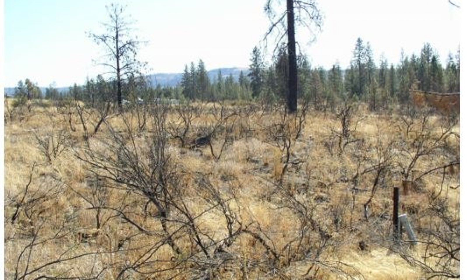
Figure 1.
Table 2. Dominant plant species
Tree (1) Pinus ponderosa
Shrub (1) Purshia tridentata
Herbaceous Not specified
Physiographic features
This site occurs predominately on outwash plains and terraces, but also on backslopes of hills. The landscape is part of the Columbia basalt plateaus and Northern Rocky foothills. They occur on treads, riser and some backslopes in all slope shapes.
Physiographic Division: Intermontane Plateau and Northern Rocky Mountain System
Physiographic Province: Columbia Plateau and Northern Rocky Mountains
Physiographic Sections: Walla Walla Plateau
Landscapes: Northern rocky mountain valleys and channeled scablands
Landform: outwash plains and terracesTable 3. Representative physiographic features
Landforms (1) Valley > Outwash plain
(2) Terrace
Flooding frequency None Ponding frequency None Elevation 1500 – 2500 ft Slope 8 – 40 % Aspect Aspect is not a significant factor Table 4. Representative physiographic features (actual ranges)
Flooding frequency Not specified Ponding frequency Not specified Elevation 0 ft Slope 3 – 60 % Climatic features
Taxonomic soil climate is primarily a mesic temperature regime and xeric moisture regime.
Table 5 Representative climatic features
Frost-free period (characteristic range) 110-130 days Freeze-free period (characteristic range) 150-170 days Precipitation total (characteristic range) 20-20 in Frost-free period (actual range) 100-140 days Freeze-free period (actual range) 150-170 days Precipitation total (actual range) 20-20 in Frost-free period (average) 130 days Freeze-free period (average) 160 days Precipitation total (average) 20 in Characteristic rangeActual rangeBarLineFigure 1. Monthly precipitation range
Characteristic rangeActual rangeBarLineFigure 2. Monthly minimum temperature range
Characteristic rangeActual rangeBarLineFigure 3. Monthly maximum temperature range
BarLineFigure 4. Monthly average minimum and maximum temperature
Figure 5. Annual precipitation pattern
Figure 6 Annual average temperature pattern
Climate stations used
-
(1) DAYTON 1 WSW [USC00452030], Dayton, WA
-
(2) POMEROY [USC00456610], Pomeroy, WA
">Influencing water features
N/A
Wetland description
N/A
Soil features
This ecological site components are dominantly Vitrandic taxonomic subgroups of Haploxerolls and Haploxerepts great group of the Mollisols and Inceptisols taxonomic order. Psamments great group of the Entisols taxonomic order occurs in limited amount. Soils are dominantly very deep and have average available water capacity of about 2.5 inches (6.4 cm) in the 0 to 40 inches (0 to 100 cm) depth range.
Soil parent material is dominantly glaciofluvial deposits with minor amounts of ash and loess in the upper part.
The associated soils are Bong, Springdale, Marble and similar soils.
Dominate soil surface is sandy loam to gravelly ashy coarse-sandy loam.
Dominant particle-size class is sandy and sandy-skeletal, but includes loamy-skeletalTable 6. Representative soil features
Parent material (1) Glaciofluvial deposits
Surface texture (1) Sandy loam
(2) Ashy, gravelly coarse sandy loam
Family particle size (1) Sandy
(2) Sandy-skeletal
(3) Loamy-skeletal
Drainage class Well drained to excessively drained Depth to restrictive layer 60 – 0 in Surface fragment cover <=3" 0 – 25 % Surface fragment cover >3" 0 – 2 % Available water capacity
(Depth not specified)0.9 – 4.2 in Calcium carbonate equivalent
(Depth not specified)Not specified Electrical conductivity
(Depth not specified)Not specified Sodium adsorption ratio
(Depth not specified)Not specified Soil reaction (1:1 water)
(0-10in)5.6 – 7.3 Subsurface fragment volume <=3"
(Depth not specified)0 – 35 % Subsurface fragment volume >3"
(Depth not specified)0 – 20 % Ecological dynamics
The Ponderosa pine dry shrub and grass ecological site (ES) is comprised of the modal Ponderosa Pine (Pinus ponderosa)/Antelope bitterbrush (Purshia tridentate)/ Idaho fescue (Festuca idahoensis) plant association (PIPO/PUTR/FEID), along with the Ponderosa Pine/Antelope bitterbrush (Purshia tridentate)/bluebunch wheatgrass (Pseudoroegneria spicata) plant association (PIPO/PUTR/PSSP ).
Collectively these two plant associations are referred to as Ponderosa pine/Antelope bitterbrush types in this MLRA. This ES is best described as an open pine/woodland site with low overall occupancy of Ponderosa pine in most plant community phases.
This ecological site is the driest conifer forest in eastern Washington, occurring in the transition between the steppe grassland and those ponderosa pine habitat types which are more fully occupied under increasing favorable moisture and temperature regimes (for example, the “Warm Dry Ponderosa pine” type).
Forests in this ecologic site consisted of nearly pure, self-replacing stands of Ponderosa pine. Historic stands are described as open, with overstory canopy coverage typically 40 percent or lower. The fire regime of the ecologic site was dominated by surface fires, which occurred historically on a mean fire return interval (MFRI) of approximately 8 years. Surface fires were the most common type of wildfire event in this ES, accounting for approximately 75 percent of all fires. Fire ignition sources came from naturally occurring lightning strikes, as well as from intentional fires started by indigenous tribal persons.
Fires were, and still are, often accompanied by windy conditions and can also be influenced by the neighboring steppe fuel characteristics. At times, relatively isolated individuals or small clumps of mature ponderosa pine would experience crown touching.
Ponderosa pine is the only conifer in this ecologic site (e.g. it is a “climax dominant” species), although Douglas-fir (Pseudotsuga menziesii) may be found in limited extent on very favorable microsites.
Ponderosa pine is well adapted to frequent fire having a thick, platy bark which begins to develop in the sapling size class, and by developing natural fire-pruned lower branches as a result of beneficial low intensity non-lethal surface fires when they occur in the smaller pole size class. Other fire adaptations include a mature open crown configuration coupled with high foliar moisture retention and protective bud formations, deep rooting structure, and the overall longevity of individual Ponderosa pine trees.
Following stand replacement events, Ponderosa pine recruitment is dependent on viable cone/seed production, coupled with a period of favorable germination and establishment conditions which will enable the seedlings to become established. Reproduction from seed occurs occasionally, and at irregular intervals (“episodic” reproduction by definition). Ponderosa pine regenerates best on mineral soils, under abundant sunlight.
Over the larger landscape level scale, Ponderosa pine forests exhibited a mosaic of densely populated stands of various ages and heights.
Ponderosa pine is subject to a variety of biotic and abiotic sources of injury and mortality. Animals such as rabbits, gophers, squirrels, along with porcupines, damage seedlings, saplings and pole sized trees. Deer will often browse the terminal and lateral branches of young plants. Western and mountain pine beetle will infest stands of various ages and densities of Ponderosa pine, and may become epidemic in scope when forest health is adversely impacted by fire stress, age, or from the stress of over-stocking within crowded patches of pine. Ipps beetles will attack Ponderosa pine, especially when green slash is carried overwinter and into spring and early summer by events such as windstorms.
Dwarf mistletoe is the most common disease in the Ponderosa pine dry shrub and grass ecological site. It is especially prevalent in this grass-dominated site and will reduce growth and vigor of pine from a relatively young age forward.
Abiotic damage comes from the impact of wildfire, and from wind as well as from the structural damage caused by heavy, wet snowfall especially in sapling and pole size classes.
Antelope bitterbrush is a long-lived shrub of medium height. It is highly susceptible to fire kill but plants may sprout after a wildfire, depending on the ecotype and severity of the fire. Young or older plants will not typically respond well in terms of sprouting. Antelope bitterbrush will be more abundant when fire return intervals stretch out to decades, but when fire is excluded from the site for long periods of time the plants will become decadent and begin to fade from the plant community. As the bitterbrush recedes, a greater expression of ponderosa pine will occur in the overall plant community mix. Shorter fire return intervals will correspond with an increase in the abundance of understory grass species with lesser amounts of newly established pine.
Antelope bitterbrush re-seeds well after mixed fire episodes from seed dispersion by birds, rodents and ants to adjacent disturbed patches. The seed is encapsulated in a hard shell which requires cool-moist stratification to break down the protective capsule which then releases the dry fruit to the soil.
Antelope bitterbrush is an important browse species for wildlife of all kinds, and especially during wintertime for big game species. It is important as well for various livestock animals during the grazing season. It is very palatable.
Under historic disturbance regimes, Idaho fescue was the dominant understory grass, accompanied by variety of adapted shrub species.
Present day Ponderosa pine/antelope bitterbrush forests are drastically altered from the historical conditions due to a multitude of factors, including fire exclusion, conversion to agriculture, grazing, and to a lesser extent orchards and urbanization conversions.State and transition model
More interactive model formats are also available. View Interactive Models
Click on state and transition labels to scroll to the respective textEcosystem states
T1A - Natural fire regime interval stopped through fire prevention T1B - Introduced non-native grasses invade site over the years of human habitation. T1C - Site converted to other land uses. R2A - Heavy overstory thinning and understory burning R3A - Site preparation and reseeding with native vegetation followed by grazing protection. R4A - Site preparation, tree planting and maintenance. State 1 submodel, plant communities
1.1A - Fire interval extended 20 or more years 1.2B - Ground fires reoccur killing shrubs and most of pine seedlings/saplings 1.2A - Reestablished pine regeneration form dense clumps in between dense bitterbrush cover in openings. 1.3A - Severe fire 1.4A - Time. Reoccurring ground fires every 7 to10 years 1.4B - Time, fire interval increased State 2 submodel, plant communities
State 3 submodel, plant communities
State 4 submodel, plant communities
State 1
ReferenceThis state can have highly variable plant cover depending on fire disturbance. With frequent ground fire every 7 to 10 years the Reference Plant Community will be an open pine/grass woodland with bunchgrasses dominating and scattered pine. In variable mixed severity fires a patchy mosaic of pine stands with open areas of bitterbrush or grass will be the common appearance. With fire exclusion, a medium to dense multi-story Ponderosa pine forest will develop, creating an alternative state. Past human disturbance has allowed introduced annual and perennial grasses to establish and mix into the natural cover, sometimes out competing the native vegetation causing an alternative state.
Ponderosa pine is the only tree species. Antelope bitterbrush is the major shrub species with kinnikinnick, snowbrush ceanothus, spirea, snowberry, and sagebrush in minor amounts depending on location and moisture. Idaho fescue and bluebunch wheatgrass dominate the grass component with varying amount of geyer’s sedge, needle and thread, blue wildrye, and rough fescue.
Site Quality/Productivity:
Site index (SI) and the resulting derivation of the Culmination of Mean Annual Increment (CMAI) are different indicators of site quality, as well as an indicator of potential yield and of the general economic rotation age of a site.
Site index is a common unit of measure for forest trees and stands. It is a simple measure of the age and height relationship of dominant and co-dominant trees, usually referenced to 50 or 100 years of age (the base age). The Culmination of Mean Annual Increment (CMAI) is an expression of maximum productivity for unmanaged, even-aged stands. It is expressed as a volume measure and is given at the age of CMAI.
Ponderosa pine is the only commercially viable tree species in the MLRA in this ecological site (Douglas-fir occurs minimally). Only two site indexes values are projected for this site: 99 and 105, and they are relatively even in terms of the acreage extent that they represent. The site index value is derived from the Meyers 100-year total age table. The corresponding CMAI ranges is 99 and 105 cubic feet/acre/year at 40 years of age in a “fully stocked stand”. It is probable that the CMAI value(s) should be lower due to the low stocking (density) as compared to fully stocked stands. Most stands are less than 40 percent stocked, but it’s uncertain that this adjustment was made to the CMAI value.
Forage production estimates from NRCS Range 5 from Columbia and Walla-Walla for this particular ESD….) in Ponderosa pine / antelope bitterbrush sites are as follows, based on overstory tree canopy. Forage production figures are in pounds per acre for all vegetation below 4.5 feet (grass, sedges, forbs, shrubs, tree regeneration):
Overstory tree canopy – Forage production
0 – 20% - 800 to 1400 lbs/ac
20 – 40% - 300 to 650 lbs/ac
The bulk of the grass production is bluebunch wheatgrass and Idaho fescue. Other grass species include needle and thread grass, prairie Junegrass, rough fescue, pine grass and big bluegrass. The most prominent forbs are lupine, balsamroot, pussytoes, hawkweed, and yarrow. The most prominent shrub is bitterbrush. Other shrubs include currant, snowbrush ceanothus, big sagebrush, rabbitbrush, and buckwheat. Tree regeneration included mostly ponderosa pine with an occasional Douglas-fir.
This ecological site is in Fire Regime Group I. For more information regarding the historic wildfire characteristics of the GF-CMF ecologic site refer to the LANDFIRE Biophysical Setting Model (BpS) which cover this ecological site (Biophysical Setting model 0910531 -- Northern Rocky Mountain Ponderosa Pine Woodland and Savanna-Mesic).
BpS model 0910531 will provide a more detailed overview of the various plant communities and the associated disturbance(s) and growth over time expressions of the individual plant communities.
The BpS summary of the historic fire regime of the reference community of State 1:
Fire Regime Group Typical Fire Interval Overall Mean Fire Return Interval
MFRI, (in years)
I 8-125 years 6
Replacement Mixed Low
% of all fires 5 18 77
Average Fire Return Interval (AFRI-in years) 125 35 8
Range of Fire Return Intervals 100+ 28-75 2-8
Source: BpS Model 0910531
The historic fire event “average size(s)” is not provided in this BpS model.
Fire Severity Classes: Replacement, greater than 75 percent kill or top kill of the upper canopy layer; Mixed, 25 to 75 percent, and low severity, less than 25 percent.
Plant List
Overstory
Trees
Ponderosa pine (Pinus ponderosa)
Shrubs
Antelope bitterbrush (Purshia tridentate)
Currant (Ribes spp.)
Snowbrush ceanothus (Ceanothus velutinus)
Serviceberry (Amelachier alnifolia)
Big sagebrush (Artemesia tridentata)
Rabbitbrush (Chrysothamnus spp.)
Plant List (continued)
Understory
Trees
Ponderosa pine (Pinus ponderosa)
Douglas-fir (Pseudotsuga menziesii)— (minor occurrence)
Shrubs
Buckwheat (Eriogonum)
Bearberry (Arctostaphylos uva-ursi)
Common snowberry (Symphoricarpos albus)
Shiny-leaf spirea (Spirea betulifolia)
Snowbrush ceanothus (Ceanothus velutinus)
Grasses:
Bluebunch wheatgrass (Pseudoroegneria spicata)
Idaho Fescue (Festuca idahoensis)
Needle and thread grass (Stipa comata)
Pinegrass (Calamogrostis rubescens)
Beardless bluebunch wheatgrass (Agropyron inerme)
Elk sedge (Carex geyeri)
Pinegrass (Calamagrostis rubescens)
Prairie junegrass (Koeleria macrantha)
Bluegrass (Poa spp.)
Forbs:
Lupine (Lupinus spp.)
Arrowleaf balsamroot (Balsamorhiza sagittata)
Western yarrow (Achillea millefolium)
White hawkweed (Hieracium albiflorum)
Pussytoes (Antennaria spp.)Community 1.1
Reference CommunityThis plant community is considered the historical plant community with ground fire frequency 7 to 10 years which maintains an open pine/grass woodland with scattered pine and bitterbrush that survived the fire. Idaho fescue and bluebunch wheatgrass will dominate ground cover with shrubs less the 10 percent cover and pine coverage 10 to 30 percent.
Community 1.2
Overstory Re-initiation PhaseNo reoccurring ground fires allow overstory of bitterbrush and Ponderosa pine to reseed and establish. Ground cover of bitterbrush will exceed that of understory bunchgrass. Ponderosa pine stands form a patchy mosaic with bitterbrush. This condition can be maintained with mixed severity fires causing varying degrees of kill to shrubs and trees creating the mosaic shrub/pine clump pattern.
Community 1.3
Stem Exclusion PhaseDense clumps of ponderosa pine shade out grass and shrubs. Bitterbrush in openings reduce bunchgrass cover.
Community 1.4
Stand Initiation Phase
Bitterbrush and some pole-sized pines are killed in ground fires; however, scattered pole- sized and some large overstory pines survive. Bunchgrasses increase in cover.
Pathway 1.1A
Community 1.1 to 1.2Frequent ground fires prevent pine and bitterbrush reestablishment maintaining pine/bunchgrass woodland. As the fire interval extends 20 or more years, it allows bitterbrush and ponderosa pine to reestablish.
Pathway 1.2B
Community 1.2 to 1.1Ground fires reoccur killing shrubs and most of pine seedlings/saplings returning site to open pine/grass woodland.
Pathway 1.2A
Community 1.2 to 1.3Reestablished pine regeneration form dense clumps in between dense bitterbrush cover in openings.
Pathway 1.3A
Community 1.3 to 1.4Severe fire killing most of pine and bitterbrush. Variable, Scattered overstory pine and maybe some pole pine stands remain.
Pathway 1.4A
Community 1.4 to 1.1Time. Reoccurring ground fires every 7 to10 years leaving scattered pine and small clumps of pine to grow and maintain open pine/grass woodland.
Pathway 1.4B
Community 1.4 to 1.2Time, fire interval increased allowing pine and bitterbrush to reestablish.
State 2
Fire ExclusionFire exclusion for over 50 years allows Ponderosa pine stands to dominate cover, and form multi-aged medium to dense woodlands. In most cases mixed severity to stand replacing fires will not revert site back to a pine/savanna condition in State 1.
Community 2.1
Reference PhasePonderosa pine forest with medium to dense stocking. Shrub layer sparse. Age is 100 plus years old and aging.
State 3
InvadedThe plant composition in this state is variable with cool-season introduced grasses encroaching from adjacent homesteads and pastures. One annual species of special note that can cause a drastic shift in grass species is cheatgrass (Bromus tectorum). It invades from overgrazed or heavily disturbed pastures and can out compete the native bunchgrasses changing to a shrub/cheatgrass site.
Community 3.1
Introduced GrassesEncroachment and establishment of introduced perennial and annual grasses; possible noxious weeds.
State 4
ConvertedThis ecological site over time has had human settlement encroachment, and some of the site extent was converted to homesteads, pastures and cropland.
Community 4.1
Cropland/hay landSite converted to crops or hay. Occasionally the site may be invaded by noxious weeds.
Transition T1A
State 1 to 2Natural fire regime interval stopped through fire prevention allowing pine to dominate site overtopping bitterbrush. Site converted to multi-storied forest condition without the natural reoccurring fire regime. Stand density increased and competition mortality begins. Forest health decreased by possible bark beetle mortality and fire severity increased.
Transition T1B
State 1 to 3Introduced non-native grasses invade site over the years of human habitation. Native grasses cannot compete with these grasses especially when heavily grazed for many years.
Transition T1C
State 1 to 4Site converted to other land uses.
Restoration pathway R2A
State 2 to 1Heavy overstory thinning and understory burning
Restoration pathway R3A
State 3 to 1Site preparation and reseeding with native vegetation followed by grazing protection.
Restoration pathway R4A
State 4 to 1Site preparation, tree planting and maintenance.
Additional community tables
Table 7. Community 1.1 plant community composition
Group Common name Symbol Scientific name Annual production () Foliar cover (%) Table 8. Community 1.2 plant community composition
Group Common name Symbol Scientific name Annual production () Foliar cover (%) Table 9. Community 1.3 plant community composition
Group Common name Symbol Scientific name Annual production () Foliar cover (%) Table 10. Community 1.4 plant community composition
Group Common name Symbol Scientific name Annual production () Foliar cover (%) Table 11. Community 2.1 plant community composition
Group Common name Symbol Scientific name Annual production () Foliar cover (%) Table 12. Community 3.1 plant community composition
Group Common name Symbol Scientific name Annual production () Foliar cover (%) Table 13. Community 4.1 plant community composition
Group Common name Symbol Scientific name Annual production () Foliar cover (%) Interpretations
Other information
Tree-Size Class and Conifer Abbreviations
Appendix 1
Tree size classes are based on the diameter measurement taken at the “Diameter Breast Height” (abbreviated as DBH). DBH is the diameter of a tree (the bole) measured at 4.5 feet above ground, on the uphill side if on sloping ground. It is a measurement of the outside of the tree bark. The DBH is given in inches.
The following Tree size class(s) are referred to in this ecological site:
Class Name DBH Range
Seedling 0-1”
Sapling 1-5”
Pole 5-9”
Sawtimber: > 9”
Small Sawtimber 9-16”
Large Sawtimber 16-21”
Very Large Sawtimber > 21”
Note: Some classification systems denote “mature and over mature” at 20 to 30” DBH and larger.
This system is likely derived from an economic production basis rather than on forest health size/age thresholds.
Abbreviations and codes for the following conifer tree(s) that occur in the MLRA:
Common Conifer Species Cross Reference List
Common Name Abbreviated Symbol ADP Code
Grand fir GF ABGR
Subalpine fir AF ABLA
Western Larch WL LAOC
Englemann Spruce ES PIEN
Whitebark pine WB PIAL
Lodgepole pine LP PICO
Western white pine WP PIMO
Ponderosa pine PP PIPO
Douglas-fir DF PSME
Western Redcedar RC THPL
Mountain Hemlock MH TSMESupporting information
Inventory data references
Data was collected from forestry references, and vegetative experience from within the NRCS field professionals.
Other references
Agee, J.K., 1993. Fire Ecology of Pacific Northwest Forests. Inland Press, Washington, DC.
Arno, S. (2000). Fire in western forest ecosystems (chapter 5). In: J.K Brown and J.K. Smith (eds), pp. 97-120, Wildland fire in ecosystems: effects of fire on flora. USDA Forest Service, General Technical Report RMRS-GTR-42-vol 2.
Crane, M. F.; Fischer, William C. 1986. Fire ecology of the forest habitat types of central Idaho. Gen. Tech. Rep. INT-218. Ogden, UT: U.S. Department of Agriculture, Forest Service, Intermountain Research Station. 86 p.
Daubenmire, R. and Daubenmire, J. 1968. Forest Vegetation of Eastern Washington and Northern Idaho. Washington State University, College of Agriculture, Tech. Bulletin 60. 49 p.
Howard, Janet L. 2003. Pinus ponderosa var. brachyptera, P. p. var. scopulorum. In: Fire Effects Information System, [Online]. U.S. Department of Agriculture, Forest Service, Rocky Mountain Research Station, Fire Sciences Laboratory (Producer). Available: https://www.fs.fed.us /database/feis/plants/tree/pinpons/all.html [ 2020, July 23].
Johnson, C. G. and Simon, S.A. 1987. Plant associations of the Wallowa-Snake Province. USDA Forest Service R6 Ecol. TP 255a-86. Pacific Northwest Regions, Portland, OR 207 p.
LANDFIRE. [2005]. [BpS 0910532 “Northern Rocky Mountain Ponderosa Pine Woodland and Savana-Xeric)]. In: LANDFIRE Biophysical Settings Models and Descriptions [Online]. LANDFIRE. Washington, DC: U.S. Department of Agriculture, Forest Service; U.S. Department of the Interior; U.S. Geological Survey; Arlington, VA: The Nature Conservancy (Producers). Available: https://www.landfire.gov/national_veg_models_op2.php [ accessed June 2020].
Lillybridge et al, October 1995. Forest Plant Associations of the Wenatchee National Forest, PNW-GTR-359.
Meyer, Walter H. 1938 (rev 1961). Yield of even-aged stands of ponderosa pine. U.S. Department of Agriculture, Forest Service Technical Bulletin 630. 59 p.
NatureServe. 2015. International Ecological Classification Standard: Terrestrial Ecological Classifications. NatureServe Central Databases. Arlington, VA. U.S.A. Data current as of 26 June 2015.
Simpson, Mike; Dickinson, James and Owens, Dave. 2005. Biophysical Setting (BpS) Model 910531, Northern Rocky Mountain Ponderosa Pine Woodland and Savana-Mesic. U.S. Department of Agriculture, Forest Service (LANDFIRE).
Soil Survey of Columbia County, Washington (Survey Area # 613). 1973. U.S. Department of Agriculture, Soil Conservation Service.
Soil Survey of Walla Walla County, Washington (Survey Area # 071). 1964. U.S. Department of Agriculture, Soil Conservation Service.
Steele, Robert; Phister, Robert D.; Ryker, Russell A.; Kittams, Jay A. Forest Habitat Types of Central Idaho. U.S Dept. of Agriculture, Forest Service. GTR-INT-114, September 1981. 138 p.
United States National Vegetation Classification (2008) - A3395 Central Rocky Mountains Douglas fir - Ponderosa pine/Herbaceous Understory Alliance.
USNVC [United States National Vegetation Classification]. 2019. United States National Vegetation Classification Database, V2.03. Federal Geographic Data Committee, Vegetation Subcommittee, Washington DC. [http://usnvc.org/ accessed 8/10/2019].
Rocchio, Joe & Crawford, Rex. (2015). Ecological Systems of Washington State. A Guide to Identification.
Zlatnik, Elena. 1999. Purshia tridentata. In: Fire Effects Information System, [Online]. U.S. Department of Agriculture, Forest Service, Rocky Mountain Research Station, Fire Sciences Laboratory (Producer). Available: https://www.fs.fed.us/database/feis/plants/shrub/purtri/all.html [ 2020, July 23].Contributors
Gary Kuhn
Carri Gaines
Steve CampbellApproval
Kirt Walstad, 4/01/2025
Rangeland health reference sheet
Interpreting Indicators of Rangeland Health is a qualitative assessment protocol used to determine ecosystem condition based on benchmark characteristics described in the Reference Sheet. A suite of 17 (or more) indicators are typically considered in an assessment. The ecological site(s) representative of an assessment location must be known prior to applying the protocol and must be verified based on soils and climate. Current plant community cannot be used to identify the ecological site.
Author(s)/participant(s) Contact for lead author Date 04/01/2025 Approved by Approval date Composition (Indicators 10 and 12) based on Annual Production Indicators
-
Number and extent of rills:
-
Presence of water flow patterns:
-
Number and height of erosional pedestals or terracettes:
-
Bare ground from Ecological Site Description or other studies (rock, litter, lichen, moss, plant canopy are not bare ground):
-
Number of gullies and erosion associated with gullies:
-
Extent of wind scoured, blowouts and/or depositional areas:
-
Amount of litter movement (describe size and distance expected to travel):
-
Soil surface (top few mm) resistance to erosion (stability values are averages - most sites will show a range of values):
-
Soil surface structure and SOM content (include type of structure and A-horizon color and thickness):
-
Effect of community phase composition (relative proportion of different functional groups) and spatial distribution on infiltration and runoff:
-
Presence and thickness of compaction layer (usually none; describe soil profile features which may be mistaken for compaction on this site):
-
Functional/Structural Groups (list in order of descending dominance by above-ground annual-production or live foliar cover using symbols: >>, >, = to indicate much greater than, greater than, and equal to):
Dominant:
Sub-dominant:
Other:
Additional:
-
Amount of plant mortality and decadence (include which functional groups are expected to show mortality or decadence):
-
Average percent litter cover (%) and depth ( in):
-
Expected annual annual-production (this is TOTAL above-ground annual-production, not just forage annual-production):
-
Potential invasive (including noxious) species (native and non-native). List species which BOTH characterize degraded states and have the potential to become a dominant or co-dominant species on the ecological site if their future establishment and growth is not actively controlled by management interventions. Species that become dominant for only one to several years (e.g., short-term response to drought or wildfire) are not invasive plants. Note that unlike other indicators, we are describing what is NOT expected in the reference state for the ecological site:
-
Perennial plant reproductive capability:
Print Options
Sections
Font
AAAAOther
PrintThe Ecosystem Dynamics Interpretive Tool is an information system framework developed by the USDA-ARS Jornada Experimental Range, USDA Natural Resources Conservation Service, and New Mexico State University.
Accessibility statement