Natural Resources
Conservation Service
Ecological site F009XY002WA
Mesic Xeric Loamy Hills Ponderosa Pine Warm Dry Grass
Last updated: 4/01/2025
Accessed: 07/23/2026
-
Search


Major Land Resource Area or ecological site by name and/or ID.
PreviousSectionsNextGeneral information
Provisional. A provisional ecological site description has undergone quality control and quality assurance review. It contains a working state and transition model and enough information to identify the ecological site.
MLRA notes
Major Land Resource Area (MLRA): 009X–Palouse and Nez Perce Prairies
Almost all of MLRA 9 lies within the Walla Walla Plateau Section of the Columbia Plateaus Province of the Intermontane Plateaus. The area is characterized by an undulating basalt plateau that has been highly dissected. The major streams have cut deep, steep-walled canyons. The plateau is nearly level to steeply sloping, and its surface is moderately dissected or strongly dissected. Slopes are mostly hilly and steep. Some areas in the southeastern portion of this MLRA are in the Blue Mountain Section of the Columbia Plateaus Province. Small areas on the eastern edge of the area are in the Northern Rocky Mountains Province of the Rocky Mountain System.
Classification relationships
Major land resource area (MLRA): 9 - Palouse & Nez Perce Prairie
LRU – Common Resource Areas (CRA):
9.1 - Channeled Scablands
9.12 - Moist Loess Islands
9.2 - Palouse Hills
9.3 - Dissected Loess Uplands (very limited acres)
Relationship to Other Established Classifications:
United States National Vegetation Classification (2008) – A3447 Ponderosa Pine / Herbaceous Understory Central Rocky Mt. Forest & Woodland Alliance
Washington Natural Heritage Program. Ecosystems of Washington State, A Guide to Identification, Rocchio and Crawford, 2015 – Northern Rocky Mountain Ponderosa Pine Woodland and Savanna
Description of Ecoregions of the United States, USFS PN # 1391, 1995 - M332 Middle Rocky Mt. Forest-Steppe-Coniferous Forest-Alpine Meadow Province
Level III and IV Ecoregions of WA, US EPA, June 2010 - 15r Okanogan – Colville Xeric Valleys & Foothills and 15s Spokane Valley Outwash Plains
This ecological site includes the following USDA Forest Service Plant Associations: PIPO/PSSP, PIPO/FEID, and PIPO-PSME/PSSP.Ecological site concept
The Mesic Xeric Loamy hills, Ponderosa Pine Warm Dry Grass ecological site (ES) is primarily found in Ferry, Lincoln, Spokane, and Whitman Counties, but limited in Columbia, Garfield and Asotin Counties. The ecological site is comprised of the modal Ponderosa pine (Pinus ponderosa)/Idaho fescue (Festuca idahoensis) plant association, as well as the Ponderosa pine/bluebunch wheatgrass (Pseudoroegneria spicata) and the less extensive Ponderosa pine/pinegrass (Calamagrostis rubescens) associations.
Associated sites
F009XY001WA Mesic Xeric Loamy Hills and Canyons Ponderosa Pine Moderately Warm Dry Shrub
Is slightly cooler.
F009XY003WA Warm Dry Ridges Hills and Canyons Ponderosa Pine Dry Shrub and Grass
Similar sites
F009XY001WA Mesic Xeric Loamy Hills and Canyons Ponderosa Pine Moderately Warm Dry Shrub
Is slightly cooler.
F009XY003WA Warm Dry Ridges Hills and Canyons Ponderosa Pine Dry Shrub and Grass

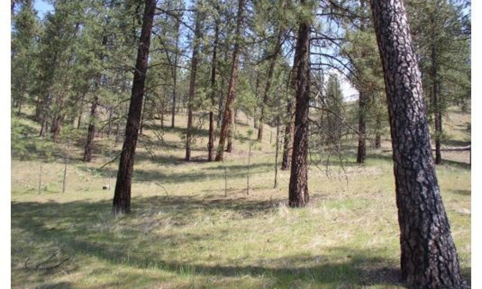
Figure 1.
Table 2. Dominant plant species
Tree (1) Pinus ponderosa
Shrub Not specified
Herbaceous (1) Festuca idahoensis
Physiographic features
This site occurs predominately on backslopes hills and basalt plateaus. The landscape is part of the Columbia basalt plateaus and Northern Rocky foothills. They occur on treads, noseslopes and some backslopes in all slope shapes.
Physiographic Division: Intermontane Plateau and Northern Rocky Mountain System
Physiographic Province: Columbia Plateau and Northern Rocky Mountains
Physiographic Sections: Walla Walla Plateau and Blue Mountain Section
Landscapes: Hills, northern rocky mountain valleys and channeled scablands
Landform: hills, canyons, outwash plains and terracesTable 3. Representative physiographic features
Landforms (1) Hills > Hill
(2) Canyon
(3) Outwash plain
(4) Terrace
Flooding frequency None Ponding frequency None Elevation 2000 – 4000 ft Slope 8 – 40 % Aspect N, NE Table 4. Representative physiographic features (actual ranges)
Flooding frequency Not specified Ponding frequency Not specified Elevation 0 ft Slope 0 – 65 % Climatic features
Taxonomic soil climate is primarily a mesic temperature regime and xeric moisture regime.
Table 5 Representative climatic features
Frost-free period (characteristic range) 110-130 days Freeze-free period (characteristic range) 120-130 days Precipitation total (characteristic range) 20-20 in Frost-free period (actual range) 70-150 days Freeze-free period (actual range) 110-140 days Precipitation total (actual range) 20-20 in Frost-free period (average) 90 days Freeze-free period (average) 130 days Precipitation total (average) 20 in Characteristic rangeActual rangeBarLineFigure 1. Monthly precipitation range
Characteristic rangeActual rangeBarLineFigure 2. Monthly minimum temperature range
Characteristic rangeActual rangeBarLineFigure 3. Monthly maximum temperature range
BarLineFigure 4. Monthly average minimum and maximum temperature
Figure 5. Annual precipitation pattern
Figure 6 Annual average temperature pattern
Climate stations used
-
(1) SPOKANE 17 SSW [USW00004136], Cheney, WA
-
(2) COLFAX [USC00451586], Colfax, WA
-
(3) POTLATCH 3 NNE [USC00107301], Potlatch, ID
">Influencing water features
N/A
Wetland description
N/A
Soil features
The components correlated to this ecological site are dominantly Vitrandic and Ultic taxonomic subgroups of Haploxerolls and Argixerolls great groups of the Mollisols taxonomic order. Soils are dominantly very deep but can get as shallow as moderately deep. Average available water capacity of about 5 inches (12.7 cm) in the 0 to 40 inches (0 to 100 cm) depth range.
Soil parent material is dominantly loess mixed with minor amounts of ash over glaciofluvial deposits over residuum.
The associated soils are Bricken, Dragoon, Marblespring, Phoebe, Seaboldt and similar soils.
Dominant soil surface is ashy silt loam and ashy sandy loam to gravelly loamy coarse sand.
Dominant particle-size class is fine-loamy to course-loamy but includes limited sandy-skeletal and loamy-skeletal.Table 6. Representative soil features
Parent material (1) Loess
(2) Glaciofluvial deposits
Surface texture (1) Ashy silt loam
(2) Ashy sandy loam
(3) Gravelly loamy coarse sand
Drainage class Moderately well drained to excessively drained Depth to restrictive layer 60 – 0 in Surface fragment cover <=3" 0 – 35 % Surface fragment cover >3" 0 – 30 % Available water capacity
(Depth not specified)2.8 – 8.3 in Calcium carbonate equivalent
(Depth not specified)Not specified Electrical conductivity
(Depth not specified)Not specified Sodium adsorption ratio
(Depth not specified)Not specified Soil reaction (1:1 water)
(0-10in)5.6 – 7.3 Subsurface fragment volume <=3"
(Depth not specified)0 – 35 % Subsurface fragment volume >3"
(Depth not specified)0 – 35 % Ecological dynamics
The Mesic Xeric Loamy hills, Ponderosa Pine Warm Dry Grass ecological site is comprised of the modal Ponderosa pine (Pinus ponderosa)/Idaho fescue (Festuca idahoensis) plant association, as well as the Ponderosa pine/bluebunch wheatgrass (Pseudoroegneria spicata) and the less extensive Ponderosa pine/pinegrass (Calamagrostis rubescens) associations. This ecologic site was identified and mapped in Asotin, Lincoln, and Spokane Counties, and in the Coleville Indian Reservation soil surveys.
The acres associated with each plant association in this ecological site are as follows:
Ponderosa pine/Idaho fescue (PIPO/FEID) 17,006*
Ponderosa pine/bluebunch wheatgrass (PIPO/PSSP) 15,890
Ponderosa pine/pinegrass (PIPO/CARU) 1,034
TOTAL: 33,930 Acres
* Another assessment of the data shows this ecologic site at 43,274 acres. The final ESD (not provisional) will need to rectify the difference.
The reference site is on warmer and drier slopes within the MLRA. Ponderosa pine stands are nearly pure and self-replacing. Ponderosa pine makes up all seral stages; in early seral through the mid seral and into the climax plant community. An occasional Douglas-fir (Pseudotsuga menziesii) may be encountered, but only on favorable microsites. Tree stocking is low, resulting in an open canopy structure in the mid and late stages of forest development. Age classes are variable, and small amounts of sapling/pole size cohorts typically exist in the understory or in patch openings of various sizes.
Frequent surface fires dominated these forests in the pre-European time period, occurring with an average fire return interval (FRI) of 2 to 10 years. Surface fires returning in such a short time period seriously hinder young Ponderosa pine seedling recruitment and development, while at the same time promoting a robust expression of grasses.
The understory is comprised of low growing shrubs and grasses, including bluebunch wheatgrass, Idaho fescue, and lesser amounts of needle and thread (Stipa comata) and rough fescue (Festuca campestris). Shrubs include very limited amounts of dwarf rose (Rosa gymnocarpa), spirea (Spiraea betulifolia), rose (Rosa woodsia) and some serviceberry (Amelanchier alnifolia). Forbs species include silvery lupine (Lupinus argenteus), basalmroot (Balsamorhiza serrata), pussytoes (Antennaria spp.), hawkweed (Hieracium albertinum), and common yarrow (Achillea millefolium lanulosa).
The modal pine/Idaho fescue association is encountered on sites with the most effective moisture in the ecological site, although the advantage is slight. This fescue types occur in favorable positions such as on lower slopes and more level positions across the landscape. The pine/bluebunch wheatgrass association is restricted to the slightly dryer and warmer locations; however, both the Idaho fescue and bluebunch wheatgrass types are often in close association.
The pine/pinegrass association is included in this ecological site because it shares common historical fire attributes and the nearly pure Ponderosa pine stand expression of the dominant fescue and bluebunch wheatgrass types. It is limited in extent. The pinegrass type is slightly more favorable in climate expression than the dominant two, although it is still warm and dry in the overall context within the ecologic site. This pinegrass association will occupy slightly higher elevational positions, is more productive and is more apt to have small expressions of Douglas-fir and perhaps western larch (Larix occidentalis).
Upland forests in this ecological site are warm and dry and exist in an ecotone position that is transitional between the hotter and drier Ponderosa pine/antelope bitterbrush (Prushia tridentata) ecosystems, and the cooler and more moist mixed conifer forests that are gradually able to support increasing levels of Douglas-fir and western larch along with early seral Ponderosa pine. The forests in this particular warm-dry grass ecological site are classified as savanna types, representing a transition between grasslands and a more typical upland mixed conifer forest.
In the early successional stages, the ESD is comprised of seedlings, saplings, and poles, which progresses in time to older age and size classes of dominant/co-dominant and mature/over-mature stands of trees. Disturbance events are likely to occur at any successional stage, but overall wildfire was the main disturbance element in the pre-settlement period. Mature canopy coverage was open to medium, with a typical range of 40 to 60 percent coverage.
These forests are typically un-even aged. On a larger scale, this ecological site is characterized overall by a heterogeneous spatial pattern across the landscape, including some small “patch” openings occupied by grass and limited shrub species, with or without recruitment of Ponderosa pine seedlings.
Naturally occurring fires in the pre-European settlement period (i.e. the historic reference) were caused by late summer lighting strikes. In addition, many fires were deliberately ignited by indigenous peoples; the early adoption of prescribed burning. Human-caused fires, commonly expressed as surface fires, were typically ignited in late spring or early fall to alter the understory plant community for a variety of purposes which were important to the local native population.
Surface fires would create areas of exposed mineral soils for a short period of time. This seedbed condition is a prerequisite for seedling germination and establishment of Ponderosa pine. The low canopy coverage of the site allowed ample sunlight to reach the forest floor, also aiding in recruitment. Those young seedlings that escaped another quick round of surface fire would develop to the sapling and pole stages where they would rapidly acquire thick fire-resistant bark. Surface fires after this point was often beneficial in terms of naturally thinning thick patches of advanced regeneration.
The long-term perpetuation of this relatively dry conifer forest type in MLRA 9 depends on the successful regeneration of Ponderosa pine as seedlings, some of which eventually grow to provide replacement for the mature component of overstory pine across the landscape. Pine recruitment is limited to a short dispersal distance away from the seed tree source because the seed is relatively heavy. Viable seed crops occur intermittently, and a succession of favorable growing season conditions is required for a new cohort of pine to develop. Ponderosa pine recruitment can be a tenuous process but is offset to a large degree by the longevity attribute of the species.
In addition to the direct impacts of wildfire, disturbance factors that resulted in the demise of mature pine included injury from lightning strikes, wind events, weather extremes, and the collective influence of various damage agents such as bark beetles, pine engraver, mistletoe, and other adapted insects and diseases. Tree age and stand stocking levels often predispose stands and individual trees to mortality. Overall, bark beetles of the genus Dendroctonus (western and mountain pine beetle) are the most destructive biological agent in terms of biotic mortality.State and transition model
More interactive model formats are also available. View Interactive Models
Click on state and transition labels to scroll to the respective textEcosystem states
T1A - The natural fire regime intervals changed to 50 or more years allowing understory pine regeneration T1B - Invasion of introduced perennial and annual grasses T1C - Land converted to crop, pasture, or urban development R2A - Overstory thinning followed by prescribed fire R3A - Site preparation, native grass reseeding, weed control, grazing protection followed by prescribed burning State 1 submodel, plant communities
1.1A - Time. Lack of fire allowing pine regeneration 1.2B - Ground fires reoccur returning site to open pine/grass site 1.2A - Time, continued lack of fire allowing pine cohorts to form dense stands. 1.3A - Stand replacing fire, dense understory pine stands killed, some large overstory pine survive. 1.4A - Natural fire interval resumes, maintaining open pine stand with abundant bunchgrass. 1.4B - Lack of reoccurring fire causing increase in pine establishment. State 2 submodel, plant communities
State 3 submodel, plant communities
State 4 submodel, plant communities
State 1
ReferenceThis state is dependent on the occurrence of frequent low intensity ground fires keeping an open grown pine stand with a dominant ground cover of bunchgrass. When fire intervals are infrequent pine regeneration can survive and a patchy pine woodland develops underneath the large old pine. Drought stress make the large old pine subject to beetle kill and the understory pine stands subject to dwarf mistletoe infestation. It is also possible to have a stand replacement fire when stand density is increased and ladder fuels can reach the larger pine crowns.
Across the overall landscape stand structure was expressed by a combination of small patch openings, clumpy (overstocked) tree groups in the younger size classes, and as well-spaced mature overstory trees encompassing larger stand groups. These mosaic patterns could occur over the landscapes in a scale of upwards of tens of thousands of acres. Disturbances from fire and other biotic and abiotic sources impacted much smaller areas within the larger landscape, on the order of thousands of acres.
The fire regime of the Historic Reference Community phase is summarized as follows:
Fire Regime Group Fire Interval (years)
I 2 – 15
Replacement Mixed Low
Fire Severity (%—probability of occurrence) 5 18 77
Mean Fire Return Interval (MFRI- years) 125 35 8
Primary Source: BpS model 910531
and FEIS Fire Regimes of N. Rocky Mountain Ponderosa pine communities.
Fire Regime Groups: I: 0-35 year frequency, surface severity; II: 0-35 year frequency, replacement severity; III: 35-100+ year frequency, mixed severity; IV: 35-100+ year frequency, replacement frequency; V: 200+ year frequency, replacement severity
Fire Severity Classes: Replacement, >75% kill or top kill of the upper canopy layer; Mixed 26-75%, and low severity, < 25%
Site index (SI) and the resulting derivation of the Culmination of Mean Annual Increment (CMAI) are different indicators of site quality, as well as an indicator of potential yield and of the general economic rotation age of a site. Site index is a common unit of measure for forest trees and stands. It is a simple measure of the age and height of dominant and co-dominant trees, usually referenced to 50 or 100 years of age. Site index is an indicator of site quality with implications of forest productivity. Additional information on SI and CMAI are provided in the table shown immediately below.
Ponderosa pine is the only conifer, and therefore the only commercial tree species in this ESD.
The NRCS site index interpretations is summarized as follows:
Site Quality & Productivity
Plant Association Conifer Symbol Site Index-Low Site Index-High CMAI* CMAI Age of CMAI SI ADP Code** Curve Basis
Low High
Ponderosa Pine
PIPO/PSSP (12) PIPO 72 85 58 77 50/40 600 100TA
Ponderosa Pine
PIPO/FESC (3) PIPO 45 74 34 60 60/50 600 100TA
Ponderosa Pine
PIPO/CARU (1) PIPO 91 87 40 600 100TA
* CMAI (volume) is the point at which the annual growth rate is at the maximum level. The CMAI (age) is where that growth increment occurs. CMAI is expressed as cubic foot per acre per year (ft3/ac/yr.) of growth.
** The base reference is Meyer, NRCS code 600. The full citation is in the reference section.
Plant List
Overstory
Trees
Ponderosa pine (Pinus ponderosa)
Shrubs
Antelope bitterbrush (Purshia tridentate)
Currant (Ribes spp.)
Snowbrush ceanothus (Ceanothus velutinus)
Big sagebrush (Artemesia tridentata)
Rabbitbrush (Chrysothamnus spp.)
Understory
Trees
Ponderosa pine (Pinus ponderosa)
Douglas-fir (Pseudotsuga menziesii)
Shrubs
Buckwheat (Eriogonum)
Herbs
Lupine (Lupinus spp.)
Arrowleaf balsamroot (Balsamorhiza sagittata)
Western yarrow (Achillea millefolium)
White hawkweed (Hieracium albiflorum)
Pussytoes (Antennaria spp.)Lupine (Lupinus spp.)
Grasses:
Pinegrass (Calamagrostis rubescens)
Prairie junegrass (Koeleria macrantha)
Sandberg bluegrass (Poa secunda)
Bluebunch wheatgrass (Pseudoroegneria spicata)
Idaho Fescue (Festuca idahoensis)
Needle and thread grass (Stipa comata)
Rough fescue (Festuca campestris)Community 1.1
Reference Community
Figure 7. Ponderosa pine/bluebunch wheatgrass site on south slope. Open grown pine stand
Large open grown pine with bunchgrass understory. Pine canopy coverage may range from 10 to 30 percent. Understory dominated by bluebunch wheatgrass on the drier sites and Idaho fescue on the moister sites. Other key understory species include arrowleaf balsamroot, western yarrow, buckwheat, and needle and thread.
Community 1.2
Stand Re-initiation Phase
Figure 8. Understory pine become established. Occasional Douglas-fir and shrubs may be present.
Understory pine starts to establish. Bunchgrass cover reduced. Woodland shrubs and fir may establish at higher elevations.
Community 1.3
Understory Stem Exclusion PhaseUnderstory pine stands start to decline through competition. Snags and woody debris develop. Beetle-kill possible. Stand susceptible to stand replacing fire with possible large old pine killed. Mixed severity fire will thin out understory pine stand, woodland shrubs and kill fir regeneration. Bunchgrass cover will increase.
Community 1.4
Stand Initiation Phase
Figure 9. Ponderosa pine / Idaho fescue site with stand replacing fire. Pine seedlings established in clumps after 10 years.
Understory pine stand killed by fire, some larger overstory pine killed. Bunchgrass cover increased. Sporadic pine regeneration dependent on moisture, topographic position, and good seed crop years.
Pathway 1.1A
Community 1.1 to 1.2
Reference Community
Stand Re-initiation PhaseCommunity Phase Pathway 1.1A Frequent ground fires burn out most of pine and shrub regeneration maintaining open pine/bunchgrass. But with time, lack of fire allowing pine regeneration to survive in a patchy mosaic underneath overystory pine. Some woodland shrubs like snowberry, serviceberry, chokecherry and rose species may establish. Occasionally a Douglas-fir may establish in this condition. A mixed severity fire will thin out the understory pine stand and kill the shrubs and Douglas-fir.
Pathway 1.2B
Community 1.2 to 1.1
Stand Re-initiation Phase
Reference CommunityGround fires reoccur returning site to open pine/grass site
Pathway 1.2A
Community 1.2 to 1.3Time, continued lack of fire allowing pine cohorts to form dense stands.
Pathway 1.3A
Community 1.3 to 1.4Stand replacing fire, dense understory pine stands killed, some large overstory pine survive.
Pathway 1.4A
Community 1.4 to 1.1
Stand Initiation Phase
Reference CommunityNatural fire interval resumes, maintaining open pine stand with abundant bunchgrass.
Pathway 1.4B
Community 1.4 to 1.2
Stand Initiation Phase
Stand Re-initiation PhaseLack of reoccurring fire causing increase in pine establishment.
State 2
Fire ExclusionFire Exclusion for 50 or more years leads to a light to medium dense pine woodland with all ages present. Canopy cover ranges from 30 to 60 percent. Canopy cover will be higher in the pine/fescue habitat. Mixed severity fires will create a mosaic of pine stands between burned areas which will seed in with pine maintaining a multi-level pine woodland.
Community 2.1
Reference PhaseMulti-story pine stand with scattered old large pine. Beetle kill possible in large old pine
Age: 100 years and older.State 3
InvadedInvasion of introduced perennial and annual cool-season grasses from adjacent pastures, homesteads, and abandoned areas. One particular annual grass of concern from past overgrazing is the invasion of cheatgrass. Once it gets established in the understory it will prevent native bunchgrasses from reestablishing and restoring site.
Community 3.1
Introduced grassesInvasion of perennial and annual introduced grasses
State 4
ConvertedLower level terrain converted to crops, pasture or urban development. Much of the Mesic Xeric Loamy hills, Ponderosa Pine Warm Dry Grass ecological site is adjacent to local towns and cities. They have been converted to housing developments, shopping malls, or urban recreation areas. In the more rural areas, these sites have been converted to pastures and dry or irrigated cropland.
Note: Significant urban conversion of this forest type has occurred, especially in the Spokane area, but the impact is not specifically addressed in this ecologic site. Urban conversion is a permanent loss of the extent of this ecologic site, and not a true state/transition ecologic process. Additionally, there are limited restoration opportunities for land converted to urban uses.Community 4.1
crop/pasture, or urban conversionLower slope or level ground converted to crops, pasture, or urban
Transition T1A
State 1 to 2The natural fire regime intervals changed to 50 or more years allowing understory pine regeneration to survive and grow creating more of a woodland site. Older larger pine now more susceptible to mortality from stand replacing fire.
Transition T1B
State 1 to 3Invasion of introduced perennial and annual grasses outcompete native bunchgrasses
Transition T1C
State 1 to 4Land converted to crop, pasture, or urban development
Restoration pathway R2A
State 2 to 1Overstory thinning followed by prescribed fire
Restoration pathway R3A
State 3 to 1Site preparation, native grass reseeding, weed control, grazing protection followed by prescribed burning after establishment to maintain site in reference plant community.
Additional community tables
Table 7. Community 1.1 plant community composition
Group Common name Symbol Scientific name Annual production () Foliar cover (%) Table 8. Community 1.2 plant community composition
Group Common name Symbol Scientific name Annual production () Foliar cover (%) Table 9. Community 1.3 plant community composition
Group Common name Symbol Scientific name Annual production () Foliar cover (%) Table 10. Community 1.4 plant community composition
Group Common name Symbol Scientific name Annual production () Foliar cover (%) Table 11. Community 2.1 plant community composition
Group Common name Symbol Scientific name Annual production () Foliar cover (%) Table 12. Community 3.1 plant community composition
Group Common name Symbol Scientific name Annual production () Foliar cover (%) Table 13. Community 4.1 plant community composition
Group Common name Symbol Scientific name Annual production () Foliar cover (%) Interpretations
Other information
Appendix 1
Tree-Size Class
Tree size classes are based on the diameter measurement taken at the “Diameter Breast Height” (abbreviated as DBH). DBH is the diameter of a tree (the bole) measured at 4.5 feet above ground, on the uphill side if on sloping ground. It is a measurement of the outside of the tree bark. The DBH is given in inches.
The following Tree size class(s) are referred to in this ecological site:
Class Name DBH Range
Seedling 0-1”
Sapling 1-5”
Pole 5-9”
Sawtimber: > 9”
Small Sawtimber 9-16”
Large Sawtimber 16-21”
Very Large Sawtimber > 21”
Note: Some classification systems denote “mature and over mature” at 20 to 30” DBH and larger.
This system is likely derived from an economic production basis rather than on forest health size/age thresholds.
Abbreviations and codes for the following conifer tree(s) that occur in the MLRA:
Common Conifer Species Cross Reference List
Common Name Abbreviated Symbol ADP Code
Grand fir GF ABGR
Subalpine fir * AF ABLA
Western Larch WL LAOC
Englemann Spruce ES PIEN
Whitebark pine WB PIAL
Lodgepole pine LP PICO
Western white pine WP PIMO
Ponderosa pine PP PIPO
Douglas-fir DF PSME
Western Redcedar RC THPL
Mountain Hemlock MH TSME
* Subalpine fir is also abbreviated a “SAF”Supporting information
Inventory data references
Data was collected from forestry references, and vegetative experience from within the NRCS field professionals. NRCS Soil and Site Index data for selected soil survey areas within MLRA 9 in form of excel spreadsheets.
Other references
Biophysical Classification- Habitat Groups and Description of Northern Idaho and Northwestern Montana, Lower Clarkfork and Adjacent Areas. Zack, 1997, Revised 2005
Clausnitzer, R. R., and B. A. Zamora. 1987. Forest habitat types of the Colville Indian Reservation. Unpublished report prepared for the Department of Forest and Range Management, Washington State University, Pullman. 1100 p.
Cooper, Stephen V.; Neiman, Kenneth E.; and Roberts, David W. 1991. Forest Habitat Types of Northern Idaho: A Second Approximation. Gen. Tech. Rep. INT-236. Ogden, UT: U.S. Department of Agriculture, Forest Service, Intermountain Research Station. 135 p.
Forest Vegetation of Eastern Washington and Northern Idaho. Washington State University, College of Agriculture, Tech. Bulletin 60, R. Daubenmire and J. Daubenmire, 1968
Fire Ecology of the Forest Habitat Types of Northern Idaho. USFS Intermountain Research Station, GT Report INT – GTR – 363, Smith and Fischer, 1997.
Forested Plant Associations of the Colville Nat. Forest, Williams et al. PNW-GTR-360-1995
Fryer, Janet L. 2016. Fire regimes of Northern Rocky Mountain ponderosa pine communities. In: Fire Effects Information System (FEIS), [Online]. U.S. Department of Agriculture, Forest Service, Rocky Mountain Research Station, Missoula Fire Sciences Laboratory (Producer). [2020, August 10].
Johnson, CG, Jr.; Clausnitzer, R.R. 1992. Plant Association of the Blue and Ochoco Mountains. Tech. Publ. R6-ERW-TP-036-92. Portland, OR; U.S. Department of Agriculture, Forest Service, Pacific Northwest Region, Wallow-Whitman National Forest. 164 p.
McDonald, G. I.; Harvey, A. E.; Tonn, J. R. 2000. "Fire, Competition and Forest Pests: Landscape Treatment to Sustain Ecosystem Function", in Neuenschwander, Leon F.; Ryan, Kevin C., tech. eds. Proceedings from the Joint Fire Science Conference and Workshop: crossing the millennium: integrating spatial technologies and ecological principles for a new age in fire management; the Grove Hotel, Boise, Idaho, June 15-17, 1999. Moscow, Idaho: University of Idaho, 2000: 195-211.
Meyer, Walter H. 1938 (rev 1961). Yield of even-aged stands of ponderosa pine. U.S. Department of Agriculture, Forest Service Technical Bulletin 630. 59 p.
Powell, D.C.; Johnson, C.G.; Crowe, E.A.; Wells, A.; Swanson, D.K. 2007. Potential vegetation hierarchy for the Blue Mountains section of northeastern Oregon, southeastern Washington, and west-central Idaho. Gen. Tech. Rep. PNW-GTR-709. Portland, OR: U.S. Department of Agriculture, Forest Service, Pacific Northwest Research Station. 87 p.
Simpson, Mike; Dickinson, James, Owens, Dave. 2005 (draft rev. 2017). Biophysical Setting (BpS) Model 10531, Northern Rocky Mountain Ponderosa Pine Woodland and Savanna-Mesic. U.S. Department of Agriculture, Forest Service (LANDFIRE).
The U.S. National Vegetation Classification System (USNVC)
Soil Survey of Asotin County, Washington (Survey Area # 603): 1984. United States Department of Agriculture, Soil Conservation Service. 376 p.
Soil Survey of Lincoln County, Washington (Survey Area # 043): 1981. United States Department of Agriculture, Soil Conservation Service. 93 p.
Soil Survey of Spokane County, Washington (Survey Area # 063): United States Department of Agriculture, Natural Resources Conservation Service. 2016. Soil Survey of Spokane County, Washington. http://soils.usda.gov/survey/printed_surveys/3451 p.
Washington National Heritage Program (NHP)
Contributors
Steve Campbell
Gary Kuhn
Carri GainesApproval
Kirt Walstad, 4/01/2025
Rangeland health reference sheet
Interpreting Indicators of Rangeland Health is a qualitative assessment protocol used to determine ecosystem condition based on benchmark characteristics described in the Reference Sheet. A suite of 17 (or more) indicators are typically considered in an assessment. The ecological site(s) representative of an assessment location must be known prior to applying the protocol and must be verified based on soils and climate. Current plant community cannot be used to identify the ecological site.
Author(s)/participant(s) Contact for lead author Date 04/01/2025 Approved by Approval date Composition (Indicators 10 and 12) based on Annual Production Indicators
-
Number and extent of rills:
-
Presence of water flow patterns:
-
Number and height of erosional pedestals or terracettes:
-
Bare ground from Ecological Site Description or other studies (rock, litter, lichen, moss, plant canopy are not bare ground):
-
Number of gullies and erosion associated with gullies:
-
Extent of wind scoured, blowouts and/or depositional areas:
-
Amount of litter movement (describe size and distance expected to travel):
-
Soil surface (top few mm) resistance to erosion (stability values are averages - most sites will show a range of values):
-
Soil surface structure and SOM content (include type of structure and A-horizon color and thickness):
-
Effect of community phase composition (relative proportion of different functional groups) and spatial distribution on infiltration and runoff:
-
Presence and thickness of compaction layer (usually none; describe soil profile features which may be mistaken for compaction on this site):
-
Functional/Structural Groups (list in order of descending dominance by above-ground annual-production or live foliar cover using symbols: >>, >, = to indicate much greater than, greater than, and equal to):
Dominant:
Sub-dominant:
Other:
Additional:
-
Amount of plant mortality and decadence (include which functional groups are expected to show mortality or decadence):
-
Average percent litter cover (%) and depth ( in):
-
Expected annual annual-production (this is TOTAL above-ground annual-production, not just forage annual-production):
-
Potential invasive (including noxious) species (native and non-native). List species which BOTH characterize degraded states and have the potential to become a dominant or co-dominant species on the ecological site if their future establishment and growth is not actively controlled by management interventions. Species that become dominant for only one to several years (e.g., short-term response to drought or wildfire) are not invasive plants. Note that unlike other indicators, we are describing what is NOT expected in the reference state for the ecological site:
-
Perennial plant reproductive capability:
Print Options
Sections
Font
AAAAOther
PrintThe Ecosystem Dynamics Interpretive Tool is an information system framework developed by the USDA-ARS Jornada Experimental Range, USDA Natural Resources Conservation Service, and New Mexico State University.
Accessibility statement