
Natural Resources
Conservation Service
-
Search


Major Land Resource Area or ecological site by name and/or ID.
PreviousSectionsNextGeneral information
Draft. A draft ecological site description is either incomplete or has not undergone quality control and quality assurance review.
MLRA notes
Major Land Resource Area (MLRA): 006X–Cascade Mountains, Eastern Slope
MLRA 6 - Cascade Mountains, Eastern Slope - Pumice Plateau Forest, CRA 6.11
This unit occurs on the southern extreme of the MLRA and is characterized by nearly level to undulating pumice mantled plateaus dominated by lodgepole pine and ponderosa pine. The soils consist of deep deposits of ash and pumice from Mt. Mazama. Cold temperatures and frost limit the production of ponderosa pine. Temperature regime is cryic; moisture regime is xeric.
Table 1. Dominant plant species
Tree (1) Pinus contorta ssp. murrayana
Shrub Not specified
Herbaceous Not specified
Physiographic features
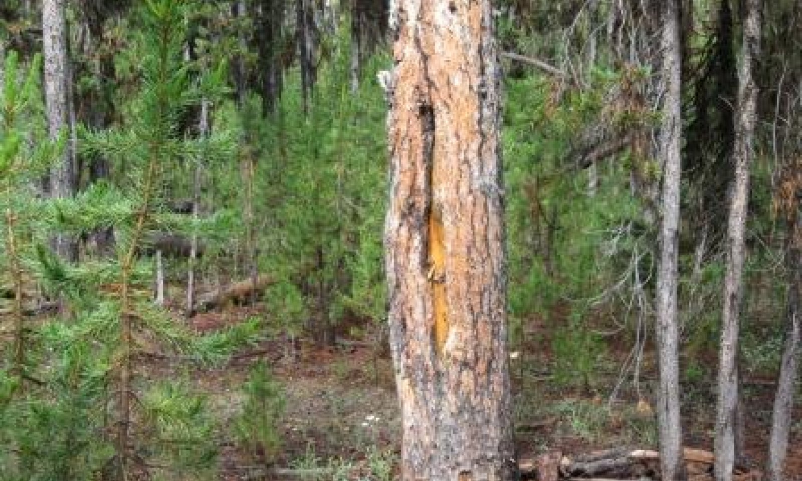
This ecological site is located east of the Cascade range in a very wide and flat basin. The soils are air fall ash and pumice from Mt. Mazama. The basin is influenced by very cold air in the winter. Air drainage is poor which influences temperatures. Frost heaving does occur. Lodgepole pine is the only tree specie that grows in this harsh environment.
Table 2. Representative physiographic features
Landforms (1) Ash flow
Ponding duration Very brief (4 to 48 hours) to brief (2 to 7 days) Ponding frequency Frequent Elevation 4900 – 5660 ft Slope 0 – 2 % Ponding depth 0 – 12 in Water table depth 0 – 72 in Aspect Aspect is not a significant factor Climatic features
This site like all the others in the pumice basin has cold and snowy winters. Winter generally starts in early November and can run thru March. Much of the annual precipitation falls as snow during this period. The summers are generally cool and dry, even though occasional summer thunderstorms can occur. The growing season is short, less than 60 days. At any time during the growing season a hard frost can occur.
Table 3 Representative climatic features
Frost-free period (average) 50 days Freeze-free period (average) 70 days Precipitation total (average) 30 in BarLineFigure 1. Monthly precipitation range
BarLineFigure 2. Monthly average minimum and maximum temperature
">Influencing water features
Soil features
Soils derived from the volcanic activity of Mount Mazama and surrounding area. They formed in air fall coarse ash and pumice and occur in low-relief, depressional areas that are cold air pockets and zones of hydrologic discharge. Water tables are highest in late spring and early summer. This site to date has only been recognized on Deepdish soils, which frequently have a spodic horizon with bright orange or reddish colors within 16 inches of the surface and a buried soil below 40 inches, consisting of loam or clay loam material.
Table 4. Representative soil features
Surface texture (1) Ashy coarse sandy loam
(2) Ashy loamy coarse sand
Family particle size (1) Sandy
Drainage class Somewhat poorly drained Permeability class Moderately rapid to rapid Surface fragment cover <=3" 5 – 15 % Surface fragment cover >3" Not specified Available water capacity
(0-40in)6.5 – 8 in Calcium carbonate equivalent
(0-40in)Not specified Electrical conductivity
(0-40in)Not specified Sodium adsorption ratio
(0-40in)Not specified Soil reaction (1:1 water)
(0-40in)5.1 – 7.3 Subsurface fragment volume <=3"
(Depth not specified)10 – 35 % Subsurface fragment volume >3"
(Depth not specified)10 – 35 % Ecological dynamics
This site occurs on infertile pumice soils that were laid down by the eruption of Mt. Mazama (Crater Lake) over 6,000 years ago. This site is within a very large flat pumice basin that is dominated by a single tree specie. Lodgepole pine (Pinus contorta ssp.murrayana ) is the seral/climax forest and the only tree specie that occurs on the site. The growing environment is harsh with long and cold winters. The topographic slope is low, ranging from 0.1 % to 2.0%. It is generally thought that due to the very flat slopes air drainage in the entire basin is slow. The cold air settles in, creating a harsh growing environment.
Under historic forest conditions there were 2 major disturbance factors in climax Lodgepole pine forests; Fire and Mountain pine beetle (Dendroctonus ponderosae) (Stuart et. el. 1989). Several research projects conducted in the lodgepole forests of the pumice zone concluded that fine fuels were not generally present. This type of fuel is needed to have frequent low intensity fires. Agee (1981) suggests a fire return interval of 60 years for a climax forest in Crater Lake National Park. Agee concludes that fire moved thru the Lodgepole stands in downed logs.
In a 130 year old Lodgepole pine stand (Geiszler, et. al. 1980) reported finding only 1 fire scar on the trees in his study area. Even though there had been 11 fires (1855-1903) the single fire scar per tree suggests that fire did not occur more than once in any location during the 130 years. In a study of the effect of a prescribed fire, in an open stand of Lodgepole pine, fire spread mostly in downed partially decayed logs that had been killed by mountain pine beetles many years prior (Agee 1981). Enough decayed downed wood needs to be of the forest floor accompanied by the right weather conditions for a fire to occur. Fire spreads slowly in the interior decayed material, igniting a surface fire when fine fuels (grass/pine litter) were present, damaging a tree bole by burning thru direct contact (burning log in direct contact with live tree) or killing tree roots thru heat transfer into the soil. In this ecological site, ground vegetation cover is limited, leading to the possible conclusion that this sites fire return interval was determined by the occurrence of downed logs. This is not to say that stand replacement fires do not occur, they do. A conceptual model of Lodgepole pine forest development (Gara, et al, 1985) proposes that stand replacement fires occur, leading to stand regeneration. Over time the stand grows, stagnates, snags fall and fuels accumulate. When enough fuels accumulate a ground fire will eventually occur. Damaged trees are invaded by beetles and killed or they become infected by fungi. The remaining trees continue to grow, but at a much slow pace due to fungal infestation. Over time the fungi kills the growing trees or weakens them to where a beetle outbreak occurs. The weak trees are attacked first and when the beetle populations build up they move into the older live trees, and then smaller trees if epidemic levels are reached. Trees die and fall over creating conditions for a possible stand replacement fire.
Historic regeneration patterns were determined by disturbance, either fire, mountain pine beetle outbreaks and fungi infections that occur in trees after injury or death. Successful regeneration was found to be limited by the lack of soil moisture (Geiszler et.al, 1980). So the killing of trees increased available water in the soil for seedling establishment. The type of disturbance determines that forest structure. A wildfire that killed most of the trees would encourage an even-aged forest. A light fire would maintain a predominance of two age classes (Agee 1981). Stands with periodic mountain pine beetle attacks could have 2 or 3 main age classes and stands with endemic beetle levels would be multi-aged (Stuart, 1989).
Mountain pine beetle have been found to attack older larger size Lodgepole pine trees first. Infestation maybe a function of lower tree resistance (older age) or size (availability of brooding sites) or fungal decay weakening the tree. Stands most likely to have a mountain pine beetle outbreak have a quadratic mean diameter of 20 cm (8 in) or more and have > 27 rings per cm (66 rings/inch) in the outermost centimeter (Stuart, et.al. 1989).
Fire frequency can also be influenced by a stand proximity to other forest types. In another study Gara et. al. (1985) surveyed 2 adjacent climax lodgepole stands and found one stand (A) had not had a fire for at least 350 years and the other had (B) a stand replacement fire in 1839 and a light ground fire in 1898. Stand B was immediately next to a Ponderosa pine stand that experienced frequent low intensity fires. Fire would move in to the climax Lodgepole forest when burning conditions were just right, burning and smoldering in downed logs. This created a two aged stand. Stand A, on the other hand, had a variety of age classes in clumps and no fire evidence, suggesting periodic pine beetle activity that would kill clumps of trees creating openings for regeneration.
Stand structure is influenced by the amount and timing of each occurrence, both singly and together along with the affect of fungi that invade damaged trees.State and transition model
More interactive model formats are also available. View Interactive Models
Click on state and transition labels to scroll to the respective textEcosystem states
State 1 submodel, plant communities
State 1
Reference CommunityThe reference plant community is made up of only Lodgepole pine trees. There is a mix of age and sizes, but it is dominated by an older mature set of trees with either one or two additional age classes. The disturbance regime and frequency will determine the number of additional age classes.
Community 1.1
Mature Lodgepole
Forest overstory.Lodgepole pine make up the overstory. No other tree specie is present. The crowns are fairly open, allowing light to the forest floor
Forest understory. Understory vegetation is very low. Forbs dominate what plant community is present. Shrub and grass cover is very low.
Table 5. Soil surface cover
Tree basal cover 0-0% Shrub/vine/liana basal cover 0% Grass/grasslike basal cover 0.1-1.0% Forb basal cover 0% Non-vascular plants 0% Biological crusts 0% Litter 30-70% Surface fragments >0.25" and <=3" 0% Surface fragments >3" 0% Bedrock 0% Water 0% Bare ground 0-0% Table 6. Woody ground cover
Downed wood, fine-small (<0.40" diameter; 1-hour fuels) 10-20% Downed wood, fine-medium (0.40-0.99" diameter; 10-hour fuels) 5-10% Downed wood, fine-large (1.00-2.99" diameter; 100-hour fuels) 5-15% Downed wood, coarse-small (3.00-8.99" diameter; 1,000-hour fuels) 1-10% Downed wood, coarse-large (>9.00" diameter; 10,000-hour fuels) 0-3% Tree snags** (hard***) – Tree snags** (soft***) – Tree snag count** (hard***) 0-10 per acre Tree snag count** (hard***) 0-0 per acre * Decomposition Classes: N - no or little integration with the soil surface; I - partial to nearly full integration with the soil surface.
** >10.16cm diameter at 1.3716m above ground and >1.8288m height--if less diameter OR height use applicable down wood type; for pinyon and juniper, use 0.3048m above ground.
*** Hard - tree is dead with most or all of bark intact; Soft - most of bark has sloughed off.
Community 1.2
Seedling/Sapling
Figure 3. Young lodgepole stand
This community occurs when a major disturbance occurs, usually a wildfire. All or almost all trees are consumed by the wildfire removing competition for moisture. A mountain pine beetle epidemic may also kill a majority of a lodgpole stand, creating a suitable environment. Seedling regeneration is typically high. Stuart, 1989 reported an average of 5500 seedlings per acre, after a major mountain pine beetle outbreak.
Forest overstory.Overstory composition is all Lodgepole. Early in seedling stage there is little to no overstory (>13 ft). Over time as seedlings become saplings does the overstory canopy develop. The canopy cover can be as high as 60% but will eventually lower due to stagnation and weaker trees die.
Forest understory. There is neglible understory vegetation. Seedling density is so high that it out competes all other vegetation.
Table 7. Soil surface cover
Tree basal cover 0% Shrub/vine/liana basal cover 0% Grass/grasslike basal cover 0-0% Forb basal cover 0-0% Non-vascular plants 0% Biological crusts 0% Litter 20-40% Surface fragments >0.25" and <=3" 0.5-3.0% Surface fragments >3" 0% Bedrock 0% Water 0% Bare ground 10-20% Table 8. Woody ground cover
Downed wood, fine-small (<0.40" diameter; 1-hour fuels) 3-12% N* Downed wood, fine-medium (0.40-0.99" diameter; 10-hour fuels) 0-8% N* Downed wood, fine-large (1.00-2.99" diameter; 100-hour fuels) 0-8% N* Downed wood, coarse-small (3.00-8.99" diameter; 1,000-hour fuels) 0-5% N* Downed wood, coarse-large (>9.00" diameter; 10,000-hour fuels) 0% Tree snags** (hard***) – Tree snags** (soft***) – Tree snag count** (hard***) 0 per acre Tree snag count** (hard***) 0-0 per acre * Decomposition Classes: N - no or little integration with the soil surface; I - partial to nearly full integration with the soil surface.
** >10.16cm diameter at 1.3716m above ground and >1.8288m height--if less diameter OR height use applicable down wood type; for pinyon and juniper, use 0.3048m above ground.
*** Hard - tree is dead with most or all of bark intact; Soft - most of bark has sloughed off.
Additional community tables
Table 9. Community 1.1 plant community composition
Group Common name Symbol Scientific name Annual production () Foliar cover (%) Table 10. Community 1.1 forest overstory composition
Common name Symbol Scientific name Nativity Height ft Canopy cover (%) Diameter in Basal area (square ft/acre) TreeSierra lodgepole pine PICOM Pinus contorta var. murrayana Native 35-65 20-35 7-15 0 Sierra lodgepole pine PICOM Pinus contorta var. murrayana Native 13-20 0.1-1 3-5 0 Table 11. Community 1.1 forest understory composition
Common name Symbol Scientific name Nativity Height (ft) Canopy cover (%) Grass/grass-like (Graminoids)squirreltail ELELE Elymus elymoides ssp. elymoides Native 0–2 1–10 western needlegrass ACOCO Achnatherum occidentale ssp. occidentale Native 0–2 0–4 long-stolon sedge CAIN9 Carex inops Native 0–0.9 0.1–1 sedge CAREX Carex Native 0–0.5 0.1–0.3 Forb/Herblongstalk clover TRLO Trifolium longipes Native 0.1–0.7 10–30 Virginia strawberry FRVI Fragaria virginiana Native 0.1–0.3 0.1–2 ash penstemon PECI2 Penstemon cinicola Native 0–1.5 0.1 Shrub/Subshrubkinnikinnick ARUV Arctostaphylos uva-ursi Native 0–0.5 0.1–1 antelope bitterbrush PUTR2 Purshia tridentata Native 0.2–1 0.1–0.5 Treelodgepole pine PICO Pinus contorta Native 1–6 20–40 lodgepole pine PICO Pinus contorta Native 3–13 20–30 lodgepole pine PICO Pinus contorta Native 0.5–3 10–15 Table 12. Community 1.2 plant community composition
Group Common name Symbol Scientific name Annual production () Foliar cover (%) Table 13. Community 1.2 forest overstory composition
Common name Symbol Scientific name Nativity Height ft Canopy cover (%) Diameter in Basal area (square ft/acre) TreeSierra lodgepole pine PICOM Pinus contorta var. murrayana Native 40-65 0-5 4-8 0 Table 14. Community 1.2 forest understory composition
Common name Symbol Scientific name Nativity Height (ft) Canopy cover (%) Grass/grass-like (Graminoids)squirreltail ELELE Elymus elymoides ssp. elymoides Native 0–1.5 0–3 western needlegrass ACOCO Achnatherum occidentale ssp. occidentale Native 0–1.5 0–3 Forb/Herblongstalk clover TRLO Trifolium longipes Native 0.1–0.6 5–15 ash penstemon PECI2 Penstemon cinicola Native 0.1–1 0.1–0.5 TreeSierra lodgepole pine PICOM Pinus contorta var. murrayana Native 1–13 20–60 Interpretations
Other information
Diseases and Insects
Mountain Pine Bettle--Dendroctonus Ponderosae
Lodgepole dwarf Mistletoe--Arceuthobium Americanum
Western Gall Rust -- Endocronartium harknessii
Table 15. Representative site productivity
Common name Symbol Site index low Site index high CMAI low CMAI high Age of CMAI Site index curve code Site index curve basis Citation Sierra lodgepole pine PICOM 55 55 0 0 0 520 100TA Alexander, Robert R. 1966. Site indexes for Lodgepole pine, with corrections for stand density: instructions for field use. USDA, Forest Service. Rocky Mountain Forest and Range Experiment Station Research Paper RM-24. Supporting information
Other references
Geiszler, D.R., R.I Gara, C.H. Driver, V.F. Gallucci, and R.e. Martin. Fire, Fungi, and Beetle Influences on a Lodgepole Pine Ecosystem of South-Central Oregon. Oecologia 46, 239-243 (1980).
Gara, R., Littke, W., Agee, J., Geiszler,D., Stuart,J. and Driver,C. Influence of Fires, Fungi and Mountain Pine Beetles on Development of a Lodgepole Pine Forest in South-Cental Oregon, pp 153-162 in DM Baumgartner et. al. (eds) Lodgepole Pine: The species and Its Managment Symposium Proceeding. Washington State University, Pullman.
Stuart, J.D., Agee, J.K., and Gara, R.I. 1989. Lodgepole Pine Regeneration in an Old, self-perpetuating Forest in south Central Oregon. Can. J For. Research 19: 1096-1104.
Agee, J.K. 1981. Initial Effects of prescribed fire in a climax Pinus contorta forest: Crater Lake National Park. National Park Service CPSU/UW 81-4. College of Forest Resources, University of Washington, Seattle.
Forested Plant Associations of the Oregon East Cascades. Mike Simpson. USFS R6-NR-ECOL-TP-03-207.Rangeland health reference sheet
Interpreting Indicators of Rangeland Health is a qualitative assessment protocol used to determine ecosystem condition based on benchmark characteristics described in the Reference Sheet. A suite of 17 (or more) indicators are typically considered in an assessment. The ecological site(s) representative of an assessment location must be known prior to applying the protocol and must be verified based on soils and climate. Current plant community cannot be used to identify the ecological site.
Author(s)/participant(s) Contact for lead author Date Approved by Approval date Composition (Indicators 10 and 12) based on Annual Production Indicators
-
Number and extent of rills:
-
Presence of water flow patterns:
-
Number and height of erosional pedestals or terracettes:
-
Bare ground from Ecological Site Description or other studies (rock, litter, lichen, moss, plant canopy are not bare ground):
-
Number of gullies and erosion associated with gullies:
-
Extent of wind scoured, blowouts and/or depositional areas:
-
Amount of litter movement (describe size and distance expected to travel):
-
Soil surface (top few mm) resistance to erosion (stability values are averages - most sites will show a range of values):
-
Soil surface structure and SOM content (include type of structure and A-horizon color and thickness):
-
Effect of community phase composition (relative proportion of different functional groups) and spatial distribution on infiltration and runoff:
-
Presence and thickness of compaction layer (usually none; describe soil profile features which may be mistaken for compaction on this site):
-
Functional/Structural Groups (list in order of descending dominance by above-ground annual-production or live foliar cover using symbols: >>, >, = to indicate much greater than, greater than, and equal to):
Dominant:
Sub-dominant:
Other:
Additional:
-
Amount of plant mortality and decadence (include which functional groups are expected to show mortality or decadence):
-
Average percent litter cover (%) and depth ( in):
-
Expected annual annual-production (this is TOTAL above-ground annual-production, not just forage annual-production):
-
Potential invasive (including noxious) species (native and non-native). List species which BOTH characterize degraded states and have the potential to become a dominant or co-dominant species on the ecological site if their future establishment and growth is not actively controlled by management interventions. Species that become dominant for only one to several years (e.g., short-term response to drought or wildfire) are not invasive plants. Note that unlike other indicators, we are describing what is NOT expected in the reference state for the ecological site:
-
Perennial plant reproductive capability:
Print Options
Sections
Font
AAAAOther
PrintThe Ecosystem Dynamics Interpretive Tool is an information system framework developed by the USDA-ARS Jornada Experimental Range, USDA Natural Resources Conservation Service, and New Mexico State University.
Accessibility statement


