
Natural Resources
Conservation Service
Ecological site AX002X01X007
Puget Lowlands Wet Hemlock Forest
Last updated: 12/03/2024
Accessed: 08/30/2026
-
Search


Major Land Resource Area or ecological site by name and/or ID.
General information
Provisional. A provisional ecological site description has undergone quality control and quality assurance review. It contains a working state and transition model and enough information to identify the ecological site.
MLRA notes
Major Land Resource Area (MLRA): 002X–Willamette and Puget Sound Valleys
The Willamette and Puget Sound Valleys Major Land Resource Area (MLRA 2) is in western parts of Washington and Oregon. It occupies a forearc basin between the Coast Ranges and the Cascade Mountain volcanic arc. The northern part contains Pleistocene drift, outwash, and lacustrine and glaciomarine deposits associated with continental glaciers. The southern part contains Late Pleistocene deposits from glacial outburst floods (Missoula Floods).
Climate is mild and moist, and the growing season is long. Mean annual precipitation ranges from 20 to 60 inches, received mostly in fall, winter, and spring. Summers are dry. The soil temperature regime is mesic, and the soil moisture regimes are xeric and aquic.
Most sites in this MLRA can support forested vegetation, but some were maintained as prairie, savanna, or woodland through cultural burning prior to Euro-American settlement. Puget Sound has a moderating effect on temperatures, and humidity can be higher in the northern part of the MLRA. Douglas-fir (Pseudotsuga menziesii) is widespread throughout. Oregon white oak (Quercus garryana) is common on uplands in the south and on warm, exposed or droughty sites in the north. Pacific madrone grows in areas close to saltwater. Western hemlock (Tsuga heterophylla) is codominant with Douglas-fir in the north. Flood plains typically contain Brayshaw black cottonwood (Populus balsamifera ssp. trichocarpa) and red alder (Alnus rubra). Oregon ash (Fraxinus latifolia) is typical of forested wetlands in the south.
Forestry, urban development, and cultivated agriculture are currently the most extensive land uses (USDA, Agriculture Handbook 296, 2022).LRU notes
This ecological site may occur in both LRU A and B within MLRA 002. The Puget Sound Trough Lowlands Land Resource Unit (LRU A) is bounded to the north by the Frasier River Valley at the international border with Canada and extends south to the Cowlitz River. To the west lie Puget Sound and the Strait of Juan De Fuca; to the east lie the foothills of the Cascade Range. The LRU is affected by the proximity of climate-moderating saltwater. Modest annual swings in temperature, winters that seldom experience freezing temperatures, adequate rainfall, and warm, dry summers support small-scale agriculture and forestry. This climate also supports the largest population and highest population density in the Northwest. Aside from isolated areas affected by local rain shadows and marine-influenced fog, the climate is consistent throughout the Puget Lowlands.
The LRU represents the furthest southern extent of repeated advances of continental glaciers in western Washington. Glacial drift is the predominant parent material. The LRU also includes intermittent areas of glacially modified, resistant bedrock and several alluvial systems. Volcanic ash is present but intermittent. Soil moisture varies considerably over short distances. This variability creates a mosaic of small plant communities. Soil drainage can be restricted by dense glaciomarine sediments or till. This restriction can create widespread areas of seasonal high water tables and ponding. In places, soils that developed in deep, unconsolidated, coarse-textured sandy drift or in bedrock- restricted colluvium have low available water capacity. South-facing areas near shorelines and minor outwash plains are typically some of the drier areas in the LRU. Precipitation increases with elevation and distance from Puget Sound.
The Portland Basin and Hills Land Resource Unit (LRU B) is in southwestern Washington and northwestern Oregon. The LRU extends north to the Cowlitz River and transitions to the Willamette Valley in the south. The Columbia River Gorge limits the eastern extent, and influence of tidewater at Cathlamet identifies the northwestern extent. Elevation ranges from sea level to about 2,000 feet. Major landforms include glaciofluvial terraces along the Columbia River, as well as residual hills and foothills surrounding the basin. Minor areas of Columbia River flood plain are present in Washington and more extensively in Oregon. Residual hills are composed primarily of Quaternary-Pliocene and Tertiary volcanic and sedimentary rocks. The lower-relief basin is composed primarily of sediment from catastrophic Quaternary glacial flooding from Glacial Lake Missoula.
The Columbia River splits this LRU between Oregon and Washington.
In Washington, mean annual precipitation ranges from 35 to 60 inches. Most falls as rain between October and May. The frost-free period ranges from 160 to 220 days. Locations near the Columbia River Gorge experience strong winds and infrequent ice storms with little winter snow. Average daily maximum temperatures in summer at Vancouver, Washington, are 1 to 3 degrees F warmer compared to Seattle or Olympia, Washington (Agricultural Climate Information System, 2007a, 2007b).
Oregon white oak and Douglas-fir are common north of the Columbia River in Washington. Western redcedar and western hemlock grow in areas of higher moisture, at higher elevations, or on protected aspects.Ecological site concept
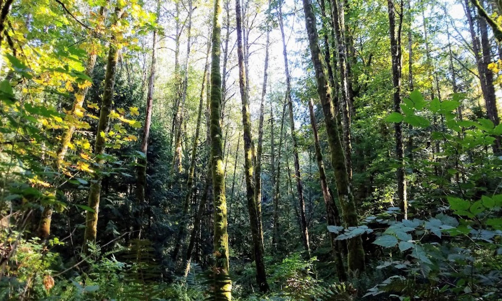
This ecological site consists of forested wetlands in depressions and drainageways at elevations generally less than 500 feet. Areas of the site are affected by a seasonal high water table. The site is strongly influenced by physiography and hydrology, which provide rare and unique habitats in Puget Sound. The climate has warm, moist summers and cool, wet winters. Precipitation falls mostly as rain. Snow is rare. Soils that support this ecological site are in the mesic soil temperature regime and aquic soil moisture regime. Most areas of this site can be subject to residual ponding in addition to extended periods of water at the surface. These anaerobic conditions lead to a slowed rate of organic decomposition. The seasonal high water table and ponding dynamics may be altered by artificial drainage of the site or adjacent areas. A thin organic horizon consisting of decomposing twigs, needles, and litter is on the surface. This horizon helps to protect the soils from wind and water erosion. Fire in this ecological site historically occurred at relatively longer return intervals (100 or more years) similar to other hemlock, western red cedar and Douglas-fir ecological sites of the Pacific Northwest (Agee 1993).
The most common overstory species are western hemlock (Tsuga heterophylla), western redcedar (Thuja plicata), Douglas-fir (Pseudotsuga menziesii), Cascara buckthorn (Frangula purshiana), bigleaf maple (Acer macrophyllum), and red alder (Alnus rubra). Black cottonwood (Populus trichocarpa) may also occur, especially in the wettest portions of this ecological site and in the Puget Trough LRU to the north. As a result of soil saturation during much of the year, conifers may be restricted to nurse logs or higher microsites and they commonly are short and stunted (Roccio and Crawford, 2015).
Shrubs may be sparse or entirely absent in some areas. Shrubs may include salmonberry (Rubus spectabilis), devilsclub (Oplopanax horridus), vine maple (Acer circinatum), red huckleberry (Vaccinium parvifolium), thimbleberry (Rubus parviflorus) and salal (Gaultheria shallon). The herb layer commonly is dominantly American skunkcabbage (Lysichiton Americanus), threeleaf foamflower (Tiarella trifoliata), small enchanter’s nightshade (Circaea alpina), ladyfern (Athyrium filix-femina), deer fern (Blechnum spicant), and slough sedge (Carex obnupta).Associated sites
AX002X01X002 Puget Lowlands Tidal Flat
AX002X01X003 Puget Lowlands Peat Wetlands
AX002X01X008 Puget Lowlands Riparian Forest
Similar sites
F002XN904WA Sitka spruce - red alder/salmonberry/field horsetail
Table 1. Dominant plant species
Tree (1) Tsuga heterophylla
(2) Alnus rubraShrub (1) Rubus spectabilis
Herbaceous (1) Lysichiton americanus
Legacy ID
F002XA007WA


