
Natural Resources
Conservation Service
Ecological site AX002X01X004
Puget Lowlands Forest
Last updated: 12/03/2024
Accessed: 08/21/2026
-
Search


Major Land Resource Area or ecological site by name and/or ID.
PreviousSectionsNextGeneral information
Provisional. A provisional ecological site description has undergone quality control and quality assurance review. It contains a working state and transition model and enough information to identify the ecological site.
MLRA notes
Major Land Resource Area (MLRA): 002X–Willamette and Puget Sound Valleys
The Willamette and Puget Sound Valleys Major Land Resource Area (MLRA 2) is in western parts of Washington and Oregon. It occupies a forearc basin between the Coast Ranges and the Cascade Mountain volcanic arc. The northern part contains Pleistocene drift, outwash, and lacustrine and glaciomarine deposits associated with continental glaciers. The southern part contains Late Pleistocene deposits from glacial outburst floods (Missoula Floods).
Climate is mild and moist, and the growing season is long. Mean annual precipitation ranges from 20 to 60 inches, received mostly in fall, winter, and spring. Summers are dry. The soil temperature regime is mesic, and the soil moisture regimes are xeric and aquic.
Most sites in this MLRA can support forested vegetation, but some were maintained as prairie, savanna, or woodland through cultural burning prior to Euro-American settlement. Puget Sound has a moderating effect on temperatures, and humidity can be higher in the northern part of the MLRA. Douglas-fir (Pseudotsuga menziesii) is widespread throughout. Oregon white oak (Quercus garryana) is common on uplands in the south and on warm, exposed or droughty sites in the north. Pacific madrone grows in areas close to saltwater. Western hemlock (Tsuga heterophylla) is codominant with Douglas-fir in the north. Flood plains typically contain Brayshaw black cottonwood (Populus balsamifera ssp. trichocarpa) and red alder (Alnus rubra). Oregon ash (Fraxinus latifolia) is typical of forested wetlands in the south.
Forestry, urban development, and cultivated agriculture are currently the most extensive land uses (USDA, Agriculture Handbook 296, 2022).LRU notes
The Puget Sound Trough Lowlands Land Resource Unit (LRU) is bounded to the north by the Frasier River Valley at the international border with Canada and extends south to the Cowlitz River. To the west lie Puget Sound and the Strait of Juan De Fuca; to the east lie the foothills of the Cascade Range. The LRU is affected by the proximity of climate-moderating saltwater. Modest annual swings in temperature, winters that seldom experience freezing temperatures, adequate rainfall, and warm, dry summers support small-scale agriculture and forestry. This climate also supports the largest population and highest population density in the Northwest. Aside from isolated areas affected by local rain shadows and marine-influenced fog, the climate is consistent throughout the Puget Lowlands.
The LRU represents the furthest southern extent of repeated advances of continental glaciers in western Washington. Glacial drift is the predominant parent material. The LRU also includes intermittent areas of glacially modified, resistant bedrock and several alluvial systems. Volcanic ash is present but intermittent. Soil moisture varies considerably over short distances. This variability creates a mosaic of small plant communities. Soil drainage can be restricted by dense glaciomarine sediments or till. This restriction can create widespread areas of seasonal high water tables and ponding. In places, soils that developed in deep, unconsolidated, coarse-textured sandy drift or in bedrock-restricted colluvium have low available water capacity. South-facing areas near shorelines and minor outwash plains are typically some of the drier areas in the LRU. Precipitation increases with elevation and distance from Puget Sound.Ecological site concept
The soil moisture control section of this ecological site is dry for 60 to 75 consecutive days a year. Most of the annual precipitation is received from October through April, primarily as rain. Snow is rare. This ecological site is widespread in Puget Sound on soils with variable drainage. The extensive plant community is supported by the consistent maritime climate and soils derived from continental glacial parent materials throughout Puget
Sound. It is the most common plant community in much of the Washington portion of MLRA 2. It is typically on bedrock hills, glacially modified hills, and glacial terraces. It is also in some areas between the dry, warm shoreline of Puget Sound and the cooler, wetter areas bordering the Cascade and Coast Range foothills.
This site can be compared to the Portland Basin and Hills Forest site in LRU B, which is similar but has a higher summer temperature and lower amounts of summer precipitation. Drier conditions during the growing season are possible in LRU B, leading to a longer recovery between disturbances and higher fire frequency than in LRU A.Associated sites
AX002X01X006 Puget Lowlands Dry Prairie
AX002X01X007 Puget Lowlands Wet Hemlock Forest
AX002X01X008 Puget Lowlands Riparian Forest
Similar sites
F002XN902WA Western hemlock - Douglas-fir/Cascade Oregongrape
F002XN906WA Western hemlock-western redcedar/red huckleberry-salal/western swordfern
AX002X02X004 Portland Basin Forest
Table 1. Dominant plant species
Tree (1) Tsuga heterophylla
(2) Pseudotsuga menziesiiShrub (1) Mahonia nervosa
(2) Gaultheria shallonHerbaceous (1) Polystichum munitum
Legacy ID
F002XA004WA
Physiographic features
This site is on slopes of bedrock hills, glacially modified hills, and glacial terraces.
Table 2. Representative physiographic features
Flooding frequency None to rare Ponding frequency None Elevation 0 – 1000 ft Slope 5 – 30 % Aspect W, NW, N, NE, E, SE, S, SW Table 3. Representative physiographic features (actual ranges)
Flooding frequency Not specified Ponding frequency Not specified Elevation 0 – 2000 ft Slope 0 – 90 % Climatic features
Mean annual air temperature: 48 to 52 degrees Fahrenheit
Table 4 Representative climatic features
Frost-free period (characteristic range) 160-240 days Freeze-free period (characteristic range) Precipitation total (characteristic range) 20-70 in ">Influencing water features
This site is not influenced by water from a wetland or stream.
Soil features
Surface textures: Gravelly sandy loams, sandy loams, loams, and silt loams
Soil family textures: Sandy, fine-loamy, coarse-loamy, loamy-skeletal, and sandy-skeletal
Parent material: Glacial drift, including outwash or till, colluvium, residuum are most typical. Alluvium and some volcanic ash can are also possible.
Soil depth: 20 to more than 60 inches. Lithic or densic contacts are possible restrictions.
Soil drainage: Somewhat poorly drained to somewhat excessively drained. Moderately well drained and well drained are most common.
Available water capacity in the top 40 inches: 1 to 10 in/in
pH in water: 4.5 to 7.3
Soil is dry in all parts from 60 to 75 consecutive days.Ecological dynamics
Fire, wind and storm damage are important disturbance agents in this ecological site. Wind and storm damage occurs regularly in winter, causing small patches of seedbed to be exposed by uprooted trees and small earthflows, and providing release to sub-dominant species in shaded understories. Western hemlock and Douglas-fir are the dominant trees. Douglas-fir is not as shade tolerant as western hemlock and western redcedar (Hermann and Lavender 1990). Because of this, western hemlock and western redcedar often develop in sub-dominant canopy positions alongside faster growing Douglas-fir after major disturbances. The more shade tolerant conifers can also establish in the understory and persist until minor disturbances cause overstory mortality and allow narrow gaps for them to grow into (Minore 1990, Packee 1990). Lodgepole pine and western white pine are infrequent but when present are often pioneering species after canopy opening fires. Western white pine can persist longer than lodgepole pine within stands until it is overcome by greater height potential of Douglas-fir and western hemlock. Douglas-fir can persist in the overstory for very long periods due to its great height, thick fire-protective bark, and longevity (800+years), but it also requires disturbances that cause greater canopy openings and exposure of mineral soil to establish in abundance (Hermann and Lavender 1990). During longer fire free intervals stand composition tends to shift in favor of highly shade tolerant western hemlock and western red cedar as Douglas-fir is intolerant of deep shade (Munger 1940, Henderson et al. 1989). In contrast to Douglas-fir and pines, western hemlock is very successful germinating on organic matter in the understory, such as duff or rotten logs (Packee 1990). Thus, exposure of mineral soil is not a requirement for its regeneration in this site.
In the dry range of this ecological site, plant species common to the Puget Lowlands Dry Douglas-fir can occur, such as Pacific madrone and oceanspray (Holodiscus discolor). In moister areas plants common to the Puget Lowlands Moist Forest may occur, such as western redcedar and evergreen huckleberry (Vaccinium ovatum). Grand fir, bigleaf maple, and western white pine may also be present. In some cases, bigleaf maple can come to dominate the overstory by resprouting after a disturbance, such as fire or logging, and temporarily outpace growth of conifers. It will persist for variable lengths of time depending on how quickly conifers establish and the time required for them to surpass the maple canopy. Sword fern, red huckleberry, and salal are common in the understory.
There is strong agreement in the research community that fire is a critical determinant of stand structure and composition in Puget Lowlands Forest (Munger 1940, Henderson et al. 1989, Agee 1993, Wetzel and Fonda 2000). Historic fire frequency in western Oregon and Washington conifer-dominated forests is an ongoing topic of debate with recent research suggesting that assigning a long-interval (150+ year), stand-replacing fire regime to these forests (as has been the long-held view) is inaccurate, or at least over-simplified (Wendel and Zabowskl 2010, Tepley et al. 2013). In general, fire in this ecological site is likely to have occurred in the past with relatively long (75+ year) mean fire return intervals (MFRI) but with great variability in behavior and effects. While an individual point location (such as a tree or plot) may be unlikely to experience fire at quick intervals, when considered at a watershed scale, fire occurred often, burning different areas at different times (Agee 1993, Wetzel and Fonda 2000, Wendel and Zabowskl 2010). Fires also displayed varying behavior including infrequent stand-replacing events alongside lower intensity events that cause small patch or individual tree mortality and leave many surviving overstory trees, particularly Douglas-fir (Wetzel and Fonda 2000). This variable, rotational pattern supports high structural and compositional diversity. Much of the area where this ecological site occurs has experienced little fire between the early 20th century and time of this writing (2024) due to active fire suppression, and most research suggests a trend toward more western hemlock and less Douglas-fir on unmanaged lands where fire is excluded (Munger 1940, Huff 1995, Henderson et al. 1989, Wendel and Zabowskl 2010).State and transition model
More interactive model formats are also available. View Interactive Models
Click on state and transition labels to scroll to the respective textEcosystem states
State 3 submodel, plant communities
State 1
ReferenceWestern hemlock and Douglas-fir mosaic.
Community 1.1
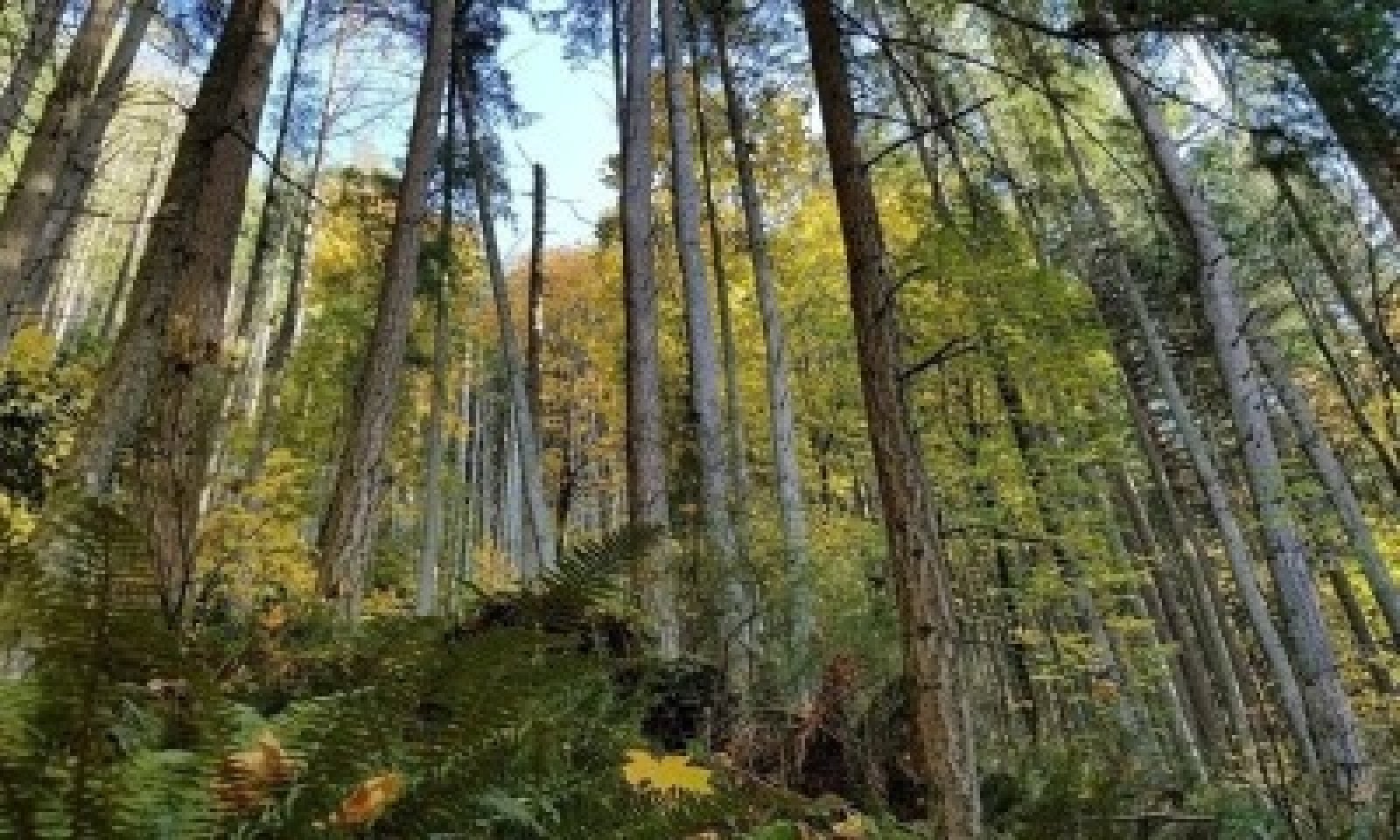
Western Hemlock and Douglas-fir Old ForestThe structure is multistory with many very large, old conifers and intermittent small gaps.
Western hemlock and Douglas-fir dominate this plant community. Other tree species that may occur at lower frequencies in the canopy or sub-canopy include western red cedar, western white pine, Pacific madrone, and bigleaf maple. Many dominant overstory conifers are quite old, often exceeding 200 years. Douglas-fir and western red cedar regenerate in the reference community within small gaps created by periodic disturbances that expose mineral soil, while hemlock establishes on both mineral and plant matter substrates, even in deep shade. Douglas-fir’s longevity and great height allow it to persist for centuries without disturbance, if it can attain a dominant canopy position in canopy gaps. Large Douglas-firs resist and survive low to moderate intensity fire with thick bark and canopy crown fuels held very high above the forest floor. Armillaria root rot can be a locally common disease. It can kill young hemlocks and Douglas-firs and weaken older trees, leaving them susceptible to windthrow and insect attacks. The small openings created by the death of one or several trees allow sunlight into the understory, benefiting shrubs and forbs and releasing advanced tree regeneration.
Western hemlock is also prone to other types of root rot. Pockets of dead and dying trees can extend for several acres, allowing enough sunlight for the regeneration of less shade-tolerant species. Storm events and infrequent low to moderate intensity fires also cause minor openings and soil exposure that provides a pathway for regeneration of many species which persist in this reference state by occupying these small openings before trees overtake them.Dominant plant species
-
western hemlock (Tsuga heterophylla), tree
-
Douglas-fir (Pseudotsuga menziesii), tree
-
western redcedar (Thuja plicata), tree
-
bigleaf maple (Acer macrophyllum), tree
-
salal (Gaultheria shallon), shrub
-
western swordfern (Polystichum munitum), other herbaceous
Community 1.2
Mixed RegenerationThe structure is dense conifer seedlings and resprouting hardwoods among a thick native shrub layer, beneath many large snags.
This community consists of a mix of regenerating trees, shrubs, forbs and grasses over a large area that has recently experienced a significant overstory tree mortality event, usually high severity fire. Snags and other large woody debris are abundant. Species composition is diverse, with young trees representing pre-fire dominant species of western hemlock and Douglas-fir, as well as western red cedar and occasionally lodgepole pine and western white pine. Many shrub and herbaceous species have increased or expanded opportunistically; some species that were not apparent prior to the disturbance may regenerate from persistent seed banks. Vegetation is often very dense and vigorous, and most species exhibit accelerated growth in the high light conditions. Shrub growth response is emblematic of many species’ ability to resprout from the root collar, rhizomes, or shallow subsurface roots. If present, big leaf maple and madrone will also regenerate by resprouting from the root collar of burned stems with rapid initial growth of many sprouts from each surviving parent stump. This resprouting mix will typically dominate while young conifer trees have yet to emerge above this tall shrub layer. Shrubs often include salmonberry, salal, oceanspray and red huckleberry. If introduced to the site, non-native Himalayan blackberry (Rubus armeniacus) and Scotch broom (Cytisus scoparius) may become abundant in this phase, usually at the expense of native shrubs and trees. A rich mix of herbaceous species are typically present.Dominant plant species
-
Douglas-fir (Pseudotsuga menziesii), tree
-
western hemlock (Tsuga heterophylla), tree
-
western redcedar (Thuja plicata), tree
-
bigleaf maple (Acer macrophyllum), tree
-
salal (Gaultheria shallon), shrub
-
salmonberry (Rubus spectabilis), shrub
-
oceanspray (Holodiscus discolor), shrub
-
red huckleberry (Vaccinium parvifolium), shrub
-
western brackenfern (Pteridium aquilinum), other herbaceous
Community 1.3
Western Hemlock and Douglas-fir Canopy ClosureThe structure is single story of pole to medium sized conifers with diminished understory, infrequent small gaps, frequent large snags.
This community typically consists of a forest undergoing canopy closure from natural regeneration. Western hemlock and Douglas-fir has overcome early shrub dominance across much of the forest by forcing its way through gaps in shrub cover or occupying space opened up by successive minor disturbances. Western red ceder is present as a sub-dominant canopy tree, persisting despite heavy side-shading from adjacent hemlock and Douglas-fir. Occasional western white pine persists in areas where other conifer growth was slightly slower or less dense. If present, re-sprouting bigleaf maple has now overtopped the shrub layer and often exhibits a multi-stemmed tree form in a co-dominant canopy position and will sometimes dominate the canopy in large patches where conifer regeneration was less abundant or where they have not yet grown through the canopy. With canopy closure, competition for sunlight has led to a diminished understory that favors more shade tolerant species such as red huckleberry, swordfern and salal. Other shrub species resembling the composition typical of the previous early seral re-sprouting forest phase are limited to infrequent small gaps in the canopy where conifers were not able to establish. Tree density is variable, but there is minimal vertical overstory differentiation due to the tree layer being relatively even aged. The herbaceous component is limited but present.Dominant plant species
-
Douglas-fir (Pseudotsuga menziesii), tree
-
western hemlock (Tsuga heterophylla), tree
-
western redcedar (Thuja plicata), tree
-
bigleaf maple (Acer macrophyllum), tree
-
salal (Gaultheria shallon), shrub
-
red huckleberry (Vaccinium parvifolium), shrub
-
western swordfern (Polystichum munitum), other herbaceous
Community 1.4
Maturing Western Hemlock and Douglas-fir
The structure is single story with canopy that is beginning to thin.
This community consists of maturing western hemlock and Douglas-fir dominated forest. Western red cedar may be present in the overstory but has largely been forced into a subdominant canopy position by the increasing height of Douglas-fir and western hemlock. Conifers are now also overtaking bigleaf maple as they grow through and above maple crowns. As it is less shade tolerant, western white pine, if present, is in decline. The forest canopy is now fully closed, and the stand is starting to differentiate vertically, becoming more complex as some trees are suppressed and die and the canopy has lifted high above the forest floor resulting in a more open understory. A mix of shrubs and herbs has persisted in the understory and some species that do well with dappled light, such as red huckleberry, are expanding. Shade tolerant species also perform well, such as salal and western swordfern. Herbaceous species typical of the reference western hemlock and Douglas-fir old forest phase have begun to reappear.Dominant plant species
-
Douglas-fir (Pseudotsuga menziesii), tree
-
western hemlock (Tsuga heterophylla), tree
-
bigleaf maple (Acer macrophyllum), tree
-
salal (Gaultheria shallon), shrub
-
red huckleberry (Vaccinium parvifolium), shrub
-
western swordfern (Polystichum munitum), other herbaceous
Pathway 1.1A
Community 1.1 to 1.2This pathway occurs from a stand-replacing fire in which all or nearly all overstory trees are killed.
Pathway 1.2A
Community 1.2 to 1.1This pathway represents growth over time with only very minor or no additional disturbances.
Pathway 1.3B
Community 1.3 to 1.2This pathway occurs from a stand-replacing fire in which all or nearly all overstory trees are killed.
Pathway 1.3A
Community 1.3 to 1.4This pathway represents growth over time. Minor disturbances may occur without disrupting this pathway, such as low-intensity fires, understory fuels management, pockets of pests or disease, and damage from weather events. These may help accelerate advancement toward Pathway 1.4a by opening space for more understory species and creating more structural complexity.
Pathway 1.4A
Community 1.4 to 1.1This pathway represents growth over time and a mix of minor disturbances. Minor disturbances play an important role in this pathway, and may include low to moderate-intensity fires, understory fuels management, pockets of pests or disease, and damage or mortality from weather events. These disturbances create new canopy gaps that facilitate tree regeneration, open space for more understory species and create more structural complexity.
Pathway 1.4B
Community 1.4 to 1.2This pathway occurs from a stand-replacing fire in which all or nearly all overstory trees are killed.
State 2
Timber PlantationCommunity 2.1
Mature Western Hemlock and Douglas-fir PlantationStructure is single story forest of even-aged trees.
This community is the management-controlled climax condition for a Western Hemlock and Douglas-fir plantation. The overstory is even-aged and exclusively or near exclusively Douglas-fir and hemlock. Trees are usually less than 100 years old. Trees are relatively evenly spaced, owing to there having been artificially established on a tight grid; there are typically no significant canopy gaps and little complexity in canopy structure. Stock used for planting is often skewed to more heavily favor Douglas-fir as it is typically of greater value than western hemlock, though western hemlock may regenerate readily in the shaded understory. Western red cedar may be included in planting or occur naturally from adjacent seed sources depending on management objectives. Hardwoods such as maple are typically less abundant due to efforts to control them and increase space for and growth of desired conifers. The understory may be somewhat sparse to relatively well-vegetated with a mix of highly shade-tolerant shrubs and herbaceous species, especially western sword fern or salal (Gaultheria shallon). Large snags are very few or absent.Dominant plant species
-
Douglas-fir (Pseudotsuga menziesii), tree
-
western hemlock (Tsuga heterophylla), tree
-
salal (Gaultheria shallon), shrub
-
western swordfern (Polystichum munitum), grass
Community 2.2
Regenerating Western Hemlock and Douglas-fir PlantationStructure is single story small trees and shrub.
This community consists of regenerating conifer forest over a large area that has been opened by timber harvest. Species composition is strongly controlled by management actions. The site is typically planted with Douglas-fir, and lesser amounts of western hemlock and western red cedar. Non-timber shrubs and trees are controlled to facilitate planted seedling survival, resulting in a dense, young conifer forest. Shrubs and mixed herbaceous species typically occupy space between planted saplings. These may include oceanspray, salal, red huckleberry, western sword fern and salmonberry. Introduced Himalayan blackberry (Rubus armeniacus) and Scotch broom (Cytisus scoparius) are often present and may be abundant, usually at the expense of native shrubs or planted trees. Snags are very few or absent. Downed woody debris may be abundant or limited depending on thoroughness of its reduction during the prior timber harvest.Dominant plant species
-
Douglas-fir (Pseudotsuga menziesii), tree
-
western hemlock (Tsuga heterophylla), tree
-
salal (Gaultheria shallon), shrub
-
salmonberry (Rubus spectabilis), shrub
-
Himalayan blackberry (Rubus armeniacus), other herbaceous
Community 2.3
Stem Exclusion Western Hemlock and Douglas-fir PlantationStructure is single story forest of even-aged trees.
This community is the interim point in a Douglas-fir and western hemlock plantation between regeneration and the mature state. Composition is exclusively or near exclusively Douglas-fir and western hemlock, and the stand is very dense, having been artificially established on a grid and tended with weed control methods to maximize conifer survival. Western red cedar is often present at a lower frequency. A pre-commercial thin may be applied at or shortly before this phase to reduce inter-tree competition and maintain high growth rates. The understory is often very sparse, particularly if pre-commercial thinning is not performed, owing to the very limited light that reaches the forest floor. Only highly shade tolerant species occur, if present at all. Snags are very few or absent. Downed woody debris may be abundant or limited depending on thoroughness of its reduction during the prior timber harvest.Dominant plant species
-
Douglas-fir (Pseudotsuga menziesii), tree
-
western hemlock (Tsuga heterophylla), tree
-
salal (Gaultheria shallon), shrub
-
western swordfern (Polystichum munitum), other herbaceous
Pathway 2.1A
Community 2.1 to 2.2This pathway represents even-aged harvest of a mature western hemlock and Douglas-fir plantation followed by conifer planting. This pathway may also result from a stand-replacing fire followed by a salvage harvest and replanting. Site preparation and removal of woody material to limit fire hazard is usually performed prior to planting.
Pathway 2.2A
Community 2.2 to 2.3This pathway represents growth of an even-aged western hemlock and Douglas-fir plantation alongside active weed controls to limit competition with undesired species. Thinning of conifer saplings and pruning may or may not occur, depending on stand density or fire hazard concerns. Disturbances, such as fire, pests, and disease, are discouraged and controlled if possible.
Pathway 2.3A
Community 2.3 to 2.1This pathway represents growth of an even-aged western hemlock and Douglas-fir plantation that is maturing and dominates the overstory. Light thinning may or may not occur, depending on stand density or fire hazard concerns. Disturbances, such as fire, pests, and disease, are discouraged and controlled if possible.
Pathway 2.3B
Community 2.3 to 2.2This pathway results from a stand-replacing fire or a major pest or disease event that kills all or nearly all trees, followed by replanting of conifers. Salvage harvesting may occur if there is sufficient commercially viable material in the stand. Site preparation and removal of woody material to limit fire hazard is usually performed prior to planting.
State 3
DeforestedCommunity 3.1
Cropland or HaylandStructure is annual or perennial non-native species monoculture.
This community consists of a range of crops, including annually planted species, short-lived perennial species, and more permanent perennial crops. Hay and grasses and legumes for silage are included in this community.Community 3.2
Introduced Grass and ShrubsStructure is annual or perennial herbaceous or shrubby species.
Community phase 3.2 is characterized by low-level or more intermittent management activity such as occasional or light grazing or sporadic mowing. This plant community is dominated by introduced weedy species and the less frequent disturbance supports a more shrubby character. The site is grazed, mowed or burned often enough to prevent re-establishment of forest. Dominant shrubs are typically invasive rhizomatous species that form thickets such as Himalayan blackberry (Rubus armeniacus) or those that develop a robust seedbank and flourish in open conditions such as Scotch broom (Cytisus scoparius). Some tougher native shrub species such as California blackberry (Rubus ursinus) and salmonberry may be interspersed. Areas where ponding or brief inundation occurs commonly support non-native rhizomatous grasses. Between shrub thickets introduced pasture species such as tall fescue (Schedonorus arundinaceus), orchardgrass (Dactylis glomerata), redtop (Agrostis gigantea) and red fescue (Festuca rubra) are common. Fire and soil disturbing activities often favors an increase in western brackenfern (Pteridium aquilinum).Dominant plant species
-
Himalayan blackberry (Rubus armeniacus), shrub
-
salmonberry (Rubus spectabilis), shrub
-
California blackberry (Rubus ursinus), shrub
-
tall fescue (Schedonorus arundinaceus), grass
-
orchardgrass (Dactylis glomerata), grass
-
red fescue (Festuca rubra), grass
-
western brackenfern (Pteridium aquilinum), other herbaceous
Community 3.3
Managed Perennial GrasslandStructure is perennial herbaceous species.
This community phase is an introduced grassland that receives regular grazing or mowing disturbance and may include soil amendments such as fertilizers or lime. Weeds are aggressively controlled and desired herbaceous species are reseeded as necessary. Grazing, mowing and other weed control actions prevent the phase from transitioning to a forested state. This plant community is typically dominated by introduced perennial pasture species that are seeded after clearing. Common species include tall fescue (Schedonorus arundinaceus), orchardgrass (Dactylis glomerata), redtop (Agrostis gigantea), and red fescue (Festuca rubra).Dominant plant species
-
tall fescue (Schedonorus arundinaceus), grass
-
orchardgrass (Dactylis glomerata), grass
-
redtop (Agrostis gigantea), grass
-
red fescue (Festuca rubra), grass
Pathway 3.1A
Community 3.1 to 3.2In the absence of agronomic and livestock management activities, seeds from surrounding weedy plant communities are transported to the site by wind, animals, or vehicle traffic, and the adapted species become established. Management activities include tilling; adding soil nutrients and other soil amendments, such as lime; mowing; burning; harvesting or chemically controlling vegetation; planting desirable herbaceous species; and implementing grazing management plans.
Pathway 3.1B
Community 3.1 to 3.3This pathway occurs by intentional establishment of a perennial grass-dominated plant community. Often, the site will be prepped for seeding and desired pasture species artificially sown. In some cases, simply discontinuing crop production activities may allow the site to transition to grass, provided emergence of woody shrubs or trees is actively controlled with mowing, fire, or chemical treatment. Consistent grazing is essential to the maintenance of this community and to prevent establishment of woody shrubs. Other maintenance practices, such as targeted mowing, prescribed fire, chemical treatment, or other mechanical treatment are utilized as needed.
Pathway 3.2B
Community 3.2 to 3.1This pathway represents agronomic activities. Examples include tilling; adding soil nutrients and other soil amendments, such as lime; mowing; burning; harvesting or chemically controlling vegetation; and planting desirable crop species.
Pathway 3.2A
Community 3.2 to 3.3This pathway represents agronomic and livestock management activities. Examples include tilling; adding soil nutrients and other soil amendments, such as lime; mowing; burning; harvesting or chemically controlling vegetation; planting desirable herbaceous species; and implementing grazing management plans.
Pathway 3.3A
Community 3.3 to 3.1This pathway represents agronomic activities. Examples include tilling; adding soil nutrients and other soil amendments, such as lime; mowing; burning; harvesting or chemically controlling vegetation; and planting desirable crop species.
Pathway 3.2B
Community 3.3 to 3.2In the absence of agronomic and livestock management activities, seeds from surrounding weedy plant communities are transported to the area by wind, floodwater, animals, or vehicle traffic, and the adapted species become established. Management activities include tilling; adding soil nutrients and other soil amendments, such as lime; mowing; burning; harvesting or chemically controlling vegetation; planting desirable herbaceous species; and implementing grazing management plans.
Transition T1A
State 1 to 2This transition represents a shift to a Douglas-fir and western hemlock timber plantation management system. This transition is typically initiated by clear cut of old forest in the reference state but can be initiated after a large stand-replacing fire in the reference state. Management actions include even-aged harvests and replanting of evenly spaced Douglas-fir. Other tree species, especially non-conifers such as madrone and maple, are heavily controlled to promote maximum dominance and growth of Douglas-fir.
Transition T1B
State 1 to 3This transition is caused by an intentional clearing of land or a stand replacing fire in state 1, followed by intense, frequent disturbance such as grazing, mowing, crop production, or frequent fire to prevent trees from re-establishing. This transition can be initiated from any community in state 1.
Transition R2A
State 2 to 1This restoration occurs by artificial or natural re-establishment over time of species resembling overstory and understory diversity typical of the reference state. This transition can be initiated from any community phase in state 2.
Transition T2A
State 2 to 3This transition is caused by an intentional clearing of land or a stand replacing fire in state 2, followed by intense, frequent disturbance such as grazing, mowing, crop production, or frequent fire to prevent trees from re-establishing. This transition can be initiated from any community phase in state 2.
Restoration pathway R3A
State 3 to 1This restoration occurs by artificial or natural re-establishment over time of species resembling overstory and understory diversity typical of the reference state. Intentional planting, site preparation, and control of competing invasive weeds will accelerate this transition. This transition can be initiated from any community phase in state 3.
Restoration pathway T3A
State 3 to 2This transition occurs with a change in land management from a cleared non-forest state to a Douglas-fir plantation. The site is typically treated mechanically or with fire to prep the seed bed before planting Douglas-fir on an even spacing. Competing species are heavily controlled to improve seedling survival and growth. This transition can be initiated from any community phase in state 3.
Additional community tables
Table 5. Community 1.1 plant community composition
Group Common name Symbol Scientific name Annual production () Foliar cover (%) Table 6. Community 1.2 plant community composition
Group Common name Symbol Scientific name Annual production () Foliar cover (%) Table 7. Community 1.3 plant community composition
Group Common name Symbol Scientific name Annual production () Foliar cover (%) Table 8. Community 1.4 plant community composition
Group Common name Symbol Scientific name Annual production () Foliar cover (%) Table 9. Community 2.1 plant community composition
Group Common name Symbol Scientific name Annual production () Foliar cover (%) Table 10. Community 2.2 plant community composition
Group Common name Symbol Scientific name Annual production () Foliar cover (%) Table 11. Community 2.3 plant community composition
Group Common name Symbol Scientific name Annual production () Foliar cover (%) Table 12. Community 3.1 plant community composition
Group Common name Symbol Scientific name Annual production () Foliar cover (%) Table 13. Community 3.2 plant community composition
Group Common name Symbol Scientific name Annual production () Foliar cover (%) Table 14. Community 3.3 plant community composition
Group Common name Symbol Scientific name Annual production () Foliar cover (%) Interpretations
Supporting information
Inventory data references
Relationship to Other Established Classifications: This site is related to plant associations PICO-PSME/GASH, PSME-ABGR/FEOC, PSME-ABGR/HODI/POMU, PSME-ARME/GASH, PSME-ARME/HODI/LOHI, PSME/GASH-HODI, SPME/HODI-SYAL, SPME/ROGY-HODI, and QUGA-PSME/SYAL/POMU in Chappell, C.B. (2006). Chappell, C.B. 2006. Upland plant associations of the Puget Trough ecoregion, Washington. Natural Heritage Rep. 2006-01. Washington Department of Natural Resources, Natural Heritage Program, Olympia, WA. https://file.dnr.wa.gov/publications/amp_nh_upland_puget.pdf (accessed 29 January 2021).
Other references
Agee, J.K. 1993. Fire ecology of Pacific Northwest forests. Island Press. Covelo, CA. ISBN: 978-1559632300.
Henderson, J.A., Peter, D.H., Lesher, R.D. and Shaw, D.C., 1989. Forested plant associations of the Olympic National Forest.
Hermann and Lavender, 1990. Pseudotsuga menziesii. In: Burns, R.M. and Honkala, B.H., 1990. Silvics of North America. Volume 1. Conifers.
Huff, M.H., 1995. Forest age structure and development following wildfires in the western Olympic Mountains, Washington. Ecological Applications, 5(2), pp.471-483.
Minore, D. 1990. Thuja plicata. In: Burns, R.M. and Honkala, B.H., 1990. Silvics of North America. Volume 1. Conifers.
Munger, T.T., 1940. The Cycle form Douglas Fir to Hemlock. Ecology, 21(4), pp.451-459.
Packee, E.C. 1990. Tsuga heterophylla. In: Burns, R.M. and Honkala, B.H., 1990. Silvics of North America. Volume 1. Conifers.
Perry, D.A. 1994. Forest ecosystems. The Johns Hopkins University Press. Baltimore, MD. ISBN: 0-8018-4760-5.
Tepley, A.J., Swanson, F.J. and Spies, T.A., 2013. Fire‐mediated pathways of stand development in Douglas‐fir/western hemlock forests of the Pacific Northwest, USA. Ecology, 94(8), pp.1729-1743.
U.S. Department of Agriculture, Forest Service, Rocky Mountain Research Station, Fire Sciences Laboratory. 2019. Fire Effects Information System (FEIS). https://www.feis-crs.org/feis/ (accessed 8 January 2021).
Wendel, R. and Zabowskl, D., 2010. Fire history within the lower Elwha river watershed, Olympic National Park, Washington. Northwest Science, 84(1), pp.88-97.
Wetzel, S.A. and Fonda, R.W., 2000. Fire history of Douglas-fir forests in the Morse Creek drainage of Olympic National Park, Washington. Northwest science., 74(4), pp.263-279.Contributors
Erik Dahlke
Kathryn Smith
Marty Chaney
Mathew CockingApproval
Kirt Walstad, 12/03/2024
Rangeland health reference sheet
Interpreting Indicators of Rangeland Health is a qualitative assessment protocol used to determine ecosystem condition based on benchmark characteristics described in the Reference Sheet. A suite of 17 (or more) indicators are typically considered in an assessment. The ecological site(s) representative of an assessment location must be known prior to applying the protocol and must be verified based on soils and climate. Current plant community cannot be used to identify the ecological site.
Author(s)/participant(s) Contact for lead author Date 08/21/2026 Approved by Approval date Composition (Indicators 10 and 12) based on Annual Production Indicators
-
Number and extent of rills:
-
Presence of water flow patterns:
-
Number and height of erosional pedestals or terracettes:
-
Bare ground from Ecological Site Description or other studies (rock, litter, lichen, moss, plant canopy are not bare ground):
-
Number of gullies and erosion associated with gullies:
-
Extent of wind scoured, blowouts and/or depositional areas:
-
Amount of litter movement (describe size and distance expected to travel):
-
Soil surface (top few mm) resistance to erosion (stability values are averages - most sites will show a range of values):
-
Soil surface structure and SOM content (include type of structure and A-horizon color and thickness):
-
Effect of community phase composition (relative proportion of different functional groups) and spatial distribution on infiltration and runoff:
-
Presence and thickness of compaction layer (usually none; describe soil profile features which may be mistaken for compaction on this site):
-
Functional/Structural Groups (list in order of descending dominance by above-ground annual-production or live foliar cover using symbols: >>, >, = to indicate much greater than, greater than, and equal to):
Dominant:
Sub-dominant:
Other:
Additional:
-
Amount of plant mortality and decadence (include which functional groups are expected to show mortality or decadence):
-
Average percent litter cover (%) and depth ( in):
-
Expected annual annual-production (this is TOTAL above-ground annual-production, not just forage annual-production):
-
Potential invasive (including noxious) species (native and non-native). List species which BOTH characterize degraded states and have the potential to become a dominant or co-dominant species on the ecological site if their future establishment and growth is not actively controlled by management interventions. Species that become dominant for only one to several years (e.g., short-term response to drought or wildfire) are not invasive plants. Note that unlike other indicators, we are describing what is NOT expected in the reference state for the ecological site:
-
Perennial plant reproductive capability:
Print Options
Sections
Font
AAAAOther
PrintThe Ecosystem Dynamics Interpretive Tool is an information system framework developed by the USDA-ARS Jornada Experimental Range, USDA Natural Resources Conservation Service, and New Mexico State University.
Accessibility statement


